Originally posted by Bwana_John
| Quote: |
Mission-era warehouse ruins on the shore of the bay dont waste your time looking for this alleged jesuit warehouse, the military has used the "ruins"
to spell out their unit name on the adjacent slope
|
| Quote: |
re you sure we are talking about the same place? The military base/ checkpoint is in the valley on the other side of the hill from the bayside ruin.
|
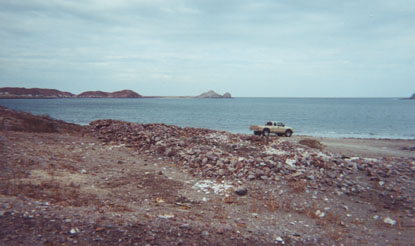
The old warehouse site on the bay was used by "Marine Special Forces" for a couple of years, they had the plastic high speed patrol boats moored in
front, and much of the preexisting rock work(mission era?) was "reconfigured" for fighting pits, borders for walkways to outhouses and other things
the military seems to make the boys do to waste time.
WG is NOT talking about the current sight of the Army (Motorized Cavalry) checkpoint on Mex 5 which is over the hill. |