BajaNomad

Laguna Chapala

Bajaboy - 9-27-2013 at 05:38 AM

On my way south a few days ago, I noticed a very large lot near the turn to Gonzaga marked off. Anyone have any ideas on what might be going in here....maybe a Pemex:light:

[Edited on 9-27-2013 by Bajaboy]

chuckie - 9-27-2013 at 05:50 AM

large large?

Bajaboy - 9-27-2013 at 05:52 AM

I'm not very good estimating lot sizes....maybe half a football field more or less.

chuckie - 9-27-2013 at 05:58 AM

But a large large what? I hope not a UFO? I am flying over that manana

Pacifico - 9-27-2013 at 06:43 AM

Interesting.... CoCo told me awhile back that the new paved road was going to cut over west to the north of his place and not go by his place. Maybe this has changed and it will follow the existing road? Someone is planning ahead perhaps?

Bob H - 9-27-2013 at 06:55 AM

Maybe an OXXO !!

chuckie - 9-27-2013 at 07:06 AM

Thats about where a guy needs a cuppa.............

Ateo - 9-27-2013 at 07:17 AM

I heard it'll be an In N Out with a liquor store attached.

Ateo - 9-27-2013 at 07:23 AM

A Pemex would be a great idea. It would put a few guys out of business in Catavina though.

durrelllrobert - 9-27-2013 at 08:36 AM

Quote:
Originally posted by Ateo
A Pemex would be a great idea. It would put a few guys out of business in Catavina though.


Oh no! Gotta Peso outa business? Say it isn't so.

David K - 9-27-2013 at 09:23 AM

Quote:
Originally posted by Pacifico
Interesting.... CoCo told me awhile back that the new paved road was going to cut over west to the north of his place and not go by his place. Maybe this has changed and it will follow the existing road? Someone is planning ahead perhaps?


The Coco Bypass is only going to affect Coco I believe... If you look at Google Earth, the old road to Chapala (of 1955) passes through that rancho west of Coco's and rejoins the newer graded road... From there it will likely use the same roadbed as the current graded road that was built around 1982.

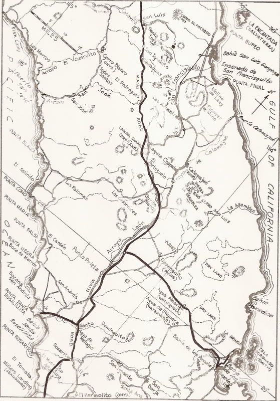
Have a look at this 1962 Howard Gulick map that I added in new roads over (Hwy. 1 and dirt Hwy. 5):


Note just below 'Las Arrastras' the single line drawn in and the circle in it? That's Coco's Corner.... It sounds like the new highway will stay on the older road, just west for that couple of miles.

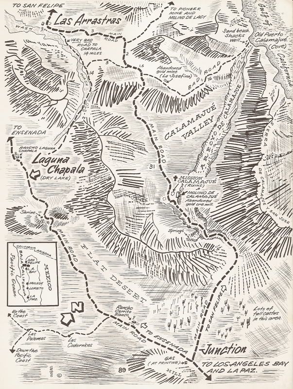
Here is one of Cliff Cross' 'birds-eye-view' maps of the area from his 1970 guide...


Note below Las Arrastras and the bad road warning the mileage 14 and mileage 3 on the two roads... Coco's Corner would be between those two figures at the foot of the mountain slope shown.

[Side note, in a later edition Cliff noted he placed the Calamajué mission site on the wrong side of the arroyo]

[Edited on 9-27-2013 by David K]

Vince - 9-27-2013 at 10:14 AM

We are driving down to Coyote Bay tomorrow. I'll check it out. That Cliff Cross map brings back memories. I drove down several times in my VW bus in 1970 and '71 and the road went right thru the middle of Lake Chapala dry lake bed. The silt was so fine it coated the windshield and had to use wipers to see. Also it plugged up the air filter in the engine which was easily fixed once I diagnosed it. His book was very useful. Memorable trips.

David K - 9-27-2013 at 10:23 AM

Quote:
Originally posted by Vince
We are driving down to Coyote Bay tomorrow. I'll check it out. That Cliff Cross map brings back memories. I drove down several times in my VW bus in 1970 and '71 and the road went right thru the middle of Lake Chapala dry lake bed. The silt was so fine it coated the windshield and had to use wipers to see. Also it plugged up the air filter in the engine which was easily fixed once I diagnosed it. His book was very useful. Memorable trips.


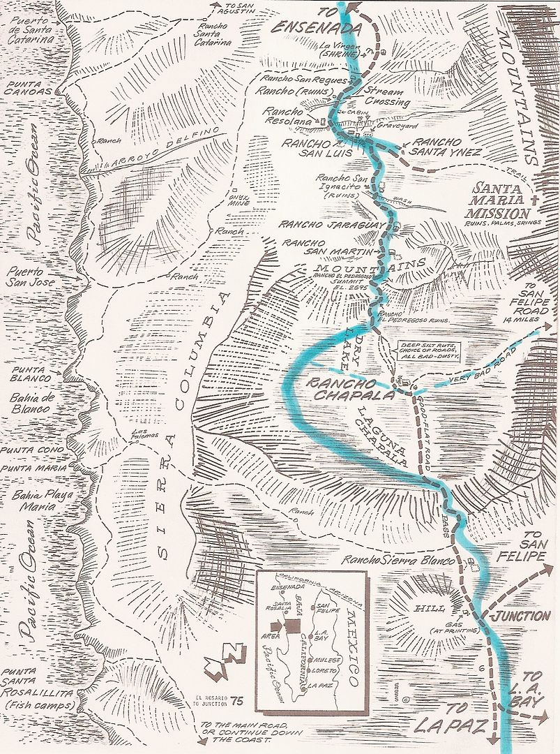
Cross map of Chapala and the new highway added in blue highlighter relative to the old main road (through the dust bowl). When the highway was built on the opposite side of the valley from the ranch, Arturo Grosso just moved his ranch to the highway! Renamed Rancho Nueva Chapala! The foundations of the original ranch can be seen next to the road to Gonzaga.


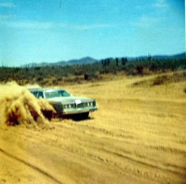
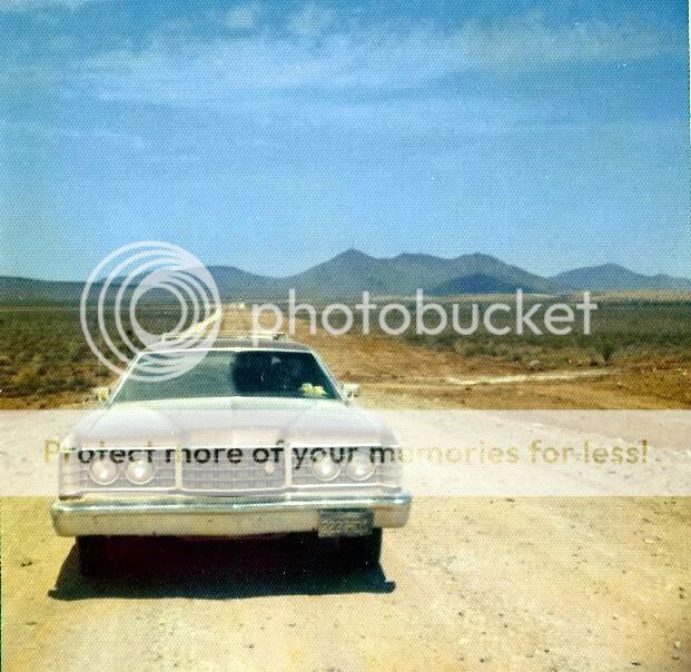
July 1973, Laguna Chapala along the new highway, under construction:


[Edited on 9-27-2013 by David K]

Howard Gulick Photos

David K - 9-27-2013 at 10:36 AM

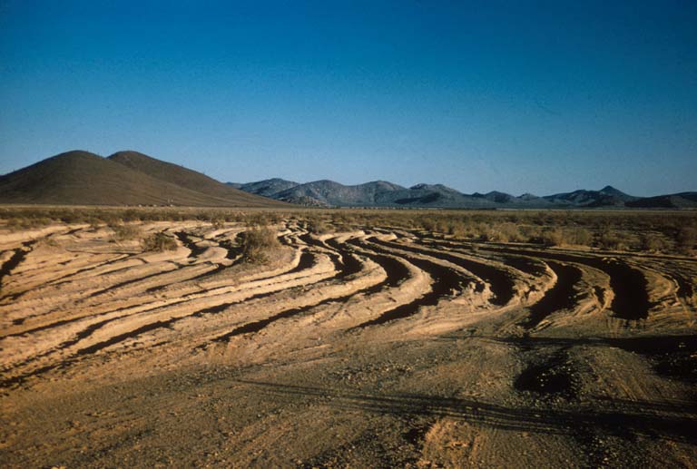
1965 Laguna Chapala dust bowl (worst section of the Old Road in many opinions):


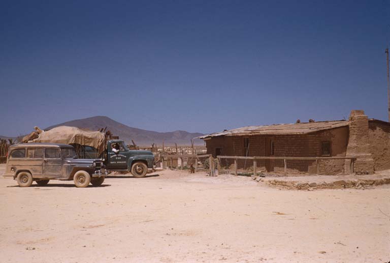
1955 Rancho Laguna Chapala (Arturo Grosso):


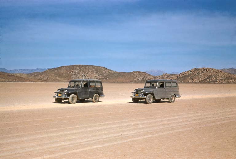
1956 Laguna Chapala lake bed (best section of the Old Road):


Vince - 9-27-2013 at 01:56 PM

Great photos, David. That's just how I remember Lake Chapala.

David K - 9-27-2013 at 02:05 PM

Quote:
Originally posted by Vince
Great photos, David. That's just how I remember Lake Chapala.


Have a great trip Vince! :bounce::bounce::bounce::cool:

Pacifico - 9-27-2013 at 02:13 PM

Are the foundations of the old ranch on the north side of the road? I remember seeing something like that in that area.

David K - 9-27-2013 at 02:15 PM

Quote:
Originally posted by Pacifico
Are the foundations of the old ranch on the north side of the road? I remember seeing something like that in that area.


YES! There is a bit of a tree there, too...

In the 1965 Gulick photo, you can see the ranch in the distance beyond the dust bowl, at the bottom of the distant hill.

[Edited on 9-27-2013 by David K]

Russ - 9-27-2013 at 02:41 PM

I don't remember much of my '68 drive to Cabo but I do remember that section. I was in a 56 Chevy p/u and there were 2 couples that had doing it for many years. We didn't get stuck! That's the day I found a liking for tequila. No cold beer to be had. I finally got a mes of slides from that trip so when I get back Maybe there will be something to share.

[Edited on 9-27-2013 by Russ]

DavidE - 9-27-2013 at 02:53 PM

"Lookit! Lookit! Lookit! We're doing fifty miles an hour"

The tilted gas drums were out back of the ranch house. Seems to me remembering they had to haul water. No rain for a long time. The flash flood that nailed tres enriques did not get to Chapala. This was the place I got my very first taste of machaca con huevos revueltos. Hard to believe now LBJ had been in office only seven months. How bad was Chapala dust? Wear a pair of levi's for the trip, on the far side take 'em off and they'll stand upright.