BajaNomad

Best GPS for Baja travel?

Reeljob - 11-7-2013 at 06:38 AM

I know it has been discussed previously, but ......

Mula - 11-7-2013 at 06:56 AM

I want to know, too . . . . .

Best GPS for what use???

bajaguy - 11-7-2013 at 07:16 AM

Depends on what you want to use it for.

For road navigation, I have the Garmin 2455LMT. Has mexico pre loaded, will accept mini SD cards and has lifetime updates. Really like the street features, helps me navigate in TJ, Rosarito and Ensenada. Also showed the streets in San Quintin.

For handheld and trail use, I have the Garmin Map 62s. Comes preloaded with a bunch of maps, can also add a mini SD card.

Great units..........but depends on what you are going to use them for

Mula - 11-7-2013 at 07:28 AM

I have a Garmin Etrex 20 and so far for me it is a nightmare.

I want to use it to mark fishing holes in Mag Bay, do back road trips like this one, etc.

Not for highway driving.

http://forums.bajanomad.com/viewthread.php?tid=70218

GPS Choice

skippermike - 11-7-2013 at 09:23 AM

If you want a traditional, dedicated GPS - rather than an Iphone/pad app - I think the two choices are Garmin or Lowrance.
Garmin is easier to use, gives directions and has great maps. It can be a large-screen (7") for your vehicle, or a smaller-screen handheld for hiking/exploring/fishing.
For really serious offroad use, the most frequently seen is the Lowrance.
Good navigating!

Bajamatic - 11-7-2013 at 09:46 AM

In my experience, which is extensive, nothing beats MotionX on the Ipad. Gen 1 Ipad on ebay runs between 200 and 250 bucks. GPS reciever is 60 bucks. There's really nothing else out there that compares, IMHO.

I also use it to keep documents (nomad threads, manuals, etc.), stargazing maps, shortwave radio schedules, weatherfax, and on and on and on. It's become a critical item in my baja kit.

Russ - 11-7-2013 at 10:04 AM

I have the Garmin Nuvi 855. I bought a Mexico map down load and it shows quite a lot of the topo features and way more trails than I expected. After a ride I down load my journey in the Garnim Base Camp program and it show where I've gone and stitches the route making new trails part of the map. I had some operator errors last trip over the mountains past San Jose Magdalena.

PaulW - 11-7-2013 at 10:25 AM

So far just Garmin's discussed.
My Garmin is a 4" screen Montana650 It will accept 3rd party background maps and allows sharing trails. It is useful in Baja and the states with appropriate background maps. Choose any Garmin carefully to make sure 3rd party maps and trail exchange is not blocked. If your Garmin has these capabilities then updated Baja maps are available and we can share trails from our trips.

My Favorite GPS is a Lowrance 7200C. However any discontinued Lowrance 5" color screen will have the same capabilities as my 7" 7200. The main advantage of Lowrance is new background maps are more frequently updated for the latest findings of Baja back country roads and are more up to date than the Garmin versions due to the demand from the Baja racers.
The newer HDS models have blocked for using 3rd party BG maps resulting in Baja only usefulness. The result is they useful for are Baja only. Let price be your method of choosing. The used Lowrance units are becoming pricey due to the demand from the racers who do not want the spendy HDS models.

Bottom line is bigger is always better and new BG maps are important.
Paul

David K - 11-7-2013 at 12:01 PM

Quote:
Originally posted by Mula
I have a Garmin Etrex 20 and so far for me it is a nightmare.

I want to use it to mark fishing holes in Mag Bay, do back road trips like this one, etc.

Not for highway driving.

http://forums.bajanomad.com/viewthread.php?tid=70218


Mula, is this your first GPS? There is lots of help out there on the Internet... Garmin GPS forums, Geocaching.com, here on Nomad. Can you be specific what is the nightmare? I have two Garmin eTrex models... but from over ten years ago... so I might not be the best to help, but the general how-to stuff I can try and help with should you not get any other's assistance for your eTrex 20...

Mula - 11-7-2013 at 12:09 PM

I spent a couple hours with it after download the manual this morning.

I guess my biggest problem with it is actually just me.

I can't hardly see the screen. I used to to mark the route for the cabalgata and finally got that done and the route named, etc. But took a long time.

Also want to use it for fishing holes out in Mag Bay and that seems to be a whole other ball of wax.

On edit: yes this is my first GPS

[Edited on 11-7-2013 by Mula]

mulegemichael - 11-7-2013 at 04:38 PM

garmin nuvi...hands down...all models have been good for us....but don't expect to find a gps for deep down in soc waters, like south of GN, as even with the maps we've purchased, it sometimes shows us waaaaay up on dry ground when we are actually still a hundred yards from shore....don't trust even the most sophisticated gps, satellite imaging, top o the line instruments in southern baja, as they are just not accurate yet, imho.

David K - 11-7-2013 at 04:41 PM

Quote:
Originally posted by Mula
I spent a couple hours with it after download the manual this morning.

I guess my biggest problem with it is actually just me.

I can't hardly see the screen. I used to to mark the route for the cabalgata and finally got that done and the route named, etc. But took a long time.

Also want to use it for fishing holes out in Mag Bay and that seems to be a whole other ball of wax.

On edit: yes this is my first GPS

[Edited on 11-7-2013 by Mula]


If my son was still at Mag Bay, he could help... When Geocaching got started, my kids were at the perfect age for going on hikes with dad and we used the eTrex to find and hide Geocaches. When the kids got to that age where it was more fun to be with friends than parents, the Geocaching sport pretty much ended for me.

[Geocaching is a 'hide-and seek' or treasure hunt game played with a GPS and their web site http://geocaching.com , many Nomads are also Geocachers and have hidden many in Baja since the first one, about the year 2001]

willardguy - 11-7-2013 at 04:57 PM

I've had great luck with the foldable paper garmin/lowrance/magellan/motionX/blahblahblah. cant beat it for adventure and even give your brain a little exercise!:yes:


Russ - 11-7-2013 at 05:16 PM

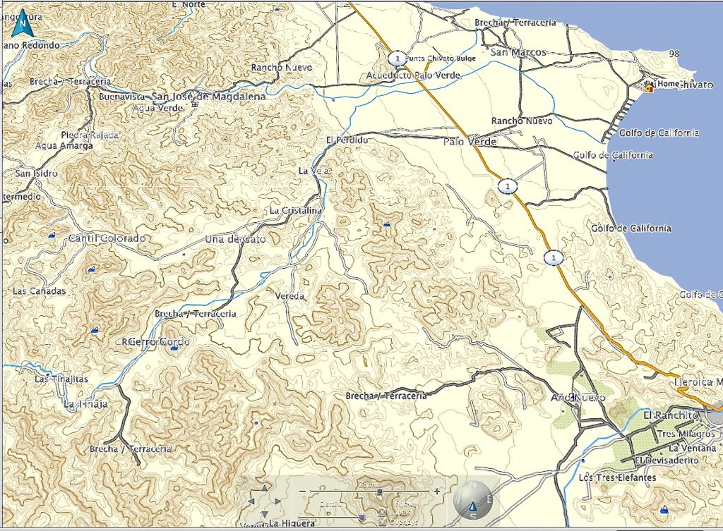
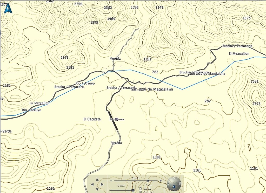
Here's a screen shot fro my computer of what my Nuvi has.

David K - 11-7-2013 at 05:21 PM

That's awesome Russ... I can almost see the Magdalena ruins on it! :wow:

Russ - 11-7-2013 at 05:32 PM

Zoomed in it really shows detail. Where ever your cursor is the altitude will pop up.


Chupacabra - 11-7-2013 at 05:52 PM

Quote:
Originally posted by Bajamatic
In my experience, which is extensive, nothing beats MotionX on the Ipad. Gen 1 Ipad on ebay runs between 200 and 250 bucks. GPS reciever is 60 bucks. There's really nothing else out there that compares, IMHO.

I also use it to keep documents (nomad threads, manuals, etc.), stargazing maps, shortwave radio schedules, weatherfax, and on and on and on. It's become a critical item in my baja kit.


Thanks, 'matic. Great advice, I think I'm going to do just that.

chuckie - 11-7-2013 at 06:09 PM

Whats wrong with a map and eyeballs? With enough electronics, ya all can just stay home and "do" Baja.....

Bajamatic - 11-7-2013 at 06:35 PM

Quote:
Originally posted by chuckie
Whats wrong with a map and eyeballs? With enough electronics, ya all can just stay home and "do" Baja.....


Absolutely nothing! But since we're on the topic, whats wrong with tinkering with gadgets? To some, like myself, there's equally as much fun in precision technology as there is in getting lost in Baja and figuring it out with a map and a compass. Personally, I started with the old, "turn left at the busted wagon" nav system. These days, after mastering the Almanac, I've become curious as to how "perfect" a system I can create. My driving buddy is much less impressed than I with this newfangled gadgetry, but I can promise you he enjoys being lost less when the sun is sinking low and we're racing to make camp. :yes:

David K - 11-8-2013 at 12:14 AM

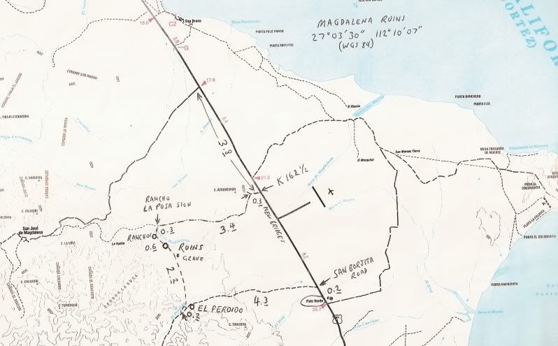
Here they are Russ... GPS waypoint written on the top right:


Lowrance screen shots

PaulW - 11-8-2013 at 01:17 PM


Detailed shot:

For comparison with the ones Russ posted
Note the box which shows the elevation , miles from San Felipe and direction from SF. Cross hairs is the location for the box.

Russ - 11-8-2013 at 03:02 PM

What model Lowrance is that and what map? Very cool!

Russ - 11-8-2013 at 03:06 PM

Quote:
Originally posted by chuckie
Whats wrong with a map and eyeballs? With enough electronics, ya all can just stay home and "do" Baja.....


I'm pretty much getting tired of your negative snide comments. Do you have anything else in your bag?

Alan - 11-9-2013 at 06:29 AM

Is anyone using an IPad with a GPS app? I talked to someone briefly who was using an IPad for his chartplotter. He explained that once you download the app and maps for your area you aren't dependent on WiFi, as his position is set by the built-in GPS of the unit. He said the base maps of app were from Navionics and he said the charts were spot on accurate for the BCS area of the SOC. We only had a chance to talk briefly so I don't have more details. Can anyone else provide them?

PaulW - 11-9-2013 at 08:05 AM

Quote:
Originally posted by Russ
What model Lowrance is that and what map? Very cool!

=====
The screen shots are from my Bronco Lowrance 7200C and the BGM is v 10/13 Murdock download. I am to cheap to buy the Garmin version for my Montana650, But I sure would like to have it to compare. I have not che4cked, but I sus[pect Murdock has a new version now that he has the latest Baja 1000 files. He usually generates an update for the racers to show all the local roads near the races.
Paul

PaulW - 11-9-2013 at 08:08 AM

Quote:
Originally posted by PaulW
Quote:
Originally posted by Russ
What model Lowrance is that and what map? Very cool!

=====
The screen shots are from my Bronco Lowrance 7200C and the BGM is v 10/13 Murdock download. I am to cheap to buy the Garmin version for my Montana650, But I sure would like to have it to compare. I have not che4cked, but I sus[pect Murdock has a new version now that he has the latest Baja 1000 files. He usually generates an update for the racers to show all the local roads near the races.
Paul

Correction the version I have is v5/13 not the 10/13 PW

PaulW - 11-9-2013 at 08:18 AM

Quote:
Originally posted by Alan
Is anyone using an IPad with a GPS app? I talked to someone briefly who was using an IPad for his chartplotter. He explained that once you download the app and maps for your area you aren't dependent on WiFi, as his position is set by the built-in GPS of the unit. He said the base maps of app were from Navionics and he said the charts were spot on accurate for the BCS area of the SOC. We only had a chance to talk briefly so I don't have more details. Can anyone else provide them?

=======
I guess the test would be to make a track with several WPs, save it and forward it to a Garmin and Lowrance guy and see if they can display what you generated. If your rig passes that test then it should be useful. And you need to see if you can load a track from a Garmin or Lowrance created track as well. I understand you will need the conversion SW, but that should not be an issue.
Of course you need a screen that can be mounted in your rig and is not so big as to be cumbersome. Sure bigger its better to some reasonable limit. I see 12" screens in the larger race trucks , but 7 to 8" seems to be the sweet size.
Paul

Alan - 11-9-2013 at 10:37 PM

Quote:
Originally posted by PaulW
Quote:
Originally posted by Alan
Is anyone using an IPad with a GPS app? I talked to someone briefly who was using an IPad for his chartplotter. He explained that once you download the app and maps for your area you aren't dependent on WiFi, as his position is set by the built-in GPS of the unit. He said the base maps of app were from Navionics and he said the charts were spot on accurate for the BCS area of the SOC. We only had a chance to talk briefly so I don't have more details. Can anyone else provide them?

=======
I guess the test would be to make a track with several WPs, save it and forward it to a Garmin and Lowrance guy and see if they can display what you generated. If your rig passes that test then it should be useful. And you need to see if you can load a track from a Garmin or Lowrance created track as well. I understand you will need the conversion SW, but that should not be an issue.
Of course you need a screen that can be mounted in your rig and is not so big as to be cumbersome. Sure bigger its better to some reasonable limit. I see 12" screens in the larger race trucks , but 7 to 8" seems to be the sweet size.
Paul
Thanks, I think??? Not sure I understand your post:?:

floydo - 11-10-2013 at 06:29 PM

My experience, beyond paper maps which we use for big picture, is with garmin nuvis.

On road garmin North America maps are pretty good and getting better.

Offroad ----

Nuvis work well with the mex E32 topos, and the bici mexico topos (now purchased by garmin and published as a garmin mexico topo). bici has improved their baja place details in the last few years. E32 historically has had more baja offroad trail detail, but I think bici has gotten closer. My Garmin Oregon 450 (3"x2.6"screen) is really pretty small for anything but hiking or biking offroad close proximity stuff. The garmin maps can also be put on a laptop for browsing. Problem is with all smaller devices you only easily see the area nearby, so if exploring larger areas, paper or laptops large screens really help.
Nuvis do not show all the topo details, but laptops do so you get more shading, etc, and the current garmin mexico topo has some pretty nice shading...but that is really not necessary, just pretty and makes it easier to get a feel for larger areas.
Paper is so good because it simplifies the claptrap!
Nuvis and handhelds are so good because you always know where you are.
Topo maps are great for offroad how to get there or get out of there.
Non topo maps are fine for roads, but when you wander off.......

So "best" depends on what you want to do....

I have not used Lawrence or other maps for comparison....
:)

Bajamatic - 11-11-2013 at 10:32 AM

Quote:
Originally posted by Alan
Is anyone using an IPad with a GPS app? I talked to someone briefly who was using an IPad for his chartplotter. He explained that once you download the app and maps for your area you aren't dependent on WiFi, as his position is set by the built-in GPS of the unit. He said the base maps of app were from Navionics and he said the charts were spot on accurate for the BCS area of the SOC. We only had a chance to talk briefly so I don't have more details. Can anyone else provide them?


There are tons of apps available. There is also available hardware to convert nmea data into an ipad friendly app allowing you to monitor any NMEA hardware you already own, and it can all be streamed over a wireless network.

MotionX allows you to download sat images as well as topo maps for offline use. You can send waypoints back and forth to and from any other GPS model easily, though you need a computer to do that (files are transferred via itunes). There are many options as far as software goes, ranging from simple GPS based alarms to full blown chartplotters with autopilot integration. I've tested it against popular handheld GPS and I find that against google earth imagery its practically spot on accurate. I had all my waypoints from Garmin Map software send in to motion x - took about 20 minutes, learning curve inclusive.

Alan - 11-11-2013 at 11:19 AM

Quote:
Originally posted by Bajamatic
Quote:
Originally posted by Alan
Is anyone using an IPad with a GPS app? I talked to someone briefly who was using an IPad for his chartplotter. He explained that once you download the app and maps for your area you aren't dependent on WiFi, as his position is set by the built-in GPS of the unit. He said the base maps of app were from Navionics and he said the charts were spot on accurate for the BCS area of the SOC. We only had a chance to talk briefly so I don't have more details. Can anyone else provide them?


There are tons of apps available. There is also available hardware to convert nmea data into an ipad friendly app allowing you to monitor any NMEA hardware you already own, and it can all be streamed over a wireless network.

MotionX allows you to download sat images as well as topo maps for offline use. You can send waypoints back and forth to and from any other GPS model easily, though you need a computer to do that (files are transferred via itunes). There are many options as far as software goes, ranging from simple GPS based alarms to full blown chartplotters with autopilot integration. I've tested it against popular handheld GPS and I find that against google earth imagery its practically spot on accurate. I had all my waypoints from Garmin Map software send in to motion x - took about 20 minutes, learning curve inclusive.
Awesome!! Now I know what I am getting for Xmas.

JZ - 4-16-2014 at 02:34 PM

Quote:
Originally posted by Russ
I have the Garmin Nuvi 855. I bought a Mexico map down load and it shows quite a lot of the topo features and way more trails than I expected. After a ride I down load my journey in the Garnim Base Camp program and it show where I've gone and stitches the route making new trails part of the map. I had some operator errors last trip over the mountains past San Jose Magdalena.


What's the best map download?

Marinero - 5-12-2014 at 06:30 AM

Interesting thing I have observed about Baja names for towns, mountains, rivers etc., is that they seem to use the same names over and over. I know duplication is common everywhere, but in this area it seems to be a cottage industry.

deanfootlong - 5-12-2014 at 07:40 AM

I just picked up a garmin 62s and have been playing around with open street maps. lots of good free maps out there. unfortunately I havent found a decent baja map. anyone know of a good free map?

rts551 - 5-12-2014 at 08:05 AM

I haven't found any "good" maps that are free.

So paid the 50 for the Garmin Mexico map for the NUVI in the truck

and 40 for the Baja Navigator and 100 for the Biimapas topo map in the 62csx.

churro - 5-12-2014 at 07:33 PM

So what do you guys use for fishing?