BajaNomad

TINAJA DE YUBAY DIRECTIONS

TMW - 1-29-2014 at 01:08 PM

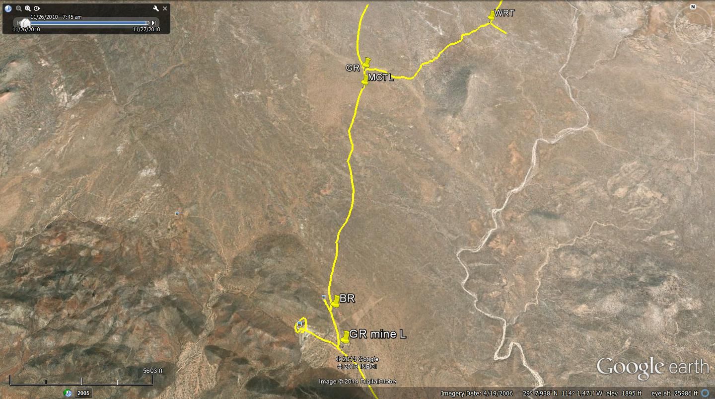
On a recent trip we visited Tinaja de Yubay. It took us a little while to figure out the way in from Hwy 12 as the original road was blocked. I assumed it was by the rancher to control his cattle. A new road was cut to the right and almost in parallel with the old road for the first 2.5 miles. I've hand drawn a map and also did a drawing on Google Earth.

Note the concrete post, the first are round and the second are square.


Yubay a week ago

David K - 1-29-2014 at 01:19 PM

Wonderful maps... Can't tell, but was there any surface water? Is that the fig tree on the left?

The road that continues ahead north (marked "to blue palms"), have you tried to ride it all the way to the Salsipuedes ranch road? Amo Pescar and I camped by the blue palms (Rock Palm Hill), but it appears at least a m/c could connect with the road (that Mark_BC recently was on)?

Thank you TW... Mando told me he met you on the L.A. Bay highway just after you came out mapping the area. I was looking forward to hearing what you discovered! :light:

Neal Johns - 1-30-2014 at 06:21 PM

DK,
A decade ago, Marian and I walked it to where it goes over a small hill and then goes left (west) in a small side arroyo to the road Mark took. I suggested it to Ken Cooke for a Jeep road.

There is a lot of vegetation in the road where it bypasses rough spots in the arroyo due to no usage. "Move" the cholla cactus and it is passable for a Jeep. A little too sidehill for my Pop-Top. Passable now for an MC.
Neal

TMW - 1-30-2014 at 08:47 PM

The only water we saw was at the place where the cattle were drinking in the picture in my trip report, it was about half way between the lower Yubay and the upper Yubay. We did not try going on the Blue Palm road. I noted it because it was noted on a map you (DK) made.

David K - 1-30-2014 at 08:52 PM

Quote:
Originally posted by Neal Johns
DK,
A decade ago, Marian and I walked it to where it goes over a small hill and then goes left (west) in a small side arroyo to the road Mark took. I suggested it to Ken Cooke for a Jeep road.

There is a lot of vegetation in the road where it bypasses rough spots in the arroyo due to no usage. "Move" the cholla cactus and it is passable for a Jeep. A little too sidehill for my Pop-Top. Passable now for an MC.
Neal


Great photos of Yubay and other nearby sites from Neal and Marian: http://vivabaja.com/neal2


Yubay overflowing:


güéribo - 11-6-2014 at 08:05 PM

Yubay is a special place. A 1911 photo:


Neal Johns - 11-6-2014 at 08:55 PM

Thanks, güéribo

David K - 11-7-2014 at 09:27 AM

:bounce:

Santiago - 11-7-2014 at 04:40 PM

by the way, how is Yubay pronounced? I say "You-Bay" but I'm pretty sure that's wrong.

David K - 11-7-2014 at 04:43 PM

I say YOU BUY (like: you buy it with your own money)