BajaNomad

mexicali crossing

bajaemma - 2-10-2014 at 05:20 AM

getting ready for our yearly 2 weeks (not enough) traveling from northern California. Just wondering if there are any nomads who regularly use this this route. Any suggestions? I have always gone thru Tijuana. Thanks bajaemma

EnsenadaDr - 2-10-2014 at 05:43 AM

It's a very confusing crossing if you don't know the area. You can go south to San Felipe or go west to Tecate and head south depending where you are going. The road from Mexicali to Tecate is ok but if you are heading south to Baja, and not San Felipe area I would take highway 8 to Tijuana. It's much more direct through the mountains.

Mula - 2-10-2014 at 06:03 AM

After years of going through TJ and Tecate, we went through Mexicali 2 weeks ago.
It was smooth and not confusing.

The road signs to San Felipe and across to Ensenada were up and easy to spot.

We went on down south to Coco's Corner and on over to Mex 1 to miss the San Quintin traffic. From The Papa Hernandez turn off going south to Mex 1 is construction and gravel. Slow going, but if you have 3 hours - no problem.

Basically, I thought this route was a breeze with very little traffic.

nbacc - 2-10-2014 at 08:44 AM

Mexicali............easy crossing at the East crossing

bonanza bucko - 2-10-2014 at 09:18 AM

We have a house at Alfonsina's and drive there through Mexicali a lot.....about twice a month lately. As Mula, above, says the route through Mexicali is not confusing anymore; they have rebuilt many streets and the road signs are accurate.

The road from Mexicali to San Felipe is also recently rebuilt in most places but there is one five mile construction stretch at la Ventana just about in the middle of the 126 mile trip to San Felipe. South of San Felipe the road is paved but narrow until you reach Puertecitos (47 miles). Between Puertecitos and Gonzaga Bay you have a new and well built road of about 51 miles. There is construction between Papa Fernandez and the Alfonsina's/Rancho Grande turn off (3.5 miles) but the road that is available is a construction road.....generally much better than the old road ever was. Then you have 31 miles or construction road past Coco's Corners to Mex I at Lake Chapala.

But Mexico is not PC and there is no OSHA or DMV to place approved signs telling stupid Gringos not to drive their sedans into a 20 foot ditch....so you gotta stay awake and see what is happening because the construction crews are focussed on the job and not saving your sorry ass. I find this delightful and one of the best benefits of being in Baja. :-)

The times of the trip are as follows: Mexicali to San Felipe 2 hours; San Felipe to Puertecitos 1 hour; Puertecitos to Alfonsina's 1 hour....maybe a little longer if you stop to take pictures and enjoy the view turn offs. The Islas Encantadas are spectacular from the Tres Marias

The Tres Marias are the three mountains along the coast where we used to stop at a shrine at the bottom of each one to pray we made it thought them on THAT ROAD:-) Now the speed limit is 110 KM (70 MPH) through them. Even the old wooden cross with the hat on it memorializing Ray Grove who went over the cliff at the top of the middle Tres Maria is gone....his ghost is down at the bottom where they found his skeleton with an empty bottle of Jim Beam in his hands.

I am sharing this info with you because I am senile and I have become too nice in my old age---we have spent the last 40 years at Alfonsina's in delightful seclusion because we could only get there by airplane (runway under water at high tide) or by a 12 hour plus drive through the Tres Marias.

We have spent years telling Gringos that the drive was through barrancas full of Bandidos polishing their pistolas and stroking their mustachios as they waited for a fat Gringo in a Cadillac to stop to take a leak. We have also advertised the Chupacabras awaiting Gringos in 2X4 Chevy trucks and other such rigs which were not ready for the trip. But, sadly, now we have been found out and I must confess that the trip via truck/car is delightful and we don't need to fly anymore; you could even get there in a SMART car, for heaven sakes!

Papa Fernandez has a super cantina with good food which they make after you arrive....bring your own beer because they haven't paid the *&;)*%$ bureaucracy the $20K to get a beer license. Alfonsina has another very, very good cantina. Antonio runs the place and they even have a menu and a waiter; sad to say the place is "modern" now. Rancho Grande has a super market and Alfonsina's PEMEX has food and supplies---it is run by Trino and Adella who are very nice people.

But please treat this place with the reverence it deserves. If you don't the Chupacbras with find you and suck the blood out of your goat and the Bandidos, who are good friends of ours, will stick you and steal all your cookies.
BB:-)

Desertbull - 2-10-2014 at 09:28 AM

Amen BB!


Quote:
Originally posted by bonanza bucko
We have a house at Alfonsina's and drive there through Mexicali a lot.....about twice a month lately. As Mula, above, says the route through Mexicali is not confusing anymore; they have rebuilt many streets and the road signs are accurate.

The road from Mexicali to San Felipe is also recently rebuilt in most places but there is one five mile construction stretch at la Ventana just about in the middle of the 126 mile trip to San Felipe. South of San Felipe the road is paved but narrow until you reach Puertecitos (47 miles). Between Puertecitos and Gonzaga Bay you have a new and well built road of about 51 miles. There is construction between Papa Fernandez and the Alfonsina's/Rancho Grande turn off (3.5 miles) but the road that is available is a construction road.....generally much better than the old road ever was. Then you have 31 miles or construction road past Coco's Corners to Mex I at Lake Chapala.

But Mexico is not PC and there is no OSHA or DMV to place approved signs telling stupid Gringos not to drive their sedans into a 20 foot ditch....so you gotta stay awake and see what is happening because the construction crews are focussed on the job and not saving your sorry burro. I find this delightful and one of the best benefits of being in Baja. :-)

The times of the trip are as follows: Mexicali to San Felipe 2 hours; San Felipe to Puertecitos 1 hour; Puertecitos to Alfonsina's 1 hour....maybe a little longer if you stop to take pictures and enjoy the view turn offs. The Islas Encantadas are spectacular from the Tres Marias

The Tres Marias are the three mountains along the coast where we used to stop at a shrine at the bottom of each one to pray we made it thought them on THAT ROAD:-) Now the speed limit is 110 KM (70 MPH) through them. Even the old wooden cross with the hat on it memorializing Ray Grove who went over the cliff at the top of the middle Tres Maria is gone....his ghost is down at the bottom where they found his skeleton with an empty bottle of Jim Beam in his hands.

I am sharing this info with you because I am senile and I have become too nice in my old age---we have spent the last 40 years at Alfonsina's in delightful seclusion because we could only get there by airplane (runway under water at high tide) or by a 12 hour plus drive through the Tres Marias.

We have spent years telling Gringos that the drive was through barrancas full of Bandidos polishing their pistolas and stroking their mustachios as they waited for a fat Gringo in a Cadillac to stop to take a leak. We have also advertised the Chupacabras awaiting Gringos in 2X4 Chevy trucks and other such rigs which were not ready for the trip. But, sadly, now we have been found out and I must confess that the trip via truck/car is delightful and we don't need to fly anymore; you could even get there in a SMART car, for heaven sakes!

Papa Fernandez has a super cantina with good food which they make after you arrive....bring your own beer because they haven't paid the *&;)*%$ bureaucracy the $20K to get a beer license. Alfonsina has another very, very good cantina. Antonio runs the place and they even have a menu and a waiter; sad to say the place is "modern" now. Rancho Grande has a super market and Alfonsina's PEMEX has food and supplies---it is run by Trino and Adella who are very nice people.

But please treat this place with the reverence it deserves. If you don't the Chupacbras with find you and suck the blood out of your goat and the Bandidos, who are good friends of ours, will stick you and steal all your cookies.
BB:-)
elgatoloco - 2-10-2014 at 09:38 AM

:lol:

David K - 2-10-2014 at 10:41 AM

Good one BB, good one!:lol:

Whale-ista - 2-10-2014 at 11:04 AM

Thanks to everyone for their perspectives. I am more familiar with west coast driving.

So, it appears it is "only" 31 miles from Cocos corner to lake Chapala /hwy 1 yet it takes 3 hours?

Is it really that bad the entire stretch? Can anyone post photos?

Is it similar to the conditions and construction work being done out to San Ignacio lagoon?

Thank you for clarification.

David K - 2-10-2014 at 11:08 AM

Emma, what is your destination? If L.A. Bay or beyond, then keep in mind the 35 unpaved miles south of Gonzaga Bay. So, if rough roads of those miles isn't an issue, than the gulf road is a great way to avoid the zoo of Tijuana and Ensenada and San Quintin traffic.

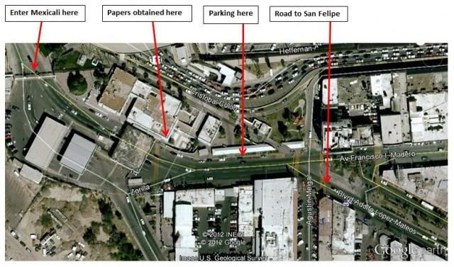
The INM (for your tourist cards) is on the LEFT, just after entering at Mexicali.

The correct street for San Felipe is the center divided boulevard, and it has the train tracks in the middle for a couple miles... plus well signed for San Felipe. Look it over on Google Earth if you want to see the layout... 5 miles from the border is a major split, and San Felipe is the right hand fork... and here you cross the train tracks.

The highway is a 4 lane road for about 30 miles... and it widens back to 4 lanes about a dozen miles north of San Felipe.

Enjoy!

[Edited on 2-10-2014 by David K]

David K - 2-10-2014 at 11:18 AM

Quote:
Originally posted by Whale-ista
Thanks to everyone for their perspectives. I am more familiar with west coast driving.

So, it appears it is "only" 31 miles from Cocos corner to lake Chapala /hwy 1 yet it takes 3 hours?

Is it really that bad the entire stretch? Can anyone post photos?

Is it similar to the conditions and construction work being done out to San Ignacio lagoon?

Thank you for clarification.


I measured it closer to 35 miles from Rancho Grande to Chapala... and it takes me in a Tacoma about 1-2 hours depending on how long we visit with Coco or take photos or have to fix a flat (lol)... Deflate to 20 psi!

Coco's Corner to Chapala (Hwy. 1) is only 13 miles! That is the roughest part, however.

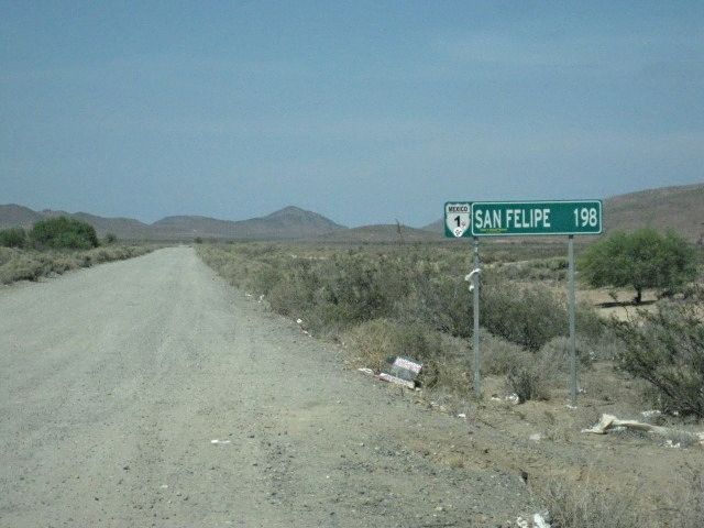
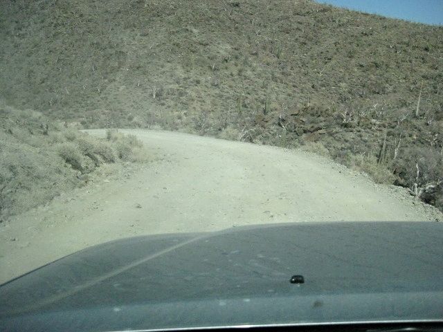
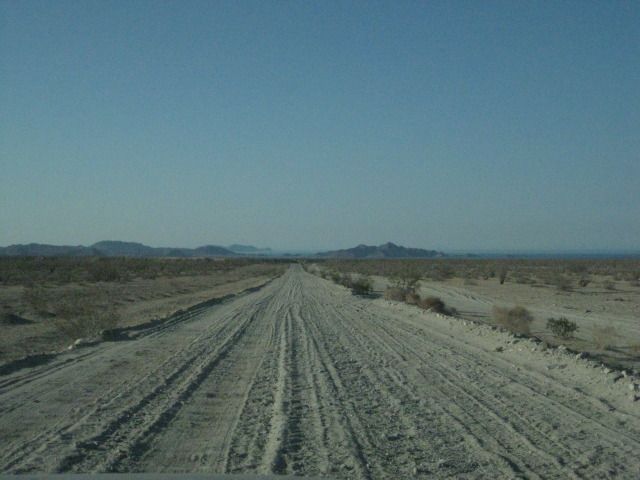
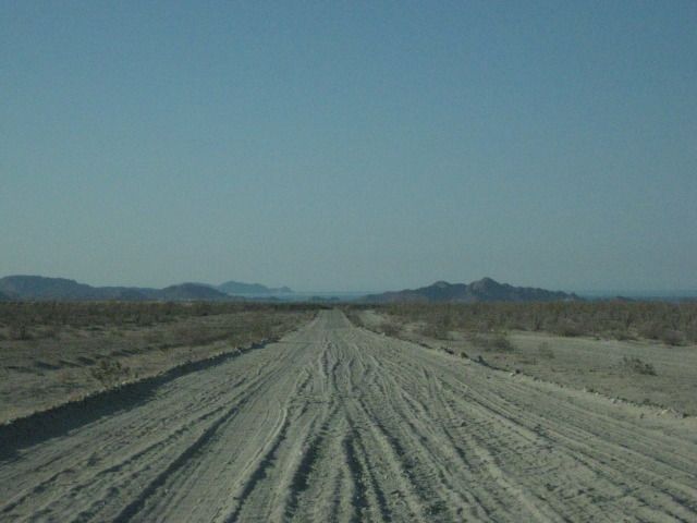
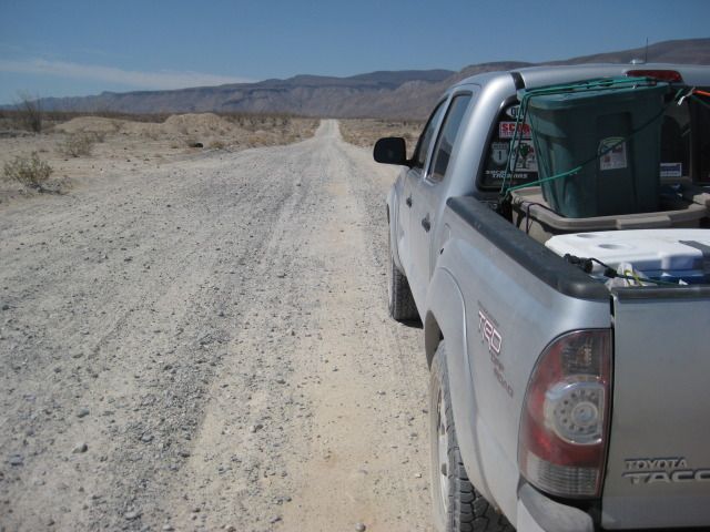
Photos taken in 2012:
Going South:


Going North:


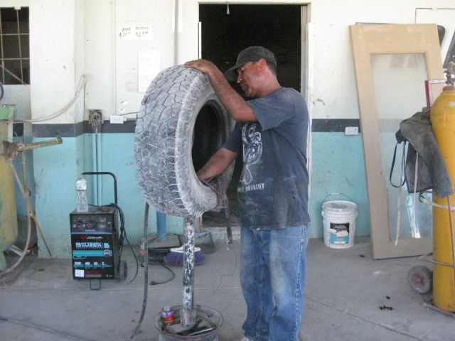
Rancho Grande Tire Repair (I didn't deflate!):


[Edited on 2-10-2014 by David K]

Mexicali Border Southbound

David K - 2-10-2014 at 03:36 PM

John M posted this:


Bajajorge - 2-11-2014 at 10:29 AM

Calexico East crossing into Mexicali is very easy, no lines. Northbound at just about any crossing is another story though.

bajaemma - 2-12-2014 at 07:02 AM

Thank you all. We will be going to places in BCS just thought a change might be fun

CortezBlue - 2-12-2014 at 09:26 PM

Anyone who has crossed at Mexicali East or West knows it is not confusing, at all.

I cross the east side most of the time coming or going.
Turn right when you exit the crossing area.

You will come to road that will show a sign that says San Felipe, turn left.

Stay on that road for a while till you get to the Kenworth facility, turn left and you are on Hwy 5.

you will go past Costco on your left.

At that point it is a straight shot.

Now, it may seem simple cause I stayed at a Holiday Inn Express last night