BajaNomad

Question and more questions

250xcfw - 3-2-2014 at 11:23 PM

First off this will be my first trip in an rv to Mexico. So I have a list of question regarding crossing the boarder and what i need to do so.

1) Vehicle Insurance, truck, 5th wheel, 4 wheelers, How, where, how much, proof of ownership?
2)Pets what is needed?
3)Fishing licence where to buy?
4)Good place to buy food after crossing in Tecate?
5)Crossing at Tecate and taking Hwy 3 in a 5th wheel toyhauler good idea?
6)Plan on making it to San Quintin or close the first night? Gas, Rv camping?
7)Do I pay for gas and food with card or cash

All advice would be helpful.

I will be in Baja for 3-4 week, going as far south as Loreto.
Anyone going down in mid March?

Thank you,
John

redhilltown - 3-3-2014 at 12:31 AM

Howdy and welcome. A good place to start for a few of your questions might be


http://www.discoverbaja.com/

After joining you can take care of the insurance, fishing license, and tourist visas. You'll still need to stop at Tecate and get them stamped but you'll save some paperwork/time. Others will be able to better tell you if a rig your size is doable at that crossing as to parking and going in to the immigration office...parking is a bit tight there.

Gas is cash and keep an eye on things...you'll be spending quite a bit and always a good idea to know the prices and your liters...calculator can help. I am not saying they WILL cheat ya a bit but if they did, it certainly wouldn't be the first time.

San Quintin no problem for a first night as to distance. Jardines is a fantastic hotel and restaurant. Have a blast!

(There are also many threads on here on all of this...use the search option. )

DENNIS - 3-3-2014 at 01:34 AM

Quote:
Originally posted by 250xcfw

4)Good place to buy food after crossing in Tecate?
5)Crossing at Tecate and taking Hwy 3 in a 5th wheel toyhauler good idea?
6)Plan on making it to San Quintin or close the first night? Gas, Rv camping?
7)Do I pay for gas and food with card or cash


Welcome to BajaNomad, John.
Let me take only a few of your questions:

[5] No problem on the "3" with your rig. The first section out of Tecate is a long and fairly steep incline, but not bad.

[6] I think Estero Beach, south of Ensenada, would be enough for your first day. Stay the night there and get a fresh start in the morning.
Maneadero is only a few more miles south and easy access gas stations are right there on Hwy 1.

[7] Pay with cash for everything. Know the rate of exchange and keep a calculator handy if you don't have pesos, but try to stock up on local money before you hit the road.
If dollars are all you have, just be prepared to take a small hit on the exchange when you make a purchase, but buy pesos asap.

Have a great trip and stay in touch.

RnR - 3-3-2014 at 07:11 AM

Quote:
Originally posted by redhilltown

San Quintin no problem for a first night as to distance. Jardines is a fantastic hotel and restaurant.


Welcome!

Jardines is a hotel and the restaurant is closed on Mondays.

Los Olivos RV park is next to Jardines. (One house between the two).

There are signs for both at the highway. About a 1/2 mile off the highway. Quiet and peaceful.

Both Jardines and Los Olivos have websites.

Always our first and last nights stop.

250xcfw - 3-3-2014 at 07:54 AM

Keep the good information coming. Los Olivos is the place I was planning on staying
I heard it was safe and there was good food close
What mile marker?

Thanks,
John

Udo - 3-3-2014 at 08:33 AM

There is also an RV park next to Jardines. You'll see the silarge sign as you leave San Quintin (the turn-off is just after the large power transformers, on the left).


Quote:
Originally posted by redhilltown
Howdy and welcome. A good place to start for a few of your questions might be


http://www.discoverbaja.com/

After joining you can take care of the insurance, fishing license, and tourist visas. You'll still need to stop at Tecate and get them stamped but you'll save some paperwork/time. Others will be able to better tell you if a rig your size is doable at that crossing as to parking and going in to the immigration office...parking is a bit tight there.

Gas is cash and keep an eye on things...you'll be spending quite a bit and always a good idea to know the prices and your liters...calculator can help. I am not saying they WILL cheat ya a bit but if they did, it certainly wouldn't be the first time.

San Quintin no problem for a first night as to distance. Jardines is a fantastic hotel and restaurant. Have a blast!

(There are also many threads on here on all of this...use the search option. )

Udo - 3-3-2014 at 08:36 AM

The mile marker is actually "0", because San Quintin is a new KM start until the Bahia De Los Angeles torn off...then it resets to zero again.


Quote:
Originally posted by 250xcfw
Keep the good information coming. Los Olivos is the place I was planning on staying
I heard it was safe and there was good food close
What mile marker?

Thanks,
John

mtnpop - 3-3-2014 at 08:47 AM

FYI,,, from personal experience also... when you leave San Quintin in about 40 miles you will see a pemix on the left as you enter El Rosario.. stop there and top off your fuel... It is approx 200 miles to the next Pemix and there is some mtn grade to cross in that stretch... you can buy fuel from vendors beside the road, but I don't know what you get.. Pulling a large 5th wheel as we did mpg was low... Watch the curves and shoulders on the road some tight turns meeting 18 wheelers and big drop offs on narrow highway..
We always have Pesos for fuel... the exchange is lower at Pemix and sometimes the transaction happens so fast you leave a pretty good tip that you realize when you get down the road...
Take your time and enjoy the trip,,, drive safe...
If you stop in Mulege we have cold beer...

El Jefe - 3-3-2014 at 09:00 AM

Tell your bank you are going to Mexico so they don"t ixnay your card. Then use your ATM card for pesos. 4000 pesos is about 300 dollars. There are several banks on the long four lane road on the way out of Ensenada. Also a good area for stocking up on groceries. Big box stores etc. have large lots for your rig.

After arriving in San Quintin take a deep breath. It gets so much better from there on. For planning purposes figure on averaging about 50 mph on your trip.

One more thing. Make sure you have title or registration papers for all your motorized vehicles. May need to show at border crossing.

[Edited on 3-3-2014 by El Jefe]

Ensenada Area

bajaguy - 3-3-2014 at 09:08 AM

As you are leaving the "main" downtown area headed south, there will be a large Wal-Mart - Home Depot shopping center on your right. Plenty of RV parking and several banks with ATM's. Just avoid the Bancomer ATM's....highest user fees.

On your left as you pass the Wal-Mart center there is a COSTCO and a Commercial Mexicana shopping center. Good RV parking and a variety of bank ATM's inside the stores

David K - 3-3-2014 at 09:19 AM

Great info...

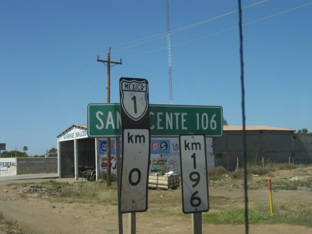
To add... The Kilometer Marker for Los Olivos RV park/Jardines Restaurant (next door) is 1... at the south side of San Quintin & Lazaro Card##as (twin towns) the highway NARROWS to 19 ft. and that is Km. 0. Just a kilometer ahead look for the Jardines sign and turn right... go 1/2 mile and turn left...Los Olivos is on your right... and Jardines is just beyond. I think Jardines is closed on Monday, however.

No fishing license needed for surf fishing, only boat fishing. (Discover Baja Travel Club is $39/ year and a good source for that and other stuff (books, maps, etc.)

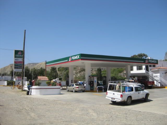
Hwy. 3 is fine and recently widened... even 4 lanes in part. You will have much more twisty roads, and narrower further south on Hwy. 1. Don't be in a hurry! Last Pemex Pumped gas for 200 miles is El Rosario... about 30 miles from Los Olivos, as you come down the hill, on your left. Honest station, owned by Baja Nomad member 'BajaCactus' (Antonio).


Km. 0 San Quintin/ but looking north.


Baja Cactus Pemex in El Rosario

[Edited on 3-3-2014 by David K]

wilderone - 3-3-2014 at 09:55 AM

Get vehicle insurance online.
"Food" can be bought in the large grocery stores in Ensenada - Calimax, Gigante, Soriana
There is a big outdoor fruit/vege market as you're passing out of town - past Maneadero I think.
But for dried fruit, nuts, chips, crackers, drink mixes, canned beans, pasta - get it in San Diego. Go to the 99 cent Only Store on Market St at 27th; the Grocery Outlet on Market Street (at 10th); and the Big Lots stores. You can stock up on the basics that you won't find in Baja at a very reasonable cost. At the 99 cent store, obviously everything is 99 cents - toilet paper, napkins, cleansers, toiletries, seasonings, basic hardware, toys, plastics of all kinds.
Then, buy tortillas, fresh stuff, eggs, ice, beer in Baja. Eat at all the fish taco places.
Mex. 3 has been greatly improved - will be no problem
"Cash" should be pesos. You can exchange at the small convenience store on the US side at the Tecate Border. You can also buy insurance, coffee and gas there. If you don't get pesos there, there are exchange places in Ensenada on the main drag. Look for the flashing neon signs with their exchange rates. In the past, I have found them to be competitive to San Ysidro's rates. You can get pesos at ATMs en route as well.

cocoscabana - 3-3-2014 at 10:31 AM

If you are going down for 4 weeks in the middle of March, this means you will be returning NOB in mid April. This coincides with Semana Santa...2 weeks of major road traffic and fully occupied beaches, as mucho mucho Mexicans flock to Baja for Easter. Just a word of caution!!! Be especially cautious driving, and camp in an RV park, not on the beach. This is the Mexican time to enjoy beaches and they get very crowded.

Enjoy your trip.

apple - 3-3-2014 at 10:32 AM

Hey, I've said this before but this book has a lot of great info for the drive down, especially when it comes to advice on the roads. It has been a god send us on our travels.
http://www.amzn.com/0974947180/

That said, you can't miss a Pemex and ALWAYS pay in pesos.
"Lleno, por favor"

DENNIS - 3-3-2014 at 10:41 AM

Quote:
Originally posted by bajaguy
As you are leaving the "main" downtown area headed south, there will be a large Wal-Mart - Home Depot shopping center on your right. Plenty of RV parking and several banks with ATM's. Just avoid the Bancomer ATM's....highest user fees.

On your left as you pass the Wal-Mart center there is a COSTCO and a Commercial Mexicana shopping center. Good RV parking and a variety of bank ATM's inside the stores


Don't confuse "RV Parking" for overnighting. I don't think that would go well here.

Nope

bajaguy - 3-3-2014 at 11:08 AM

Quote:
Originally posted by DENNIS
Quote:
Originally posted by bajaguy
As you are leaving the "main" downtown area headed south, there will be a large Wal-Mart - Home Depot shopping center on your right. Plenty of RV parking and several banks with ATM's. Just avoid the Bancomer ATM's....highest user fees.

On your left as you pass the Wal-Mart center there is a COSTCO and a Commercial Mexicana shopping center. Good RV parking and a variety of bank ATM's inside the stores


Don't confuse "RV Parking" for overnighting. I don't think that would go well here.


Providing info on shopping and ATM's, didn't mention, nor would I suggest overnite parking at either location

DENNIS - 3-3-2014 at 11:13 AM

Quote:
Originally posted by bajaguy


Providing info on shopping and ATM's, didn't mention, nor would I suggest overnite parking at either location


Yeah...I know. Just thought the mention of RV parking and WalMart might suggest a stateside tradition of camping in the parking lot. :)

bajaguy - 3-3-2014 at 11:29 AM

Wouldn't even suggest stopping on the US side at Tecate. parking for that rig will be a problem. Minimize your time at Tecate......however if you need to get FMM's at the Tecate INM, you may not have a choice.

1) Vehicle Insurance, truck, 5th wheel, 4 wheelers, How, where, how much, proof of ownership?..............get your insurance on-line from Bajabound, they will have the info you need for your rig and toys bring copies of your vehicle titles and registrations:

http://www.bajabound.com/

2)Pets what is needed?......officially, an International Health Certificate from your vet within the last 10 days. You can get by with vet records showing current rabies vaccination.

3)Fishing licence where to buy?....as mentioned above, no license required for shore fishing

4)Good place to buy food after crossing in Tecate?.......again, minimize your time in Tecate with your rig. Several places in Ensenada that have easy access for your rig....see above

5)Crossing at Tecate and taking Hwy 3 in a 5th wheel toyhauler good idea?.......No problem S/B. you will probably get flagged into Mexican Customs "secondary" for a quick look at your RV and load. Highway 3 is in good shape, some construction areas, not bad. the 2 lane opens up to a 4 lane at the north end of the Guadalupe Valley

6)Plan on making it to San Quintin or close the first night? Gas, Rv camping?......doable, but don't push. Don't drive at night. plenty of PEMEX stations

7)Do I pay for gas and food with card or cash....Having a card is good back up, but cash is king. Use pesos. Get 'em from ATM's....see above. Most places will take dollars, but with the new money laundering laws in Mexico it is becoming more difficult for the locals to convert dollars to pesos.....although it is good to have a "stash" of US dollars....just in case


Quote:
Originally posted by 250xcfw
First off this will be my first trip in an rv to Mexico. So I have a list of question regarding crossing the boarder and what i need to do so.

1) Vehicle Insurance, truck, 5th wheel, 4 wheelers, How, where, how much, proof of ownership?
2)Pets what is needed?
3)Fishing licence where to buy?
4)Good place to buy food after crossing in Tecate?
5)Crossing at Tecate and taking Hwy 3 in a 5th wheel toyhauler good idea?
6)Plan on making it to San Quintin or close the first night? Gas, Rv camping?
7)Do I pay for gas and food with card or cash

All advice would be helpful.

I will be in Baja for 3-4 week, going as far south as Loreto.
Anyone going down in mid March?

Thank you,
John


[Edited on 3-3-2014 by bajaguy]

Pappy Jon - 3-3-2014 at 12:22 PM

Quote:
Originally posted by cocoscabana
If you are going down for 4 weeks in the middle of March, this means you will be returning NOB in mid April. This coincides with Semana Santa...2 weeks of major road traffic and fully occupied beaches, as mucho mucho Mexicans flock to Baja for Easter. Just a word of caution!!!


Uh? This is new to me. Can somebody explain? I scheduled my vacation to avoid the college spring break crowd. What is NOB? What is Semana Santa?

bajaguy - 3-3-2014 at 12:38 PM

Uh? This is new to me. Can somebody explain? I scheduled my vacation to avoid the college spring break crowd..............
Uh, the US College Spring Break crowd has nothing (much) to do about it.

What is NOB?..............North of the Border

What is Semana Santa?........big week long holiday for Mexicans.

All campgrounds and beaches will be elbow to elbow, roads will be busy with traffic headed to the recreation spots or back home. Many US Mexicans also participate and drive down to be with family


Quote:
Originally posted by Pappy Jon
Quote:
Originally posted by cocoscabana
If you are going down for 4 weeks in the middle of March, this means you will be returning NOB in mid April. This coincides with Semana Santa...2 weeks of major road traffic and fully occupied beaches, as mucho mucho Mexicans flock to Baja for Easter. Just a word of caution!!!


Uh? This is new to me. Can somebody explain? I scheduled my vacation to avoid the college spring break crowd. What is NOB? What is Semana Santa?

Great advice everyone

250xcfw - 3-3-2014 at 01:51 PM

So how much is the auto insurance? I checked online and it said 600 Is that true?
So on to the good questions. Where to stay on the way down, first stop Bahia LA. Anyone have a favorite spot on the beach?

John

apple - 3-3-2014 at 01:53 PM

As with all insurance, it depends on what kind of coverage you choose and how much your vehicle is worth.
We paid $400 for full coverage for a year this year. (and it was probably more than we needed to pay)

RnR - 3-3-2014 at 01:55 PM

Quote:
Originally posted by Pappy Jon
Uh? This is new to me. Can somebody explain? I scheduled my vacation to avoid the college spring break crowd. What is NOB? What is Semana Santa?


Semana Santa - April 13-19, 2014.

Semana Santa is the week before Easter, so, it is different every year.

It has nothing to do with spring break. US college "spring break" means crowds of college students in the usual tourist/party area. Cancun, Mazatlan, Cabo, etc.

Mexican "semana santa" is a Mexican tradition to head to the beaches for the entire week. ALL beaches (everywhere in the country) will be beyond PACKED!

BajaBlanca - 3-3-2014 at 02:02 PM

Pompano, some pics of the crowded beaches?! It is beyond crazy busy that week.

mtnpop - 3-3-2014 at 02:02 PM

You should be able to buy shorter time span than annual for vehicle insurance
Also be sure that you add the 5th wheel and the 4 wheelers just to be safe
I don't remember if you can get auto insurance for 30 days but do know that you can do 6 month coverage.. and probably 30 days..

Insurance

bajaguy - 3-3-2014 at 02:19 PM

Call Geoff at Bajabound

David K - 3-3-2014 at 04:50 PM

Quote:
Originally posted by 250xcfw
So how much is the auto insurance? I checked online and it said 600 Is that true?
So on to the good questions. Where to stay on the way down, first stop Bahia LA. Anyone have a favorite spot on the beach?

John


At the top of the Nomad page is a banner ad from our sponsor, http://bajabound.com and if you click that you can get a quote for the coverage needed... If more than 2 or 3 weeks of coverage you may look at the 6 month or full year policy for better value or about the same price!

Already mentioned was Discover Baja Travel Club, which sells the same brand insurance, but offer membership discounts. I have had annual full coverage from both places throughout the past dozen years. Baja Bound has always been great to buy online, print out at home for the days you want or annual policy.

Both insurance agents (Baja Bound & Discover Baja) travel Baja and provide online newsletters on current conditions and trip ideas.

A third popular insurance option is joining Vagabundos del Mar (primarily a Baja/ Cortez boating club). They are in the Sacramento area instead of San Diego, as the other two are.

250xcfw - 3-4-2014 at 07:48 AM

When is semana santa? I can always explore the desert and canyons for a week.

John

DENNIS - 3-4-2014 at 08:05 AM

Quote:
Originally posted by 250xcfw
When is semana santa? I can always explore the desert and canyons for a week.

John


Traditionally, it's the week leading up to Easter Sunday.
Semana Santa......Holy Week.

El Jefe - 3-4-2014 at 08:06 AM

April 17, 18, 19 and Easter 20 will be the busiest days at the beaches. Thursday through Sunday. Packed and pretty crazy fun. The week long camp outs of old are not as popular as they once were. Mexicans gotta work too.

Where we live on the east cape the beach that is deserted most of the year is cheek to jowl with campers for four days at semana santa. Costco dome tents as far as the eye can see. Motos running up and down the sand. Kids rolling in the surf and giggling. Mamas cooking for the masses. Dads drinking beer. Teens moving in packs, looking for packs of the opposite sex to talk to. Grandmas in chairs shucking something or other for dinner. Grandpas in chairs too, staring off with happy grins. It is all good and wonderful, but you gotta like polka music late into the night if you want to hang.

250xcfw - 3-4-2014 at 08:52 AM

So I did a online quote for insurance and it was $650 for 4 weeks. 6 months was a $100 more a year was around a $1000. Does this sound right. With a 5th wheel, truck and quads it's easy to get to $100,000 of stuff.

John

Udo - 3-4-2014 at 09:04 AM

Great photo, Bob!

David K - 3-4-2014 at 09:09 AM

Quote:
Originally posted by 250xcfw
So I did a online quote for insurance and it was $650 for 4 weeks. 6 months was a $100 more a year was around a $1000. Does this sound right. With a 5th wheel, truck and quads it's easy to get to $100,000 of stuff.

John


Was that from one or all of the places I mentioned? We know they are honest outfits... and a couple offer membership (club) discounts. The Baja Good Life Club also has membership discounts and uses one of the companies mentioned.

250xcfw - 3-4-2014 at 09:47 AM

$650-$750

Grupo National Provincial
Standard Coverage

Grupo National Provincial
Extended Coverage


ACE Seguros
Standard Coverage


ACE Seguros
Extended Coverage


ABA Seguros
Standard Coverage


ABA Seguros
Extended Coverage

my twp pesos

captkw - 3-4-2014 at 10:14 AM

I've have found the week before,,the main event (lol) and the week after is nuts and crazy on all the roads..I belive more folks die on the roads in that three week (about) time frame than any other !! my self have learned to hunker down with plenty of supplies and stay put and enjoy where I'm staying...and its not a beach !! K&T:cool::...I get liability for a year $60 dll
[Edited on 3-4-2014 by captkw]

250xcfw - 3-4-2014 at 10:43 PM

So where does everyone stay in Bahia LA? I need very little as far as amenities go.
I`m looking for a nice beach, fishing and able to ride the quads to town without going on the hwy.

John

redhilltown - 3-5-2014 at 12:24 AM

La Gringa? North of town just about as far as you can go. Great views, sand, water...nothing else except a nice guy who will come around once a day and collect the rent.

David K - 3-5-2014 at 08:33 AM

Well, a paved road goes about halfway to La Gringa from town. Riding a quad on it is probably not an issue with anyone?

An all dirt to town option is to camp at the south end of the bay... huge all sand beach... about 6 miles south of town, just past Muņoz' property, where the bay bottoms out.

250xcfw - 3-7-2014 at 08:48 PM

Quote:
Originally posted by David K
Well, a paved road goes about halfway to La Gringa from town. Riding a quad on it is probably not an issue with anyone?

An all dirt to town option is to camp at the south end of the bay... huge all sand beach... about 6 miles south of town, just past Muņoz' property, where the bay bottoms out.


What is the place called in La Gringa ? Are there signs? GPS location?

John

250xcfw - 3-7-2014 at 08:53 PM

Quote:
Originally posted by redhilltown
La Gringa? North of town just about as far as you can go. Great views, sand, water...nothing else except a nice guy who will come around once a day and collect the rent.


How much rent? How's the fishing in La Gringa?

John

redhilltown - 3-8-2014 at 12:54 AM

Quote:
Originally posted by 250xcfw
Quote:
Originally posted by redhilltown
La Gringa? North of town just about as far as you can go. Great views, sand, water...nothing else except a nice guy who will come around once a day and collect the rent.


How much rent? How's the fishing in La Gringa?

John


I "think" for our regular vehicles it was $5.00 a day...the usual going rate in Baja...for your rig I am not sure. Fishing is just your resident locals of bay bass, triggers, corvina and a few others. For the most part the shore fishing in L.A. Bay is not too exciting. Find Igor at Guillermo's or stop by Dagget's if you want a day on the water...depending on how important fishing is to you. They will find you something. If shore fishing is key then head south to Bahia de Las Animas or San Rafael. Rough roads though and I'm not sure if you are towing a Jeep or the like...a bit far for quads.

David K - 3-8-2014 at 02:02 AM

Quote:
Originally posted by 250xcfw
Quote:
Originally posted by David K
Well, a paved road goes about halfway to La Gringa from town. Riding a quad on it is probably not an issue with anyone?

An all dirt to town option is to camp at the south end of the bay... huge all sand beach... about 6 miles south of town, just past Muņoz' property, where the bay bottoms out.


What is the place called in La Gringa ? Are there signs? GPS location?

John


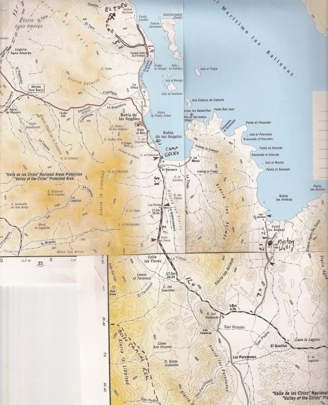
La Gringa up close


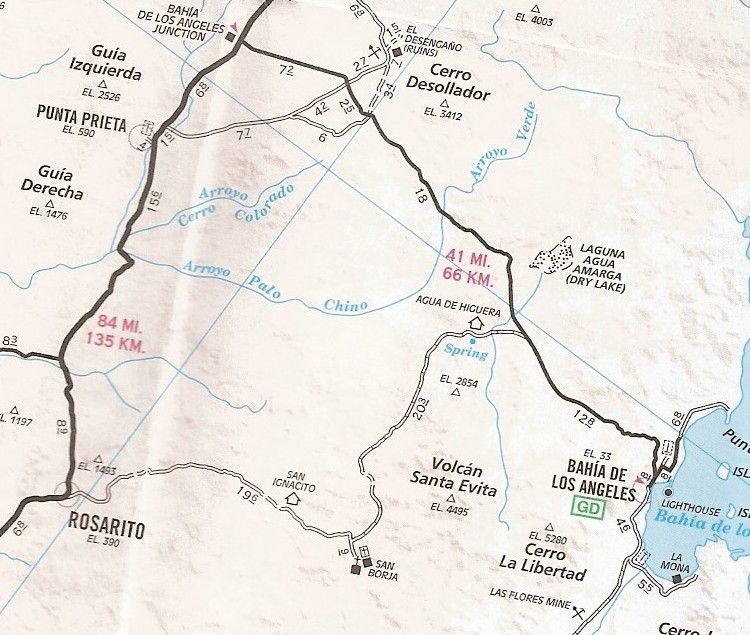
See the road going north from the town of L.A. Bay, mileages 0.8 and then 6.8, paved half way? That's the La Gringa road... The Punta La Gringa (with this map cut off after Pun...) is it... the north end of L.A. Bay.

Some photos taken there...


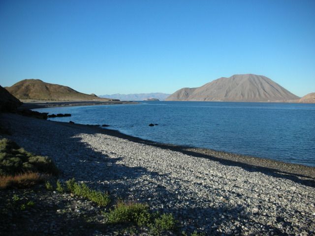
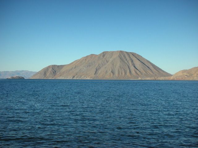
Smith Island (a volcano) is just off shore.

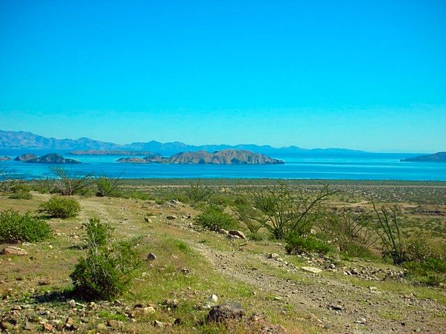
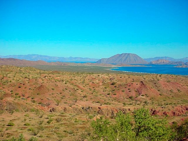
L.A. BAY as seen where the highway comes out of the mountain...


There's La Gringa and Smith Island, beyond...


A sand beach is just before La Gringa, as well.

250xcfw - 3-8-2014 at 10:40 AM

Looks good to me, I'm thinking of staying at Daggetts and using it for a base for a day or two. Then using the quads to scout the roads before going to far off the beaten path. La Gringa looks like what I'm after.
I've been using https://maps.google.com/maps/ms?msa=0&msid=2049990104019... for rv parks along the way. It seems to have quit a few spots to camp but little detail on most.
Once again thanks for all the info and once again everyone has given more than I ever expected.
My next stop will be Santa Rosalia area, Mulege area, and then on to Loreto.

Thanks,
John

250xcfw - 3-8-2014 at 11:08 AM

This is my setup I'm big and heavy 5th wheel toy hauler with quads and kayaks on board for exploring both land and sea. If you see me stop by and have a beer.

[Edited on 3-8-2014 by 250xcfw]

[Edited on 3-8-2014 by 250xcfw]

David K - 3-8-2014 at 11:13 AM

Hi John,

I think the best data on motels and campgrounds at Bahia de los Angeles is at Mia's web site: http://bahiadelosangeles.info

Here is the page over there: http://bahiadelosangeles.info/rv-trailer-parks.htm

Daggett's is along the La Gringa road, right by Raquel & Larry's Motel.

There is a copper mine about 7 miles north and west from La Gringa that makes an interesting side trip... It is the El Toro copper mine, and not on maps (most maps).

The copper ore (green rock) was shipped out from La Gringa... and some ore may still be seen along the hill there. Tossed into a campfire, the copper adds beautiful colors to the flames once it heats up. Paulina named them 'Magic Rocks'... :light:


David K - 3-8-2014 at 11:21 AM

Quote:
Originally posted by 250xcfw
This is my setup I'm big and heavy. I've have quads and kayaks on board for exploring both land and sea. If you see me stop by and have a beer.

[Edited on 3-8-2014 by 250xcfw]


I am going to guess that you tried to upload a photo directly from your folder onto Nomad (using the attachment feature)?

Sadly, the photo must be shrunk to under 50 kb to show here... BUT, a better way, that doesn't reduce the photo quality or use bandwidth on Nomad, is to use a photo hosting site, such as Photobucket.com. Just set the UPLOAD size to 800 pixels or less to not distort the page. Full instructions on how to use Photobucket for Nomad are at the top of the Nomad Photo forum, here: http://forums.bajanomad.com/viewthread.php?tid=65085

250xcfw - 3-8-2014 at 11:35 AM

Yes, I was trying to use the upload function.
What maps are you using or what are the best maps to use?

John

redhilltown - 3-8-2014 at 04:27 PM

Uh oh!!! A David K map question!!!!!!! :spingrin::spingrin::spingrin::spingrin:

You have come to the right place John!

Final thought on La Gringa...good place to hear the whales sing at night if it is quiet/no wind...quite magical if you've never heard it.

David K - 3-8-2014 at 04:34 PM

The Baja Almanac (topo road/ trail map book) would be #1, and the AAA Baja map is next as far as usefulness. The Nat Geo maps are nice and big, but really don't help with planning where to go.

Google Earth or Bing Birdseye satellite images are great to see what's there and where there are track to explore... Most or only a year to 6 old, so you can see all the roads and tracks in Baja... You just need to know where to look!

In my web site, are lots of resources and pages to look at to help plan a Baja adventure... There is so much I have put in them, I am happy to help. I just need to know where you will be based, what you will be driving/ riding and what is interesting to you. I did make a index that you can click on to see some points of interest around various Baja destinations.... look here: http://vivabaja.com/tours

Here's the sites listed for L.A. Bay on that page:


Bahia de los Angeles Area

Tinaja de Yubay
Punta Candeleros & Remedios (Bahia Guadalupe)
El Toro Copper Mine
Camp Gecko cabin, turtle research station, & La Gringa
Bahia de los Angeles highway, Pemex, etc. '05
Bahia de los Angeles Museum
Mision San Borja
Mision San Borja (inside)
Old San Gregorio
Santa Ana, San Ignacito
Montevideo Petroglyphs
Las Tinajitas Petroglyphs
Camp Gecko '03
Las Flores
Los Paredones, La Bocana, Bahia San Rafeal
Las Flores Railroad and Tramway
Rock Palm Hill (near Yubay)
Bahia las Animas
Punta La Gringa
Mysterious Ruins/ Lost Mission Site?

[Edited on 3-8-2014 by David K]

250xcfw - 3-16-2014 at 09:43 PM

I should be entering Mex in the AM and headed south. Wish me luck.
I will try and ask question as i go but I not sure on reception.

Thanks for the help.

John

redhilltown - 3-17-2014 at 12:06 AM

Have a safe fun trip and please report back!

wilderone - 3-17-2014 at 06:56 AM

"What is the place called in La Gringa?"
It's at the end of the road north of town. Some brutle washboard en route. You'll see the military camp and then it's just past. There's a fenced area with camp sites, or you can find dispersed camping. Some of the larger places for larger vehicles are right on the sand - make sure you won't get stuck. And you'll have to make some turns, in, out and around.

absinvestor - 3-17-2014 at 07:41 AM

Lots of good info. I would just reiterate two things. After San Quintin the road narrows to 19ft. Many times the 18 wheelers take up more than their half. No shoulders so lots of mirrors lost and a few roll overs so be careful. I did one Santa Semana in Baja and would not do it again. During Santa Semana finding beach parking for anything bigger than a tricycle will be impossible. Santa Semana is from April 13th to April 20th. The crowds will start a couple days earlier. You'll have lots of fun- enjoy!!

ss2-a.jpg - 37kB

redhilltown - 3-17-2014 at 11:15 PM

Quote:
Originally posted by wilderone
"What is the place called in La Gringa?"
It's at the end of the road north of town. Some brutle washboard en route. You'll see the military camp and then it's just past. There's a fenced area with camp sites, or you can find dispersed camping. Some of the larger places for larger vehicles are right on the sand - make sure you won't get stuck. And you'll have to make some turns, in, out and around.


Yikes! I don't remember brutal washboard, fences, or a military camp!! But I was there for fishing and I guess my brain (what is left of it that is) was focused somewhere else... :spingrin:

250xcfw - 3-22-2014 at 08:12 AM

Made it to Loreto everything going good. Any good places to camp on the beach north of Loreto.

shari - 3-22-2014 at 09:55 AM

Quote:
Originally posted by RnR

Mexican "semana santa" is a Mexican tradition to head to the beaches for the entire week. ALL beaches (everywhere in the country) will be beyond PACKED!


Not true amigo...the beaches on the Gulf side will be packed but the Pacific side beaches are mostly empty as all the locals from our side go over to the Gulf for nice hot weather. It's a good time to visit the Pacific side in places like Bahia Asuncion, La Bocana, Abreojos where the villages are like ghost towns on the long weekend.

David K - 3-22-2014 at 11:56 AM

Quote:
Originally posted by 250xcfw
Made it to Loreto everything going good. Any good places to camp on the beach north of Loreto.


Hope you get a reply for north, but south of Loreto, past Puerto Escondido, is PLAYA LIGUI, just before the highway climbs the mountain. Public sand beach with palapas.

DavidE - 3-22-2014 at 12:35 PM

Semana Santa on the Pacific side! Shorts and Tee shirt time

If you bring a 12 foot parabolic mirror...

250xcfw - 3-23-2014 at 09:50 AM

So how is the hwy south coming out of San Felipe? One of the guys staying next to use is planning on going home that way? Any thoughts?

John

David K - 3-23-2014 at 10:34 AM

The pavement expansion south of San Felipe has got to be one of the most common topics here on Nomad, not sure how you miss seeing them!? :tumble:

I don't mind repeating data for anyone who can't find it...
San Felipe to Gonzaga Bay is PAVED (100 miles)... pavement ends about 2 miles south of the Gonzaga Pemex (Alfonsina's entrance)/ Rancho Grande store, per a Nomad.

From the end of pavement to Hwy. 1 (Laguna Chapala) is about 34 miles and is a 2WD graded dirt road, but ROUGH surface from rocks, washboard, lack of maintenance. Low cars, trailers, motorhomes would do better to go around via San Quintin on all paved roads.