BajaNomad

8 Day Offroad trip - Ensenada to San Juanico and Back

Pacifico - 7-3-2014 at 06:04 PM

I just got back the other day from an 8 day offroad trip in Baja. Great trip with great people! We did about 1550 miles total. The trip started in Ensenada at Horsepower Ranch outside of town. We arrived and unloaded the cars; doing last minute preps.


The next day we headed through Ojos Negros over to Diablo Dry Lake and made it to San Felipe where we stayed at the El Cortez.


The El Cortez was great (POOL) and we had a fantastic dinner at El Nido.

The next day we headed south down the old Puertocitos road and stopped at Cow Patty's. Unfortunately they were closed. We continued south through Gonzaga and visited Coco! We introduced him to Fireball and he loved it!


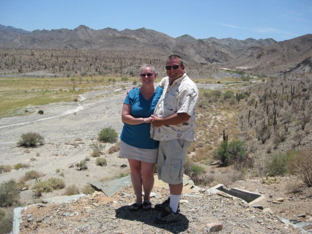
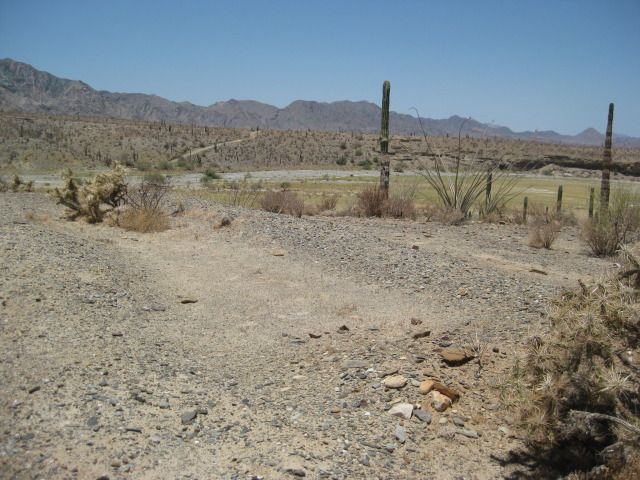
From Coco's we headed south through Calamajue Canyon which was beautiful as ever! We continued to the BOLA road and stopped to enjoy the view:


We stayed at Guillermo's for the night in BOLA and another great meal was had! The next day was a long one! We took the NORRA course mostly all the way to San Juanico. After some repairs on the trail, we finally arrived at Juan y Juan's where we were met by one of the greatest hosts ever! Juan! (Sorry, no pic!)
This was our view for the next day:


We had a down day the next day where we pretty much just cruised the beach, fished, went swimming, and enjoyed some Pacificos! There was hardly any swell, but it looked like it would have been fun for the longboards...


The next day we headed back north for BOLA. We made a quick stop along the way at Pozo Aleman which is a really cool old town:


We did another night at Guillermo's and got some rest for the next day. The next morning we left for San Quentin as our destination. We headed to San Borja Mission and some of the group took the tour of the mission.


We left San Borja and headed west over to Nuevo Rosarito. We took a quick break at the Santa Rosalillita road and took on fuel from our chase truck. We then headed north up the coast. It is a very remote area with no services or help for many miles! Stay out unless you are prepared for the worst!
;D


We went through many silt beds; some were not that long, some were 1/4 mile or more! Both a truck and a buggy got stuck in the silt which required the tow rope. Nasty stuff!


We made it to San Quentin by nightfall and stayed at the Mision Santa Maria. It was my 1st time staying there and I really liked it! Great food and nice rooms... I highly recommend it!

We had 3 other friends show up and meet us there in their Broncos. They made the trip the next day back to Ensenada with us. We picked our way north along the coast through Camalu and Erindera. We finally came off the dirt at Santo Tomas and that was the end of our dirt adventure. We motored back to the ranch and headed for home. Time to start planning the next trip!

Here is an overlay of our trip on Google Earth:


Thanks to all the Mexican people for letting us enjoy their beautiful country once again! Hope my fellow Nomads enjoy the report! Adios!

BajaRat - 7-3-2014 at 06:14 PM

Great stuff. is there access to BOLA from the north or yall went through Chapala ?
Thanks for the great report :cool:

David K - 7-3-2014 at 06:18 PM

Oh so cool... and can I ask to see a better or bigger GE map, please?

Pacifico - 7-3-2014 at 06:58 PM

Quote:
Originally posted by BajaRat
Great stuff. is there access to BOLA from the north or yall went through Chapala ?
Thanks for the great report :cool:


BajaRat,

From Coco's we went east to Calamajue Canyon. When you follow the canyon south it comes out on Hwy 1 south of Chapala at a place called El Crucero. Then you have just a short bit of pavement and you peel off the hwy where there are 2 blue fence posts on the east side of the hwy. From there, it is more dirt and it brings you out onto the BOLA road about 11 or 12 miles in from the intersection of hwy 1. Check out Calamajue Canyon! It is really beautiful!

Pacifico - 7-3-2014 at 07:01 PM

Quote:
Originally posted by David K
Oh so cool... and can I ask to see a better or bigger GE map, please?


David, check your U2U!

BajaLuna - 7-3-2014 at 08:10 PM

Awesome! Livin' the dream!

Ateo - 7-3-2014 at 08:35 PM

Thanks Pacifico. Jealous.

woody with a view - 7-3-2014 at 08:35 PM

good trip! you can't imagine the lines at juanico when it's on.... once you get it ON you won't ever go back.

ehall - 7-3-2014 at 11:26 PM

sounds like a great trip. Funny I was check checking google earth for a route from calamajue to bola.

willyAirstream - 7-4-2014 at 06:52 AM

Thanks for the great report. Is Juan y Juans on the main road along the beach? Was the beach pic taken from there? Can you post a link to the GE file?
ThX

Pacifico - 7-4-2014 at 07:30 AM

Quote:
Originally posted by ehall
sounds like a great trip. Funny I was check checking google earth for a route from calamajue to bola.


Years ago you could come out from Calamajue at El Crucero and turn south before hitting the pavement; staying on dirt all the way to where the dirt hit the BOLA road. There is a small ranch there now, so you have to hit the hwy.

Pacifico - 7-4-2014 at 07:41 AM

Quote:
Originally posted by willyAirstream
Thanks for the great report. Is Juan y Juans on the main road along the beach? Was the beach pic taken from there? Can you post a link to the GE file?
ThX


Yes, Juan y Juan's is on the main road by the beach south of 1st point. Juan said they call where they are "zero point". The pic where you see the point in the background was taken from Juan y Juan's. Not sure if I have a link with the GE file, but the program that does the overlay is called GPS Visualizer. Send me your email and I can send you a better pic of it.

ehall - 7-4-2014 at 08:01 AM

Quote:
Originally posted by Ateo
Thanks Pacifico. Jealous.


X2 planning my next one

willyAirstream - 7-4-2014 at 08:02 AM

Thanks. U2u d you w email

David K - 7-4-2014 at 09:19 AM

Quote:
Originally posted by Pacifico
Quote:
Originally posted by ehall
sounds like a great trip. Funny I was check checking google earth for a route from calamajue to bola.


Years ago you could come out from Calamajue at El Crucero and turn south before hitting the pavement; staying on dirt all the way to where the dirt hit the BOLA road. There is a small ranch there now, so you have to hit the hwy.


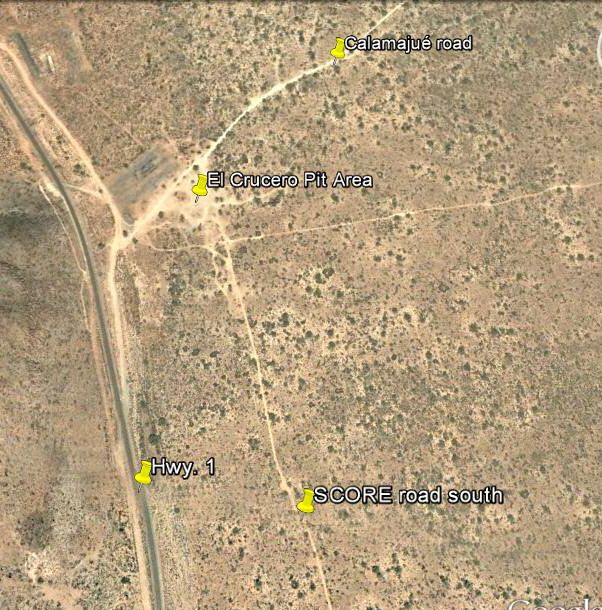
The SCORE road is there, parallel to Hwy. 1 so you don't need to use the highway for the 5.4 miles from El Crucero to the old L.A. Bay road, if you don't want to. It heads south from the pit area just below the highway. The newer ranch is farther away and out-of-sight of the highway.

The ranch is near the dart 'Calamajué road'...

Pacifico - 7-4-2014 at 09:24 AM

Quote:
Originally posted by David K
Quote:
Originally posted by Pacifico
Quote:
Originally posted by ehall
sounds like a great trip. Funny I was check checking google earth for a route from calamajue to bola.


Years ago you could come out from Calamajue at El Crucero and turn south before hitting the pavement; staying on dirt all the way to where the dirt hit the BOLA road. There is a small ranch there now, so you have to hit the hwy.


The SCORE road is there, parallel to Hwy. 1 so you don't need to use the highway for the 5.4 miles from El Crucero to the old L.A. Bay road, if you don't want to. It heads south from the pit area just below the highway. The newer ranch is farther away and out-of-sight of the highway.

The ranch is near the dart 'Calamajué road'...


Hmmmm.....I thought it was blocked off when we went by. I could be mistaken, however.

Desertbull - 7-4-2014 at 10:46 AM

we saw you at Juan's with the "live band" ... we were in the two black Dodge trucks with all the surfboards ... :lol::lol::lol: ... our party was in the jacuzzi at the Scorpion Bay club

TMW - 7-4-2014 at 12:49 PM

Great stuff Pacifico, thanks for sharing. Did you take the same route north from San Juanico as you came in on?

Pacifico - 7-4-2014 at 01:16 PM

Quote:
Originally posted by Desertbull
we saw you at Juan's with the "live band" ... we were in the two black Dodge trucks with all the surfboards ... :lol::lol::lol: ... our party was in the jacuzzi at the Scorpion Bay club


I wish I knew that was you! I would have loved to meet you. I loved your rigs...they looked set-up well!

Pacifico - 7-4-2014 at 01:20 PM

Quote:
Originally posted by TW
Great stuff Pacifico, thanks for sharing. Did you take the same route north from San Juanico as you came in on?


Yep TW, same route out for the most part. Small variances if any. That sand road near El Datil was awesome! 70-90 mph through there! One of my new favorite roads in Baja for sure!

woody with a view - 7-4-2014 at 02:16 PM

that silt is insane, as usual! complete misery if there is any rain....

BajaRat - 7-4-2014 at 03:09 PM

Quote:
Originally posted by Pacifico
Quote:
Originally posted by BajaRat
Great stuff. is there access to BOLA from the north or yall went through Chapala ?
Thanks for the great report :cool:


BajaRat,

From Coco's we went east to Calamajue Canyon. When you follow the canyon south it comes out on Hwy 1 south of Chapala at a place called El Crucero. Then you have just a short bit of pavement and you peel off the hwy where there are 2 blue fence posts on the east side of the hwy. From there, it is more dirt and it brings you out onto the BOLA road about 11 or 12 miles in from the intersection of hwy 1. Check out Calamajue Canyon! It is really beautiful!


I've really wanted to slow down and explore more of that area, every time we're at Cocos I say " maybe on the next trip we will have more time and follow that road out to Calamajue " . We appreciate you taking us along vicariously with your fun post ! :cool:

And on Woodys note I killed a VW van motor in the sister silt back in the day :no:

[Edited on 7-4-2014 by BajaRat]

David K - 7-4-2014 at 03:23 PM

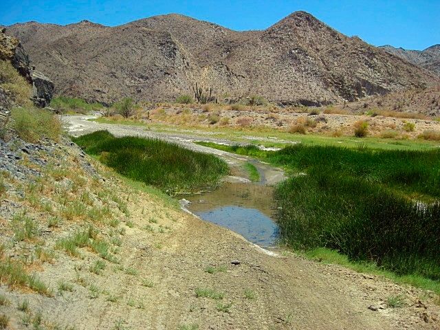
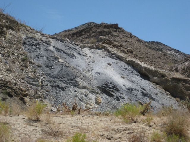
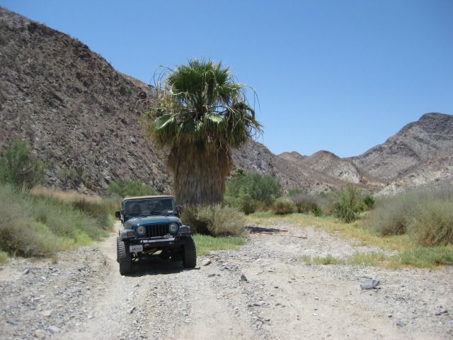
Here are some photos from Coco's Corner to El Crucero, via Calamajué Canyon (July 2012).

This was the main gulf side route (Hwy. 5) before 1983 when the Laguna Chapala to Puerto Calamajué road was graded.


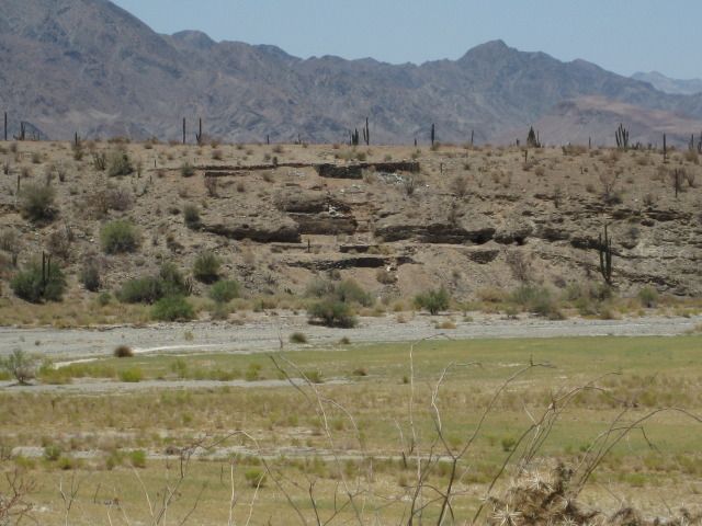
Arroyo Calamajué view from next to the mill ruins


Mission ruins across arroyo from mill.


Mill ruins as seen from mission.


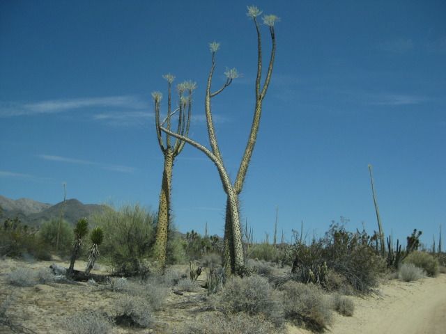
Dancing boojums... now is my web site page image.

BajaRat - 7-4-2014 at 04:05 PM

Good ruins on the route, what was the mill for and by whom ? Was that seep or spring the water source for the operation ?
Thanks D

David K - 7-4-2014 at 04:13 PM

Quote:
Originally posted by BajaRat
Good ruins on the route, what was the mill for and by whom ? Was that seep or spring the water source for the operation ?
Thanks D


Gold ore mill... Dick Daggett operation from early 1900's from what I read by Arthur North (1906 trip).

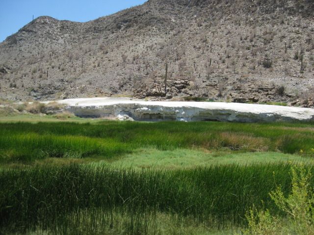
The mineral bank is a spring formation... water runs in the creek in which the road is in for several miles... year round mineral stream.

The mission could not survive there because the water was no good to grow crops in... moved to Santa María in May, 1767 less than a year after the founding in 1766.