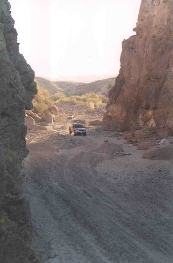
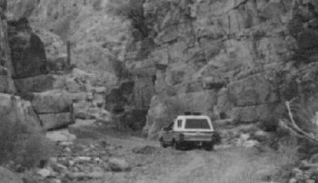
After hearing about a Jeep making it thru last year, then hearing about several ATVs making this year we drove thru going from W to E on Friday. The
condition at the narrows since the original flood have improved and the huge rocks have moved slightly and holes are mostly filled with rocks and
sand. The result is 3 tight places. With some rock stacking the Bronco and the buggies all made it, however all of us needed to do some backing to get
aligned to avoid driving over/between the big ones. If one drives from E to W then it will be harder because slipping tires will spit out our loose
rocks. Yup, it takes some time with all the kibitzing and rock stacking. Ha. One of the hard places is at 30 29.485, 115 00.089
BTW, west of the 3 hard places are several areas that we all drove thru without stopping to recon. I bet some will wonder if they are the ones
described or pictured. Not..
All had either 35 or 33 tires.
The rest of Matomi is deep soft sand and except for the buggies 4wd is required.
David K - 1-17-2015 at 12:57 PM
Awesome!!David K - 1-17-2015 at 04:14 PM
Arroyo Matomi has always been a quest for me since Arnold of Arnold's Restaurant in San Felipe told us about the waterfall there, back in 1966-67...
even marked it on a map for us.
Here is the area, and the narrows of Paul's photos is just below the letter o in Arroyo. Note the 115 degree latitude line on the 1962 map.
In 2001, the arroyo boulders were covered with sand, so the passage was easy for us. In 1978, it was quite difficult and the boulders were exposed.
Feb. 2001, elgatoloco photographs my truck entering the narrows eastbound... and you can see Mike Humfreville's head, as he rode in back...
Another look at the narrows west side entrance from egl's and Amo Pescar's cameras:
That's MexRay's Subaru Brat...
In 2006, we traveled from east to west, and the Narrows was still covered with sand.
But, the 'famous' Matomi waterfall was only a trickle (June)...
After hearing about a Jeep making it thru last year, then hearing about several ATVs making this year we drove thru going from W to E on Friday.
Super cool, thanks for sharing! Been probably 10+ years since I've been thru Matomi. If the big Bronco made it, my Tacaoma should have no issues
(given the smaller size).StuckSucks - 1-17-2015 at 04:39 PM
=======
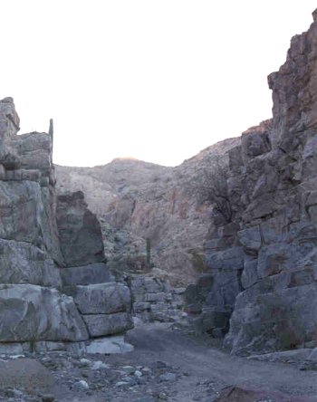
These hard places are not at the narrows shown in David's pics, but are slightly west. My guess is at the narrowest place the water flow scrubs is
down to a solid sand bed.
Anyway these hard places are the same ones that have been there for many years. One still has to drive next to the north wall beside a couple of big
boulders. The new boulders just get hung up at the same place every flood and never reach the narrows - so far.
With more and more traffic and more rock stacking the path will surely get easier - until the next flood
PW
jan 27 2015
PaulW - 1-28-2015 at 10:01 AM
History
Matomi in recent years has been used for the San Felipe 250 from 2008 thru 2012. Then in the summer of 2012 the wash became impassable due to rock
fall and flooding at the hard place shown in my pictures then no races since
2010 videos show little change except for the rocky place
Now the track wanders in the wash differently from side to side and the bushes are much higher http://tiny.cc/i4k6sx
Video starts at the west end and is pretty boring until the near the end of the video where the video shows the rocky place http://tiny.cc/e5k6sx
This one pretty boring video of the east end of the wash