BajaNomad

Road Condition for El Mano Pass

GalacticGS - 2-6-2015 at 08:40 AM

Has anyone been over El Mano Pass lately?

For clarification, this is the road between Rancho Cerro Prieto (or Rancho Tres Pinos) and Laguna Salada; which is north of the other pass often called The Summit.

Thanks for any current info on road conditions!

Larry

David K - 2-6-2015 at 09:15 AM

Haven't read any reports recently... It was maybe 12 years ago for me down that road. Hang in there, someone will have newer data, or you will be the one who provides it, after your run!

TMW - 2-6-2015 at 11:32 AM

NORRA and CODE used it in September of 2013 for their race. That is when I went down it. I do not think it got any unusual rain since then so there is no reason to think it is in bad shape. It's easy to find from the desert floor but much harder up in the forest. I think I still have the GPS and Google Earth files for it if you need them.

DirkEXC - 2-6-2015 at 12:23 PM

I rode it back in march of 2013, I know not real recent, but I would
expect the races that have gone down it would have removed most of
the loose grape fruit size rocks we saw.

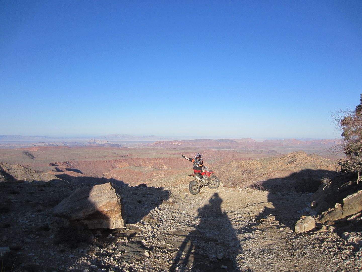
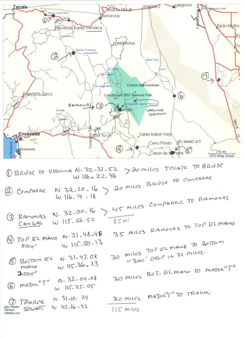
I will send a picture and a map I did to David k and see if he can post them. When we rode it it was fine just a long 3000 foot drop in 30 miles.

Let us know what you plan to do one you are at the bottom. Go right to the summit road ? go to pole line ? or left to Cohabuzo Jct. Also I hope you leave Ramonas with at least 4 Gallons of gas, you are going to need every drop.

StuckSucks - 2-6-2015 at 12:40 PM

If we remember back to March 2014 during the Baja 250, the course got rerouted from the Summit due to heavy rains and mudslides - could that have affected nearby El Mano as well?

GalacticGS - 2-6-2015 at 01:02 PM

Thanks for the info. I rode down it in Sept 2013 in the NORRA race. Thinking of riding up (east to west), but wasn't sure if it had any washouts due to severe rain since then - sounds like it should be OK.

Trying to determine whether I can put a route together going from San Felipe via Laguna Diablo, north on part of the Baja course, cut over to El Mano and make it to Ramona's or Ojos without running out of gas.

PaulW - 2-6-2015 at 01:17 PM

U2U sent
Thanks
===========
Quote: Originally posted by TMW  
NORRA and CODE used it in September of 2013 for their race. That is when I went down it. I do not think it got any unusual rain since then so there is no reason to think it is in bad shape. It's easy to find from the desert floor but much harder up in the forest. I think I still have the GPS and Google Earth files for it if you need them.

David K - 2-6-2015 at 06:22 PM

Quote: Originally posted by DirkEXC  
I rode it back in march of 2013, I know not real recent, but I would
expect the races that have gone down it would have removed most of
the loose grape fruit size rocks we saw.

I will send a picture and a map I did to David k and see if he can post them. When we rode it it was fine just a long 3000 foot drop in 30 miles.

Let us know what you plan to do one you are at the bottom. Go right to the summit road ? go to pole line ? or left to Cohabuzo Jct. Also I hope you leave Ramonas with at least 4 Gallons of gas, you are going to need every drop.


TMW - 2-7-2015 at 12:42 PM

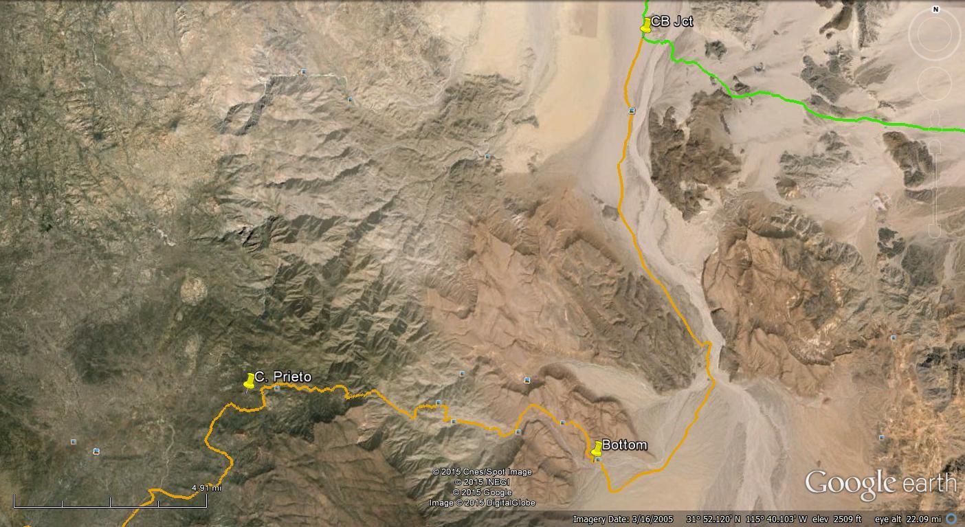
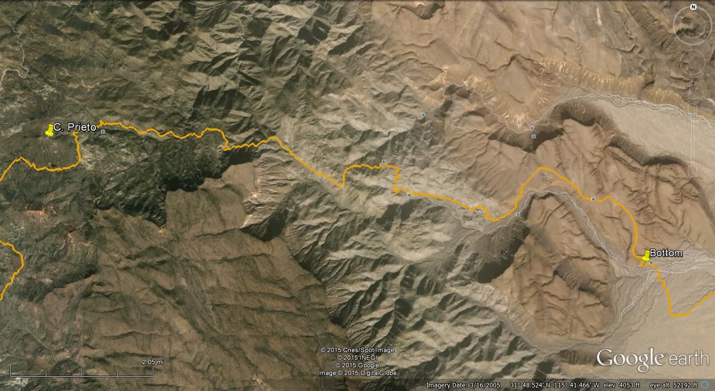
Google Earth view CODE/NORRA course down El Mono