BajaNomad

Anza Borrego

Ateo - 2-7-2015 at 05:25 PM

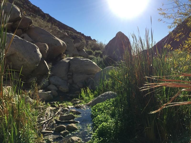
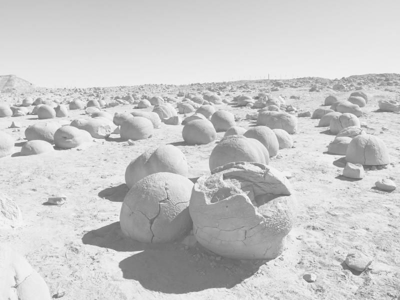
I'll post a report when I get home but thought I'd share this.


David K - 2-7-2015 at 05:31 PM

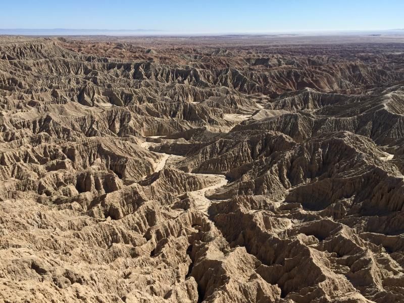
It's really neat out there... out in the Badlands!

woody with a view - 2-7-2015 at 05:43 PM

not a good place to get lost.....

:light:

Howard - 2-7-2015 at 06:36 PM

Have a c-cktail or two at Carlee's Place for me.

Barry A. - 2-7-2015 at 06:42 PM

----from Font's Point???? Wonderful!!!

Barry

wessongroup - 2-7-2015 at 07:19 PM

Thanks, really clear ... nice time of the year .. in that area :):)

Bajaboy - 2-7-2015 at 07:42 PM

headed out there next weekend:biggrin:

AKgringo - 2-7-2015 at 08:09 PM

I'm lost! Southern CA?

Whale-ista - 2-7-2015 at 08:11 PM

Great image!

That San Andreas Fault sure causes some geologic mischief...
(see: http://www.abdnha.org/anza-borrego-desert-geology.htm)

[Edited on 2-8-2015 by Whale-ista]

elgatoloco - 2-7-2015 at 09:31 PM

Quote: Originally posted by Bajaboy  
headed out there next weekend:biggrin:


Lucky you! :cool:

AB is a gem of a place. So much to see and do.

I envy you! :saint:

Hoping for wildflowers this spring.

http://www.desertusa.com/wildflo/ca_abdsp.html

Skipjack Joe - 2-7-2015 at 10:51 PM

What an incredible place. I never knew there were places like that there.

Bajaboy - 2-7-2015 at 10:57 PM

Quote: Originally posted by elgatoloco  
Quote: Originally posted by Bajaboy  
headed out there next weekend:biggrin:


Lucky you! :cool:

AB is a gem of a place. So much to see and do.

I envy you! :saint:

Hoping for wildflowers this spring.

http://www.desertusa.com/wildflo/ca_abdsp.html


plenty of room around the fire:light:

count me out !!!

captkw - 2-7-2015 at 11:24 PM

No waterfalls,fish,turtles,eels,,crawdads,,topless babes,,trees....swimming,washing,wading...more pics please of What ??????

Ateo - 2-8-2015 at 08:33 AM

Count you out of this Cap.


Ateo - 2-8-2015 at 08:39 AM


mtgoat666 - 2-8-2015 at 08:40 AM

Quote: Originally posted by captkw  
No waterfalls,fish,turtles,eels,,crawdads,,topless babes,,trees....swimming,washing,wading...more pics please of What ??????


Your posting-while-drunk ignorant opinions about places you have never been is sad.

rts551 - 2-8-2015 at 09:05 AM

Grandparents settled in Borrego Springs in 1957. We lived in the Coachella Valley (what is now La Quinta). When the Borrego Salton Seaway was built through the badlands in 1968 it provided a convenient shortcut. I still remember the area in all its untouched glory. Borrego Springs was so small the kids went to school in Julian.

StuckSucks - 2-8-2015 at 09:54 AM

Quote: Originally posted by Ateo  


Ahhhh ... the Pumpkin Patch!

Mexitron - 2-8-2015 at 10:24 AM

Borrego is still pretty small--4,000 people or so, impressive being so close to the big cities. When the mayor is elected they receive a traffic signal to put in their office--and they must take a vow never to install one during their term.

Barry A. - 2-8-2015 at 11:17 AM

One reason the town of Borrego Springs remains "small" is that it is served by a small aquifer (fossil water) that has been drastically drawn-down by the agriculture and golf-courses there over the years, and is not being replenished that much due to lack of precipitation. Coyote Creek is the only full-time creek in the Valley, and it is tiny. Even the famous "Borrego Palm Canyon" creek does not run all year round on the surface, normally.

The water-battles continue to this day, even though Ag has been reduced very significantly.

Barry

elgatoloco - 2-8-2015 at 11:33 AM

Quote: Originally posted by Bajaboy  
Quote: Originally posted by elgatoloco  
Quote: Originally posted by Bajaboy  
headed out there next weekend:biggrin:


Lucky you! :cool:

AB is a gem of a place. So much to see and do.

I envy you! :saint:

Hoping for wildflowers this spring.

http://www.desertusa.com/wildflo/ca_abdsp.html


plenty of room around the fire:light:


Day trip on Sunday! Maybe. :coolup:

Bob53 - 2-9-2015 at 02:56 PM

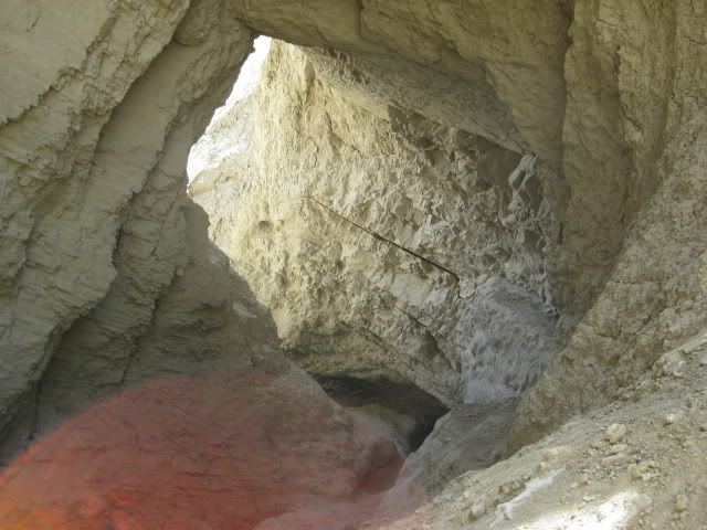
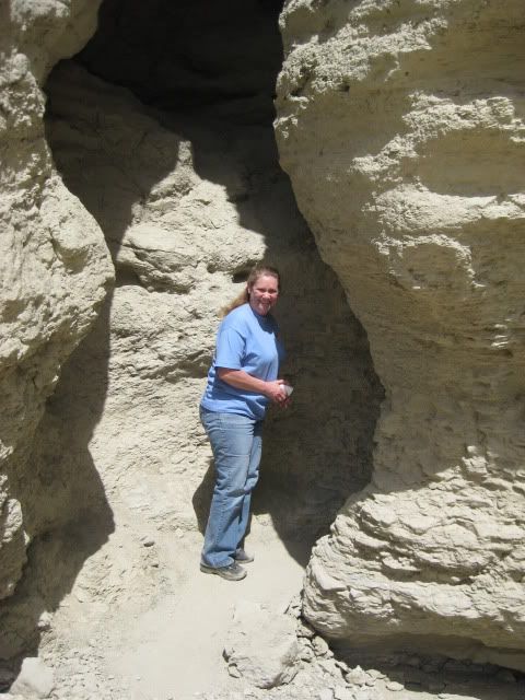
Have any of you been to the mud caves further south off of S-2?

Bajaboy - 2-9-2015 at 03:14 PM

Quote: Originally posted by Bob53  
Have any of you been to the mud caves further south off of S-2?


Yes, in Tapiado Canyon?

Barry A. - 2-9-2015 at 03:28 PM

Quote: Originally posted by Bob53  
Have any of you been to the mud caves further south off of S-2?


Bob--------I assume you mean the one's along Arroyo Tapiado, a feeder canyon of Vallecito Creek, which in turn flows into Carrizo wash-----yes, been to them several times, starting in the early '50's with the Sierra Club, San Diego chapter. I have not been IN the caves, however, as I am distrustful of anything made out of "mud". For the most part, they are only "caves" because the sides of very narrow slot canyons have collapsed onto each other. They have changed over the last 60 years that I am familiar with, which tends to support my suspicion that they are rather unstable. They ARE in neat bad-lands country and fairly deep semi-slot canyons, and I really enjoy it all. Last time there at the "caves" was spring of 2001. They are normally accessible via SUV, and occasionally you might need 4-wheel drive due to sand or mud, and/or exposed rocks.

Barry

David K - 2-9-2015 at 03:42 PM

Quote: Originally posted by Bob53  
Have any of you been to the mud caves further south off of S-2?


Fun in the desert... USA or BAJA!

Bob53 - 2-9-2015 at 03:55 PM

I have been all over that area and inside a lot of the caves. There are more hidden ones if you are in the mood to hike back and look for them. They actually seem very stable to me.

woody with a view - 2-9-2015 at 04:04 PM

Those caves look like snake magnets!

David K - 2-9-2015 at 04:14 PM

Quote: Originally posted by Bob53  
I have been all over that area and inside a lot of the caves. There are more hidden ones if you are in the mood to hike back and look for them. They actually seem very stable to me.


Did you do the 'belly crawl'? Very intense, scary if there was a quake! I learned of it back in my Geocaching days, around 2001, with my kids. It is past the first caves of my photos above... and to the right... takes you to the top of the mesa.

Bob53 - 2-9-2015 at 05:03 PM

Quote: Originally posted by David K  
Quote: Originally posted by Bob53  
I have been all over that area and inside a lot of the caves. There are more hidden ones if you are in the mood to hike back and look for them. They actually seem very stable to me.


Did you do the 'belly crawl'? Very intense, scary if there was a quake! I learned of it back in my Geocaching days, around 2001, with my kids. It is past the first caves of my photos above... and to the right... takes you to the top of the mesa.


Haven't been inside that one. I'll check it next time I go which will probably be in April. A bunch of us usually camp a Blair Valley every April and head down to the caves.

Barry A. - 2-9-2015 at 05:25 PM

Quote: Originally posted by Bob53  
I have been all over that area and inside a lot of the caves. There are more hidden ones if you are in the mood to hike back and look for them. They actually seem very stable to me.


Whatever turns you on. (-:

I was much more comfortable hiking and camping all over the now-closed "Carrizo Bombing Range" just north of the "caves" back in the late '40's and '50's, even with blown-up tanks, and ordinance sticking out of the ground. (No touchy, tho)

Barry

Bob53 - 2-9-2015 at 05:34 PM

Quote: Originally posted by Barry A.  
Quote: Originally posted by Bob53  
I have been all over that area and inside a lot of the caves. There are more hidden ones if you are in the mood to hike back and look for them. They actually seem very stable to me.


Whatever turns you on. (-:

I was much more comfortable hiking and camping all over the now-closed "Carrizo Bombing Range" just north of the "caves" back in the late '40's and '50's, even with blown-up tanks, and ordinance sticking out of the ground. (No touchy, tho)

Barry


I really enjoy doing that too. I have been trying to find one of Patton's tanks that was left stuck in a wash out there for years. I have yet to find it.

Barry A. - 2-9-2015 at 05:51 PM

I significant sweep of the Bombing Range was accomplished many years ago by the Military, and I believe all the "visible" military stuff was removed. My understanding is that it remains closed because new military stuff kept resurfacing after the "sweep" after rains, which scared the Manager's immensely (and understandably). Now, they are very serious about the closure, and there are big fines for going in there, I believe. My last trip thru the Bombing Range was solo back in about 1961 via auto (Fish Creek Wash over the divide to N. Fk. of Deguynos Wash and down to Carrizo Wash with side trips up Red Rock and Barrett Washes, and the Military caught me in Barrett :O. ) They were great guys, but I definitely got an escorted evacuation out to Plaster City, with an admonition to NEVER do THAT again.

Barry

David K - 2-9-2015 at 05:54 PM

But Barry, did you keep the black nuggets??? :light:

David K - 2-9-2015 at 06:02 PM

Quote: Originally posted by Bob53  
Quote: Originally posted by David K  
Quote: Originally posted by Bob53  
I have been all over that area and inside a lot of the caves. There are more hidden ones if you are in the mood to hike back and look for them. They actually seem very stable to me.


Did you do the 'belly crawl'? Very intense, scary if there was a quake! I learned of it back in my Geocaching days, around 2001, with my kids. It is past the first caves of my photos above... and to the right... takes you to the top of the mesa.


Haven't been inside that one. I'll check it next time I go which will probably be in April. A bunch of us usually camp a Blair Valley every April and head down to the caves.


I just checked Geocaching.com... and it is an archived cache (from 2001), it is no longer there or active, so enjoy the description of where we went back then:

Mud Cave Cookie Tin N 32 55.830 W 116 11.756

Geocache Description:

This cache is fairly hard to reach due to it's location even though it is not far from Palm Spring and the corner of Hollywood and Vine (you will see when you get out there). The scenery and views are well worth the trouble! Four wheel drive is recommend due to sandy washes or an extra 4 mile hike from the main hwy. While you are in the area, be sure to visit the Palm Spring.

Located in southern Anza-Borrego desert, this cache will require some thinking on your part to find the right path to get there. If you find this cache, please hide it well again due to its exposure. Please be thoughtful of where you walk as the ground is susceptible to erosion and crumbles easily.
There is a hidden split in the path that is the best way to take (very near the cache), but is hard to see (really hard!) at N32 55.773 W116 11.770. Then get on your belly and crawl Be careful of the path you take, the ground is unstable in places and a fall could be fatal.

Additional Hints

The cache is located above the mud caves in Arroyo Tapiado canyon wash. Enter the larger mud cave at N32 55.628 W116 11.725. Follow this back for about 10-15 minutes. Watch for the belly crawl on your right about knee level at N32 55.773 W116 11.770. You really have to get down on your knees to see this! It's a 35 degree up-hill crawl on your belly for the first few feet, but really isn't too hard. Work to the top the ridges once you find a safe spot, you will see a group of 5 ocotillos at the cache site. The cache is buried under the largest of the ocotillos, under a pile of rocks.

JohnMcfrog - 2-10-2015 at 06:10 AM

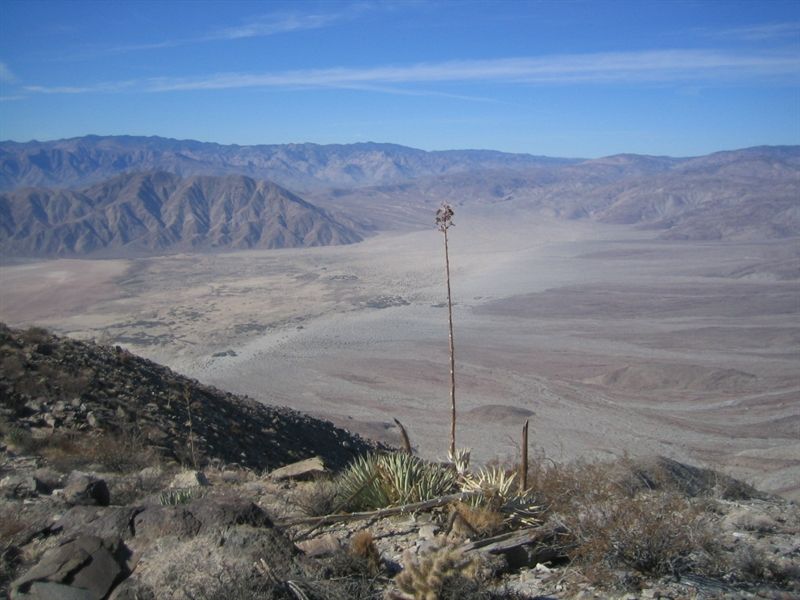
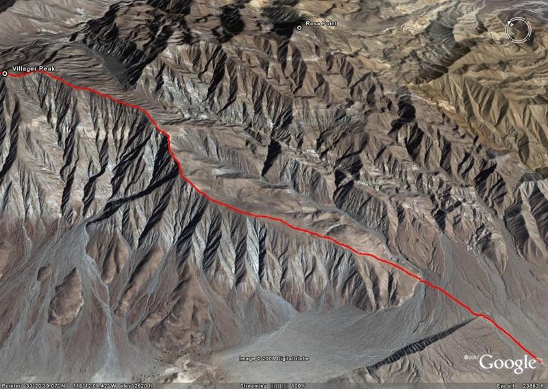
My wife Kathy and I go to Anza Borrego quite frequently. About mid January, we camped free at Peg Leg Monument (BLM land) and got an early start on Villager Peak. The parking area for the hike is a little over a mile from the turnoff to Font's Point, on the left. We started hiking about 6:30 because I had run out of daylight in November. It is a 5000 foot elevation gain in 6.5 miles. Great views the entire hike.


View towards the West from Villager Ridge


Google View of the route

Got back to the truck about 4 PM. Met a guy on the mountain named Dave who rides every year with some vaqueros in Baja Norte for a week in the area around San Pedro Martir. Small world!

Barry A. - 2-10-2015 at 12:01 PM

Great pics, McFrog, and a great hike.

With a little more effort you could also bag Rabbit Peak. :biggrin:

(something I never accomplished)

Barry

Barry A. - 2-10-2015 at 01:22 PM

Quote: Originally posted by David K  
But Barry, did you keep the black nuggets??? :light:


No, I traded them all in for Stocks in America's and the World's premier Corporations which have rewarded me many times over what the actual "nuggets" would ever have. :biggrin:

-------and JoJo, I know you will brand this statement as BS, and for once you will be right!!!

Barry

David K - 2-10-2015 at 01:50 PM

One thing Choral Pepper told me she regretted doing was giving the black gold nuggets to the new Desert Magazine publisher when she sold the magazine. As you might know, the person who claimed to have found Peg Leg Smith's gold (that was coated with a black desert varnish) in letters to Desert Magazine, mailed them to her as proof. I believe she made one into a piece of jewelry she kept.

When she sold the magazine, she sold everything that was part of it, 'furnished' if you will... except for the Baja related letters, and photos... which was given to me per her wishes, by her children.