BajaNomad

los barilles/santa teresa highway

bledito - 2-11-2015 at 08:25 PM

What is the condition of this road post Odile ? Last time I drove it there was a lot of missing road at a precipice crossing about 1/2 hour or so north of Los Barilles. Has it gotten worse? What if any chance is there of repairs to that area in the future? I was just very nervous crossing that damaged road section. the tight side of the road was gone and the drop off was a long way down. didn't travel it much further than that crossing thought my Missus wanted to turn back after that crossing and all the damage and road collapsing.

AKgringo - 2-11-2015 at 10:14 PM

I am not familiar with a Santa Teresa north of Los Barriles.
If you are refering to the paved road north from los Barriles to El Cardonal, I drove it in November. There are damaged sections and missing shoulders in a few places, but I would feel safe driving anything on it. Just don't hug the edges of the pavement.

bledito - 2-12-2015 at 08:46 AM

Yes that is the road in Question. Google Earth lables it as the Los Barilles/Santa Teresa. I spoke to people in town who won't drive it due to it's condition. Just wondering if any repairs will ever be made to this road. It's a long bumpy ride taking the dirt road north.

AKgringo - 2-12-2015 at 09:08 AM

I drove both roads in mid November, and I don't think there have been any major storms since then.
The paved road, although damaged. was far better than the dirt road along the coast. I would drive anything from a sports car to a motorhome over it.
The coast road had some landslides onto it that had been bypassed, but it was a rugged two wheel drive road at best! There may have been some repairs since then, but I wouldn't count on it.
I don't know when the new road was constructed, but the design gaurantees that any repairs will be difficult, and expensive. That road doesn't even show up on my GPS.

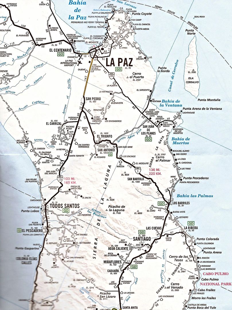
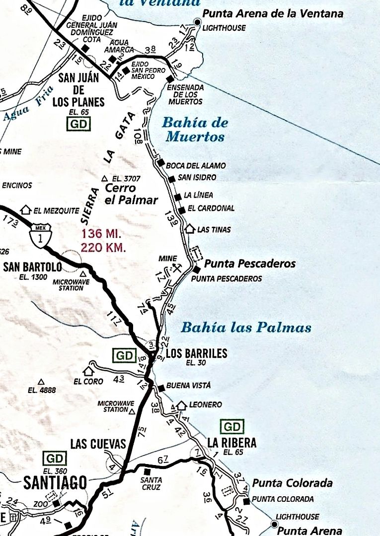
North of LOS BARRILES

David K - 2-12-2015 at 09:30 AM


The paved road north along the coast was only partly done when the above map was researched. In 2012 it was completed to El Cardonal, but stays inland in the hills and not along the coast.

I re-posted a road conditions report

AKgringo - 2-12-2015 at 09:50 AM

Bledito, I just bumped my own road conditions report from November. I was driving a small SUV and came down from the north, so by the time I found the pavement from El Cardonal, it looked like Mex 1 to me.

[Edited on 2-12-2015 by AKgringo]

AKgringo - 2-12-2015 at 10:07 AM

D.K., I did not think the road was that new! I first drove that road in 2012, and the storms of that year had already done quite a bit of damage (rock falls, pot holes, eroded shoulders) Really a poorly designed and constructed road, I wonder where the money behind that project came from?

David K - 2-12-2015 at 10:22 AM

Quote: Originally posted by AKgringo  
D.K., I did not think the road was that new! I first drove that road in 2012, and the storms of that year had already done quite a bit of damage (rock falls, pot holes, eroded shoulders) Really a poorly designed and constructed road, I wonder where the money behind that project came from?


Some politician must own some land or that mine to get the road paved? There are other poorly engineered roads in Baja, as well.

4x4abc - 2-12-2015 at 11:40 AM

the paved road was built to keep the traffic away from the beach communities