BajaNomad

Baja California Mission Map

David K - 3-12-2015 at 09:17 AM

Trying different map making programs, and while not what I was looking for, here is a map (zoomable right to the building) of the peninsula with markers on all the mission sites one can go to... missions, not visitas (yet). Where the mission was in 2 or more locations, they all have been plotted, with maybe the exception of San Pedro Martir's first site (where it was for less than 4 months).

See if this is user friendly... I think you can drop down a list of the sites and they will illuminate on the map and if you click on the marker, it will give the site name.

https://a.tiles.mapbox.com/v4/davidk57.lecflhmf/page.html?ac...

27 missions at 36 sites shown.

[Edited on 3-12-2015 by David K]

mtgoat666 - 3-12-2015 at 10:14 AM

Quote: Originally posted by David K  
Trying different map making programs, and while not what I was looking for, here is a map (zoomable right to the building) of the peninsula with markers on all the mission sites one can go to... missions, not visitas (yet). Where the mission was in 2 or more locations, they all have been plotted, with maybe the exception of San Pedro Martir's first site (where it was for less than 4 months).

See if this is user friendly... I think you can drop down a list of the sites and they will illuminate on the map and if you click on the marker, it will give the site name.

https://a.tiles.mapbox.com/v4/davidk57.lecflhmf/page.html?ac...

27 missions at 36 sites shown.

[Edited on 3-12-2015 by David K]

dk:
mapbox is OK, but you really should try making maps in google earth, it is more user friendly and more reader friendly. you can easily plot locations, roads, use many symbols and line types, and share maps as kml or kmz files. GE works much better than mapbox, and free GE is pretty powerful.

David K - 3-12-2015 at 11:37 AM

I was looking for a map program that wasn't all cluttered with highways, town names, etc. Mapbox uses the same GE image, but free of all the added text. Can you tell me how to remove stuff from GE map? Thank you!

I actually am seeking a map with terrain or topography instead of the satellite image as a base, and all the town names removed. I think I found one, but still working on it.

StuckSucks - 3-12-2015 at 11:52 AM

Quote: Originally posted by David K  
I was looking for a map program that wasn't all cluttered with highways, town names, etc. Mapbox uses the same GE image, but free of all the added text. Can you tell me how to remove stuff from GE map? Thank you!

I actually am seeking a map with terrain or topography instead of the satellite image as a base, and all the town names removed. I think I found one, but still working on it.


I always start with Google Maps, then move the .kml file to GE if necessary. But within the new Google Maps, you are given an option of your map base - roads, no roads, satellite, terrain, etc.


David K - 3-12-2015 at 11:55 AM

So Google Maps vs. Google Earth? Thank you!

StuckSucks - 3-12-2015 at 11:57 AM

Quote: Originally posted by mtgoat666  


dk:
mapbox is OK, but you really should try making maps in google earth, it is more user friendly and more reader friendly. you can easily plot locations, roads, use many symbols and line types, and share maps as kml or kmz files. GE works much better than mapbox, and free GE is pretty powerful.


Strongly agree. When you mouseover your pushpins, you can see cool data/text/links/photos/html:


mtgoat666 - 3-12-2015 at 11:57 AM

Quote: Originally posted by David K  
I was looking for a map program that wasn't all cluttered with highways, town names, etc. Mapbox uses the same GE image, but free of all the added text. Can you tell me how to remove stuff from GE map? Thank you!

I actually am seeking a map with terrain or topography instead of the satellite image as a base, and all the town names removed. I think I found one, but still working on it.


google earth has layers of data, you turn on/off layers in the "layers" menu that appears on left side of screen

mtgoat666 - 3-12-2015 at 11:59 AM

Quote: Originally posted by David K  
So Google Maps vs. Google Earth? Thank you!


use google earth. it's a free program, you have to download it

David K - 3-12-2015 at 08:00 PM

Thanks for the help Goat and StuckSucks... I will play with that stuff tomorrow. I have a writing job request I need to produce, along with my new book project I want the maps for.

David K - 3-13-2015 at 08:59 AM

OK amigos, I have tried GE, signed in, turned off all layers, and have a satellite image. Now, how do I convert that to a terrain map?

I also went to Google Maps (New version) and do not see where you choose Base Maps? Sorry, this old guy needs it in steps...

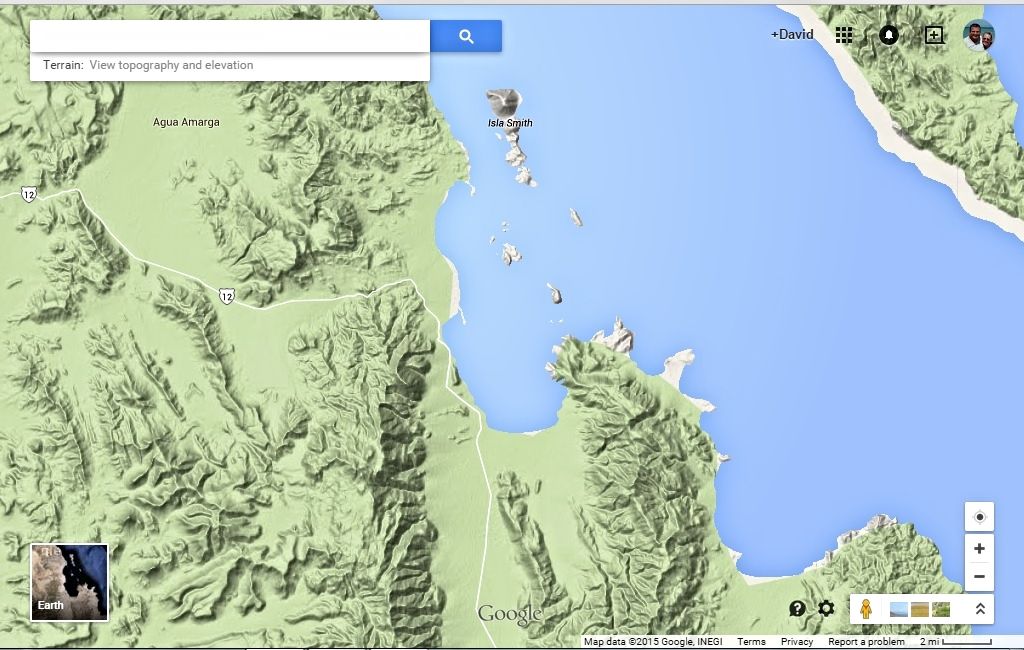
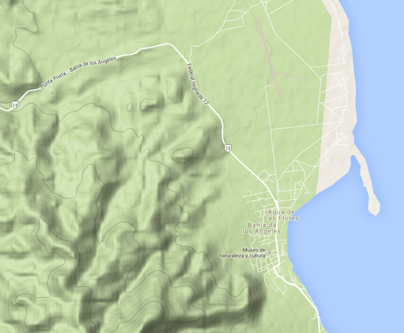
Here is what I see in Google New Maps, terrain setting, L.A. Bay...
Note that labels for highways and places are still on the map. I would want to add my own labels and paths (El Camino Real, etc.)...


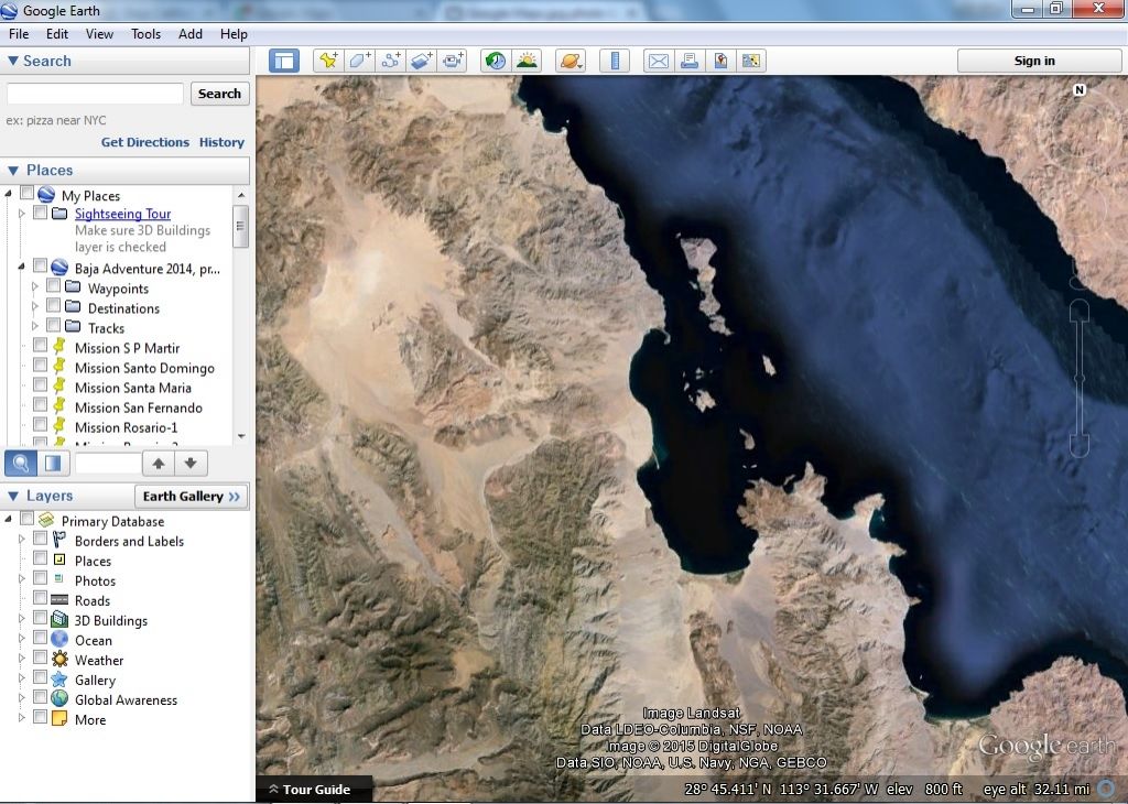
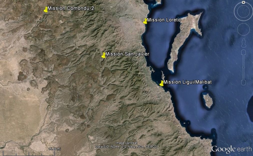
Here is what I see in Google Earth, L.A. Bay... Looks like all labels are gone, but how do I add labels and paths, and convert to a terrain map, if possible?


Thanks a bunch!

mtgoat666 - 3-13-2015 at 09:04 AM

Quote: Originally posted by David K  
OK amigos, I have tried GE, signed in, turned off all layers, and have a satellite image. Now, how do I convert that to a terrain map?

I also went to Google Maps (New version) and do not see where you choose Base Maps? Sorry, this old guy needs it in steps...

Here is what I see in Google New Maps, terrain setting, L.A. Bay...
Note that labels for highways and places are still on the map. I would want to add my own labels and paths (El Camino Real, etc.)...

Thanks a bunch!


to make maps in google maps and change base map, you need to be in google maps engine. play around with it, you'll figure it out. sign in to google account so your maps are saved to google drive.

i think google earth does not have terrain base map in free version, probably you got to sign up and pay for expanded version?

David K - 3-13-2015 at 09:14 AM

Thanks, I am signed in on Google Maps (new)... where is the 'maps engine' please?

StuckSucks - 3-13-2015 at 09:47 AM

Try starting here:

https://mapsengine.google.com/map/u/0/

Disclaimer: I use Google Maps extensively at work, so I've added extra map-related bells and whistles. I also realized that I have it set in my preferences to NOT see the new Google Maps - I'm still going old school (faster, better, in my opinion). Your mileage may vary.

David K - 3-13-2015 at 10:10 AM

Quote: Originally posted by StuckSucks  
Try starting here:

https://mapsengine.google.com/map/u/0/

Disclaimer: I use Google Maps extensively at work, so I've added extra map-related bells and whistles. I also realized that I have it set in my preferences to NOT see the new Google Maps - I'm still going old school (faster, better, in my opinion). Your mileage may vary.


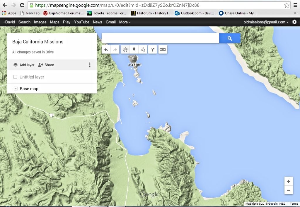
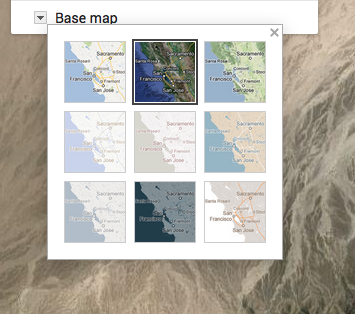
Thank you... I went there, changed to terrain (good), and now how do I remover the names on the map? By-the-way, it does say I am on New Google Maps at that link.

Here is what I have...


StuckSucks - 3-13-2015 at 10:24 AM

Quote: Originally posted by David K  

Thank you... I went there, changed to terrain (good), and now how do I remover the names on the map? By-the-way, it does say I am on New Google Maps at that link.


That appears to be a function of zoom. When I zoom into the BofLA area, I'm seeing names.


mtgoat666 - 3-13-2015 at 10:31 AM

Quote: Originally posted by David K  
I went there, changed to terrain (good), and now how do I remover the names on the map? By-the-way, it does say I am on New Google Maps at that link.


the free version does not have choice to show/hide names. perhaps such choice exists if you upgrade to paid?
GE is much better for editing - perhaps the paid version of GE has topo layers?

David K - 3-13-2015 at 11:38 AM

So I can't have my cake ... and eat it too?

Thanks for your help guys! If I do get this new book finished, I will happily send you copies! Remind me when that happens... :light::biggrin:

David K - 3-15-2015 at 12:04 PM

Here is close to what I am seeking... terrain map (this one even has topo lines). But, I will need to add labels and tracks (El Camino Real) using a different system. I am still going to play with Google as recommended.

This is the Gaia Map program... overview of the Missions nearest Loreto (5 mile scale), then the 4 mission sites up close (1 mile scale)... Let's see if they look good:


Mission Topo Map 1.jpg - 154kB Mission Topo Map 1a.jpg - 105kB Mission Topo Map 1b.jpg - 162kB Mission Topo Map 1c.jpg - 96kB Mission Topo Map 1d.jpg - 149kB

[Edited on 3-15-2015 by David K]

Google Earth

David K - 3-15-2015 at 03:50 PM

Same area as Mission Map 1 above, in Google Earth


Google Maps vs Gaia

David K - 3-15-2015 at 04:11 PM

With some cropping of menu boxes I couldn't get rid of...

GM Missions-1.jpg - 156kB

[Edited on 3-15-2015 by David K]

Mission Topo Map 1.jpg - 154kB

Test view in book form...

David K - 3-15-2015 at 05:29 PM

Seeing how the maps might appear in the new book...


Book test.jpg - 124kB