
David K - 5-2-2015 at 09:21 AM
Looks like we have the procedure nailed down (?)... thanks to Bryan McKenzie.
1) Map you want to overlay must have url (web address, not from your PC folder)... http:// etc.
2) Open Google Earth, and drop the eye view down so you are over the area, not at an angle, looking at it. have it bigger than the area of the map you
want to paste over it.
3) Click on the Image Overlay+ button (along the top of the GE page, 4th to right from the yellow push pin button). Pop up appears.
4) Give the map a name then paste the map url into the pop up box, and SLIDE then transparency adjuster from opaque to the left, somewhere between
clear and the halfway point on the slider (to see through your map and onto Google Earth).
5) Click OK, and move the pop up box over to the left side so it isn't blocking your map view, but so you can still grab it.
6) There should be green alignment tools around the map and a diamond and a cross in the middle. Use these to stretch or shrink your map to align it
with known points on Google Earth... If not there, right click on the map name, listed on your Google Earth left side menu, and click Properties at
the bottom of the box that appears. The pop up for that map appears, and the alignment green lines are around your map. If you have multiple maps, you
can only click on one at a time for adjusting.
You can grab the sides or corners of the map and change its shape and size to align with the Google Earth view below it. The diamond is for tilting
the map. The center cross moves the whole map.
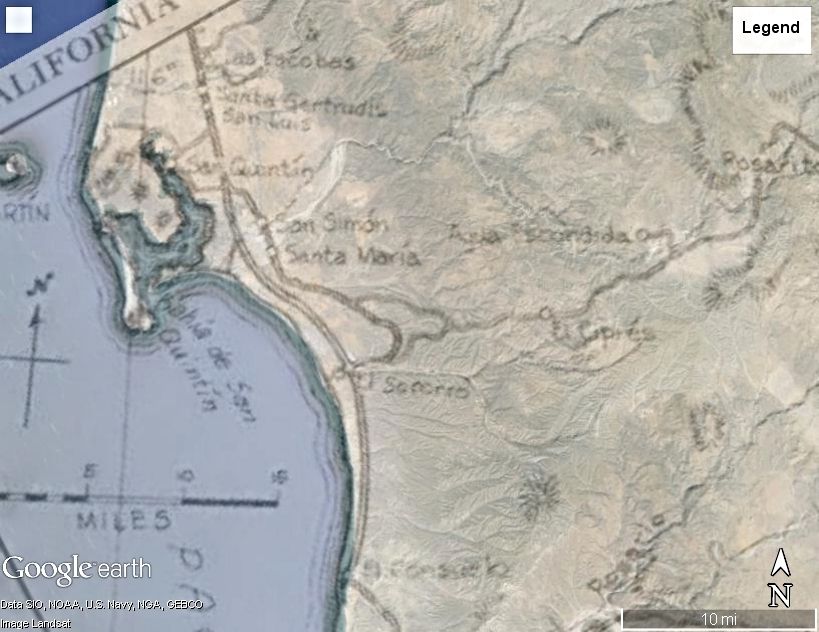
OK, my first solo on the GE/Map transparency... Here is San Quintin in 1974 over Google Earth:

David K - 5-2-2015 at 09:45 AM
1962 Gulick Map #5 overlay... the only push pin I have shown is for Mission Santa Maria, and Gulick was right on with its location...

Here is a zoom in on San Quintin with the 1962 map...
OK, that's done... Any requests?


