
PaulW - 5-22-2015 at 01:39 PM
Pole Line Rd & Zuk story
Two things: The history story of the Samari (ZUK) and my latest PLR GPS track with added info (bottom of the thread)
Here is the chronology for the Suzuki Samari (ZUK). Nothing really new, but just documentation of interest to me.
April 2005
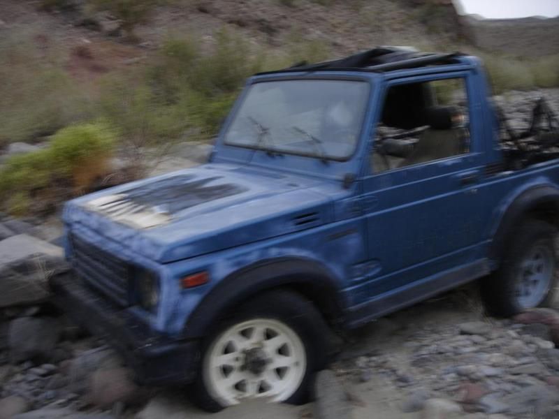
Ken Cooke said the Zuk was parked 1.5Km east of the basketball turn to enter/exit Enmedio. This picture is a grab from the video Wrong way in
Enmedio. I plotted the 1.5Km from the basketball hill turn and found the coordinates 30 35.42, -115 24.618. Ken said it looked like it was waiting
for it is owner. Parked on a rock pile as if it needed a jump start or maybe some fluids. All the tires were round and inflated and there was no body
damage. Of course if the owner was trying to do the Pole Line Road then he made the same mistake that Ken and party did?
By the way that turn was hard to negotiate even when coming down the basketball hill because the path turu the trees required walking it before
driving it. Likely nearly invisible from Enmedio.
Jan 2014
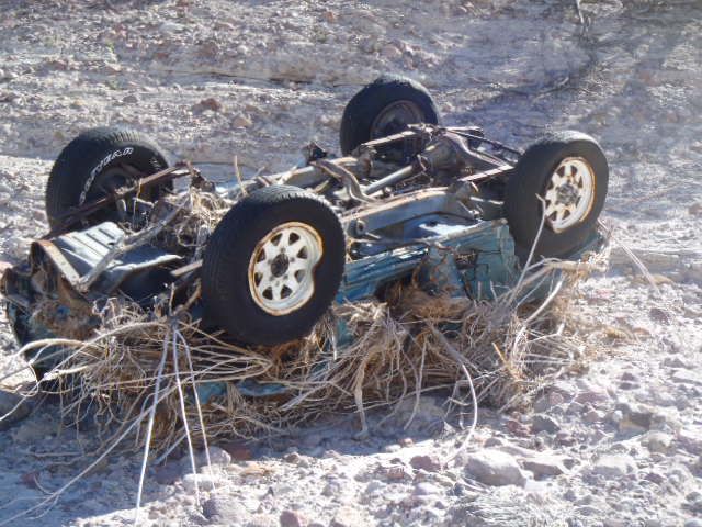
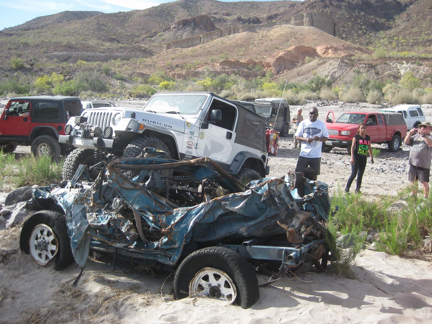
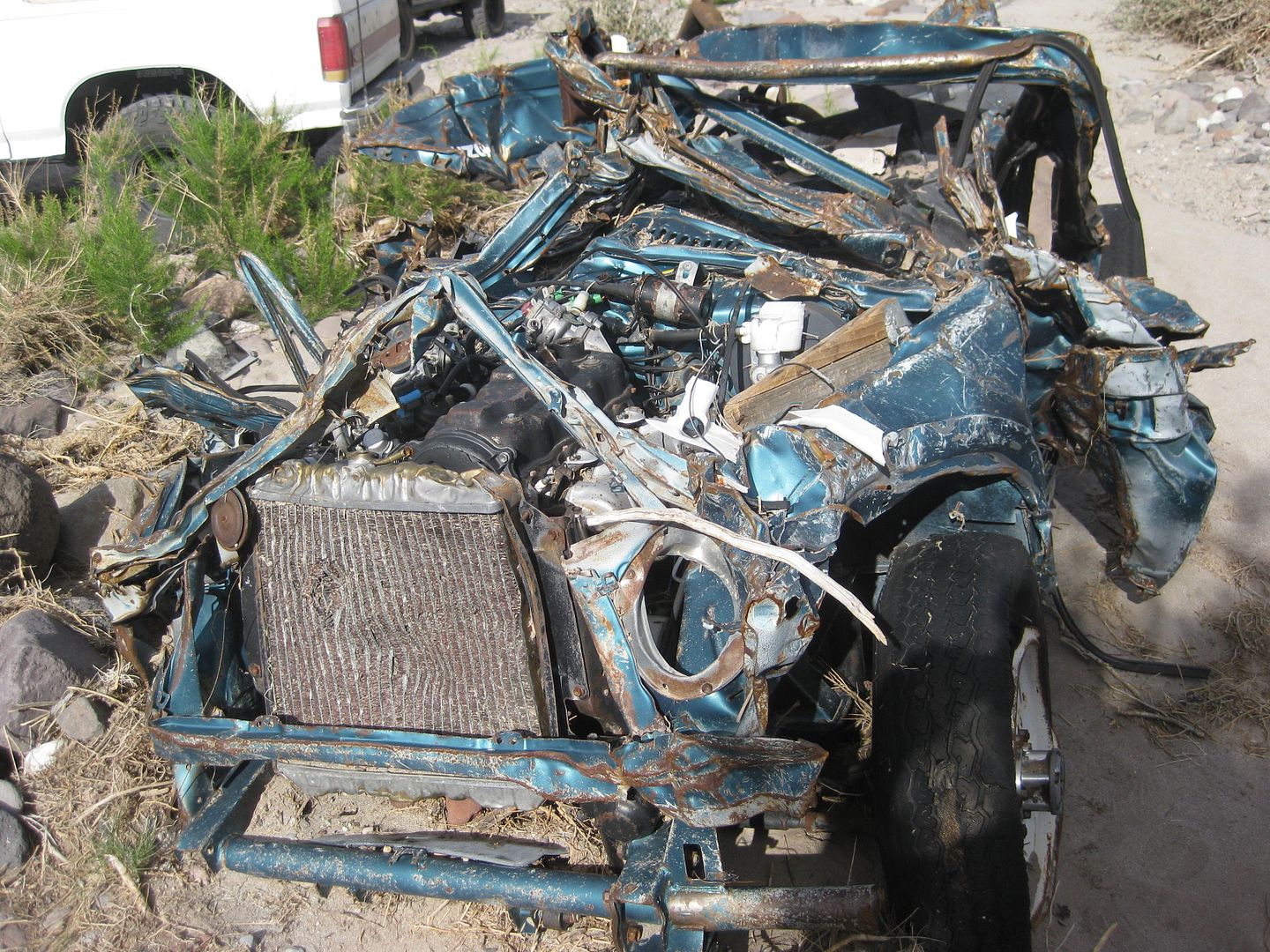
The Zuk appears to have all it parts although they are in a very compressed state. It lies about 5-10' above the wash bed at: 31 35.42043 -115
24.61807 The Zuk had been washed down Enmedio and over the substantial cliff and into Jaquegel wash to this place. So it appears the Zuk had moved
about 0.5 miles downstream.
March 2015
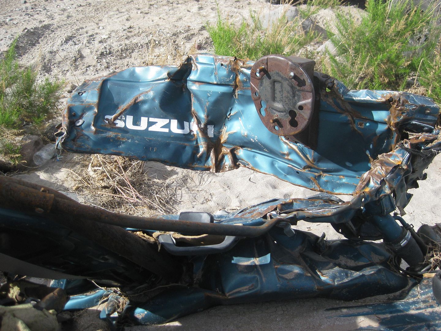
Zuk has moved another 0.65 miles down Jaquegel wash since Jan 2014 and its now at 30 35.512, -115 24.057. It is located a few feet west of the PLR
turn of Jaquegel to/from no-name wash.

Meanwhile I revised my GPS track to add the waypoints near the Zuk places
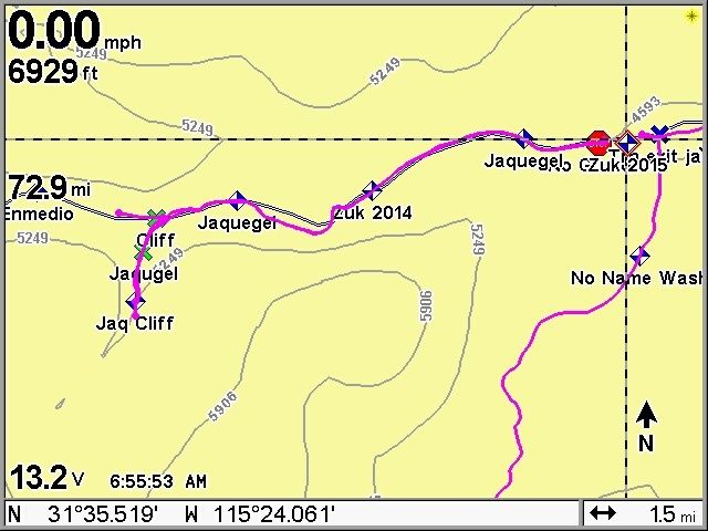
GPS screen shots:
West image with Zuk 2005 plotted 1.5Km from the Basketball turn. In 2014 I was able to drive to the cliffs of Jaquegel and Enmedio so I plotted them
on my track.

The east image with the plots of the 2014 and 2015 location are shown. Also noted is the huge impassable rock pile that appeared between Jan 2014 and
March 2015 with the stop sign symbol.
Below is an image annotated image from the Topo H11B25. It shows the relationship between Jaquegel, Enmedio, No-Name washes, and the PLR track. In
the image Zuk1 is the 2014 location, Zuk is the 2004 location. Annotations are for my east to west travel.

Latest GPS file can be found in the Zip file. Find a Lowrance >USR file.
Use http://www.gpsvisualizer.com/ to convert to your desired format. I use Trackmaker because it is simple and has all the necessary formats for
converting.Lots of new waypoints requireing lots of zooming to get all the detail. Entrance from PLR to Siaz and Jamau summits also added.
Attachment: PLR V7.zip (35kB)
This file has been downloaded 382 times
David K - 5-22-2015 at 03:22 PM
That Suzuki gets more publicity than the poles on the Pole Line Road! Does it have some magical powers?
Just kidding... thanks for the plotting you did Paul. Shows how strong a flash flood is against good Japanese steel!
Land of damaged goods
Ken Cooke - 5-23-2015 at 07:35 AM
The driver possibly traveled down Enmedio past Basketball hill to do some rock crawling and then possibly tried to return back up the canyon as the
Suzuki had been oriented.
There is a nice rock that must be negotiated as seen in the "Wrong Way Enmedio" video (YouTube) which the driver (and his party) had to negotiate on
their way down and back.
Our Jeeps (and the full sized Chevy truck) traveled downstream and quickly returned to the large boulder where we winched the half-ton Chevy truck
back over the gatekeeper rock and camped in Enmedio for the night.
Now, a damaged full sized Chevy truck rests along the trail midway up Basketball Hill. Its condition is 'poor', but like the Suzuki, it will one day
be the source of speculation and emergency trail parts!
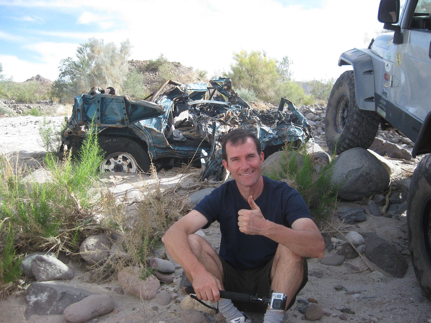
Here are my Suzuki photos, for the record... Easter, 2015
David K - 5-23-2015 at 10:42 AM
Frigatebird
Udo - 5-23-2015 at 12:59 PM
Great Suzuki story...this should be one for the Suzuki bulletin boards.


