BajaNomad

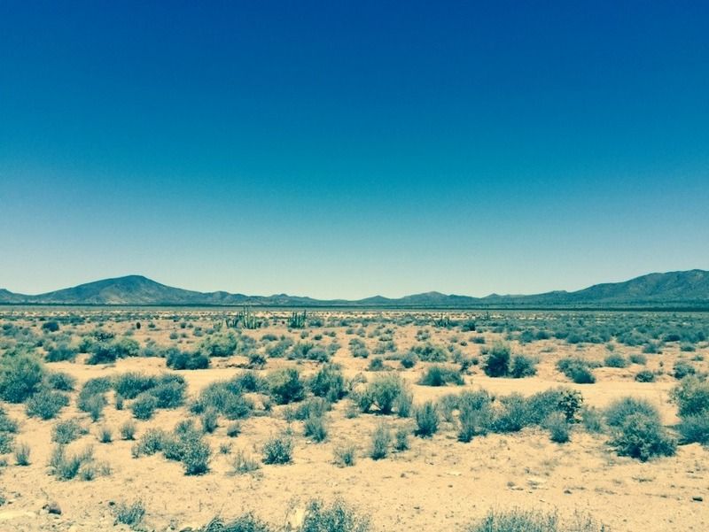
Laguna Chapala Hoy

Ateo - 8-2-2015 at 05:34 PM

A nice trip over to Cocos today.


ehall - 8-3-2015 at 07:17 AM

Whole bunch of nothing out there. I like it. How's coco?

El Jefe - 8-3-2015 at 02:32 PM

Any of that heavy equipment I saw staged in early July moving around doing connecting road improvements yet?

BornFisher - 8-3-2015 at 03:34 PM

Great pic. Have another for today??

Ateo - 8-3-2015 at 03:40 PM

Quote: Originally posted by ehall  
Whole bunch of nothing out there. I like it. How's coco?


Coco looked great actually. We stopped for about 20 minutes and my wife gave him the enormous stash of food that we couldn't take back across the border.

Ateo - 8-3-2015 at 03:43 PM

Quote: Originally posted by El Jefe  
Any of that heavy equipment I saw staged in early July moving around doing connecting road improvements yet?


Yeah, nothing is connected, but there is a serious presence of construction crews and equipment out there. Mountainsides being blasted, rocks being moved around, and what I thought was an insanely steep grade for a tractor to traverse to toss the rocks into some sort of canyon that was being filled in for the road. I'm not an engineer so I have no idea what the terminology is. :saint::saint::saint::saint::saint:

Ateo - 8-3-2015 at 04:06 PM

Quote: Originally posted by BornFisher  
Great pic. Have another for today??


Thanks friend. Just got home. I'll post more than another in a few days. Back to the grind now. =)

David K - 8-3-2015 at 04:41 PM

Quote: Originally posted by El Jefe  
Any of that heavy equipment I saw staged in early July moving around doing connecting road improvements yet?


Have a look at this Tom: http://forums.bajanomad.com/viewthread.php?tid=79774

El Jefe - 8-3-2015 at 05:49 PM

Thanks Ateo and DK. Sounds and looks like they are finally gonna git er done.

"Cut and fill" is what they call it when they take the top off a hill and put it down into the valley to make the road bed relatively flat, or at least less hilly. The new road they are creating looks pretty nice where they have completed it. Will really change my trips north and back again. Such a stress free way to go.

David K - 8-4-2015 at 08:56 AM

Quote: Originally posted by El Jefe  
Thanks Ateo and DK. Sounds and looks like they are finally gonna git er done.

"Cut and fill" is what they call it when they take the top off a hill and put it down into the valley to make the road bed relatively flat, or at least less hilly. The new road they are creating looks pretty nice where they have completed it. Will really change my trips north and back again. Such a stress free way to go.


It is, no dozens of small towns with topes and traffic! However, a LOT of people will be using Hwy. 5 to get north. The San Felipe-Puertecitos section is going to be a problem, as it is an OLD style paved road (19ft. wide, no shoulders, few pullouts, and worse of all, the sudden steep vados that will launch and crunch you if you hit them more than 25 mph)!

The long range plan is a new style highway that bypasses San Felipe, stays inland, as the old Puertecitos road did via the sulfur mine, and connects the two modern style highways with same... staying outside of San Felipe (avoiding town east of the entrance monument). Not everyone likes speed bumps, countless four way stop signs, and city traffic, I guess?! LOL

El Jefe - 8-4-2015 at 12:45 PM

So true DK, those vados are world class! You either take flight and hit your head or bottom out and crack your tail bone. Too much fun either way. Never the less, much better than the west side for just getting the miles behind you.

PaulW - 8-4-2015 at 01:16 PM

Quote: Originally posted by David K  


The long range plan is a new style highway that bypasses San Felipe, stays inland, as the old Puertecitos road did via the sulfur mine, and connects the two modern style highways with same... staying outside of San Felipe (avoiding town east of the entrance monument). Not everyone likes speed bumps, countless four way stop signs, and city traffic, I guess?! LOL

======
Several parcels have change hands as the Govt procures what is needed for the new highway. The sellers have been allowed to remain living on the land. The parcels sort of line up heading south starting north of the arches. South of that just speculation that the route will follow OPR? Subtle inquiries are needed to get up to date info. All that land from San Felipe south is in private ownership by private parties or the several Ejido's.

David K - 8-6-2015 at 08:47 AM

Quote: Originally posted by PaulW  
Quote: Originally posted by David K  


The long range plan is a new style highway that bypasses San Felipe, stays inland, as the old Puertecitos road did via the sulfur mine, and connects the two modern style highways with same... staying outside of San Felipe (avoiding town east of the entrance monument). Not everyone likes speed bumps, countless four way stop signs, and city traffic, I guess?! LOL

======
Several parcels have change hands as the Govt procures what is needed for the new highway. The sellers have been allowed to remain living on the land. The parcels sort of line up heading south starting north of the arches. South of that just speculation that the route will follow OPR? Subtle inquiries are needed to get up to date info. All that land from San Felipe south is in private ownership by private parties or the several Ejido's.


Only time will tell! Thanks Paul.

Cliffy - 8-6-2015 at 08:53 AM

So with all the destruction of the flora and fauna did the government file the proper EPA reports? :-) :-)

David K - 8-6-2015 at 05:47 PM

Quote: Originally posted by Cliffy  
So with all the destruction of the flora and fauna did the government file the proper EPA reports? :-) :-)


That's rich! Do you have any idea of the millions of cardons, boojums and other plants destroyed when making Hwy. 1 between El Rosario and Guerrero Negro in 1973?

They cleared a path through the desert so wide, it was easy to see from space in the early space age satellites images of that time! Around 100 feet on each side of the road was cleared, and then the dirt was bulldozed up like a levee on top of which the highway was placed.

Not all of the transpeninsular highway, mind you... just through the most beautiful desert vegetation parts (north and south of Punta Prieta for one). Almost as if they hated the desert so much, they were going to stick it to it just a bit more!

The government was in charge, so no EPA was involved, if Mexico ever had one at that time... or they simply signed off on the proposal, after all the highway was in great need and many years past due... it had to be built no matter how much some of us were against it.

Highway 5 is finally nearing completion (just 23 miles to go) after decades of being promised. The alignment for it was surveyed in 1974!

In 1986, a dirt-highway roadbed was graded from Puertecitos through to Gonzaga Bay and on to the 1983 Laguna Chapala/Puerto Calamajué road. Only the section to Puertecitos was paved by 1990, so thinly it didn't last and was repaved about 2006. The graded road south of Puertecitos was not maintained after 2005, and became very uncomfortable the past 10 years.

Cliffy - 8-6-2015 at 08:42 PM

I don't have an emoticon for "tongue in cheek" !
Check the smiles !
It was meant in jest
I know how things work down there

joel - 8-6-2015 at 10:21 PM

Since we're talking about the Highway 5 route, can anyone point me to information on the marsh land north of San Felipe. In November last year the area was very wet, but super dry this summer. What's the water source?

David K - 8-6-2015 at 11:22 PM

Two factors other than rainfall:
1) High gulf tides (full or new moon), salt flats from salt water.
2) Flooding Colorado River (periodic dam flood gates opened).