BajaNomad

Looking for suggestions for time-killing exploring

StuckSucks - 10-20-2015 at 11:14 AM

Hi All!

I'd love to hear everyone's suggestions for some time-killing exploring.

I'll have a day to kill headed south on Highway 5 between Puertocitos and Chapala and was wondering if there's a fun side-trip I can take to see some Baja coolness. I will be 4x4-enabled, but we need to be mindful of my gas since I'm ultimately on my way to Punta Blanca, including race-car silt extraction and return.

Thoughts, por favor?

Jim

David K - 10-20-2015 at 11:30 AM

Oh boy!
Well, north of San Felipe is the Lost Diaz Grave! Near Gonzaga is the onyx springs, El Camino Real to Santa Maria, Las Palmitas, Molino de Lacy, La Turquesa Canyon, gold mines and more!

BornFisher - 10-20-2015 at 11:36 AM

Find some geocaches like this one---

http://www.geocaching.com/geocache/GC3AZBZ_puertecitos-cache

motoged - 10-20-2015 at 12:04 PM

Some time with Coco and maybe a trip east out to Calamujue fish camp.....:light:

woody with a view - 10-20-2015 at 12:08 PM

all those dirt roads coming off the hiway. always wanted to see where a few went out into the midst of nowhere.

StuckSucks - 10-20-2015 at 12:16 PM

Thanks for the suggestions! I should have mentioned that I'm looking for off-beaten-path suggestions - I've already been to many mainstream locations.

re: Coco's been there thousands of times, yes we will stop (In 2006 during the 1000, we watched Dust to Glory with Coco in his yard - projected on the big screen)

re: Calamujue is a good idea - been 30 years since I was there, perhaps a revisit is in order

re: Been to Molino de Lacy and La Turquesa Canyon, but that's spurring other ideas ...

Thanks everyone!

David K - 10-20-2015 at 01:50 PM

On my web site, go to the list of links to photos of Baja places and click on the Gonzaga Bay list. There is also the Serra Cargo Trail that Baja Bucko placed a GeoCache on, or near it at an oasis. It heads up the arroyo from the bridge just north of Papa Fernandez' entrance road.

Howard - 10-20-2015 at 03:15 PM

Is the Richmond Bar and Grill or the Patio too far out of the way?

StuckSucks - 10-20-2015 at 03:24 PM

Quote: Originally posted by Howard  
Is the Richmond Bar and Grill or the Patio too far out of the way?


Not at all - as a matter of fact, we may have to trek by there soon ...

StuckSucks - 10-20-2015 at 03:53 PM

Quote: Originally posted by David K  
On my web site, go to the list of links to photos of Baja places and click on the Gonzaga Bay list. There is also the Serra Cargo Trail that Baja Bucko placed a GeoCache on, or near it at an oasis. It heads up the arroyo from the bridge just north of Papa Fernandez' entrance road.


In his description he says "Feet required for this one" - holy cow it's out there: https://goo.gl/maps/dnkrPtscAUN2 (near the group of palms)

The geocache: No Wheels Need Apply!


BigBearRider - 10-20-2015 at 04:29 PM

Quote: Originally posted by David K  

Well, north of San Felipe is the Lost Diaz Grave!\


Classic!

MMc - 10-20-2015 at 06:11 PM

"When you come to fork in the road take it". There are some graet beaches and some big ones too. get on Google maps and go explore some of it. It is easy to kill 1/2 to 3/4 day just driving and doing a little beach walking. Bring a beer too.

motoged - 10-20-2015 at 06:17 PM

Quote: Originally posted by StuckSucks  


re: Coco's been there thousands of times, yes we will stop (In 2006 during the 1000, we watched Dust to Glory with Coco in his yard - projected on the big screen)....

re: Calamujue is a good idea - been 30 years since I was there, perhaps a revisit is in order....


SS,
As a Race Dog I assumed you have spent time s w/Coco.....

You could venture out to Calamujue Canyon, get out of the truck, walk the different "race lines" and measure how deep the water is in the ruts and pools without getting stuck....place bets as to which line was really the best.....see if your guesses got you out of there safely or needing a tow....all while your truck is parked with a cooler full of refreshments in a safe place....some exercise and a whole new way to visit that "stinky pit of despair"... :light: :biggrin:


Ken Cooke - 10-20-2015 at 07:25 PM

Quote: Originally posted by David K  
Oh boy!
Well, north of San Felipe is the Lost Diaz Grave! Near Gonzaga is the onyx springs, El Camino Real to Santa Maria, Las Palmitas, Molino de Lacy, La Turquesa Canyon, gold mines and more!


La Turquesa Canyon!! :bounce:


mtgoat666 - 10-20-2015 at 09:19 PM

Quote: Originally posted by StuckSucks  
Hi All!

I'd love to hear everyone's suggestions for some time-killing exploring.

I'll have a day to kill headed south on Highway 5 between Puertocitos and Chapala and was wondering if there's a fun side-trip I can take to see some Baja coolness. I will be 4x4-enabled, but we need to be mindful of my gas since I'm ultimately on my way to Punta Blanca, including race-car silt extraction and return.

Thoughts, por favor?

Jim


Go for a hike! Will save your gas!
And, no, Being a Nomad is not a good excuse for being sedentary!

Feel the bern!

David K - 10-20-2015 at 10:55 PM

Quote: Originally posted by StuckSucks  
Quote: Originally posted by David K  
On my web site, go to the list of links to photos of Baja places and click on the Gonzaga Bay list. There is also the Serra Cargo Trail that Baja Bucko placed a GeoCache on, or near it at an oasis. It heads up the arroyo from the bridge just north of Papa Fernandez' entrance road.


In his description he says "Feet required for this one" - holy cow it's out there: https://goo.gl/maps/dnkrPtscAUN2 (near the group of palms)

The geocache: No Wheels Need Apply!


HER description... one tough lady who rides mules on mission trails and researches the Baja Mountain families, whose ancestors were the Spanish soldiers sent to Baja to guard the missions!

Here is the link to see pictures of possible Baja destinations, click on Gonzaga Bay and other destinations: http://vivabaja.com/tours/index.html

Here is what is listed:

Bahia San Luis Gonzaga Area

Mission-era warehouse ruins on the shore of the bay
Alfonsina's Beach
Onyx Springs create a mineral glacier
Molino de Lacy ruins & grave
Las Palmitas oasis and Santa Maria Canyon
El Camino Real to Mision Santa Maria
Santa Maria Canyon from the air
La Turquesa Canyon
La Turquesa Grade
Calamajue mission site
Campo Beluga (Gonzaga Bay)
Coco's Corner 11-06
Alfonsina's 11-06
more Coco's Corner

Here are the L.A. Bay site listings:

Bahia de los Angeles Area

Tinaja de Yubay
Punta Candeleros & Remedios (Bahia Guadalupe)
El Toro Copper Mine
Camp Gecko cabin, turtle research station, & La Gringa
Bahia de los Angeles highway, Pemex, etc. '05
Bahia de los Angeles Museum
Mision San Borja
Mision San Borja (inside)
Old San Gregorio
Santa Ana, San Ignacito
Montevideo Petroglyphs
Las Tinajitas Petroglyphs
Camp Gecko '03
Las Flores
Los Paredones, La Bocana, Bahia San Rafeal
Las Flores Railroad and Tramway
Rock Palm Hill (near Yubay)
Bahia las Animas
Punta La Gringa
Mysterious Ruins/ Lost Mission Site?

Lot's more: http://vivabaja.com/tours/index.html


[Edited on 10-21-2015 by David K]

PaulW - 10-21-2015 at 06:20 AM

Hi Stuck,
Drive many roads heading W just N of Gonzaga. However not much to recommend.
Explore the coast campos just S of Gonzaga?
My GPS map shows roads between Coco's and Chapala heading W from the normal route. They are on my bucket list. Some just lead to gravel pits based on my look on GE.
Give the Arroyo Heme a try its on my bucket list.
Try Alfredo W of El Faro another bucket list item.
Further N there are no reports on Matomi. You could be the first one this year?
Take the side trip to the arch - always a good ride. It starts in Matomi had heads S up Las Blancas
If Matomi is passable the head up to the rancho. Who knows what you will find there?
Of course the arroyos N of Matomi may be a challenge after the summer rains?

StuckSucks - 10-21-2015 at 08:32 AM

Thanks everyone for tons of great ideas -- hummm ... getting out of the truck, what a revolutionary idea!!

The BoLA is a little farther than I want to go, but tons of great Gonzaga-neighborhood ideas.

Regardless of where I go/what I find, I will share photos on return.

woody with a view - 10-21-2015 at 08:44 AM

Quote: Originally posted by MMc  
Bring a beer too.


he meant "or 9".

StuckSucks - 10-21-2015 at 10:49 AM

Quote: Originally posted by woody with a view  
Quote: Originally posted by MMc  
Bring a beer too.


he meant "or 9".


Goes without saying. Implied.

StuckSucks - 10-21-2015 at 11:34 AM

I started doing homework for Turquesa Canyon, and realized that I'd taken a photo sphere in the wash were the road for the canyon intersects Highway 5.

https://goo.gl/maps/c3VtxLfkJAR2


David K - 10-21-2015 at 05:17 PM

I am following Nomad 'Pappy Jon' (from New Mexico) with his DeLorme In Reach signal and he was there last night, up by the green pools...

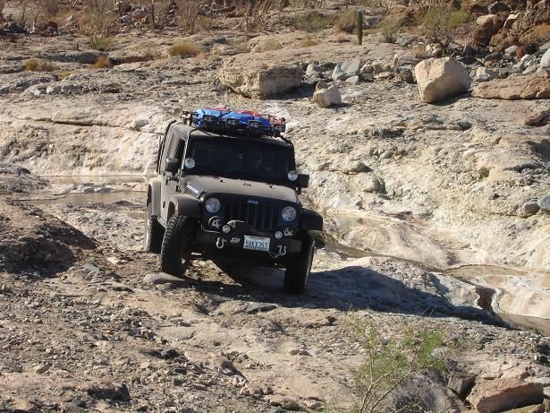
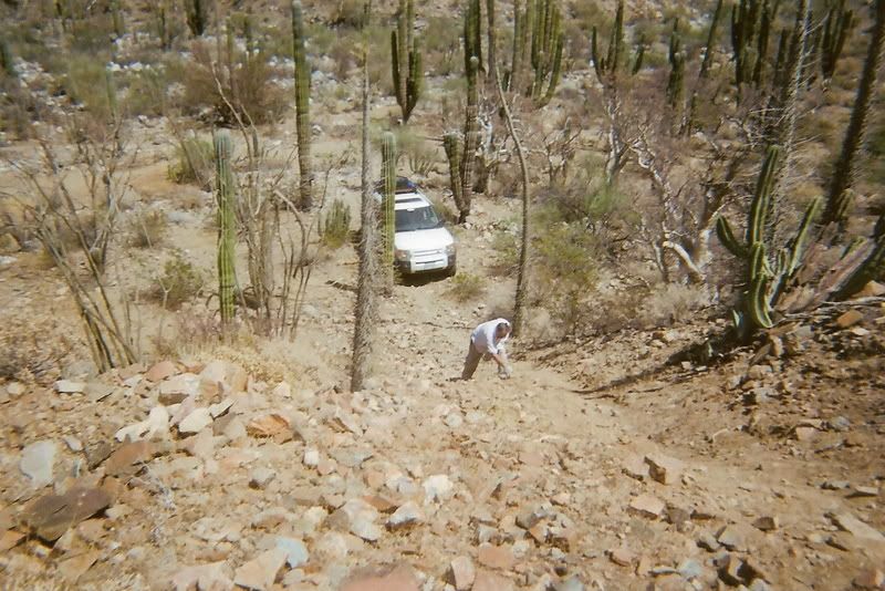
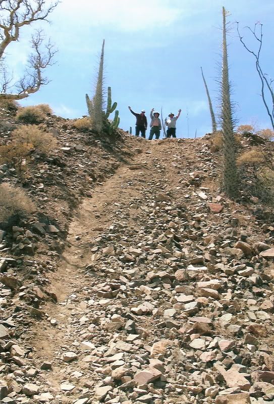
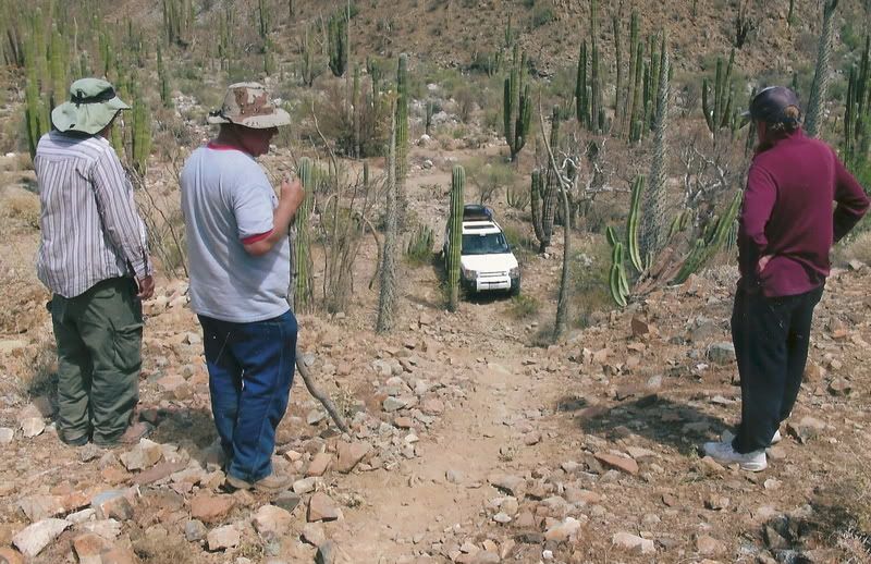
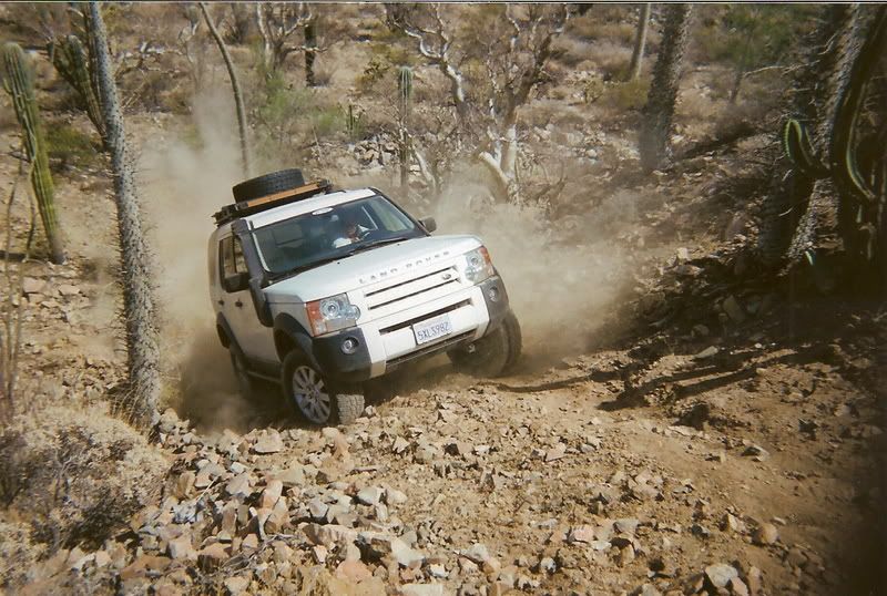
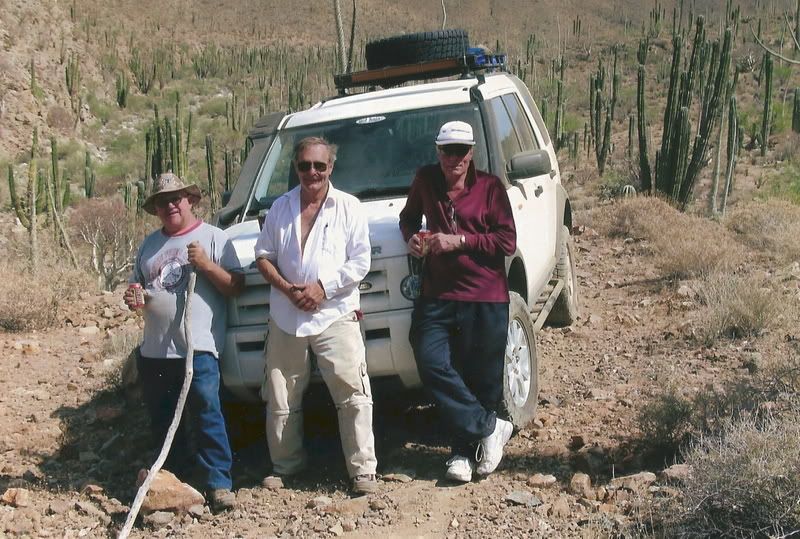
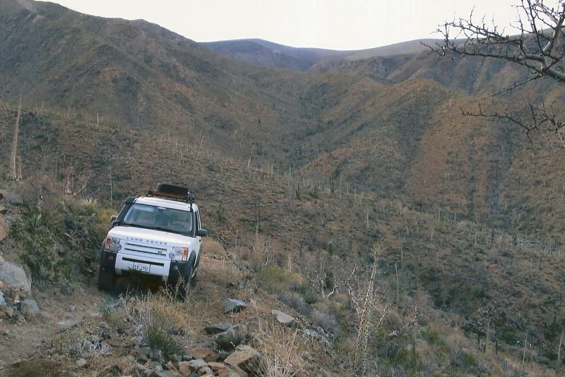
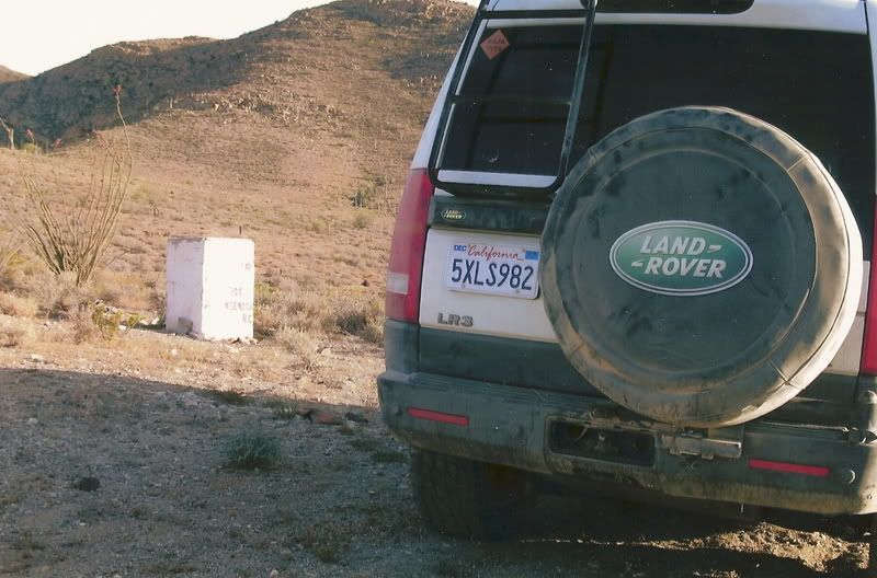
If you are macho, like The Squarecircle (Roy), you can drive from the pools, past the turquoise mine and to the bottom of the switchback grade that comes down from Highway One (by El Pedregoso 'The Boulder Hill'). Of course he used a Land Rover, so it was easy (NOT)! TW was there and helped blaze the trail from the mine to the switchback.

I am surprised Score hasn't used it yet, but they don't like roads that are too rough, for off road racing! LOL

[Edited on 10-22-2015 by David K]

MMc - 10-21-2015 at 05:58 PM

I was saying also bring beer, there is never enough beer.

Quote: Originally posted by StuckSucks  
Quote: Originally posted by woody with a view  
Quote: Originally posted by MMc  
Bring a beer too.


he meant "or 9".


Goes without saying. Implied.

StuckSucks - 10-22-2015 at 11:43 AM

Quote: Originally posted by David K  
If you are macho, like The Squarecircle (Roy), you can drive from the pools, past the turquoise mine and to the bottom of the switchback grade that comes down from Highway One (by El Pedregoso 'The Boulder Hill').


Ultimately, I need to get to Highway 1 to get to the Pacific Coast, so if I had juevos ...

If a Landcruiser made it, then I might have to put the Tacoma in 4x4 ...

PaulW - 10-22-2015 at 12:31 PM

Quote: Originally posted by StuckSucks  
I started doing homework for Turquesa Canyon, and realized that I'd taken a photo sphere in the wash were the road for the canyon intersects Highway 5.

https://goo.gl/maps/c3VtxLfkJAR2


=======
Hi James,
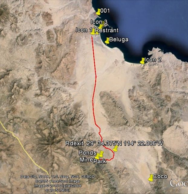
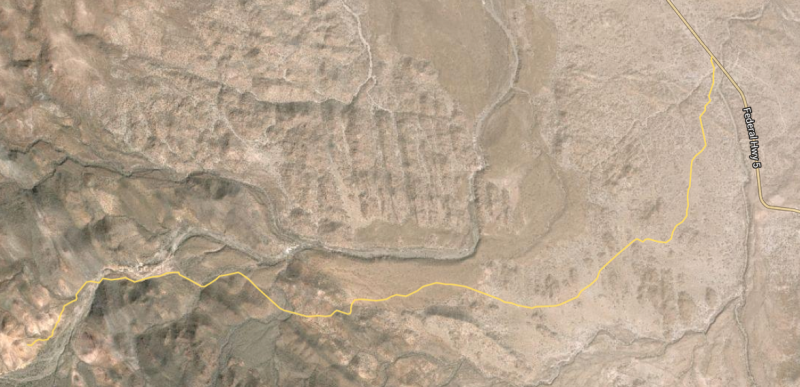
here is the post on another discussion showing the turn from the road to Coco's to the turq ponds. From what I have read a 4WD high clearance rig can do the grade for the pond or mine area to Hwy 1.


David K - 10-22-2015 at 12:45 PM

Quote: Originally posted by StuckSucks  
Quote: Originally posted by David K  
If you are macho, like The Squarecircle (Roy), you can drive from the pools, past the turquoise mine and to the bottom of the switchback grade that comes down from Highway One (by El Pedregoso 'The Boulder Hill').


Ultimately, I need to get to Highway 1 to get to the Pacific Coast, so if I had juevos ...

If a Landcruiser made it, then I might have to put the Tacoma in 4x4 ...


It was Roy's LR3 Land Rover!


The Top!

StuckSucks - 10-22-2015 at 03:06 PM

Quote: Originally posted by PaulW  

Hi James,
here is the post on another discussion showing the turn from the road to Coco's to the turq ponds. From what I have read a 4WD high clearance rig can do the grade for the pond or mine area to Hwy 1.


Thanks Paul,

I just added the road to a map, and will make a file to move to my GPS. I assume the pools are in that rocky area when you enter the canyon approaching the mine?


StuckSucks - 10-22-2015 at 03:09 PM

Quote: Originally posted by David K  

It was Roy's LR3 Land Rover!


Whoa - looks like a loose, gravely mess. And fun.

PaulW - 10-22-2015 at 03:56 PM

James, attached is the USR Zip file for the track. Hope it works?
Pools are surrounded with hard rock. Park and walk a short distance to view/explore them. Short gravel approach to the mine. Slim pickings to find the turq. The climb up the grade is described a difficult. Its on my bucket list to do sometime.
Paul
=============
Quote: Originally posted by StuckSucks  
Quote: Originally posted by PaulW  

Hi James,
here is the post on another discussion showing the turn from the road to Coco's to the turq ponds. From what I have read a 4WD high clearance rig can do the grade for the pond or mine area to Hwy 1.

[


Thanks Paul,

I just added the road to a map, and will make a file to move to my GPS. I assume the pools are in that rocky area when you enter the canyon approaching the mine?


Attachment: Turq Ponds.zip (2kB)
This file has been downloaded 269 times

StuckSucks - 10-22-2015 at 05:24 PM

Quote: Originally posted by PaulW  
James, attached is the USR Zip file for the track.


Thank Paul, worked great. I embedded in a Google Map to have a good look-see. How did you know .usr is my flavor?

PaulW - 10-23-2015 at 06:29 AM

Quote: Originally posted by StuckSucks  
Quote: Originally posted by PaulW  
James, attached is the USR Zip file for the track.


Thank Paul, worked great. I embedded in a Google Map to have a good look-see. How did you know .usr is my flavor?

=======
Involved in Cops racing - racers always use Lowrance. When I see you doing tracks USR is the obvious way to go. I use Garmin and Lowrance and Garmin sucks I may just dump the G units.

TMW - 10-23-2015 at 09:01 AM

From the mine to the hill out of the wash there were two places we had some difficulty getting Roy thru. The first was an S shaped turn against the north embankment soon after leaving the mine. This section is not for a long wheel base vehicle. The second was a step up that needed some road building.

That was several years ago and the rains could have changed all that. The trail Roy followed was what the bikers use. It mostly stays along the north side of the arroyo.

Roys problem getting up the hill was because he does not have a locker. He has all kinds of traction control stuff that in his case did not provide the type of traction needed on a hill of loose rocks. He finally just blasted his way up. He said they had to move a lot of rocks after the hill top for a short section.

If I remember right it took us about 8 hours to go 2 miles. It's 2 miles from the mine to the hill out of the wash.


[Edited on 10-23-2015 by TMW]

David K - 10-23-2015 at 09:15 AM

Yes, the motorcycles love it and Kacey Smith named it the "XR Ride Up" in her first book ('All About Your Whereabouts' Baja GPS Guide). It is also called, "Coco's Shortcut".