BajaNomad

Off Road Trip-Where to for you

TMW - 12-1-2015 at 08:17 AM

I've taken some pretty good trips around Baja north and south. What would be your ideal trip for 7-10 days. Keep it mostly in the dirt with as little hwy as possible. Sites maybe you've not been to but have dreamed of going.

As an alternative where would you like to go to spend a week and why, in Baja of course.

As an example dtbushpilot just did an 8 day off-road motorcycle trip down Baja with his son. From all indications it was a blast.

MMc - 12-1-2015 at 09:24 AM

I am not a drive around guy, I tend to go to a place and post up for a week. I look for places that I can surf, kayak, fish and hike.
I would love to have this discussion around a campfire.

David K - 12-1-2015 at 09:31 AM

Tom, perhaps just look at the map and draw a line along connecting roads that avoid Hwy. 1 or 5. Sadly, there isn't a parallel dirt route south of Matomi to Coco's Corner, so some Hwy. 5 must be used on the east coast.

I hope you still consider the Sierra San Miguel road (the San Pedro Martir foothills) and can get to San Isidoro on the trail to Mission San Pedro Martir.

Tom, here is a thread that includes Kevin in Ok photos taken at San Isidoro in 2002 and maps: http://forums.bajanomad.com/viewthread.php?tid=22448

[Edited on 12-1-2015 by David K]

chuckie - 12-1-2015 at 09:38 AM

Ascuncion area is a good place to spend a week.....AND Shari is there...(SIGH).............

bajatrailrider - 12-1-2015 at 09:59 AM

Follow TMW and David would always be good ride. I would love to show you guys routes in north baja.That you guys have not been on.Then keep going south,to see routes you guys know.

willardguy - 12-1-2015 at 10:34 AM

wouldn't it be great if you guys could collaborate on a book of baja off road trails! or does something like this already exist?

bajatrailrider - 12-1-2015 at 10:42 AM

If we did,routes change by the year.Every year I see old route closed.Due to locked gate,or wash out.Then next year,no gate road fixed.Things sure change in Baja.I know routes I have in north Baja,are not on any maps. I hope to take the guys.On these routes,then with there mapping knowledge.Map it.I think over half the routes I do, are not on any map.

4x4abc - 12-1-2015 at 11:20 AM

Quote: Originally posted by bajatrailrider  
If we did,routes change by the year.Every year I see old route closed.Due to locked gate,or wash out.Then next year,no gate road fixed.Things sure change in Baja.I know routes I have in north Baja,are not on any maps. I hope to take the guys.On these routes,then with there mapping knowledge.Map it.I think over half the routes I do, are not on any map.


what keeps you from sharing them?

bajatrailrider - 12-1-2015 at 01:29 PM

Nothing keeps me from sharing them Harald.Im inviting you and all to go.I have asked all do next trip in this area.Waiting on you.If you mean show on map.I posted they are not on maps.I dont use GPS,old school way.I get on my bike explore,then I know if 4x4 can do it.

motoged - 12-1-2015 at 01:56 PM

An area of Baja that will be my next focus for "new to me adventures" will be the coastline on Gulf of California south between Agua Verde and La Paz.

Seems like there are a number of rough roads heading east from Hwy 1 to that coastline....lots of in and outs to the highway, but lots I haven't seen yet.

My tentative plan is to go by dirtbike and camp.....water toting being the biggest challenge for several days at a time.

Probably will be a year from now (Dec/16 - Jan-17), so I have lots of time to plan and maybe even connect with a few like-minded folks. 4X4ers welcome....(solution to toting water.... :coolup: )

[Edited on 12-1-2015 by motoged]

TMW - 12-2-2015 at 10:55 AM

Quote: Originally posted by David K  
Tom, perhaps just look at the map and draw a line along connecting roads that avoid Hwy. 1 or 5. Sadly, there isn't a parallel dirt route south of Matomi to Coco's Corner, so some Hwy. 5 must be used on the east coast.

I hope you still consider the Sierra San Miguel road (the San Pedro Martir foothills) and can get to San Isidoro on the trail to Mission San Pedro Martir.

Tom, here is a thread that includes Kevin in Ok photos taken at San Isidoro in 2002 and maps: http://forums.bajanomad.com/viewthread.php?tid=22448

[Edited on 12-1-2015 by David K]


I'm still planning on going into the area of San Isidoro and check out other trails too. I'm waiting for some things to clear up, hopefully soon.

TMW - 12-2-2015 at 10:57 AM

Quote: Originally posted by bajatrailrider  
Follow TMW and David would always be good ride. I would love to show you guys routes in north baja.That you guys have not been on.Then keep going south,to see routes you guys know.


That would be great. Always love to find new routes.

TMW - 12-2-2015 at 11:04 AM

Quote: Originally posted by motoged  
An area of Baja that will be my next focus for "new to me adventures" will be the coastline on Gulf of California south between Agua Verde and La Paz. [Edited on 12-1-2015 by motoged]


The area north of Timbabichi looks interesting. On another post someone went to a ranch and on GE I saw two ranches to the north. Maybe abandoned maybe not but fun to check out.

I need to get Harald and Karl to lead the way.

bajatrailrider - 12-2-2015 at 01:06 PM

Quote: Originally posted by TMW  
Quote: Originally posted by bajatrailrider  
Follow TMW and David would always be good ride. I would love to show you guys routes in north baja.That you guys have not been on.Then keep going south,to see routes you guys know.


That would be great. Always love to find new routes.
The one most interesting.New road up to forest,just below park.It is locked gates,but I have keys.Permission. Give me advance notice,we will be riding.Dec 5 till 11.Then Dec 12 toward Tecate. After Dec 15 anywhere.

David K - 12-2-2015 at 02:52 PM

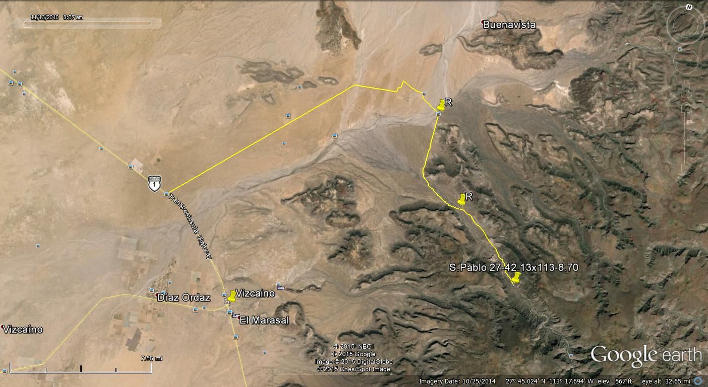
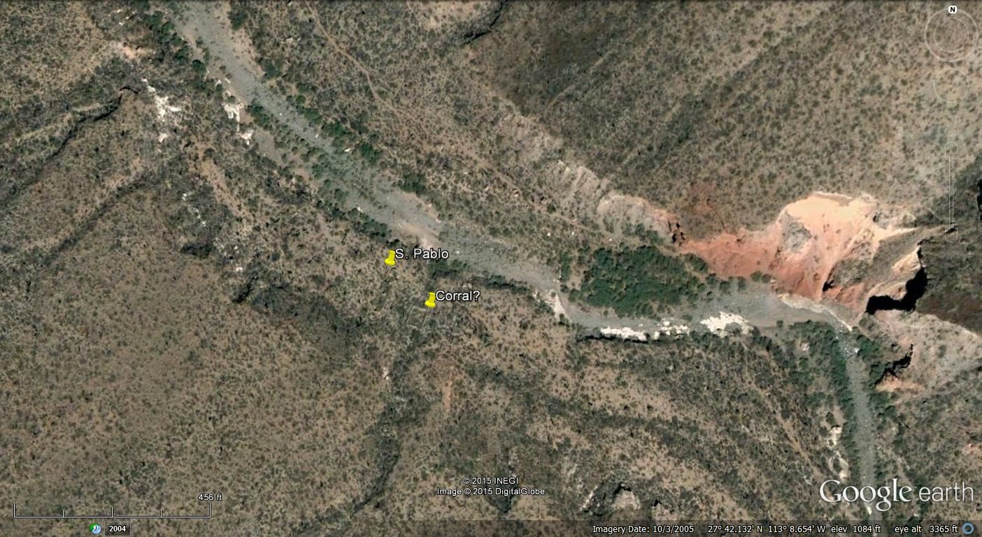
I would love to see the San Pablo visita if it has a Tacomable road to it.

That is east of Vizcaino up in the canyon a little. XRPhil was there in 2010.

TMW - 12-3-2015 at 11:24 AM


TMW - 12-3-2015 at 11:38 AM

A close up view

David K - 12-3-2015 at 11:54 AM

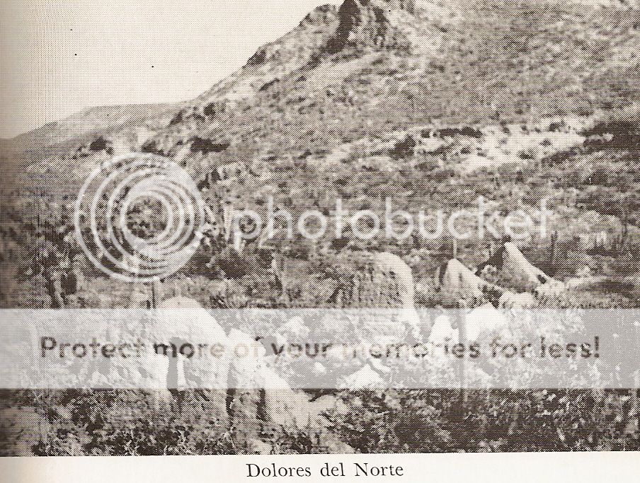
Yup!

1949:


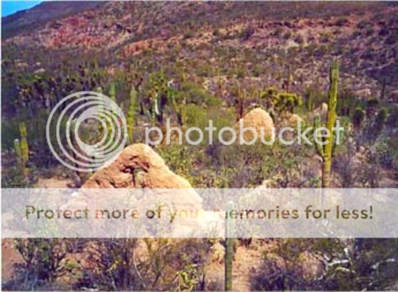
2010:


[Edited on 12-3-2015 by David K]

motoged - 12-4-2015 at 01:26 PM

And.......the coastline north of Loreto up to San Nicolas....:light:


Quote: Originally posted by motoged  
An area of Baja that will be my next focus for "new to me adventures" will be the coastline on Gulf of California south between Agua Verde and La Paz.

Seems like there are a number of rough roads heading east from Hwy 1 to that coastline....lots of in and outs to the highway, but lots I haven't seen yet.

My tentative plan is to go by dirtbike and camp.....water toting being the biggest challenge for several days at a time.

Probably will be a year from now (Dec/16 - Jan-17), so I have lots of time to plan and maybe even connect with a few like-minded folks. 4X4ers welcome....(solution to toting water.... :coolup: )

[Edited on 12-1-2015 by motoged]

My not yet trip

AKgringo - 12-7-2015 at 10:39 PM

I should have been on my way back north by now, but my road trip has been delayed three times so far.

The non-Baja part of the trip is going to be crossing the Sierra Nevada range in Northern CA somewhere between Tahoe and Yosemite if the passes are open and the weather good, then down 395 toward Mexicali. If it is stormy weather, then over to Reno, and down Nevada 95.

From Mexicalli, I want to take the old La Rumorosa grade east, then south through Laguna Hansen, hoping to find my way to highway 3 somewhere near Heroes de la Indepencia, then scouting for the road through Laguna Diablo to San Felipe.

A road trip south on five to Gonzaga will be a rest period, and I want to check out some of the camps and roads around there (optional)

From Coco's, I want to head to Bahia Calamajue, then return to highway 1 through Calamajue Canyon, then on to B.O.L.A and south to Las Animas, and other points of interest, camping where ever daylight starts to fade.

I don't have much of a plan, or schedule, but places I would like check out include Punta Chivato, spend a bit of time in Mulege, check out the east side of Bahia Conception, then head west to San Juanico, then north to San Ignacio, or back east to Mulege.

By then, time, money, and the condition of my rig will determine my course north. A side trip to Bahia Asuncion would probably be in order as well.

For what it is worth, I travel alone except for my dog, and my budget doesn't include a lot of hotel time.

David K - 12-7-2015 at 10:41 PM

Sounds perfect AK!

AKgringo - 12-8-2015 at 09:48 AM

DK, I almost forgot, I really should look for the 'Shell Island' you speak of!

If only I had a map to find my way......just kidding, I can find it!

TMW - 12-8-2015 at 09:59 AM

Don't forget to stop by Panchos place after Las Animas, maybe spend the night there. If you have room in the cooler for a couple of beers give him one for me.

AKgringo - 12-8-2015 at 10:12 AM

Quote: Originally posted by TMW  
Don't forget to stop by Panchos place after Las Animas, maybe spend the night there. If you have room in the cooler for a couple of beers give him one for me.


On my last trip through there,Pancho shared a fish he had just cooked, with tortillas he just made, so I owe him! I don't usually have beer with me, but I will throw in a six pack for him. Some dog and cat food, and a little fresh fruit would probably be appreciated as well.

David K - 12-8-2015 at 10:40 AM

Quote: Originally posted by AKgringo  
DK, I almost forgot, I really should look for the 'Shell Island' you speak of!

If only I had a map to find my way......just kidding, I can find it!


If it is a full or new moon, then you will know why I named it Shell ISLAND and not Beach! The access road across the salt-mud flat is usually dry the rest of the month.