
fishbuck - 7-6-2016 at 01:27 AM
[URL=http://s285.photobucket.com/user/fishbuck/media/Mobile%20Uploads/1467784798989.jpg.html]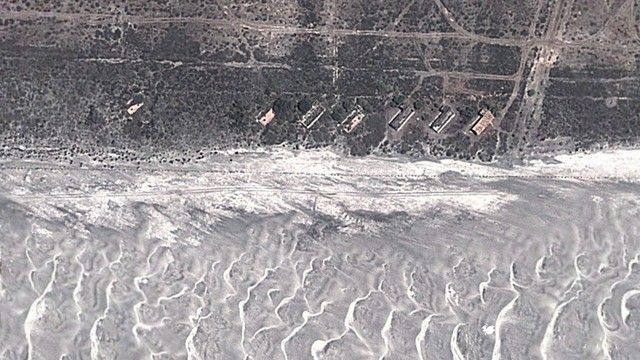
Can anyone please give me any information regarding this location?
Abandoned beach casitas from days gone by? I have never heard anyone speak of this place?
[Edited on 7-6-2016 by fishbuck]
fishbuck - 7-6-2016 at 01:39 AM
I know what it is now but I am incredibly curious about what it was? Some might say obsessed. Even feverish...
Playa de Oro
John M - 7-6-2016 at 03:50 AM
North of San Felipe?
We have a friend that lives there, and has for quite some time. If that is the same Playa de Oro you are interested in, I will call or email him to
see what he knows or who to chat with.
John M
PaulW - 7-6-2016 at 06:43 AM
Image posted - Not PDO. Maybe its south of town? Nothjing like the image north. If you make an image with placemark and coords I will locate it for
you
Here is PDO beach area with coords
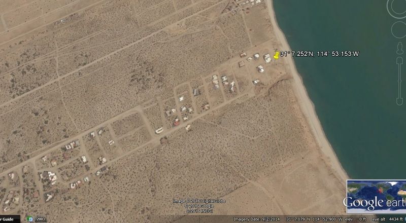
David K - 7-6-2016 at 08:00 AM
San Quintín's Playa de Oro is the beach between Cielito Lindo and Hotel Misión Santa María (former La Pinta/El Presidente Hotel).
Pacific vs Sea of Cortez
John M - 7-6-2016 at 09:13 AM
What looks like wave action might indicate that this is more likely on the Pacific as David suggests.
John M
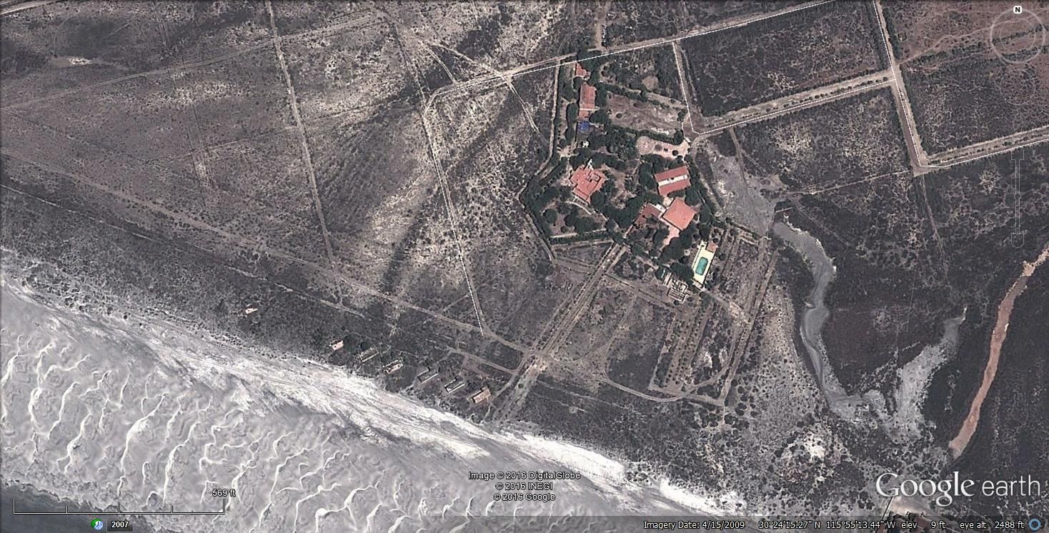
TMW - 7-6-2016 at 09:32 AM
Near Cielito Lindo.
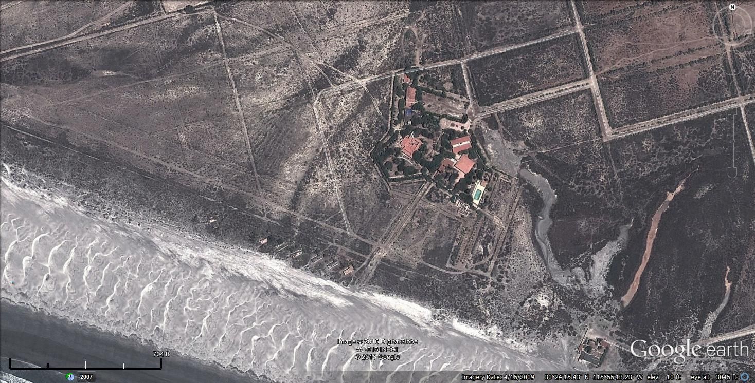
A little closer
[Edited on 7-6-2016 by TMW]
fishbuck - 7-6-2016 at 11:14 AM
Yes, TMW got the spot right. If one looks very closely and just a tad of imagination you can see the trace of the old Playa de Oro runway paralleling
the beach.
What happened? And who did it?And why is it in ruins?
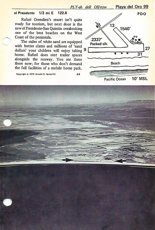
1969 & 1974 editions of Airports of Baja California
David K - 7-6-2016 at 01:00 PM
Here's Cielito Lindo and Playa de Oro airport pages... as you can see, Playa de Oro runway is between Cielito Lindo runway and the beach...

[Edited on 7-6-2016 by David K]
fishbuck - 7-6-2016 at 07:17 PM
So yes. If you look very closely you can see the El Presedente is on the very corner of Orendain land. Rafael the dad gave them that land. My guess
was to encourage developemnt of the area. He was San Quintin valley's original developer. As far as I know he was never a farmer.
The orignal land grant went to his father. Another long story.
The Playa De Oro runway predates the Rancho La Manana/Cielito Lindo runway and became unneeded. My guess is that Rafael the dad built both.
But it's possible it was built before they were granted the land.
And there is no doubt that he kept the best pieces of land for himself and sold the rest as quickly as possible.
That is a very pretty beach and next time I'm in town I will make a special trip there for some nastalgic beach dreaming.
I can here an old Beechcraft cranking up now...
[Edited on 7-7-2016 by fishbuck]
fishbuck - 7-7-2016 at 05:23 PM
I am guessing that Orendain's Playa de Oro campsite meet the same fate as the "Wet Buzzard" did.
The few times I bothered to drive all the way out there it was deserted except for the nice lady who ran the place.
Anyone know the current status off the former Wet Buzzard?
I read somewhere that the Orendain family got the land grant in 1947. It is possible that they had been in the valley long before that and lobbied to
get the grant.
I know that the runway either Playa or Manana/Lindo where used by Rafael the dad and maybe his father also to fly directly to Mexico City to take care
of all the land related business.
Do any Nomads have any info about this location prior to the Orendains or 1947?


