I'm getting to take off from Colorado and drive down to ligui on oct 30 . Two new to baja friends are taking the run down with me . We are going to
take hwy 5 to hwy 1 to ligui . It's been 18 years since I've driven that route . Looking forward to getting away from the states and getting in some
well needed scuba diving.
Last trip down was for two days and came and went by air . Not fun at all ( for paperwork ).
Wish me luck ! I'll be there for three weeks so drop on by for cold one or two .
shari - 10-16-2016 at 07:09 AM
Yeah...great news you will be returning to your namesake! Have a safe, fun journey.weebray - 10-16-2016 at 07:14 AM
FYI. In Espanol the word for namesake is tocayo.fish101 - 10-16-2016 at 07:42 AM
Hi Ligui, you might know Andreas and Jutta from Germany that camp on the beach quite often in Ligui.. They are in Loreto waiting for it to cool off a
bit before going, but Andreas does a lot of fishing while there. I will have to ask him today if he knows you. Look them up when you get back home.. StuckSucks - 10-16-2016 at 02:23 PM
One of my favorite places in BCS - how long before we see a Nopolo-like American compound here?
David K - 10-16-2016 at 02:27 PM
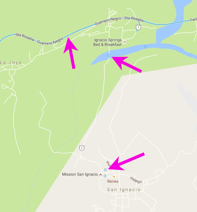
The name of where California's third Spanish mission was founded, November 1705... San Juan Bautista de Ligüí.yumawill - 10-19-2016 at 12:51 PM
OK I give. i've looked. where is this place please.Sandlefoot - 10-19-2016 at 01:23 PM
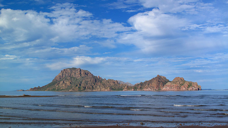
20/25 miles South of Loreto, Beautiful place!!!
Happy Trails
[Edited on 10-19-2016 by Sandlefoot]David K - 10-19-2016 at 01:38 PM
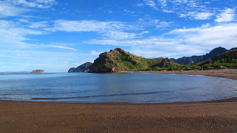
It's the village next to highway, there's a school too. Typical road sign giving the name... and maybe a playa publica sign too? The beach is a mile
away and the mission monument is halfway in. This is just north of the bottom of the mountain grade.mojo_norte - 10-19-2016 at 05:52 PM
nice beach camping ? busy ?David K - 10-20-2016 at 09:28 AM
On your first viewing, there is a short tutorial - these things are easy to shoot. Hint: keep your phone absolutely vertical, plumb, for the best
results. You will shoot in ALL directions, then the app will stitch everything together - even making lighting corrections.
The only way to share the photo spheres is to embed them on Google Maps - you will have to have a Google account to do that.
To see where Photos spheres are located, grab Pegman from Google Maps and drag him onto the blue lines of highways, or the blue dots of photo spheres. Look around, zoom in and out.
If you would like some to oogle at, here's some of mine in random form - hit RELOAD to see another random photo sphere (they take a few seconds to load, depending on your internets
connection).