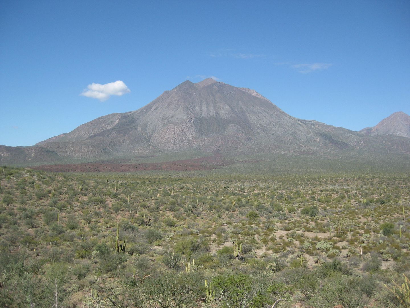
I'm heading back to Baja (trip #4) in another week and change only this trip will be a tad different than the last few. This time my very active 72
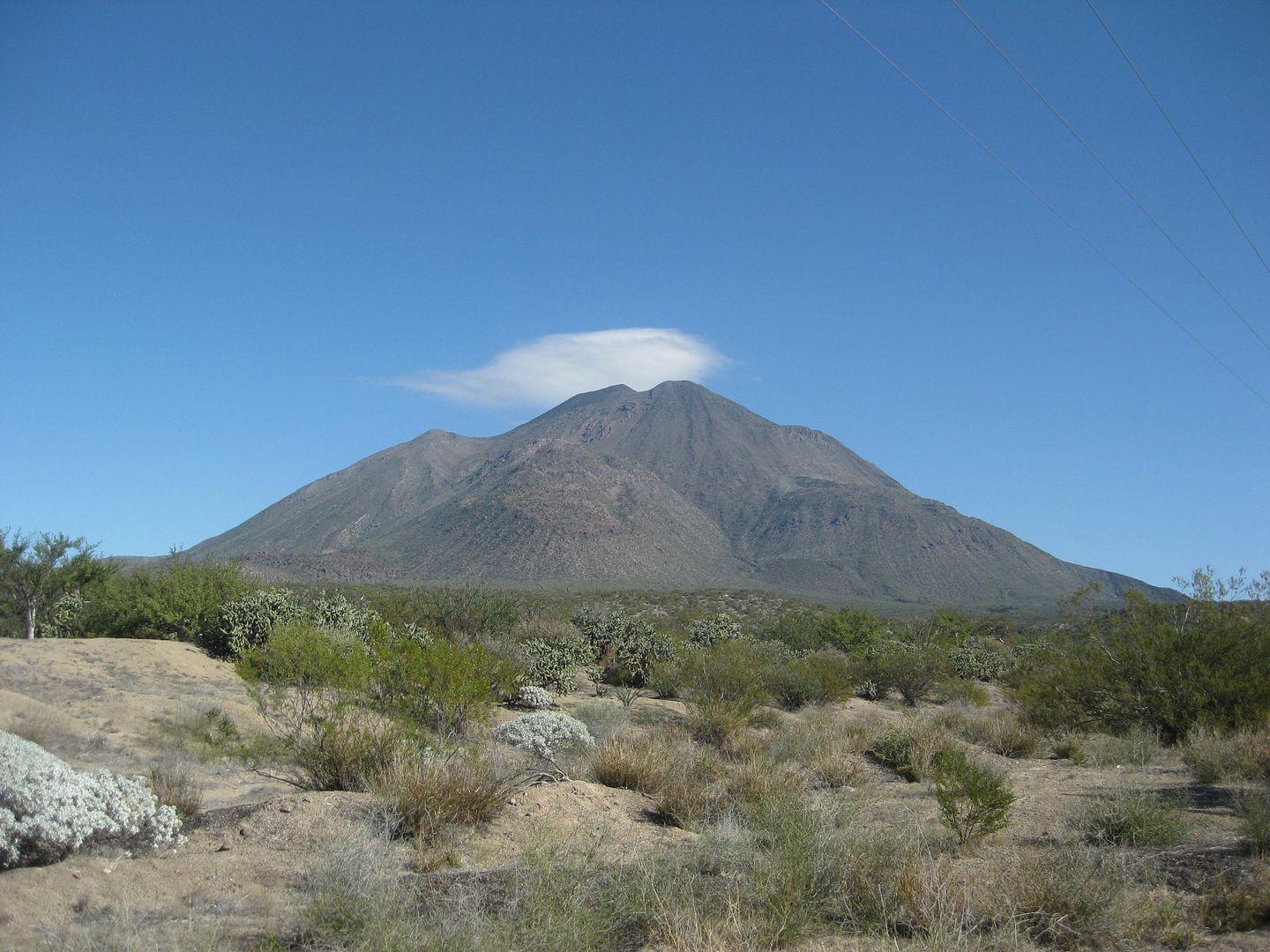
year old mother is coming along. We've got a road trip planned out but there is one area we're both very interested in and that's Tres Virgenes.
I've done some snooping around Baja Nomads and online and can't really find a definitive answer to my question and that is, is it possible to camp at
the base of the volcano? Are there facilities like an outhouse available for moms and lastly, how is the hike up the volcano or even part of the way?
Any info would be muchly appreciated and I promise plenty of photos and/or video when I get back. Cheers!!
ScottPaulW - 3-16-2017 at 02:21 PM
Camping places are few if any. When you get down the road you will find the industrial water infrastructure.
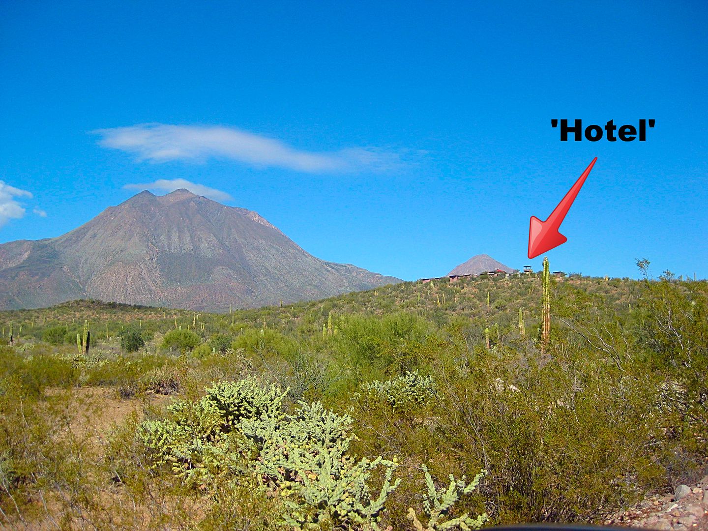
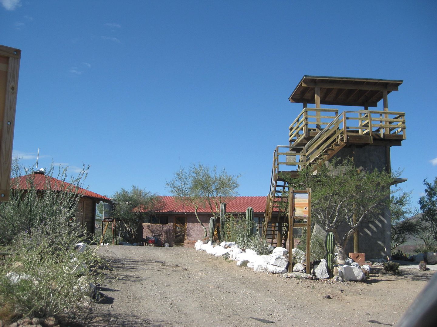
The Eco Lodge would be a great place to stay.
coords: 31 24.274, -112 31.603
Search and find David's report.Wanderglobe - 3-16-2017 at 02:30 PM
Thanks for the info. I've contacted the eco lodge. Looks very nice. StuckSucks - 3-16-2017 at 02:31 PM
Camping places are few if any. When you get down the road you will find the industrial water infrastructure.
The Eco Lodge would be a great place to stay.
coords: 31 24.274, -112 31.603
Search and find David's report.
The most recently active volcano on the peninsula is passed between San Ignacio and Santa Rosalia, Tres Virgenes is the complex of three volcanoes...
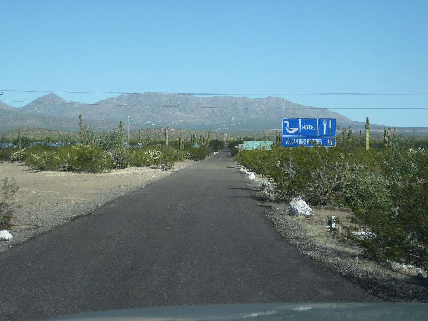
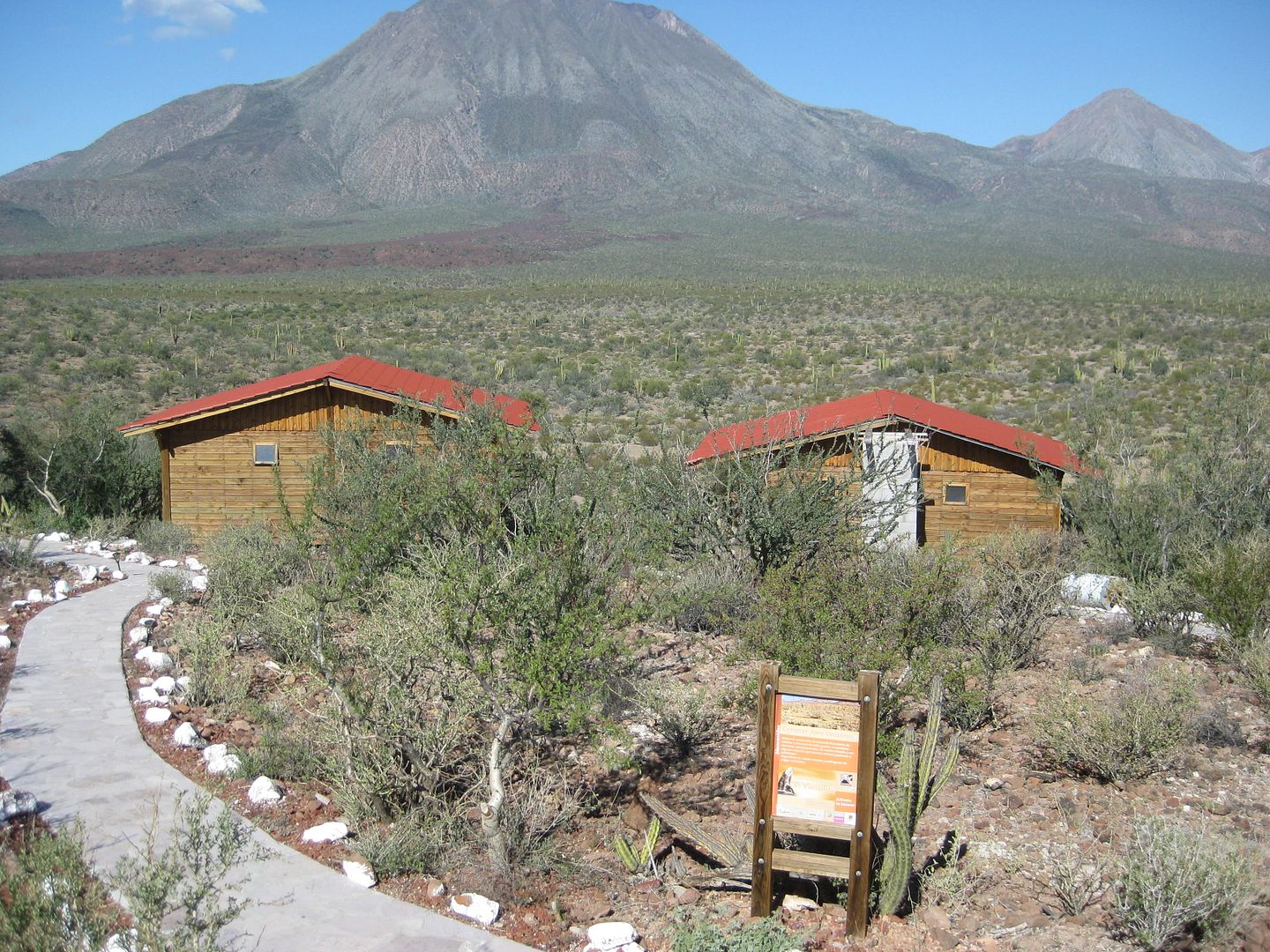
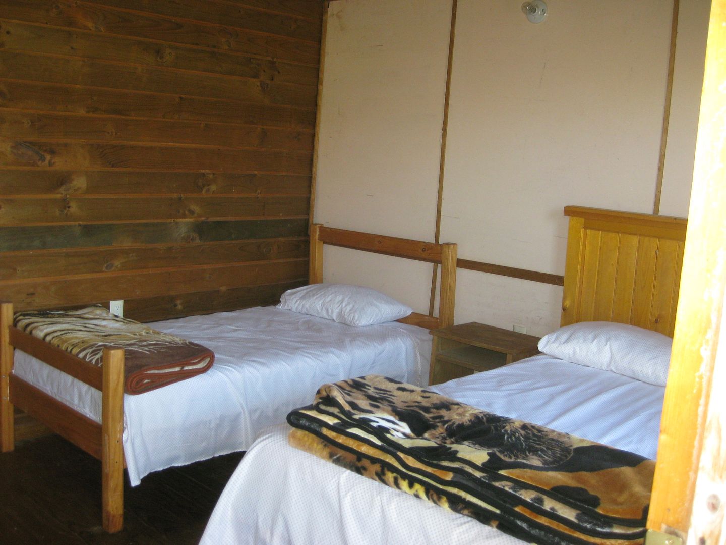
Km. 31.5 Paved road north to an eco-lodge, Volcán Trés Vírgenes (1.8 mi. in). 5 ؙcabins have 10 rooms with shower and toilet, 350 pesos. Food
served in the lodge. The paved road beyond the resort (gated) goes to a geothermal electric plant.
Francisco (likes to be called 'Borrego') manages the lodge and he showed me around... I will be back!
chuckie - 3-16-2017 at 03:12 PM
Neat Place do it! I have enjoyed it...BajaBlanca - 3-16-2017 at 03:18 PM
so green
so beautiful
we have never stayed there but have visited.Frigatebird - 3-16-2017 at 03:26 PM
I hiked it with a required guide (Alfonso? Arce) from the eco lodge about 12 years ago in the spring. We drove a mile or so up the alluvial arroyos
from the lodge to reach the trailhead/base of the volcano. To make the summit in a day, you'll need your hiking legs. IIRC the summit is just over
6000', but can't remember the net gain. Water was available from stashes along the trail if needed. Lots of loose rock, pumice, old lava flows,
boojums. Interesting palm-like mini trees and wind! near the top, and great views. No borrego sitings unfortunately. A good time & workout.
Looking forward to your report.
bajabuddha - 3-16-2017 at 04:22 PM
every trip down and back for years and every trip from Concepcion to Sta. Rosalia for propane or whatever, seeing that big beautiful volcano I have to
admit I wished it would smoke a little. Rumors abounded about a 17th century minor eruption... I wouldn't wish it on the populace, but oh what a
spectacle it would be. Have stopped a few times on the south flow that the highway cuts through and wandered in the magical basalt flows, huge
elephant trees growing everywhere, very fertile patches of soil, but hard-going. Never attempted a hike up the mountain, that basalt is formidable.
Please post a trip report when you get back, or while still there for that matter. It's magic-land at its' finest.Wanderglobe - 3-16-2017 at 06:03 PM
Thanks for all the info and the pics Dave. I just showed them to mom and she's stoked. Barring any issues I should be able to get some nice drone
footage there and will post a travel update on the area. Looking forward to it. I don't think we'll shoot for the summit but a nice hike in the area
would be worth it. David K - 3-16-2017 at 06:10 PM
Awesome!!!fishbuck - 3-17-2017 at 12:30 AM
Looking forward to a report. Looks very beautiful. Always love seeing them when driving past.Udo - 3-17-2017 at 09:40 AM
WOW!...
Thanks for the great photos, David.
I always wondered what the place looks like.ehall - 3-17-2017 at 09:51 AM
wow, that place looks cool. Adding it to my list of places to see.David K - 3-17-2017 at 11:14 AM
They were in my trip report, but I do put a lot of photos in them and they could get missed.
There is just so much Baja... and so little time!ehall - 3-17-2017 at 11:43 AM
Would of seen them but photobucket doesn't work at work anymore.Alm - 3-17-2017 at 12:19 PM
When I stayed a few days in San Ignacio due to technical emergency, it was raining every 2-3 hours in February. The elevation isn't that high, must
be something to do with terrain. Sudden changes from rain to shine. Top soil is clay/mud, very slippery when wet, I'm not 72 yet but fell once - my
fault, shouldn't have panicked and run for cover.
[Edited on 3-17-2017 by Alm]David K - 3-17-2017 at 01:23 PM
Would of seen them but photobucket doesn't work at work anymore.
So, no photos (from all who use Photobucket, Picasa, or other hosting sites) on the Nomad pages when you look on your workplace computer?ehall - 3-17-2017 at 03:21 PM
Would of seen them but photobucket doesn't work at work anymore.
So, no photos (from all who use Photobucket, Picasa, or other hosting sites) on the Nomad pages when you look on your workplace computer?
Photobucket for sure. Haven't tried the others. The IT dept. must be bored. I look at the pics on my phone but it isn't the same.philodog - 3-17-2017 at 09:17 PM
Another guide led hike is down the canyon past the geothermal plant. Petroglyphs, pictographs, hot spring (no pool). Easier than straight up the
volcano. Ask at the lodge about it.
elfbrewery - 3-17-2017 at 09:27 PM
I posted this back in 2011, but my (Shaw) webspace has disappeared, so I can only relay this.
--------------------------------------------------------------------------
Tres Virgenes Exploratory Trip Report
Eleven of us from Posada Concepción, south of Mulegé, drove up to Las Tres Vírgenes, a geothermal area just east of Highway 1 between Santa Rosalia
and San Ignacio. Our intention was to arrive sometime in the afternoon of December 28th, 2010 and stay one night at the hunting lodge, some sleeping
in the cabañas, others in their campers. On the second day we would hope to see bighorn sheep, walk, see volcanic stuff and whatever was available.
My husband and I arrived around noon. Oscar, the first man to greet us, was in a little of a panic because the staff had no idea when we were to
arrive that day, they had been anticipating us all morning. My fault. Alfredo, the absent main guide, had asked me via email when we would come, but I
thought he meant dates, not time. It makes sense now.
The first thing Oscar did, though, was offer us coffee and lunch. Our group had agreed to come self-sufficient, so we didn't take him up on lunch, but
enjoyed the good coffee. While we were discussing our communication problems, another of our group drove straight up the main road, so Oscar gave me a
Gatorade and said, "get in" (into his truck) and we drove after him. Not a problem, it's just that the staff are really concerned about our safety.
"We are responsible," Oscar kept saying. By the time we caught up with our renegade, another truck (the patrolling white pickup from the geothermal
plant) had already started pursuing him to the gate (about 8 miles in from the Highway 1). We had him cornered and he laughingly confessed. What we
were to learn was that the staff have permission to take us anywhere in the ejido, but they are responsible for us, so all we have to do is ASK. By
the way, we were told that the electricity from the plant powers the area from San Ignacio to Santa Rosalia (maybe even Mulegé?). There are 100
employees that work for the geothermal plant. Some work in offices in Santa Rosalia, but most work either first or second shift. The pipelines running
along the road carry steam from the plant that condenses and flows into catchments. The water from these catchments are recycled into the plant.
The Ejido Alfredo V. Bonfil is defined by land boundaries and by membership. The land is vast: from San Francisquito to San Ignacio (including Santa
Marta and Sierra San Francisco), past Mulegé to Playa El Coyote. The area is 519,000 hectares, the membership is 142. These members work for the
benefit of the land and its population. Someone may be able to explain the ejido structure in more detail.
The rest of our band came in over the next couple hours. Meanwhile, we were helped with our gear to move into our cabañas, make our beds, you name
it. Oscar made a point of learning everyone's name and introducing us to José, a ranger I believe, Élias, the treasurer, and Juan, who has been here
for 15 years. Once everyone was settled in, whether inside or in their campers, we took a 2 hour stroll out to the lava flow (3 miles return). It was
a chance to stretch our legs and view the vegetation and animal tracks: cattle, deer, mule, fox, rabbits. A nice view of "El Barco" (Ship Rock) was
afforded to us. The trees were typical to the area, but only the copalquín grew on the old lava flow. Plenty of cholla to dance around as well.
Back at the lodge with the huge kitchen, it was after 5pm and our group took over heating up all the prepared pots of soups, beans, rice and more. We
were spending so much time looking over the "trophies" and reading about them, while slurping away, that we missed the best part of sunset. Oscar,
whose main job was to translate, had Jose tell us about tomorrow's activities. We discussed the possibilities and decided to leave at 8am after coffee
(at 7am) and breakfast, then try to find the bighorn sheep, walk the canyon, view the fumaroles and see more of the area around the geothermal plant.
By 8pm all were heading to their sleeping stations. Oh, and we were supplied electricity for lighting our rooms from 6pm till 10pm and then again in
the morning while we got our acts together.
In the morning, Alfredo, our contact, and others appeared. Alfredo, Oscar and José would be our guides for the day, but others came along to help
spot animals. Then 10 of the 11 (one had a bad tummy) jumped into vehicles, some in their own, others in the ejido's and departed on schedule. We were
escorted past the gate to around Km 15 of the main road and climbed up to the viewing platform to look for sheep. The high-power binoculars were
required to spot the animals almost a kilometer away on the other side of the canyon. Some of us got to see one bighorn and some got to see a deer.
When the patience dwindled, we drove a little farther to the trailhead and descended into the canyon. Now, most of our group have not done much canyon
walking this season, so this was not another walk on the beach. Our guides informed us that before the 1959 floods, there used to be a road through
the canyon to a rancho. (I got the impression the rancho may still be there, but we never saw it.) A little later we were told that before Hurricane
Jimena brought down the rocks all along the canyon walls, the walk along the wash was very pleasant. Our trek required stepping up and over many
landslides, but there were nice sections of wash and tufa to soften our footsteps. Some of our party started to get too stressed, one finally quit
only minutes from our destination (after some ibuprofen and rest, she was fine). The rest of us endured to reach the thermal springs and rock art.
Compared with the beautiful canyon, this was an anticlimax, but still interesting. LUNCH. The return was quicker, taking only 1.5 hours instead of
2.5. The length of the walk was 5 miles in and out. There were places to stop to examine geology, like the seashells imbedded in the floor and ceiling
of a cave. The story goes that when the Baja Peninsula separated from the Mainland, there was an upthrust of the Peninsula and the seafloor can now be
seen in this canyon among other places. I must make a disclaimer that I am giving my impressions of what was said, not what is the truth.
Back at the vehicles we carried on to the end of the road (Km 17+), where there was some more geothermal machinery, we clambered over rocks to view
fumaroles or steam vents. There is a small viewing platform here and the only place we smelled sulfur.
We stopped on the way back to camp to try again to view sheep. One did appear, but only showed its wide, white back end, no profile; however, its
horns were enormous, if that's what I saw.
We're pooped. Time to pay up and drive home. We thanked everyone smilingly because it was a successful trip.
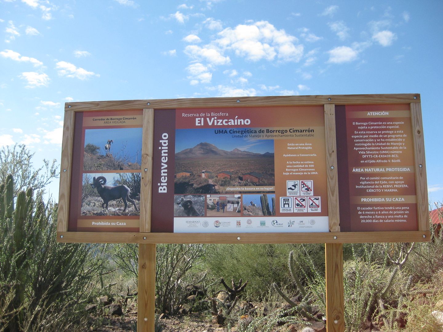
Now for more details and a little perspective. The lodge area was initially built up to care for the licensed hunters. There are 6 or 7 permits
granted each year. In 1994, 90 sheep were counted. Now 450 exist. Only the rams are shot, which are normally 8-10 years old, mainly because of the
size of the trophy. (See this website http://www.wildsheep.org/auctions/biosphere/pdf/biosphere-sk... for details of a recent hunt). Each hunter comes to hunt for 10 days, sometime
between the end of November and late March. He is guided all over to view his perspective target and when he chooses his sheep he shoots it (at around
300 yards). Saying that, one can begin to understand the attention the guides and staff give to their clients and wildlife. However, there is a shift
to more tourism, but it's in its infancy.
-- Getting to the lodge, for lack of a better word, was simple and required no special vehicle. Just drive to the turnoff from Highway 1 near Km 32
(20 miles north of Santa Rosalia) and turn east. Soon you will see a hill to your left with structures. Turn left at the sign and drive up the dirt
road. There is always someone there, I'm told.
-- It is best to bring all your food, drink, bedding. However, the kitchen in the lodge is very well equipped and the staff are happy to rustle up
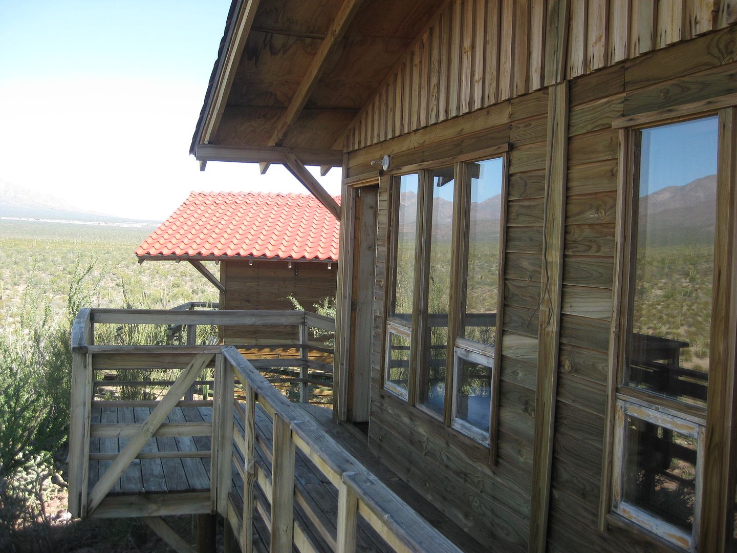
some grub and coffee for you. They eat here, too. Each cabaña has a bed platform, toilet, nice mural and hot shower. There are 5 buildings with 2
rooms in each building. The decks make great viewing areas with table and 2 chairs each. One of the cabañas is intended to house the hunting party,
the other 4 for tourists and staff. Two of those buildings have mattresses enough for 3 doubles and 1 single. As I mentioned, electricity is available
during the dark hours as needed. One of our couples used an inflatable to sleep on the bed platform in the hunters' cabaña and another couple slept
in the cook's cabaña. This is all interchangeable as required, but more mattresses need to be purchased by the ejido.
-- Many of our group wanted to bring dogs. Well, dogs are okay at the "lodge," and they will be watched, however, they are not allowed on the walks or
in the buildings. It's best not to bring them if you are thinking about taking them on hikes; it's not going to happen.
-- There is more to be seen here and the program is very flexible, especially if there is not a hunting party. One of the other options is to walk the
La Vírgen volcano. This is a minimum 2 day trip, ideally 3 or more days. Day 1 would be to drive to the trailhead, walk up a ridge to base camp. Day
2 would include the ascent and then back to the vehicles. Everything included, this would cost 1000 pesos (for 2 days), if they add mules, there would
be an extra charge. I can definitely see a lot of potential for other more casual trips in this area because of the quiet, beauty, accommodation and
great staff.
-- We paid 500 pesos for each room (no matter how many occupants). When asked what the charge was for the second day tour was we were quoted $50 US
per person. We agreed on a price of 350 pesos per person, since we were under the impression that this was what to expect; the first day's walk was
gratis. No problem. Camping was paid by tip/donation. As I said, the tourism is still in its infancy.
-- As to touring the geothermal plant, I suppose that can be arranged, but it's not really part of the flora and fauna.
-- Contact Alfredo Aviña Barajas, cell: 615 106-8998, email: alfredoborrego36@hotmail.com for reservations. The phone at the lodge is 615-15-54241,
and the cell phone for Oscar Castaneda is 615-10-68999. As mentioned above, there are staff here, but they need to know who to expect and when; it is
best to avoid conflicts. Many of the staff we met understand English and speak at least a little.
While on your walks, remember: keep together, keep your voices low. Enjoy your time there.
For more information about the volcanoes, see also this link from the Smithsonian http://www.volcano.si.edu/world/volcano.cfm?vnum=1401-01=&am...
--------------------------------------------------------------------------
The photos are of the kitchen, the paintings that were in the rooms, the borrego spotters and the rock art in the river bed.