BajaNomad

Tell me about the route you would take to ride bikes from the border to Cabo

JZ - 4-15-2017 at 05:03 PM

Want to go mostly in the dirt and have a chase truck following most of it, or at least semi close.

I'd prefer to start on the East side and go down through Coco's.

Time frame would be late November. Would go with my 13yo and 15yo. Both are intermediate to advanced riders.

What are the major way points?

[Edited on 4-16-2017 by JZ]

David K - 4-15-2017 at 05:19 PM

First Leg:
Closest to Mexicali would be down Laguna Salada, Cohabuzo Jcn., near Tres Pozos to the dunes or further to La Ventana or stay on Score road to El Chinero. Then a bunch of highway down to Coco's Corner and on to Hwy. 1. Or at San Felipe go west to Valle Chico then to Matomi and out to the 5 (chase can stay on 5 and wait for you at Matomi wash crossing).

Or
La Rumorosa south past Laguna Hanson to Valle de Trinidad to near San Vicente and south. The 7 Sisters coast road can avoid 200 paved miles.

That's a couple ideas for Baja norte half. Is this what kind of routes you are seeking?

TedZark - 4-15-2017 at 06:48 PM

Quote: Originally posted by David K  
The 7 Sisters coast road can avoid 200 paved miles.


I am curious about that road. Can you tell me where to find it? Follow it from where to where?

Thank you!

David K - 4-15-2017 at 08:30 PM

Santa Catarina road (jcn. with Hwy. 1 near Guayaquil) to the Santa Rosalillita paved road. There are 4 other roads between Hwy. 1 and the coastal road between those two.

LukeJobbins - 4-15-2017 at 10:30 PM

You can go south to the wall past santa rosalillita. Takes a bit more out of pavement travel.

Its not the east side, but i regularly take the coast dirt road from santo tomas all the way to san quintin. Then a few miles on pavement to the road to 7 sisters all the way to the wall and most of the pavement is avoided on decent dirt roads with lots of fun sections half way down baja.

You can check out old baja 1000 or norra mex rally maps for trails and dirt roads also.


ehall - 4-16-2017 at 04:38 AM

https://sites.google.com/site/gpskevin/gpskevin-ride-calenda... A friend of mine went on this last year. Gps kevin was nice enough to leave maps and gps tracks for all to use.

TedZark - 4-16-2017 at 10:02 AM

Thank you David, Luke and ehall. A new adventure awaits!

TMW - 4-16-2017 at 11:07 AM

What size bikes and how big is the gas tanks. I would assume they are 4 strokes.

TMW - 4-16-2017 at 11:14 AM

Since you are asking what routes to take I assume you are not that familiar with Baja dirt roads. If that is correct you will need to study maps such as the Baja almanac and plot your course, especially gas stops. There are gps tracks available or you can go to Google Earth and trace your route and save it to your PC and convert it to a gps route with GPS Visualizer. http://www.gpsvisualizer.com/

There are some pretty simple routes to take that would be hard to get lost on. Like the 7 sisters DK mentioned, LA Bay to El Arco or Vizcaino, San Ignacio to San Juanico and La Purisima to the San Javier Mission.

[Edited on 4-16-2017 by TMW]

chippy - 4-16-2017 at 01:19 PM

From Constitucion south you can either take the east route via Evaristo to La Paz or the west along the coast to Todos Santos.

JZ - 4-16-2017 at 01:27 PM

Quote: Originally posted by TMW  
Since you are asking what routes to take I assume you are not that familiar with Baja dirt roads. If that is correct you will need to study maps such as the Baja almanac and plot your course, especially gas stops. There are gps tracks available or you can go to Google Earth and trace your route and save it to your PC and convert it to a gps route with GPS Visualizer. http://www.gpsvisualizer.com/

There are some pretty simple routes to take that would be hard to get lost on. Like the 7 sisters DK mentioned, LA Bay to El Arco or Vizcaino, San Ignacio to San Juanico and La Purisima to the San Javier Mission.

[Edited on 4-16-2017 by TMW]


We rode from Gonazaga to Bahia de Los Angles and then on to San Fransquito and back out to Hwy 1 last year. With a couple side trips. Put the bikes on the truck and drove down to San Rosilia and over the ferry to San Carlos and rode up the coast of Sonora a bit.

I use MotionX for the maps and GPS. Set and download the way-points from Google Earth into MotionX. It's the best setup I've seen.

But that said, yeah I'm not super familiar with that many roads. Know Baja better by boat. But, I've been reading about the Seven Sisters today and that's what we are gonna do I think.

Any more advice is appreciated.

JZ - 4-16-2017 at 01:33 PM

Quote: Originally posted by ehall  
https://sites.google.com/site/gpskevin/gpskevin-ride-calenda... A friend of mine went on this last year. Gps kevin was nice enough to leave maps and gps tracks for all to use.


Exactly what I was looking for.


David K - 4-16-2017 at 01:35 PM

My road log down the remote coast (7 Sisters) from 2007, and it did go past Sta. Rosalillita and the wall (Pta. Rosarito), is at www.vivabaja.com/707 . Look for a fresh road log soon, as 10 years was a while ago!

[Edited on 4-16-2017 by David K]

JZ - 4-16-2017 at 01:40 PM

Quote: Originally posted by chippy  
From Constitucion south you can either take the east route via Evaristo to La Paz or the west along the coast to Todos Santos.


I've been to Evaristo twice via boat and once driving from there to La Paz. Fun road.

Would you say that's better or the West coast? Never done it.

chippy - 4-16-2017 at 02:03 PM

I did the west route in March 2017. It was fun alot empty beaches and what looked to me(not a moto guy) as fun dirt bike riding? I like both!

Sweetwater - 4-16-2017 at 05:24 PM

Quote: Originally posted by JZ  
Quote: Originally posted by ehall  
https://sites.google.com/site/gpskevin/gpskevin-ride-calenda... A friend of mine went on this last year. Gps kevin was nice enough to leave maps and gps tracks for all to use.


Exactly what I was looking for.


Wow, I've been on some of that route but none of the northwestern pieces. A sag wagon would be a stupendous asset. My only concern is how much time that map spends on the rocky ridge that splits Baja. Those are time, energy and mechanical consuming sections to ride.

JZ - 4-16-2017 at 05:35 PM

Thinking about riding El Rosario to Santa Rosaliíta at the end of May to check it out. Drive down to El Rosario, unload and ride where the dirt starts. Have the truck follow.

How rough is the 7 sisters road down to Santa Rosaliíta. What's the best spot(s) to stop and camp? Probably can only ride two days (maybe 3), so wondering if Santa Rosalitia is too far or cut back over to Hwy 1 sooner?


David K - 4-16-2017 at 05:40 PM

In the link I gave, our 2 day drive is detailed. We camped by Punta Lobos.

JZ - 4-16-2017 at 05:56 PM

Quote: Originally posted by David K  
In the link I gave, our 2 day drive is detailed. We camped by Punta Lobos.


Yeah, I read it. How slow was the going?

mcnut - 4-16-2017 at 06:07 PM

Quote: Originally posted by ehall  
https://sites.google.com/site/gpskevin/gpskevin-ride-calenda... A friend of mine went on this last year. Gps kevin was nice enough to leave maps and gps tracks for all to use.


Firstly, the one and only gpskevin route in Baja (02.3 Shortcut) I have tried (3/12/17) was DOA after pulling up to a manned/guarded gate and obvious no trespassing signs after just 1 1/2 miles, YMMV.

Also in an interesting 180 deg about face, Kevin is now charging for the GPS info. You would need to know the backstory from the ADVRider forum to understand just how hypocritical this change is.

Bruce

ehall - 4-17-2017 at 07:50 AM

Didn't know that Bruce. I don't know kevin. I do know a lot of the trails are open and the sleeping bag trail is one of the best single tracks I have ever ridden.

TMW - 4-17-2017 at 10:09 AM

Many if not most of the roads down Baja are used in various races and many of them have a GPS track that you can get from Murdock Nav.

http://www.murdocknav.com/mapsmex1.php

TMW - 4-17-2017 at 10:13 AM

Quote: Originally posted by ehall  
Didn't know that Bruce. I don't know kevin. I do know a lot of the trails are open and the sleeping bag trail is one of the best single tracks I have ever ridden.


What/where is the sleeping bag trail?

bajatrailrider - 4-17-2017 at 10:17 AM

Ed showed me sleeping bag trail From Vicente Guerrero to San Quintin. Its Moto only med hard going South.Going north hand full.

TMW - 4-17-2017 at 10:18 AM

If you are really adventurist do the No Wimp Trail, El Barril to San Ignacio. Picking your way thru the La Trinidad arroyo to El Gato is very interesting. Bring gas and water.

TMW - 4-17-2017 at 10:22 AM

Quote: Originally posted by bajatrailrider  
Ed showed me sleeping bag trail From Vicente Guerrero to San Quintin. Its Moto only med hard going South.Going north hand full.


So it doesn't follow any of the Baja 1000 tracks.

David K - 4-17-2017 at 11:50 AM

Quote: Originally posted by JZ  
Quote: Originally posted by David K  
In the link I gave, our 2 day drive is detailed. We camped by Punta Lobos.


Yeah, I read it. How slow was the going?

Day 1 was from El Rosario to just beyond Canoas. Including stops at Santa Catarina Landing and not early start that day.
Day 2 went from that camp to Punta Lobos beach camp. Slow day, rough south of San Jose.
Day 3 was from Lobos to Hwy. 1 south of Pta. Rosarito that included a visit to Santa Rosalillita and the harbor. That same day we went on to Shari's at Asuncion.

That is why I said it was a 2 day drive just for the remote coast section and not 3. Obviously, fast riding on m/c could do it in 1 day.

ehall - 4-17-2017 at 11:51 AM

No Tom. It is just a single track gpskevin included in his ride for the dirt bikes on the trip. I have heard it was made by Jimmy sones and friends quite a while ago.

TMW - 4-17-2017 at 02:28 PM

If you are doing the 7 sisters route stop over night at Bahia Blanco. Before dark and at sunrise is a great time for surf fishing.

joerover - 4-17-2017 at 07:55 PM

The map google in the middle of the page shows a route from Bahia De Los Angles south to MX 1. It does not go through El Arco, it joins the highway east of San Ignacio. Has anyone been this way? My Nationañ Geographic map does not show roads there.


Quote: Originally posted by ehall  
https://sites.google.com/site/gpskevin/gpskevin-ride-calenda... A friend of mine went on this last year. Gps kevin was nice enough to leave maps and gps tracks for all to use.

TMW - 4-17-2017 at 09:17 PM

That is what's called the No Wimp Trail from El Barril to San Ignacio. Just did it a week ago.

TMW - 4-17-2017 at 09:27 PM

Since the ops kids are 13 and 15 I assume his time frame is Thanksgiving with the kids out of school. Thanksgiving is the week after the Baja 1000 race. This year the Baja 1000 will celebrate it's 50th anniversary with a run to La Paz. All he has to do is follow the SCORE markers and all will be good. Course will be posted at the Off Road Expo in Pomona in Oct.

geoffff - 4-17-2017 at 10:52 PM

The Google map gpsKevin has on his web page can be "shared" with your own maps in your own Google account, and then the tracks and waypoints can be downloaded to your computer. Here they are in both Google Earth and GPX formats:

Baja-California-Discovery-Route--gpsKevin.kmz
Baja-California-Discovery-Route--gpsKevin.gpx

-- Geoff

JZ - 4-17-2017 at 11:44 PM

Quote: Originally posted by TMW  
If you are doing the 7 sisters route stop over night at Bahia Blanco. Before dark and at sunrise is a great time for surf fishing.


On our May trip I don't know if we can go much South of Blanco. From what I've seen it looks like a really pretty bay? Is it nice?

From there what would be the easiest way back out to Hwy1?

TMW - 4-18-2017 at 11:41 AM

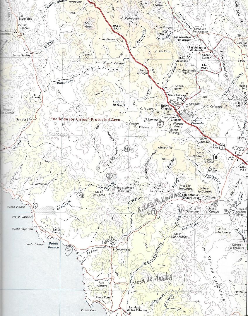
It is a really beautiful beach area. At the very north end is a small fish camp. I don't know how active it is. About midway is a sort of rock section and that is where I usually stay. From there you you can follow the road to a Y, go left and follow it to an abandoned ranch with an old windmill. Follow the road east. If memory serves me you take the left road at the three Ys you will come to. If you go too far there is a working ranch called Las Palomas. You want to go to the south or the right side as you get to it.

This sounds a little complicated but it's because there are several roads in the area and they probably all come together I don't know. Anyway once you start up the mountain out of the arroyo it is or was a good road to Hwy 1 at KM252. There is a jct and the right fork goes to Hwy 1 at KM 270. SCORE has used this leg for the Baja 1000 course. At the Jct you will see a white house to your left setting up the side of the mountain. There are a couple of abandoned ranches along the way.

In the section from the windmill to Rancho Las Palomas there are lots of silt beds, pick your line carefully.

If you want I can trace the route on Google Earth with way points or I can convert it to a GPX file for your GPS.

In the map below F is the fishing spot. The first Y is just after you turn inland not shown on map.

JZ - 4-18-2017 at 12:33 PM

Quote: Originally posted by TMW  

If you want I can trace the route on Google Earth with way points or I can convert it to a GPX file for your GPS.

In the map below F is the fishing spot. The first Y is just after you turn inland not shown on map.
[/URL]


Thanks man. Google Earth would be awesome. I can convert for GPS.

About how long did it take you? Easy enough for a 4x4?

I'd really like to make it down to Lobos, it might be a little too far for this trip. Looks like there are dunes down there.

joerover - 4-19-2017 at 03:11 PM

Quote: Originally posted by TMW  
That is what's called the No Wimp Trail from El Barril to San Ignacio. Just did it a week ago.


Got any videos from the no wimps trail? Any water out there?
Anything at all on the trail?

TMW - 4-19-2017 at 08:23 PM

I don't know of any videos. I did the trail in Dec. and a couple of weeks ago. Here is the report from Dec.

http://forums.bajanomad.com/viewthread.php?tid=85247

There are a couple of abandoned ranches along the way that may have water I don't know for sure. We always take plenty of water with us as well as gas. It's pretty much an abandoned area of Baja. The scenery is beautiful.

I'm told that the northern end around Rancho San Miguel and Rancho Santa Barbara is being fenced off with gates, Maybe locked, but who knows for sure. We were hoping to meet the man in charge at Rancho La ILusion on our last trip but no one was there.

joerover - 4-19-2017 at 08:43 PM

oh, so it is a bicycle route.
The Baja Divide Bicycle Route, goes from Biaha De Los Angles to San Ignacio through El Arco,¡.

Any idea if the no whips trail would be better or worse?

David K - 4-19-2017 at 09:34 PM

No, not really! It is a rocky, sandy, rough track along or near the coast from El Barril to Punta Trinidad then goes west in the arroyo and on to mission roads, including El Camino Real south by Santa Marta to Hwy. 1, east of San Ignacio.
This was a motorcycle route until some hardy Nomads got their 4x4s through, too.

TMW - 4-20-2017 at 11:09 AM

It's a long way to go on a bicycle. It's about 120 miles from El Barril to San Ignacio. The only active ranch is La ILusion near El Barril at the top and Santa Marta near the bottom but they are 85 miles apart. We did see bicycle tracks and a tent at the abandoned Rancho San Miguel in December but didn't see anyone. I think it would be a tough ride for a bicycle but doable with a chase vehicle. The SquareCircle and I would be available to run chase for anyone wanting to try it on a bicycle, get a group together and let's go.

joerover - 4-20-2017 at 10:17 PM

this quote seems to fit Baja best

"If it were lush and rich, one could understand the pull, but it is fierce and hostile and sullen. The stone mountains pile up to the sky and there is little fresh water. But we know we must go back if we live, and we don't know why." - Steinbeck, Log from the Sea of Cortez

Quote: Originally posted by David K  
No, not really! It is a rocky, sandy, rough track along or near the coast from El Barril to Punta Trinidad then goes west in the arroyo and on to mission roads, including El Camino Real south by Santa Marta to Hwy. 1, east of San Ignacio.
This was a motorcycle route until some hardy Nomads got their 4x4s through, too.


Is it worse than the route they use now?
https://ridewithgps.com/routes/17688817

If there was a known easy to find water source in the middle some where it would be doable.

[Edited on 4-21-2017 by joerover]

joerover - 4-20-2017 at 10:36 PM

I think cycling season starts again in November


Montevideo was a little warm in the middle of March. I had 18 liters of water on my bicycle. I drank them in 40 hours. On the way in it was hard work pushing a bicycle through some soft sand for a few miles. I decided to camp between two pointed hills, (so I could find my tent again,) and walk the last couple of miles.

Is this the dos soles art?


Quote: Originally posted by TMW  
It's a long way to go on a bicycle. It's about 120 miles from El Barril to San Ignacio. The only active ranch is La ILusion near El Barril at the top and Santa Marta near the bottom but they are 85 miles apart. We did see bicycle tracks and a tent at the abandoned Rancho San Miguel in December but didn't see anyone. I think it would be a tough ride for a bicycle but doable with a chase vehicle. The SquareCircle and I would be available to run chase for anyone wanting to try it on a bicycle, get a group together and let's go.


If I can remember that until November, thank you sir. That tent in your post looks more like it belongs to a Mexican than a Baja Divde rider. So, He is camped back there for a while? Must be water some where?

DENNIS - 4-21-2017 at 06:36 AM


My route......

Ride your bike to the airport, buy a first class seat, and enjoy the journey. SALUD

TMW - 4-21-2017 at 10:01 AM

Rancho San Miguil, 25 miles south of R La ILusion and Rancho La Trinidad, about 50 miles south of La ILusion and 35 miles north of R Santa Marta are both abandoned but may have a well or other source of water since they were active ranches at one time. El Gato, 15 miles SW Of R La Trinidad has a well but it is dry. They did put in a large black plastic water tank in the NW corner of the corral. We didn't check to see if it had water in it but since it was not there a couple of years ago I assume it is for the cattle.

I think it would be hard going on a regular mtn bike. I'd suggest one of the fat tire type bikes. I think the tires are about 4 inches in diameter. There was a guy on Nomad (Mike, I think) that road one in the hills northwest of LA Bay near Bahia Guadalupe a couple of years ago.

note to self

joerover - 4-21-2017 at 08:14 PM

I should check this out. (New route ).

Do not drink water out of plastic tanks, unless you are going to die or something. The plastic leaches into the water and ends up blocking neural pathways. Plastic is for cold food and drinks only, the softer the plastic the more this is true.

2.8 or 3 inch tires should be good. 4 or 5 inch tires are for snow. My 2.4 inch tires let me push in the deep sand. 18 liters is about 39 pounds. This extra weight make the bicycle hard to push in soft sand. Maybe a cool December ride would cut the water down to a weight I could carry.

A reliable water source out there would make this a better path, no?

Quote: Originally posted by TMW  
Rancho San Miguil, 25 miles south of R La ILusion and Rancho La Trinidad, about 50 miles south of La ILusion and 35 miles north of R Santa Marta are both abandoned but may have a well or other source of water since they were active ranches at one time. El Gato, 15 miles SW Of R La Trinidad has a well but it is dry. They did put in a large black plastic water tank in the NW corner of the corral. We didn't check to see if it had water in it but since it was not there a couple of years ago I assume it is for the cattle.

I think it would be hard going on a regular mtn bike. I'd suggest one of the fat tire type bikes. I think the tires are about 4 inches in diameter. There was a guy on Nomad (Mike, I think) that road one in the hills northwest of LA Bay near Bahia Guadalupe a couple of years ago.


[Edited on 4-22-2017 by joerover]

TMW - 4-22-2017 at 03:40 PM

If drinking water from a plastic container is bad why do so many people have the black plastic containers for water for their homes? I just assume it's plastic or is it another material?

TMW - 4-22-2017 at 04:07 PM

A guy named Mark did a trip with a fat tire bicycle this page shows the bike about half way down.

http://forums.bajanomad.com/viewthread.php?tid=70746&pag...

joerover - 4-22-2017 at 10:35 PM

Quote: Originally posted by TMW  
If drinking water from a plastic container is bad why do so many people have the black plastic containers for water for their homes? I just assume it's plastic or is it another material?


The black plastic containers are for showers, dish washing, etc. I noticed that they use stainless steel containers at the rural agua pura places.

Sun light causes the plastic to decompose on a molecular level.

Plastic water bottles are made for 1 time use, keep them out of the sun.
Quote: Originally posted by Mark_BC  


The softer the plastic the worse for your health.
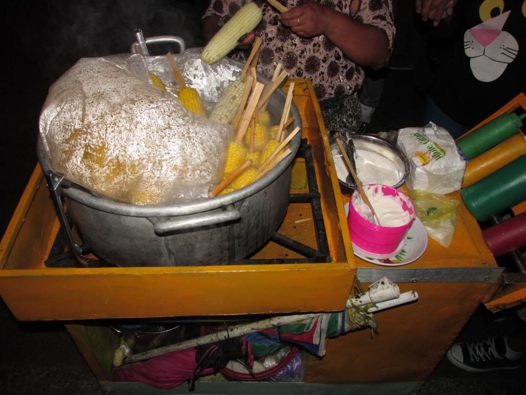
After eating plastic corn for 30 years, this womens husband has some serious brain problems. He thinks in slow motion, not smart.


The sales guy does not care about your health, oh, you knew that.

TMW - 4-23-2017 at 10:57 AM

Here are two companies that have plastic water tanks that you can drink the water from. They use a resin that reduces the effect of UV from the sun.

https://www.ntotank.com/2500gallon-norwesco-black-vertical-w...

http://www.plastic-mart.com/category/9/plastic-water-tanks

TedZark - 4-23-2017 at 11:45 AM

I see lots of Rotoplas plastic tanks for potable water in my area. There are not for sinks and toilets here as everyone in my area has a pila.

joerover - 4-23-2017 at 07:32 PM

Quote: Originally posted by TedZark  
I see lots of Rotoplas plastic tanks for potable water in my area. There are not for sinks and toilets here as everyone in my area has a pila.


Pila?

As I said, The sales guy cares about your money only, he dont care about your health.

There are stainless steel tanks and good filters at the community tiendas.
Tienda Diconsa., hard to believe the government made available safe drinking water for 1 peso per liter, not to mention price fixing to make food affordable.

Using a plastic tank for drinking water, and having safe drinking water are not the same thing.

A couple of links for steel water tanks
¨Stainless Steel Tanks are the perferred choice for commercial and residential applications. From the harshest industrial applications to the most secure storage of residential drinking water, Stainless Steel is unsupassed in safety and durability.¨
http://www.nationalstoragetank.com/tanks/stainless-steel.htm...
http://www.bssa.org.uk/topics.php?article=88

Oh stainless cost double the plastic tank
Plastic = $1 gallon about, 500 gallon tank = $500 more or less
Stainless = $2 a gallon or a little more. 500 gallon tank = over $1,000

[Edited on 4-24-2017 by joerover]

TedZark - 4-23-2017 at 08:11 PM

I wasn't contesting your issue with plastic containers. Only this statement:
The black plastic containers are for showers, dish washing, etc.

For reference, read Snopes, the well known urban legends website where they state: UNDETERMINED: Heating up some types of plastic bottles could increase the leaching of harmful phthalates into the fluids they contain. See: http://www.snopes.com/medical/toxins/plasticbottles.asp

Snopes also states: Nasty chemicals can be and sometimes are found in plastic items, and heat tends to allow them to break free. It therefore makes sense to eschew letting any plastic not clearly identified as “microwave safe” or “microwaveable” touch food you’re going to heat. If you cover a dish you intend to microwave with ordinary plastic wrap, do not let the covering touch the food, because some of the plasticizer in the wrap — which may contain toxic chemicals, as opposed to does contain toxic chemicals — could migrate to what you’re cooking, especially foods high in fat.
But that is in regards to heating food in a microwave. That's an extreme condition vs warmth of the sun.

Happy to see other references on the issue, pro or con. I've head this issue raised several times. Wouldn't mind knowing if there is any science behind it.


[Edited on 4-24-2017 by TedZark]

David K - 4-24-2017 at 09:48 AM

Quote: Originally posted by TMW  
It is a really beautiful beach area. At the very north end is a small fish camp. I don't know how active it is. About midway is a sort of rock section and that is where I usually stay. From there you you can follow the road to a Y, go left and follow it to an abandoned ranch with an old windmill. Follow the road east. If memory serves me you take the left road at the three Ys you will come to. If you go too far there is a working ranch called Las Palomas. You want to go to the south or the right side as you get to it.

This sounds a little complicated but it's because there are several roads in the area and they probably all come together I don't know. Anyway once you start up the mountain out of the arroyo it is or was a good road to Hwy 1 at KM252. There is a jct and the right fork goes to Hwy 1 at KM 270. SCORE has used this leg for the Baja 1000 course. At the Jct you will see a white house to your left setting up the side of the mountain. There are a couple of abandoned ranches along the way.

In the section from the windmill to Rancho Las Palomas there are lots of silt beds, pick your line carefully.

If you want I can trace the route on Google Earth with way points or I can convert it to a GPX file for your GPS.

In the map below F is the fishing spot. The first Y is just after you turn inland not shown on map.


Hi Tom, I drove down the road yesterday using the shortcut south of El Crucero to go west. The grade down the mountain was seriously eroded, boulder blocking part of it and a broken Ford Ranger near the bottom... I met the owner and his wife who run the only ranch down there, except they said it was Rancho 'Mystery' (in Spanish). They were out of food and heart meds. They had not seen another vehicle in 4 months. The ranch owner has not been seen to check on them in ages. Leo and Lorena are their names and last night, instead of camping at Bahia Blanco or ?, I took them to Santa Rosalillita and then to Punta Prieta, as the only people they knew were not home in S. R.
I have the mileages and stuff. There were two cattle control gates west of their ranch, which was down to the north of the San Antonio route. They blocked the west bound road with a sign pleading for food and help so anyone on that road from Hwy 1 would go to the ranch. Of interest, it had a pool and hot tub! All solar. But, no communications for help, just the Ranger, broken while trying to get out for supplies, 6 months ago!

Edit: The ranch was in the valley where Arroyo El Sauz meets the arroyo the road follows from San Antonio. Where you have Las Palomas is the lower part of that monster grade, where Leo's Ranger was broken down.


[Edited on 4-24-2017 by David K]

ehall - 4-24-2017 at 12:59 PM

Good work David. I bet they were happy to see you.

David K - 4-24-2017 at 01:11 PM

Oh my, yes!!! When we arrived at Santa Rosalillita, the people they knew were gone... So, I taxi'd them to Punta Prieta, where, at 11 pm, they found friends and I found gasoline, to get me to Baja Cactus! A flat tire and a couple re-repairs in the dark, moonless night really challenged my energy!
At 4 am, I had a wonderful, hot shower and the most comfortable bed and pillow in Baja!

TMW - 4-24-2017 at 01:45 PM

The map shown above is not correct. I mislabeled it. 7 is not where R. Las Palomas is but where the new road up the mountain was made several years ago. R. Las Palomas is about half way between 6 and 7. The new road is north of the old road but they both could be in bad shape from the rains. There was an abandoned ranch at the bottom of the mountain on the south side. Maybe that is where the people you found were living. R. Las Palomas would be further west on the north side.

David K - 4-24-2017 at 02:19 PM

Hi Tom, no, they were half way between the grade and the road junction (#6). In the valley where A. El Sauz comes in fron the north. At the bottom of the grade, I saw a water trough at an apparent anandoned ranch.
Their ranch was nice, had swimming pool and hot tub, windmill, antenna (but no radio), and must be what was Las Palomas, as there is nothing else in that area. Otherwise, Leo and Lorena would not be so desperate. The new name is Rancho Misteria (mystery). The owner has a taxi business and has not checked in on them in ages. When Leo's distributor failed, he abandoned his Ranger on the lower part of the huge grade heading up the mountain. They have been hoping for help to come by ever since, I gathered.


TMW - 4-24-2017 at 05:46 PM

OK, that sure sounds like R. Las Palomas from when I was there a few years ago. Wow good thing you came by and helped them. If they are going to live out there they need a way to communicate with someone.

blackwolfmt - 4-24-2017 at 06:24 PM

Jeez DK your back again so soon, why don't you buy a casita on the beach and i'll rent it from you

David K - 4-24-2017 at 06:31 PM

Quote: Originally posted by blackwolfmt  
Jeez DK your back again so soon, why don't you buy a casita on the beach and i'll rent it from you

Funny!
I am asked if I have a home in Baja, often! My answer is, if I did, then I would keep going to it as it would become a 'project' and my freedom to explore new places or revisit old ones would mostly end.

PS Let me start my trip report when I get home so this thread about plastic and aluminum can get back on track (lol).

blackwolfmt - 4-24-2017 at 06:44 PM

Peace amigo

joerover - 4-24-2017 at 07:22 PM

Quote: Originally posted by David K  

PS Let me start my trip report when I get home so this thread about plastic and aluminum can get back on track (lol).


Stainless steal

high grade stainless steal makes a good water container.

Titanium is the best, but who could pay that much.

https://www.youtube.com/watch?v=Cxo9pC9HuRs&index=5&...

Did you say 4 months without a car

Tell me about the route you would take to ride bikes from the border to Cabo

joerover - 4-24-2017 at 07:28 PM

I will tell you about the route I want to take my bicycle on after I figure out where my water is comming from.

The no whip trail sounds better than the sand road south out of El Arco.
If
I
say
IF
someone tells me the precise location of some drinkable water.

mtgoat666 - 4-24-2017 at 07:43 PM

Quote: Originally posted by joerover  
I will tell you about the route I want to take my bicycle on after I figure out where my water is comming from.

The no whip trail sounds better than the sand road south out of El Arco.
If
I
say
IF
someone tells me the precise location of some drinkable water.


The area is totally rideable by bike. But you need to first do a trip by truck to visit local ranches and identify water sources, then string together a route via identified reliable water sources. Most every ranch you find on google sat photos or old maps has or had water,... but some ranches have been abandoned, some water sources have run dry, some water sources are only seasonal, etc.

If you inquire with individual ranchers, you would probably find they would tell you about other local water sources.

I think you should ride across the sierra San Francisco, via the town at top of range,... ride up one valley, down another. Most of the deep canyons got springs. Plenty of stock trails in the valley floors. Officially, you need a guide, but if you befriend the locals, share your wacky plan, you'll find a way past the guide requirement.


TMW - 4-24-2017 at 07:44 PM

If you are going to ride a bicycle from the border to Cabo without a chase vehicle why not drive down and place containers with food and water at various locations like Mike Younghusband did when he walked it. Otherwise you need to stick with the paved hwy.

David K - 4-24-2017 at 07:46 PM

And... those containers need to be coyote proof!

mtgoat666 - 4-24-2017 at 07:47 PM

Quote: Originally posted by joerover  
Quote: Originally posted by David K  

PS Let me start my trip report when I get home so this thread about plastic and aluminum can get back on track (lol).


Stainless steal

high grade stainless steal makes a good water container.

Titanium is the best, but who could pay that much.

https://www.youtube.com/watch?v=Cxo9pC9HuRs&index=5&...

Did you say 4 months without a car


Glass and ceramic are pretty good for water storage.
Plastic storage is probably OK if you filter it with carbon.
If you can taste the plastic, you are certainly investing the unstudied chemicals that make up plastic. Even if you can't taste the plastic, you are being exposed - unless filtered.

joerover - 4-24-2017 at 08:26 PM

Quote: Originally posted by mtgoat666  

I think you should ride across the sierra San Francisco, via the town at top of range,... ride up one valley, down another. Most of the deep canyons got springs. Plenty of stock trails in the valley floors. Officially, you need a guide, but if you befriend the locals, share your wacky plan, you'll find a way past the guide requirement.


When I go home next week I will try to figure out what you are talking about from maps. From memory there is no route on my map to go that way.

mtgoat666 - 4-24-2017 at 08:42 PM

Quote: Originally posted by joerover  
Quote: Originally posted by mtgoat666  

I think you should ride across the sierra San Francisco, via the town at top of range,... ride up one valley, down another. Most of the deep canyons got springs. Plenty of stock trails in the valley floors. Officially, you need a guide, but if you befriend the locals, share your wacky plan, you'll find a way past the guide requirement.


When I go home next week I will try to figure out what you are talking about from maps. From memory there is no route on my map to go that way.


Your maps won't help. There are no roads. The area has only trails. Visit sierra de San Francisco town and ask around.

[Edited on 4-25-2017 by mtgoat666]

joerover - 4-24-2017 at 08:46 PM

Quote: Originally posted by TMW  
If you are going to ride a bicycle from the border to Cabo without a chase vehicle why not drive down and place containers with food and water at various locations like Mike Younghusband did when he walked it. Otherwise you need to stick with the paved hwy.


Have to say no and no, thanks for worrying though.

The current bicycle mentality is self supported
We had a baja divide bicycle route thread over the winter. People younger and stronger than me are are better with computers as well.
https://bajadivide.com/
http://forums.bajanomad.com/viewthread.php?tid=84947

I rode part of that route and used Volaris to return. I had to mail my bike case to Oregon, then find it about 3 miles from the La Paz airport, thanks very much.

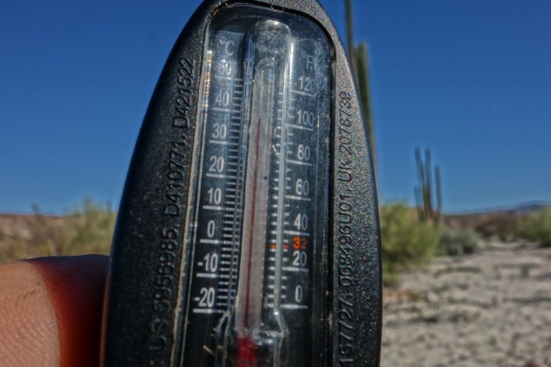
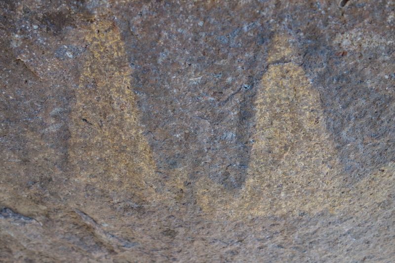
Then I went looking for pintura rupestre. See above photo showing 102*
I rode north on mx1 to get home.


not fun


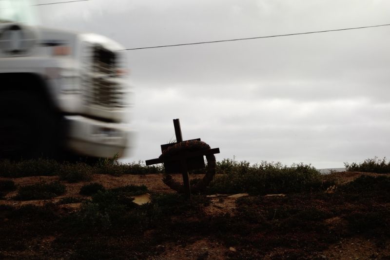
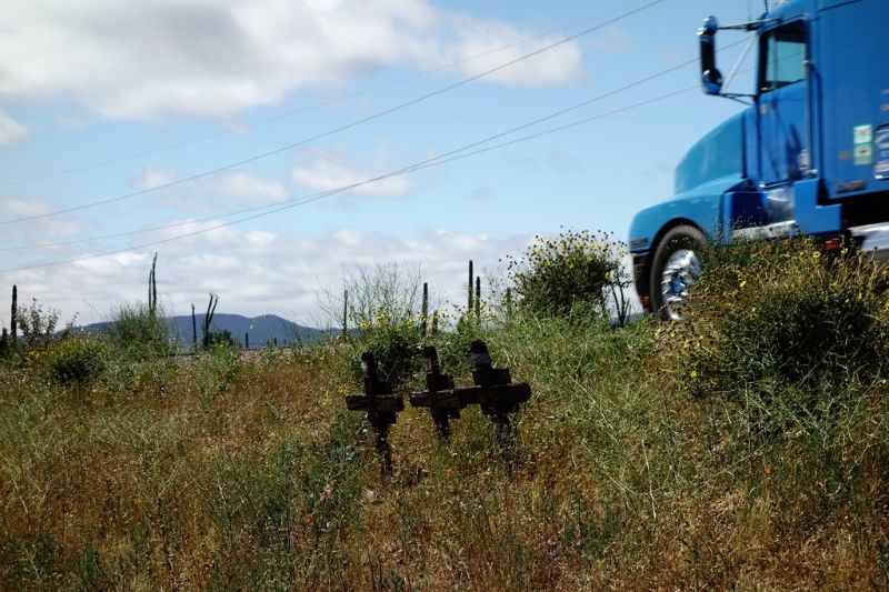
You do not see all these crosses from your truck.

The last 15 miles up to Ensenada after dark were more dangerous than I can type about. Death by no water sounds better than death under the wheels of a bus. I had about $150 worth of lights and 3m reflective tape. Maybe that bought me the 3 inch difference betwen life and death.

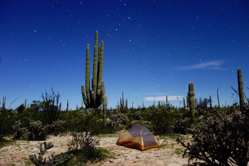
This is more safe and relaxing


[Edited on 4-25-2017 by joerover]

joerover - 4-24-2017 at 08:51 PM

Quote: Originally posted by mtgoat666  

Your maps won't help. There are no roads. The area has only trails. Visit sierra de San Francisco town and ask around.

[Edited on 4-25-2017 by mtgoat666]


OH

I can carry 2 days of water on bike if it is not to hot. Is that enough for the map will not help area?

joerover - 4-24-2017 at 08:56 PM

Quote: Originally posted by mtgoat666  

Glass and ceramic are pretty good for water storage.
Plastic storage is probably OK if you filter it with carbon.
If you can taste the plastic, you are certainly investing the unstudied chemicals that make up plastic. Even if you can't taste the plastic, you are being exposed - unless filtered.


Glass is the best, no leaching what so ever. Broken glass is dangerous though.
Ceramic, I have no info on that.

What is the latest and greatest filter?
https://www.msrgear.com/water/guardian-purifier