BajaNomad

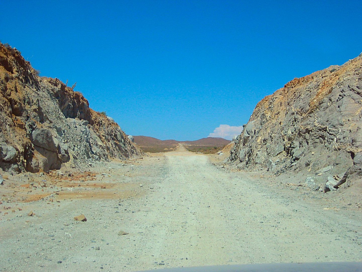
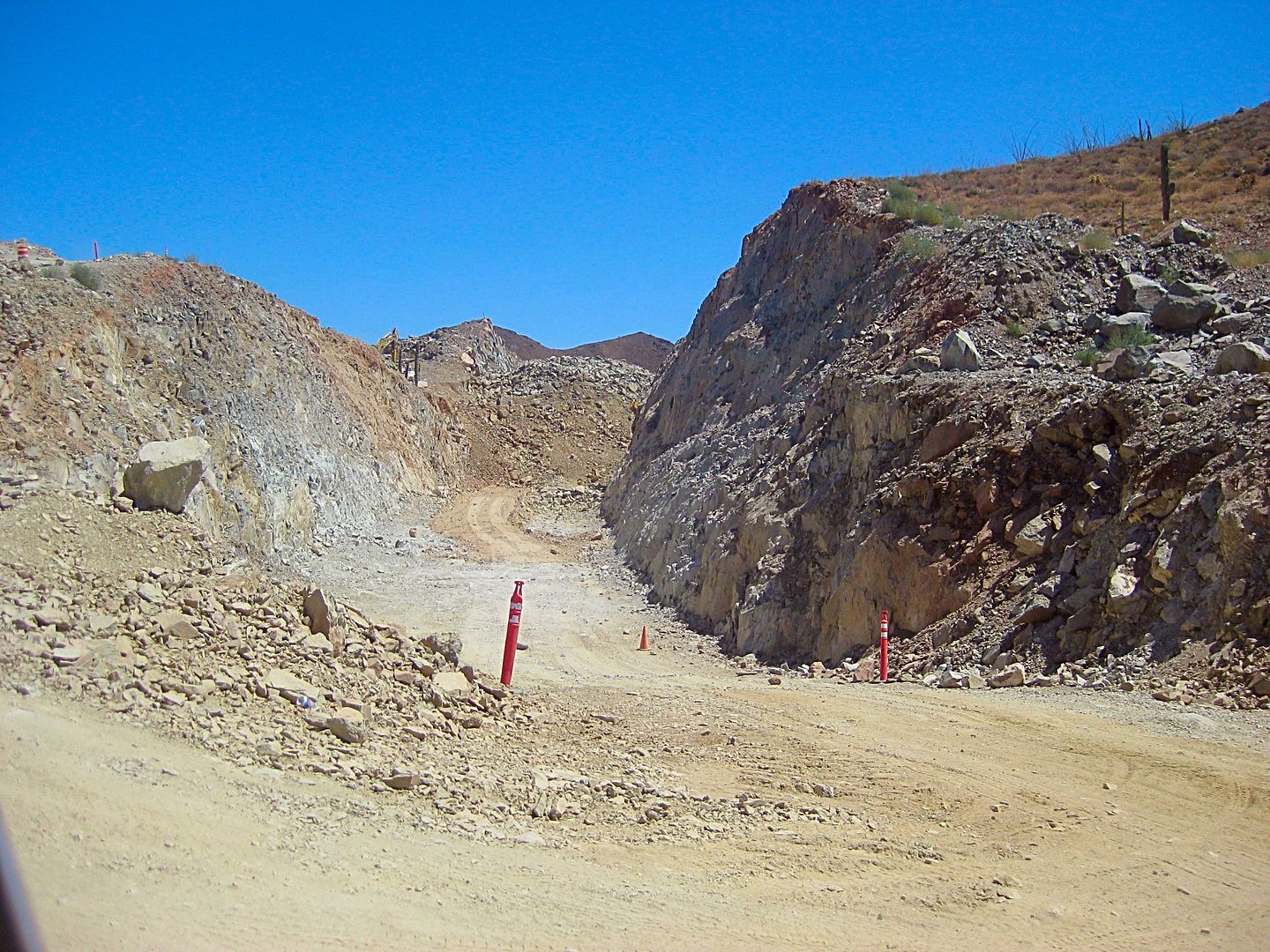
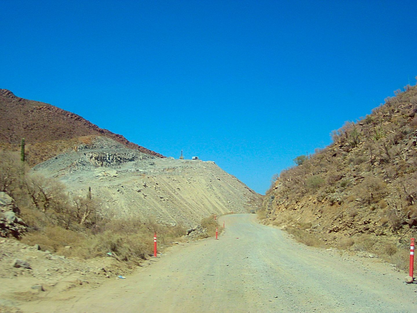
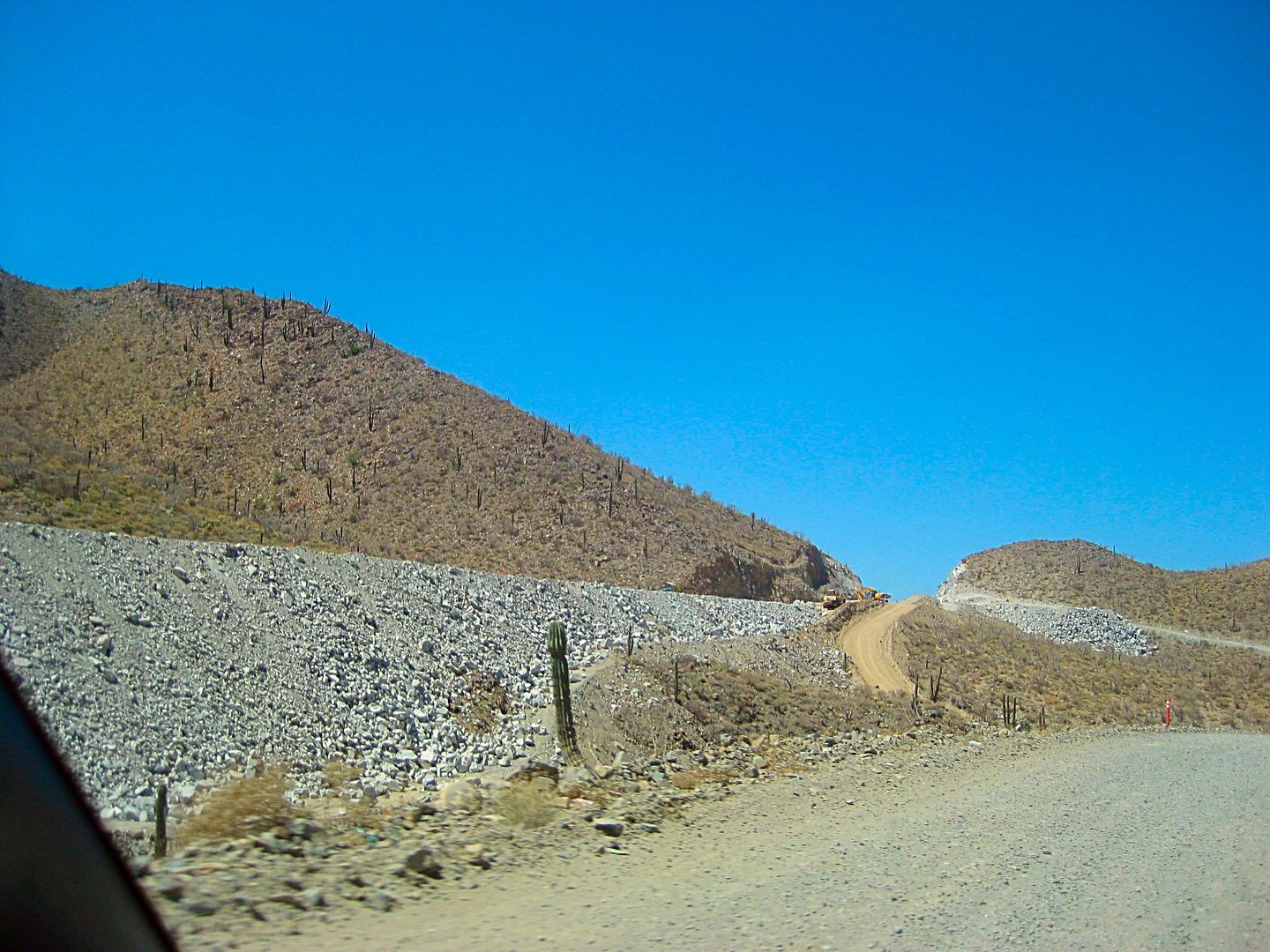
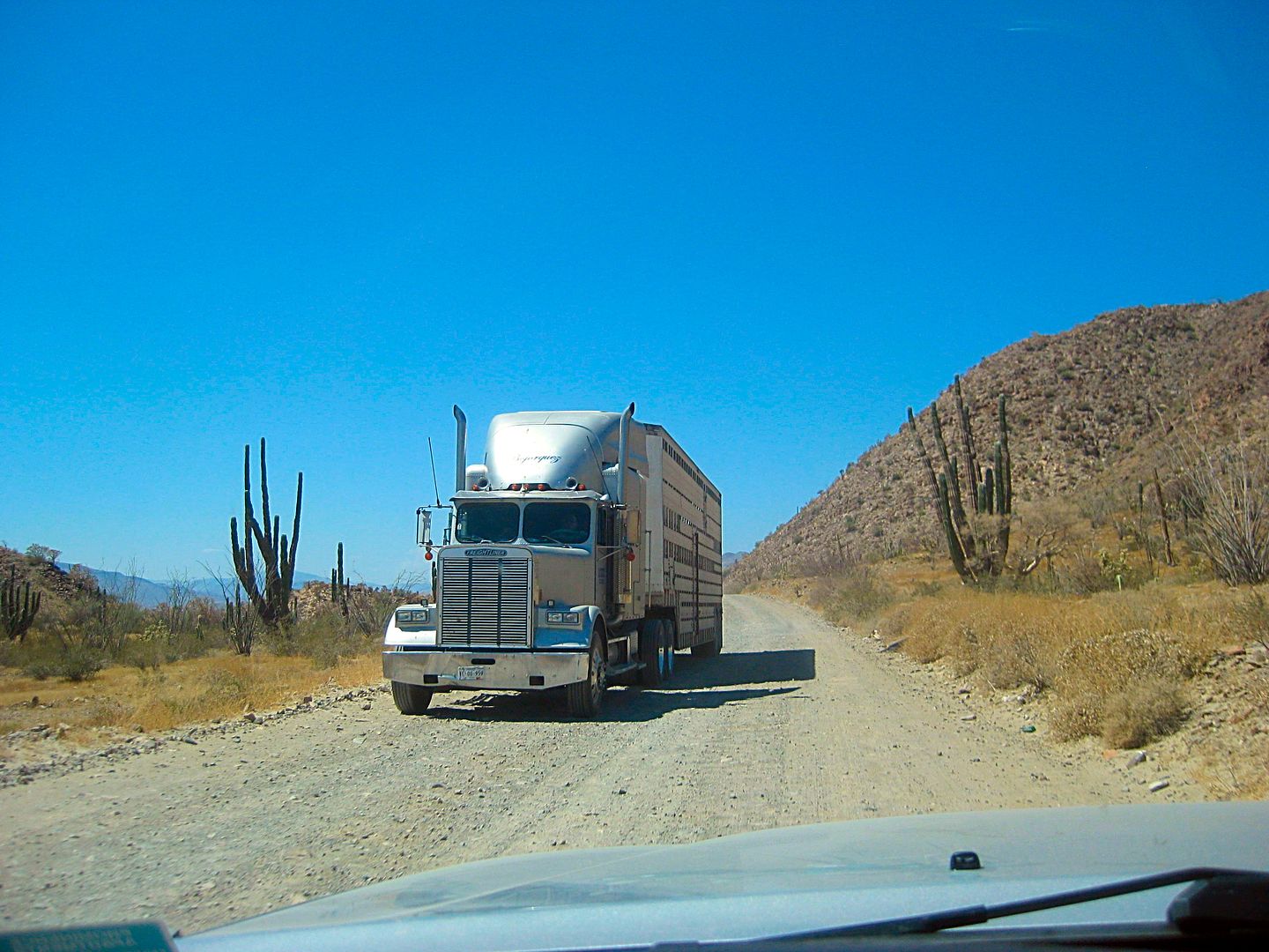
Highway 5, north of Laguna Chapala

StuckSucks - 6-12-2017 at 04:14 PM

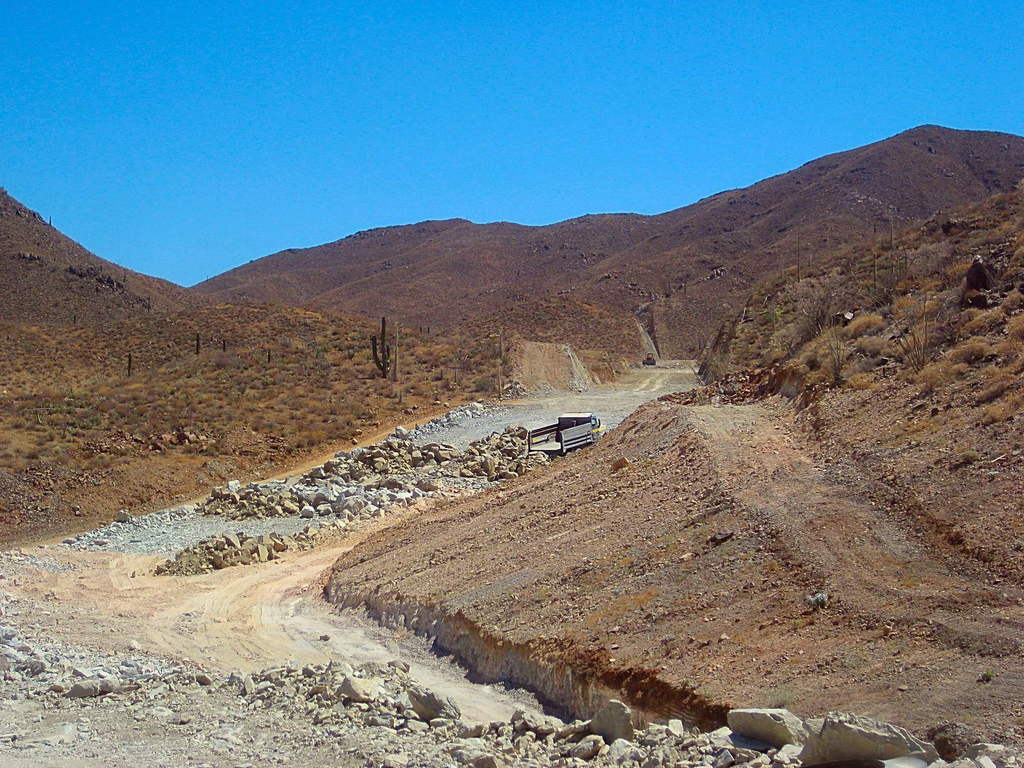
Since there is this constant chatter on Nomad asking about dirt Highway 5's condition, I shot a video so everyone could get a look. I removed or fast-forwarded the tedious or irrelevant sections, but focused more on the new alignment construction. 15 minutes of your life that you will never get back. Map geeks, I'm talking to you David K, will get a kick out of the data overlay.


Quick

John M - 6-12-2017 at 04:40 PM

Certainly the quickest I've been through that dirt section. Pretty well sums it up!

John

rts551 - 6-12-2017 at 04:48 PM

Nice video.

BajaGlenn - 6-12-2017 at 04:54 PM

Thanks --last time i went that way was 75 and it took 3 days:biggrin::o

David K - 6-12-2017 at 05:15 PM

That was great Jim...
I like the drama at the Coco Corner signs! LOL
23.1 unpaved miles... right on!
Unchanged for, what has it been, 3 years now?
This will help those who want to take their motorhomes over it to judge... also what a military checkpoint (Gonzaga) looks like!

Bob and Susan - 6-12-2017 at 05:23 PM

that was GREAT!!!

StuckSucks - 6-12-2017 at 05:29 PM

Thanks guys - glad you like it. But I doubt it will reduce the number of posts asking: "Can I take my 60' bus towing a 35' yacht?"

pacificobob - 6-12-2017 at 05:29 PM

excellent. i'm thinking you bought the "good" shocks.

StuckSucks - 6-12-2017 at 05:40 PM

Quote: Originally posted by pacificobob  
excellent. i'm thinking you bought the "good" shocks.


Yes aftermarket reservoired shocks and different leafs. Also, carrying 340 pounds of tires (two) plus gear helps smooth the ride.

mtgoat666 - 6-13-2017 at 08:36 AM

Quote: Originally posted by StuckSucks  
Map geeks, I'm talking to you David K, will get a kick out of the data overlay.


cool gps overlay on the video. what brand/model camera/software gives you the video merged with GPS data?

Udo - 6-13-2017 at 08:42 AM

VERY nice video, Stuck! Sensible driving.

Which camera did you use so that it gave you all that telemetry in the upper right corner?

bkbend - 6-13-2017 at 10:14 AM

Gee, it looks the same as it did about three hours earlier that day when I drove it. The overlay was cool, I was consistently about half your speed in a 1-ton pickup with stock suspension. It did look like the northern end was getting close to pavement ready.

StuckSucks - 6-13-2017 at 11:01 AM

Quote: Originally posted by Udo  
Which camera did you use so that it gave you all that telemetry in the upper right corner?


I was shooting with my new Garmin Virb XE - you can overlay all sorts of data, e.g. your car's OBD info, heart rate monitor (if you're a jogger), G-forces, etc. It will even display your hangtime - not applicable here. I especially like the image stabilization - you can see that in the video when the camera moves a little different than the truck.

StuckSucks - 6-13-2017 at 11:09 AM

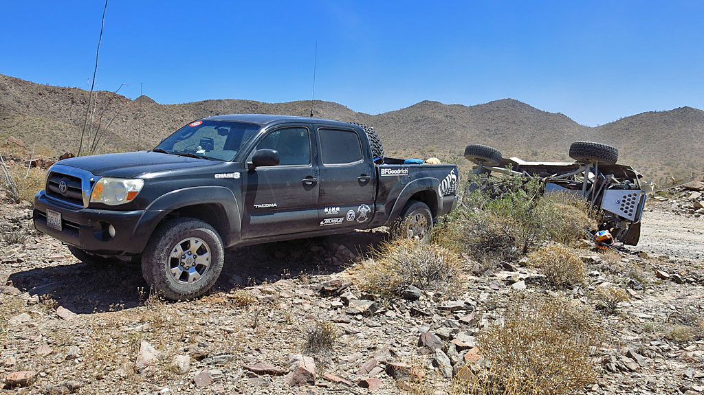
A week earlier on the same road ...

A mile south of Coco’s Corner we were able to help Randy Wilson who had rolled at a particularly sneaky curve. Both occupants were out of the truck and OK. The 1993 Ford Ranger was racing in the Prerunner Truck class, and finished first in class at the checkers. As we were leaving, I said to the driver “Be safe out there.” He replied with “It’s a little late for that advise.”


TMW - 6-13-2017 at 11:47 AM

The video was really cool, thanks.

JZ - 6-13-2017 at 12:50 PM

Nice. My 13yo drove my truck on that stretch all the way to CoCo's two weeks ago.

Udo - 6-13-2017 at 03:14 PM

Cool!

You'll be his hero for the rest of his teenage years. I did the same with mine, but he had troubles with driving a stick. He could not get coordinated on shifting gears until he went into the Navy and drove several vehicles.


Quote: Originally posted by JZ  
Nice. My 13yo drove my truck on that stretch all the way to CoCo's two weeks ago.

JZ - 6-13-2017 at 03:27 PM

Quote: Originally posted by Udo  
Cool!

You'll be his hero for the rest of his teenage years. I did the same with mine, but he had troubles with driving a stick. He could not get coordinated on shifting gears until he went into the Navy and drove several vehicles.


My then 14 drove a stick for the first time last summer from San Evaristo (just pass the sketchy mountain part) all the way to the end of the dirt road near La Paz. Pretty much got it right away, but he rides dirt bikes. He drives all over Baja now at age 15 (almost 16). Drove us from Gonzaga to San Felipe two weeks ago.

David K - 6-13-2017 at 03:52 PM

Super JZ!
I also taught my kids how to drive in Baja and the desert of California. It began with them sitting on my lap until they could reach the pedals. While my Tacoma was an automatic, they both had no problem with a clutch after they turned 16. That was how my dad taught me in Baja and elsewhere.

mtgoat666 - 6-13-2017 at 07:03 PM

Quote: Originally posted by JZ  
Quote: Originally posted by Udo  
Cool!

You'll be his hero for the rest of his teenage years. I did the same with mine, but he had troubles with driving a stick. He could not get coordinated on shifting gears until he went into the Navy and drove several vehicles.


My then 14 drove a stick for the first time last summer from San Evaristo (just pass the sketchy mountain part) all the way to the end of the dirt road near La Paz. Pretty much got it right away, but he rides dirt bikes. He drives all over Baja now at age 15 (almost 16). Drove us from Gonzaga to San Felipe two weeks ago.


LOL, I learned to drive at 12, taught by my 13 year old friend. At that age we went far in trucks on our own. Things are different living in the boonies where pre-teen kids can roam 20+ miles from home on their own in a truck and never see another car. At that age and place, all kids got themselves around and were smart about it.

[Edited on 6-14-2017 by mtgoat666]

BajaBreak - 6-13-2017 at 09:36 PM

Quote: Originally posted by mtgoat666  
[/rquote]

LOL, I learned to drive at 12, taught by my 13 year old friend. At that age we went far in trucks on our own. Things are different living in the boonies where pre-teen kids can roam 20+ miles from home on their own in a truck and never see another car. At that age and place, all kids got themselves around and were smart about it.

[Edited on 6-14-2017 by mtgoat666]


I wish I'd learned to drive from a teenager. Imagine the breadth of experience they could have shared!

g0rgedude - 7-26-2017 at 04:32 PM

Great video. Drove north on 6/27 towing a boat and it took 1:45 to traverse the unpaved section. Very much worth the extra time as compared to the potholes on Mex 1.

David K - 7-28-2017 at 09:25 AM

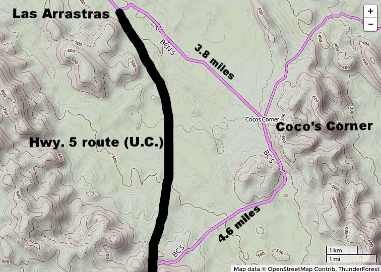
It has been over three years that the paved drive has not been extended. There is some distance the highway has been paved but not open. Hard to believe this section was more difficult than the volcanoes south of Puertecitos that they blazed through in 2007-2010. The 10 km./year average of newly opened pavement is not the case anymore. I expect a section to open very soon... at least to Las Arrastras? That's where the road leaves the new highway alignment and shoots to Coco's Corner.


Alan - 7-29-2017 at 07:19 PM

Great video! Thanks. Answered all my questions except where do I get my FMM southbound in Mexicali. I haven't been on Hwy 5 for nearly 30 years but it sure looks like it will cut some time off my trips to La Paz.

AKgringo - 7-29-2017 at 07:31 PM

I am not familiar with Mexicali East, but when I crossed south at Mexicali West last fall, it was a snap.

I was in the far left lane, asked the agent where to go, and she pointed to a building just past the entry on the left. There was a small parking spot for my Kia, and no line!

Total crossing time, including paying for my FFM right where I got it, was about 15 minutes

David K - 7-29-2017 at 08:01 PM

The INM building is always right where your vehicle enters Mexico. Usually on the right, but as mentioned, Mexicali downtown is on the left... immediately after the covered entry, red/green light area. You may need to double park as there are very few spots to park.

Alan - 7-29-2017 at 08:20 PM

Is there a bank next door or do I have to go find one? East, West crossings? Its been nearly 30 years.

AKgringo - 7-29-2017 at 08:31 PM

No bank necessary! I paid the agent directly with pesos, but I think US dollars would have worked as well.

He even filled out the form for me!

The west crossing is the original port of entry. The crossing east of town is newer, and from what I understand is more RV accessible. I was going to use it for my first time, but I needed a wifi hotspot, and could not find one there, so I crossed at the one in mid town.


[Edited on 7-30-2017 by AKgringo]

David K - 7-30-2017 at 06:43 AM

Quote: Originally posted by AKgringo  
No bank necessary! I paid the agent directly with pesos, but I think US dollars would have worked as well.

He even filled out the form for me!

The west crossing is the original port of entry. The crossing east of town is newer, and from what I understand is more RV accessible. I was going to use it for my first time, but I needed a wifi hotspot, and could not find one there, so I crossed at the one in mid town.


[Edited on 7-30-2017 by AKgringo]


Exactly, the INM officers have their own cash box and have been taking payments for the tourist cards for five years. The other "new" thing is that the 180 day (pay) one does not need to be returned or mailed back as was the case before. Only the free 7-day tourist card is supposed to be returned. However, the Tijuana INM has told some here (apparently) that even it can be tossed. Mexicali INM was very firm it was to be returned and our passports were scanned. We returned ours at Tecate, and the passports were scanned then also.

Alan - 7-30-2017 at 09:46 AM

Thank you for the great responses. Now I can't wait to give it a try. I have to bring my truck home soon to get it's smog test done so I'll definitely try this route. Can't wait to see how much San Felipe has changed in 30 years. I imagine its easy enough to do but just in case I want to smell the roses, is there lodging between GN and San Felipe?

David K - 7-30-2017 at 09:55 AM

Quote: Originally posted by Alan  
Thank you for the great responses. Now I can't wait to give it a try. I have to bring my truck home soon to get it's smog test done so I'll definitely try this route. Can't wait to see how much San Felipe has changed in 30 years. I imagine its easy enough to do but just in case I want to smell the roses, is there lodging between GN and San Felipe?


*Villa Jesus Maria has a 3-room hotel next to the highway.
*Nuevo Rosarito has rooms reported, as well (I have not seen those).
*Santa Rosalillita has a little motel, 9 paved miles west of Hwy. 1.
*Many many places in L.A. Bay, but 40 paved miles east of Hwy. 1.
*Gonzaga Bay has a nice motel at Alfonsina's, cabins at El Sacrificio, and rooms at Punta Bufeo, 5 miles north.

Mexitron - 7-31-2017 at 10:11 AM

Nice video, last time I was on that section was in 1995, the washboard was so bad my passenger took to drinking Presidente--after an hour most the brandy was gone and he was turning green, pulled over to let him blow chunks, saw a little sandy arroyo, was getting late in the day anyway, and decided we better camp. I put up his tent, shoved him in and spent a lovely evening watching the moon and stars and gazillions of different night insects, just another day in Baja!

David K - 7-31-2017 at 10:20 AM

Quote: Originally posted by Mexitron  
Nice video, last time I was on that section was in 1995, the washboard was so bad my passenger took to drinking Presidente--after an hour most the brandy was gone and he was turning green, pulled over to let him blow chunks, saw a little sandy arroyo, was getting late in the day anyway, and decided we better camp. I put up his tent, shoved him in and spent a lovely evening watching the moon and stars and gazillions of different night insects, just another day in Baja!


Ah, the good times!!
I will be over this road soon and will post any changes once I have Internet again.


baja Steve - 7-31-2017 at 10:25 AM

heard yesterday that more road was open and about 5 miles of dirt left. Anyone else anything.

David K - 7-31-2017 at 10:55 AM

About time! LOL. I will do a GPS track of it so we can see the difference between its route and the original route. Thank you.

StuckSucks - 7-31-2017 at 11:43 AM

Quote: Originally posted by David K  
About time! LOL. I will do a GPS track of it so we can see the difference between its route and the original route. Thank you.


Looking at the video, you can see the old Highway 5 share the new highway alignment in several places.

David K - 7-31-2017 at 01:28 PM

Yes, I am more interested in seeing how the Coc's Corner bypass looks in real time.

Here is how I showed it a year or so ago, estimated:


tehag - 7-31-2017 at 08:45 PM

Drove that today and it seemed a good deal rougher than the video suggests.

Won't do it again, I don't hate my car.

David K - 7-31-2017 at 09:15 PM

Quote: Originally posted by tehag  
Drove that today and it seemed a good deal rougher than the video suggests.

Won't do it again, I don't hate my car.


Only 5 miles of dirt as reported or still 23?

[Edited on 8-1-2017 by David K]

surfinggrandpa71 - 8-1-2017 at 03:33 AM

this might be the rumor of the month,,,,,,,,,,5 miles of dirt ??? Not 23, I figured this would be front page news,,,,,,,,this must be " fake news"

chuckie - 8-1-2017 at 04:02 AM

The "Scaramucci Hiway"?

surfinggrandpa71 - 8-1-2017 at 04:27 AM

I truly would of figured some sort of " grand opening " with some politician living within 50 miles of the road , cutting a ribbon ceremony, on in the local papers calming it was his/her great leadership that completed the road.......Im still claiming " fake news"

rts551 - 8-1-2017 at 05:42 AM

Quote: Originally posted by surfinggrandpa71  
I truly would of figured some sort of " grand opening " with some politician living within 50 miles of the road , cutting a ribbon ceremony, on in the local papers calming it was his/her great leadership that completed the road.......Im still claiming " fake news"


I can guarantee you have it right.

David K - 8-1-2017 at 06:21 AM

Quote: Originally posted by surfinggrandpa71  
this might be the rumor of the month,,,,,,,,,,5 miles of dirt ??? Not 23, I figured this would be front page news,,,,,,,,this must be " fake news"


Ask the Nomad who posted it:
Quote: Originally posted by baja Steve  
heard yesterday that more road was open and about 5 miles of dirt left. Anyone else anything.


I will measure the dirt section very soon and report here when I have Internet again.

gator - 8-1-2017 at 07:28 AM

Drove the road on Sunday. Still the same 23 miles of dirt.

rts551 - 8-1-2017 at 08:10 AM

Quote: Originally posted by gator  
Drove the road on Sunday. Still the same 23 miles of dirt.


looks like we will have to wait for the "measurement".

rts551 - 8-1-2017 at 03:32 PM

I went across it a couple of weeks ago and just talked to someone who crossed today. definitely, 23 miles left although some people are driving around the barricades and topes to cut ff a couple of miles. Nothing changed...but a lot of work going on. Guess we do not have to wait for the official Nomad measurement.

rts551 - 8-1-2017 at 03:45 PM

Quote: Originally posted by willardguy  
Quote: Originally posted by rts551  
I went across it a couple of weeks ago and just talked to someone who crossed today. definitely, 23 miles left although some people are driving around the barricades and topes to cut ff a couple of miles. Nothing changed...but a lot of work going on. Guess we do not have to wait for the official Nomad measurement.


yeah but just wait as the excitement builds to a crescendo when you see the "NEW" photo's! :yes:


for those that can or figured out how to load fotos... maybe others will. for Now we will have to rely on the official fotos.

baja Steve - 8-1-2017 at 03:47 PM

Just talked to the nomad that said he was on 5 miles of dirt road. He did go around several barriers where the road is paved but not open.

AKgringo - 8-1-2017 at 04:36 PM

On my way south last November, I drove a few miles of new, graded highway that was not paved yet. When I got to the end, it was a bit difficult getting back on to where I was supposed to be driving.

I did not intend to be in the construction zone, but whatya you gonna do when the flagman isn't there?

rts551 - 8-1-2017 at 05:43 PM

Quote: Originally posted by AKgringo  
On my way south last November, I drove a few miles of new, graded highway that was not paved yet. When I got to the end, it was a bit difficult getting back on to where I was supposed to be driving.

I did not intend to be in the construction zone, but whatya you gonna do when the flagman isn't there?


It is/was rather obvious that it is/was blocked. even today. more so last November.

PaulW - 8-2-2017 at 06:02 AM

That last leg before highway 1 has been sitting there for a very long time. It ends at the top of a hill. The hold up is a bridge in the south side of the hill. Turns out there are several cut off roads the can be used if you explore that incomplete section. The cutoffs are easy drives and get you back to the traditional crappy road to get to Hwy 1.

Last time I drove to Hwy 1 from SF I did take many segments of the construction roads. It was pretty dicey due to heavy construction trucks. At that time the paving was not done, but the road base was 90% completed on those segments. I do not recommend doing what I did. I have gone past this area many times and have never seen any blockage or signs, however it was pretty obvious that I was not on the proper road.

rts551 - 8-2-2017 at 01:07 PM

Quote: Originally posted by PaulW  
That last leg before highway 1 has been sitting there for a very long time. It ends at the top of a hill. The hold up is a bridge in the south side of the hill. Turns out there are several cut off roads the can be used if you explore that incomplete section. The cutoffs are easy drives and get you back to the traditional crappy road to get to Hwy 1.

Last time I drove to Hwy 1 from SF I did take many segments of the construction roads. It was pretty dicey due to heavy construction trucks. At that time the paving was not done, but the road base was 90% completed on those segments. I do not recommend doing what I did. I have gone past this area many times and have never seen any blockage or signs, however it was pretty obvious that I was not on the proper road.


It is still road base and getting worse all the time because of the people driving on it....it is rather obvious it is not the proper road.

StuckSucks - 8-2-2017 at 01:29 PM

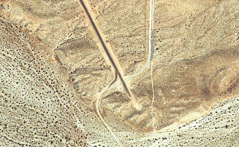
I found a semi-recent sat photo of the end of pavement south of Gonzaga. Today, south of the pavement end, there is a long bridge spanning the arroyo.


David K - 8-2-2017 at 02:11 PM

Today, Aug. 2, 2017. NO CHANGE in the paved vs. dirt part. Still 23 unpaved miles.
Have a nice day!

willardguy - 8-2-2017 at 02:28 PM

those are some duro hombres for sure....but can you imagine laying asphalt in august! :(

David K - 8-3-2017 at 03:48 PM

There were no crews working north of Las Arrastras and very few working in the canyon and nothing happening or changed across the Chapala valley.

There is only about 2 miles of pavement south of the detour then just the base material, which they could pave, but have not.

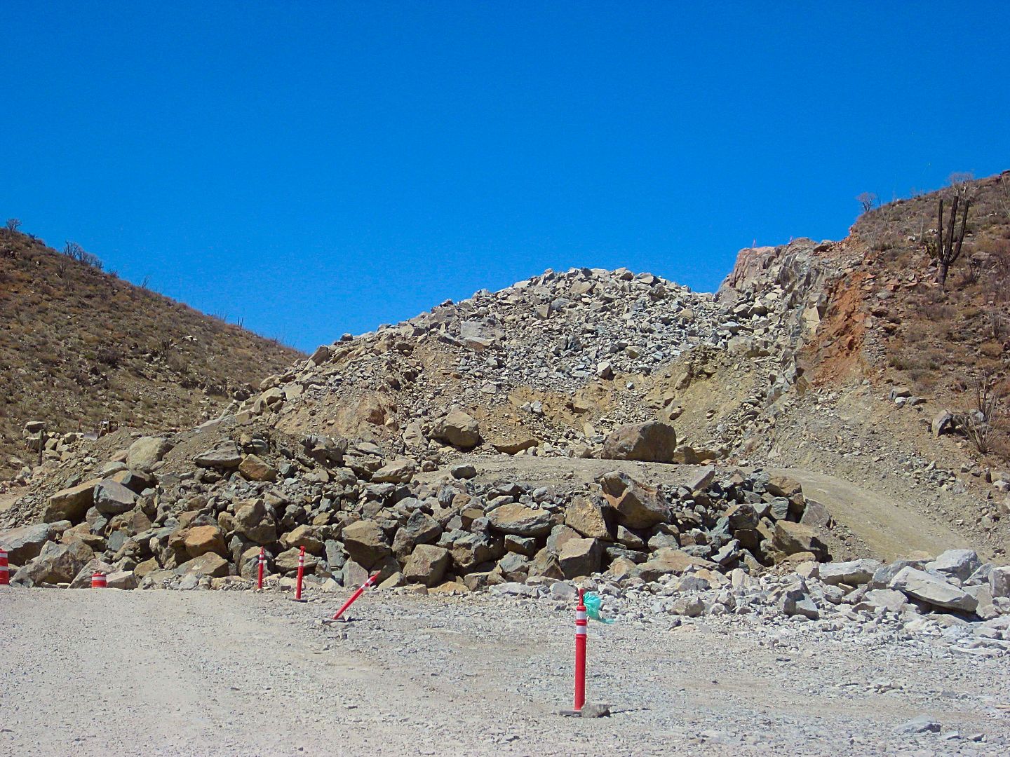
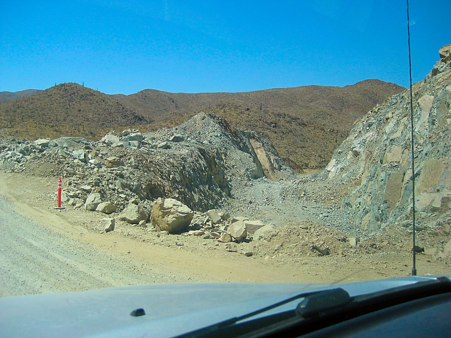
The Coco bypass seems ready to pave also but entering the canyon and through the canyon still is far far from being ready.

They are still trying to reduce one entire peak to road grade level, and they are only 1/4 down from where they began years ago now.

The 23 miles was again mostly rough, so motorhomes and trailers not recommended.
If you are lucky, they may do a scrape and fill before you drive it?

Many pot holes south of Chapala were fixed. Still, the few miles just north of the L.A. Bay junction are very very bad.

A crew was filling holes north of the Santa Rosalillita junction, yesterday.

Be well!


[Edited on 8-3-2017 by David K]

BajaGlenn - 8-6-2017 at 03:06 PM


I for one thank you David for your updates:biggrin:

Bridges

Sr.vienes - 8-6-2017 at 03:42 PM

Please be cautious when driving the unopened sections of Hwy. 5. In the late 1970's I40 between Kingman Az. and Seligman had been setting with no asphalt, but with bladed road base in place. The road base was tapered up to the concrete bridges during construction and all of us locals used the unopened road as it saved 28 miles. I discovered they had squared off the road base for the blacktop at about 4am in an old F700 Ford, I still have a few kinks in my neck from hitting the roof. Just saying things can chancge everyday.

David K - 8-6-2017 at 03:45 PM

El gusto es mio, amigo.

I like recording travel details and if others enjoy them too, why not share? I drew my first Baja map when I was 9 or 10 (1967, glad I dated it) and my first published road guide when I was 15 (1973). So, I guess I was born to do this stuff! I have my parents to thank for infecting me with 'Baja Fever' and it sure directed my life!

My dad introduced me to Baja authors Ray Cannon, Howard Gulick, Tom Miller, and we just missed meeting Erle Stanley Gardner when we went to his Temecula ranch... he had just left to Baja, his wife (or future wife) told us. She was his secretary for years and was in his books. I recall reading they married shortly before his death, which (I think) was in 1970?

chuckie - 8-6-2017 at 03:52 PM

Geezo..More time is spent talking about this lil bitty 23 miles of road, which by Baja standards isn't even really bad, than has been spent discussing Christianity...Drive it and shut up! ITS 23 MILES! Wimps

David K - 8-6-2017 at 04:38 PM

Hmmm, why would we discuss that on a Baja Road Conditions forum?
;)
Kind of like discussing gas prices, as if that would stop you from going to Baja? Dirt roads are one of the many things that Baja is famous for.

That it is taking them so many years for this ~20 mile section of highway (23 dirt detour miles) is what is amazing (that they can milk a job for so long). If they would just curve around a couple of peaks instead of removing the mountain so this highway can run almost straight, it bet it could be done in a year or two.

Only a couple of earth mover scoops were working, some machines/dump trucks appeared parked and broken, and what few workers that could be seen were mostly at the food shack. That was also the only work camp (in the canyon). The camp at Las Arrastras, active last January, was gone.

They had been averaging about 6-8 miles a year from when the started at Puertecitos in 2007 to where the pavement reached in early 2014. Now, nearing 4 years and not a single meter of new paving open to use.

I guess no incentive to complete early or on time exists? We know Mexico can do it, as they did in 1973 with the Transpeninsular Highway from San Quintin to San Ignacio all in one year!

AKgringo - 8-6-2017 at 04:39 PM

Quote: Originally posted by David K  
El gusto es mio, amigo.

I like recording travel details and if others enjoy them too, why not share? I drew my first Baja map when I was 9 or 10 (1967, glad I dated it) and my first published road guide when I was 15 (1973). So, I guess I was born to do this stuff! I have my parents to thank for infecting me with 'Baja Fever' and it sure directed my life!


A generation later, you would be prescribed Adderall for ADHD, and have your therapist to thank! :spingrin::tumble:

Just kidding David, I appreciate what you do (non-political), and have done in the past.

David K - 8-6-2017 at 04:40 PM

I agree, lol!

rts551 - 8-6-2017 at 09:37 PM

I guess we need some of these very successful gringo businessman/engineers to manage these road projects. hmmmmm maybe not.

AKgringo - 8-6-2017 at 10:13 PM

I would guess that the reason for the massive cuts through the mountain, is because they need a hell of a lot of fill material going across the dry lake bed.


David K - 8-6-2017 at 10:49 PM

The levee is already done across the valley. You drive on about 2 miles of it, a bit on each side. The closed part is south of the older road. An interesting stop is at the trees in the middle, which was the original Rancho Laguna Chapala site, before the highway was built to the west side of the valley. A large, ooen, deep well is there. Can't see the bottom!

AUG. 13, 2017 NEWS

David K - 8-29-2017 at 10:47 AM

NEW ROADBED OPEN!
In the 2 weeks since I was last on this route, barriers blocking the new highway elevated roadbed (south of the original road) were removed and other cars were on it. During construction, these detours could very well change back.

Mile 0.0 Hwy. 1 & Hwy. 5 Junction, 1:58 pm.
Mile 0.9 Fork right onto new roadbed.
Mile 3.5 original and new roads rejoin.
Mile 5.2 off of new roadbed.
Mile 8.0 Construction camp, leave new road alignment and head for Coco's Corner.
Mile 12.9 Coco's Corner 2:36 pm
Mile 16.8 Las Arrastras 2:45 pm Rejoin new road route.
Mile 22.3 On pavement and new bridges.
Mile 23.2 Km. 167 (just north of previous pavement start.
Mile 35.5 Km. 147 Gonzaga Bay Pemex, 3:12 pm


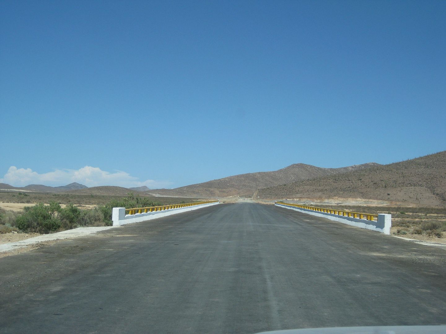
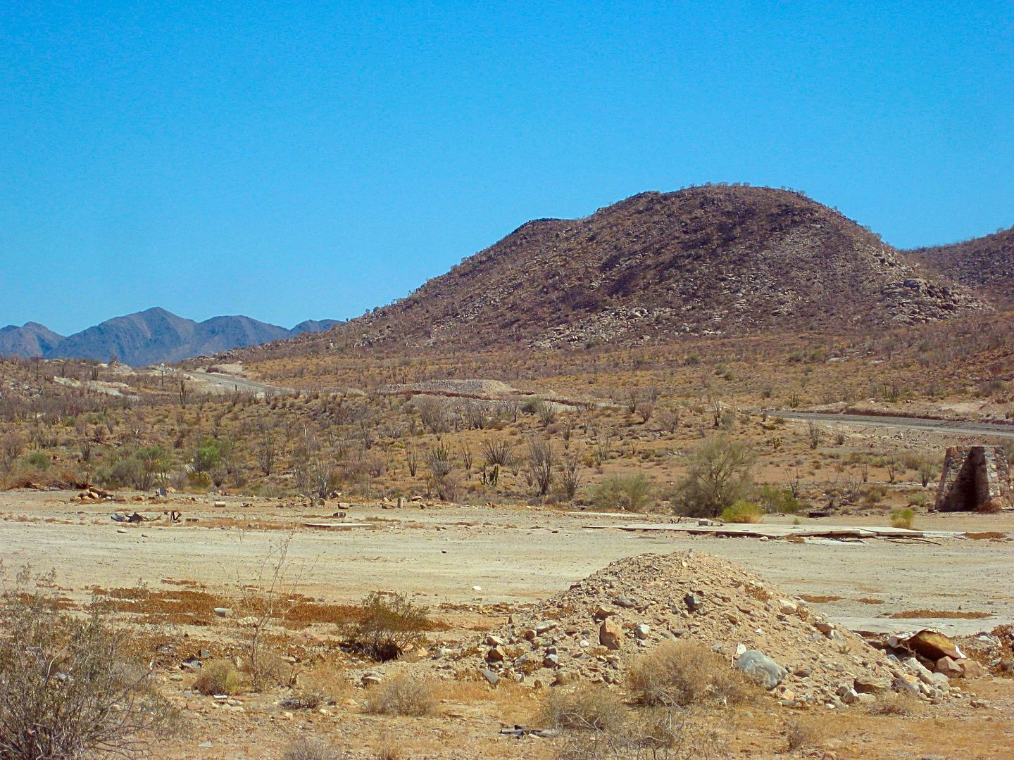
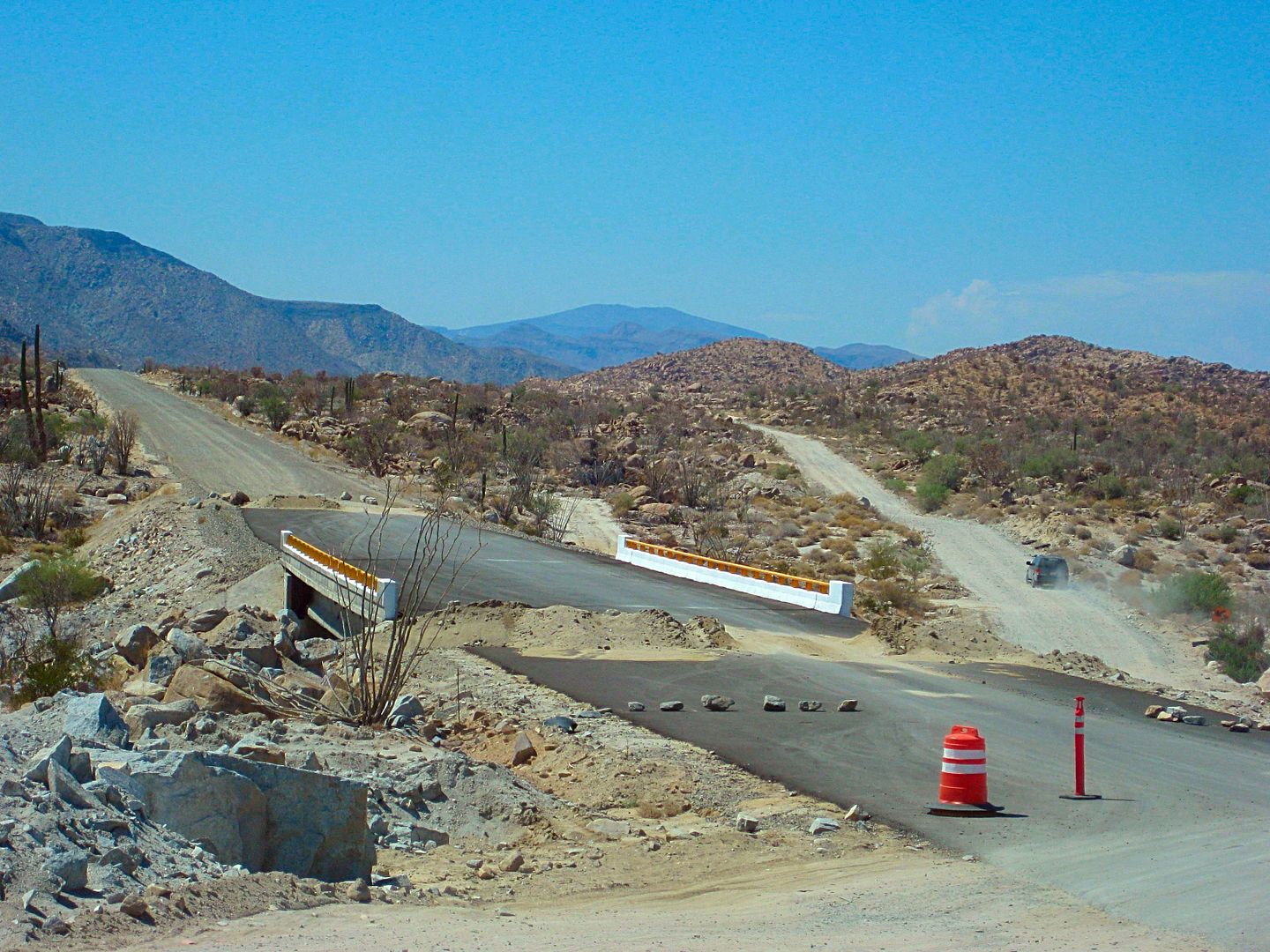
Paved bridge, new section, Chapala Valley.


New section, Chapala Valley.


Can you imagine how Arturo Grosso made the first road through here, in 1955? Picks and dynamite!


Here is where the highway leaves the original route (northbound) and shoots straight to Las Arrastras, bypassing Coco's Corner.


Nearing Coco's Corner.


Here at Las Arrastras, is where the new highway returns to the original route, on the north end of the Coco's Bypass.


Old and new routes criss-cross a few times.


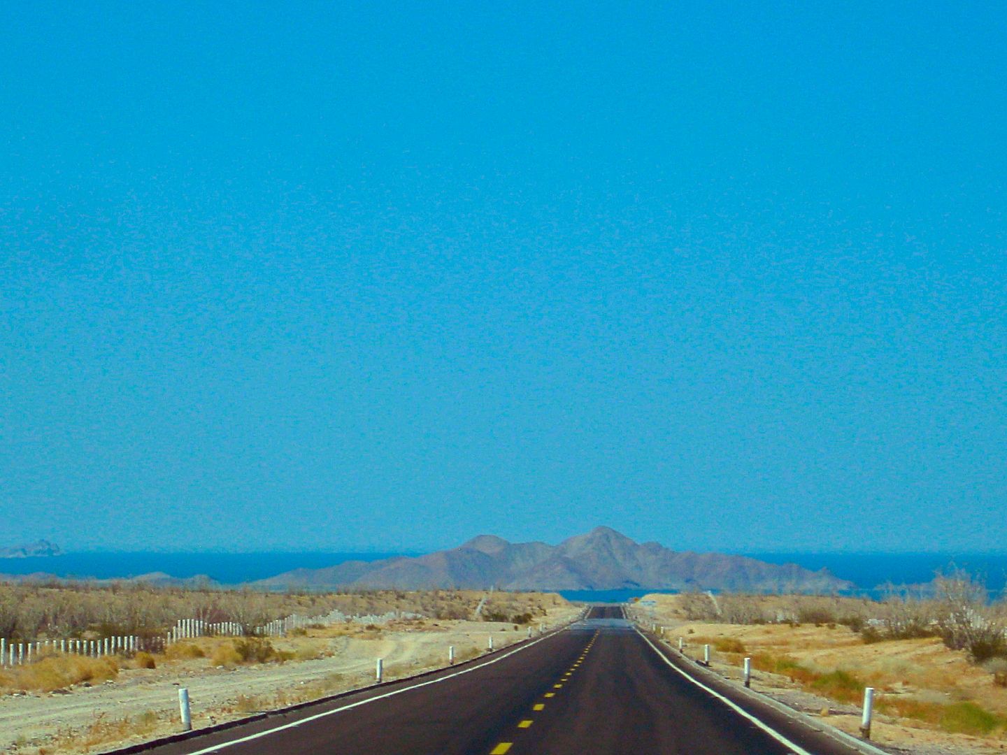
Gonzaga Bay, dead ahead!

[Edited on 9-7-2017 by David K]

SuperScrappy - 9-7-2017 at 08:30 AM

We came thru on 9/4 after Lidia. We were a little worried about the rain damage, but not an issue. It does look like there are far less workers on hwy 5 from our last trip down which was about 6 months ago. The work seems to mostly be thru the pass. You can drive on a lot of the sections of the road as long as the construction people don't put the piles of dirt back up. We easily took our 30ft travel trailer thru without an issue. Really the only issue is more with the pave section north of Gonzaga where big rocks have fallen on to the road (an important reason not to travel at night). Several areas do have some sort of warning, but not all. Its the Baja, take your time, travel during the day, and be safe.

norte - 9-7-2017 at 11:26 AM

Didn't we see these pictures somewhere else already?

TMW - 9-7-2017 at 04:29 PM

The next to last picture showing a bridge with dirt piles at each end looks like the turn off to the La Turquesa mine. Turn off is at the upper left side of the bridge.

StuckSucks - 9-7-2017 at 05:26 PM

In Nov 2014 I shot a photo sphere, I *think* at that location, pre-construction.

http://tinyurl.com/ybcjuwrc

Jaybo - 9-30-2017 at 08:03 PM

OK, so, How many miles of dirt do we have now?

David K - 9-30-2017 at 10:53 PM

About 22 miles last month.

rts551 - 10-1-2017 at 07:19 AM

About 22 miles. Lots of progress knocking the mountain down going through the pass. That is all. Rood is in worse condition after the rains.

Jaybo - 10-1-2017 at 02:53 PM

Oh OK, I had gotten from Davids last post that more paved was open but I guess just another mile is opened..

David K - 10-1-2017 at 04:01 PM

Quote: Originally posted by Jaybo  
Oh OK, I had gotten from Davids last post that more paved was open but I guess just another mile is opened..

Yes, 0.9 mile (1.5 kms.) additional was open last month... but for how long, who knows? It may have been a fluke that the barrier northbound was removed.
There isn't much more blacktop applied south of where we got on the pavement.

Jaybo - 10-1-2017 at 04:37 PM

There is a small chance we will be going down again after Feb. so would like to go that way again. Be taking a non 4x4 vehicle though so may may end up going down 1

David K - 10-1-2017 at 08:00 PM

4WD is not needed on that or any other graded dirt road in Baja. The exception is during heavy rain maybe.

is driving a Toyota Highlander down 5 a good idea?

JoelovesBaja - 11-26-2017 at 07:30 PM

Quote: Originally posted by StuckSucks  
Thanks guys - glad you like it. But I doubt it will reduce the number of posts asking: "Can I take my 60' bus towing a 35' yacht?"


I need to ask, I am taking a trip to Mulege next December. My wife wants us to take HER Toyota 2014 Highlander. I want to ease her mind re assuring her car will be ok through the 23 mile of gravel. I saw the entire video and I think we will be fine.

whats you opinion? we are tanking this Highlander for comfort
or should I take my 2003 for explorer?

Sandlefoot - 11-26-2017 at 07:59 PM

If an overloaded 18 wheeler can make it, your Highlander will be fine!!! The car can make it if the driver can!!!:bounce:

Happy Trails

willardguy - 11-26-2017 at 08:06 PM

I'd take the exploder and leave the highlander home in the garage.

StuckSucks - 11-27-2017 at 01:54 PM

Quote: Originally posted by JoelovesBaja  
whats you opinion? we are tanking this Highlander for comfort
or should I take my 2003 for explorer?


You will be fine. I drove northbound through there Saturday and it was essentially the same as the video.

David K - 11-27-2017 at 03:34 PM

If you need a road to be paved before driving it, perhaps Baja is not the best choice for your vacation?
Most roads are unpaved and most cars drive them. If it is rough, you drive slower. This fear of taking a Highlander sure is unwarranted. Ferraris and big motorhomes are the kinds of vehicles that only need to be concerned about dirt road driving, in dry weather.
Enjoy Baja, everything works out if you are not in a rush.

StuckSucks - 11-27-2017 at 07:26 PM

The guard shack cavity search along with modern, tourist-friendly facilities, means my Gonzaga days are limited.


motoged - 11-27-2017 at 08:00 PM

omygod....sawdust and cement grit in the tacos :o:o :biggrin:

JoelovesBaja - 11-28-2017 at 12:31 AM

Thank you guys.

basautter - 11-28-2017 at 04:44 AM

Thanks for the update! I just started planning an early 2018 dirt bike trip, and was wondering about that section of road. Not much left for the imagination except when they will be done! :light:

Cliffy - 11-28-2017 at 07:46 PM

How many 4X4s never leave the asphalt in Orange Co. CA? Its always been amazing to me how many people fear dirt roads. Been that way since I first went down in the early 70s. Some of the places the locals drove with normal everyday 1 wheel drive cars would blanch the face of many today.

Roads gets wet and we need active traction control, 4X4 drive, ABS brakes and FWL RADAR to close the throttle. YIKES how did we survive with mechanical brakes on only 2 wheels? Now we need the car to parallel park itself because we can't do it!

Just go to a big boat launch ramp any weekend and see how many can't backup a trailer.

This video shows me I can make it with my 22 ft travel trailer with ease as long as I go at it in a reasonable manner.

One last item- many wonder/complain about when they are going to finish it but I think just the opposite. I'm impressed with how it is going considering they are trying to build a "modern" highway a hundred miles out in the middle of no where, in the most inhospitable terrain imaginable. I can't imagine working as a powder monkey or scoop driver out there in the middle of summer. I'm amazed its moving as well as it is.

I drove this road from Hwy 1 to Papa's in the early 70s in the middle of the night. A completely different experience than this "now" graded road.


mtgoat666 - 11-28-2017 at 08:28 PM

Quote: Originally posted by Cliffy  
How many 4X4s never leave the asphalt in Orange Co. CA? Its always been amazing to me how many people fear dirt roads. Been that way since I first went down in the early 70s. Some of the places the locals drove with normal everyday 1 wheel drive cars would blanch the face of many today.

Roads gets wet and we need active traction control, 4X4 drive, ABS brakes and FWL RADAR to close the throttle. YIKES how did we survive with mechanical brakes on only 2 wheels? Now we need the car to parallel park itself because we can't do it!

Just go to a big boat launch ramp any weekend and see how many can't backup a trailer.

This video shows me I can make it with my 22 ft travel trailer with ease as long as I go at it in a reasonable manner.

One last item- many wonder/complain about when they are going to finish it but I think just the opposite. I'm impressed with how it is going considering they are trying to build a "modern" highway a hundred miles out in the middle of no where, in the most inhospitable terrain imaginable. I can't imagine working as a powder monkey or scoop driver out there in the middle of summer. I'm amazed its moving as well as it is.

I drove this road from Hwy 1 to Papa's in the early 70s in the middle of the night. A completely different experience than this "now" graded road.


Cliffsy,
That was a good old-man-Luddite-rant.

I suspect you got a rotary dial phone in your house and you still use that old black and white TV you purchased back in 1972.

Now go eat your daily fiber shake, and get back to yelling at the clouds and screaming at the neighbor kids to stay off your lawn!


willardguy - 11-28-2017 at 08:58 PM

Quote: Originally posted by mtgoat666  
Quote: Originally posted by Cliffy  
How many 4X4s never leave the asphalt in Orange Co. CA? Its always been amazing to me how many people fear dirt roads. Been that way since I first went down in the early 70s. Some of the places the locals drove with normal everyday 1 wheel drive cars would blanch the face of many today.

Roads gets wet and we need active traction control, 4X4 drive, ABS brakes and FWL RADAR to close the throttle. YIKES how did we survive with mechanical brakes on only 2 wheels? Now we need the car to parallel park itself because we can't do it!

Just go to a big boat launch ramp any weekend and see how many can't backup a trailer.

This video shows me I can make it with my 22 ft travel trailer with ease as long as I go at it in a reasonable manner.

One last item- many wonder/complain about when they are going to finish it but I think just the opposite. I'm impressed with how it is going considering they are trying to build a "modern" highway a hundred miles out in the middle of no where, in the most inhospitable terrain imaginable. I can't imagine working as a powder monkey or scoop driver out there in the middle of summer. I'm amazed its moving as well as it is.

I drove this road from Hwy 1 to Papa's in the early 70s in the middle of the night. A completely different experience than this "now" graded road.


Cliffsy,
That was a good old-man-Luddite-rant.

I suspect you got a rotary dial phone in your house and you still use that old black and white TV you purchased back in 1972.

Now go eat your daily fiber shake, and get back to yelling at the clouds and screaming at the neighbor kids to stay off your lawn!


what a pathetic little man you are :no:

thebajarunner - 11-30-2017 at 06:10 PM

Quote: Originally posted by willardguy  
Quote: Originally posted by mtgoat666  
Quote: Originally posted by Cliffy  
How many 4X4s never leave the asphalt in Orange Co. CA? Its always been amazing to me how many people fear dirt roads. Been that way since I first went down in the early 70s. Some of the places the locals drove with normal everyday 1 wheel drive cars would blanch the face of many today.

Roads gets wet and we need active traction control, 4X4 drive, ABS brakes and FWL RADAR to close the throttle. YIKES how did we survive with mechanical brakes on only 2 wheels? Now we need the car to parallel park itself because we can't do it!

Just go to a big boat launch ramp any weekend and see how many can't backup a trailer.

This video shows me I can make it with my 22 ft travel trailer with ease as long as I go at it in a reasonable manner.

One last item- many wonder/complain about when they are going to finish it but I think just the opposite. I'm impressed with how it is going considering they are trying to build a "modern" highway a hundred miles out in the middle of no where, in the most inhospitable terrain imaginable. I can't imagine working as a powder monkey or scoop driver out there in the middle of summer. I'm amazed its moving as well as it is.

I drove this road from Hwy 1 to Papa's in the early 70s in the middle of the night. A completely different experience than this "now" graded road.


Cliffsy,
That was a good old-man-Luddite-rant.

I suspect you got a rotary dial phone in your house and you still use that old black and white TV you purchased back in 1972.

Now go eat your daily fiber shake, and get back to yelling at the clouds and screaming at the neighbor kids to stay off your lawn!


what a pathetic little man you are :no:


Cliffy, good post, what a creepy response you got....
I love that road!
Few months back my 20 year old F150 ate it up at 40-50 mph.
And in the really rocky places, you just slow down and don't kill your rig.
Great comment about "Orange County 4x4s.
Except for hard core Baja types I tell 4x4 buyers "If you are where you need four wheel drive, you are probably somewhere you should not be." 40+ years of pounding Baja I have never been there in a 4x4.... and yeah, that includes 12 years of racing the big ones...