BajaNomad

My (31) 2018-2021 Series BAJA CALIFORNIA MAPS

 Pages:  1  

David K - 1-9-2018 at 03:32 AM

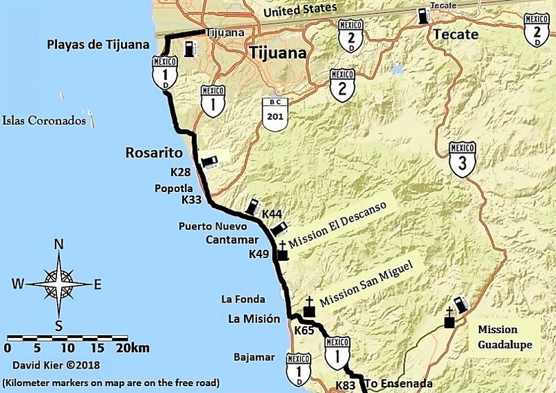
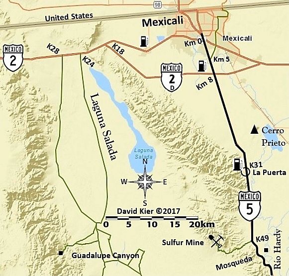
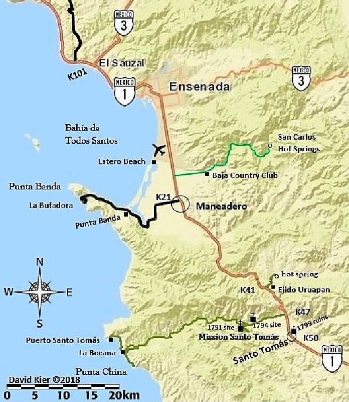
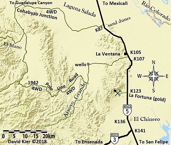
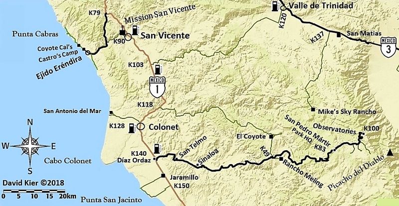
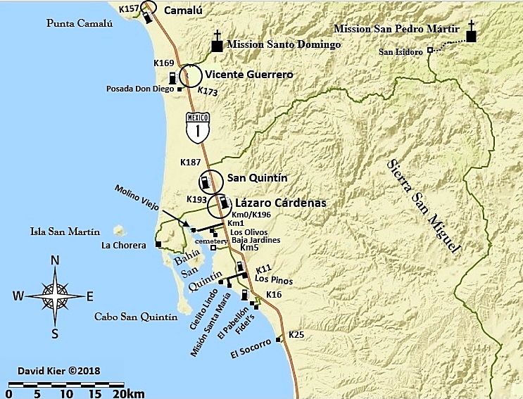
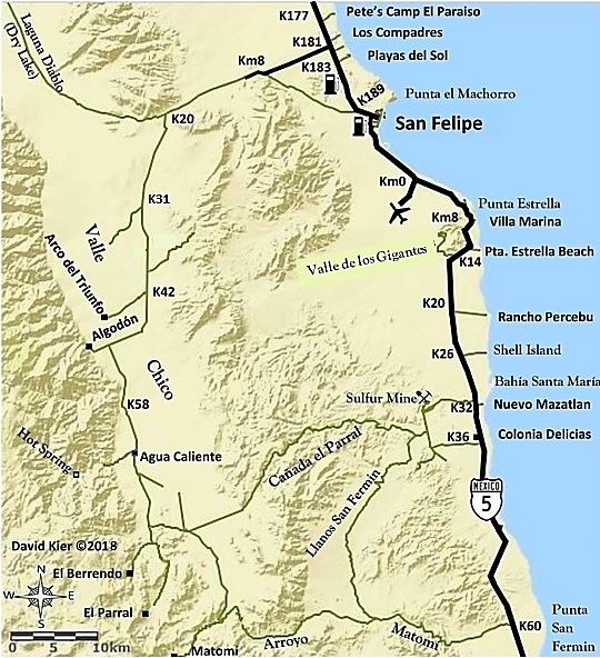
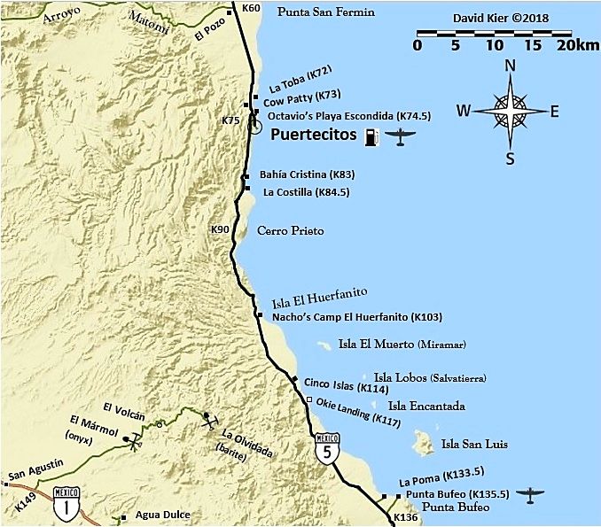
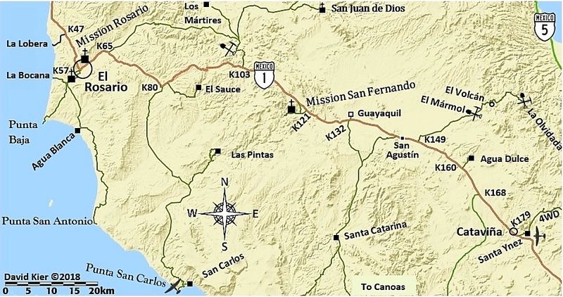
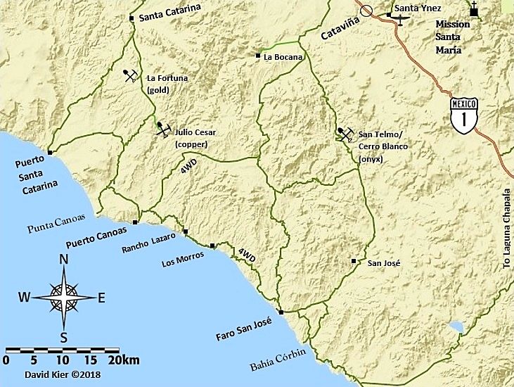
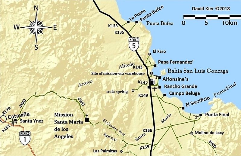
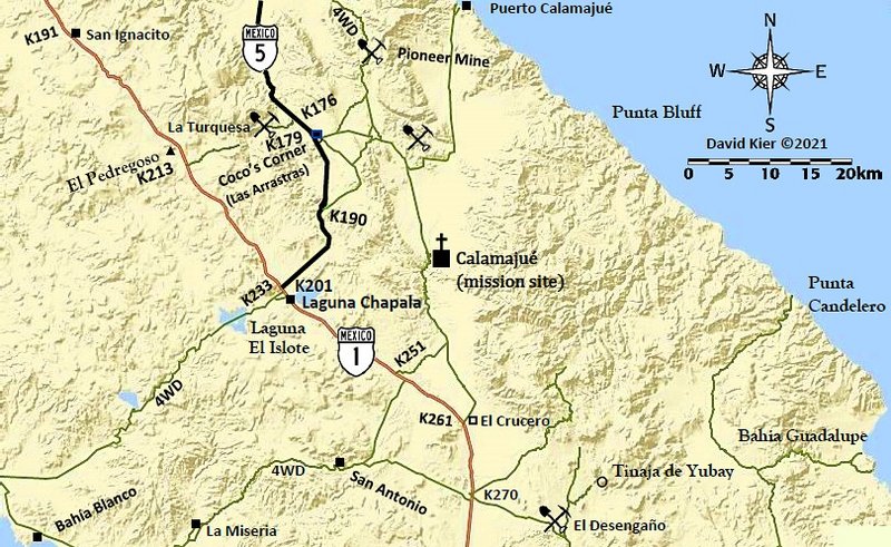
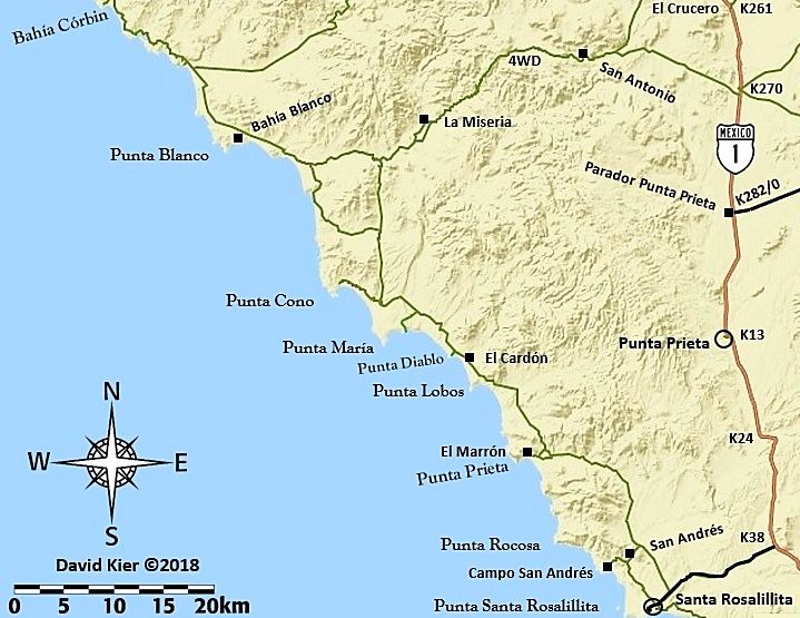
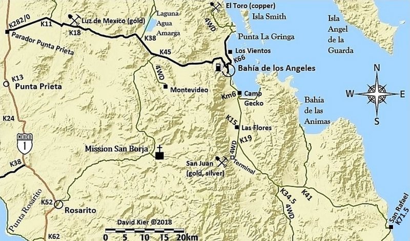
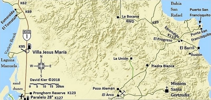
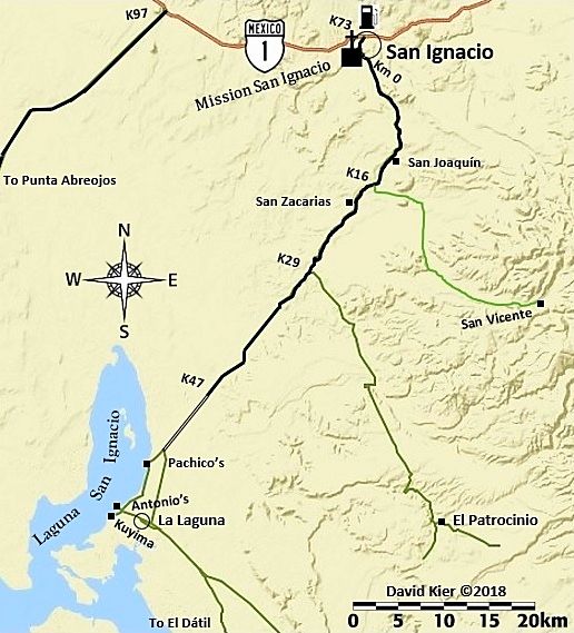
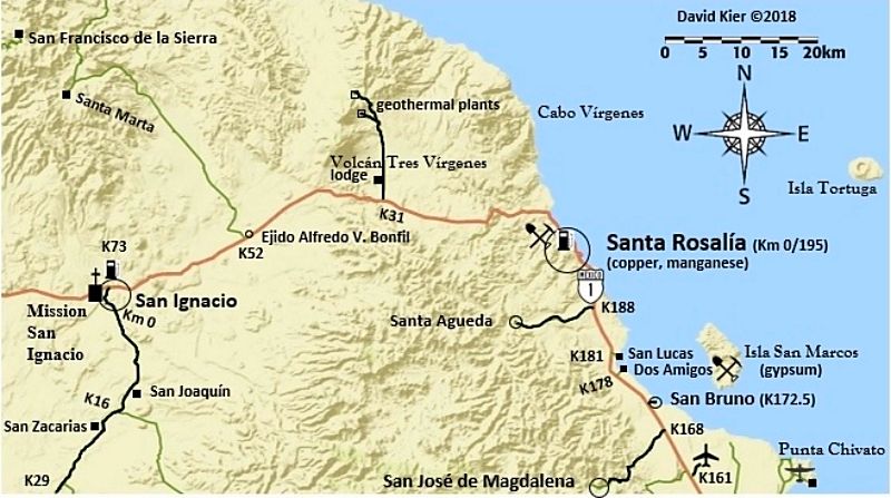
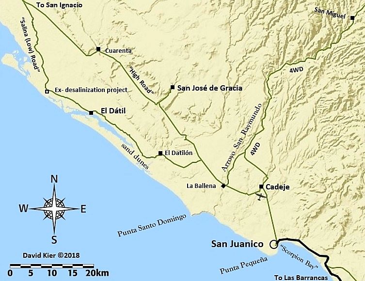
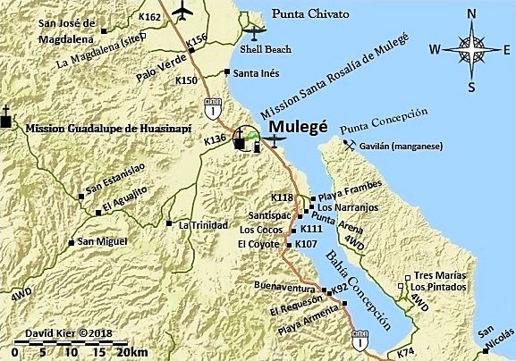
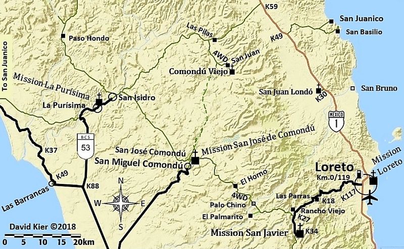
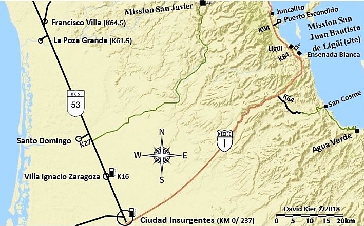
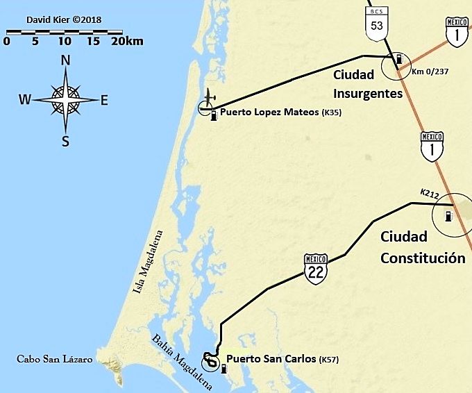
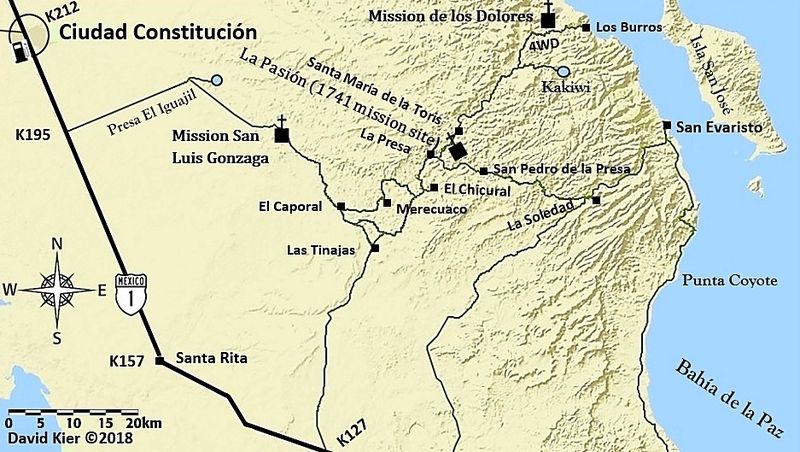
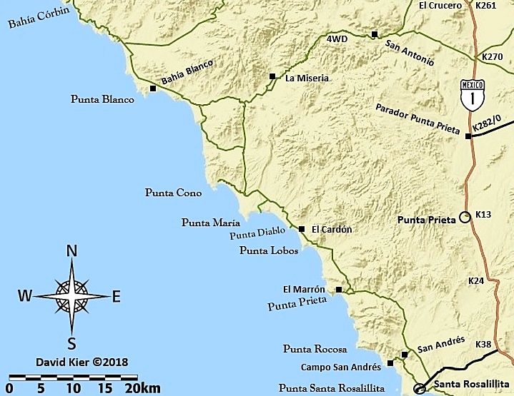
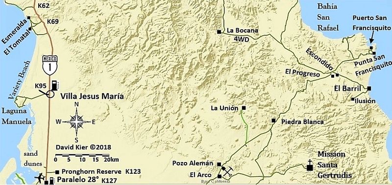
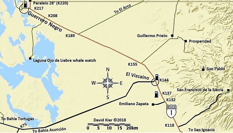
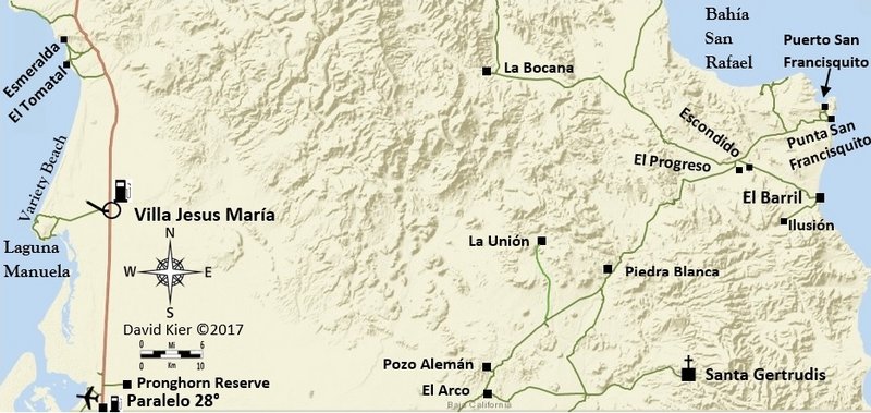
Without expensive software or professional IT assistance but great help from a couple of Baja Nomads with their knowledge and skills (John M & Taco Felix)... I produced these maps to help the reader of the Baja Bound Book orient himself/herself to the surrounding area as they are using the kilometer by kilometer or mile by mile road logs... or just to be inspired to see more of this magnificent peninsula.

The maps are all handmade using computer-aided drawing, as I have described in the other threads I posted to while making these. There is some consistency in style and use of symbols but as each map was made individually, there are some differences. My idea was to make it a casual but accurate map. One that shows only the places logged or visited in 2017 and just a few additional roads if they were mentioned in the road log. Not too much stuff that wouldn't help with using the log, which has great details in it.

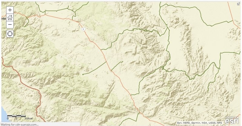
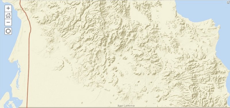
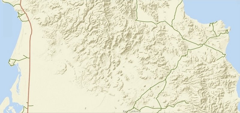
The base map is a terrain relief map based on actual satellite imagery. The base map only shows coastlines and mountains plus some of the federal highways at the scale size I am using. Other paved roads and highways on the map (drawn in black) I added. All dirt roads and many paved roads were drawn by me, tracing over satellite images so I am placing the roads I traveled accurately ... other than some jiggles from hand drawing them.

Icons for the map (highway signs, airplanes, gas pumps, mission churches, mine symbols, etc. were all created by John. Taco Felix helped with an improved compass rose and the scale bar. Squares and circles are from me using the software in Word.

The base map is from a company that has this program for exactly this kind of map making, ArcGIS. These maps are for education and enlightenment and discussion and enjoyment. They are here, free for your enjoyment. I have not been paid to make them... I made them on faith.

I will post them here from north to south, and where the peninsula is wider, from west to east. Not all areas of Baja have maps showing them. I concentrated on areas that would benefit readers the most from these maps. One map is a larger scale than the rest (Gonzaga Bay Area) and the others have been sized to fit the page/screen. So, while the rest may have all been drawn at the same scale, sizing them may have 1" being different amounts of kilometers. The scale bar is in kilometers, showing 5, 10, 15, and most cases also 20. Rounded to the nearest mile, that is 3, 6, 9, and 12 miles (3.1, 6.2, 9.3, 12.4 to be more exact).

Maybe in the future, They can be made universal and can fit together... make a wall map with them?

I have asked for your help to spot typos or corrections when I was making these, and you have, thanks. I imagine some of you will find more, and I welcome the message. Maybe u2u or email me your findings?

In the (near) future, I would like to amend these maps with mileages placed along the side roads that lack kilometer posts. This may make them even more fun to use or check out against your odometer?
With no AAA map since 2010 and no Almanac editions since 2009, a map with our favorite roads and sites in Baja seems like a great idea! If anyone wants to contact me to produce more Baja maps, I am available!

I am just in need of a break now that I reached this point!

Would you like to have me plan a trip or advise on the roads I traveled the past couple of years, maybe have me lead a tour or just buy a copy of my book on the history of the Spanish colonization of the Peninsula of California? See the link at the bottom of my posts for books.

BAJA CALIFORNIA (NORTE) Maps 1-15:

Map 1


Map 2


Map 3


Map 4


Map 5


Map 6


Map 7


Map 8


Map 9


Map 10


Map 11


Map 12


Map 13 (2021)


Map 14


Map 15


Map 16


Baja California Sur, Maps 17-31

Map 17


Map 18


Map 19


Map 20


Map 21


Map 22


Map 23


Map 24


Map 25


Map 26


Map 27


Map 28


Map 29


Map 30


Map 31


[Edited on 6-21-2021 by David K]

advrider - 1-9-2018 at 04:11 AM

Very nice, I think many will find these very useful!

Abel.Villesca - 1-9-2018 at 08:46 AM

Fantastic! Thanks David.

StuckSucks - 1-9-2018 at 09:00 AM

Thorough job!!

BajaBill74 - 1-9-2018 at 09:33 AM

You left out Santa Rosa, Ca. How do expect me to get home from Mulege?:)

chuckie - 1-9-2018 at 09:57 AM

Keen! Nicely done!

mtgoat666 - 1-9-2018 at 10:05 AM

Thanks for all the maps! Now I wont need to buy the book! :biggrin:


4x4abc - 1-9-2018 at 10:11 AM

San Jose de Garcia = San Jose de Gracia

4x4abc - 1-9-2018 at 10:14 AM

San Juaquin = San Joaquin

TacoFeliz - 1-9-2018 at 10:45 AM

Really nice job David. Two thumbs up!

Thank you.

nbentley1 - 1-9-2018 at 10:55 AM

These are great. Thanks for putting them together.

gator - 1-9-2018 at 12:01 PM

Awesome job. Must have taken a lot of work. Thanks for sharing.

MulegeAL - 1-9-2018 at 01:40 PM

Nice maps David, thank you!

Of course now that you have published them and are taking a break:

Consider extending the road from Palo Verde at K156 to the rancho San Borja, which is check-in place to the well-known cave. The local guide here is running tourists in there with a long F350 van, so how bad can it be?

Report this season is the last half is lots of arroyo rock driving.

fishbuck - 1-9-2018 at 02:13 PM

Mission historian, cartographer, photographer, offroad adventurer...
DavidK: Renansance man.
Maybe we can mount a gopro on my plane and ad photos.

rancho guillermo - 1-9-2018 at 02:24 PM

A lot of work..very nice job. I am sure also some fun was involved in doing the research.

TMW - 1-9-2018 at 02:45 PM

A job well done David, thanks.

ehall - 1-9-2018 at 02:54 PM

Nice work David.

David K - 1-9-2018 at 03:04 PM

Well, they can only get better, right? For a casual look, non-computer guy attempt, and color blind, too! Not bad, right? If printed, they would likely be in black and white... I could show what that would look like, might be cool?

Black & White

David K - 1-9-2018 at 05:01 PM

Here are a couple of B&W views of one of the maps (Gonzaga Bay Area):


Gonzaga Map B&W.jpg - 174kB


[Edited on 1-24-2018 by David K]

Mileages

David K - 1-9-2018 at 06:27 PM

OK, I took the Dolores/San Evaristo map and added mileages along roads I drove. I found that at the map scale I am using mostly, anything less than 5 miles is too small to insert a number (a number that is big enough to see). So, I combined numbers for a section of road such as both sides of the LaPasión mission site. Also, with the mountain terrain, it was very difficult to read the numbers, so I highlighted them.
I am not sure if this works or looks well???


Dolores Mileages-1.jpg - 242kB

MulegeAL - 1-9-2018 at 07:51 PM

I like it, and try display/print in black and white before you make a decision.

David K - 1-16-2018 at 12:51 PM

With Santa Rosalia and Magdalena Bay maps posted, there are now 30 maps to cover the peninsula that I have driven in 2017 researching the Road Guide.

The only missing area I think is the Sierra Juarez and Ensenada to Valle de Trinidad, in detail.

Jack Swords - 1-16-2018 at 01:17 PM

Very nice David. Are you publishing the map collection? Also are some maps able to be connected together? Again, great job!

David K - 1-16-2018 at 01:25 PM

Quote: Originally posted by Jack Swords  
Very nice David. Are you publishing the map collection? Also are some maps able to be connected together? Again, great job!


Yes, well... published right here and on Facebook, anyway!
The maps are to make my Baja Bound work even more desirable as maps always enhance a road guide. I hope the Road Guide is made available soon. I have had some great editing help from desert historian author John M and AAA Baja guidebook author Dave Brackney.

By-the-way Jack, my mission book will be going into its 5th printing soon! Sales via our publishing company (M&E BOOKS), Sunbelt, Barnes & Noble, and Amazon are still trickling in. I updated some travel details and swapped out some photos with new ones I took in 2017. Your photo of Loreto is still the best and that stays (as well as several others you took)!

bkbend - 1-16-2018 at 04:07 PM

David, sorry I didn't notice this earlier but on Map14 the mine off the Bahia de los Angeles highway is Luz de Mexico and not Lux. Here's one of the claim markers from the site.

mina luz.jpg - 246kB

Loretana - 1-16-2018 at 06:25 PM

Thank you for your hard work, David. I just color printed the route I've decided to take to Loreto this weekend. I want to avoid the horrible potholes, so I've decided to cross at Tecate and take 2D to 5 to Mex 1.

Your excellent map series is stapled together and in my pack. :D

Diane

David K - 1-17-2018 at 04:45 PM

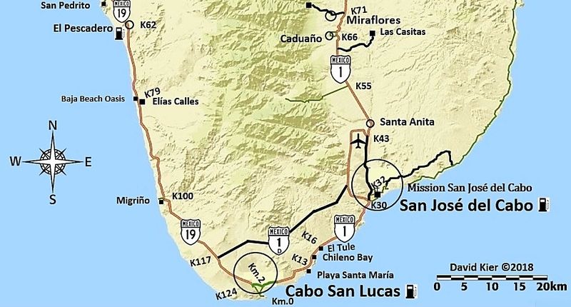
With so much discussion about gas station locations in another map thread, I have added gas pump icons to two of the maps that had none before because they were both in areas with numerous gas stations (San Quintín and Los Cabos).

The icon only is to indicate there is a gas station in that area of the icon (not necessarily on that side of the road) or in that town (if the icon is placed next to the town name).

David K - 1-19-2018 at 10:22 AM

Today's edit:
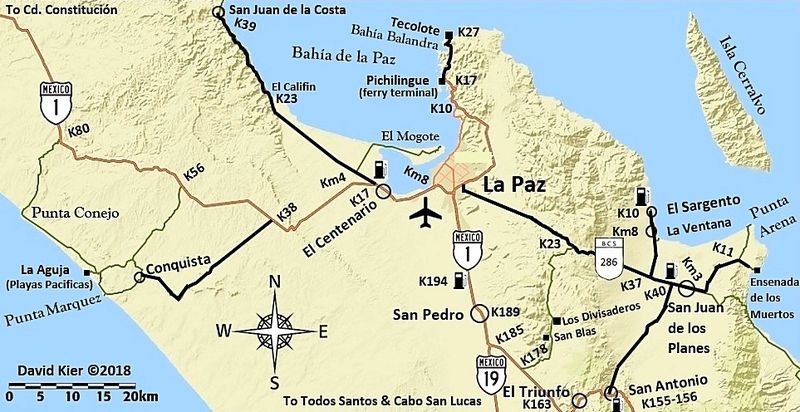
Map 28 (La Paz Area); the Pemex location north of San Pedro had a typo to fix (it is at K194, not 184) and I removed the periods following Km where I use Km (kilometer markers from 0 to 9). This matches how I did them on the maps before. Just have one at Cabo San Lucas to fix.
If you look long enough, all maps have errors! The key is taking time and having more eyes help you!!
Thank you.

David K - 1-27-2018 at 11:22 AM

The maps with mileages added along the roads shown is an idea for the future. The scale is not big enough on most of the maps to insert mileages less than about 3, however. We shall see, and I am sure you guys will provide input!

I have a couple other projects I will be doing, in the meantime.

Requests are always welcome and I may squeeze in a custom map while taking a break from the other projects.

Thank you for your interst, and Viva Baja, everyone!

oldbroncoguy - 1-29-2018 at 03:16 PM

I just found this site, and this thread in particular. I'm heading down in May with a group (13) of Vintage Broncos. We are doing on/off road down to La Paz, trying to hit as many of the missions as possible. These maps are really great as a way to validate some of my route selection. Thanks much. I can't imagine the work you've put into these!

thebajarunner - 1-30-2018 at 12:33 PM

David, love the maps!! Great service provided for us casual travelers.
My question, is the solid black line indicating paved?
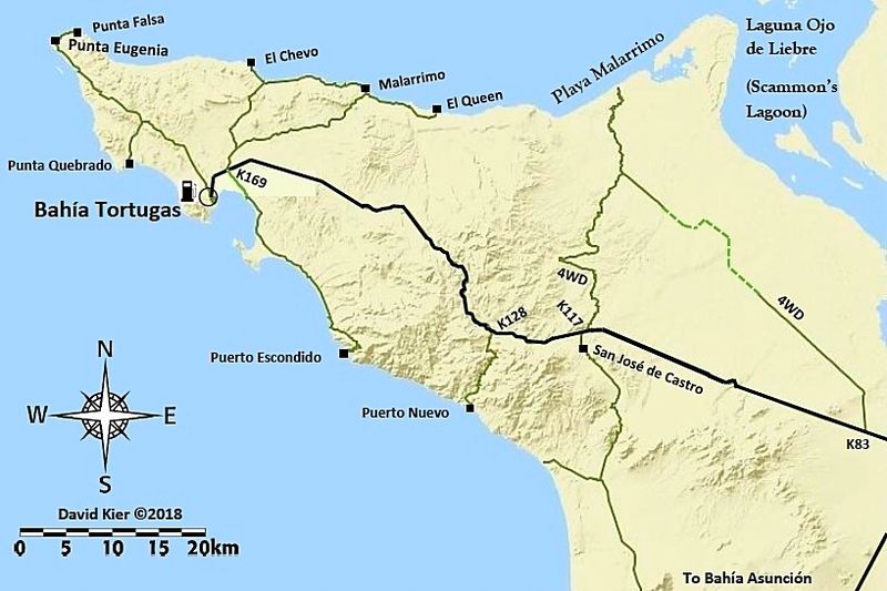
Specifically, we plan to go out to Bahia Tortugas above Asuncion in June. It looks solid most of the way with a bit of different coloration partway out.
Can we assume that this road is paved, or at least easily traveled?
Some of my guys don't always enjoy following my lead on iffy roads.

And, block out a week and join us.... we can teach each other a lot about the Baja experience.

gueribo - 3-6-2018 at 08:29 AM

Great maps. I love mileage notes along the dirt roads. Very helpful.

LancairDriver - 3-6-2018 at 08:44 AM

Great job David. These maps are much appreciated. Many possibilities in later organizing in the book.

gueribo - 3-6-2018 at 03:24 PM

I'd love to see another little guide like "Backroad Baja." The landmarks are out of date now, but those logs are really helpful.

David K - 3-6-2018 at 06:15 PM

I am making about 6 mini-guides (3 for Norte and 3 for Sur) in addition to the full guide.

It is a matter of both having maps with the guide as well as offering something specific to your travels.

The full guide was maxed-out with the hundreds of photos it has, to go with the road logs. Maps will have to be a separate file. This may be just an issue for me as a non-computer tech person?

The mini-guides can have the maps in the same file.
Baja Norte has :
1) Tijuana to San Quintin (+ Hwy. 3 and San Pedro Martir road logs).
2) Mexicali to Laguna Chapala (+ Hwy. 2; Across Baja via Valle de Trinidad; to Valle Chico/Matomí/Sulfur Mine).
3) San Quintin to Guerrero Negro (+ 'Distant Pacific' Coast Road; to L.A. Bay and Punta San Francisquito).

Baja Sur will have (this is in the works and may change):
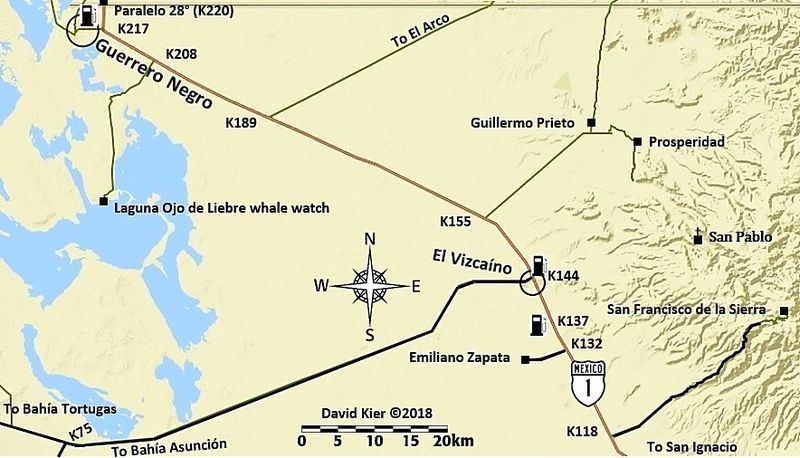
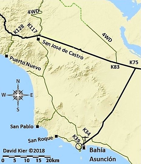
4) Guerrero Negro to San Ignacio (+ to El Arco and El Barril; Vizcaino to Tortugas area; to Abreojos and on to Asuncion; San Ignacio to San Juanico, and on to Insurgentes).
5) San Ignacio to Insurgentes (+ Mulege to Mission Guadalupe; Loreto to San Javier/Comondu/La Purisima).
6) Insurgentes to La Paz and both highways to Cabo San Lucas (+ to Lopez Mateos and Puerto San Carlos; to Mission San Luis Gonzaga, La Pasion, Los Dolores, San Evaristo; to Ensenada de los Muertos/La Ventana; to Tecolote).

Thank you for your interest and support.

gueribo - 3-6-2018 at 09:28 PM

Looking forward to it!

David K - 4-12-2018 at 10:41 AM

The six mini-guides (in addition to the full guide) are completed. However, if needed, they (and the maps) can be edited. It just takes a bit of work with the maps... but Baja is worth it!

The mini-guides are just a little different than I had envisioned earlier.

Baja Norte has :
1) Tijuana to San Quintin (+ Hwy. 3 and San Pedro Martir road logs).
2) Mexicali to Laguna Chapala (+ Hwy. 2; Across Baja via Valle de Trinidad; to Valle Chico/Matomí/Sulfur Mine).
3) San Quintin to Guerrero Negro (+ 'Distant Pacific' Coast Road; to L.A. Bay and Punta San Francisquito).

Baja Sur has:
4) Guerrero Negro to San Ignacio (+ to El Arco and El Barril; Vizcaino to Tortugas area; to Abreojos and on to Asuncion; San Ignacio to San Juanico, and on to Insurgentes, and Lopez Mateos).
5) San Ignacio to Loreto (+ Mulege to Mission Guadalupe; Loreto to San Javier/Comondu/La Purisima).
6) Loreto to La Paz and both highways to Cabo San Lucas (+ Puerto San Carlos; to Mission San Luis Gonzaga, La Pasion, Los Dolores, San Evaristo; to Ensenada de los Muertos/La Ventana; to Tecolote).

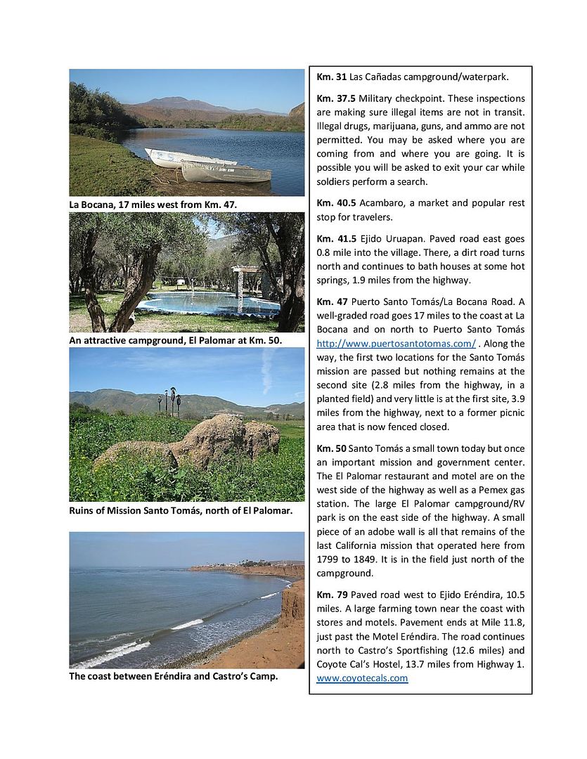
Here are a couple sample pages:

(South of Ensenada)


(South of San Felipe)


(Sideroad, south of Constitución)

fishbuck - 4-12-2018 at 12:10 PM

Hi Dave! I am back on the boardwalk in Newps.
I will travel to San Diego soon to fly my Baja plane a bit to prep for my Jun 1 BOLA trip.If you can break away from your cartography for a moment I'll stop by and by you lunch.
Speaking of my BOLA trip. Are there any adventuros BajaNomads out there who want to fly with me to BOLA.
I guarantee you a yellowtail or two and a good sunburn.
The airplane ride will be fast, interesting, and routine.
I flown in there a bunch.
We can split a nice boat. I can carry all rodes and coolers.
4 people max besides the pilot.
The are a few 30 ft pangas that can take 5 anglers easy.

TMW - 4-12-2018 at 12:31 PM

DK the guide above looks good. Lots of hard work finally paying off for an end product all can enjoy.

HeyMulegeScott - 4-12-2018 at 05:11 PM

Looks like some great info. I like the format of the guides.

David K - 4-12-2018 at 06:04 PM

Quote: Originally posted by Three2tango  
Looks like some great info. I like the format of the guides.


Thank you!
As one who has used Baja road guides since before I could drive (reading Gerhard & Gulick to my dad as we four-wheeled down the Baja roads in the 60s), I put it together in what I considered user-friendly.

*Samples of scenery along the way with the photos
*Uses the existing kilometer markers on highways to easily find points
*Uses trip-odometer on the dirt roads
*No tedious GPS data downloading
*At-a-glance orientation maps

u2u or email me if you would like to know more

fishbuck - 4-13-2018 at 09:56 AM

Quote: Originally posted by David K  
Quote: Originally posted by fishbuck  
Hi Dave! I am back on the boardwalk in Newps.
I will travel to San Diego soon to fly my Baja plane a bit to prep for my Jun 1 BOLA trip.If you can break away from your cartography for a moment I'll stop by and by you lunch.
Speaking of my BOLA trip. Are there any adventuros BajaNomads out there who want to fly with me to BOLA.
I guarantee you a yellowtail or two and a good sunburn.
The airplane ride will be fast, interesting, and routine.
I flown in there a bunch.
We can split a nice boat. I can carry all rodes and coolers.
4 people max besides the pilot.
The are a few 30 ft pangas that can take 5 anglers easy.


Sounds like fun. I will u2u you my phone number... text ok.

Yep:coolup:

4x4abc - 4-15-2018 at 02:00 AM

David,

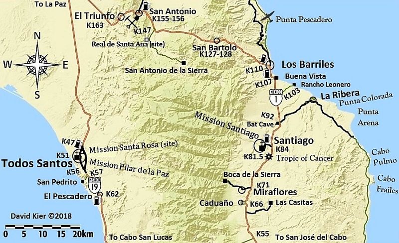
map 29 - Santo Domingo de la Sierra, not San Antonio de la Sierra

Cappy - 4-15-2018 at 05:25 AM

Thank you David

4x4abc - 4-15-2018 at 11:30 AM

check your email, David

kevin_in_idaho - 4-17-2018 at 05:47 AM

Awesome! Thanks.

pacificobob - 4-18-2018 at 04:46 PM

well done cartography.

David K - 4-19-2018 at 09:27 AM

Thank you Bob!

I will look at adding mileage figures along the dirt roads shown. I know distances of under 3 miles is hard to fit the figures into without reducing the font size, however. I will just need to play with them a bit and show you guys here for feedback.

As they are now, the maps are to be used with the road logs which have the mileages.

These are so helpful-- Thanks DK

thebajarunner - 10-8-2018 at 03:20 PM

Every time I head south (going to Cabo this weekend) I download these and print out all that might be applicable
Best maps available, by far
Thanks my friend!!

thebajarunner - 12-10-2018 at 05:09 PM

We drove it in June, your maps in hand
It was definitely paved, nice job in fact.
From Tortugas to Punta Falsa is wide graded dirt- lots of ups and downs and a few tight corners
Good road, but lots of fisherman and abalone harvesting traffic so take it easy coming over the sharp rises and around the corners.

msawin - 12-10-2018 at 10:33 PM

Awesome. Thanks for sharing..

roktaxi - 12-15-2018 at 06:52 PM

Great detail!

I didn't see the section showing below Conception Bay to Loreto. Did I miss it somehow?

David K - 12-15-2018 at 08:38 PM

Quote: Originally posted by roktaxi  
Great detail!

I didn't see the section showing below Conception Bay to Loreto. Did I miss it somehow?


Thanks.
Map 24.
There is about a 14 km. section of the highway below the previous map not included.

FinsUp - 1-17-2019 at 10:06 AM

These maps are fantastic! Amazing work, thank you.

joerover - 1-18-2019 at 06:12 PM

I dont see parque 1857 and all those roads on the map?

David K - 1-18-2019 at 06:31 PM

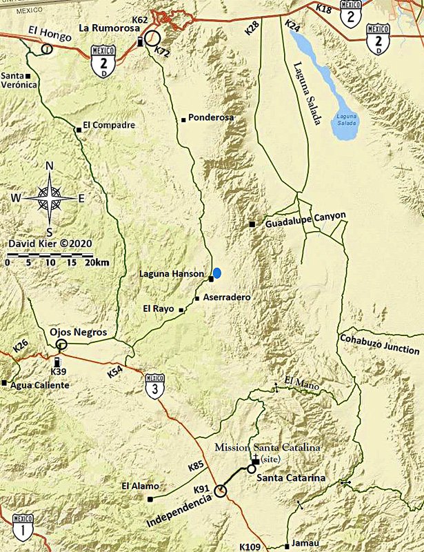
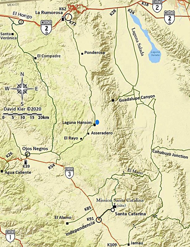
Nope, I didn't travel Parque Constitucion 1857 until last August and these maps I produced after my 2017 trips. If and when I make another to include the Laguna Hanson roads, I will add it to this page. I am just low on energy for such work at the moment... It takes a lot of work to make these maps!

David K - 4-17-2019 at 06:31 AM

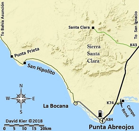
The road to La Bocana from Punta Abreojos is now paved... Map 19.

TMW - 7-9-2019 at 03:55 PM

What are the differences between 17a and 17b and 18a and 18b?

David K - 7-9-2019 at 04:15 PM

Pavement added

msulkers - 10-21-2019 at 03:12 PM

Quote: Originally posted by David K  
Nope, I didn't travel Parque Constitucion 1857 until last August and these maps I produced after my 2017 trips. If and when I make another to include the Laguna Hanson roads, I will add it to this page. I am just low on energy for such work at the moment... It takes a lot of work to make these maps!


We travelled this route, from La Rumarosa to Rancho la Ponderosa and then south to Laguna Hanson and then Ojos Negros from October 15-17th, 2019. Road to Rancho la Ponderosa is good 2wd; the rancho is no longer open, but makes a good camp spot. The road from RLP south is generally good 2WD, but when one comes to an obvious three way "Y", the centre route is signed as the route to Rancho El Topo and Parque Nacional Constitucion 1857.

This is not the most direct route, and involves a higher clearance, narrow alternative with some water damage that brings one out to Rancho El Topo. At RET, we turned east to gain the original left fork and continued on good 2WD to Laguna Hanson. We did not encounter a single vehicle in over 70km of backroad...

The park was deserted, but relatively well maintained. The parqueguardes didn't have annual passes available and no longer sell one night passes, so we had to pay for three days (250$M) to stay for one night. There is water available at the parqueguarde camp, but it must be boiled...

Road out to Ojos Negros was solid, sporty washboard and took more than an hour in our loaded truck.

Can't wait for your guidebook, David K!

David K - 10-21-2019 at 03:34 PM

Quote: Originally posted by msulkers  
Quote: Originally posted by David K  
Nope, I didn't travel Parque Constitucion 1857 until last August and these maps I produced after my 2017 trips. If and when I make another to include the Laguna Hanson roads, I will add it to this page. I am just low on energy for such work at the moment... It takes a lot of work to make these maps!


We travelled this route, from La Rumarosa to Rancho la Ponderosa and then south to Laguna Hanson and then Ojos Negros from October 15-17th, 2019. Road to Rancho la Ponderosa is good 2wd; the rancho is no longer open, but makes a good camp spot. The road from RLP south is generally good 2WD, but when one comes to an obvious three way "Y", the centre route is signed as the route to Rancho El Topo and Parque Nacional Constitucion 1857.

This is not the most direct route, and involves a higher clearance, narrow alternative with some water damage that brings one out to Rancho El Topo. At RET, we turned east to gain the original left fork and continued on good 2WD to Laguna Hanson. We did not encounter a single vehicle in over 70km of backroad...

The park was deserted, but relatively well maintained. The parqueguardes didn't have annual passes available and no longer sell one night passes, so we had to pay for three days (250$M) to stay for one night. There is water available at the parqueguarde camp, but it must be boiled...

Road out to Ojos Negros was solid, sporty washboard and took more than an hour in our loaded truck.

Can't wait for your guidebook, David K!


Thanks... that belongs in a trip report here!

I traveled the main Laguna Hanson road from Hwy. 3 to Hwy. 2/ La Rumorosa in August 2018. This was after I made my 30 maps and I didn't know I was going to be able to get Laguna Hanson into the road guide before that trip... so no map was created for the Sierra Juarez.

Here is my road log:

Mile 0.0 Highway 3 (Km. 54.5)

Mile 2.7 Fork left.

Mile 3.8 Fork right.

Mile 4.8 Oak trees.

Mile 5.2 Fork left. Elev. 4,000’.

Mile 11.2 Pine trees begin. Elev. 5,000’.

Mile 13.7 Rancho El Rayo.

Mile 15.1 Road southeast to Rancho La Botella. Cattle Guard crossing.

Mile 16.2 Aserradero an abandoned sawmill town with some tourist services. Food.

Mile 17.5 Cabins, market, food.

Mile 19.8 Laguna Hanson: park headquarters, cabins, daily use fee 64 pesos. Elev. 5,300’.

Road heads north passing by the lake which is shallow and often empty.
Mile 20.5 A Kilometer 60 sign facing north.

Mile 22.1 Road east to Rancho San Luis.

Mile 24.6 Rodeo del Rey, an abandoned hotel.

Mile 25.0 Road west to Rancho Bajío Largo.

Mile 35.6 Road west to Rancho El Topo.

Mile 40.4 Former mining area of La Milla.

Mile 41.4 Road northwest to El Condor. Elev. 4,900’

Mile 42.7 Road junction southwest from Las Margaritas.

Mile 45.6 Rancho Ponderosa road east. Tourist services offered.

Mile 48.7 Rancho Nuevo road east.

Mile 53.1 Inspection station.

Mile 55.1 Blacktop paved road.

Mile 55.4 Parques Los Potrillos and El Tesoro campgrounds.

Mile 57.5 Highway #2 (Km. 72), La Rumorosa. Mexicali is east and Tecate is west. The toll highway, Mexico 2-D can be accessed by turned west for a short distance on Highway #2.


I have photos to go with the road log. You can see them in the Trip Reports section in TRIP #8.

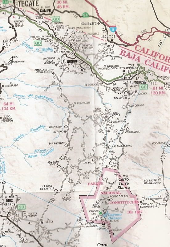
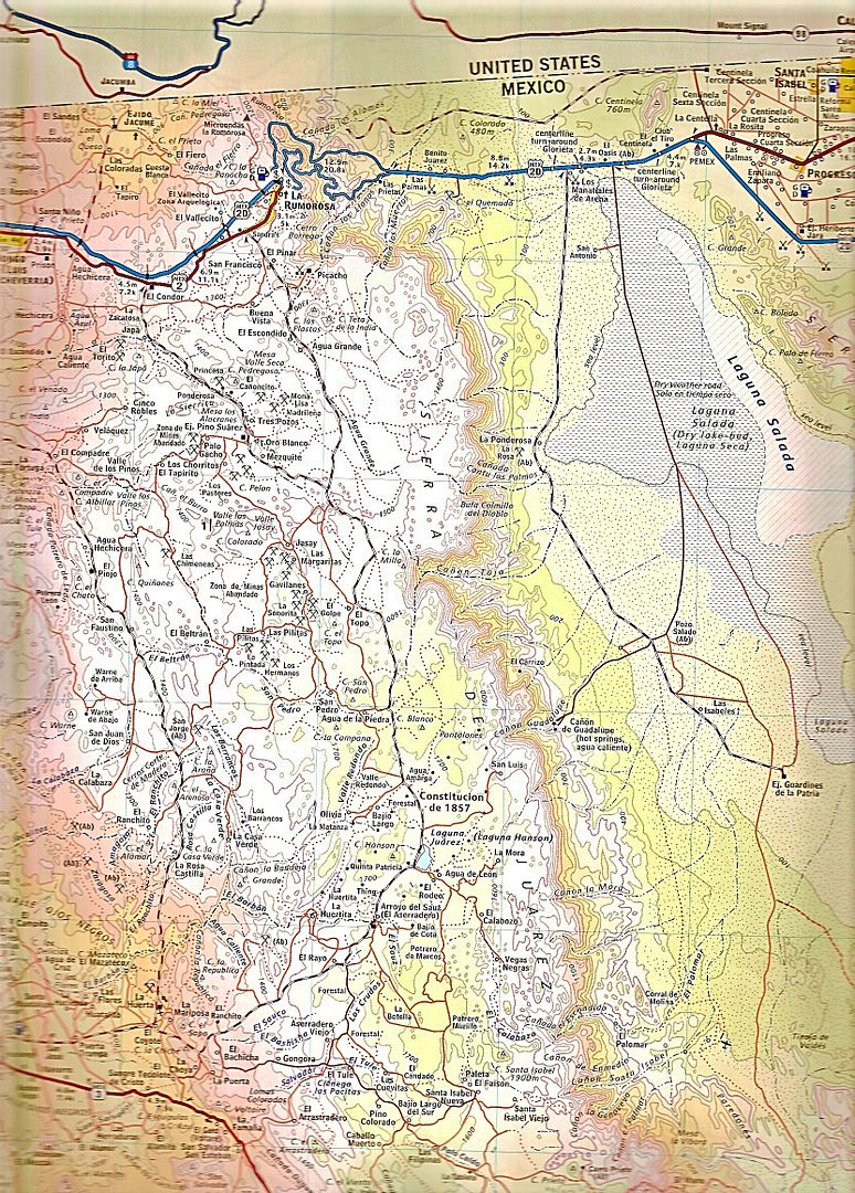
Here are AAA and Baja Almanac maps covering that road:


New:


[Edited on 11-23-2020 by David K]

msulkers - 10-21-2019 at 07:57 PM

Perfect! On the AAA map, just south of Rancho la Ponderosa, the three way "Y" is indicated. From Las Margaritas to Rancho El Topo, the middle road is single width and has some water damage. There would be passing points in some of the arroyos.

Faster route would be the more easterly option, but the middle one was very scenic...

David K - 10-22-2019 at 09:12 AM

Quote: Originally posted by msulkers  
Perfect! On the AAA map, just south of Rancho la Ponderosa, the three way "Y" is indicated. From Las Margaritas to Rancho El Topo, the middle road is single width and has some water damage. There would be passing points in some of the arroyos.

Faster route would be the more easterly option, but the middle one was very scenic...


For fun, let's compare my mileage figures with AAA (in bold), at the same points (or close)... Naturally, since AAA did their mapping nearly 20 years ago, the road could have been realigned with new grading.

Mile 0.0 Highway 3 (Km. 54.5)

Mile 2.7 2.9 Fork left.

Mile 3.8 4.1 Fork right.

Mile 13.7 13.7 Rancho El Rayo.

Mile 19.8 20.4 Laguna Hanson: park headquarters, cabins, daily use fee 64 pesos. Elev. 5,300’.

Mile 22.1 22.5 Road east to Rancho San Luis.

Mile 25.0 25.4 Road west to Rancho Bajío Largo.

Mile 35.6 35.9 Road west to Rancho El Topo.

Mile 42.7 43.1 Road junction southwest from Las Margaritas.

Mile 45.6 45.9 Rancho Ponderosa road east. Tourist services offered.

Mile 57.5 57.9 Highway #2 (Km. 72), La Rumorosa. Mexicali is east and Tecate is west. The toll highway, Mexico 2-D can be accessed by turned west for a short distance on Highway #2.

Not bad... mostly I was the same to .4 of AAA. Laguna Hanson point for me was the entrance gate and for AAA looks to be a road junction just past so maybe why .6 difference there?


[Edited on 10-22-2019 by David K]

ehall - 1-10-2020 at 10:07 AM

Bump to the top for 2020. Thanks again DK , this makes for easy trip planning.

Barry A. - 1-10-2020 at 10:23 AM

This is really great, David. Probably because you have not explored the area yet, I did notice that a map of the east coast south of El Barril down to Santa Rosalia appears to be missing. Some incredible country and coast along that stretch, and there are rudimentary "roads" accessing much of it. That area has been hit with devastating flash-floods which have altered or destroyed many of the previous roads in this area.

Ken Cooke - 1-10-2020 at 10:37 AM

Will these maps be published? I saw me too of a Baja Bound Map? Is this the title of a book?

David K - 1-10-2020 at 11:14 AM

Quote: Originally posted by Barry A.  
This is really great, David. Probably because you have not explored the area yet, I did notice that a map of the east coast south of El Barril down to Santa Rosalia appears to be missing. Some incredible country and coast along that stretch, and there are rudimentary "roads" accessing much of it. That area has been hit with devastating flash-floods which have altered or destroyed many of the previous roads in this area.


Thanks for the nice words, Barry and Ed!

I made maps to show the area of Baja I was doing road logs of in 2017 for Baja Bound's future road guide. There are areas without roads or roads I hadn't drove, so no map of those parts of Baja. South of El Barril being one of those areas. The other major area I did not make a map of, but had started to, was the Sierra Juarez (Laguna Hanson region).

I was going to cover that area on my October 2017 trip (Trip #7) but I had a brake fail going to Mike's Sky Rancho from El Coyote, so I needed to turn around. I was able to get back to cover Laguna Hanson roads in August of 2018 (Trip #8), but the map making did not get done with one more to cover that area... It is VERY hard work and I didn't have any more energy.

The map making for the guide I did on my own, it was not requested and I was not being paid to make them.. I just thought the guide would work better with the visual aid of maps. I first looked for maps already made I could use or edit but the ones from Google and other sources all had BAD information on them I couldn't get rid of, such as wrong names for towns or highways. I had to make a map from scratch with just a satellite or terrain base map.

I found one that only had the major federal highways and nothing much else. I then drew in all the dirt roads by switching to satellite view and drawing a line over them then going back to the terrain map to save. I also had to add symbols for highways, airports, gas stations, mines, etc. John M helped a lot with these symbols for me! Lots of work... but I am glad I did them!

Maybe before the first edition of the new guide is published, I will make the Sierra Juarez map?


Quote: Originally posted by Ken Cooke  
Will these maps be published? I saw me too of a Baja Bound Map? Is this the title of a book?


*) Yes, the release date is by this summer, the maps will likely be in the book.
*) I don't understand: "me too of a Baja Bound Map"?
*) The book may be called the 'Baja Bound Road Guide' but that is not set in stone.

Ken Cooke - 1-11-2020 at 10:25 AM

Thanks for answering my questions. One of which I did not ask correctly due to auto correction having it's own input.:light:

This will be helpful as Baja has gone through some changes since the days of the Baja Almanac. I also prefer a printed, non-virtual medium as a counterpart to the ubiquitous Gaia that I hope to one day also run alongside my Android apps.

David K - 4-15-2020 at 04:47 PM

When we can't drive Baja, then looking at maps of Baja can help with virtual travel!

MontyF - 4-15-2020 at 05:37 PM

thank you David for all the work and enthusiasm you have committed.
I know I will use these maps in the future and would definitely be interested in a published version.


David K - 4-15-2020 at 05:56 PM

Quote: Originally posted by MontyF  
thank you David for all the work and enthusiasm you have committed.
I know I will use these maps in the future and would definitely be interested in a published version.


Very kind of you to say so! Welcome to Baja Nomad, too.
The publishing of them was to take place for release this summer...
Alas, no doubt that the Coronavirus will delay that...


[Edited on 4-16-2020 by David K]

4x4abc - 4-15-2020 at 06:02 PM

do it every day
keep finding great stuff

found the Enterprise

Enterprise.jpg - 181kB

Attachment: MESA ENTERPRISE.kmz (814B)
This file has been downloaded 323 times

David K - 5-21-2020 at 04:41 PM

Just a heads-up.
Photobucket (where most of my maps and images are hosted for forum posting) is being difficult (again) and these maps and other images may vanish temporarily...

I have been using lately, www.PostImages.org as a very easy way to share photos and maps, resized to 800 pixels, to fit on Nomad without stretching the page sideways. I will put the maps back up using that service, if needed.

I was being prepared for a Photobucket meltdown but my images have been ok even when other Nomads have lost theirs or experienced blurred/ watermarked additions.

Sadly, even PostImages.org added a pay level to maintain sharpest quality that used to be standard for free. Nothing stays the same, as they say!

My 31 Baja Maps hosted on PostImages.org

David K - 5-21-2020 at 05:06 PM

Map 1


Map 2 (new)


Map 3


Map 4


Map 5


Map 6


Map 7


Map 8


Map 9


Map 10


Map 11


Map 12


Map 13


Map 13-A (kilometer markers added)


Map 14


Map 15


Map 16


Map 17


Map 18


Map 19


Map 20


Map 21


Map 22


Map 23


Map 24


Map 25


Map 26


Map 27


Map 28


Map 29


Map 30


Map 31


[Edited on 12-1-2020 by David K]

[Edited on 1-28-2021 by David K]

David K - 11-9-2020 at 06:27 PM

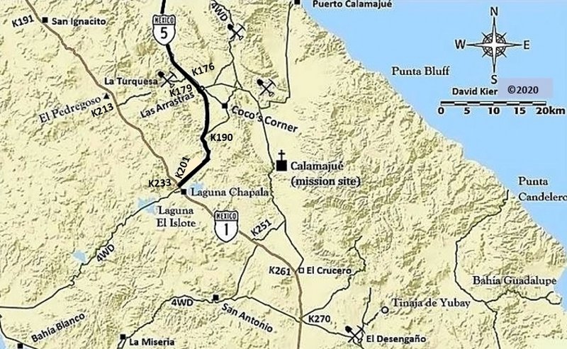
Baja Nomads are welcome to copy my 2018 maps for your private use. I welcome updates you find. I know that the road between Punta Abreojos and La Bocana is now paved. I have edited Hwy. 5 to show the paving being completed earlier this year.
The possible Kilometer note additions on the newest Hwy. 5 paving:
K176 La Turquesa Mine Rd.
K180 Las Arrastras (bridge)
K190 just south of the south (old) road to Coco's
K201 End of Hwy. 5 at Hwy. 1

geoffff - 11-12-2020 at 12:19 AM

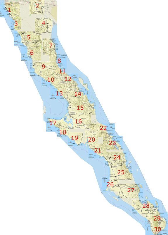
I love your maps, David! I decided I want to print them as a big wall map so I can highlight where I've been and see where I need to explore.

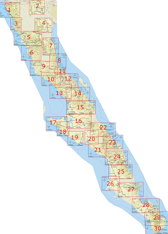
Here is a combo map I stitched together with all 30 of your maps, as well as an index with your map numbers. Click for big versions.


David K - 11-12-2020 at 08:39 AM

WOW!!! :bounce::light::biggrin:

Thanks, so cool!

Mr. Bills - 11-12-2020 at 09:03 AM

So cool in fact that I'd love a copy of the files if available.

I tried "stitching" David's maps together and failed miserably.

David K - 11-12-2020 at 11:35 AM

Indeed a lot of work from Geoff!

The problem with stitching the maps together is that each map was made to show a certain region, independently... While the scale is the same for several, some were more detailed (larger scale) such as around Gonzaga Bay. To match up with the smaller scale maps, the larger ones needed to shrink in size. That is why the text at Gonzaga Bay is so reduced compared to the other maps.

I was going to produce the map for the Sierra Juárez (Laguna Hanson roads)... but I just got exhausted and took a break. Now, unless I find the base map I started, my map source (Arc GIS) no longer offers the same base map!

mtgoat666 - 11-12-2020 at 11:44 AM

Quote: Originally posted by David K  
Indeed a lot of work from Geoff!

The problem with stitching the maps together is that each map was made to show a certain region, independently... While the scale is the same for several, some were more detailed (larger scale) such as around Gonzaga Bay. To match up with the smaller scale maps, the larger ones needed to shrink in size. That is why the text at Gonzaga Bay is so reduced compared to the other maps.

I was going to produce the map for the Sierra Juárez (Laguna Hanson roads)... but I just got exhausted and took a break. Now, unless I find the base map I started, my map source (Arc GIS) no longer offers the same base map!


Your maps are in arcgis, so just reformat, add new base layer, and print full penninsula map.

David K - 11-12-2020 at 12:15 PM

The base layer I originally used is no longer offered. The remaining base maps are all full of place names that don't compute and/or don't show topography as well. I am very fussy when it comes to maps!

PS I am working on a new Baja map book for another publisher, so be happy that a replacement for the Baja Almanac or something similar is in the works!

geoffff - 11-12-2020 at 01:10 PM

Quote: Originally posted by Mr. Bills  
So cool in fact that I'd love a copy of the files if available.

I tried "stitching" David's maps together and failed miserably.


Hi Mr Bills, if you click on the image I posted, you'll get redirected to the large-size image. Here is the URL in any case: http://octopup.org/img/misc/forums/bajanomad/maps/o/Baja--Da...

If you are interested in my Photoshop file, I can send you that directly.

It wasn't too much work for me. I've gotten fast at this. It took me about 1-2 minutes per map - so about an hour total.


Mr. Bills - 11-12-2020 at 01:21 PM

Thanks, the resolution is better now.

No need for the Photoshop file. I wouldn't know what to do with it.

Do you have a url for the image with the map numbers?

I think I might like to blow it up to 11 x14, laminate it, and tape it to the wall of my van so I can visualize my next adventure.

Assuming Covid-19 lets me have a next adventure.

geoffff - 11-12-2020 at 04:17 PM

Quote: Originally posted by Mr. Bills  

Do you have a url for the image with the map numbers?


This is the large image with page numbers: http://octopup.org/img/misc/forums/bajanomad/maps/o/Baja--Da...

And here is a version I tried with boxes around the maps too (Generated with OziExplorer), but the boxes didn't turn out perfect: http://octopup.org/img/misc/forums/bajanomad/maps/o/Baja--Da...


geoffff - 11-12-2020 at 04:30 PM

Quote: Originally posted by David K  
The base layer I originally used is no longer offered. The remaining base maps are all full of place names that don't compute and/or don't show topography as well. I am very fussy when it comes to maps!

Yeah that sucks that they pulled the rug out from under you. ...

World Ocean Base doesn't have any words, and could probably be tweaked to look almost like your maps with some color adjustments in Photoshop: http://www.arcgis.com/home/webmap/viewer.html?url=http%3A%2F...

And there's their National Geographic layer - but some words would need removing: http://www.arcgis.com/home/webmap/viewer.html?url=http%3A%2F...

But long term, Open Street Maps with a hillshading overlay might be the way to go. You can get OSM maps rendered any way you like (no words).

[Edited on 11-12-2020 by geoffff]

Mr. Bills - 11-12-2020 at 05:03 PM

Thanks for the links. The version with the boxes looks perfect to me.

Geoff, any hope here...?

David K - 11-12-2020 at 05:36 PM

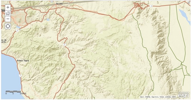
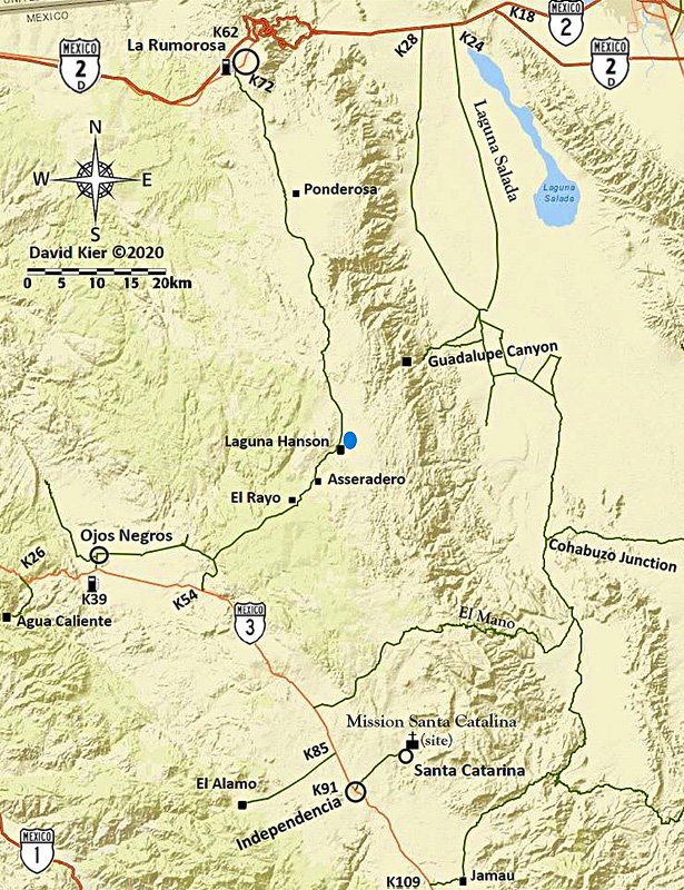
So, I found the two maps I had captured to make the Sierra Juárez/ Laguna Hanson regional map. This was the one map that is missing from my series to cover the majority of roads.

Looks like I began working on them by adding the main dirt roads.
Two captures, labeled Sierra Juárez and Hwy. 3...


With just these saved images can I wonder if make the set complete? I used ArcGIS to draw in dirt roads by flipping to satellite image and back to the base map. Maybe I have enough dirt roads?

I use Word to add place names and symbols.

==============================================================================
Here are some of the steps I made to create a map with editing out and adding to, using the El Arco map:

This is what I start with, only Hwy. 1 is shown, few or no names:


Using satellite image flipping to and drawing over, I add dirt roads I want to include.


Pasting onto a Word page, I add names and symbols...


I then changed the kilometer scale and added Hwy. 1 logos, gas pumps, airplanes, mine symbols, mission symbols, etc. I also enhanced the image color with a feature on Photobucket, (that is no longer the same)!

Tah dah...


geoffff - 11-14-2020 at 05:31 PM

For those who were wondering, David and I found a way to get back access to the base layer maps he was using.

First draft 2020 Map #31 Sierra Juárez Region

David K - 11-20-2020 at 02:19 PM

Well, blowing the dust off my map work station and with support from geoffff for his knowledge of getting back a layer that had been removed from the ArcGIS menu, I just been working the past 6 hours and think I may close...
Now, geoffff can enhance the image from this so it will resemble the other 30 maps.

Pre-enhancing version for your viewing entertainment!:


Enhanced by geoffff:


[Edited on 6-21-2021 by David K]

PaulW - 11-21-2020 at 07:02 AM

David, you need to mark a lock gate between Jamau and the junction of the old poll line track. The only access is for races, and then for that limited time.

And for Mano there are two gates at a ranch, but most of the time they are unlocked. I suggest just showing "gate".

[Edited on 11-21-2020 by PaulW]

David K - 11-21-2020 at 09:25 AM

Quote: Originally posted by PaulW  
David, you need to mark a lock gate between Jamau and the junction of the old poll line track. The only access is for races, and then for that limited time.

And for Mano there are two gates at a ranch, but most of the time they are unlocked. I suggest just showing "gate".

[Edited on 11-21-2020 by PaulW]


Thank you Paul...
The maps reflect roads I have traveled or that I mentioned in the guide to give guide users some orientation as to where these roads are in relation to where they are.
The Pole line road gate was driven around on our 2015 trip after you or someone reported a go around, which is the line. I fear gates will continue to be an issue preventing enjoyment of vast open lands and corralling people into tourist area, which is not healthy with Covid!
Since I elected to not include road logs for the dirt roads with gates you mentioned, I am not sure if adding them is needed?
Do you have the GPS for gates you think should be included? Maybe geoffff can help me add them?

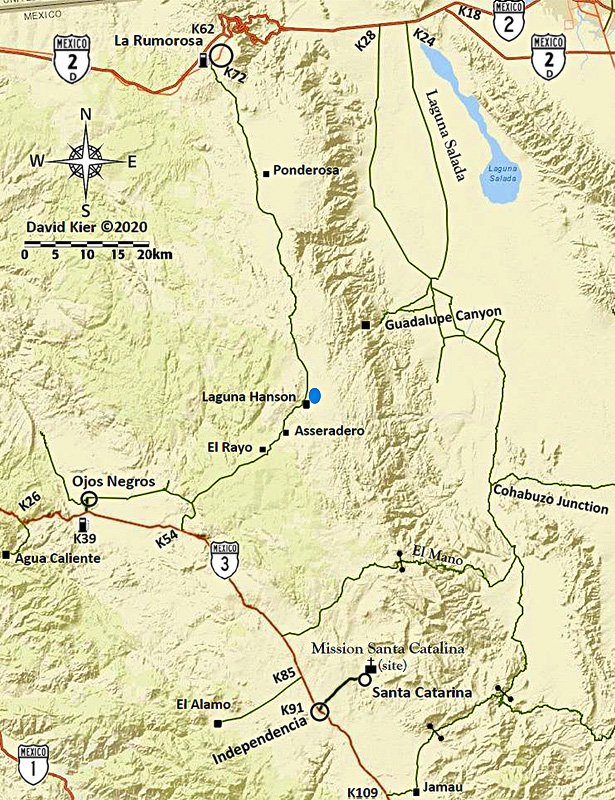
Here is the enhanced map from geoffff... I may try and improve the line for Hwy. 3 :


PaulW - 11-21-2020 at 10:46 AM

Gates:
Mano: Two corral gates at Ranch. Locked years back. Now open.
31 49.249, -115 45.293 per GPS
Pole L R Locked gate:
31 37.7877, -115 35.154 per GPS
Pole L R Lock gate bypass: Cable, not passable
31 37.75, -115 35.19 Nearby on that track
Pole L R Fence gate:
31 38.099, -115 34.94 per GPS
Race Summit road gate: Forgot to make WP and I will not drive there because I cannot turn around due to big drop off.
31 35, -115 42 is close

David K - 11-21-2020 at 12:48 PM

Thanks Paul... Geoffff is working on it now... I am not home currently.

mtgoat666 - 11-21-2020 at 02:25 PM

Quote: Originally posted by PaulW  
David, you need to mark a lock gate between Jamau and the junction of the old poll line track. The only access is for races, and then for that limited time.

And for Mano there are two gates at a ranch, but most of the time they are unlocked. I suggest just showing "gate".

[Edited on 11-21-2020 by PaulW]


re gated private roads, suggest deleting the roads, as they are not public routes.

mapping convention for these types of maps is to show only public routes.

David K - 11-21-2020 at 02:30 PM

Most gates are to control cattle movement not people movement.

David K - 11-21-2020 at 05:05 PM


Gate symbols added plus Highway 3 darkened, etc.
Thanks Geoffff.

NOMADS: Feedback on the gates (Paul?)... please.

Paul, should the gate shown at the bottom of the Summit grade be on the road heading to Pole Line Road area rather than be on the road heading to Cohabuzo Jcn.?
In 2015, there was a cattle gate we went through nearing the bottom of the summit as we were driving south from Cohabuzo Jcn. then the impassable iron gate on the Pole Line Road at Arroyo Saiz requiring that detour.

Thanks!

PaulW - 11-22-2020 at 07:25 AM

Quote: Originally posted by David K  


Gate symbols added plus Highway 3 darkened, etc.
Thanks Geoffff.

NOMADS: Feedback on the gates (Paul?)... please.

Paul, should the gate shown at the bottom of the Summit grade be on the road heading to Pole Line Road area rather than be on the road heading to Cohabuzo Jcn.?
In 2015, there was a cattle gate we went through nearing the bottom of the summit as we were driving south from Cohabuzo Jcn. then the impassable iron gate on the Pole Line Road at Arroyo Saiz requiring that detour.

Thanks!

=== =
* Suggest moving the Iron PLR gate as shown in red
* Forget about the cable due to lack of detail in that area
* The cattle fence gate closer to Mano Jct is part of a fence line shown in red. In fact one has to pass thru two more fence gates along the ranchers fence line when driving from Mano Jct up the toward the summit. The coords for the fence gate is where we pass thru to head N/S to access Enmedio or Saiz the then to PLR.
* Is it possible to make the Mnao gate dashed or shaded to indicate it may be open as opposed to locked? Same comment about the fence gate just S of Mano Jct.

Regarding the Mano trail the common track passes thru Indepencia and past the mission to the track you show. I have not driven Mano from Hwy3 as you depict

1DK Map.jpg - 208kB

David K - 11-22-2020 at 08:50 AM

Hi Paul,
Thank you for your comments!
Yes, you show where the iron gate at the beginning of the original Pole Line Road run should be shown. I emailed geoffff to look and move the gate symbol.

I don't think the Mano area cable gates need to be added and as I said before, this map is really for orientation while using the Baja Bound Road Guide. I mention the Pole Line Road and the Guadalupe Canyon road but not the Mano Canyon road or the route I drove from Hwy. 3 to Mano that you correctly say isn't the common road used.

I wanted folks to see there were routes over the mountain (that I personally drove) and to have a little more on the map.

The route I show from Hwy. 3 to Mano is one I drove in June 2003 after watching the Baja 500 near Hwy. 3 (Rancho Agua Blanca area). My son and I were going on to meet with Ken Cooke and his Jeep posse in Guadalupe Canyon Hot Springs and I took the shortest route (some of it was the Baja 500 course that year).

It was an easy drive for us in my 2001 Tacoma, and no gates anywhere to open on the road, but midway down Mano, where AAA maps showed a locked gate, there was the posts and concrete but no closed or locked gate.

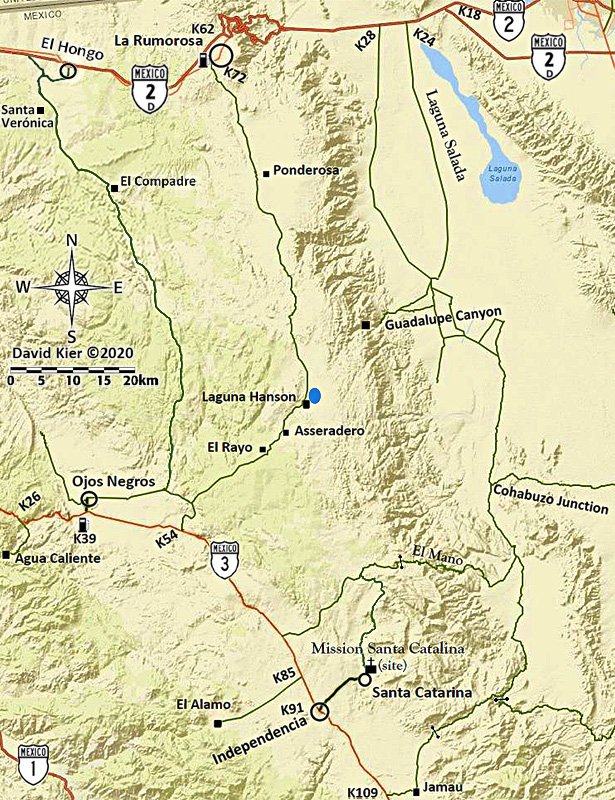
Sierra Juárez Map (final edit)

David K - 11-23-2020 at 08:14 AM

With many thanks to geoffff... now featuring gates, the common way to Mano from Santa Catalina mission, and the "Compadre Trail"...


I will also renumber the maps so they make a logical key map. The newest map will be map 2, between 1 (Tijuana-Tecate) and 3 (Mexicali), rather than Map 31.

[Edited on 11-23-2020 by David K]

PaulW - 11-23-2020 at 08:28 AM

Good job. I like the map now.
Having made further review of the Mano track I just realized I forgot about the Los Pinos gate. I do not think it was ever locked or closed.
For completeness here are the details
Los Pinos Ranch: 31 48.776, -115 46.326
Los Pinos Gate: 31 48.768, -115 46.448
Both from My GPS track
All the other ranches along/near the Mano track are on side roads and were not located on my tracks.

 Pages:  1