BajaNomad

Serra's 1769 Diary: San Borja to Velicatá (San Fernando) & San Fernando Petroglyphs

David K - 3-30-2018 at 03:00 PM

During the expedition from Loreto to San Diego, Junípero Serra detailed his daily activities. With the recent trip report by Emerson on Mission Santa María, I thought this earlier trip report may be of interest! That there was regular mail delivery along Baja's El Camino Real as far north as Santa María is impressive as well the distance covered each day. They often began to travel well before sunrise.
{Modern name in brackets}

On the first day of May, in the evening, I set forth from the Mission
of San Borja, and arrived at the place called "the Beginning." {El Principio} There, night having already come on, I received mail, which on account of the inconvenience of the place and the hour, was returned without reply, simply as a sign of having fulfilled its commission.

On the 2nd I got from the foregoing place to that of Juvay {Yubay}, and from there I did not sally, because I had arrived tired, altho' there was time to have walked a little in the evening.

On the 3rd I arrived at the old Mission of Calomofue {Calamajué}, where I tarried all the evening and celebrated Mass the following day with the ornaments I had already asked of the Mission of Santa Maria.

On the 4th, which was the day of the Ascension of the Lord to the
Heavens, I celebrated Mass in that deserted Church, a ruinous/anz/ [hut of palisades], and employed the rest of the morning in answering all the back letters: and the mail set forth a little after midday for the Mission of San Borja. I set forth from this spot, and arrived at that of San Francisco {San Francisquito, a waterhole just downstream/ north of Las Arrastras}.

On the 5th I rose good and early, and by a most grievous road, which
they call [that of] the Caxon {Cajon},* arrived at about half-past eight of the morning at the Mission of Santa Maria de los Angeles. Here I encountered the Senior Governor with the Father Fray Miguel de la Campa; and part of the Retinue had already gone on ahead to Vila Catha [Velicatá], for the recuperation of the beasts, which there had grass that they lacked here. We were mutually glad to see ourselves already joined to begin anew our peregrination through a desert land populated only with Infidelity, with innumerable Gentiles.
* Cajon, a great box; a " box-canyon.

On the 6th, while they should bring from the beach of San Luis Gonzaga
the cargo of Maize and other provisions which had arrived there on the
Canoe "San Xavier" for this expedition—in which [bringing] some 4
days were spent—and finish the fixing of the Aparejos and harness for the
beasts of burden—the Father Campa, the Senor Governor and I, accompanied by the Soldier Salgado, the escort of that Mission, examined its watering places and arable lands, estimated the conveniences it offered in its vicinity for pasture and watering-places for beasts, and the other matters a Mission needs. And it did not seem to us so bad as they had
very differently painted it to us. So that though I had before been entirely
inclined that the Mission should be moved from there on account of what
they had reported to me concerning it, now that I saw it I remained firmly
addicted to the spot and to the contrary opinion. And thus I wrote it to
the Most Illustrious Inspector-General, and to the Father-Reader Palou
who had to administer it as President of the Missions who had to remain
in my absence.

On the 7th, which was Sunday, I said High Mass and preached to those
Neophytes, [who were] the poorest of all. In the evening I went to the
new discovery of a road {Serra's Cargo Trail} to the beach of San Luis {Gonzaga} and we found it to be a half shorter than the one which until now had been traveled; and that although it was rough, being through rocky hills, they say the other is worse besides being longer. And we found the convenience that just midway it had a handsome watering-place, until now unknown, with plenty of pasture for the passage of the beasts. And because a handsome antelope was caught there, and we saw the dexterous method of hunting them, the place and water were called " of the Antelope." [del Verrendo] I went with the idea of [seeing] if that water might serve for some cultivation, but saw that [it could] not, because there is not in all those surroundings any level land. And so it can serve for the aforesaid [i. e., for watering stock on the road], and to put some beasts there sometimes. But in crossing, both going and returning, we passed an arroyo, less than half [maybe] quarter of a league [a league =~2.5 miles} from the Mission, of which I will speak later.

On the 8th, 9th and 10th we continued in said Mission, partly to await
the cargo, partly to give the Senor Governor the last arrangements for our
March. From that Mission I took Ornaments to celebrate [services] on
the road—Chalice, chasuble, and everything necessary, of which I gave in-
dividual account to Loreto, in order that it might be repaid to this Mission,
as it is so poor. And I took my farewell from those poor [people] with
pain at having to leave them for the time without a Minister, altho' with
the hope that their orphanage should not endure for a great while.

On the 10th in the morning we set forth from the Mission, we two
Fathers with the Senor Governor. And after a short bit, entering upon
the arroyo of which I have already made mention, and following it for
more than a league, we saw it all most leafy with the innumerable palms,
grass and water which it contains throughout, and that it offers various
declivities to which the water could be applied for irrigation, and to people
it with fruit trees and some sowing; and in fine that it can give much
utility to the Mission. The water can be dammed at a sufficient altitude;
and so I do not find any impediment which might delay this improvement
and benefit. Leaving the arroyo, we pursued our journey, and arrived to
make noon at the arroyo called San Antonio. And in the evening we
traveled a little less than two leagues and arrived at the place called San
Nicolas.

On the 12th we arrived at the place called la Poza de agua dulce ["sweet-
water well"]. By the road we saw various little ranches of Gentile Indians,
and recent tracks of them. But not one, little or big, let himself be seen;
their retreat mortifying my desires to talk to them and caress them.

On the 13th, considering that if we went at the gait of the pack-train, we
would have to make two other Days' Journey to arrive, and that the second of them would be the day of Pentecost, I prayed the Senor Governor that we might go ahead in light order to accomplish the road in one day which the pack-train had to make in two. Thus it was done; and we two Fathers with the said Senor and one soldier, and the pages, traveling all the day, arrived at the fall of evening at Vila Catha {Velicatá}, where the number of soldiers that were there received us with much content. Likewise we saw various little houses and tracks of the Indians, but of themselves not a one. All this stretch of country is even [less] supplied than the rest of the Californias for the poor sustenance of its inhabitants; since from Santa Maria unto here, inclusive, I did not see even a single tree of pitahayas, neither
the sweet nor the sour—but only now and then a cactus, and a rare garambullo. The most are candle [cactus] {cirio/boojum}, a tree useless for everything, even for fire.


[Edited on 8-15-2020 by David K]

mtgoat666 - 3-30-2018 at 03:21 PM

DK,
They still travel by foot and beast of burden in the Sierras. With your fascination for mission life and baja days of yore, you should get out of your Toyota and use equine transport and/or backpack :light::light::light:

if you leave the air-conditioned comfort of the car, there is a whole lot of old-timey baja to experience!

[Edited on 3-30-2018 by mtgoat666]

David K - 3-30-2018 at 03:51 PM

Yes, I have hiked some of El Camino Real, but Serra, the other missionaries, and the soldiers were ordered by the King's representative to ride, not walk.

The padres only dismounted if the trail was impossible to do on horseback or muleback. This was for the success of the expedition because the unconverted Natives were fearful of the animals and the Spaniards could better escape from attack when mounted.

My Tacoma is my mule... and with limited days to travel where I want or need to go, hiking is not an option, even if I was younger!

Here I am on El Camino Real, between Gonzaga and Mission Santa María, when I did have a hike planned with my son:


surfhat - 3-30-2018 at 04:48 PM

Hey DK I occasionally get update emails from the Overland Journal and the latest to come yesterday. listed a review of the Toyota Tacoma that you should find interesting.

It was outfitted with all the coolest stuff on the market and a few upgrades to the factory TRD suspension and some other parts.

Enjoy.

Thanks for all of your informational postings here on Nomad. You make this site all the more beloved by Baja lovers of all stripes and we sure have a spectrum here. Thanks to all here.

BajaBlanca - 3-30-2018 at 05:07 PM

How amazing those missionaries were. I cannot believe their energy and courage. Interesting that they could see signs of the Indians but not a one made themselves visible.

mtgoat666 - 3-30-2018 at 05:10 PM

Dk, You ain’t seen the mountains and experienced the culture until you do a pack trip...

David K - 3-30-2018 at 05:12 PM

Quote: Originally posted by BajaBlanca  
How amazing those missionaries were. I cannot believe their energy and courage. Interesting that they could see signs of the Indians but not a one made themselves visible.


Fear, and seeing bizarre creatures that were half men and half horse... as they had never seen horses or men on horses before!

Quote: Originally posted by surfhat  
Hey DK I occasionally get update emails from the Overland Journal and the latest to come yesterday. listed a review of the Toyota Tacoma that you should find interesting.

It was outfitted with all the coolest stuff on the market and a few upgrades to the factory TRD suspension and some other parts.

Enjoy.

Thanks for all of your informational postings here on Nomad. You make this site all the more beloved by Baja lovers of all stripes and we sure have a spectrum here. Thanks to all here.


Thank you, I appreciate your comments here! Baja is a magic place.

BajaBlanca - 3-30-2018 at 05:46 PM

Ahaaa half human half horse would really be scary. Good point.

pacificobob - 3-31-2018 at 07:03 AM

"By the road we saw various little ranches of Gentile Indians,
and recent tracks of them. But not one, little or big, let himself be seen;
their retreat mortifying my desires to talk to them and caress them".

i think as a local indian i too would have hidden to avoid being "caressed" by those fellows.

[Edited on 3-31-2018 by pacificobob]

bajapedro - 3-31-2018 at 07:12 AM

Hey DK, I appreciate the history, pics and stories of Baja. Keep them coming.

David K - 3-31-2018 at 07:17 AM

Quote: Originally posted by bajapedro  
Hey DK, I appreciate the history, pics and stories of Baja. Keep them coming.


Thanks, I will!
I made a page to introduce the new Google Earth El Camino Real Map website, on my site: http://vivabaja.com/elcaminoreal.html

thebajarunner - 3-31-2018 at 09:00 AM

Good stuff David

Tough old dudes to make those treks, then put on the robes and preach

David K - 3-31-2018 at 09:04 AM

Quote: Originally posted by thebajarunner  
Good stuff David

Tough old dudes to make those treks, then put on the robes and preach


Wearing flip flops, too!
(riding horses didn't require heavy boots)

wilderone - 3-31-2018 at 04:58 PM

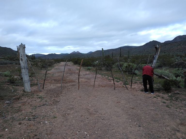
So couple weeks ago, I head into Mision San Fernando to camp for the night, and as I'm driving the dirt road toward the mission, I observe a largeish rancho, fenced off, and a fence extending all along the road (which I believe is) heading to the mission. I encounter a fork in the road, wide and sandy to the right, and branching again; I keep left, shortly thereafter coming to a gate across the road. It's high and assumedly heavy - no signs. No previous signs pointing the direction to the mission. Since I wasn't sure if it was one of those cattle gates and OK to proceed, and not sure if I could wrangle the heavy gate back into place, I turned around. Very disappointing that there was no clear access road. I'd appreciate an update as to directions if anyone is inclined to pass by in the future.

David K - 3-31-2018 at 05:40 PM

Quote: Originally posted by wilderone  
So couple weeks ago, I head into Mision San Fernando to camp for the night, and as I'm driving the dirt road toward the mission, I observe a largeish rancho, fenced off, and a fence extending all along the road (which I believe is) heading to the mission. I encounter a fork in the road, wide and sandy to the right, and branching again; I keep left, shortly thereafter coming to a gate across the road. It's high and assumedly heavy - no signs. No previous signs pointing the direction to the mission. Since I wasn't sure if it was one of those cattle gates and OK to proceed, and not sure if I could wrangle the heavy gate back into place, I turned around. Very disappointing that there was no clear access road. I'd appreciate an update as to directions if anyone is inclined to pass by in the future.


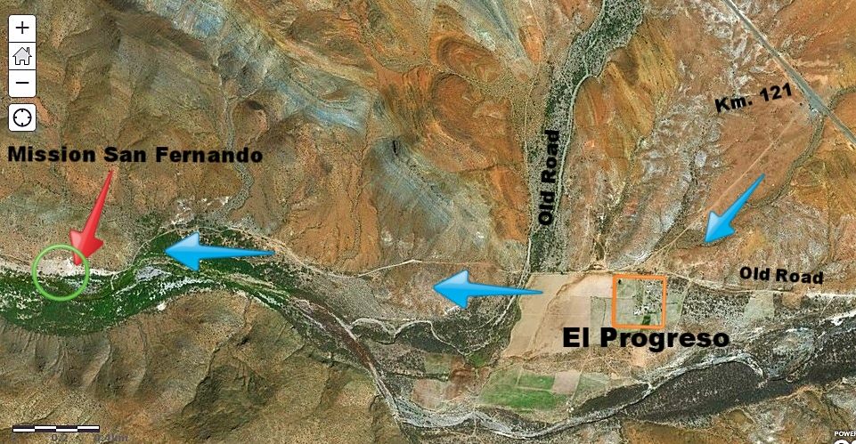
Sure, as of my last trip (June 2017) it is the same road as before.. ie. leave Hwy 1 at the (now abandoned) El Progreso café (Km. 121+)...

The road goes south to a huge farm (El Progreso) cultivated area (fenced) and turns west along the fence. Keep going west, into the small valley ahead.

A road or two come in from the right (north)... these are the original Baja main road to La Paz and the original mission access road (from Km. 118.5).

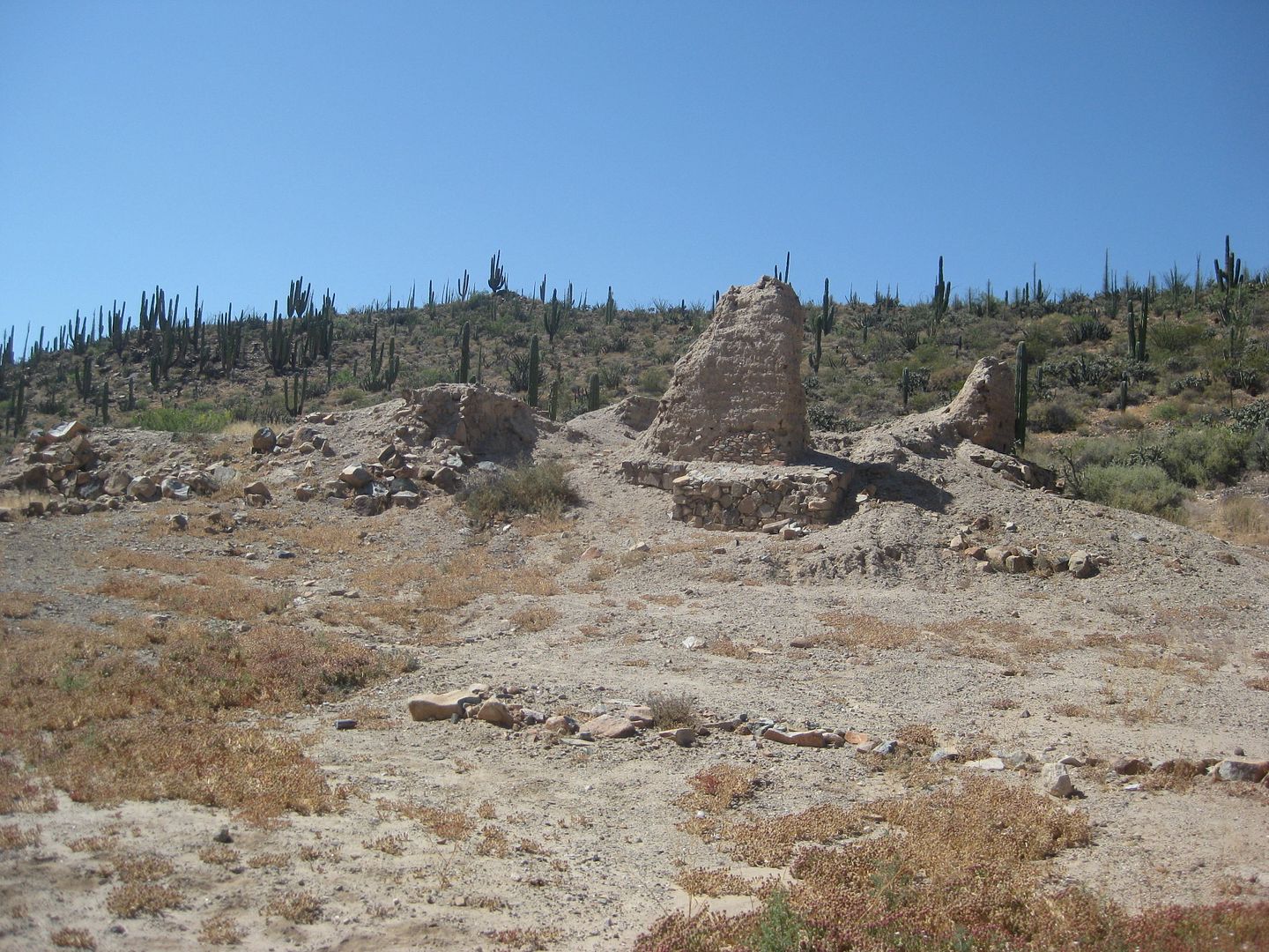
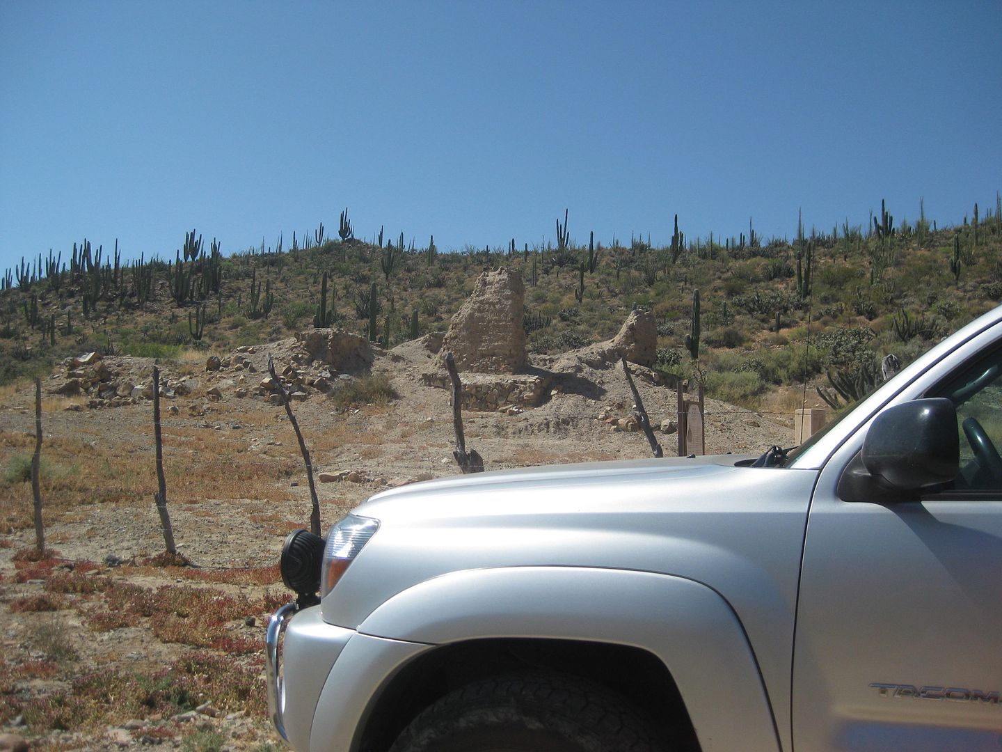
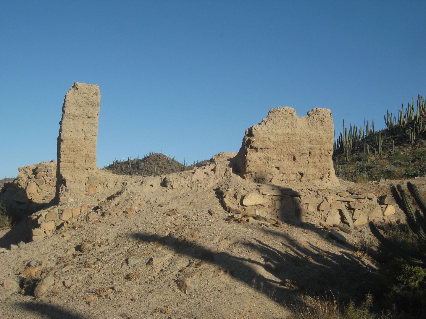
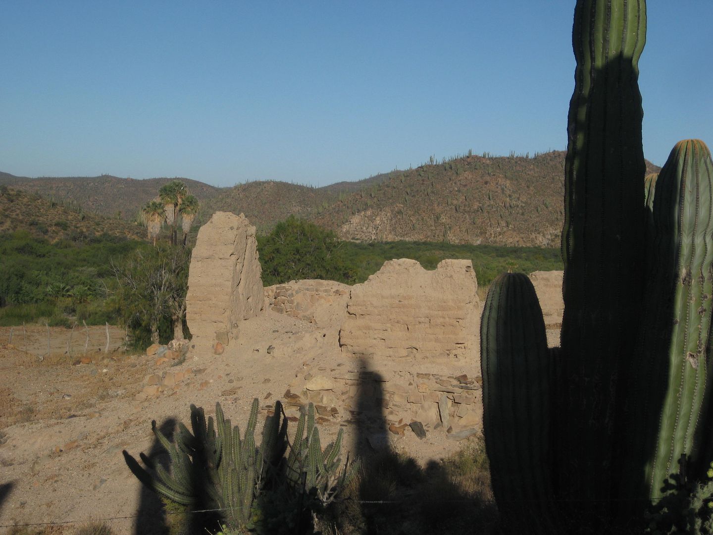
What was new was a cattle control fence across the road before getting to the mission. The mission is just 2.3 miles from Hwy. 1 (at Km. 121+).


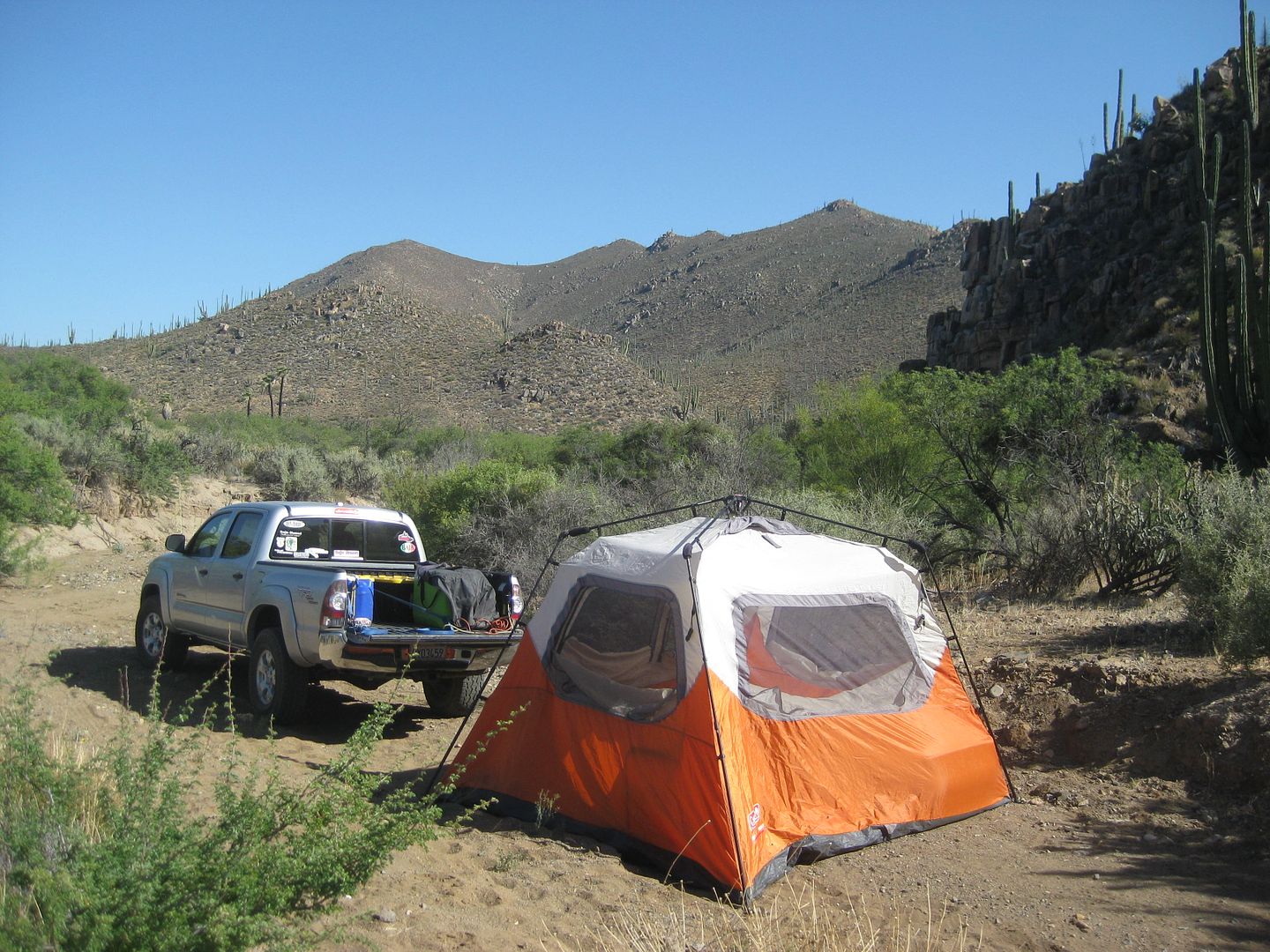
As I was here not long before taking lots of photos, I only took these first two that afternoon, and the following two the next morning when I left.

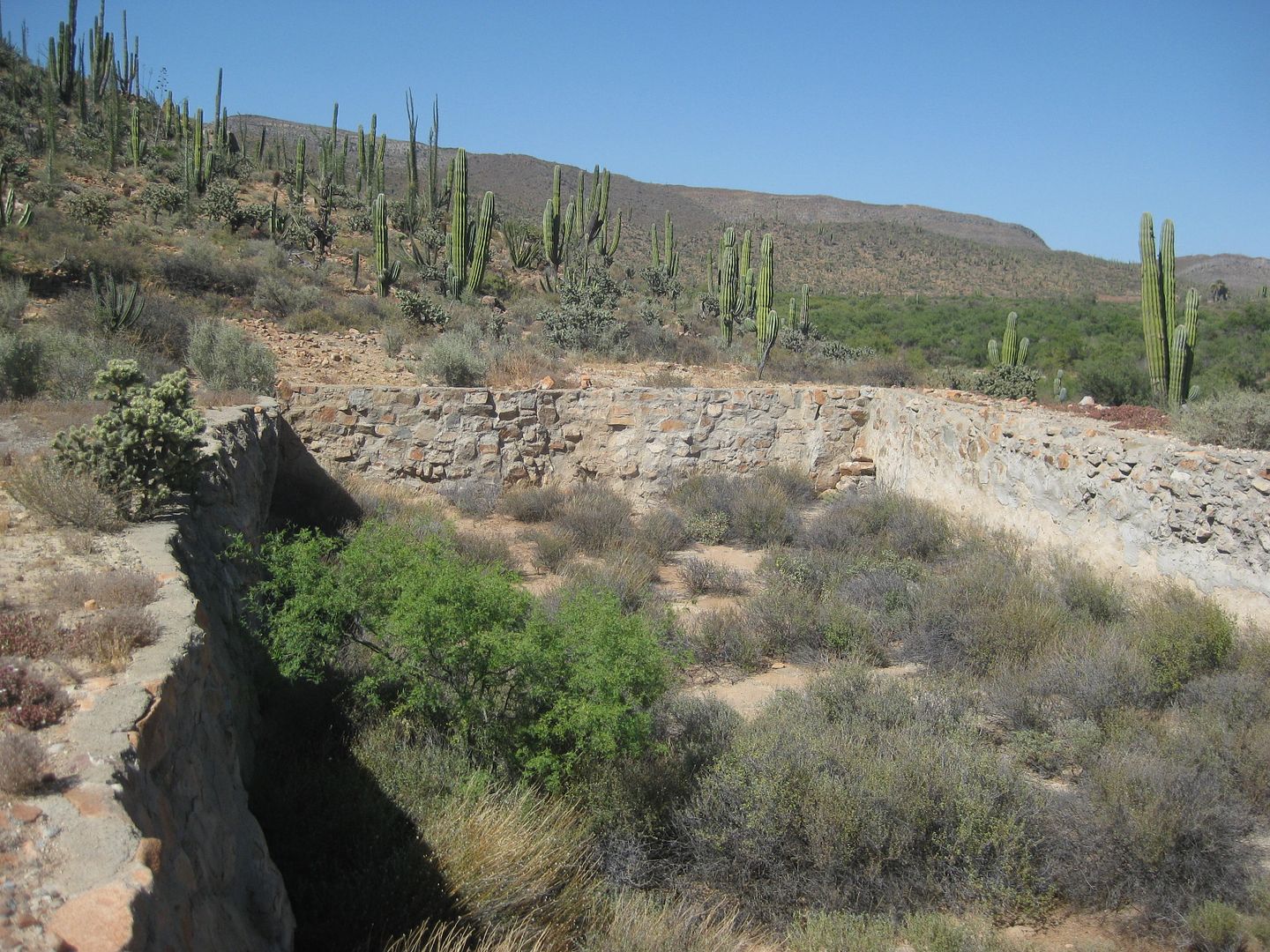
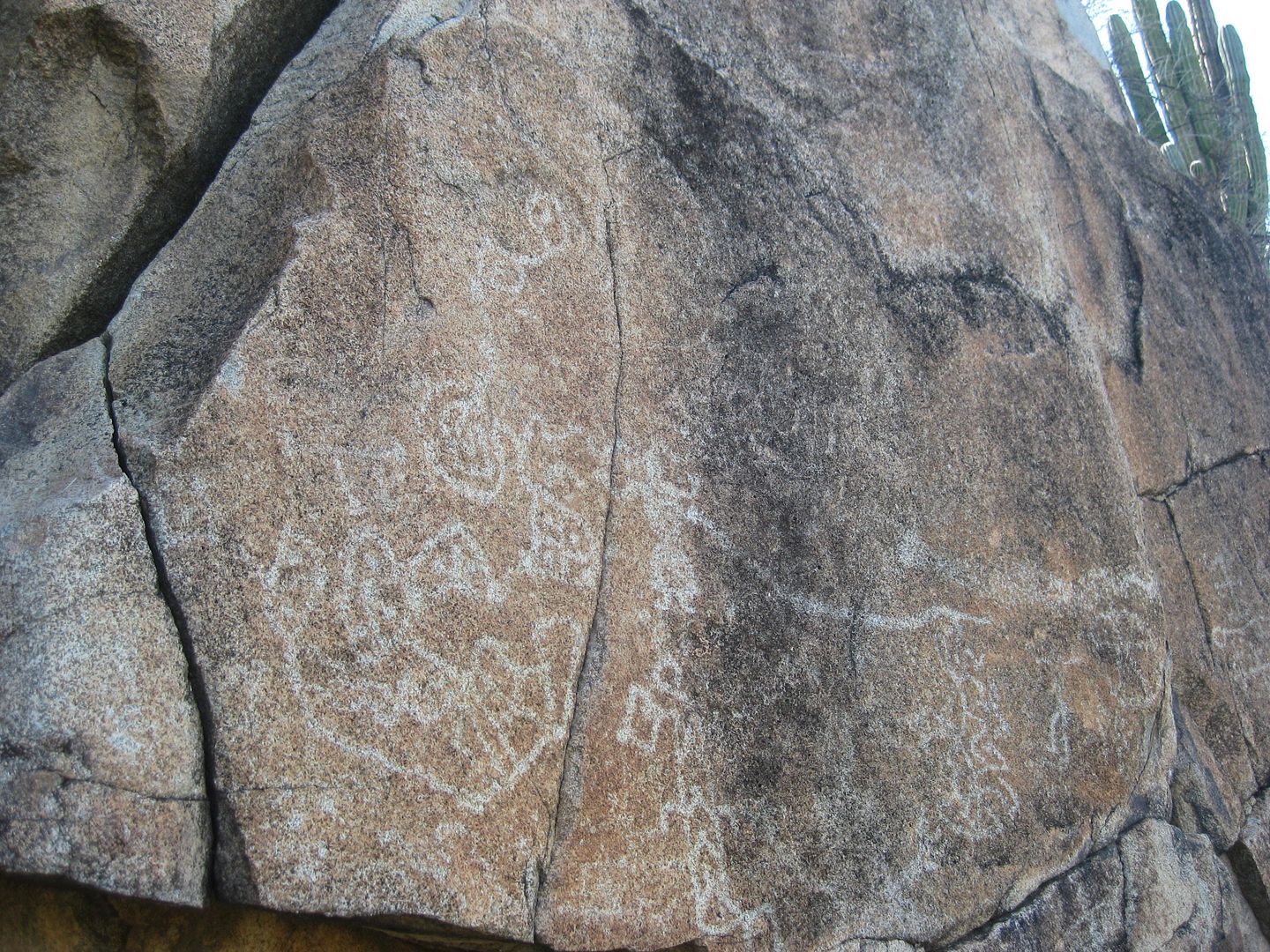
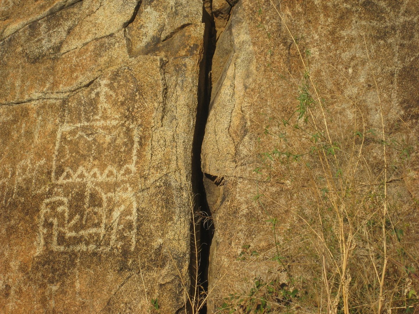
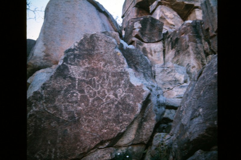
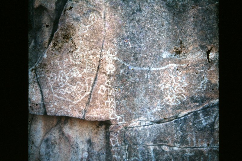
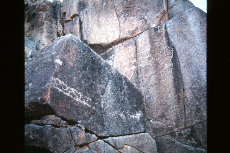
I took many photos of the petroglyphs and the pila, which is just beyond the petroglyph cliff, a kilometer beyond the mission.


The cliff in the background contains the petroglyphs... pics in my TRIP REPORT #5 (June 2017).


[Edited on 8-28-2021 by David K]

wilderone - 3-31-2018 at 06:53 PM

So you went through the gate? Was it manageable? Appeared heavy and unwieldy to me.

David K - 3-31-2018 at 08:13 PM

It was a simple wire gate like the dozens of others all over to control cattle. Maybe it was replaced with what you saw? Were you on the mission road per the map above, near the mission? I camped near the petroglyph cliff. The ranch past the pila was abandoned.


Here's the pila:


... and the petros:


[Edited on 8-28-2021 by David K]

wilderone - 4-1-2018 at 08:09 AM

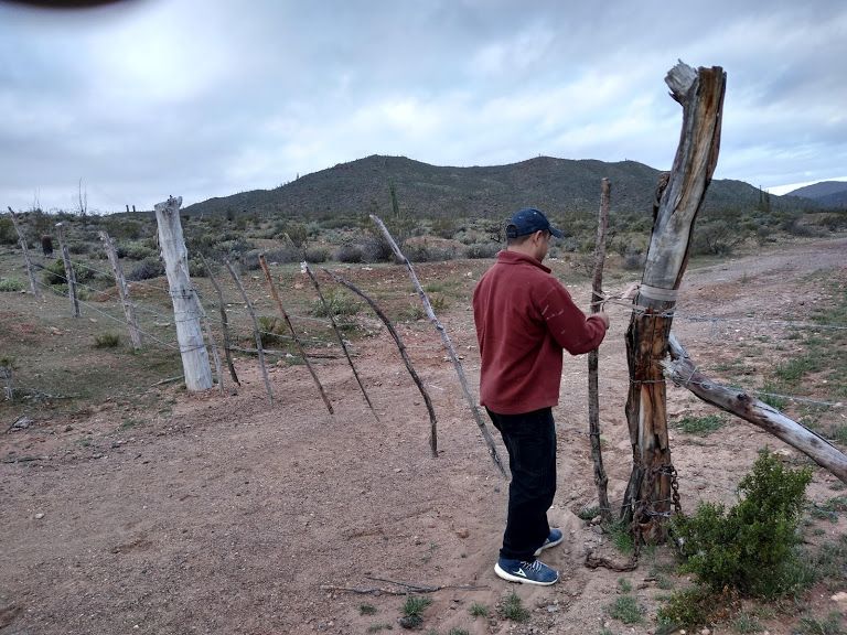
The gate was fairly high - at least 6 ft - made with larger than usual "sticks". I had wrestled with wire gates a few months ago at Nevada BLM sites, and they were difficult enough to drag around and put back in place. My concern was that I wouldn't be able to put the gate back in place and let the cattle in, or that I was entering private property. I've been to the mission several times - I'm sure I was on the right road - but the fence all along, and the gate was new to me. Also, saw no signs - there used to be two with arrows.

David K - 4-1-2018 at 08:41 AM

Quote: Originally posted by wilderone  
The gate was fairly high - at least 6 ft - made with larger than usual "sticks". I had wrestled with wire gates a few months ago at Nevada BLM sites, and they were difficult enough to drag around and put back in place. My concern was that I wouldn't be able to put the gate back in place and let the cattle in, or that I was entering private property. I've been to the mission several times - I'm sure I was on the right road - but the fence all along, and the gate was new to me. Also, saw no signs - there used to be two with arrows.


But just barbed wire and sticks, right? That is what I went through.
In August, I had to open and close those kinds of gates so many times on the road to "Ex-misión Guadalupe" west of Mulegé!!!

Gate Photos... now locked.

David K - 3-11-2019 at 01:33 AM


The lock and chain were added sometime before November 2018 but after my previous trip in June 2017. The gate is not over a mile from the mission.

David K - 8-15-2020 at 11:53 AM

San Fernando was the first Baja mission I visited, on my first self-driven Baja trip. I was 16 and it was Easter Vacation 1974. My friend and I camped there on the first night of our vacation. My first mission photograph...


This was a slide converted to digital.

David K - 8-15-2020 at 12:00 PM

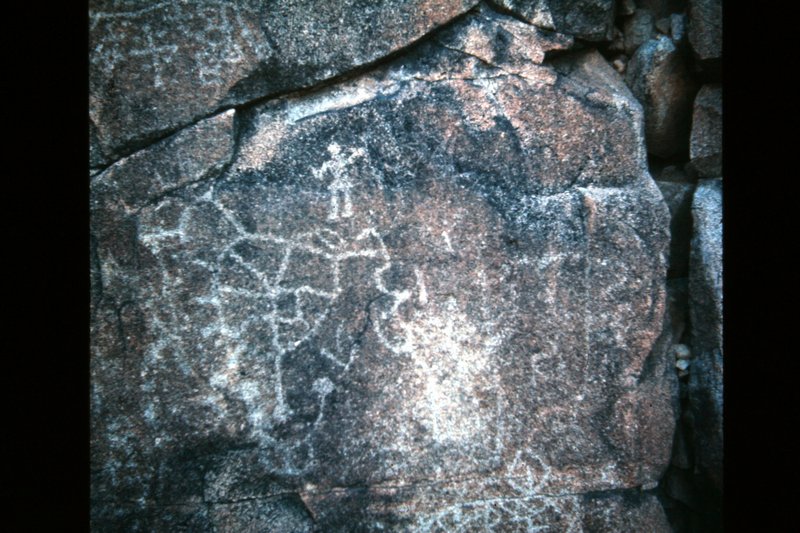
The petroglyphs, 1/2 mile past the mission, in 1974:


Barry A. - 8-15-2020 at 01:00 PM

This is all really great stuff, David. I am constantly amazed at the stamina and grit the Padres and their entourage have, and how much country they cover in such a small amount of time. No way I could have ever done that, and I have done a lot of hiking in the past. I climbed Mt. Whitney from Whitney Portal and back, in 1 & 1/4 days when 16, and I thought I was going to die from exhaustion and just plain pain, plus the worst head-ache of my life. For the Padres grit alone, I applaud them.

thanks again, David.

David K - 9-25-2020 at 11:25 AM

My pleasure Barry! Baja California has an endless supply of exciting adventures and fascinating history! :light::biggrin::bounce:

BajaBlanca - 9-27-2020 at 06:06 AM

There is a cemetery right in front of the mission photo you took DK. How I wish we knew the story of each individual buried there!

David K - 9-27-2020 at 09:38 AM

Quote: Originally posted by BajaBlanca  
There is a cemetery right in front of the mission photo you took DK. How I wish we knew the story of each individual buried there!


Being "Holy ground", it is common to use the ruins as a cemetery. Wooden crosses don't last in the harsh environment. The photo was taken on Spring break, 1974, at San Fernando de Velicatá... my first mission photo.

David K - 8-28-2021 at 06:08 PM

In the diary, on May 4, 1769... Padre Serra passes by where Coco's Corner is now located and camped by the spring he named San Francisco (since renamed San Francisquito). This spring is in sight of Hwy. 5, just north of Coco's, west of the bridge between Km. 178 and 179, in the arroyo.

This famous spring is how so many places of the region got the name 'San Francisquito': Arroyo, Bay, Gold Mill, etc. However, names do change, or simply get replaced unofficially!

*Arroyo de San Francisquito to Arroyo de Las Arrastras
*Molino de San Francisquito to Molino de Lacy
*Ensenada de San Francisquito to 'Gonzaga Bay' (the bigger half)
*Puerto de San Francisquito to Punta Final Resort (It was briefly called Villa Mar y Sol, around 1970.)

I hope to pass on these tidbits of history to you younger people so that the past is passed on to the next generation, so it won't be forgotten or rewritten.