Isignay - 4-25-2018 at 11:03 AM
Has anyone ever driven through the many washes back roads and 4x4 trails to guadalupe canyon oasis from Mikes Sky Ranch ? Thinking about trying to
get there from South to North on my way home instead of the usual route from the border down...
There's some random roads in my Almanac but wanted to know if anyone's ever driven this way or if it's a crap shoot.
[Edited on 4-25-2018 by Isignay]
David K - 4-25-2018 at 11:13 AM
Can you be more specific of the route north of Mike's becuase these are two very different location in different mountain ranges.
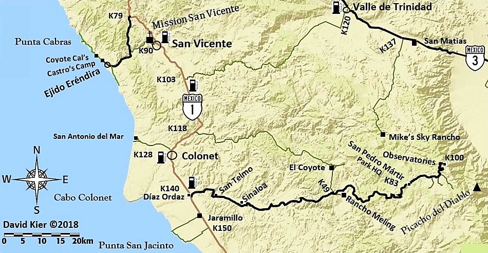
The road to Mike's from Colonet/El Coyote is trashed real bad... motorcycles only or extreme rock crwaler type 4x4s maybe. Better to take the road
from near San Vicente to Valle de Trinidad.
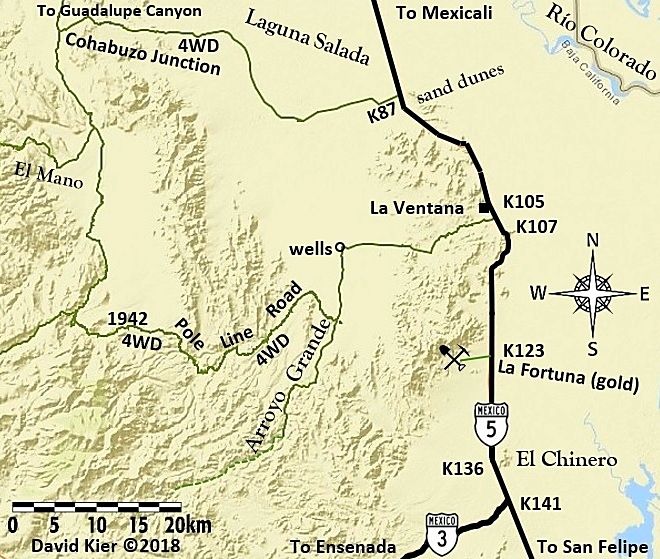
South of Guadalupe Canyon are two possible roads up the mountain and a couple more that are gated and locked typically. Mano Canyon and the 'Summit'
(Portezuelo de Jamau, Pole Line Road original route).
Directly south from Guadalupe is the Pole Line Road and it was pretty thrashed by rains a year or two ago. It can take you to Arroyo Grande where the
road out to near San Matias Pass via Rancho Arroyo Grande had a locked gate blocking the way by the ranch (in 2015).
Arroyo Grande north then east to La Ventana being the only reasonable option with the Baja race course to Borrego pit area an off road option.
Happy to help with maps or links, if this is what you have in mind.
Of course Mike's to Hwy. 3/ San Matias is an easy 20 mile graded road.
[Edited on 4-25-2018 by David K]
Isignay - 4-25-2018 at 11:27 AM
I was thinking of cutting east from Camalu or Colonet, through Mikes Sky Ranch to highway 3, 3 East, Highway 5 North to La Ventana, but from La
Ventana I can't figure out which routes to take to get to Guadalupe.... I have a 4x4 truck with some suspension, it's no rock crawler so if the road
to Mikes Sky ranch is what you're saying it may be best to just save this trek for another time.
TMW - 4-25-2018 at 11:34 AM
You want to go north of La Ventana to KM87 and take the road west toward Saldana. The road will interesct with a road north to what is called Cohabuso
Jct. From there north to Guadalupe Canyon.
I you want I can map it and provide a GPS file.
TMW - 4-25-2018 at 11:36 AM
If you are adventurest you could take one of the SF250 race courses north from Hwy 3 and join the road north just west of La Ventana.
Isignay - 4-25-2018 at 12:06 PM
best forum ever! thank you guys
David K - 4-25-2018 at 12:28 PM
Use the road south of San Vicente to Valle de Trinidad then use TMW's road to Cohabuzo Junction. Forget Mike's or the Pole Line Road. Maps coming!
TMW - 4-25-2018 at 12:30 PM
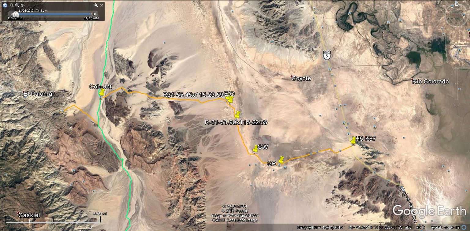
Here is a GE image of the route from H5 at KM87 to Cohabuzo Jct.
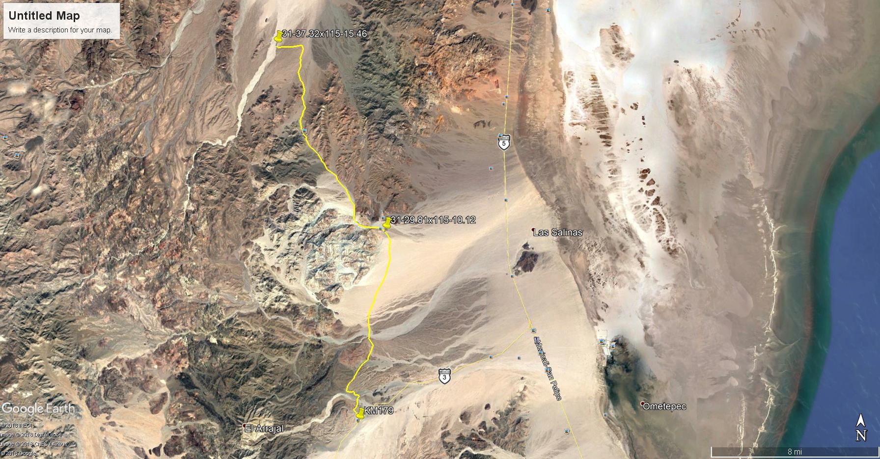
TMW - 4-25-2018 at 12:33 PM
Here is a GE image showing the route from Hwy 3 at KM179 north to Arroyo Grande. Should be easy to follow since SCORE just used it for the SF250 race
a couple of weeks ago. Markers and ribbons are probably still there. From Arroyo Grande It's not too hard to follow the road north and meet the road
in from Hwy 1 at KM87.
[Edited on 4-25-2018 by TMW]
Isignay - 4-25-2018 at 02:16 PM
Awesome, thank you!!
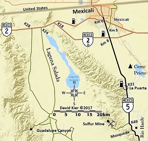
OK, back home... overall area maps:
David K - 4-25-2018 at 03:27 PM
North to South: