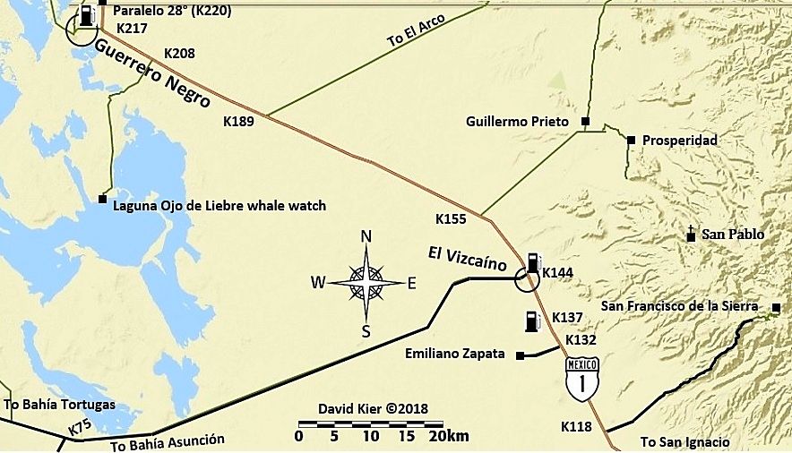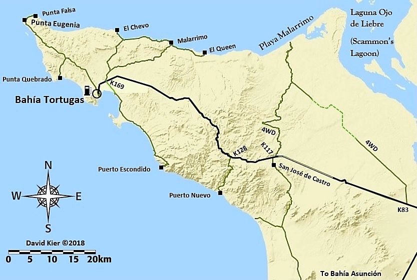
My maps are FREE for any Baja traveler to enjoy or use. I drew in all the roads you see above except for Hwy. 1. I use satellite images and my GPS track to draw in the roads in nearly every place... a couple are freehand added in but close to the actual location. They were a lot of work to make. I did not use someone else's map or Google maps because they are full of errors and did not show just what I wanted to show.


