I came north about 2 weeks ago.
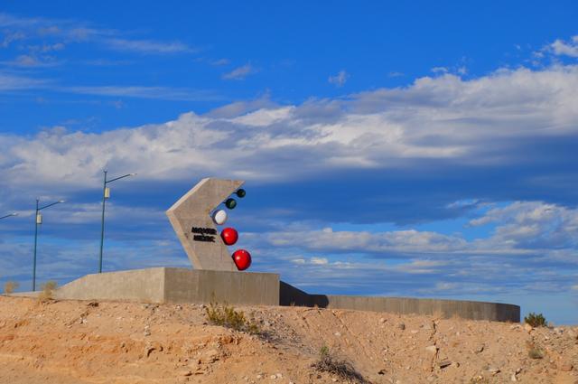
Looks the same. I never saw the concrete monument, where is that?
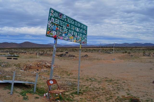
It's at the view parking/ rest area on the north side of the Arroyo Santa María bridge (Arroyo Las Arrastras on their sign) at Km. 154.5 or just over
4 miles south of the Gonzaga Bay Pemex/Rancho Grande.
msteve1014 - 2-9-2019 at 09:47 AM
Maybe I was driving too fast, I do that.bajaguy - 2-9-2019 at 09:59 AM
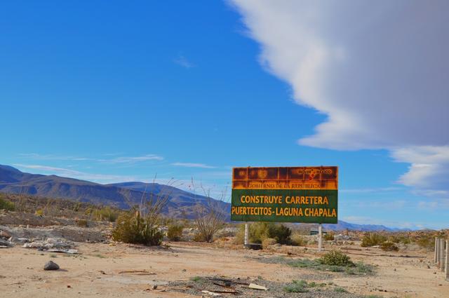
Maybe they should have eliminated the view/parking area and put more effort into building the bridges and road correctly
It's at the view parking/ rest area on the north side of the Arroyo Santa María bridge (Arroyo Las Arrastras on their sign) at Km. 154.5 or just over
4 miles south of the Gonzaga Bay Pemex/Rancho Grande.
David K - 2-9-2019 at 02:13 PM
Well, that bridge and the one just north of Gonzaga survived???
Anyway, monuments are far more important than hospitals or good bridges, in Mexico!
Dec. 1, 1973 Parallelo 28° (4 miles from Guerrero Negro)MexicoTed - 2-9-2019 at 02:36 PM
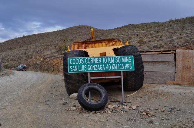
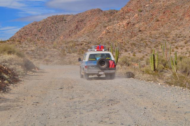
Thank you - Heading down next week and was curious about conditions. Legit 40 series Land Cruiser at Coco's in that picture.
[Edited on 2-9-2019 by kk6mbh]
The FJ40 was our vehicle in the race. Strong burro!Whale-ista - 2-9-2019 at 03:53 PM
Thank you for the visual report- very helpful.
Did you encounter many others driving this route? I've been considering taking that vs. Hwy 1 to avoid the Pacific coast traffic, but worry about
being stranded if I have any mechanical issues.
Likewise- what's the distance between gas stations?
(I've grown accustomed to filling up to make the El Rosario/Jesus Maria gap.)
Thanks again!
fishbuck - 2-9-2019 at 04:32 PM
Thanks. Very informative and good photos.
hyw 5 or take 1?
msawin - 2-10-2019 at 10:22 AM
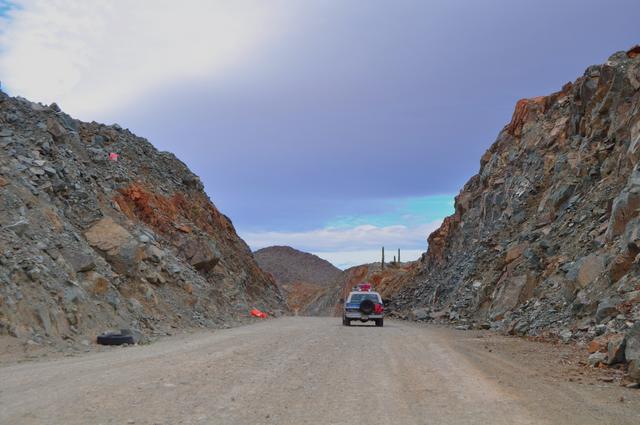
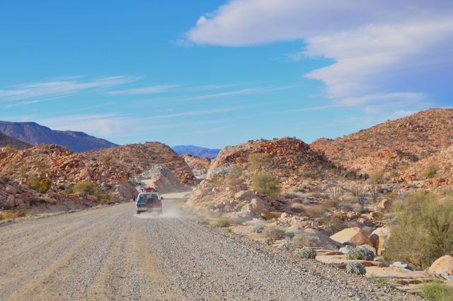
End of October made the trip south taking 5. After making it to hyw 1, I said we are taking hyw 1 on the return trip.
One of the positives of the tropical storm that did the hyw in is, it gives the higher aboves the chance to fix all of the defaults in their new
concrete bridge structures that would have failed when the highway was ( someday) completed.
I like 5. In any shape. I have been making the drive usually at least 2 times a year, 20 years now, both up and back.
so on the return north in November I came to the intersection at chapala and took a right hand turn.
Low stress. I'll do it again. Enjoy the views. MexicoTed - 2-13-2019 at 01:29 PM
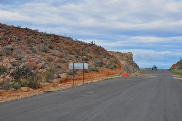
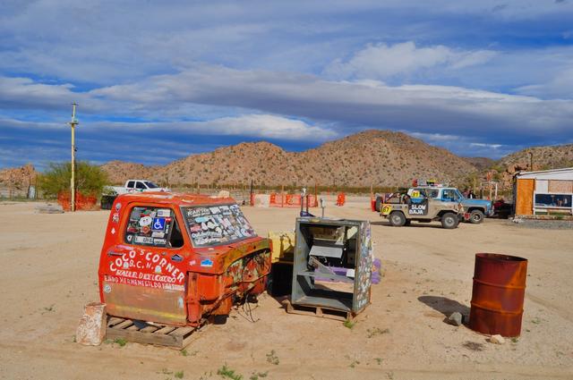
I forgot to point out that in the photo just after Coco's artwork, the local have already made a new, softer road to drive i on for a couple miles.
The main roads are rough.MexicoTed - 2-13-2019 at 01:32 PM
Did you encounter many others driving this route? I've been considering taking that vs. Hwy 1 to avoid the Pacific coast traffic, but worry about
being stranded if I have any mechanical issues.
Likewise- what's the distance between gas stations?
(I've grown accustomed to filling up to make the El Rosario/Jesus Maria gap.)
Thanks again!
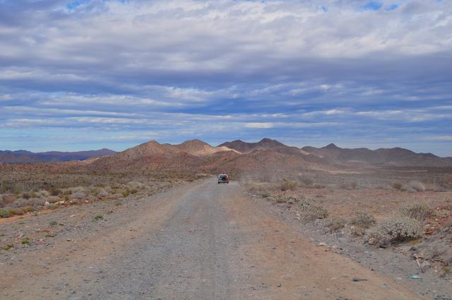
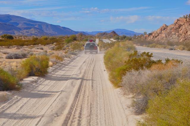
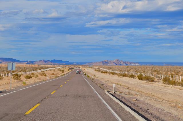
It was a Saturday and we came across 4 cars (two locals & two tourists) and one motorcycle between Chapala and Gonzaga. Ran into over 20 between
Gonzaga and Puertecitos.
We filled up in Jesus Maria and then got gas again in Gonzaga, no problem there.
Ted
[Edited on 2-13-2019 by MexicoTed]David K - 2-13-2019 at 03:56 PM
Did you encounter many others driving this route? I've been considering taking that vs. Hwy 1 to avoid the Pacific coast traffic, but worry about
being stranded if I have any mechanical issues.
Likewise- what's the distance between gas stations?
(I've grown accustomed to filling up to make the El Rosario/Jesus Maria gap.)
Thanks again!
This is a federal highway and not some backcountry trail. Because 20 miles are not completed doesn't make people drive the 100 mile longer Hwy. 1.
Have no fear about not seeing other cars and trucks. Gonzaga Pemex to Villa Jesus María Pemex is about 70 miles shorter than El Rosario to Jesus
María. Just enjoy the scenic but rougher route.