BajaNomad

el imposible trip report 4/4 (Mission Santa Maria/Laguna Chapala 2019/Cocos Corner?/San Felipe)

Ken Cooke - 2-23-2019 at 06:23 AM

el imposible: Mission Santa María (a.k.a. “Mission Impossible”)
Last night, our group and I figured it would not be possible. Steady rains fell all through the desert from about 3 pm the day before until dawn. Our goal would be a modest one - go take a look at the trail. Perhaps drive to the peninsular divide then turn around.
By 11:30 am, our vehicles had paid the roughly $5/vehicle fee which has become the common donation amount in Baja, California when one wishes to access exclusive network of dirt trails that crisscross this undeveloped region the way that the interstate system crosses the Los Angeles area.

The Mission Santa Maria trail is a box canyon trail of sorts as it ends at a junction where the El Camino Real bisects the Mission trail, but requires the driver to exit their vehicle and continue on foot. Our goal was to drive in and immediately out of this trail, so the Camino Real held little tangible significance. An open gate leading to this magnificent region is passed and you must first pick your way through a Sandy wash and then up above the general vicinity and across two or three valleys each with their own steep valleys, all lined with rocks.

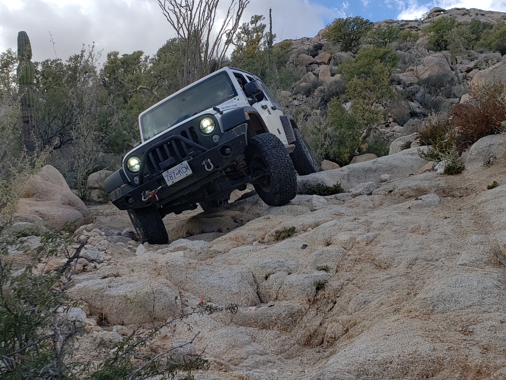
Once one continues roughly one hour, an off camber shelf road gets you right into the very rough stuff before backing off, providing more mild trails. The Mission Santa Maria trail doesn't reveal herself until much later. There, loose, steep hill limbs give way to relatively easy stretches before the trail becomes more off camber. The hill climbs become more steep. Everything here changes for the better, or for the worse - depending on how you and your vehicle interpret what is good versus bad. Before you know it, you're committed to the Mission trail, and you're in it until you reach the swamp. The swamp is not a political metaphor, rather a stagnant zone of palm trees and a two track path which meanders in a zig zag pattern from the base of the steep, rocky “Widowmaker” hill on one end and a spectacular row of palm trees - some with rare, blue palm fronds.
Once past the swamp, a series of short but steep rocky hills must first climbed over before reaching the Mission Santa Maria. Actually, the Mission consists of a foundation and adobe walls which were erected in the late 1700’s and utilized as a Mission warehouse by the Jesuit order for several decades.
Our Jeeps and Toyota handled both the swamp and the rocky path leading to the Mission quite well, although the Toyota had developed a peculiar stance that more than one driver noticed. Victor “Ru KinKon”s vehicle was grounded - stuck in the lot of the Mision Santa Maria Hotel parking lot with a failed cooling system. He got to drive one of the Jeeps, but he mainly had to ride with his wife in the backseat of the long distance, Canadian 4 door Rubicon. Victor asked David why the rear wheels appeared off square? The explanation was that, with this being a replacement to the original rear axle housing that suffered the same fate, this second replacement axle housing was also bent. A Rock Jock Dana 60 was on order and would likely be replaced by the time you have read this. David's rear axle housing appeared bent, and squeaked continuously - likely because of the amount of stress placed on axle bearings being ran at a noncongruent angle.

The entire trip lasted 6 hours from start to finish. Near the end of our run, David noticed that Rich T's rear shock was no longer connected to his Jeeps lower shock mount - due to the mount failing on the trail. We had to stop for 25 minutes while this shock and it's mount were removed for a full repair in San Felipe.

Back at the Hotel, all four drivers and our passengers celebrated over dinner and a bottle of 'el imposible’ wine - produced by Victor himself! We toasted to a weeklong series of all moderate to most difficult trails that were all successfully completed. The impossible is now one for the record books.


[Edited on 2-23-2019 by Ken Cooke]

David K - 2-23-2019 at 07:09 AM

I can't wait for the photos!

So, who collects money... someone at Santa Ynez came out and walked to you guys or was the left gate closed and you walked to them?

Did you see Ralph? Maybe you can drive to Ralph's place and then up the wash to the mission road and not go through the ranch gate?

If you don't like the word swamp, use what we have always called it: The Bog.

Were they collecting money to get to Laguna Salada or with the rains, did everyone go to the graded road?

Ken Cooke - 2-23-2019 at 09:20 PM

Quote: Originally posted by David K  
I can't wait for the photos!

So, who collects money... someone at Santa Ynez came out and walked to you guys or was the left gate closed and you walked to them?

Did you see Ralph? Maybe you can drive to Ralph's place and then up the wash to the mission road and not go through the ranch gate?

If you don't like the word swamp, use what we have always called it: The Bog.

Were they collecting money to get to Laguna Salada or with the rains, did everyone go to the graded road?


Mayra from Rancho Santa Ines collected money at her kitchen.

We also paid roughly $5 to access the roads into the Laguna Salada área. This is becoming more customary. I'm sure these fees keep the losers out.

advrider - 2-23-2019 at 11:05 PM

Ken you are a gifted writer for sure! They collected money from us at Santa Inez last year, they said to maintain the road? It was cheap, we paid...

David K - 2-24-2019 at 02:57 AM

So, the second gate, left of the restaurant is locked now?
Maintain the road? LOL, that was last done in 1973!

advrider - 2-24-2019 at 08:32 AM

The gate wasn't locked, they had someone drive down and park by the gate, kind of blocking it. They were nice about it but acted as if we could not pass the gate without paying? If the money does help to keep the road open I don't mind donating a few dollars. My Spanish isn't that good but they had cold beer for sale when we came back from our ride.
Ken Cooke - 2-24-2019 at 08:44 AM

El imposible: End of run (back to San Felipe)

On Saturday 2/23, our group departed in its respective directions with Victor and David driving north along Hwy 1, while Richard, Ken and Daryl went south to the Hwy 5 turnoff. While Richard drove directly to San Felipe without stopping, Daryl and I chose to first stop at Cocos Corner for a brief visit with the legend.

Cocos Corner has undergone changes since the last time I had visited almost a decade ago. Gone was the wooden backyard awning where so many underwear and memories had been posted. Instead, Coco's house with many of the adornments were placed inside served as his base of beverage sales. Coco announced to us that he is now 82 years old and very much alive when I told him of a rumor that he had recently passed away. Coco asked us to sign his guest book before leaving and we took several photographs with the Baja icon. With the patchwork of road construction projects leading to and around his property, I can see why he chose to remain off of the main highway now under construction. His legion of friends and visitors would likely disapprove of a new location after the indellible print he has left on “El Valle de Coco.”
Our next stop was at the upscale Alfonsinas. Complete with a new guard post and a third floor of guest housing, Alfonsinas leaves visitors either loving or hating it. Gone is the ability to drive out to the peninsula just past the ever growing collection of guest rooms as signs posted that driving on the sand is now prohibited. This appears to allow the justification in charging the now $100/night accomodation fees and more than $20 per plate for dinner - although with some of the best ceviche I have tasted from Los Angeles to Lima, Peru where the first ceviche dish was invented.
Traveling north into San Felipe, a brilliant display of desert wildflowers was now underway. The ground was literally carpeted in guess of cream and violet along stretches that normally appeared void of much life. Ocotillo were green from recent rains as if they were dutifuly tended to by residents of the South Campo. I stopped and parked for photographs of this remarkable Superbloom which is gradually creeping north and will take hold of the California norte deserts within the next few weeks.

el imposible is now a memory. Like a Baja racecourse, so many trails were stitched together to be completed within a relatively short length of time. The memories, photographs and tshirts will now tell the story of one of Bajas greatest 4WD events of the 21st century.

mcnut - 2-24-2019 at 11:03 AM

Thanks for taking us along, sound like a memorable adventure!

Bruce

David K - 2-24-2019 at 01:44 PM

Wonderful Ken, just wonderful!

6WHEELN - 2-24-2019 at 02:50 PM


David K - 2-24-2019 at 03:16 PM

Please type in your Fox Shock story!

6WHEELN - 2-24-2019 at 07:53 PM

Quote: Originally posted by David K  
Please type in your Fox Shock story!


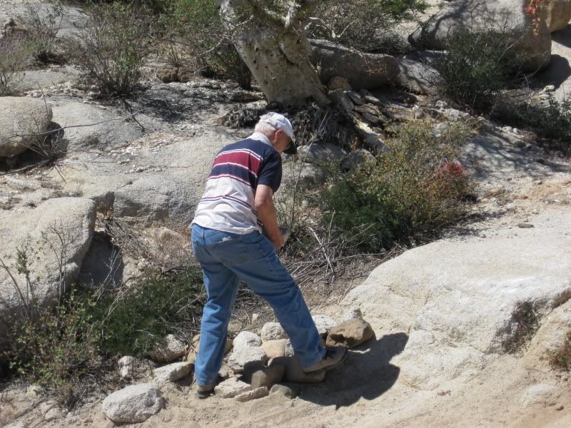
That’s Rich T holding up a trophy specimen of the elusive Mission Santa Maria Fox. 🦊

The rear lower shock mount broke.

https://youtu.be/Um_ku0JM1KY


David K - 2-27-2019 at 05:31 PM

Still hoping for more details on the road from Ken and others, plus photos...

Since I am into the mission history and Ken is in education, I think I am compelled to add to this line from Ken:

"Once past the swamp, a series of short but steep rocky hills must first climbed over before reaching the Mission Santa Maria. Actually, the Mission consists of a foundation and adobe walls which were erected in the late 1700’s and utilized as a Mission warehouse by the Jesuit order for several decades."

Details in my book...

The Jesuits were at Santa María for less than a year (May 1767 to Jan. 1768) and had only erected palm log cabins when they were forced back to Europe.

In April 1768, the Franciscan friars arrived in Loreto to replace the already departed Jesuits. Padre Juan de Medina Beitia was assigned to Santa María, the most distant mission from Loreto, arriving there some weeks later. It was the Franciscan, Beitia, who had the adobe church and side building erected at Santa María between May 1768 and when he left in April 1769. The Franciscans at Mission San Borja would travel to Santa María to see to its needs.

Junípero Serra, on his journey from Loreto to San Diego, arrived at Santa María in May 1769 and spent a week there planning a future for this isolated mission. This changed when he moved on to Velicatá and founded his first California mission of San Fernando, there. He considered San Fernando de Velicatá a far superior location and pretty much abandoned the plans he had for Santa María.

When the Franciscans handed off their Baja missions to the Dominicans in May 1773 in order to concentrate on Alta California, the Dominicans had not assigned priests to only Santa María, but that the two assigned to San Fernando would also attend Santa María.

1774 was the final year that saw mission population records recorded for Santa María, as by 1775, the native population that could relocate, did so, to San Fernando.

So, Santa María was active as a mission site for only a few years and less than one decade.


Ken Cooke - 2-27-2019 at 09:29 PM

I imported seventy photos from Google Photos to Imgur. Photobucket is back to it's old pricing tactics. Posting photos to this site is time intensive. Maybe this weekend I will be caught up and I will have time to post photos. The road hasn't changed since the last time I was on the Mission Santa Maria route in 2011.


David K - 2-28-2019 at 09:27 AM

Ken, www.postimages.org, set the upload size to 800 or 640 to fit on Nomad, and you can make albums for each trip. Best part, it's free. Use the link for forums (has tags like this [img]).

PaulW - 2-28-2019 at 09:40 AM

Ken, FYI, Some future suggestions
Use a camera with a resolution setting that meets the 250kb requirement for Nomads.
For screen shots use Paint to resize. Slow
For my phone I have not figured out how to limit size to 250 So I have to resize on paint to 25%. Slow
And yes Postimages works fine, but one has to do it one at a time.
I never use Photobucket any more.
Obviously the 250k setting camera is a no brainer for speed and quantity. A low cost point and shoot camera will suffice. And for high resolution pictures I always have my phone at the ready.
For all my devices I have a large memory so keeping them in the device is not an issue. Sure beats keeping them on an application.

David K - 2-28-2019 at 09:46 AM

The 250 kb limit is only if Nomad hosts the photo and that is a lower quality setting. Hosting on another website allows the quality to remain high, just size the the image on the screen to fit here.

PaulW - 2-28-2019 at 02:18 PM

Can we compare the real difference?
Why not post two images. Same pic one from Postimage and one you resize to 250k

David K - 2-28-2019 at 05:02 PM

How (what method) do you want me to shrink the file size down to 250 kb?

With Photobucket or Postimages.org, you just select the upload size once, and all your future photo selections are sized for the Internet (and your original full-size images are untouched on your PC).

I get the complaint about Photobucket, but it is still working for me, TW, and many others... Postimages.org is very easy and free, so-far.

6WHEELN - 3-5-2019 at 12:43 AM

From The Bog to The Mission:

https://youtu.be/UfSZ0fdWxj0

David K - 3-5-2019 at 01:37 AM

Quote: Originally posted by 6WHEELN  
From The Bog to The Mission:


This is great! You guys had almost no water in the bog, compared to our trip in 2010... lucky!

Do you have a video of going up the Widowmaker? That is the one big steep rocky downgrade before entering the bog.


Here's HB Murphy's 2010 video of just the bog part (under 2 minutes)... He was the lead vehicle and we were second of 6 rigs, both of us in Tacomas. Listen to his lady's shrieks as he plunged into the deep pools of unknown depths!


[Edited on 3-5-2019 by David K]

Ken Cooke - 3-5-2019 at 09:36 PM

Quote: Originally posted by 6WHEELN  
From The Bog to The Mission:

https://youtu.be/UfSZ0fdWxj0


Five stars out of five stars!

6WHEELN - 3-5-2019 at 10:06 PM

Per your request, David K, here is a video of the Widowmaker plus a few other uphill sections of the trail:

https://youtu.be/Fw3XCS0ww8I

Ken Cooke - 3-5-2019 at 10:14 PM


David K - 3-6-2019 at 07:52 AM

Awesome!!! Thank you. Love it all... four wheel drive, low range, lockers or traction control!

Ken Cooke - 3-6-2019 at 09:49 PM


6WHEELN - 3-7-2019 at 08:20 PM

Mission Accomplished


David K - 3-7-2019 at 09:14 PM

Beautiful. 1768 to 2019

Ken Cooke - 3-8-2019 at 09:26 PM

Victor had to leave his big beast in the parking lot at the Mision Santa Maria Hotel due to a cooling problem. It was a shame for such a built Jeep to be stuck in the parking lot. Something about having the original coolant from 2009 and possibly non functioning cooling system had something to do with it.


On the trail to Mission Santa Maria was first an exploration run with all of the rain the previous night and afternoon. I thought it would be foolish to attempt the trail, but Rich T. said that the dirt was in perfect condition for this sort of a run.


The trail was green and the sky had plenty of clouds to keep temperatures cooler than average on our day trip.


Hello Baja Nomads!


Here come the rest of the rigs down the trail. Better get back in the Jeep and speed it up!


What a view! I thought this would be our end point since the dirt was a little damp, but we continued on from this point, and what a good idea it was! That's Gonzaga Bay below. We were standing at the Continental Divide of Baja California where this photo was taken.


Elizabeth(left), Karen(center) and Leidys(right)


Those with good eyesight thought the trail was blocked below. It turned out to be an optical illusion.


Leidys and the Ocotillo


Blue fan palms below


Likely a breakdown and someone rolled this Jeep off of the trail - what a waste of a vehicle.


Victor smiling with his camera. What's he doing here!:?:


Ken Cooke - 3-8-2019 at 09:28 PM

Past the muddy bog, just one mile until the Mission.:bounce:


Here lies the Mission in the distance

At the mission

Ken Cooke - 3-8-2019 at 09:31 PM

The four (Jeep) copilots at the mission


Walking about the Mission, lots of photo opportunities.


Leidys holds a registry book that she signed.


I'm doing the same.


YouTube family home videos (Baja edition)

Ken Cooke - 3-8-2019 at 10:23 PM

The road down to the Mission:o

Ken Cooke - 3-8-2019 at 10:25 PM


Ken Cooke - 3-8-2019 at 10:29 PM


Everyone said, "WE MADE IT!!"

Ken Cooke - 3-8-2019 at 10:33 PM


Akula - 3-10-2019 at 03:31 AM

What an incredible place, it's a privilege to be able to visit this area.


Jeeps in their element!


It seems if you're going to get off camber, the "lean" is always to the side that has the cliff next to it.


[Edited on 6-23-2019 by BajaNomad]

David K - 3-10-2019 at 10:32 AM

Thank you for the videos and photos!
Having been in there 4 times, it warms my heart to see others feel the energy of the location.

Video one is coming down from the peninsular divide towards the mission. This is 10 miles from Rancho Santa Ynez and 4 1/2 from the mission. You can see the Sea of Cortez and Punta Final (Gonzaga Bay) in the distance. The camera is held by someone walking behind Ken's Jeep.

The next video shows Ken going over the boulder section of road and driving directly on the rocks that Neal Johns himself placed to make a ramp coming off the boulder on his final trip there in 2010:


The third video is going through the bog but Ken lucked out... very little water in there compared to 2010, the last wet year.

The final video is arriving at the mission, founded originally at Calamajué in October 1766 and moved here in May 1767 when the water at Calamajué proved deadly to growing wheat. The Jesuits built a palm log church before they were removed from the New World and were replaced by the Franciscans who arrived in California in April 1768. It was the Franciscans who built the adobe buildings we see the ruins of today between mid-1768 and early 1769. The mission bell that was once here was transferred to the new mission at Velicatá, named San Fernando.

David K - 6-19-2019 at 11:34 PM

Nice sharp photos, Ken!:bounce:

Ken Cooke - 6-20-2019 at 06:47 PM

Thanks, David. My sole camera for this trip was my Google Pixel 3 XL smartphone. Here is more information. Please start another thread as I don't want to weigh this one down with off-topic camera specs, though.

Google 3XL review

David K - 6-21-2019 at 04:07 AM

No thanks. They are nice pictures of your Baja trip. Doesn't matter to me what kind of camera you use. It's about Location-Location-Location.