BajaNomad

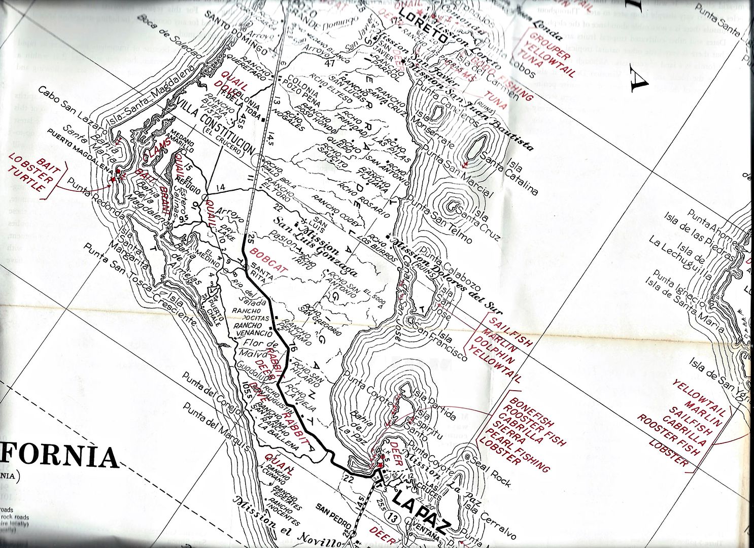
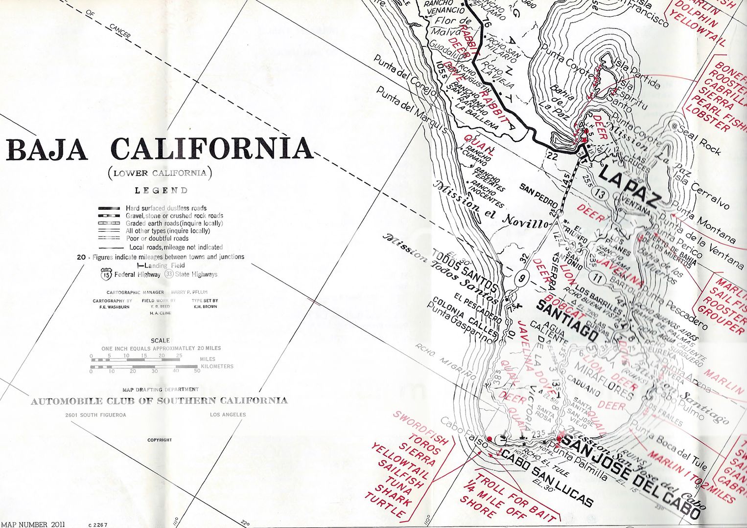
The 1962 & 1955 AAA BAJA MAP Discussion

David K - 7-22-2019 at 10:57 AM


Quote: Originally posted by 4x4abc  


that only brings up more questions

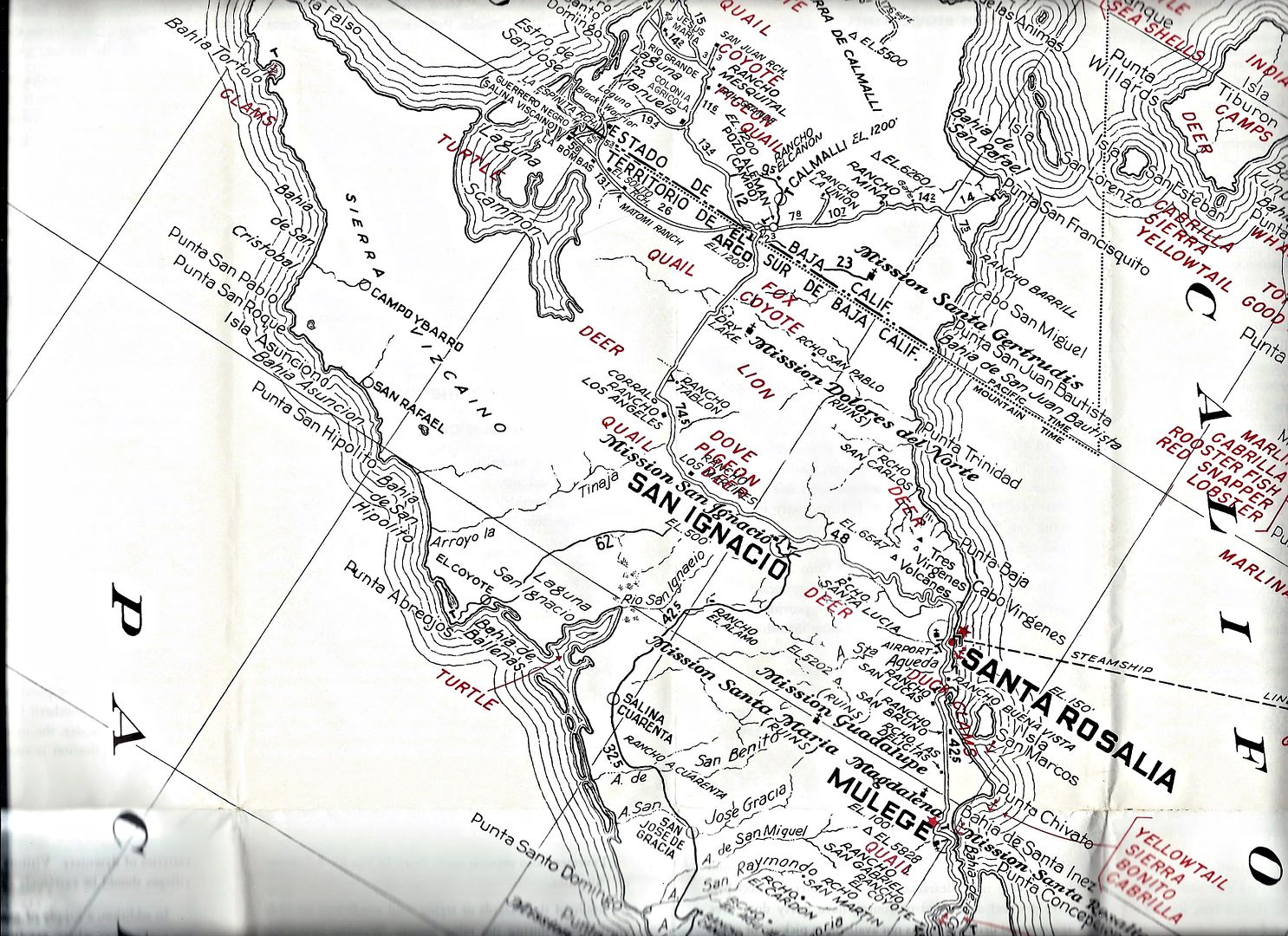
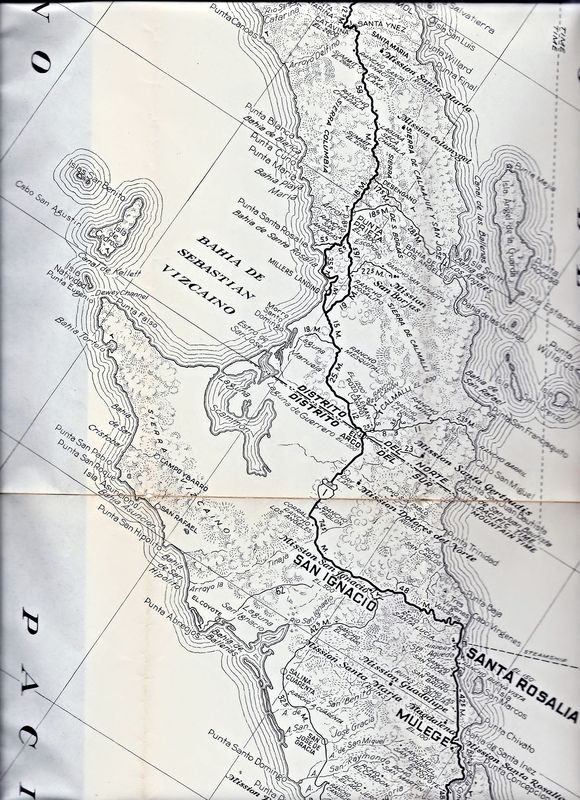
on today's map where would Rancho Las Delicias and Rancho Santa Lucia be?


I see Santa Lucia between San Ignacio and Santa Rosalia, a bit south of the road. Las Delicias looks to be about where Palo Verde is (Punta Chivato road junction). Are these the two in question?

[Edited on 7-28-2019 by David K]

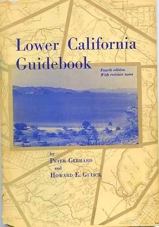
1962 Lower California Guidebook

David K - 7-22-2019 at 11:00 AM

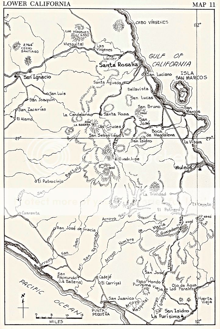
Howard Gulick's map does not have either ranch shown:


David K - 7-22-2019 at 11:15 AM

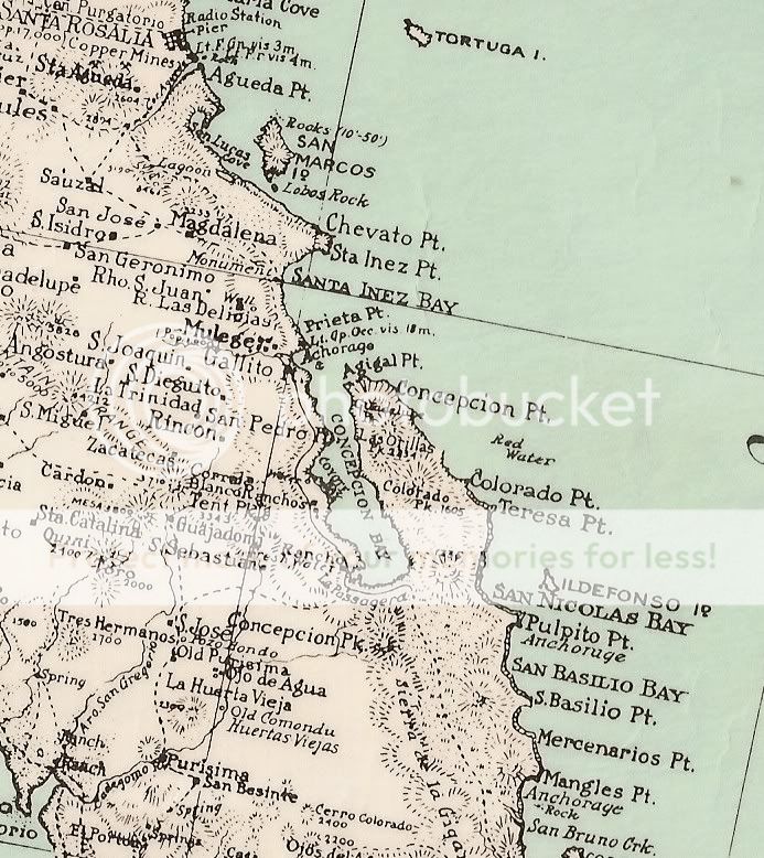
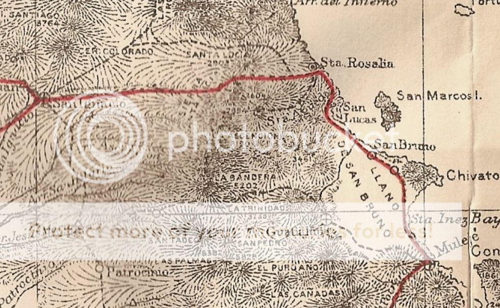
On the 1930 map is Rancho Las Delicias (but not Santa Lucia):


David K - 7-22-2019 at 11:17 AM

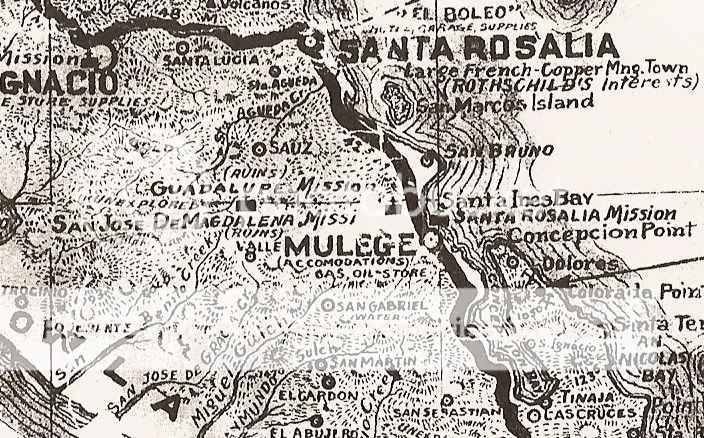
On the 1941 map is Santa Lucia, but not Las Delicias:


David K - 7-22-2019 at 11:20 AM

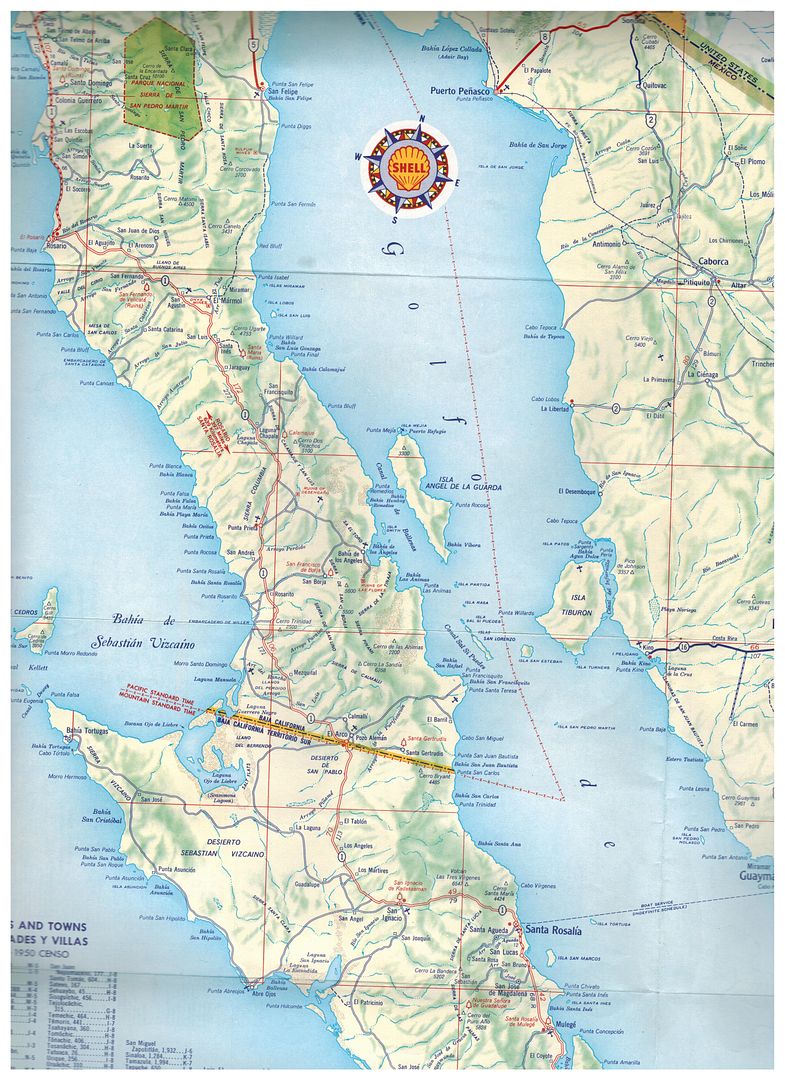
The 1958 Shell map has neither:


David K - 7-22-2019 at 11:32 AM

The 1905 Nelson map (published in 1919) does have a mountain named Santa Lucia in the area. No Delicias near Palo Verde, however.


When Nelson saw the Magdalena ruins near Mulegé, he mistook them to be the Guadalupe mission... and that error is on this map.

[Edited on 7-22-2019 by David K]

4x4abc - 7-23-2019 at 07:32 AM

the location Lucifer shows one of the major mines around Santa Rosalia, In the early years it was a small settlement, like all mines at the time. Later everyone was moved to Santa Rosalia.
Rancho Santa Lucia is in the mountains between Santa Rosalia and San Ignacio. Far away from the locations given in the maps.
27°18'39.89"N, 112°34'10.57"W

it only proves how inaccurate these maps are. They give you a general idea, but rarely a precise location.
But they are fun to compare with today's information.

Haven't found anything yet on Rancho Las Delicias. It is shown on the west side of the road, so it can't be Palos Verdes.

David K - 7-23-2019 at 08:04 AM

Quote: Originally posted by 4x4abc  
the location Lucifer shows one of the major mines around Santa Rosalia, In the early years it was a small settlement, like all mines at the time. Later everyone was moved to Santa Rosalia.
Rancho Santa Lucia is in the mountains between Santa Rosalia and San Ignacio. Far away from the locations given in the maps.
27°18'39.89"N, 112°34'10.57"W

it only proves how inaccurate these maps are. They give you a general idea, but rarely a precise location.
But they are fun to compare with today's information.

Haven't found anything yet on Rancho Las Delicias. It is shown on the west side of the road, so it can't be Palos Verdes.


In the 1962 AAA guide, Las Delicias is quite the reference, on the main road. The same is mentioned in the 1964, 1966, 1968, & 1971 guides.
In 1972, the name Las Delicias is gone and the road south of Santa Rosalia is now paved.

Let me know if you want to see a scan.

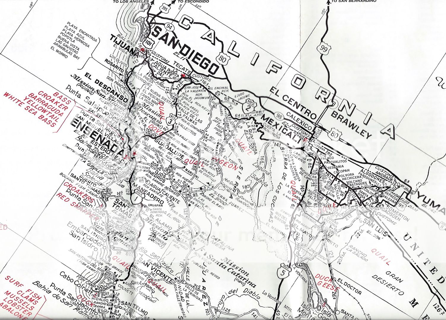
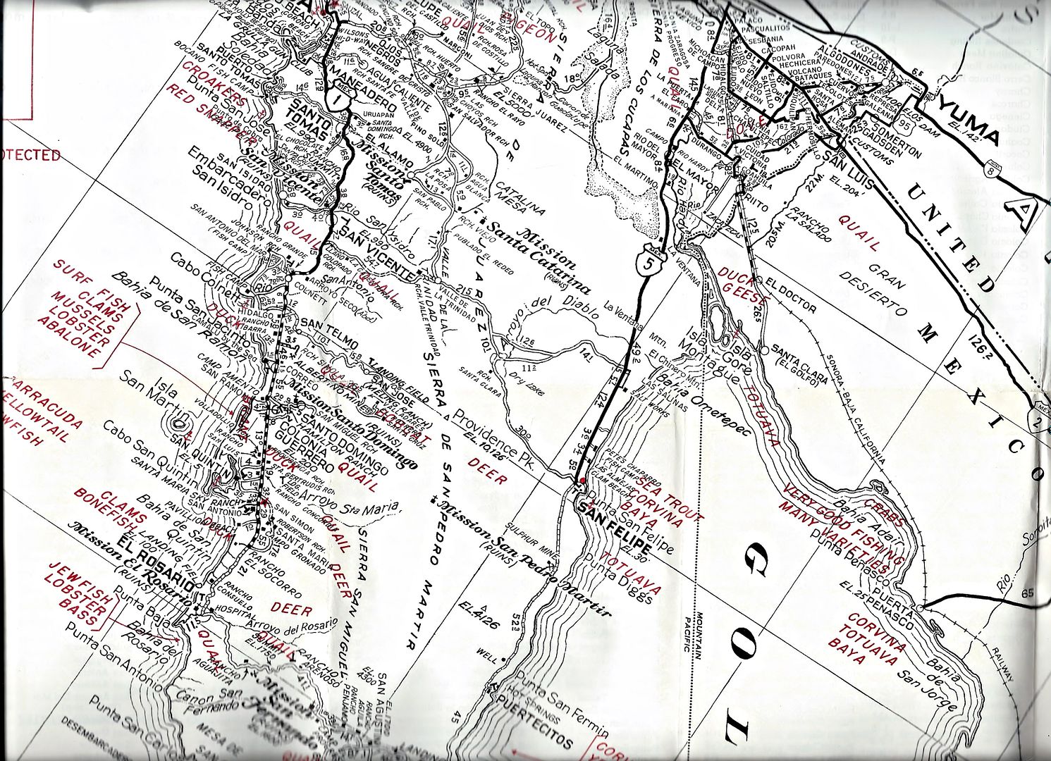
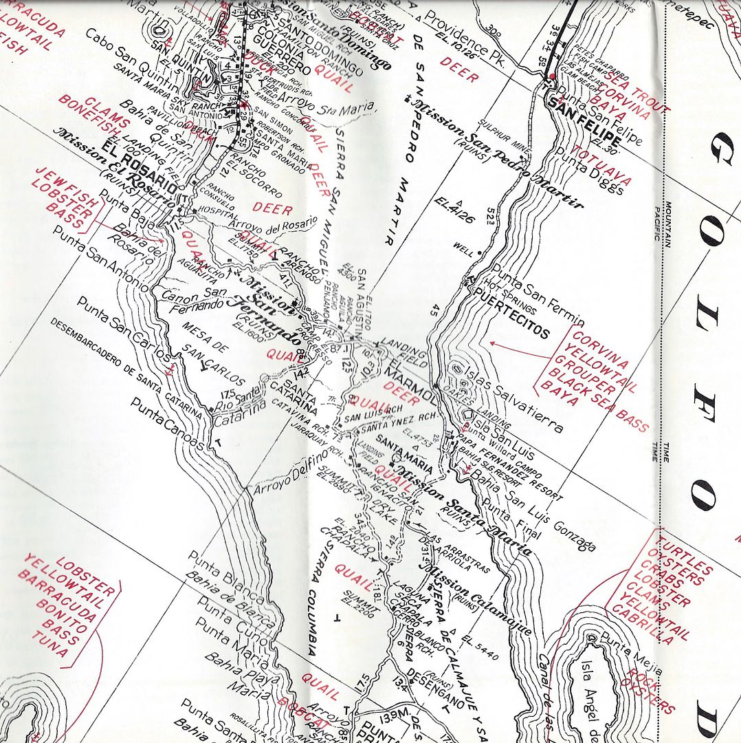
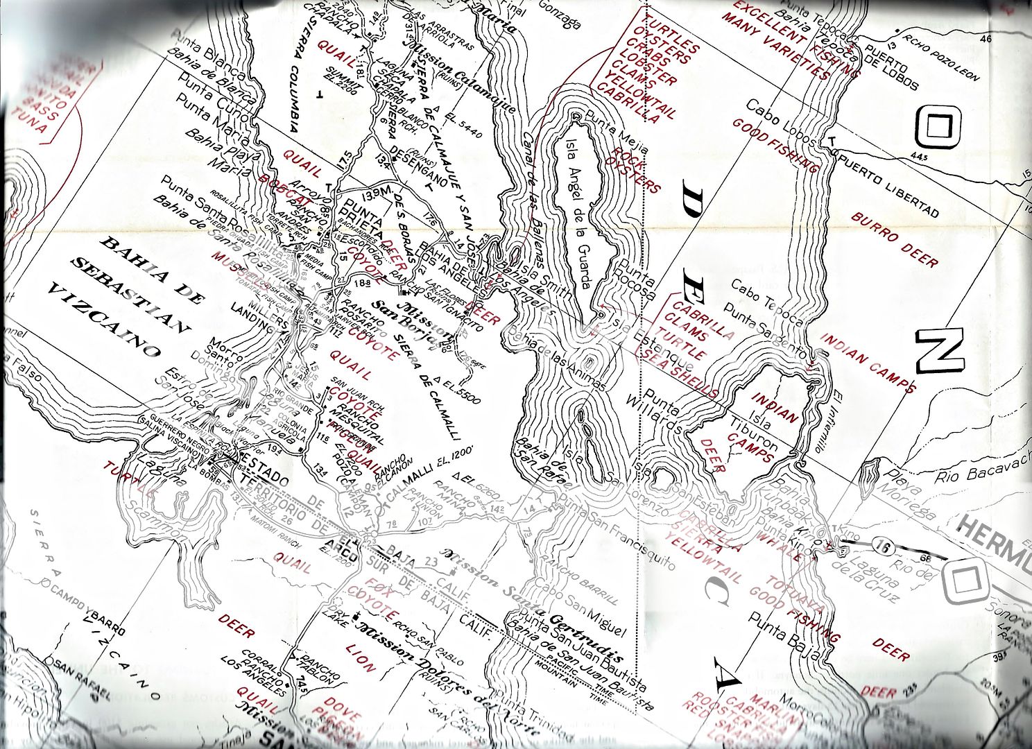
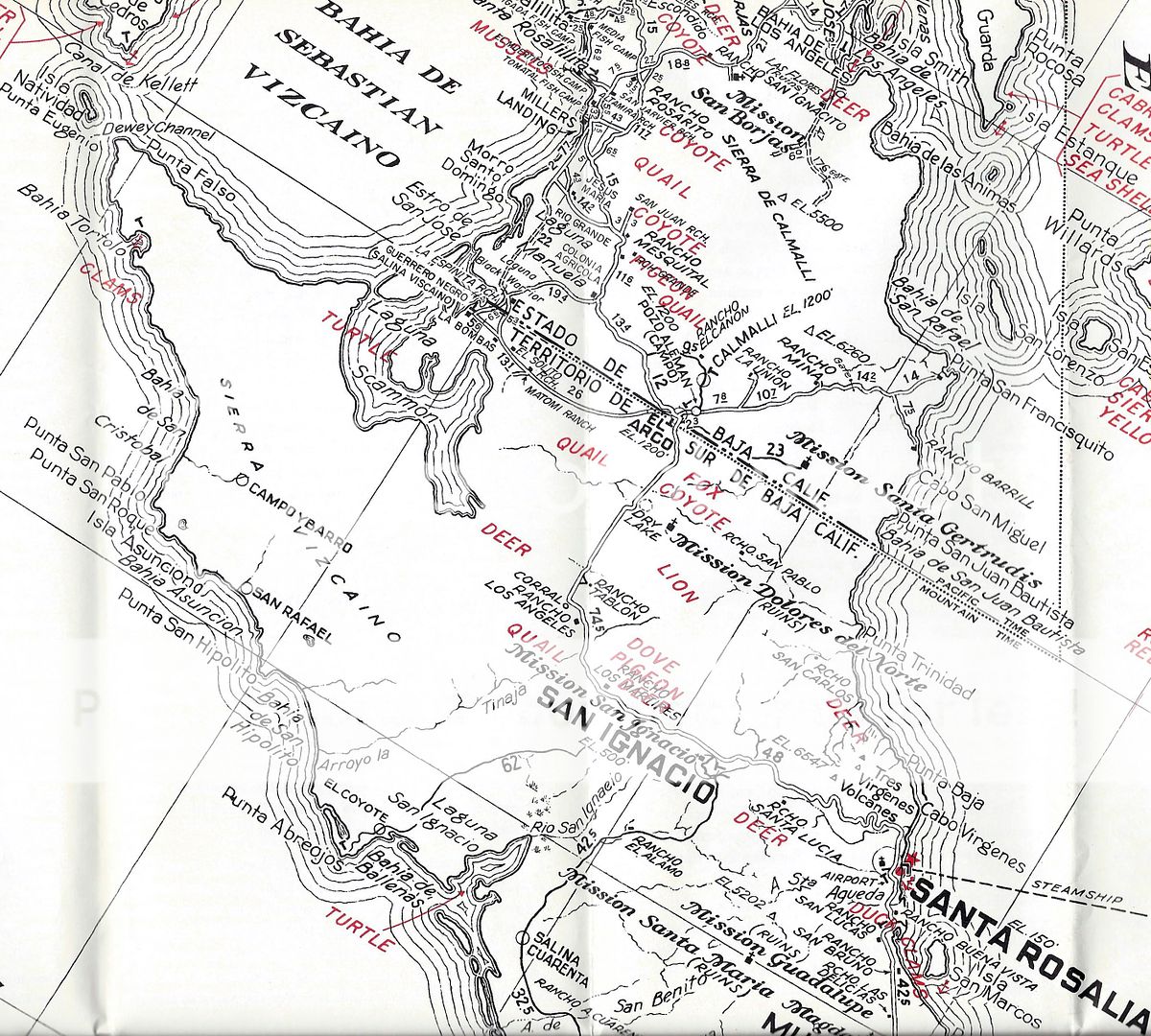
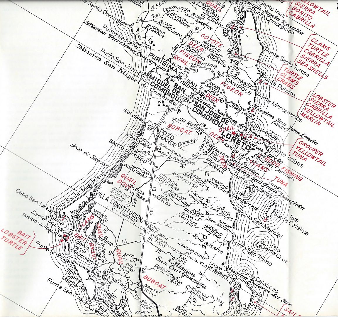
The rest of the 1962 AAA map...

David K - 7-23-2019 at 08:15 AM


4x4abc - 7-23-2019 at 12:46 PM

Quote: Originally posted by David K  


In the 1962 AAA guide, Las Delicias is quite the reference, on the main road. The same is mentioned in the 1964, 1966, 1968, & 1971 guides.


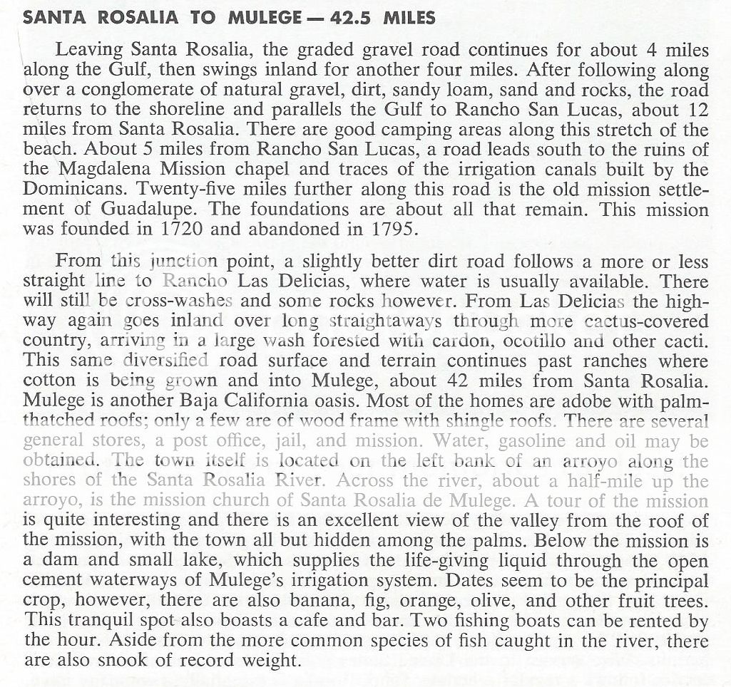
Is there a distance given to Las Delicias?
That way we could locate the site

David K - 7-23-2019 at 12:56 PM

The maps of 1962 (AAA and Gulick's) show the Baja California I was so lucky to experience, as we drove south, just three years later, going to Gonzaga Bay, in 1965. In 1966, we drove the Tijuana to Cabo road (taking over 2-weeks) and then up to La Paz via Todos Santos where we boarded the ferry to Mazatlan for a paved return to San Diego.

In those days, Highway 1 pavement ended about 70 miles from Ensenada, north of Colonet. It didn't begin again until about 100 miles north of La Paz. South from La Paz, the pavement ended in 10 miles and the new graded roadbed ended just past San Bartolo.

It was my job to read Gerhard & Gulick's Lower California Guidebook as we passed point mentioned along the way. Perhaps that is why my memory of the trip (and my love of maps and guides) is so strong?


Nice palm tree! ;)

David K - 7-23-2019 at 12:58 PM

Quote: Originally posted by 4x4abc  
Quote: Originally posted by David K  


In the 1962 AAA guide, Las Delicias is quite the reference, on the main road. The same is mentioned in the 1964, 1966, 1968, & 1971 guides.


Is there a distance given to Las Delicias?
That way we could locate the site


Nope... just midway between San Lucas and Loreto... like near where Palo Verde is today. I will scan the page... 1962 edition:


[Edited on 7-23-2019 by David K]

4x4abc - 7-23-2019 at 08:21 PM

I think, I found the location for Rancho Las Delicias
called Boca de Magdalena on the INEGI topo

27° 4'37.41"N, 112° 6'55.12"W

David K - 7-24-2019 at 07:56 AM

Quote: Originally posted by 4x4abc  
I think, I found the location for Rancho Las Delicias
called Boca de Magdalena on the INEGI topo

27° 4'37.41"N, 112° 6'55.12"W


Boca de Magdalena is the arroyo name on some maps and was the village name (to the west where the arroyo leaves the mountain pass) as shown on the Gulick map (near the ruins of La Magdalena).

Your waypoint is in a flood plain near the Palo Verde airport road and other than a building, I don't see any signs of an important rancho with trees, gardens, corrals.

I will still bet that the village of Palo Verde grew up from that rancho... but who knows for sure? The old road and the paved road seem to be one in the same in this section. So, Las Delicias would be along the highway.

4x4abc - 7-24-2019 at 03:31 PM

you are right, there isn't much left of that Rancho
especially after hurricane Odile

but the 2004 Google image shows what we are looking for:
the old road
the new paved road
a road connecting to Boca de Magdalena
and the ranch is on the west side of the old road!

image also shows significant more vegetation, indicating a source of water


roads.jpg - 201kB

David K - 7-24-2019 at 04:02 PM

Nice close-up! Maybe do a zoom in on the AAA map and 1930 map. Then, measure the distance to where they have Las Delicias from a couple of points, like Punta Chivato, Santa Rosalia, and Mulegé. Let's compare those distances and maybe we can decide where Las Delicias was. On the 1930 map, there is a well clearly shown and a black square maybe by it for the ranch? I bet the well was at the ranch, too?

4x4abc - 7-24-2019 at 05:56 PM

distances given on these maps are not worth much
remember the location of Rancho Santa Lucia
or take the Santa Rosalia - Mulege road log you copied
4 miles along the coast? then 4 miles inland?
no way
12 miles to San Lucas?
no way


4x4abc - 7-24-2019 at 06:00 PM

if I transcribe to location from map to satellite I get to this location:
27° 3'44.56"N, 112° 6'21.53"W
there is even a Pila there
but that one is connected to the water line coming from El Perdido
no vegetation - no sign of a former Rancho

so, I'll stick with the first one

David K - 7-25-2019 at 10:23 PM

Interesting, and I did see trees by the pila...? I will keep my eyes open for Rancho Las Delicias in travel books from the past. Maybe there is a mileage somewhere?

Ateo - 7-25-2019 at 10:42 PM

How dare you show my secret spot of Scorpion Bay!

4x4abc - 7-26-2019 at 12:07 PM

here is another question
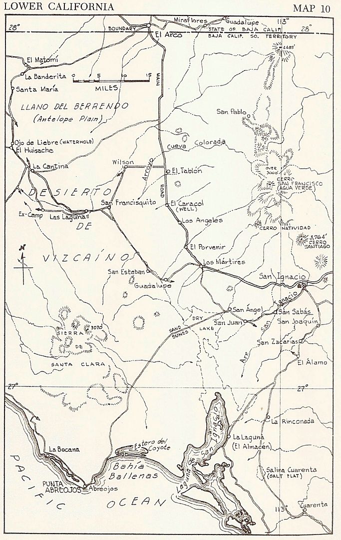
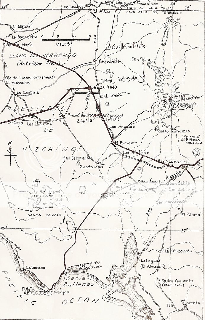
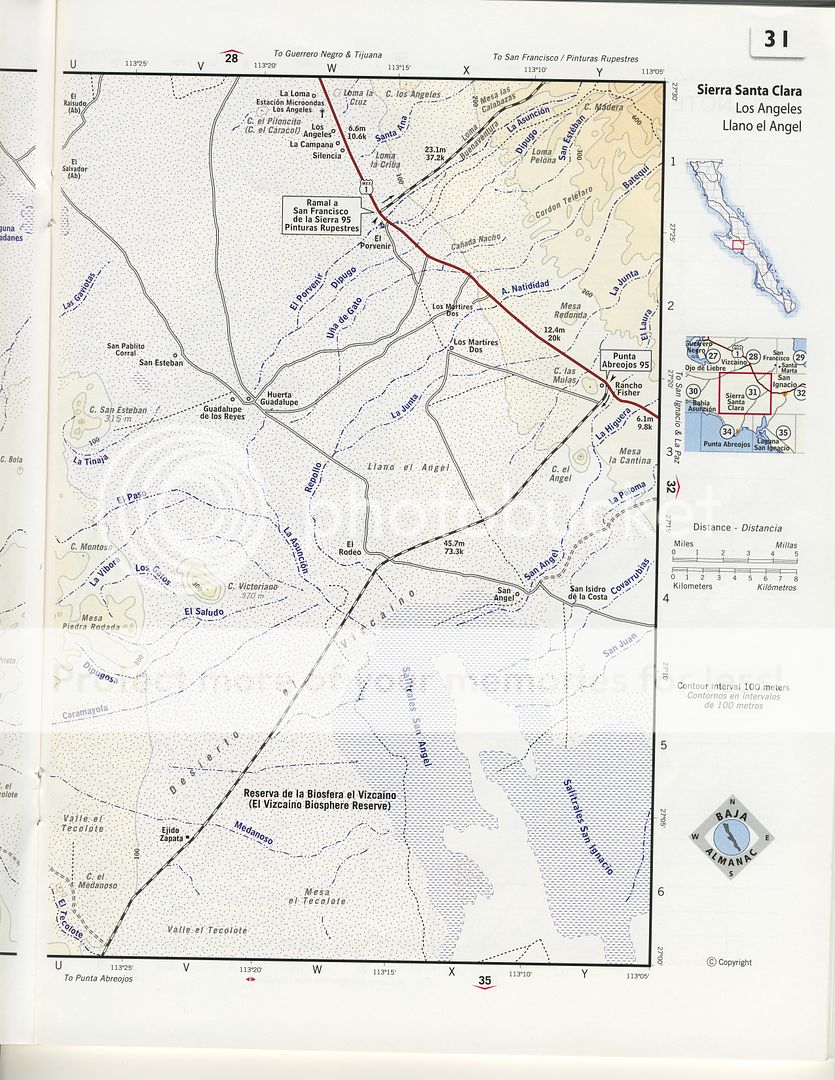
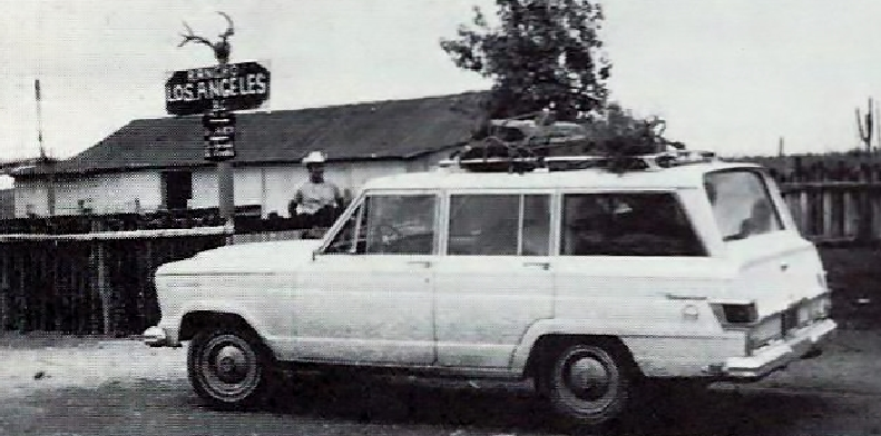
how do I locate Rancho Los Angeles?


los angeles.jpg - 82kB

David K - 7-26-2019 at 12:29 PM

See the Gulick map. I will give you a Google spot for it later. The old ranch was by the new highway and I noted it in my first logs of '73 and '74.


Now, the Gulick 1962 map with some new roads drawn in:


The 2003 Almanac (Inegi) has it on the other side of the highway:


[Edited on 7-26-2019 by David K]

David K - 7-26-2019 at 02:32 PM

OK, found it:
27° 29.063'N, 113° 17.703'W

From my 1973 notes, it was 12.6 miles from the junction to Ejido Vizcaino... Now, the junction to Bahia Tortugas since Vizcaino grew up at the old junction to where it was first established.

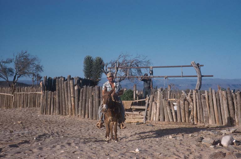
Howard Gulick photos

David K - 7-26-2019 at 02:44 PM


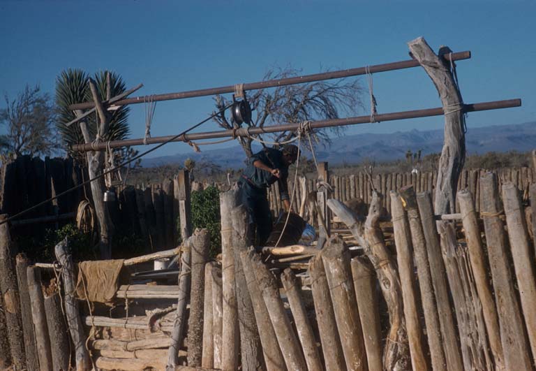
Pumping water at Los Angeles, April 20, 1959


Well at Los Angeles, April 20, 1959

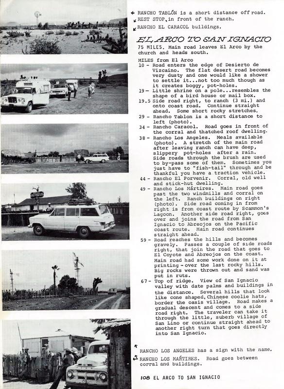
1970 Cliff Cross Baja Guide

David K - 7-26-2019 at 02:57 PM


4x4abc - 7-26-2019 at 04:38 PM

good job, David!

David K - 7-26-2019 at 05:17 PM

Gracias, Harald!

4x4abc - 7-26-2019 at 07:36 PM

amazing how much (and how little) Baja has changed

depending on the terrain, a road from 60 years ago may have completely vanished and in some places El Camino Real from 260 years ago is still visible.

But then of course there is the animal factor.
Animals love man made trails - they follow them long after the humans are gone. Plus it may have been an animal trail from the start where the padres laid out their camino.
So, the animal use of today keeps ancient human trails visible.

Or not.
Like many of the bulldozed roads of the early 1900's. They did not follow animal travel routes. Therefore animals today don't not use them and don't keep them visible.

On numerous occasions when I went out to rediscover old roads I follow a clearly visible path for some miles - and then there are bushes and trees everywhere. No more clear path. But looking for strong animal tracks will reveal the path of the old road. Some bush trimming and cactus cutting might be required. But I have always found what I was looking for

see the animal track on this forgotten mining trail?


track.jpg - 201kB

BajaRat - 7-26-2019 at 07:43 PM

Sweet ride on the mine road, worth a pretty penny now
Lionel :cool:

4x4abc - 7-26-2019 at 09:12 PM

strong companion


companion.jpg - 228kB

mtgoat666 - 7-26-2019 at 09:30 PM

Quote: Originally posted by 4x4abc  
amazing how much (and how little) Baja has changed

depending on the terrain, a road from 60 years ago may have completely vanished and in some places El Camino Real from 260 years ago is still visible.

But then of course there is the animal factor.
Animals love man made trails - they follow them long after the humans are gone. Plus it may have been an animal trail from the start where the padres laid out their camino.
So, the animal use of today keeps ancient human trails visible.

Or not.
Like many of the bulldozed roads of the early 1900's. They did not follow animal travel routes. Therefore animals today don't not use them and don't keep them visible.

On numerous occasions when I went out to rediscover old roads I follow a clearly visible path for some miles - and then there are bushes and trees everywhere. No more clear path. But looking for strong animal tracks will reveal the path of the old road. Some bush trimming and cactus cutting might be required. But I have always found what I was looking for

see the animal track on this forgotten mining trail?


It is a shame that when nature manages to grow back and cover an old road scar some flock head comes along and slashes brush so he can drink beer in his silly jeep and drive drunk to seek cheap thrills trampling nature and drive his little jeep over bumps to prove his small penis is bigger than it really is.

willardguy - 7-26-2019 at 10:05 PM

Quote: Originally posted by mtgoat666  
Quote: Originally posted by 4x4abc  
amazing how much (and how little) Baja has changed

depending on the terrain, a road from 60 years ago may have completely vanished and in some places El Camino Real from 260 years ago is still visible.

But then of course there is the animal factor.
Animals love man made trails - they follow them long after the humans are gone. Plus it may have been an animal trail from the start where the padres laid out their camino.
So, the animal use of today keeps ancient human trails visible.

Or not.
Like many of the bulldozed roads of the early 1900's. They did not follow animal travel routes. Therefore animals today don't not use them and don't keep them visible.

On numerous occasions when I went out to rediscover old roads I follow a clearly visible path for some miles - and then there are bushes and trees everywhere. No more clear path. But looking for strong animal tracks will reveal the path of the old road. Some bush trimming and cactus cutting might be required. But I have always found what I was looking for

see the animal track on this forgotten mining trail?


It is a shame that when nature manages to grow back and cover an old road scar some flock head comes along and slashes brush so he can drink beer in his silly jeep and drive drunk to seek cheap thrills trampling nature and drive his little jeep over bumps to prove his small penis is bigger than it really is.


woohoo friday night and goats on his third amstel light and flexing those beer muscles! what a tool :rolleyes:

4x4abc - 7-27-2019 at 06:30 AM

never forget

we don't see Nin.jpg - 46kB

4x4abc - 7-27-2019 at 08:04 AM

Quote: Originally posted by David K  
Maps that show roads is the topic. Goat, maps that show brush is a different subject. All the brush goats eat cannot compare to keeping a road clear of brush. Roads can be used to rescue hikers in trouble, too!


religious people can't be reached with arguments
valid for palm trees as well

David K - 7-27-2019 at 10:50 AM

Quote: Originally posted by 4x4abc  
Quote: Originally posted by David K  
Maps that show roads is the topic. Goat, maps that show brush is a different subject. All the brush goats eat cannot compare to keeping a road clear of brush. Roads can be used to rescue hikers in trouble, too!


religious people can't be reached with arguments
valid for palm trees as well


I agree!
You figure if the high tide is 2 feet below a palm in 1949 and 2 feet below in 2017, anyone could see there is no catastrophic sea level change happening now, right?
Have a great day!

4x4abc - 7-27-2019 at 12:55 PM

I don't know where this catastrophic sea level change idea is coming from

most things in nature happen very very slowly
like the temperature is rising very slowly (man made or not aside)
that does not translate into a visible sea level change (yet)

part of what scientists do is - predict
so, IF the temperature keeps rising at the rate it is doing right now
then, by 2100, sea levels could have risen by 3 feet

all humans make mistakes
scientists, too
early calculations and predictions were indeed sensational
we know today they were way off

so, your palm trees will be OK for another few decades, David
to use their status to prove that there is no warming trend is ridiculous though


David K - 7-27-2019 at 02:31 PM

Quote: Originally posted by 4x4abc  
I don't know where this catastrophic sea level change idea is coming from

most things in nature happen very very slowly
like the temperature is rising very slowly (man made or not aside)
that does not translate into a visible sea level change (yet)

part of what scientists do is - predict
so, IF the temperature keeps rising at the rate it is doing right now
then, by 2100, sea levels could have risen by 3 feet

all humans make mistakes
scientists, too
early calculations and predictions were indeed sensational
we know today they were way off

so, your palm trees will be OK for another few decades, David
to use their status to prove that there is no warming trend is ridiculous though


I have NEVER used them for any temperature reasons. They are simply a well-photographed benchmark proving the sea is not rising (at any rate that can be noticed or being alarmed over), that's it. In 80 years, through huge environmental disasters of the 40's-90's+, it sure hasn't done the sea level any harm.

4x4abc - 7-27-2019 at 03:13 PM

so you are using the palm trees to prove that the sea is not rising
the sea is rising
has been rising
nobody is claiming that the sea level has been rising visible to the naked eye
it has been rising by a few millimeters per year
and it is predicted that it will keep doing that
until in 80 years it may have risen 3 feet


David K - 7-27-2019 at 04:22 PM

Yes, and I have never disputed that. The amount of rising is so insignificant and the amount of hysteria over it is what I scoff at.
The sea used to be hundreds of feet higher... Isn't it great that these natural fluctuations are so slow so we have lots of time to adjust to them?

4x4abc - 7-27-2019 at 04:37 PM

I give up

del mar - 7-27-2019 at 05:58 PM

Quote: Originally posted by 4x4abc  
I give up


:lol:....yup might as well

mtgoat666 - 7-27-2019 at 08:23 PM

Quote: Originally posted by del mar  
Quote: Originally posted by 4x4abc  
I give up


:lol:....yup might as well


You can still use him for advice on posting pictures (remember the max width is 1200), and if you don’t feel like buying a map he does provide good reproductions of those copyrighted maps you are too cheap to buy :lol:

JZ - 7-27-2019 at 11:21 PM

Good thread guys.


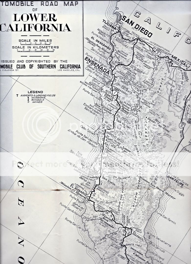
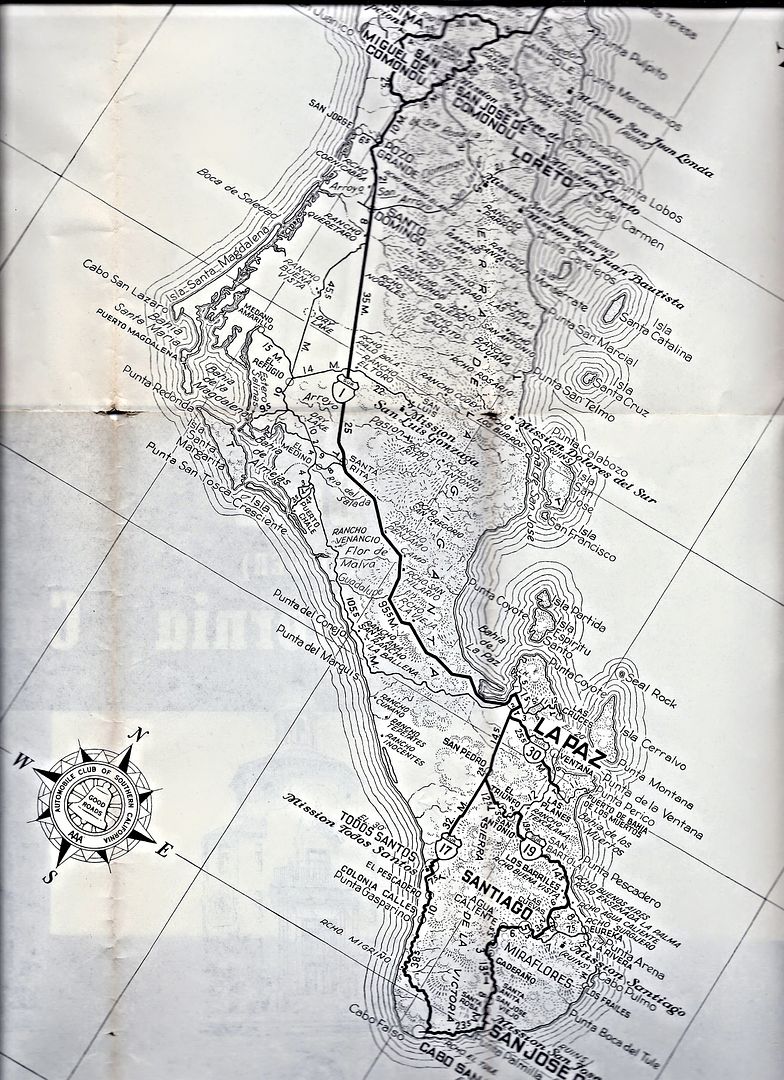
1955 AAA Map

David K - 7-28-2019 at 08:00 AM

Since the 1962 map brought so much fun to you guys, let's have a look at the 1955 AAA map. The is does not clearly differentiate between a paved road and a dirt road. The 1951 guidebook has the road paved to Arroyo Grande ('oiled macadam', is how it is worded) which is just north of Colonet. That was the end of pavement throughout the 1960s, as well. The San Felipe road is called "a good oil-mix surface" in 1951. No pavement until the town of La Paz and then dirt again, on south. The 1959 guide says the paving reached 105 miles north from La Paz (about where it was in1966, too).


Despite the Mexico Federal Highway names, these were all dirt roads in 1955. The road south of La Paz was a single lane dirt track, grading began 10 years later.

4x4abc - 7-28-2019 at 09:01 AM

what is the lat long for Seal Rock north of Isla Cerralvo?

David K - 7-28-2019 at 10:36 AM

Quote: Originally posted by 4x4abc  
what is the lat long for Seal Rock north of Isla Cerralvo?


This appears to be the correct spot, from https://mapcarta.com/20358174 :

Arrecife de la Foca
Type: reef
Location: Baja California Sur, Baja California, Mexico, North America
Latitude: 24° 26' (24.4333°) north
Longitude: 109° 59' (109.9833°) west

4x4abc - 7-28-2019 at 01:48 PM

I have 3 different locations - confusing

David K - 7-28-2019 at 04:31 PM

Well, what are they?
The Seal Rock is on all the AAA maps up to the 2010 one, and when I searched the same spot on the Internet, I found the link I shared.

4x4abc - 7-28-2019 at 04:54 PM

there is this new community south of Vizcaino
does anyone have a name?
27° 35.525'N, 113° 21.573'W

Howard - 7-28-2019 at 05:29 PM

Between the 2 of you the posting account for over 45 of the replies.

You have quite a bromance going. I think you guys should give each other a secret coded spot and meet for tea.

4x4abc - 7-29-2019 at 06:25 AM

nothing on the map
new community sprung up around 2000

4x4abc - 7-29-2019 at 08:34 AM

Islote de la Reina (Arrecife de la Foca) Seal Rock
has no precise GPS location
Latitude: 24° 26' (24.4333°) north
Longitude: 109° 59' (109.9833°) west
is not precise

all others have resorted to distances given from the most northern point of Isla Cerralvo
4.25 nm, 4 miles and 6.43 km
the coordinates given are 4.57 nm out

I trust 6.43 km the most as it is part of a master thesis at CIB
https://cibnor.repositorioinstitucional.mx/jspui/bitstream/1...

this video shows a ship wreck at the site (6:24)
https://www.youtube.com/watch?v=zFOGIu4TX-4

Islote_De_La_Reina.jpg - 61kB

BigBearRider - 7-29-2019 at 11:48 AM

There are some ruins of something around San Marcos Tierra, northeast of Palo Verde. I recall seeing what I think were ovens, and a water system. Maybe this was Las Delicias?

Also, I understand that Palo Verde, or maybe it was called then San Marcos, moved to its current location many, many years ago. It used to be about halfway to Punta Chivato from where the highway is now. Maybe 40 or 50 years ago? There are still ruins of the old buildings, including the school, in the old location. Some of the locals lived there.

As to Palm Trees and photos, no reasonable person can draw any real conclusions from such without knowing when the photos were taken relative to the tide. I propose that science deniers be denied access to science generally, including medical science.

[Edited on 7-29-2019 by BigBearRider]

David K - 7-29-2019 at 01:05 PM

Interesting... although no maps from back then show any town midway to Punta Chivato. I hope Harald scouts it out.

As for the palm beach; even if no palm was there, the sea has failed to rise higher. Otherwise, that flat area next to the beach would be underwater. The palm is at the top of the beach and high tide has remained below it, since the 1930s. The same is true of all the salt flats... When sea levels do rise any serious amount, they will be underwater, too!

BigBearRider - 7-29-2019 at 01:26 PM

Quote: Originally posted by David K  
Interesting... although no maps from back then show any town midway to Punta Chivato. I hope Harald scouts it out.

As for the palm beach; even if no palm was there, the sea has failed to rise higher. Otherwise, that flat area next to the beach would be underwater. The palm is at the top of the beach and high tide has remained below it, since the 1930s. The same is true of all the salt flats... When sea levels do rise any serious amount, they will be underwater, too!


Seriously? You believe that a photo taken st an unknown time many years ago somehow disproves climate change? The sand on the beach in front of my house moves all the time. Sometimes there are many meters of sand between my palm trees and high tide (and more during low tide) and sometimes none at all. This change (among other things) creates problems for some people whose houses are now in the federal zone, when they previously were not.

Your observation provides zero support for your argument. No health care for you!

David K - 7-29-2019 at 01:48 PM

No, I don't think it is any more than the obvious. We are not discussing sand movement/ erosion. The palm clearly shows that is not happening at El Coyote. We are discussing sea level. If the sea (at high tide or any tide) is no higher now than in 1930, at least more than the length of a cigarette or two, then there is no crisis... even if man caused it.

4x4abc - 7-29-2019 at 02:24 PM

didn't you insist on sticking to the 1962 & 1955 AAA BAJA MAP discussion?
How do the palm trees fit in - again?

bajabuddha - 7-29-2019 at 02:40 PM

"The trouble with the world is not that people know too little, but that they know so many things that ain't so."

.....Mark Twain.

4x4abc - 7-29-2019 at 03:07 PM

Quote: Originally posted by BigBearRider  
There are some ruins of something around San Marcos Tierra, northeast of Palo Verde. I recall seeing what I think were ovens, and a water system. Maybe this was Las Delicias?

Also, I understand that Palo Verde, or maybe it was called then San Marcos, moved to its current location many, many years ago. It used to be about halfway to Punta Chivato from where the highway is now. Maybe 40 or 50 years ago? There are still ruins of the old buildings, including the school, in the old location. Some of the locals lived there.


San Marcos Tierra, like many other developments in the area (San Bruno, San Rafale etc), was a Boleo project to produce food for their workers.
Created in the early 1900's.
With abundant water under ground, several more farming projects (Pozo Cien, Pozo Noventa y Dos, etc)sprung up with government support in the 1950's

Rancho Las Delicias was a small ranch next to the old road (close to the new paved road). It only made it onto the maps because they had water.

Palo Verde is a government sponsored settlement that came up in the early 1980's, initially named Ejido San Lucas.

David K - 7-29-2019 at 05:47 PM

Quote: Originally posted by 4x4abc  
didn't you insist on sticking to the 1962 & 1955 AAA BAJA MAP discussion?
How do the palm trees fit in - again?


Ask Big Bear Rider... he felt the need to bring that into this thread. He (like others who also believe in the predictions), mixed up sand erosion with sea-level rise.
The sand can move without the ocean getting higher. Wind, waves, currents, tides, all move sand. Lots of homes at Bahia Santa Maria have been lost or damaged because the sand moved away from the front of their homes... but the sea is not any higher than before.
Science is not about predicting the future, it is studying the evidence. Has any climate change/ sea level prediction made since Al Gore was made god of Global Warming come true? They don't even call it global warming anymore...

David K - 7-29-2019 at 05:48 PM

Quote: Originally posted by 4x4abc  
Quote: Originally posted by BigBearRider  
There are some ruins of something around San Marcos Tierra, northeast of Palo Verde. I recall seeing what I think were ovens, and a water system. Maybe this was Las Delicias?

Also, I understand that Palo Verde, or maybe it was called then San Marcos, moved to its current location many, many years ago. It used to be about halfway to Punta Chivato from where the highway is now. Maybe 40 or 50 years ago? There are still ruins of the old buildings, including the school, in the old location. Some of the locals lived there.


San Marcos Tierra, like many other developments in the area (San Bruno, San Rafale etc), was a Boleo project to produce food for their workers.
Created in the early 1900's.
With abundant water under ground, several more farming projects (Pozo Cien, Pozo Noventa y Dos, etc)sprung up with government support in the 1950's

Rancho Las Delicias was a small ranch next to the old road (close to the new paved road). It only made it onto the maps because they had water.

Palo Verde is a government sponsored settlement that came up in the early 1980's, initially named Ejido San Lucas.


This is GREAT research, Harald! Thank you!!

4x4abc - 7-29-2019 at 06:44 PM

Quote: Originally posted by David K  

Science is not about predicting the future, it is studying the evidence. Has any climate change/ sea level prediction made since Al Gore was made god of Global Warming come true? They don't even call it global warming anymore...


who is Al Gore?