BajaNomad

Baja Airplane Wrecks

Nikno - 10-15-2019 at 11:57 AM

I love exploring abandoned and unusual places and things. One of the things I always find fascinating are airplane wrecks. I am wondering if people know of any airplane wrecks in Baja that can be explored. Please add pictures and GPS info if you have it. Here is a list of the ones I know about :

Mexicali 727 at 32.500530, -115.396740

This is possibly the most famous airplane wreckage in Baja. It was featured in a Discovery Channel special. It was crashed remotely on the Laguna Salada west of Mexicali in 2012. The wreckage was brought here and is on display on Highway 5 between Mexicali and San Felipe.

Webp.net-resizeimage.jpg - 96kB

DC-3 at about 29.29250, -114.11585

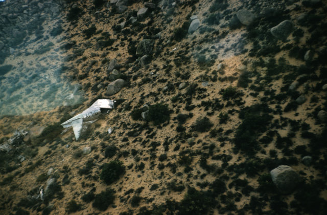
This wreckage was described by Erle Stanley Gardner in "Hovering Over Baja" so it crashed before 1961. I don't have the exact coordinates and I am unsure if there is still any wreckage visible. I can't see anything on satellite images. If anyone knows the exact location or has seen this wreckage, please reply. I would like to hike up here and check it out if I can get more information.


Helicopter at 29.42288, -114.19482

Fascinating story behind this wreckage. This helicopter was lost for many years and then discovered by chance during the Baja 1000 only about 1,000 feet away from the route. There were supposed to be 3 people on board but only 2 bodies were found. The missing person was a drug lord. There has been speculation that he faked his death.


Old wreckage in Juncalito Bay near Loreto at approx. 25.839700, -111.316781

An old 2 engine plane in 22 feet of water that can be visited on a dive tour. Either a B-24 or Dc-3 depending on reports. (Although a B-24 appears to be 4 engines). According to reports on Nomad, it was still visible in 2014.

Who knows of other wrecks? I heard about one near San Francisquito but it may have been cleaned up. Erle has a photo of another wreck in the middle of the desert in his book but the location is unclear. Does anyone know about that one?


David K - 10-15-2019 at 01:00 PM

Great thread topic. I know someone who hiked up to see the wreckage. He is a Nomad but doesn't post anymore. There are great views from up on that mountain east of El Crucero. I will dig up the posts and hopefully photos from 'billb' who wanted to go to the places Gardner did. Including Salsipuedes Canyon, whose headwater is just east of the crash site.

4x4abc - 10-15-2019 at 01:44 PM

I have found a number of wrecked planes over the years
always moved on as fast as I could

David K - 10-15-2019 at 03:30 PM

Ok, I bumped up two old threads that discussed the DC-3 site with GPS and Google Earth images. The photos of the wreck that BillB sent me were hosted by Nomad and vanished when Doug upgraded the forum (with a promise they would be restored one day). I will keep searching!

mtgoat666 - 10-15-2019 at 04:32 PM

Plane crash sites are places of death. If that is what you want, stop at any cross/memorial on the hwy for your taste of macabre.

airmech - 10-15-2019 at 05:30 PM

Quote: Originally posted by mtgoat666  
Plane crash sites are places of death. If that is what you want, stop at any cross/memorial on the hwy for your taste of macabre.


Wow debbie downer!! Not true though. Many people survive plane crashes ;D

advrider - 10-15-2019 at 06:30 PM

Cool, interesting topic. I have hiked/rode to several in California and Nevada.

4x4abc - 10-15-2019 at 09:07 PM

29° 1'10.25"N, 118°16'41.48"W

Nikno - 10-17-2019 at 10:44 AM

Great find, Harald! Isla Guadalupe has been on my bucket list for some time. Also, I agree, if you come across a fresh wreck in the middle of nowhere, probably a good idea to get the hell out of there unless you want to end up on an episode of Narcos.

David, thank you for bumping those threads. I can't identify any wreckage on the satellite but it's also been up there 70 years and there probably isn't much left or it's rusted out and scattered. I might check it out someday.

David K - 10-17-2019 at 03:46 PM

I emailed BillB asking if he still can send those mountaintop photos.. I have not heard back yet.


4x4abc - 10-17-2019 at 09:21 PM

I remember locals at Alfonsina's talking about discovering a wreck during a hike between Papa's and Mision Santa Maria
lost the location file I had in Google Earth
anyone?

pappy - 10-19-2019 at 06:55 AM

Mesa avion...all we found were some beautiful wild horses after seeping the whole Mesa by foot

4x4abc - 10-19-2019 at 07:58 AM

how did you get to Mesa el Avion?
It is a big mesa - more than 6 miles long
if there is any wreckage, it would be hard to find

the name does not necessarily mean that an airplane crashed there
could mean that it was used as a practice airfield

there is one of those in Death Valley
no roads leading to it - just a strip on a small mesa

4x4abc - 10-19-2019 at 08:02 AM

the Death Valley strip:
36°48'50.00"N, 117°43'19.02"W

David K - 10-19-2019 at 08:07 AM

Quote: Originally posted by 4x4abc  
how did you get to Mesa el Avion?
It is a big mesa - more than 6 miles long
if there is any wreckage, it would be hard to find

the name does not necessarily mean that an airplane crashed there
could mean that it was used as a practice airfield

there is one of those in Death Valley
no roads leading to it - just a strip on a small mesa


Pappy, Mexitron, Huddo, and the late Taco de Baja are featured on this page I made, and it includes their hike up to the mesa and Matomi Peak: http://vivabaja.com/mexitron/

chrishaynesusa - 10-20-2019 at 11:04 AM

Quote: Originally posted by 4x4abc  
the Death Valley strip:
36°48'50.00"N, 117°43'19.02"W


36°33'34.2"N 117°35'19.1"W

this one in saline valley has a US flag marking the spot where an A-6 aircraft went down.
pilot and bombadier lost.
short hike up a Steep trail(?) with a mesa with strewn A-6 pieces.

Marc - 10-21-2019 at 11:51 AM

Airplane wrecks are pretty cool. We found three WW2 fighters in New Guinea years ago.

pappy - 10-22-2019 at 07:07 AM

Thanks for the link David! I think the road in to base camp was perhaps more exciting than challenging than the hike itself. 4x4abc- we spent a night on the Mesa and the next day we fanned out and did a sweep of the Mesa...

David K - 10-22-2019 at 08:16 AM

Harald the road in is the right fork just north of El Sauce de Carter. This is the closet vehicle approach to Cerro Matomi and Mesa Avion that I have seen.

Stickers - 11-3-2019 at 10:57 PM

This photo made the rounds on nomad and other sites. I cant remember where in Baja it was,

Looks like a Mexican registered C-206

plane wreck .jpg - 224kB

4x4abc - 11-3-2019 at 11:31 PM

that was at the Santa Ines airfield

geoffff - 3-23-2020 at 11:53 PM

Quote: Originally posted by Nikno  

DC-3 at about 29.29250, -114.11585

This wreckage was described by Erle Stanley Gardner in "Hovering Over Baja" so it crashed before 1961. I don't have the exact coordinates and I am unsure if there is still any wreckage visible. I can't see anything on satellite images. If anyone knows the exact location or has seen this wreckage, please reply. I would like to hike up here and check it out if I can get more information.


I hiked up to that DC-3 wreck a couple weeks ago.

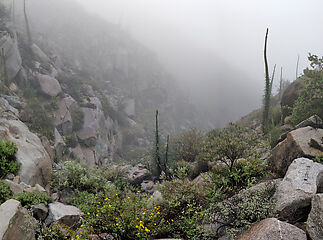
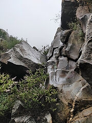
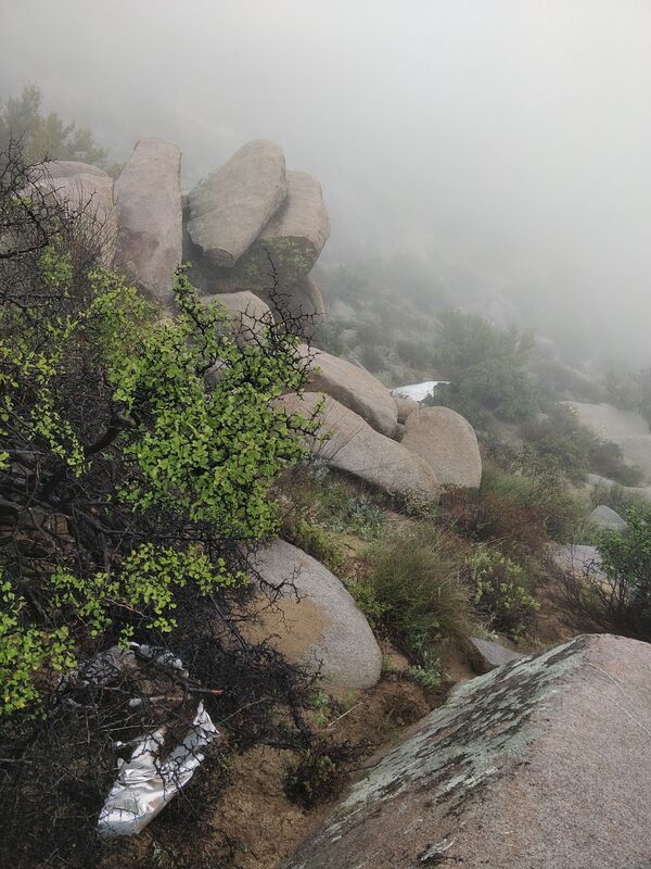
The weather was surprisingly dreary. Rainy and foggy. Somehow appropriate for visiting a site where people met their end. But the cool weather made exercise much easier! The coordinates for the crash site are only a bit over a mile from the end of the road, but it’s more of a scramble and bushwhack than a hike. It ended up taking me 6 hours round-trip to get up there and back down. My total track length was 6 miles with all the meanderings. 1900 ft. elevation gain. I spotted a few cairns to mark the way.


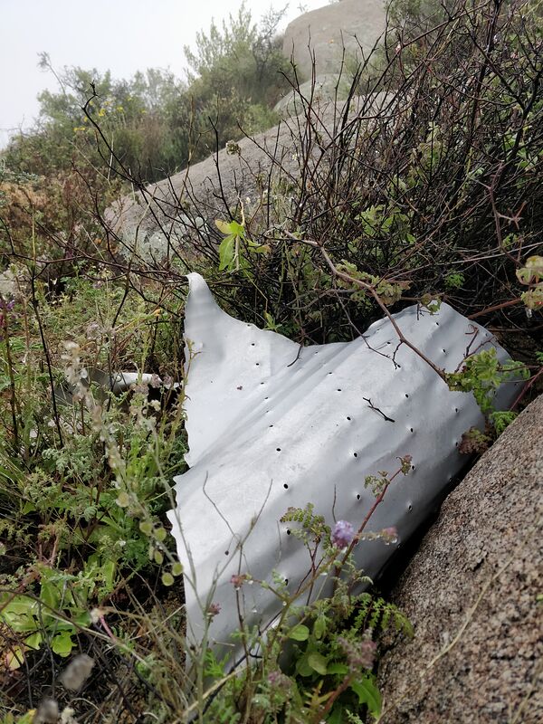
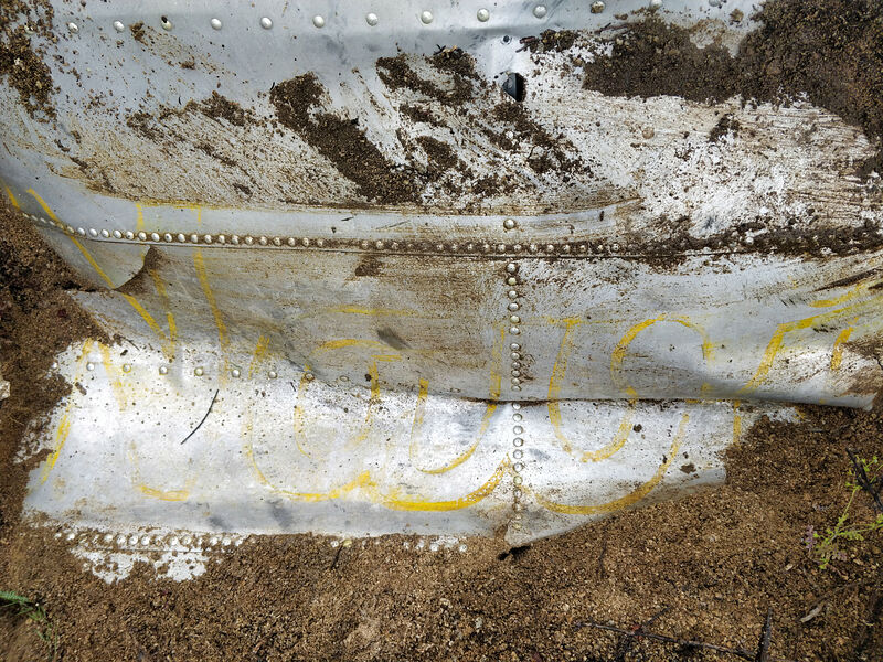
I spotted about 10 wreckage pieces on the southeast slope of Cerro la Gobernadora, just south of the GPS coordinates you gave above. In total, far less than a complete airplane! Because of the dense fog, I couldn't see very far.


What does this say? "...ome..."


"Wing Flaps"


What does this say? "Navi..."


Track log


My meanderings from looking for wreckage pieces. (Looking northwest in Google Earth.) I didn't bother climbing the last few feet to the top of the peak because there would be no view in that fog.

-- Geoff


geoffff - 3-24-2020 at 12:10 AM

My guess is this is the fateful flight: https://aviation-safety.net/database/record.php?id=19491209-... It's a DC-3 that crashed on Dec 9, 1949. The story about the cargo of lobsters matches what Erle Stanley Gardner wrote in his book Flying over Baja [edit: Hovering over Baja].

The aluminum wreckage pieces are in pretty amazing shape for having been lying around out there for 71 years!

[Edited on 3-24-2020 by geoffff]

David K - 3-24-2020 at 06:13 AM

Quote: Originally posted by geoffff  
My guess is this is the fateful flight: https://aviation-safety.net/database/record.php?id=19491209-... It's a DC-3 that crashed on Dec 9, 1949. The story about the cargo of lobsters matches what Erle Stanley Gardner wrote in his book Flying over Baja.

The aluminum wreckage pieces are in pretty amazing shape for having been lying around out there for 71 years!


Amazing find! Too bad the weather was so socked-in. BillB had a great photo from up there looking down to El Crucero and south. I could not find the photo... Why was the plane so far off course, I wonder?

Thank you Geoff!

PS Gardner's book is 'Hovering Over Baja'

[Edited on 3-24-2020 by David K]

geoffff - 3-24-2020 at 10:19 AM

Quote: Originally posted by David K  

Amazing find! Too bad the weather was so socked-in. BillB had a great photo from up there looking down to El Crucero and south.


Well, there's another part to my story.... The above trip was actually my second attempt hiking up there! A few days earlier I had made a first attempt, but needed to turn back after getting 2/3 of the way to the wreck site. I was running out of water and daylight, and the route I picked wasn't ideal. I did get some great views though!


Looking southwest


Cute snake!


Looking back up at Cerro la Gobernadora

I still haven't been able to find those BillB photos here on Baja Nomad.
-- Geoff

David K - 3-24-2020 at 10:43 AM

Stellar!
That is a very similar photo to the one from BillB, only he was higher up.
A Rosy Boa?
Will you have a full trip report for us?

Paco Facullo - 3-24-2020 at 10:47 AM

Oh My,, How cool is that !

Thanks for a MOST interesting adventure ... That snake is gorgeous !

LancairDriver - 3-24-2020 at 10:55 AM

Quote: Originally posted by geoffff  
My guess is this is the fateful flight: https://aviation-safety.net/database/record.php?id=19491209-... It's a DC-3 that crashed on Dec 9, 1949. The story about the cargo of lobsters matches what Erle Stanley Gardner wrote in his book Flying over Baja [edit: Hovering over Baja].

The aluminum wreckage pieces are in pretty amazing shape for having been lying around out there for 71 years!

[Edited on 3-24-2020 by geoffff]


That is amazing to see the condition of the metal after 71 years.
Great pictures!

BillB - 3-24-2020 at 10:55 AM

Nice work Geoff. I found a couple of photo's from the DC-3 crash site that I took in 2002. Note the survey marker at the top of la Gobernadora. As ESG said, this is the tallest mountain in the area, and had the pilot been about 30 feet higher, he would have made it. My guess is the fog you experienced was exactly what that pilot was experiencing during his fateful flight.


Baja Plane wreckage 1.jpg - 217kBBaja Plane wreckage 2.jpg - 188kBBaja Plane wreckage 3.jpg - 195kB

mtgoat666 - 3-24-2020 at 11:01 AM

what is the logo/name i see on the airplane skin in your pics?

geoffff - 3-24-2020 at 11:11 AM

Quote: Originally posted by mtgoat666  
what is the logo/name i see on the airplane skin in your pics?


I've been wondering that! Maybe someone can help me piece together the fragments?

David K - 3-24-2020 at 11:16 AM

Quote: Originally posted by BillB  
Nice work Geoff. I found a couple of photo's from the DC-3 crash site that I took in 2002. Note the survey marker at the top of la Gobernadora. As ESG said, this is the tallest mountain in the area, and had the pilot been about 30 feet higher, he would have made it. My guess is the fog you experienced was exactly what that pilot was experiencing during his fateful flight.


Thanks Bill for providing the 2002 hike pictures!

bajapedro - 3-24-2020 at 01:45 PM

Now Bill, how far up the mountain did that Rokon make it?

pacificobob - 3-24-2020 at 02:00 PM

Debris fields from cfit [controlled flight into terrain] usually are fairly large. Exactly opposite of the 9/11 Pentagon crash site.

BillB - 3-24-2020 at 03:09 PM

Quote: Originally posted by pacificobob  
Debris fields from cfit [controlled flight into terrain] usually are fairly large. Exactly opposite of the 9/11 Pentagon crash site.


Rokons are amazing machines, and do well in the desert and can go up sandy washes with ease.


Baja Rokon 2.jpg - 240kB

BillB - 3-24-2020 at 03:14 PM

But there is an easier way...


Catavina RW 1.jpg - 247kB

David K - 3-24-2020 at 03:33 PM

Pretty cool to drop into Arroyo El Volcán in a copter! :light::biggrin:

BillB - 3-24-2020 at 03:37 PM

Here is what remains of another small plane wreck. This was on one of the dry lakebeds NW of BOLA. I took this in 2001, but when I returned a few years later, there was even less of it left.


BOLA Dry Lake beds Plane wreck.jpg - 209kB

Aircraft wrecks though not in Baja

John M - 3-24-2020 at 04:40 PM

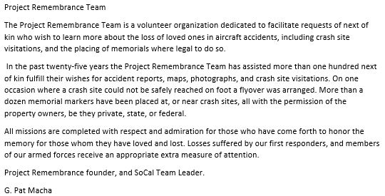
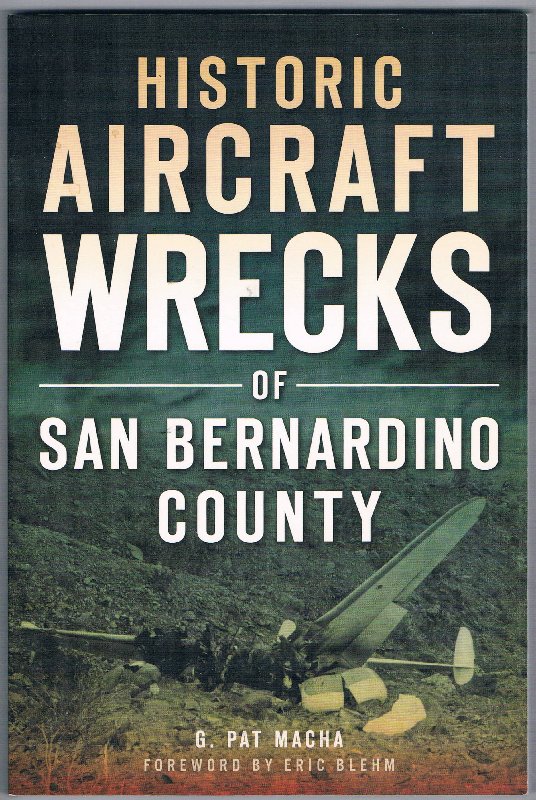
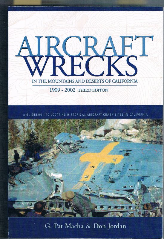
Several years ago we had occasion to meet a fellow, G. Pat Macha, while conducting a research project on the Victorville Army Flying School of WWII.

Pat had investigated the site of a B25-D Mitchell bomber that crashed shortly after takeoff on October 2, 1944 from VAFS killing all three crew including Marie Michell Robinson a graduate of the Women Airforce Service Pilots. We were doing research focused on the base, not just on the crash.

Pat Macha has developed an effort, Project Remembrance - detailed below.

His efforts have brought closure for many families impacted by these tragic accidents.


John M

pacificobob - 3-25-2020 at 08:56 AM

There are mountain passes in Alaska that have aircraft wreckage scattered across the mountain sides. I know of 20 mile stretches more than a dozen crash sites. All CTIF.

white whale - 3-26-2020 at 01:29 PM

What a great thread for a covid sidetrack. Sorry can't contribute but thanks to those that did .... an even more from ESG !, the guy just never quits with Baja history.

There must be lots of emergency landing strips all along Baja.

David K - 3-26-2020 at 01:42 PM

There were over 200 landing strips in Baja at one time. Then, the drug runners ruined things for private pilots as the Mexican army ditched most of the remote strips and demanded places with the rest to pay up to keep open.

Have you seen the old Erle Stanley Gardner Baja trip photos at www.vivabaja.com/choralpepper ?

AKgringo - 3-26-2020 at 01:59 PM

Quote: Originally posted by white whale  

There must be lots of emergency landing strips all along Baja.


I understand that many of those "emergency" landing strips were closed by digging a trench across them!

PaulW - 3-26-2020 at 02:20 PM

Yes these landing strips are everywhere. Some near the ranches, farms, emergency, and mines and some way out in the boondocks where it is very suspicious as to the purpose.
The strips also were used for mineral exploration as the are found in various places with no road access.
Never found one that did not have either trenches dug across them of lots of rocks piled to make it difficult for a typical light plane. Either way many of them are on our driving paths we like to use.

white whale - 3-26-2020 at 02:38 PM

DK , no wonder you get the "honored" title. Wow great photos.

Airstrips - yes assumed must be some drug strips mixed in, 200 is crazy. Side tangent, Is the drug business in Baja a shadow of its former self, if there was one? A side benefit perhaps of the US/Can decriminalize/legalize efforts in the last few years. The mainland, yes that never ending bloodshed will be there until there's no money left to be made.

Choral Pepper - I like her just from her name! A great historical record of the region. The bonus of having a helicopter. You think back in the day the border only applied to cars and foot traffic - no paperwork required ! Never knew about La Bufadora. Shot of old tech desalination works , now i have to figure how that might work.

Great post.

white whale - 3-27-2020 at 09:30 AM

my contribution via Davids photo link. Learned some more tricks from google earth as well so the entire thread is in bonus territory. ESG had enough pull to hire out the Goodyear Blimp - even back in '67 what a slight that must have been for those on the ground.


bufadora.jpg - 196kB

David K - 3-27-2020 at 09:48 AM

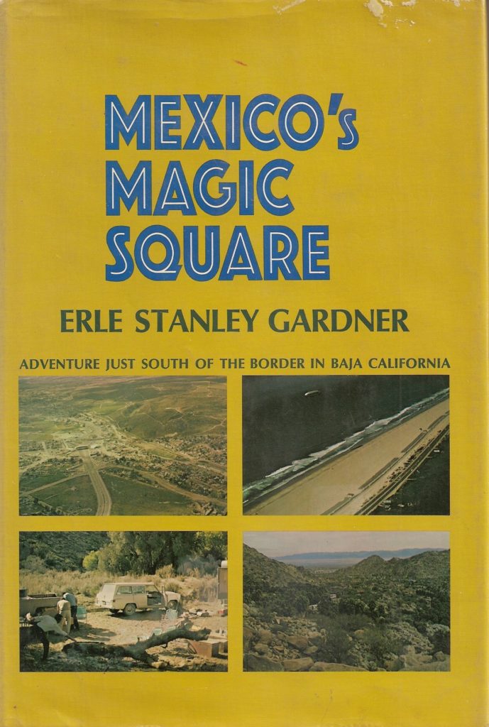
The blimp ride was featured in the book, 'Mexico's Magic Square' by Erle Stanley Gardner (1968). Choral Pepper (editor of Desert Magazine) was invited to be on the historic flight (first blimp in Baja).


[Edited on 7-29-2022 by David K]

David K - 7-29-2022 at 09:55 AM

Since this thread was posted, I have obtained many photos taken by Erle Stanley Gardner, thanks to the Temecula Valley Museum. Included in them a re many showing plane wrecks in Baja: https://vivabaja.com/esg/

Here's one:


[Edited on 7-29-2022 by David K]

vacaenbaja - 7-29-2022 at 12:19 PM

I remember in the mid seventies when I started driving down Baja

the roadside was filled with wrecks of rusted old cars. Everything

from model T's to the latest vintage victims. If they were at the side

of the road or over the side there they stayed for years. Same with

light airplanes. I remember one or two but cannot recall where they

were along the road that had made a hard landing and stayed there

for a number of years. They were sort of a land mark for me. No one

ever moved them. However there was a point in time where some


of the more accessible plane wreaks visible from the road began to

get removed. Maybe someone thought that there was money in the

scrap?

Also all the older roadside wrecks disappeared especially the ones on

the outskirts of La Paz. Within more time even the seemingly very

unrecoverable cars that would fall off those curvy mountain roads down


into a gulch 200 ft or so were removed. Nowadays every town

seems to have a "Yonke" or two.


Recent airplane wreck

Stickers - 8-1-2022 at 12:24 PM

I was watching a YouTube of a plane landing at Hotel Serenaded Mulege and noticed as it was touching down a wrecked Cirrus off to the side in the bushes! Cirrus are very expensive planes so I assume it was trucked out of there and salvaged.

I took this screenshot as the landing plane passed the wrecked plane.


Screen Shot 2018-11-27 at 9.53.47 PM.JPG - 113kB