BajaNomad

Graham's new adventure for 2019: Tracking and Messages Isla Angel de la Guarda. Photos added.

David K - 10-27-2019 at 05:26 PM

Hello Gang,
I was hoping to follow a post from Graham telling us about his return to Isla Angel de la Guarda ('Marooned With Very Little Beer', the sequel), alas he took off before making a post.

This time, instead of the standard Spot, he has a Spot X which has limited communication ability.

He has sent me two messages and so far I have not been able to establish two-way communication, yet. The inReach device seems much easier than Spot X, FWIW.

Here is today's message and location:

GPS location Date/Time: 10/27/2019 17:06:26 PDT

Message: Off to Isla Tuesday. Then may be too windy to move till weekend. Thanks for monitoring amigo. Graham

Click the link below to see where I am located.
http://fms.ws/1Dv3vg/28.93547N/113.55061W


[Edited on 11-15-2019 by David K]

Pacifico - 10-27-2019 at 09:47 PM

I thought that Spot X was supposed to have good 2 way communication?

What is the problem you are experiencing with it? I have the InReach and think I have not received a message one time in particular...I am curious as to their reliability with the 2 way communication.

Thanks!

David K - 10-28-2019 at 08:45 AM

Spot X message comes to me in email, like inReach it is limited to a certain number of characters... However, you must remove a lot from the email as it counts against the limit... Just a lot to do and nobody who I messaged with the inReach had any problems. I think because there is a respond box that automatically counts down the characters remaining to send? Last night he did respond that he knew about the fire in La Misión. He began his trip from a home there and I was not sure if he was aware of the big fire there.

StuckSucks - 10-28-2019 at 10:07 AM

Quote: Originally posted by David K  

Click the link below to see where I am located.
http://fms.ws/1Dv3vg/28.93547N/113.55061W


Is he hanging out in BofLA, or will the track update?

DawnPatrol - 10-28-2019 at 05:54 PM

and thats why I have a Sat Phone....

mtgoat666 - 10-29-2019 at 06:20 AM

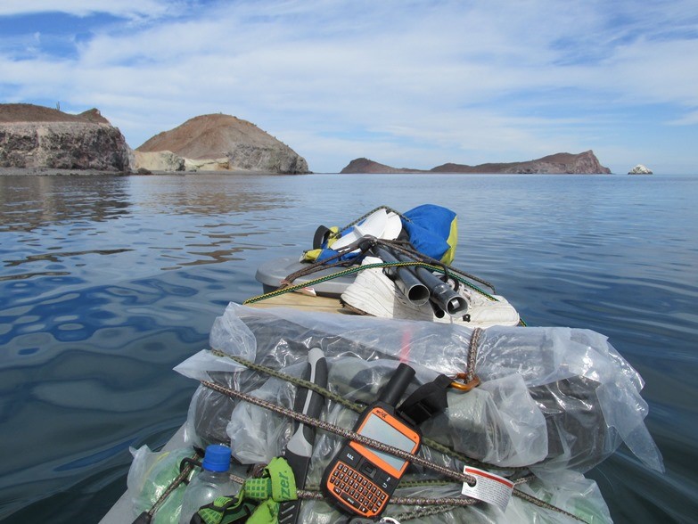
I worry about him on that over-loaded sit-on-top kayak. I can’t imagine that top-heavy kayak is possible to self-rescue (e.g. cowboy style or paddle float Re-entry). I wonder if that top-heavy SOT Kayak can even be righted after a capsize?
He needs a proper kayak and some self-rescue training...

David K - 10-29-2019 at 06:43 AM

Monday on Facebook from Graham:
https://www.facebook.com/graham.mackintosh.71

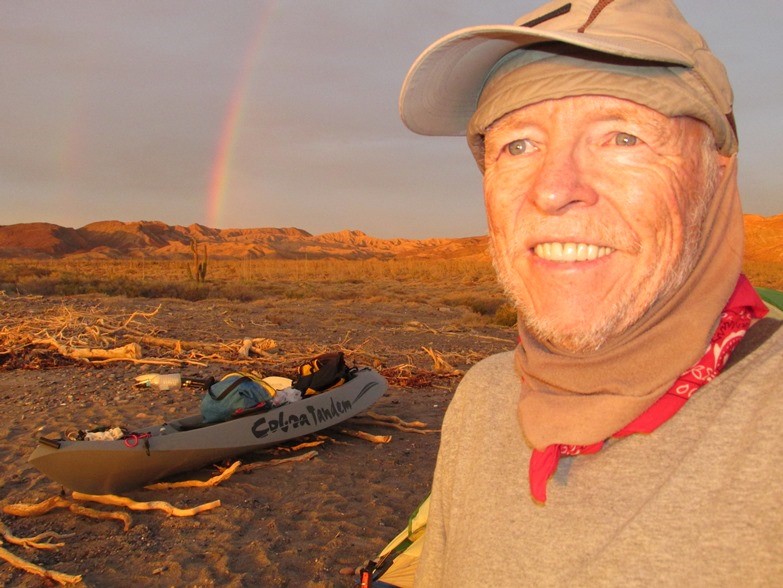
As I'm about to head over to Guardian Angel Island thoughts are with everyone and communities affected by the fires up north. Left La Mision just ahead of the conflagration, was just glad roads were clear, winds and sandstorms all the way down but had no idea how serious it would be. So sad. Hugs to everyone who have lost so much.


Graham Kayak 2019.jpg - 73kB

Tue. 10-29-2019 at 10:19 am PDT

David K - 10-29-2019 at 01:01 PM


On the island! Tue. 10-29-19 at 11:23 am

David K - 10-29-2019 at 01:03 PM


ALL OK Message at 1:03 pm Tuesday 10-29-19

David K - 10-29-2019 at 01:07 PM


David K - 10-29-2019 at 09:17 PM

Graham sent out one more Spot signal at 1:49 pm from a little ways out in that small bay... Maybe fishing?

OCEANUS - 10-30-2019 at 12:18 AM

That bay is Este Ton, which is where Graham set up his base camp during his Marooned With Very Little Beer adventure.
I was in LA Bay and met with Graham before he launched for that expedition, and visited the remnants of his camp in Este Ton the following Summer. Its the perfect anchorage along La Guarda's west coast for most of the year, especially now that LA Bay/La Guarda region is entering the north winds season.
Any idea how long he plans to stay this time?

55steve - 10-30-2019 at 08:06 AM

I'm pretty sure this is the bay...I took this last year while cabrilla fishing.

la garda.jpg - 170kB

10:08 am Wednesday... taking a hike:

David K - 10-30-2019 at 01:47 PM


4x4abc - 10-30-2019 at 04:11 PM

Caleta Staton


staton.jpg - 161kB

4x4abc - 10-30-2019 at 04:15 PM

every time something with navigation or a location comes up - I revisit the area in Google Earth
this time, checking on Graham, I found a new to me shipwreck


shipwreck.jpg - 77kB

[Edited on 10-30-2019 by 4x4abc]

JZ - 10-30-2019 at 05:33 PM

The top of that island is arguable the most beautiful place in Baja. Just an amazing bay. You could spend months kayaking up there.

https://youtu.be/g3ThXCm3XSA


David K - 10-30-2019 at 05:48 PM

Graham called the bay "Este Ton"in his book.
The Baja Sea Guide calls it "Esta Ton".
The Baja Almanac (from a Mexican topo) calls it "Estaton".
Harald's topo has it as "Caleta Staton".

Any more variations?

4x4abc - 10-30-2019 at 06:04 PM


Screen shot 2019-10-30 at 6.03.48 PM.png - 11kB

mtgoat666 - 10-30-2019 at 06:21 PM

“Caleta Staton” makes most sense.

Staton is an English surname.


OCEANUS - 10-30-2019 at 08:10 PM

Quote: Originally posted by 4x4abc  
every time something with navigation or a location comes up - I revisit the area in Google Earth
this time, checking on Graham, I found a new to me shipwreck


[Edited on 10-30-2019 by 4x4abc]


I believe that shipwreck is north west of Graham's location and is near Punta Los Machos, a great spot for yellowtail.

4x4abc - 10-30-2019 at 08:30 PM

29°20'17.44"N, 113°31'35.11"W

pniles - 10-30-2019 at 11:03 PM

Regarding the ship wreck, I think it is the trawler ESCAMA.

We kayaked from La Gringa and camped at Este Ton in April 1993. A few miles north of Este Ton we encountered the trawler. I took two photos. It seemed to have been recently abandoned. The grocery lists hanging in the galley were still fresh.

I may have copied this then, or looked it up later on the internet, but I have a note that the ship is: 2317 8030087 ESCAMA XVIII XCKK Trawler 244 1982 11 Mexico.

I asked Graham if he had seen it on his Marooned trip, and he hadn’t, but said his friend “Kayaker John” had photographed in in about 2006.


scan0003 (2).jpg - 218kB


Escama2.jpg - 89kB

David K - 10-31-2019 at 05:52 AM

Interesting!

Pacifico - 10-31-2019 at 10:50 AM

Very cool!!! That would be fun to explore...

David K - 10-31-2019 at 01:11 PM

Device Name: grahamspot
Latitude: 29.16119
Longitude: -113.33009
GPS location Date/Time: 10/31/2019 10:33:45 PDT

Message: Happy Halloween. Crossed paths today with a black cat. All's well.

Click the link below to see where I am located.
http://fms.ws/1E0u0C/29.16119N/113.33009W

David K - 11-1-2019 at 08:08 AM

I got a message from Graham that he is having a hard time connecting with satellites.

This should be a good warning to those deciding between the Spot X and the Garmin inReach.
The inReach was flawless for me (in 2017 and 2018 traveling for Baja Bound guide research) to connect with Nomads and family, and easy to use. I never failed to get a message out on the first try. Nomad StuckSucks and I would have two-way chats about what road I was on or what I was seeing there. TW, Doug, and John M, as well, exchanged messages with me while I was in Baja, with the inReach.

To send Graham a message, I have to do a lot of editing on the reply email and make sure not to exceed 140 characters. The inReach also has a limit on message size, but it is far more user-friendly. The main thing is that inReach uses the Iridium satellites and Spot does not.

Nov. 1 8:10 am "All is fine"

David K - 11-1-2019 at 08:33 AM


Graham 2019-5.jpg - 234kB

Message from Graham 11-1-19

David K - 11-1-2019 at 06:18 PM

Device Name: grahamspot
Latitude: 29.16250
Longitude: -113.33032
GPS location Date/Time: 11/01/2019 08:52:56 PDT

Message: Great to wake up in Este Ton. Beautiful cove, mountains around. Wind now less. Wild for two days. My 60 lb kayak went rolling down the beach

Click the link below to see where I am located.
http://fms.ws/1E2iZA/29.16250N/113.33032W

2nd 11-1-19 message and 11-2 location offshore

David K - 11-2-2019 at 08:21 AM

This came back after I messaged him that I hope it wasn't too cold and if he had lots of firewood available:

Device Name: grahamspot
GPS location Date/Time: 11/01/2019 19:50:54 PDT
The message sender did not share their GPS location with you.

Message: Lots of firewood. Thanks. Only a little cool in morning. Hope to get up early and start shakedown cruise. Fifty yards from shore.
=================================================================

SAT MORNING 6:59 AM LOCATION:


Graham 2019-6.jpg - 209kB

9:23 AM Saturday... all OK

David K - 11-2-2019 at 10:06 AM

He is a few miles down the coast of the island...


Graham 2019-7.jpg - 212kB

Este Ton is at the top left of this image.

5:58 pm message Saturday

David K - 11-3-2019 at 08:27 AM

Device Name: grahamspot
Latitude: 29.09975
Longitude: -113.26251
GPS location Date/Time: 11/02/2019 17:58:02 PDT

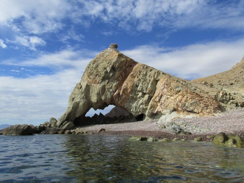
Message: Alls well. Camped by big shady arch. Saw finbacks, turtle and dolphins. Paradise here. Can walk through arch 3 ways. Tomorrow to S if calm.

Click the link below to see where I am located.
http://fms.ws/1E5P0a/29.09975N/113.26251W

4:22 am Sunday

David K - 11-3-2019 at 08:30 AM

Device Name: grahamspot
Latitude: 29.09298
Longitude: -113.26274
Altitude: -4.0 m | -13 ft
GPS location Date/Time: 11/03/2019 04:23:05 PST

Message: Check-in/OK. All's well. No problems.

Click the link below to see where I am located.
http://fms.ws/1E5xKC/29.09298N/113.26274W

1:09 pm Sunday, around the bottom of the island...

David K - 11-3-2019 at 06:07 PM

Device Name: grahamspot
Latitude: 29.05633
Longitude: -113.12173
Altitude: 2.0 m | 7 ft
GPS location Date/Time: 11/03/2019 13:09:54 PST

Message: Check-in/OK. All's well. No problems.

Click the link below to see where I am located.
http://fms.ws/1E6dpQ/29.05633N/113.12173W


Graham 2019-8.jpg - 168kB

5:48 PM Sunday Message

David K - 11-4-2019 at 05:47 AM

Device Name: grahamspot
Latitude: 29.05624
Longitude: -113.12197
GPS location Date/Time: 11/03/2019 17:48:58 PST

Message: Hi David. Great paddling day. Left hour before dawn. Glowing and sparkling sea. Yesterday was testing and finding shelter early. Today work.

Click the link below to see where I am located.
http://fms.ws/1E6-Gu/29.05624N/113.12197W

8:45 am Monday... Moving up the island's east coast

David K - 11-4-2019 at 10:03 AM

Device Name: grahamspot
Latitude: 29.17237
Longitude: -113.17203
Altitude: -10.0 m | -33 ft
GPS location Date/Time: 11/04/2019 08:45:23 PST

Message: Check-in/OK. All's well. No problems.

Click the link below to see where I am located.
http://fms.ws/1E80WY/29.17237N/113.17203W


Graham 2919-9.jpg - 210kB

Graham 2019-9a.jpg - 223kB

On the move!

David K - 11-5-2019 at 10:41 AM

Monday 2:51 pm:
Device Name: grahamspot
Latitude: 29.28575
Longitude: -113.20229
Altitude: -4.0 m | -13 ft
GPS location Date/Time: 11/04/2019 14:51:41 PST

Message: Check-in/OK. All's well. No problems.

Click the link below to see where I am located.
http://fms.ws/1E8iT6/29.28575N/113.20229W


Monday 6:58 pm Message:
Device Name: grahamspot
Latitude: 29.28581
Longitude: -113.20220
GPS location Date/Time: 11/04/2019 18:58:05 PST

Message: Thanks David. Perfect. Long day today. Using good weather to cover miles. So glad to round Punta Rocosa. Awesome. One more day then DS water

Click the link below to see where I am located.
http://fms.ws/1E922l/29.28581N/113.20220W


Tuesday 8:11 am:
Device Name: grahamspot
Latitude: 29.29223
Longitude: -113.26613
Altitude: -4.0 m | -13 ft
GPS location Date/Time: 11/05/2019 08:11:45 PST

Message: Check-in/OK. All's well. No problems.

Click the link below to see where I am located.
http://fms.ws/1EA1GI/29.29223N/113.26613W


Tuesday 9:25 am:
Device Name: grahamspot
Latitude: 29.29049
Longitude: -113.31035
Altitude: -1.0 m | -3 ft
GPS location Date/Time: 11/05/2019 09:26:13 PST

Message: Check-in/OK. All's well. No problems.

Click the link below to see where I am located.
http://fms.ws/1EAAkB/29.29049N/113.31035W


Can you guys see the map okay by clicking the links? If anyone needs me to keep making them, let me know.

AKgringo - 11-5-2019 at 11:09 AM

The link works fine, and a little playing around with it gets me to what you have been posting. Do you know what Graham means by "DS" water?

[Edited on 11-5-2019 by AKgringo]

David K - 11-5-2019 at 06:26 PM

De-Salinated

More travel on Tuesday...

David K - 11-6-2019 at 06:39 AM

3:59 pm:
Device Name: grahamspot
Latitude: 29.39419
Longitude: -113.36253
Altitude: -1.0 m | -3 ft
GPS location Date/Time: 11/05/2019 15:59:45 PST

Message: Check-in/OK. All's well. No problems.

Click the link below to see where I am located.
http://fms.ws/1EAyRb/29.39419N/113.36253W


7:50 PM MESSAGE:

Device Name: grahamspot
Latitude: 29.39414
Longitude: -113.36274
GPS location Date/Time: 11/05/2019 19:50:07 PST

Message: Another long day. After calm start was battling headwinds and tide. But wanted to get around Punta Pulpito before resting to make water.

Click the link below to see where I am located.
http://fms.ws/1EBFZY/29.39414N/113.36274W


8:06 PM MESSAGE:

Message: Amazing place. Would be surprised if I met anyone. But so many birds, dolphins, sealions, turtles and fish boils. Return to North winds.

Wednesday Nov. 6, 2019

David K - 11-6-2019 at 06:40 AM

5:18 AM

Device Name: grahamspot
Latitude: 29.39632
Longitude: -113.36176
Altitude: -1.0 m | -3 ft
GPS location Date/Time: 11/06/2019 05:18:54 PST

Message: Check-in/OK. All's well. No problems.

Click the link below to see where I am located.
http://fms.ws/1EBvUR/29.39632N/113.36176W


Graham 2019-10.jpg - 222kB

David K - 11-6-2019 at 11:40 AM

9:58 am Wed.

Device Name: grahamspot
Latitude: 29.51653
Longitude: -113.46150
Altitude: -4.0 m | -13 ft
GPS location Date/Time: 11/06/2019 09:58:56 PST

Message: Check-in/OK. All's well. No problems.

Click the link below to see where I am located.
http://fms.ws/1ECTpE/29.51653N/113.46150W

[Edited on 11-6-2019 by David K]

chuckie - 11-7-2019 at 04:31 AM

Graham is almost at the point where he will rendezvous with the Swedish womens Kayaking team! He has all the fun....!!!!

Wed. PM messages

David K - 11-7-2019 at 10:22 AM

6:17 pm:

Device Name: grahamspot
Latitude: 29.51655
Longitude: -113.46160
GPS location Date/Time: 11/06/2019 18:17:52 PST

Message: David, fine day but had to stop to make h2o and charge batts. In perfect shady, protected cove. Arches, caves, fishing, snorkeling. Baja A1

Click the link below to see where I am located.
http://fms.ws/1EDOJn/29.51655N/113.46160W


6:45 PM message:

Message: If you have time would love clues about winds. Gone beyond the forecast i took with me. Windfinder for la bay was helpful. Good days. Bad.

[any Nomads want to post an answer, please do, I will look for one]
The Spot X answers are limited to 140 characters per email.

Thursday Nov. 7, 2019

David K - 11-7-2019 at 10:23 AM

6:04 AM:

Device Name: grahamspot
Latitude: 29.51658
Longitude: -113.46161
Altitude: 2.0 m | 7 ft
GPS location Date/Time: 11/07/2019 06:04:47 PST

Message: Check-in/OK. All's well. No problems.

Click the link below to see where I am located.
http://fms.ws/1EEBTb/29.51658N/113.46161W

David K - 11-7-2019 at 10:32 AM

OK, I found the website and L.A. Bay forecast. https://www.windfinder.com/forecast/bahia-de-los-angeles

This is what I just emailed to Graham (2 emails):

Thursday no wind or gusts over 6mph. Friday 5 pm gusts to 16 mph. Sat gusts to 13 mph at 2 pm.

Friday is calm all morning. Sat is calm before 11 am. Sun is calm all day. Mon is calm all day. Wind on Tue. after 11 am.

[Edited on 11-7-2019 by David K]

5:28 PM THU.

David K - 11-8-2019 at 08:33 AM

Device Name: grahamspot
Latitude: 29.51656
Longitude: -113.46172
Altitude: -1.0 m | -3 ft
GPS location Date/Time: 11/07/2019 17:28:17 PST

Message: Check-in/OK. All's well. No problems.

Click the link below to see where I am located.
http://fms.ws/1EFTi0/29.51656N/113.46172W


Message 5:43 PM

David K - 11-8-2019 at 08:35 AM

Message: Perfect. Owe you Tecates. Had to desalinate hoy even though could have paddled to Refugio. Will leave tomorrow maybe pre dawn. Superb here.

5:32 AM Friday 11-8-19

David K - 11-8-2019 at 08:41 AM

Device Name: grahamspot
Latitude: 29.52086
Longitude: -113.46921
Altitude: -1.0 m | -3 ft
GPS location Date/Time: 11/08/2019 05:33:10 PST

Message: Check-in/OK. All's well. No problems.

Click the link below to see where I am located.
http://fms.ws/1EGFtX/29.52086N/113.46921W


Graham 2019-12.jpg - 229kB

8:23 AM Friday

David K - 11-8-2019 at 09:57 AM

Device Name: grahamspot
Latitude: 29.53794
Longitude: -113.51164
Altitude: -7.0 m | -23 ft
GPS location Date/Time: 11/08/2019 08:23:57 PST

Message: Check-in/OK. All's well. No problems.

Click the link below to see where I am located.
http://fms.ws/1EGaTk/29.53794N/113.51164W

12:29 PM Friday: Top of Angel Island

David K - 11-8-2019 at 03:47 PM

Device Name: grahamspot
Latitude: 29.53685
Longitude: -113.56078
Altitude: 2.0 m | 7 ft
GPS location Date/Time: 11/08/2019 12:29:59 PST

Message: Check-in/OK. All's well. No problems.

Click the link below to see where I am located.
http://fms.ws/1EH4Ae/29.53685N/113.56078W

David K - 11-8-2019 at 04:09 PM

Of general Nomad interest, I am also receiving Spot location pings from TMW (Tom) as he is traveling with other Nomads (John and Rudy). So Far they have been to Gonzaga Bay, Coco's Corner, L.A. Bay, The Green Door road to just beyond the La Bocana/San Pedro canyon junction (then turned back north), Bahía Las Animas (last night), Pancho's place at San Rafael, and now heading south from Piedra Blanca on the Guillermo Prieto shortcut road (maybe going to Mission Santa Gertrudis or Vizcaino or San Ignacio?).

5:45 PM Message Friday

David K - 11-8-2019 at 07:53 PM

Device Name: grahamspot
Latitude: 29.53676
Longitude: -113.56092
GPS location Date/Time: 11/08/2019 17:45:09 PST

Message: Magnificent day. Spectacular cliffs and headlands. Launched in dark and battled west winds. Way windier up here than in Bahia. Alone in Refugio

Click the link below to see where I am located.
http://fms.ws/1EHZrR/29.53676N/113.56092W

7:09 PM Message from Graham Friday 11-8-19

David K - 11-9-2019 at 12:31 AM

Device Name: grahamspot
GPS location Date/Time: 11/08/2019 19:06:25 PST


Message: Gray day. Few rain drops. Made scene wild and dramatic. Many turtles. Feral cat. And with west wind kept close in risking rocks and reefs.


Graham 2019-13.jpg - 214kB

Santiago - 11-9-2019 at 08:07 AM

Anyone know what Desal unit Graham is using? Also curious on the paddle(s) he is using.

4x4abc - 11-9-2019 at 09:41 AM

So, Graham ist in Bahia el Refugio - anyone know whether his Playa has a name?
If not, why don't we name a few places after Graham?
Like this beach
Playa Mac?
Playa Graham? ("Playa Kre Em" after the Mexicans adopt it)

David K - 11-9-2019 at 01:48 PM

Quote: Originally posted by Santiago  
Anyone know what Desal unit Graham is using? Also curious on the paddle(s) he is using.


Jim, we have 2-way communication... I will ask him.

Reply to Santiago's question...

David K - 11-9-2019 at 06:40 PM

Device Name: grahamspot
Latitude: 29.51473
Longitude: -113.56774
GPS location Date/Time: 11/09/2019 17:24:19 PST

Message: Using Katadyn 35. Made half gal yesterday and today. Great to see peninsula again and have wind at my back. Awesome spot and sunset.

Click the link below to see where I am located.
http://fms.ws/1EJNdU/29.51473N/113.56774W

SECOND MESSAGE, a few minutes ago:

Device Name: grahamspot
GPS location Date/Time: 11/09/2019 17:33:05 PST


Message: Big seas coming out of Refugio but settled all day. Dealing with awesome full moon tides and currents. If calm night will launch by moon.


[Edited on 11-10-2019 by David K]

Graham 2019-14.jpg - 215kB

Sunday 11-10-19

David K - 11-10-2019 at 07:49 AM

2:40 AM:

Device Name: grahamspot
Latitude: 29.51384
Longitude: -113.56801
Altitude: -1.0 m | -3 ft
GPS location Date/Time: 11/10/2019 02:40:51 PST

Message: Check-in/OK. All's well. No problems.

Click the link below to see where I am located.
http://fms.ws/1EJpu5/29.51384N/113.56801W


5:41 AM:

Device Name: grahamspot
Latitude: 29.40899
Longitude: -113.58844
Altitude: -4.0 m | -13 ft
GPS location Date/Time: 11/10/2019 05:41:21 PST

Message: Check-in/OK. All's well. No problems.

Click the link below to see where I am located.
http://fms.ws/1EK0Z2/29.40899N/113.58844W

[across from Punta Candelero]


12:56 PM:

Device Name: grahamspot
Latitude: 29.25875
Longitude: -113.43253
Altitude: 5.0 m | 16 ft
GPS location Date/Time: 11/10/2019 12:56:18 PST

Message: Check-in/OK. All's well. No problems.

Click the link below to see where I am located.
http://fms.ws/1EKeo4/29.25875N/113.43253W


[Edited on 11-10-2019 by David K]

Graham Sunday PM 11-10-19

David K - 11-10-2019 at 04:32 PM

Here is the satellite image from his last signal, posted above.

Graham 2019-15.jpg - 231kB

Sunday Night Messages 11-10-19 & Monday Morning 11-11-19

David K - 11-11-2019 at 10:11 AM

6:17 PM:

Device Name: grahamspot
GPS location Date/Time: 11/10/2019 18:17:45 PST
The message sender did not share their GPS location with you.

Message: Great to round cliffs of Punta Los Machos. If still calm Monday will try to reach Este Ton and return to where I started. 9 hrs paddling hoy


6:26 PM:

Device Name: grahamspot
GPS location Date/Time: 11/10/2019 18:26:07 PST
The message sender did not share their GPS location with you.

Message: After long paddle and making camp, still had to get out and make quart of water. Looking forward to my first beer. Been "Marooned" with none


Monday 6:09 AM:

Device Name: grahamspot
Latitude: 29.25184
Longitude: -113.42697
Altitude: -1.0 m | -3 ft
GPS location Date/Time: 11/11/2019 06:09:10 PST

Message: Check-in/OK. All's well. No problems.

Click the link below to see where I am located.
http://fms.ws/1ELqAB/29.25184N/113.42697W


6:29 AM:

Device Name: grahamspot
Latitude: 29.25184
Longitude: -113.42697
GPS location Date/Time: 11/11/2019 06:26:55 PST

Message: change of plans. Staying here a while. Woke at 1am big surf running up beach. Had to move tent. West wind? But not here. No to night surf go

Click the link below to see where I am located.
http://fms.ws/1ELs4B/29.25184N/113.42697W


Monday 11-11-19

David K - 11-11-2019 at 12:30 PM

10:21 AM:

Device Name: grahamspot
Latitude: 29.23900
Longitude: -113.42825
Altitude: -1.0 m | -3 ft
GPS location Date/Time: 11/11/2019 10:21:53 PST

Message: Check-in/OK. All's well. No problems.

Click the link below to see where I am located.
http://fms.ws/1EMFzy/29.23900N/113.42825W

David K - 11-11-2019 at 03:08 PM

At 1:37 pm, Graham was back at Este Ton.

[Edited on 11-12-2019 by David K]

Graham 2019-16.jpg - 213kB

Monday Messages 11-11-19

David K - 11-12-2019 at 07:18 AM

6:47 PM:

Device Name: grahamspot
Latitude: 29.16227
Longitude: -113.33027
GPS location Date/Time: 11/11/2019 18:47:21 PST

Message: Thanks for sharing David and for weather forecast. Was unsure I could safely get out and pump water so ran for ET with pm tide. Flat inside.

Click the link below to see where I am located.
http://fms.ws/1EN3iP/29.16227N/113.33027W


6:54 PM:

Device Name: grahamspot
GPS location Date/Time: 11/11/2019 18:54:18 PST
The message sender did not share their GPS location with you.

Message: Lovely island. So rugged and beautiful. All good. This cove is so sheltered. Divers camped here. Traded some snacks for gal of water.

Tuesday 11-12-19

David K - 11-12-2019 at 09:08 AM

7:47 AM:

Device Name: grahamspot
Latitude: 29.16268
Longitude: -113.33032
Altitude: -1.0 m | -3 ft
GPS location Date/Time: 11/12/2019 07:47:51 PST

Message: Check-in/OK. All's well. No problems.

Click the link below to see where I am located.
http://fms.ws/1EO2S4/29.16268N/113.33032W

TUE Messages

David K - 11-12-2019 at 07:20 PM

1:30 PM:

Device Name: grahamspot
Latitude: 29.16194
Longitude: -113.33004
GPS location Date/Time: 11/12/2019 13:30:04 PST

Message: Glad not paddling today. Much windier. Panguero friends left back to mainland. Enjoying peace of bay. If conditions allow back in Bahia Weds

Click the link below to see where I am located.
http://fms.ws/1EOi_Q/29.16194N/113.33004W


3:37 PM:

Device Name: grahamspot
Latitude: 29.16248
Longitude: -113.33035
Altitude: -7.0 m | -23 ft
GPS location Date/Time: 11/12/2019 15:37:33 PST

Message: Check-in/OK. All's well. No problems.

Click the link below to see where I am located.
http://fms.ws/1EOxMy/29.16248N/113.33035W


6:15 PM:

Device Name: grahamspot
GPS location Date/Time: 11/12/2019 17:59:15 PST
The message sender did not share their GPS location with you.

Message: Saw weird lights in sky last evening - like string of pearls. Que es? So lovely and magical cove. Fitting to end here. Thx for great wind fc


>>> I sent Graham a wind forecast for the next 5 days from this page: https://www.windfinder.com/forecast/bahia-de-los-angeles

David K - 11-12-2019 at 07:26 PM

What Graham saw (and so did Shari):

Those bright lights marching slowly in a straight line across the sky this week aren't comets or meteors -- although there was also this bright meteor -- but the second batch of SpaceX Starlink broadband satellites.

Elon Musk's space company launched 60 of the small internet routers aboard a Falcon 9 rocket Monday and within hours they were being spotted around the world, flying in formation. The sight looks like a train of staggered lights or bright stars, moving in a straight line through space.

Spotters from California to Maryland to Japan uploaded video evidence of the odd spectacle, which again raised concerns from astronomers.

SpaceX launched its first flock of 60 Starlink birds in May, and a number of scientists sounded the alarm that the company's plans to launch thousands of the reflective objects could have an adverse effect on astronomical observations.

It soon became clear the satellites become much less visible as they gain altitude and orient themselves for operation. SpaceX has pledged to coordinate with astronomers to minimize impacts and also paint the satellites to make them less reflective, although the batch that went up Monday was unpainted like the first group.

However, since the May launch, SpaceX has made its full ambitions more clear through regulatory filings that seek to launch up to 42,000 of the satellites in coming years. And SpaceX is just one of a handful of companies looking to launch such mega-constellations.

7:40 PM TUE

David K - 11-13-2019 at 09:13 AM

Device Name: grahamspot
GPS location Date/Time: 11/12/2019 19:40:55 PST
The message sender did not share their GPS location with you.

Message: Moon so bright. Lovely island no coyotes just feral cats and crazy ravens. Expect to be picked up tomorrow morn if not abducted by aliens.

Back on the peninsula! L.A. Bay. Wed. 11-13-19

David K - 11-13-2019 at 04:04 PM

Device Name: grahamspot
Latitude: 28.93564
Longitude: -113.55048
Altitude: 2.0 m | 7 ft
GPS location Date/Time: 11/13/2019 11:35:01 PST

Message: Check-in/OK. All's well. No problems.

Click the link below to see where I am located.
http://fms.ws/1EQeqg/28.93564N/113.55048W

JZ - 11-13-2019 at 04:44 PM

Refugio is really, really spectacular. Top 5 spot in all of Baja for me.

chuckie - 11-13-2019 at 05:47 PM

Graham is a really great guy....Been around him a few times,read and own his books....If JZ says its on his top5 list,I am sorry I missed it, in my 30+yearsin Baja....thanks, Graham, DK,and JZ...

chuckie - 11-13-2019 at 06:11 PM

Glad you approve!

Graham - 11-13-2019 at 07:29 PM

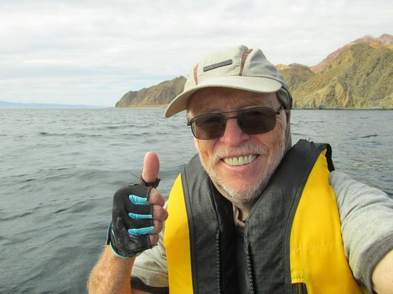
Trip over... but would love to return to that beautiful island. Thanks everyone for following and special thanks to David K for posting and sending me weather information. A great aspect of having 2-way communication. Hard to conceive that at over 40 miles long there is no permanent settlement on the island. Most days I didn't see anyone. Puerto Refugio is indeed spectacular but was amazed no one was there. The few pangueros I met were all from the mainland... night diving for sea cucumbers and whatever else they could take. When I returned to Este Ton was glad to pick up water from them. Saved me from desalinating water after hours paddling the kayak.

IMG_0481g.JPG - 181kB IMG_2280g.JPG - 157kB

Pacifico - 11-13-2019 at 07:48 PM

Wow! What a great trip, Graham! Thanks for letting us follow along...

JZ - 11-13-2019 at 10:31 PM

Surprising that the maps on the Spot site are so lacking in detail when you zoom in tight. You'd think a better map source would be available.

AKgringo - 11-14-2019 at 07:49 AM

Using the link Graham posted, I zoomed in on my house in CA. It is the exact result I get using Google Map!

mtgoat666 - 11-14-2019 at 07:55 AM

Quote: Originally posted by JZ  
Surprising that the maps on the Spot site are so lacking in detail when you zoom in tight. You'd think a better map source would be available.


Clicking graham’s links to spot website i am seeing google sat photos and google topo based on inegi topo. I doubt there is a more detailed map on the market than inegi 50k topo.
What better map source are you expecting?

JZ - 11-14-2019 at 12:40 PM

I missed the satellite option. The topo isn't very details.

David K - 11-14-2019 at 02:45 PM

Quote: Originally posted by JZ  
I missed the satellite option. The topo isn't very details.

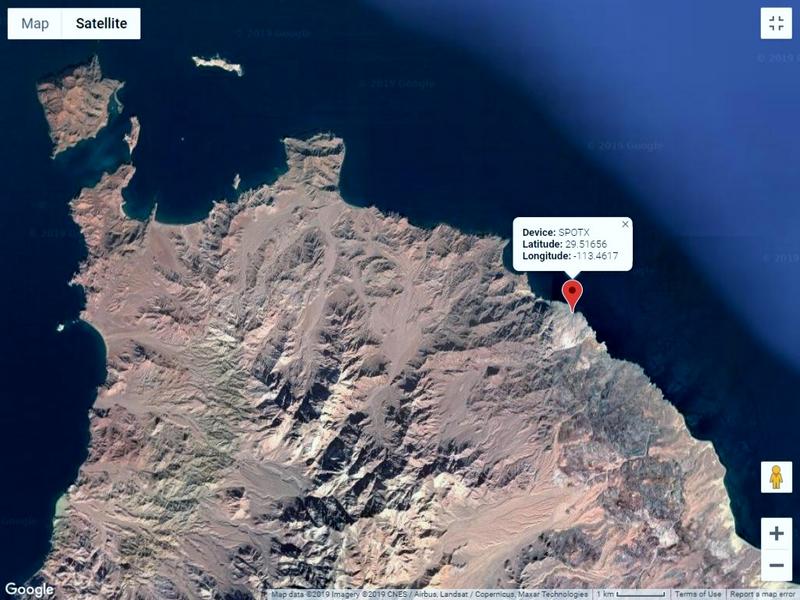
When you go to the Spot location link, in the top left corner it says: MAP (or) SATELLITE. Just click on Satellite and zoom in.

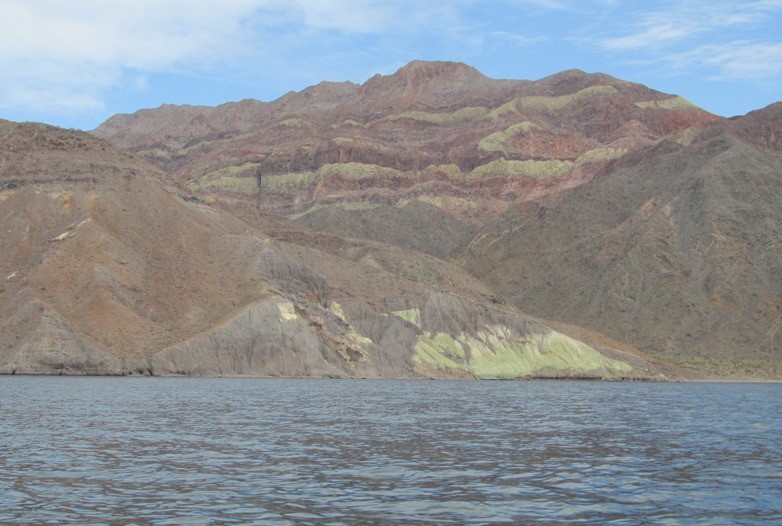
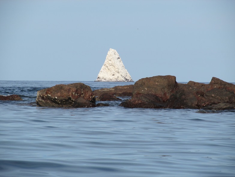
Graham has more photos than the two he posted above. Graham or I will add them soon... Very cool photos!

Skipjack Joe - 11-15-2019 at 02:41 AM

Graham,

How did the water taste that was generated by the katadyn desalinator you used? Did it taste like spring water or was it just tolerable?

How difficult was it to pump the water? Did it require a fair amount of strength and did it take a long time to generate say one liter of water. I found some you tube videos on it's usage but would appreciate your own practical report.

Thanks

Skipjack Joe - 11-15-2019 at 02:52 AM

Quote: Originally posted by Santiago  
Anyone know what Desal unit Graham is using? Also curious on the paddle(s) he is using.


Don't know if you saw this Jim:

https://www.youtube.com/watch?v=YnVKWCZdIIo

David K - 11-15-2019 at 10:48 AM

Igor, Graham emailed me last night he is going out today on a "panga trip" and might be staying in L.A. Bay until after Thanksgiving. I will be sharing some of his photos he emailed me. I will email your question to him in case he is not reading Nomad before then.

David K - 11-15-2019 at 10:58 AM

I addition to the two photos Graham posted above...


Graham - 11-15-2019 at 05:04 PM

Thanks David.

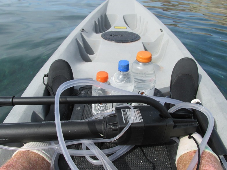
Yes the water from this device tasted great. Never hesitated to drink it. When thirsty I would pump it directly into my mouth and enjoy. It takes a little pressure to pump but you'd barely notice.

After a nine hour paddle and spending an hour getting camp set up you wouldn't always feel like paddling out for another hour. But water is everything... so you do. Biggest problem was needing to paddle as well as pump to stop drifting too far with the currents out there. Theoretical yield - a gallon an hour, but way less when you're dealing with drift. I was dependent on it for nearly a week.

Hope all that isn't sending you all to sleep.

IMG_2892g1.JPG - 129kB

Skipjack Joe - 11-17-2019 at 08:09 PM

Quote: Originally posted by David K  
I addition to the two photos Graham posted above...


The desal pump.

AKgringo - 11-17-2019 at 08:28 PM

Graham, when I look at the camp photo, I am blown away to think that you brought it all with you on your kayak!

Great adventure, great share!

mtgoat666 - 11-17-2019 at 08:47 PM

Quote: Originally posted by David K  
I addition to the two photos Graham posted above...


I think graham is great, and I enjoy his writing.

But that load on a solo kayak trip appears to be a disaster waiting to happen. Safe kayaking requires being able to self rescue: right the kayak, and scramble back on/in.
There is no way that kayak could be righted in waves and re-mounted by a swimmer.
Only way to remount that kayak is to unleash and ditch the load.

Graham, get a sea kayak, and learn/practice self-rescue!


[Edited on 11-18-2019 by mtgoat666]

Graham - 11-18-2019 at 04:42 PM

I guess my mode of transport grew out of my time camping in Baja with a 60 lb backpack. My Cobra Tandem is rated to carry 600 lbs. That kayak is broad and slow, and ultra stable. Way more than the average sea kayak.

Crucially, I know my limitations and I'm usually 50-100 yards from shore ready to land in minutes... following the shore rather than cutting point to point.

I've been kayaking and camping like that since at least 2006, and I've just kayaked from Gonzaga to La Paz. Not once have I thought I'd end up in the water.

If the sea is rough I have no business being out... I'll be ashore using all my equipment to camp in comfort and waiting, exploring, days if necessary, for conditions to improve.

I don't go offshore. I'm always expecting the worst and preparing for it, keeping one eye on where I can land, seeking the latest wind forecasts.

The fatalities I've read about often involve sea kayaks and folks who exceed their limitations.

If the worst happens I have a knife in front of me and there's nothing on top that I couldn't do without... or wait to wash ashore.

I like the idea that being alone with a sit-on-top I stand a chance of quickly righting it and climbing right back on.

I'd imagine any kayaker going over in a wild and rough Sea of Cortez would be in trouble. I aim to never be in that position.

David K - 11-18-2019 at 05:00 PM

Hi Graham,
So how did you get from L.A. Bay to the island if you didn't paddle over?
Also, I see more wonderful photos just added to your Facebook page!
https://www.facebook.com/graham.mackintosh.71

Graham - 11-18-2019 at 05:35 PM

I'll paddle over the Canal de las Ballenas when I have a death wish.

No, a panga took me, my kayak, and all my gear over on a nice calm day and dropped me in lovely Este Ton.

I should have taken more beer. :D