Quote: Originally posted by bajaric  | DK, yes, that is very near where they are punching through the mountain. Picture is looking north. I was just parked on the side of the road, all
drivable blacktop both directions, semis are using it now. Some pretty impressive bridges.
Sorry, no more photos. I always forget to still photos because I am usually shooting videos, then I wish I had taken more still photos. I have some
video but to post it here requires putting it on YouTube which is a pain because my super slow computer takes forever to convert files to be YouTube
format.
The one disappointment was I wanted to see the arrastra at Las Arrastras, and I could not find it. I checked your past post with a picture of it when
I got home and I think I was almost standing on top of it but it was hidden down in the arroyo. I was at at the bridge with the yellow guard rails
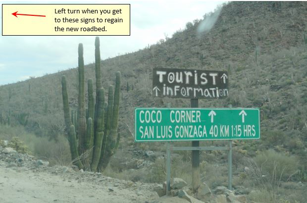
which is where the new paved road starts the Cocos bypass and splits off from the old dirt highway to Cocos. That is the second darn time I have
tried to find that thing and missed it! And it is a 600 mile round trip so not like I can just go back and check again. |
It would be the first bridge south of where the older road branched off (and now well-signed for Coco's Corner, per Nomad posts). It is very visible
from the bridge:
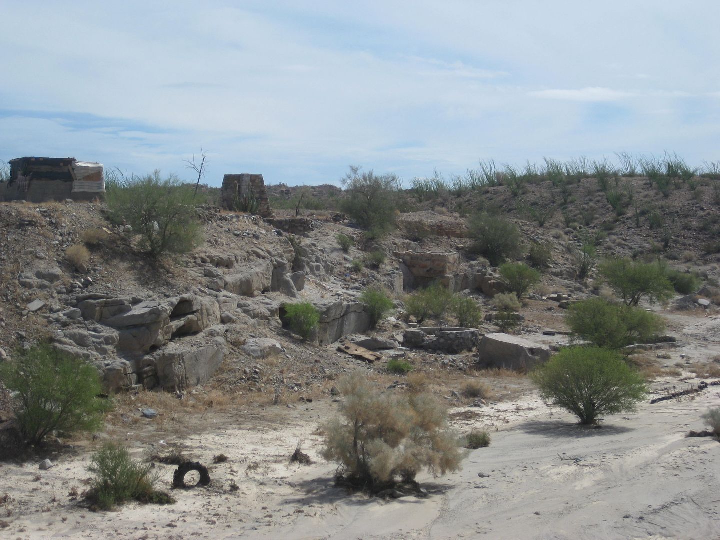
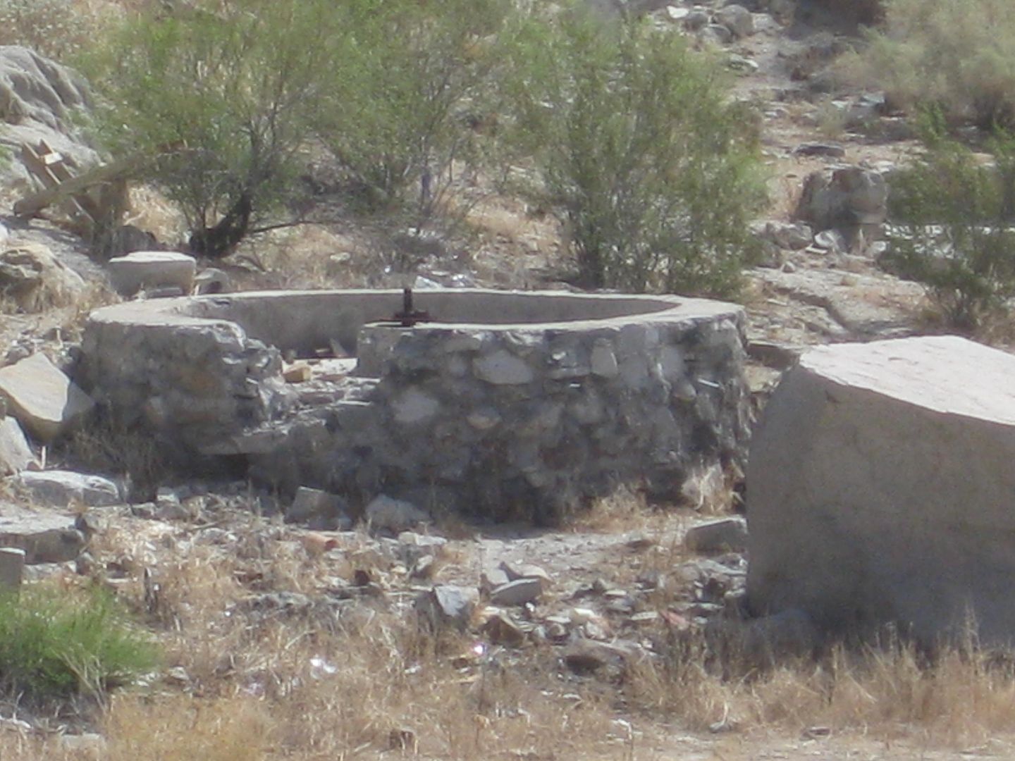
Las Arrastras de Arriola |

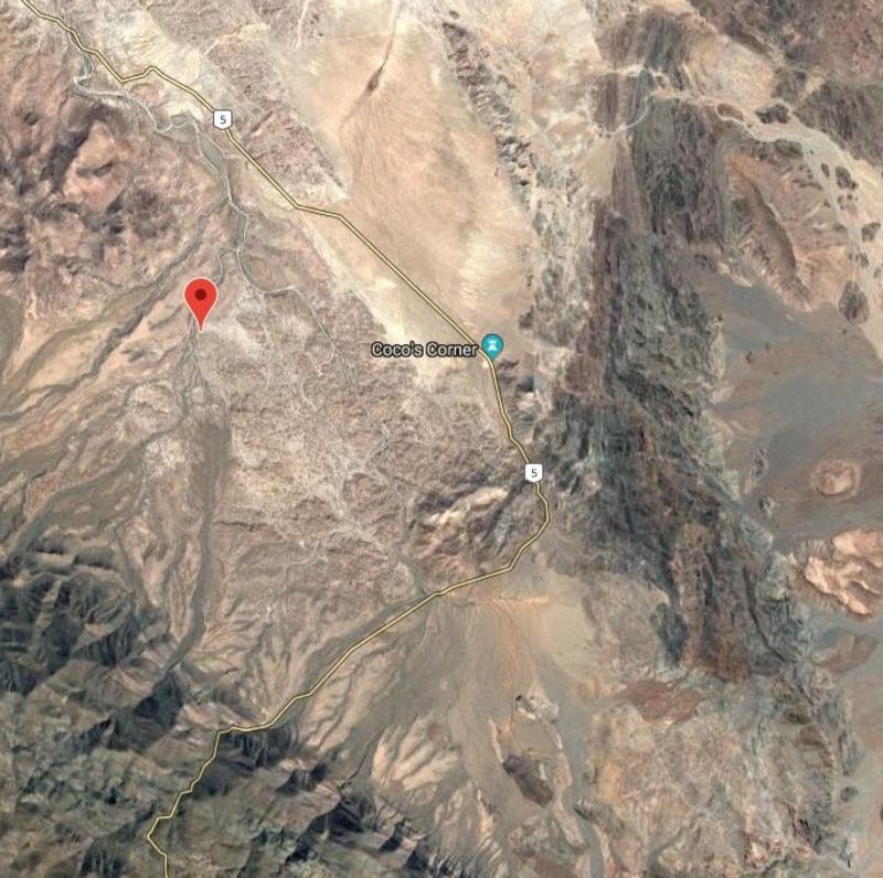

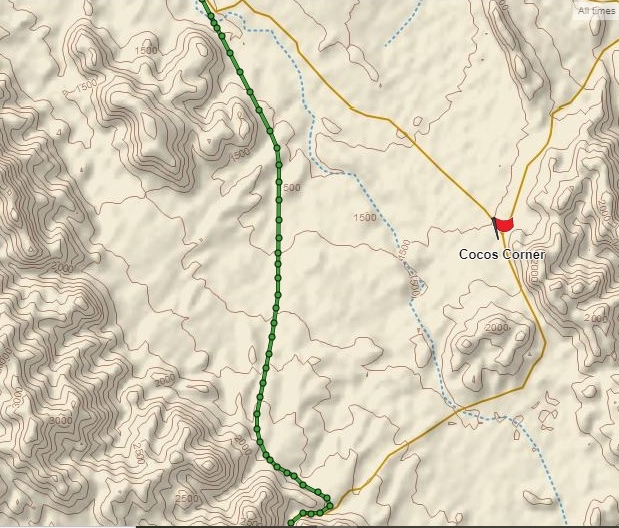
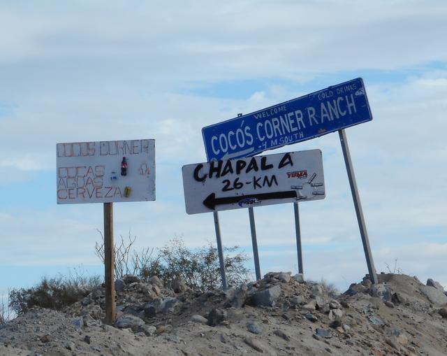 image sharing