BajaNomad

Mano summit and Pole Line road

PaulW - 2-10-2020 at 01:49 PM

Hwy3 to Mano Junction, 2/7/2020

Important waypoints
Indepencia k91, 31 36.7157, -115 53.331
Mission Santa Catalina 31 39.651, -115 49.29
Los Pinos 31 48.787, -115 46.395
Ranch with multiple lockable gates 31 49.256, -11545.266
Main Lockable gate 31 49.249, -115 45.293
Mano Junction 31 49.725, -115 33.814
Google earth files are attached:
H3-Mano0 (KML) starts at Indepencia
H3-Mano1 (KMZ) continues over the summit
H3-Mano2 (KML) continues to Mano Junction
Gate area (KML) shows details
“Gate Area” loop was made from Google Earth on existing roads. Roads not driven. Shown in case the ranch gate is locked. It is about a 7 mile loop.
Pictures:
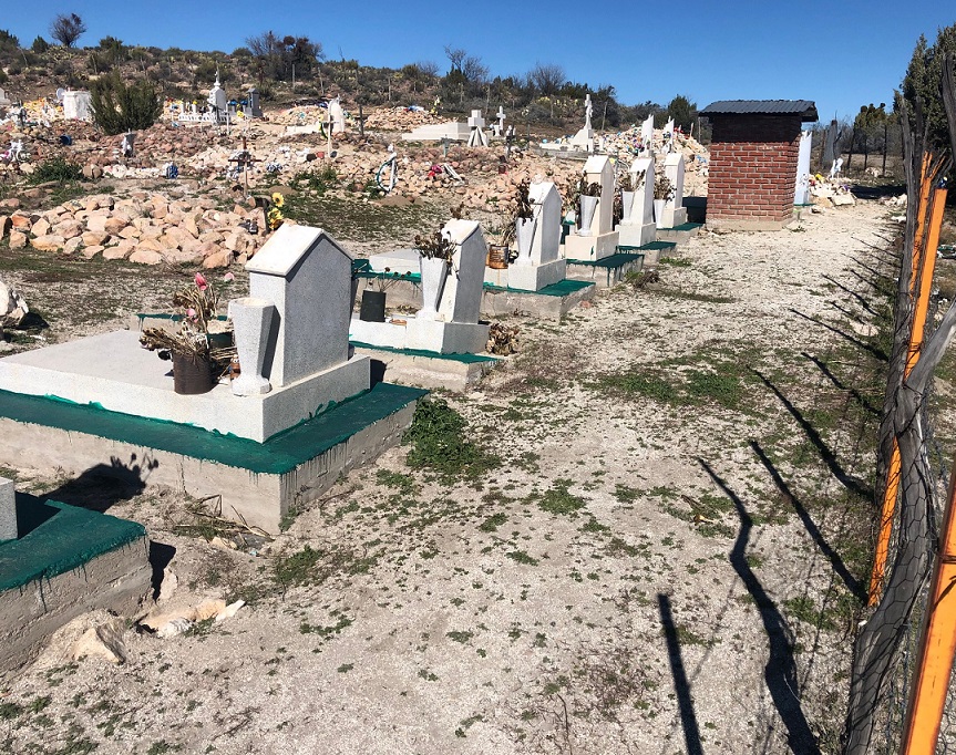
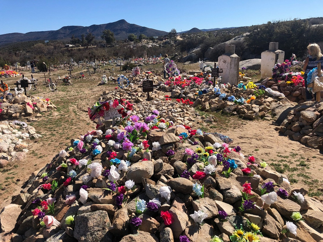
Cemetery


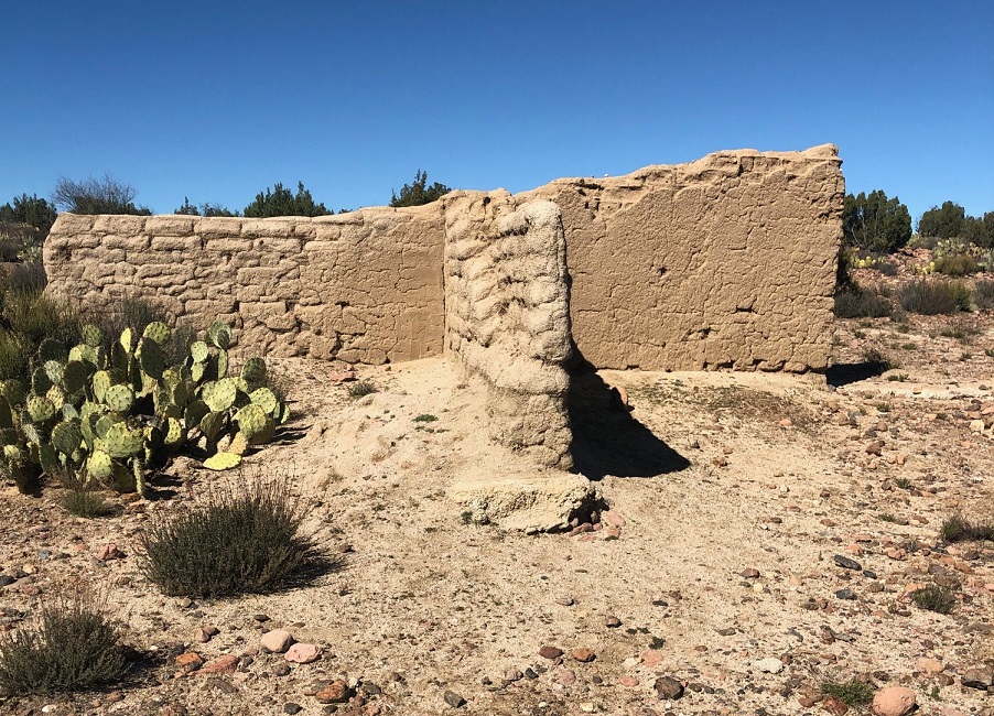
Mission Catalina


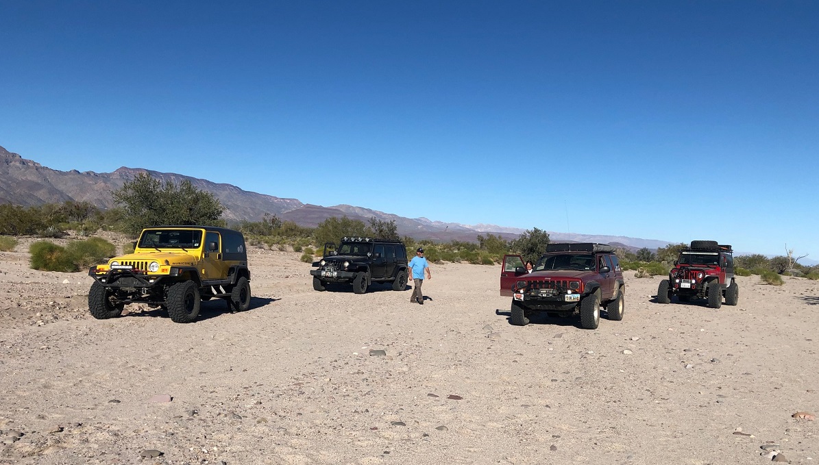
In Arroyo Enmedio


Pole Line Road Update 2/8/2020

We drove the Pole Line Road the day after Mano. Pretty much the same as last year except---
*Enmedio difficult place was different and I had to find a new track due to the boulders having been moved around. Still difficult as before.
*The Bad hill had deteriorated a bit, but going downhill was not a problem.
*Arroyo Enmedio was untracked and I had slight difficulty following my GPS track. However I hit the turn up the bank exactly correct.
*I no longer use the north end of the "Pipe Road" and made a new track after leaving Enmedio and drove sort of directly avoiding crossing a bad wash to the "Pipe road". The waypoint "Bad 4X4" has been bypassed.
See attachment PLR New section (KML). That new path is recommended.


Attachment: H3-ManoJct0.kml (22kB)
This file has been downloaded 228 times

Attachment: H3-ManoJct1.kmz (84kB)
This file has been downloaded 257 times

Attachment: H3-ManoJct2.kml (67kB)
This file has been downloaded 275 times

Attachment: Gate area.kml (102kB)
This file has been downloaded 267 times

Attachment: PLR New section.kml (58kB)
This file has been downloaded 223 times


[Edited on 2-10-2020 by BajaNomad]

4x4abc - 2-10-2020 at 02:38 PM

got a lat/long for the cemetery?

David K - 2-10-2020 at 03:33 PM

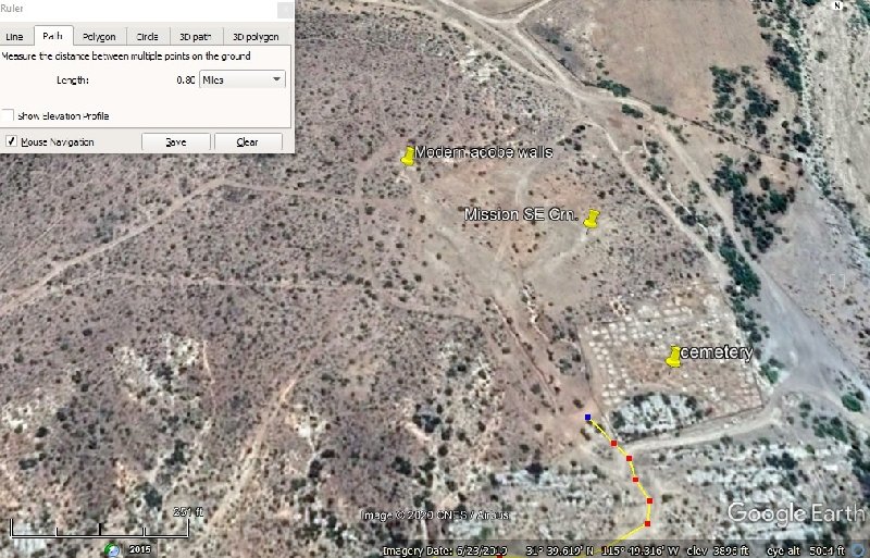
The adobe walls are a modern attempt or start to make an entrance to the mission site... that was never completed. The mission was in the big area beyond, or below that wall where you can make out the outlines of rooms still. Below those outlines are stone foundations. A cemetery is below, downhill from the big, clear area the mission was built on. The three push pins are: Modern adobe walls (see Pauls photos), Mission SW corner, and cemetery. The mission compound was the square area between the modern walls and the cemetery... The distance from the end of the concrete road at Santa Catarina village to the cemetery is 0.8 mi. (track below in yellow):


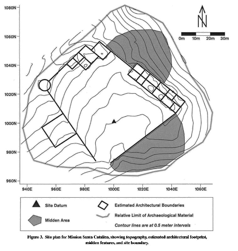
Here is a modern map of the mission compound (using ground penetrating radar)..


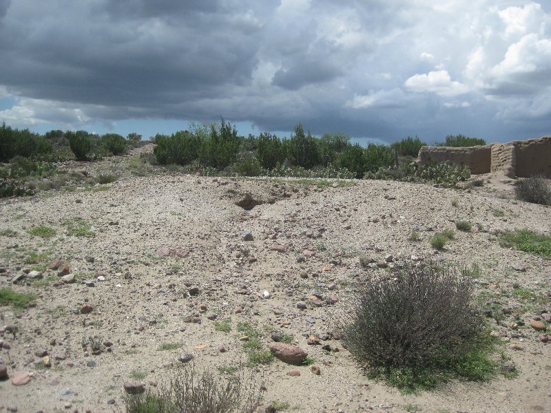
The circle in the NW corner was the lookout tower and the modern walls are just above that... and a little to the right.

My photos of the tower remains and the modern wall behind:


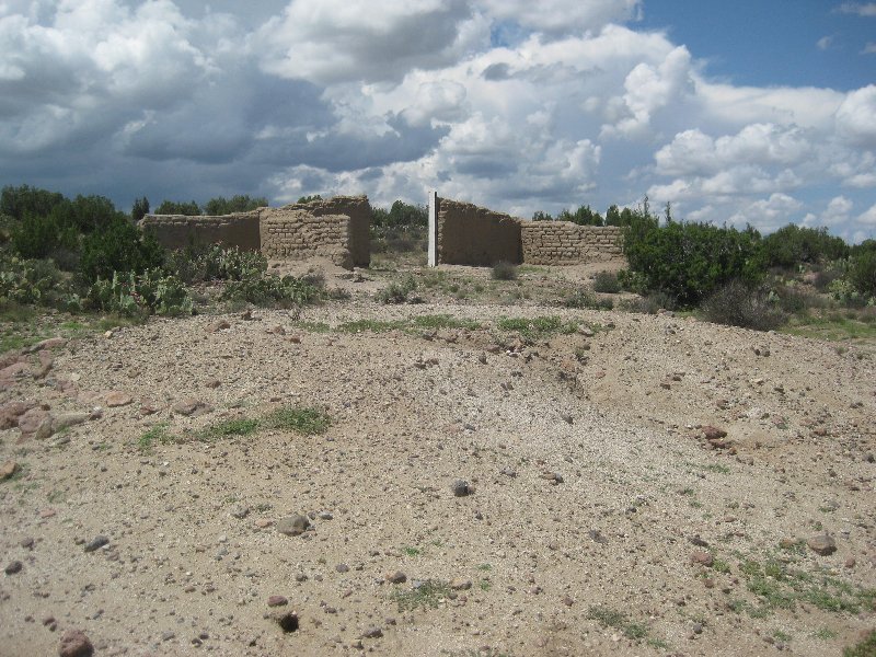
and a bit to the right of the tower...


mission rooms... along the east side of the compound:


[Edited on 2-10-2020 by David K]

ehall - 2-10-2020 at 04:15 PM

Quote: Originally posted by 4x4abc  
got a lat/long for the cemetery?


Santa Catarina. A little north of Valle de Trinidad.

PaulW - 2-10-2020 at 04:21 PM

Cemetery
31 39 35.880, -115 49 13.212
Just down the hill from the Mission.
which my camera says
31 39 39.3, -115 49 17.712

PaulW - 2-10-2020 at 05:00 PM

Some tech comments

Heck of a learning curve to get KMLs fit. 3 days part time to deal with the multiple tracks I was following. Did it by gapping my tracks then making a KMLs for each piece. You all like me can open each one then merge them together for your trip. Or just load your GPS with each piece and let the GPS do the effort. Turns out My Lowrance is having glitches as well as its 10k track point limit so I have to watch it closely.

BTW, the inReach with 5 second track point interval works great no glitches and easy to edit with my SW. For Wimps the Lowrance was a bust and the inReach saved the day.

The inreach will last for 4 days continuously with 5 second track point intervals. Wow that is a lot of track points and a lot of editing.
To do this inReach Explorer is required - SE won't cut it.

David K - 2-10-2020 at 05:24 PM

Quote: Originally posted by PaulW  
Some tech comments

Heck of a learning curve to get KMLs fit. 3 days part time to deal with the multiple tracks I was following. Did it by gapping my tracks then making a KMLs for each piece. You all like me can open each one then merge them together for your trip. Or just load your GPS with each piece and let the GPS do the effort. Turns out My Lowrance is having glitches as well as its 10k track point limit so I have to watch it closely.

BTW, the inReach with 5 second track point interval works great no glitches and easy to edit with my SW. For Wimps the Lowrance was a bust and the inReach saved the day.

The inreach will last for 4 days continuously with 5 second track point intervals. Wow that is a lot of track points and a lot of editing.
To do this inReach Explorer is required - SE won't cut it.


Great! The next time I go mapping with it (an Explorer), I will set to 5 sec. Do you shut it down at night or just let it go into pause mode? Do you make a new track each day? Thanks!

PaulW - 2-10-2020 at 05:36 PM

Yes - I just turn it off for lunch and at night. It won't miss a beat.