
PaulW - 5-13-2020 at 04:16 PM
LOOKING FOR OLD MAPS
MAP
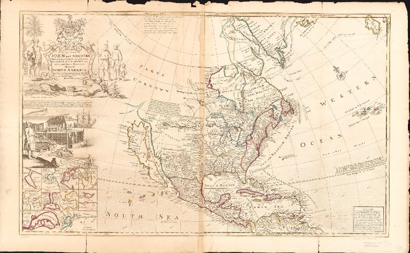
This beautiful map of North America was originally produced by Herman Moll, in 1715.
This map of North America, according to ye newest and most exact observations is most humbly dedicated by your Lordship's most humble servant Herman
Moll, geographerScale ca. 1:15,000,000. Hand colored. Relief shown pictorially. "To the Right Honourable John Lord Sommers, Baron of Evesham in ye
county of Worcester, President of Her Majesty's most Honourable Privy Council &c." Includes ill. and notes. Insets: A view of a stage & also
of ye manner of fishing for, curing & drying cod at New Foundland.--St. John's harbour.--Boston harbour.--New York &c.--[Charleston region,
S.C.]--Port...Date: 1715
Go here and use your mouse to see the detail
https://www.worldmapsonline.com/historic-map-north-america-1...
TO THE RIGHT HONOURABLE JOHN LORD SOMMERS BARON OF EVESCHAM IN THE COUNTY OF WORCESTER, PRESIDENT TO HER MAJESTY'S MOST HONOURABLE PRIVY COUNCIL
&C. THIS MAP OF NORTH AMERICA ACCORDING TO THE NEWEST AND MOST EXACT OBSERVATIONS IS MOST HUMBLY DEDICATED BY YOUR LORDSHIP'S MOST HUMBLE SERVANT
- HERMAN MOLL, GEOGRAPHER.
This beautiful map of North America was originally produced by Herman Moll, in 1715.
Map text reads:
Sold by H. Moll over against Devereux Court in the Strand. Printed for I. Bowles Print & Map seller at the Black Horse in Cornhill and T. Bowles
Print and mapseller next to the Chapter house in St. Pau's Church yard, and over against Devereux Court, without Temple Bar. And by P. Overton Map and
Printseller near St. Dunstans Church Fleetstreet and by John King at the Globe in the Poultry.
A. Here one of the Flota drops Anchor to give notice to R. de la Hacha, that the Galeons are come, and immediately Expresses are sent over Land to
Cartagena, Lima, Panama &c to hasten the Kings Treasure.
B. At Cartagena the Galeons usually stay 60 days, and thence go to Portobel where they lye 30 days, and then return again to Cartagena ; from whence
after some stay, they sail for the Havana, to meet there the Flota, which is a small number of Ships, that go to la Vera Curz to take in the Effects
of that Country.
Watch a video with more details
https://www.pbs.org/wgbh/roadshow/season/21/indianapolis-in/...
=== === ==
The oldest one I could find – 1500 by Juan de la Cosa, who sailed with Columbus on three journeys, did - leaving us with the oldest known map
showing America.
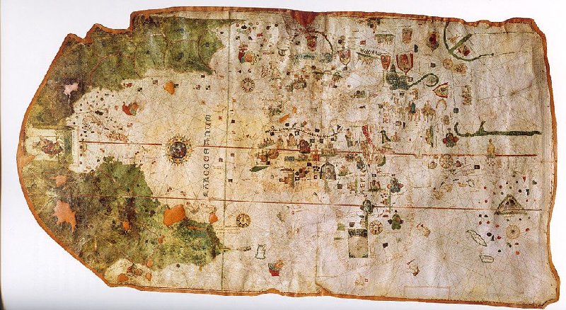
Pthalogreen saved to The Maps that should have been reproduced in color in Simon Garfield's book, On the Map
Mappa Mundi. 1500. World map by Juan de la Cosa, Christopher Columbus's master pilot on the Santa Maria. The first map to depict the New World, this
map was lost for over 300 years, until it was rediscovered in 1832 by Alexander Von Humboldt. 1500. The New World is to the left, in green, the Old
World to the middle and right, in white. This map is a portolan, but was probably meant more as an announcement of Columbus's journeys than as a
practical aid to navigation.
=== === ===
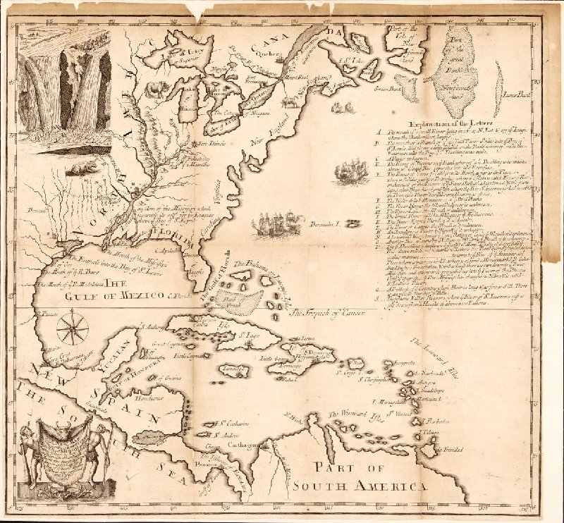
Another map of SE US 1713
 archaeologist career salary
[Edited on 5-13-2020 by PaulW]
David K - 5-13-2020 at 05:36 PM
Nice!!!
