
JZ - 6-9-2020 at 05:40 PM
1.
JZ - 6-9-2020 at 05:42 PM
2.
JZ - 6-9-2020 at 05:56 PM
3.
This one should be easy.
[Edited on 6-10-2020 by JZ]
JZ - 6-9-2020 at 06:03 PM
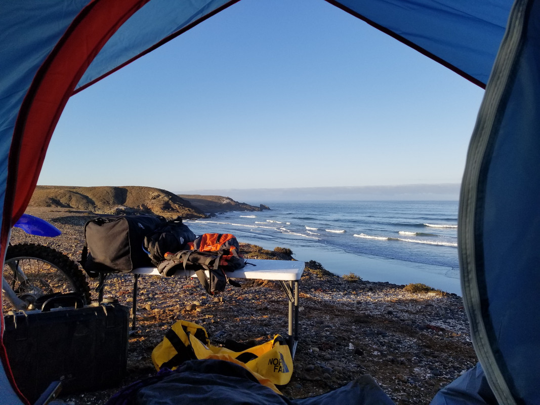
4.
JZ - 6-9-2020 at 06:06 PM
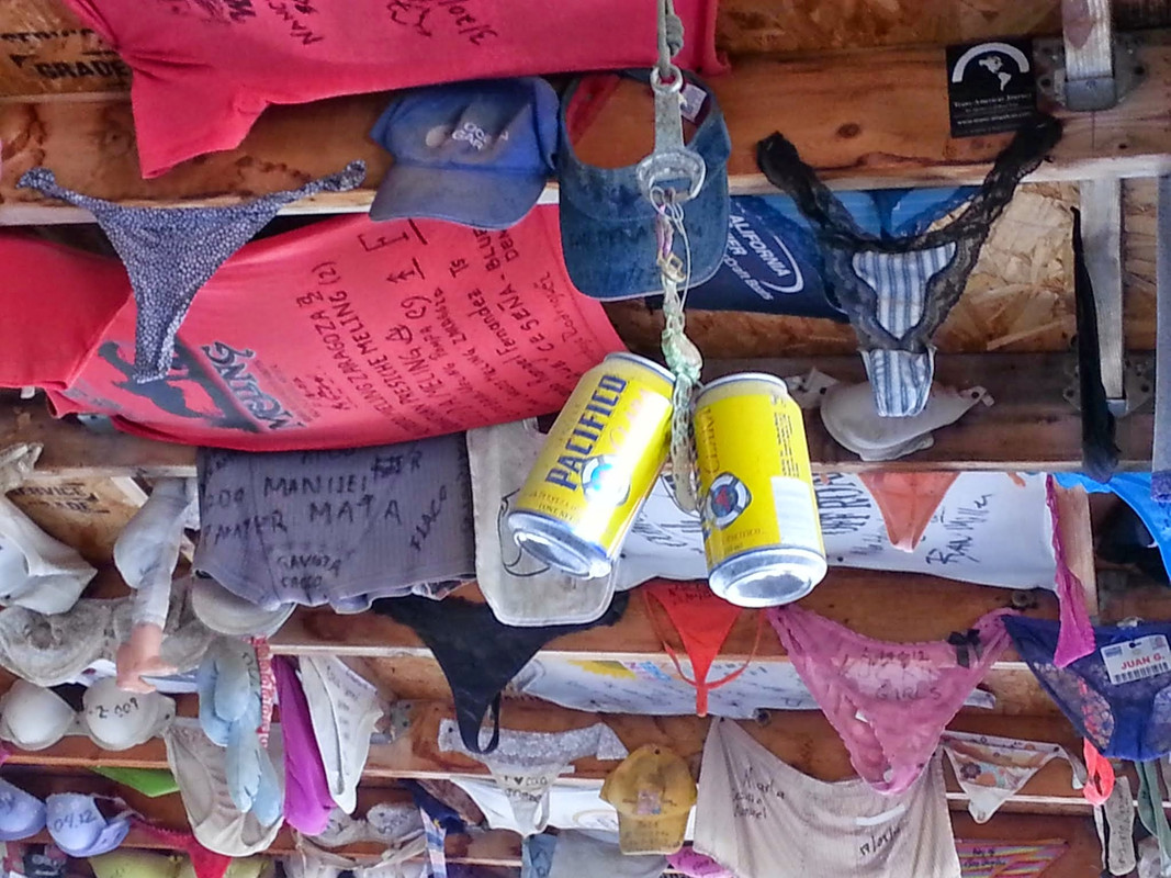
5.
Are those cans suppose to represent a pair of balls?
[Edited on 6-10-2020 by JZ]
JZ - 6-9-2020 at 06:15 PM
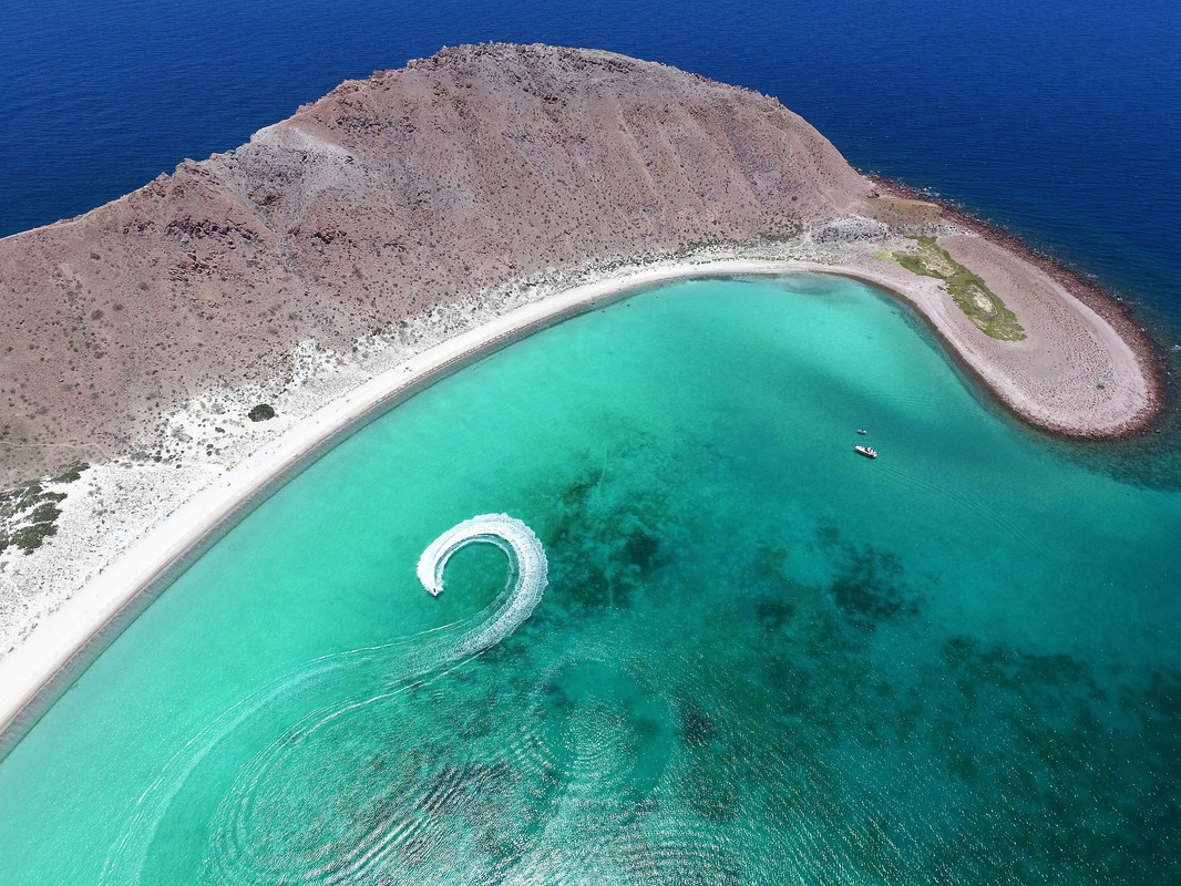
6.
A pretty famous isla in BCS.
JZ - 6-9-2020 at 06:20 PM
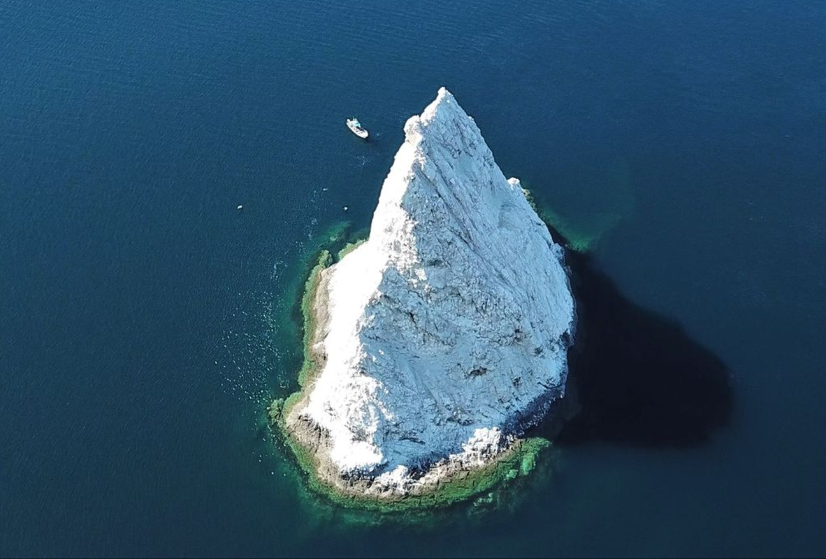
7.
One of the top 10 rock formations in Baja.

JZ - 6-9-2020 at 06:24 PM
8.
Just guess the general location on this one.
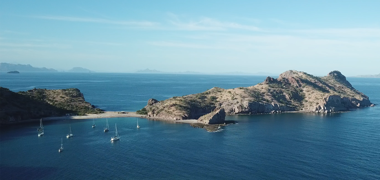
JZ - 6-9-2020 at 06:41 PM
9.
A place that is mentioned very often on here.
JZ - 6-9-2020 at 06:58 PM
10.
A tough one, but sail boaters and ppl from BoLA should know it.
BajaParrothead - 6-9-2020 at 07:26 PM
#5 Coco's?
#6 Isla San Francisco?
#10 Sail Rock?
thebajarunner - 6-9-2020 at 08:42 PM
8
Punts Falsa
David K - 6-9-2020 at 09:18 PM
3
Gonzaga Bay Pemex
4
L.A. Bay, south end, east side
5
Coco's Corner
6
Isla Coronado
7
Isla la Ventana, Bahía de los Angeles.
9
Puerto/ Bahía Agua Verde
[Edited on 6-10-2020 by David K]
BornFisher - 6-9-2020 at 09:50 PM
10 is the rock outside of Refugio.
4 is the south end of LA Bay.
All the pics are great! Thanks.
[Edited on 6-10-2020 by BornFisher]
JZ - 6-10-2020 at 07:11 PM
Pretty good guys.
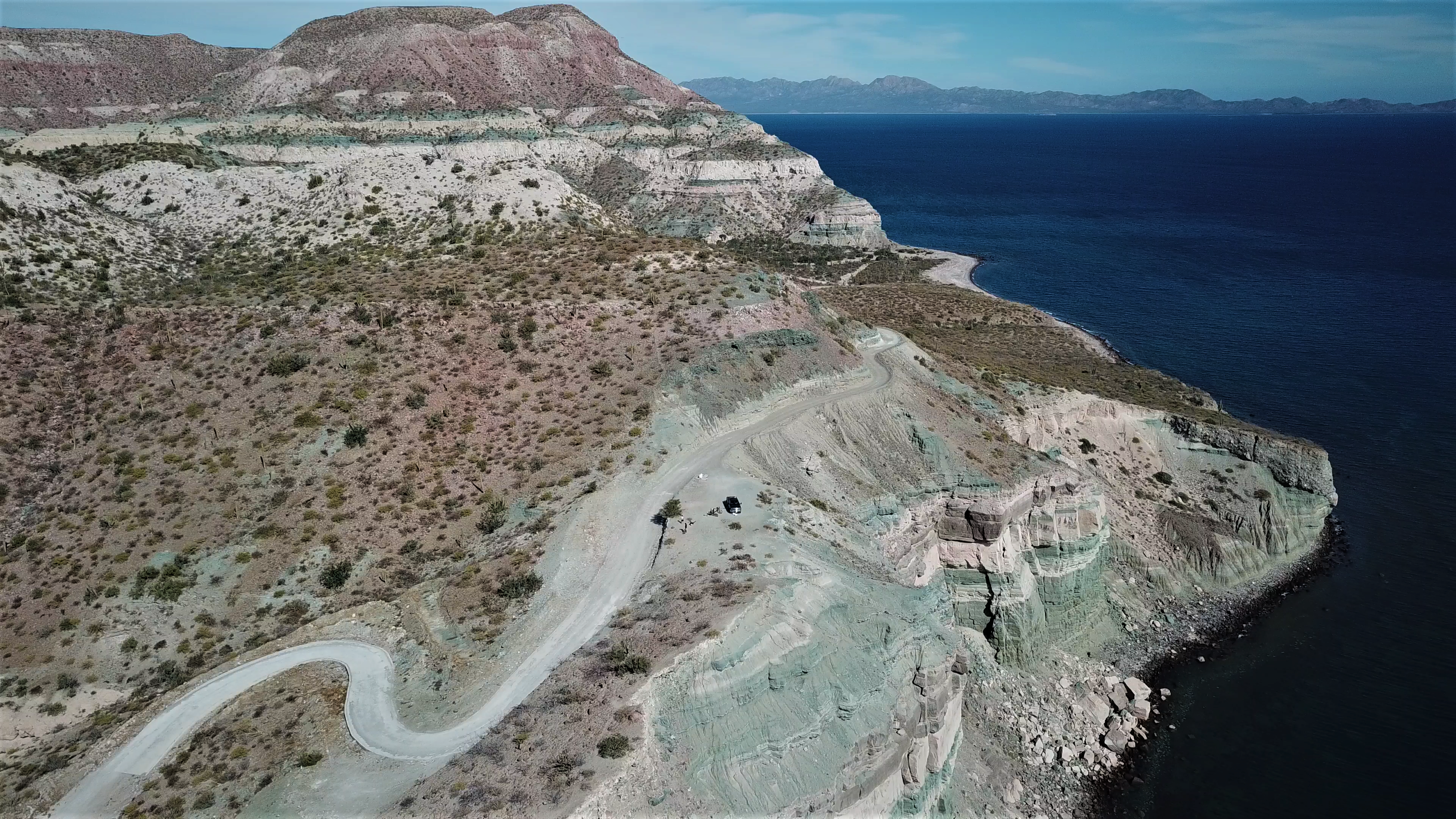
1. Road to San Evaristo.
Just before it goes through the mountains. Breath taking views.
24.764072° -110.668057°
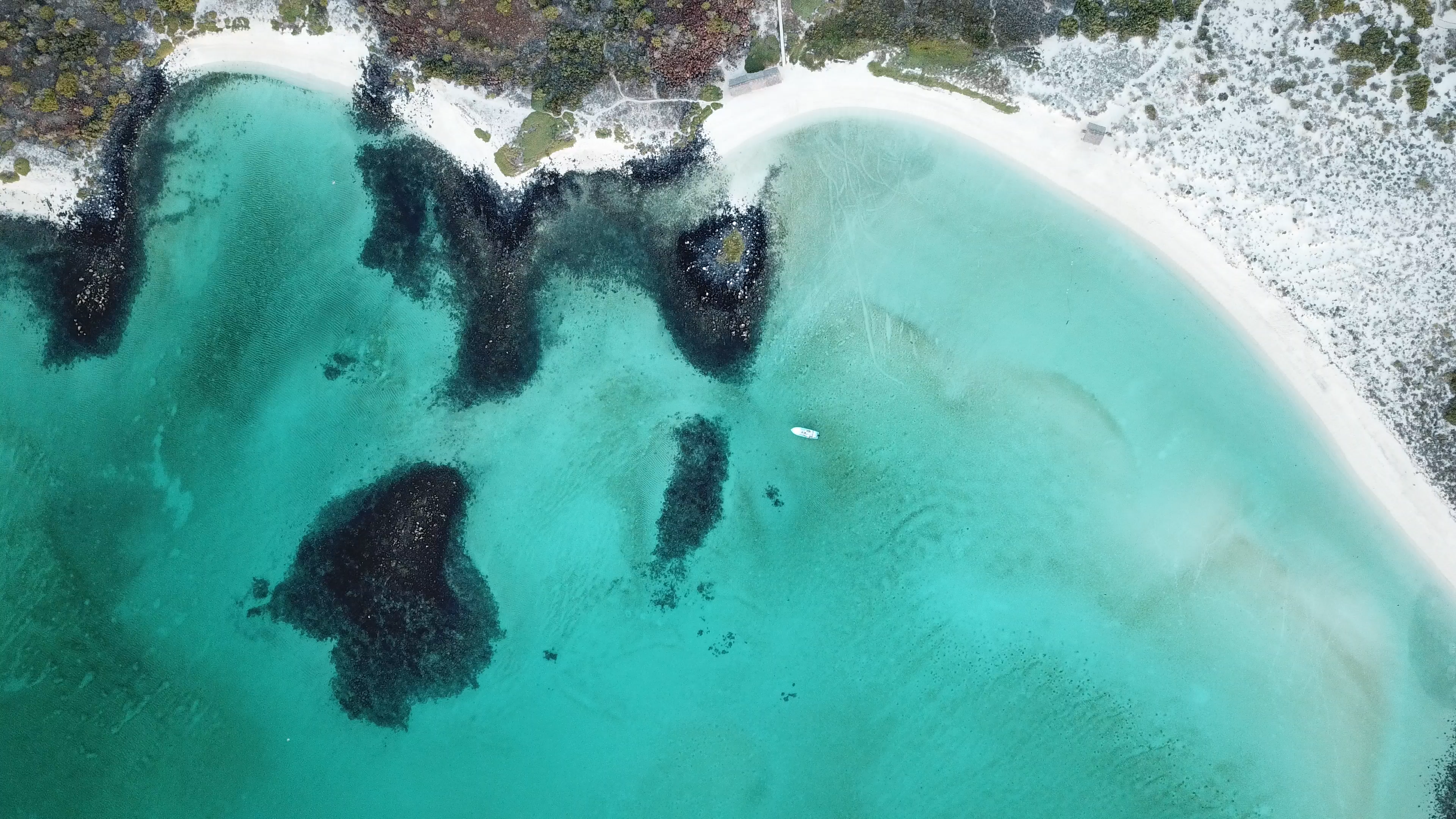
2. Isla Coronado
A few miles North of Loreto. A panga will take you up there for a 1/2 day for about 1300 pesos.
26.111302° -111.284477°
3. Right outside of Rancho Grande near Gonzaga Bay
4. Beach just to the North East of Rincon at Bay of LA.
Beautiful white sand beach. A must see when in BoLA.
28.913807° -113.471214°
5. Coco's
6. Bay on Isla San Fransisco
One of the top 5 prettiest bays in the Sea of Cortez. 9 miles from San Evaristo. You can have a panga take you out there.
24.820056° -110.569176°
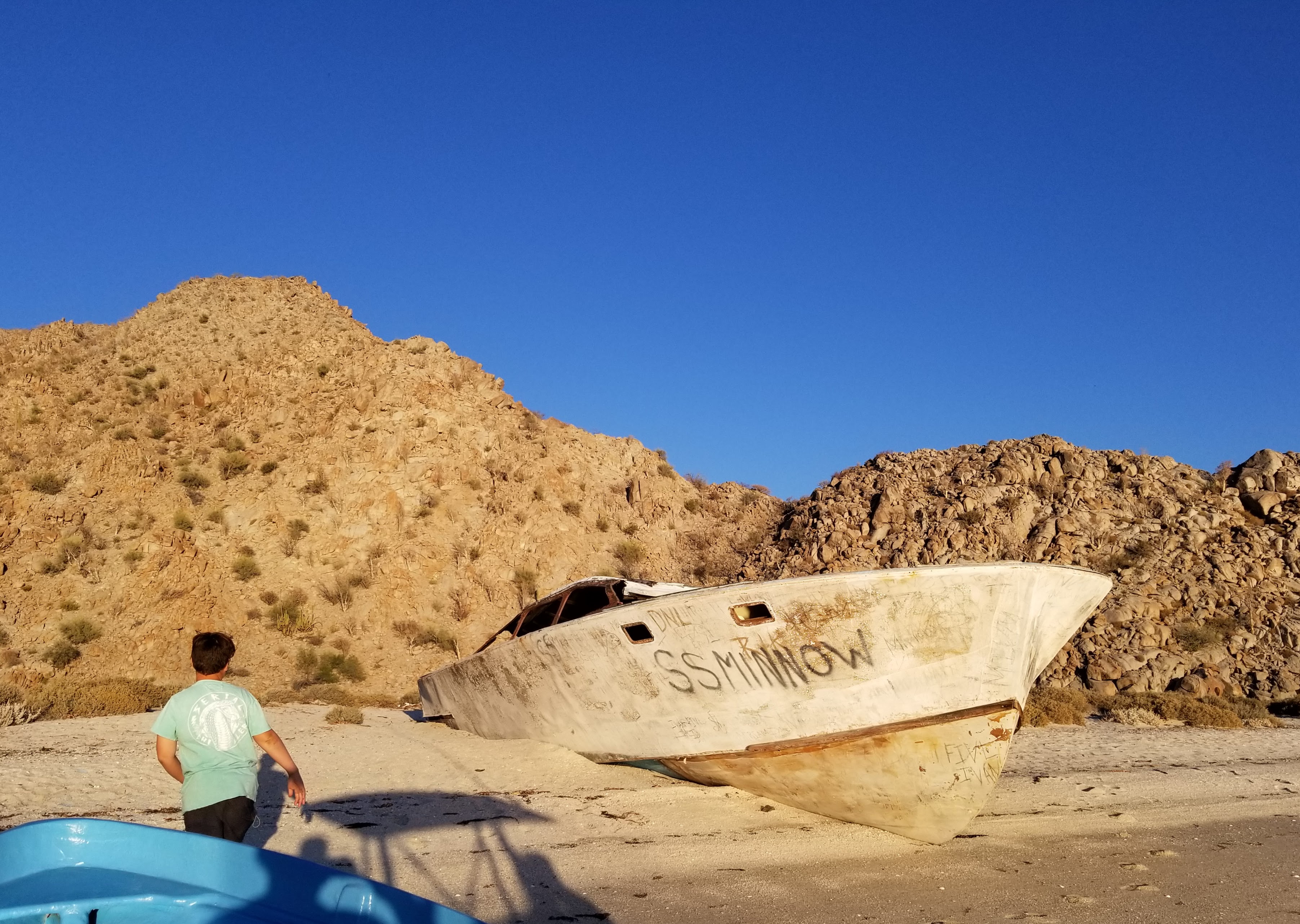
7. La Ventana at Bay of LA
It's much bigger than it looks. You can walk through it. Not far from the SS minnow. A panga will take you to see both.
28.994053° -113.501842°
8. Northern part of the Seven Sisters
About 7 miles South of San Jose.
29°13'15.0"N 114°48'51.5"W
This video has a bunch of shots of it starting at 58 secs: https://youtu.be/hrdzmTWPUQs
9. Northern end of Bahia Agua Verde
South of Loreto. A fantastic day trip.
25.523650° -111.073719°
10. Sail Rock
First went there in 2002. Took my kids to see it in 2018.
Here's a video that has several shots of it: https://youtu.be/g3ThXCm3XSA
[Edited on 6-11-2020 by JZ]
David K - 6-11-2020 at 07:58 AM
Cool list!
white whale - 6-12-2020 at 02:41 PM
#6 - that is calendar worthy photo. This thread, instant add to favs.
AND you put the co-ord's too? Such a Boss move.