vsmithpoint1 - 10-7-2020 at 02:15 PM
Hello Baja travelers. I’ve been traveling Baja for most of my life and have selected a new place to venture to in a couple weeks. We are going to
Bahia Guadalupe north of LA Bay. I don’t see a lot of information on the web about that area and I’m trying to determine how passable the dirt
Road is and see if there’s any other important information I would want to know from somebody that has possibly traveled that road.
Thanks in advance for any information you can give me about that area. It looks beautiful, pristine and undisturbed, but I wanna make sure that it’s
as hospitable as it looks in some pictures I’ve seen online. Thanks to all
Welcome to the forum!
AKgringo - 10-7-2020 at 03:48 PM
I have never been in there, but I remember someone on this forum mentioning it. I assume that you are thinking about access across the dry lake bed
off of the B.O.L.A. paved road?
I have heard that there is a way to get there from the La Gringa area, but if I remember correctly, it is for dirt bikes or quads. I did not have
much luck trying to find any usable tracks on Google earth, but I didn't spend much time at it.
Good luck getting answers, and I would be grateful if you pass on your findings here.
David K - 10-7-2020 at 03:54 PM
Welcome to Baja Nomad!
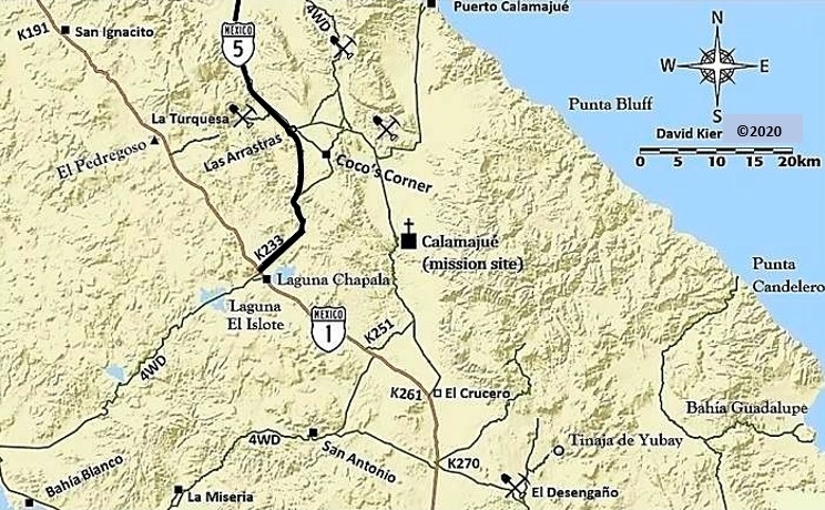
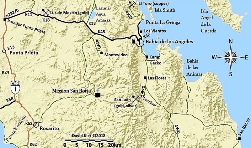
My kids and I camped there by Bahía Guadalupe and again at the north end of the road past the second dry lake, by Punta Candelero. I include the road
on my map, leaves the highway at Km. 38:


13.5 miles from the highway (Km. 38) is a T junction. To the right is Bahía Guadalupe in 9.8 miles and to the left is Candelero in 19.6
miles. If it has rained, the dry lakes won't be dry.
4x4abc - 10-7-2020 at 11:53 PM
easy drive across the lake. Some fishing activity. Not undisturbed, but quiet. Alcatraz is the nicest beach (south end). Some old mining piers there,
related to the Toro mine. Take pictures when you get there.
Cool drive when you go north on the 2nd lake. Gets you to a rocky beach - but cool drive.
David K - 10-8-2020 at 07:10 AM
A beautiful canyon full of colors is part of the drive to Candelero. Yes, a rocky beach full of driftwood. You look out to the north end of Angel
Island.
TMW - 10-8-2020 at 02:43 PM
My son and I went to Guadalupe after the 2011 Baja 1000 race. My trip report is at http://forums.bajanomad.com/viewthread.php?tid=56984
After you turn east for the Sea of Cortez we missed the left turn and went to the area south of C. Guadalupe. The next day we follow a trail that took
us to Bahia Guadalupe.
You should pickup the trail at the end of the dry lake at 29-06.770 x 113-45.540. The turn east after the dry lake bed is 29-11.212 x 113-47.220. The
turn off from the main trail coming in is at 29-11.800 x 113-42.920. On Google Earth the turn east is after a large dark hill. At Bahia Guadalupe the
beach going north looks to be a beautiful yellow beach. We started to drive along it but the sand was soft and I didn't want to air down any more than
I was so we turned and headed to the pacific side.
honda tom - 10-8-2020 at 09:28 PM
across the dry lake and through a small canyon... find the road east and have a blast... sandy wash but firm... 2wd is fine. use google earth to see
what roads take you to the multiple beaches out there..... theres a few.
4x4abc - 10-9-2020 at 12:25 AM
the question for tracks etc came up
here is what I have
Attachment: around dry lake.kmz (56kB)
This file has been downloaded 356 times
My trip to Bahía Guadalupe and Arroyo Candeleros
David K - 10-9-2020 at 09:06 AM
Our Baja trip of December, 2002 to January, 2003 had my kids (Chris and Sarah) and I exploring unmapped roads north of Bahia de los Angeles.
The day after Christmas, we drove all the way to Guadalupe Bay. The next day we continued over the next dry lake north and found the entrance to
Arroyo los Candeleros. This snaked through extremely colorful hills before reaching the gulf shore, where we camped the second night. The next few
nights we camped with the Humfreville's at Raquel & Larry's, Bahia de los Angeles. After New Year's we went south to Bahia San Rafael and then
west searching for a lost mission!
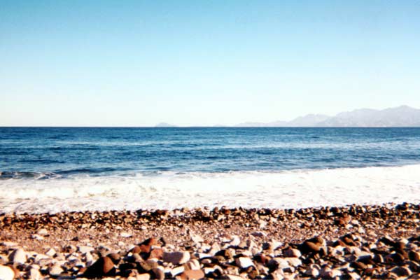
Los Candeleros Beach

At the end of Arroyo Los Candeleros the GPS is N29°22.60'/ W113°44.50'. In the distance is the north end of Isla Angel de la Guarda.

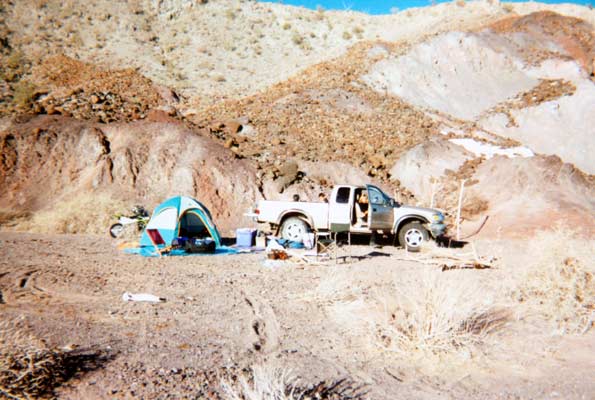
Our campsite on the north side of the arroyo. The hill gave us some protection from the north wind.


