PaulW - 2-2-2021 at 03:53 PM
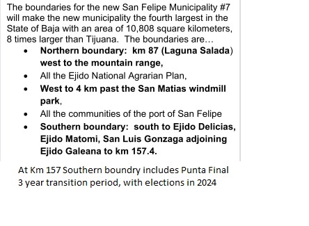
Boundaries defined

Borregoman - 2-2-2021 at 05:53 PM
I guess our south campo home in Bahia Santa Maria will now be in San Felipe instead of Ensenada which was always ridiculous.
David K - 2-2-2021 at 06:34 PM
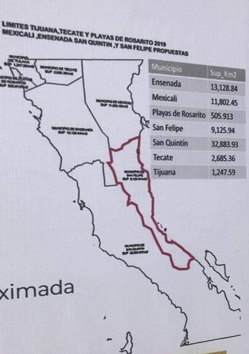
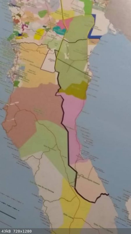
Paul, any detailed map would be appreciated! I may be able to get it onto the new Baja Atlas book if the boundary map is clear.
Thank you!
[Edited on 2-3-2021 by David K]
PaulW - 2-2-2021 at 07:13 PM
The published map was a gross interpretation of the area. They still do not have a map that I know of. The above description is much more accurate
than any thing else I have found.
Let me help you with my interpretation:
* Mountains to sea at KM 157 using a west/east line.
* Mountains to sea at Km 87 using a west/east line to capture La Ventana and Jose Saldana #2.
* Next a corredor starting at the north end of L Diablo along Highway 3 using mountains for the side marker past San Matias for 4Km past the windmill
park. Measuring from the center of San Matias at Km 140.5 for 4km results in KM Km 136.5. Mikes turn is Km 137 and there is a cluster of roads at Km
136.5 on my GPS. Could be there are houses or farms in that area? Obviously Valley Trinidad is not included.
You should be able to draw lines on your map from my descriptions?
David K - 2-3-2021 at 06:27 AM
Hi Paul,
These two maps are all I have seen so far.
I need something more detailed and an online link instead of a photo of a sign...


