Great thread! Thanks for all the great maps DK
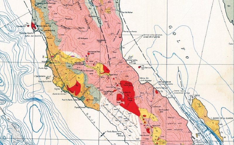
The trail that passed Agua Leon, a water hole, on the way south to Punta Prieta was mentioned by travelers in the 1920's. This trail appears to be
pretty far west of present day Hwy. 1, which of course then did not exist.
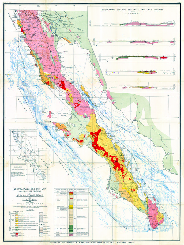
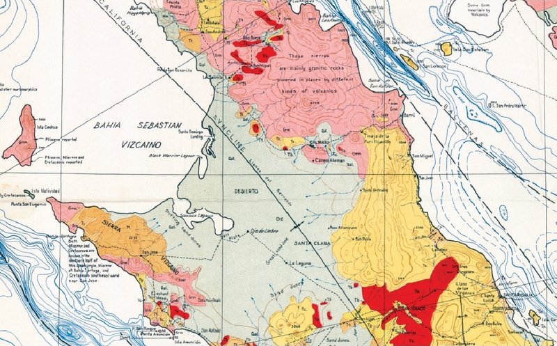
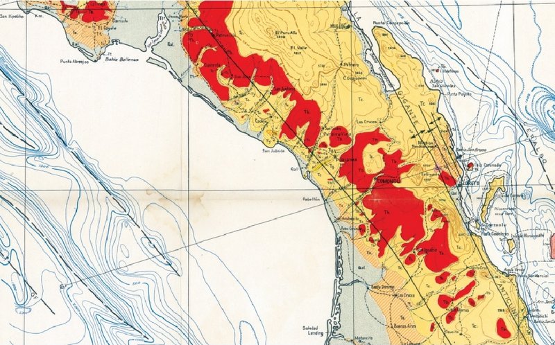
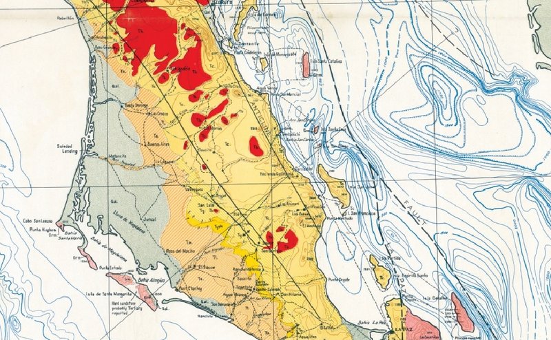
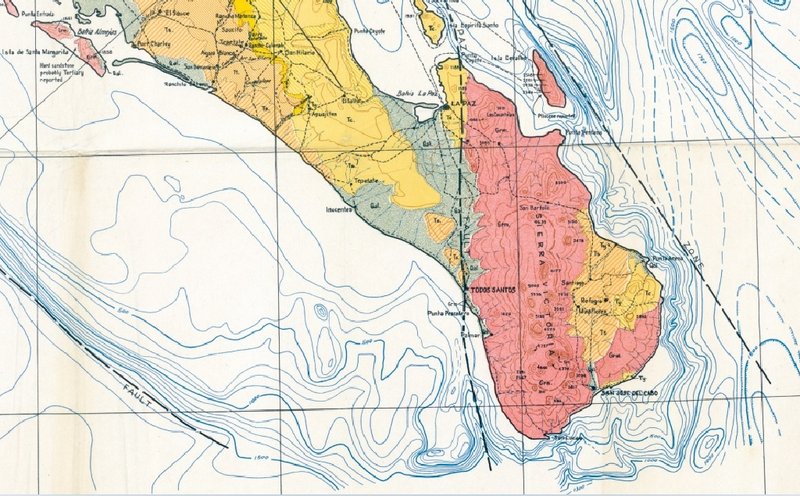
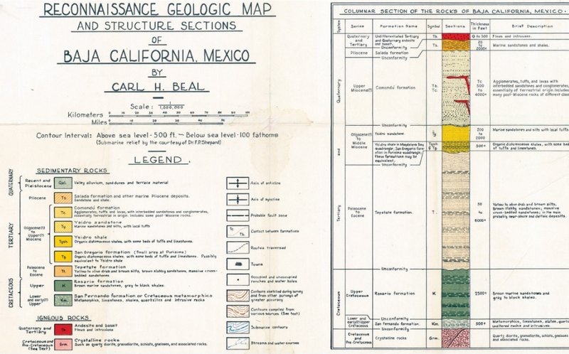
The geological article linked above has a good description at the very end of why sea shells are found at elevations far above sea level in Baja due
to the land being raised up.
[Edited on 4-25-2021 by bajaric] |