BajaNomad

New Baja Road and Recreation Atlas

LancairDriver - 5-12-2021 at 03:54 PM

I thought I had ordered the Baja Bound maps recently. It turns out I actually ordered a Baja California Road and Recreation Atlas from Discover Baja Travel Club. I must say it is an excellent publication in the large Rand McNally book format that has WAY more information than just the maps I wanted so I was pleasantly surprised. It cost $26.00 and has Landscape Maps ,Recreation Guides, Detailed Roads, and Public Lands.
Now I am going to double down and order the Baja Bound maps
so I can see all the good surf spots.

[Edited on 5-12-2021 by LancairDriver]

AKgringo - 5-12-2021 at 05:24 PM

I got mine today, and will be going over it looking for ideas for my next trip. Inside the cover sheet is a Bajabound insert, so is there a separate map other than the ones we got?

Mine is from Benchmark Maps, and has nothing indicating a connection to Discover Baja Travel Club.

[Edited on 5-13-2021 by AKgringo]

LancairDriver - 5-12-2021 at 05:53 PM

On closer inspection there is a special thank you by the Benchmark Maps Staff inside on the first page to David Kier for his invaluable editorial assistance. There is also a plug for David’s book “Baja California Land of Missions”. Congratulations David.

[Edited on 5-13-2021 by LancairDriver]

advrider - 5-12-2021 at 07:30 PM

This with David's travel guide should make for a complete Baja guide..

David K - 5-12-2021 at 09:35 PM

Thanks guys.
LancairDriver: there are no Baja Bound maps... The new Baja Atlas is from Benchmark.
Baja Bound is selling them ($20) along with Benchmark, Discover Baja, Amazon, etc. Amazon is backordered, however.

The maps I made are here on Nomad for free (Road Conditions forum) and may be in a future guide that I made for Baja Bound. Covid delayed the publication one year.

There is a thread already for the new Atlas announcement and photos from inside.

David K - 5-12-2021 at 09:40 PM

The other thread is in Baja News forum. If you use Today's Posts feature to read Nomad, I just bumped that thread up.

BajaMama - 5-13-2021 at 07:51 AM

AKgringo mine is from Benchmark, too. I love it! Now I can find all the places every talks and posts about. Such a great tool, thanks David.

Glidergeek - 5-18-2021 at 07:31 AM

Got my Atlas yesterday. What a great publication, perfect for me. Thanks David K.

David K - 5-18-2021 at 09:28 AM

Glad it is getting a friendly nod. Two of the cartographers from Benchmark and I will be on a Slow Baja Podcast to share how we made it... recording it this Friday.

Disastrogirl - 5-18-2021 at 10:07 AM

David, do you know how to order it from Baja Bound? I couldn’t find a link on their website. I’d rather order from them than amazon.

AKgringo - 5-18-2021 at 10:15 AM

Quote: Originally posted by Disastrogirl  
David, do you know how to order it from Baja Bound? I couldn’t find a link on their website. I’d rather order from them than amazon.


Try this; https://shop.bajabound.com

David K - 5-18-2021 at 10:39 AM

I posted the ordering details in the thread I made. Thank you AK.
Here is the original Baja Atlas post: http://forums.bajanomad.com/viewthread.php?tid=95688

Amazon was the first to take preorders. They have been backordered and late to get books to people.: https://www.amazon.com/Baja-California-Road-Recreation-Atlas...

Then there is the publisher, Benchmark Maps: https://www.benchmarkmaps.com/product/baja-california-road-r...

Next came Baja Bound Insurance, with a below list price offer of just $20 (and they have them in stock): https://www.bajabound.com/baja-atlas

Discover Baja Travel Club has them, too: https://www.discoverbaja.com/2021/04/05/the-new-baja-califor...

The digital Avenza version is nice for your phone or tablet! https://www.avenzamaps.com/maps/1250162/baja-california-atla...

geoffff - 5-19-2021 at 04:26 PM

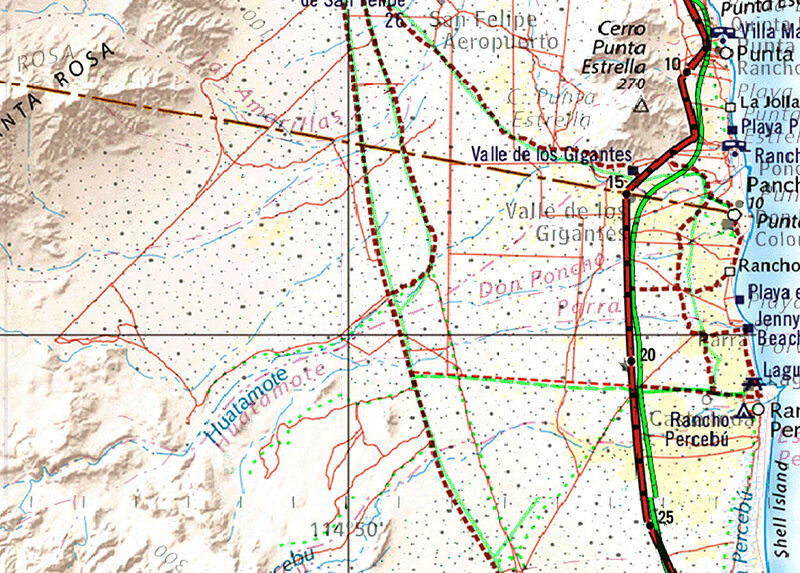
I purchased the Avenza digital version, and am already playing with it. There's Shell Island!


geoffff - 5-19-2021 at 04:31 PM


PaulW - 5-19-2021 at 04:48 PM

Geofff,
In your image Digital has the same criticism as the book.
The road up Huatamote is missing. It has been a road for over 20 years.
No road for Chanate in use for over 20 years
Probably the same comment for Parral (Azufre)
Percebu is not correct as it does not extend that far west.

David K - 5-19-2021 at 05:03 PM

Paul, make a list... Benchmark has been great at modifying these government maps. Your suggestions can appear in future additions!

geoffff - 5-19-2021 at 05:04 PM

Quote: Originally posted by PaulW  
The road up Huatamote is missing. It has been a road for over 20 years.


Up the Huatamote wash itself? In this case, the INEGI 50K map is similar to Benchmark.

I wonder what sources Benchmark used for their maps. Perhaps INEGI was their main source. And then maybe they studied satellite imagery to find some additional roads -- but roads up washes are difficult to see (can be for me), so they get missed?


PaulW - 5-20-2021 at 05:27 AM

Check the date of the INEGI maps. Hopelessly out of date. This is because they concentrate on topographical features as opposed to physical changes. The land forms hardly change over the years.

PaulW - 5-20-2021 at 06:01 AM

Actually I think the Chanate. Huatamote, Amarillas, and Azufre are not even plotted correctly? All are shown on the Almanac, some without names.
Now who wants to validate that? I do not have the time. I did all that years ago and do not even remember the study results. Back in the day the only thing I could do was plot from the track to the Almanac because I did not have digital ability. Horribly time consuming.
Load a choice of the many SCORE tracks and plot some WPs or overlay the tracks on the digital atlas.

One has to study Google Earth to resolve where Percebu goes. Then we can discuss that. And if you find that track convince us all that the west portion is it not Azufre/Parral or whatever.

David K - 5-20-2021 at 08:46 AM

Paul, the base map (INEGI) that Benchmark used already had minor roads on it, including Parral (Crazy Horse), San Fermin (Apache Tears), etc. I did correct the west end of the Cañon el Parral road, showing the route across the valley floor that followed the fence line. The INEGI base map showed the ancient route that went southwest after exiting the mountains.

gueribo - 5-20-2021 at 01:37 PM

Quote: Originally posted by David K  
Glad it is getting a friendly nod. Two of the cartographers from Benchmark and I will be on a Slow Baja Podcast to share how we made it... recording it this Friday.


Very cool. Looking forward to the discussion.

David K - 5-20-2021 at 01:52 PM

Quote: Originally posted by gueribo  
Quote: Originally posted by David K  
Glad it is getting a friendly nod. Two of the cartographers from Benchmark and I will be on a Slow Baja Podcast to share how we made it... recording it this Friday.


Very cool. Looking forward to the discussion.


Thanks! I am looking forward to news about your book, as well!
My missions book (that you contributed data to) is now at the printers a 10th time to keep up with the needs of my distributor, Sunbelt! Loving the desire out there to learn more from the past!

geoffff - 5-20-2021 at 05:01 PM

Quote: Originally posted by David K  
Two of the cartographers from Benchmark and I will be on a Slow Baja Podcast to share how we made it... recording it this Friday.
Neat! I'm also looking forward to hearing this!

Here is an overlay with Benchmark over INEGI. It's kind of difficult to see (click to enlarge), but what I see in this area is that the Benchmark map includes most of the INEGI roads, and that Benchmark has added a number of other roads:


[Edited on 5-21-2021 by geoffff]

geoffff - 5-20-2021 at 05:09 PM

And here's that same area comparing the new Benchmark map with our old favorite, the Baja Almanac (colors changed for contrast). The Baja Almanac was never spatially accurate enough for GPS use, though many years ago I did scan pages and try.


PaulW - 5-21-2021 at 09:11 AM

For reader interest.
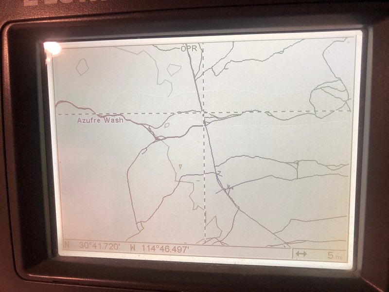
You mention Apache Tears. Here is a screen shot from my GPS that shows the roads near that place.
And yes I have driven all of the roads shown. That is what I have been doing over the years


rquote=1212319&tid=96027&author=David K]Paul, the base map (INEGI) that Benchmark used already had minor roads on it, including Parral (Crazy Horse), San Fermin (Apache Tears), etc. I did correct the west end of the Cañon el Parral road, showing the route across the valley floor that followed the fence line. The INEGI base map showed the ancient route that went southwest after exiting the mountains. [/rquote]

IMG_1195.jpg - 173kB

[Edited on 5-21-2021 by PaulW]

David K - 5-21-2021 at 09:18 AM

Nice... Geoffff, do you want to show the area adjoining south of the map you posted, so Paul might see the Llanos de San Fermin (Apache Tears) road (sulfur mine to Arroyo Matomí)?

PaulW - 5-21-2021 at 09:40 AM

For those unfamiliar.
The generally flat ground east of the mountains including Apache Tears is well known as Llanos San Fermin. I explored years back with much failure due to lack of ability to get thru the cactus vegetation. IMO it is a place to avoid except for travel on existing roads.
It extends from Matomi north to close to the Sulfur mine area. The north end is mostly barren and the area south is heavy vegetation.

PaulW - 5-21-2021 at 09:52 AM

Here is an example screen shot from My GPS map showing Huatamote road connecting to the Parral road.
The road in the wash generally follows the water path and changes year by year due to flooding from the wet season. In some places you may find a wide gravel section and in other places you may find boulders to drive over. Most years it is passable with any typical 4X4 with a bit of clearance.


Huat.jpg - 186kB

geoffff - 5-21-2021 at 03:40 PM

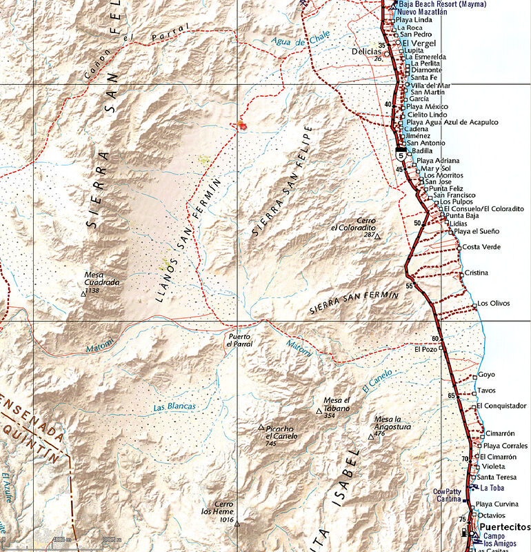
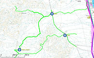
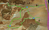
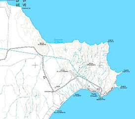
This is the Tears area in Benchmark, INEGI, Baja Almanac. Click little images to open.


geoffff - 5-21-2021 at 03:47 PM

Oh, and including Motami:


[Edited on 5-21-2021 by geoffff]

geoffff - 5-21-2021 at 04:04 PM

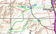
Curious how both Benchmark and Baja Almanac made the same mistake with the Agua de Chale road, sending the start of the road straight over the mountains rather than along the wash. Satellite imagery doesn't show a road going straight over the mountains. INEGI doesn't show this road at all, so can't blame them!


Did Benchmark use the Baja Almanac as a source?


[Edited on 5-21-2021 by geoffff]

advrider - 5-21-2021 at 08:49 PM

I had ordered mine on Amazon but when I found out Baja bound already had them for sale I cancelled with Amazon. Much rather support a smaller company and one that is on this form. Looking forward the getting them..

PaulW - 5-21-2021 at 08:51 PM

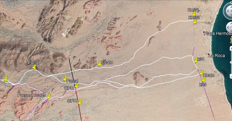
Roads near Chale/Parral
GPS Screen Shot

Notice on the GPS image at the cursor then see that WP on the GE image.
So, on the GPS plot is seems we no longer use the wash route (upper) but are using the higher ground route.
That upper Chale route is not very recent like the other tracks shown on the GPS image.

GPS


Google I drew the maroon Chale track based on coords from the GPS.


INEGI H11B67 clearly shows the main drainage is Parral. It also shows Chale just north of Parral (near OPR) and joining Parral where the upper and lower roads join up stream as seen on the GPS image.

These roads being discussed on not on the INEGI topo but were added when the Almanac was made.
No error on the Almanac/Atlas just an omission of recent roads.

geoffff - 5-22-2021 at 11:53 PM

Comparison of Benchmark with PaulW's recent map of San Felipe area trails:


PaulW - 5-23-2021 at 09:16 PM

Mistake? Curious how you decided that.
In all my research I have never found a road that used Chale as I know it. I bet if I go along my Chale path there will in fact be a road as shown below? But probably not west of OPR.
The actual roads shown in my other post go from OPR heading to Parral on a wash to the south then going west. As shown on my GPS map there was a road path north of Parral and west of OPR.
I still think the Atlas guys are correct to omit that old path north of the shown roads.
The Atlas look’s fine IMO.
Below is my latest try to explain the two arroyos. I used Google earth to find the landmarks to define where the Chale path goes.

Chale-Parral.jpg - 193kB


Quote: Originally posted by geoffff  
Curious how both Benchmark and Baja Almanac made the same mistake with the Agua de Chale road, sending the start of the road straight over the mountains rather than along the wash. Satellite imagery doesn't show a road going straight over the mountains. INEGI doesn't show this road at all, so can't blame them!


Did Benchmark use the Baja Almanac as a source?


[Edited on 5-21-2021 by geoffff]


geoffff - 5-23-2021 at 10:24 PM

Quote: Originally posted by PaulW  
Mistake? Curious how you decided that.

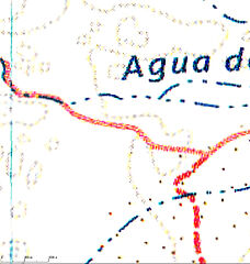
Well I am not sure, as I haven't personally explored the area -- but take a look at your tracks overlaid with the Benchmark map. (This was a bit tricky as your screenshot seems to have been taken at an angle.) What I assume to be a "mistake" is the Benchmark's dotted line going over the two hills southwest of the word "Agua" in this image. If there is a road, I can't imagine it going directly over the top of these hills -- and if I zoom into the satellite imagery, I don't see a road there.


It's not a big mistake, but if it is a mistake, then what's curious is that both the Baja Almanac and Benchmark somehow made the same mistake.


[Edited on 5-24-2021 by geoffff]

David K - 5-23-2021 at 10:55 PM

Guys, they both use INEGI maps so they both share the same potential errors. Agua de Chale is the former name for Nuevo Mazatlan. Follow that arroyo from the sea back west into the hills.

geoffff - 5-23-2021 at 11:01 PM

Quote: Originally posted by David K  
Guys, they both use INEGI maps so they both share the same potential errors.


But that's the other point I made earlier -- the INEGI map doesn't show this road! Only Benchmark and Baja Almanac.


David K - 5-23-2021 at 11:06 PM

Benchmark had my map, an AAA map, and the Almanac. They added roads that were important to show. The arroyo that is called Agua de Chale on INEGI is probably not, at least in Cañon El Parral.

geoffff - 5-23-2021 at 11:12 PM

(My above post updated with INEGI map image overlaid with Benchmark)

PaulW - 5-24-2021 at 08:26 AM

Thanks for more of your images.
Now I correctly understand the errors of both the Alamac and Atlas.
My image of the roads on GE ends any dispute of the errors.
Conclusion regarding Atlas/Almanac:
Roads are shifted or incorrectly plotted. Roads do not go over mountains or hills.
Chale is not plotted correctly or labeled correctly

Besides I do not think Chale even exists now days as depicted on INEGI. See GE which is a later image.
Maybe some cartographer decided to call Parral as Chale when the path gets close to the sea? Maybe locals used the name Chale instead of Parral for unknown reasons?

Next season I will go and drive the disputed area. I do expect more confusion due to the date of both GE and INEGI we are all using.

Meanwhile if anyone wants to go and drive the roads use the attached GPS file

Attachment: Chale Question.gpx (168kB)
This file has been downloaded 146 times

David K - 5-24-2021 at 09:28 AM

Paul, my PC won't open a GPX file, can you do a KMZ?

geoffff - 5-24-2021 at 09:29 AM

Thanks! Here's PaulW's track plotted:
Benchmark / Baja Almanac /
INEGI / satellite


David K - 5-24-2021 at 09:36 AM

Can you trace the arroyo from the coast at Nuevo Mazatlan back west? That is Arroyo Agua de Chale. I think we can see that the one coming out of Parral Canyon does not wander north to Nuevo Mazatlan.

This kind of study will help make the next edition of the Atlas better. We have friends at Benchmark Maps who want to customize maps for more accuracy!

All maps have errors, some are even intentional for copyright protection. I found a mistake last night in the Atlas, that Benchmark made (the years the final Comondú mission was open). Stuff happens.

geoffff - 5-24-2021 at 09:37 AM

Here is PaulW's track as a Google Earth file: chale.kml


[Edited on 5-24-2021 by geoffff]

geoffff - 5-24-2021 at 10:20 AM

Quote: Originally posted by David K  
All maps have errors, some are even intentional for copyright protection


Exactly -- your posting earlier about intentional map errors is what made me think it was curious that Benchmark had seemingly replicated Baja Almanac's "error" here.

PaulW - 5-24-2021 at 12:41 PM

More with possible Parral water flow paths.
As you can see on Google earth Parral spreads out widely when the terrain gets flatter.
Looking a the kml you all can make your own paths.

BTW, I have noticed over the years the roads usually follow the main drainage. However this area is pretty drivable any place.


Attachment: Chale QuestionR.gpx (209kB)
This file has been downloaded 133 times

Attachment: Chale QuestionR.kml (90kB)
This file has been downloaded 122 times

Chale East w Parral.jpg - 218kB

David K - 5-24-2021 at 12:46 PM

Is the dark blue (or is that a purple?) line with the Chale pushpin, the arroyo or a road? If the arroyo, then it does go to Nuevo Mazatlan. What are the red (or green?) lines marked Parral; arroyos or roads?

Sorry for my 'color-challenged' eyes. They do not see reds and greens well to tell them apart. Purple is red + blue, so that is why I am not sure if it is purple or a shade of blue.

PaulW - 5-24-2021 at 01:28 PM

Sorry about the colors
Legend:
Green is my guess for Parral
dark blue is Chale
Purple is roads

Top is blue Chale water path.
Next one down is green represents possible Parral water path
Third one down by Hwy 5 is purple like Hwy 5 and designates roads
Bottom is green and crosses the road

On the KML change the color to suit. If you can see a faint line right click on it choose properties then choose a color and click OK. No color also works and some like that because it shows up on a dark background.

Chale

PaulW - 5-26-2021 at 08:59 PM

One more time
Both the Almanac and Atlas show the entrance to Parral incorrectly.
Compare the Google earth and OZI Explorer images.
IMO if Arroyo Chale is to be shown on the map it must be moved south to where the images how the water is now flowing.
Of course it would be wise to do a ground check to validate the satellite images.
1) My opinion is Chale should not be shown at all because it located wrong.
2) Or be replaced by Parral at the location shown at K 34.6. Maybe Call it Parral/Chale?
K34 = 30 42.229, -114 42.842
k34.6+ WP Chale = 30 41.900, -114 42.679
k35 = 30 41.722, -114 42.679

View the KML and see what you all think.

Google


Ozi


Attachment: Latest.kml (119kB)
This file has been downloaded 135 times

[Edited on 5-27-2021 by PaulW]

David K - 5-27-2021 at 10:21 AM

Thank you Paul!! :light::bounce:

PaulW - 5-28-2021 at 08:34 AM

Quote: Originally posted by geoffff  
I purchased the Avenza digital version, and am already playing with it. There's Shell Island!
=== ===
Tell us about the digital version.
Any pros or cons?
Is it as good as INEGI regarding zooming with preserved detail?

geoffff - 5-28-2021 at 09:28 AM

Quote: Originally posted by PaulW  

Tell us about the digital version.
Any pros or cons?
Is it as good as INEGI regarding zooming with preserved detail?


The Avenza digital maps are just very good scans of the paper Benchmark atlas - so you can't zoom in past the book's maximum resolution. All the Benchmark map images I've been posting here on the BN over the last week or so are taken from the Avenza images (I don't have the paper book yet). So, no they don't really replace INEGI -- but they are much more pleasant to look at a when you are few steps zoomed out.


(The periodic image jitter you see above in the Benchmark images is my fault, caused by my image capture process.)

[Edited on 5-28-2021 by geoffff]

geoffff - 5-28-2021 at 09:33 AM

It's a bit of a shame that Avenza didn't (seemingly) get access to the raw digital images from Benchmark instead of scanning the printed book. Then the Avenza maps could look sharper - even if they didn't actually show more detail. But it's not a big deal.

David K - 5-28-2021 at 10:05 AM

Just to clarify, Avenza download is one single map of the peninsula, not separate pages with page breaks or staple binding, as is the book. You can zoom way in with crystal clarity and that I enjoy better than the book version, which requires reading glasses or a magnifying glass for old me.

The Avenza version is only the landscape map. The book has additional recreation maps, state maps, and specialty close-up maps of Los Cabos, La Paz, and Guadalupe Valley along with all the recreational text and photographs (they used two of my photos in that part).

PaulW - 5-28-2021 at 11:28 AM

Thanks
I have the book.
Your incite is greatly appreciated.
Yup, hard to read so my magnifier is close at hand. If no real digital is forthcoming I will need a bigger magnifier.

I am looking forward to a Benchmark digital version that equals the INEGI for zooming.
I wonder if that is a possibility?
And how long I have to wait?

David K - 5-28-2021 at 11:40 AM

Send them an email! All the feedback will help Taylor the product. Bridger is the head guy for this book and Neil is the lead cartographer.

PaulW - 5-28-2021 at 11:50 AM

PM me a email and I will do it.

geoffff - 5-29-2021 at 11:52 AM

Quote: Originally posted by David K  
Just to clarify, Avenza download is one single map of the peninsula, not separate pages with page breaks or staple binding, as is the book.

Yes! Having done that myself with my copy of the Baja Alamanc, I know it's a lot of work. I appreciate Avenza for doing this.

Quote: Originally posted by David K  
The Avenza version is only the landscape map. The book has additional recreation maps, state maps, and specialty close-up maps of Los Cabos, La Paz, and Guadalupe Valley along with all the recreational text and photographs (they used two of my photos in that part).

Cool! Can't wait to get a paper copy!

David K - 5-29-2021 at 12:02 PM

A second printing will answer the demand. A 48" wall map is also coming, yea!

scotinexcile - 6-3-2021 at 02:38 PM

Mine arrived from Amazon today :)

David K - 6-3-2021 at 02:53 PM

Yipeee :bounce::bounce::bounce:

Mr. Bills - 6-3-2021 at 03:55 PM

Forgot to mention,

My Benchmark atlas purchased through Baja Bound on 5/19 immediately after I cancelled my Amazon order arrived Wednesday, 6/2.

In addition, Amazon has credited my account $10 toward a future purchase as compensation for its inability to provide a shipping date for my pre-publication order.

All's well that ends well.

David K - 6-3-2021 at 04:37 PM

That is something, indeed.

RocketJSquirrel - 6-17-2021 at 08:54 AM

Got mine! Super well done. Fun just sitting and looking through it. Gets the brain spinning on the next back-road adventure.

David K - 6-17-2021 at 09:05 AM

Wonderful! A wall map is coming next!