BajaNomad

Baja Lighthouses

4x4abc - 8-11-2021 at 07:27 AM

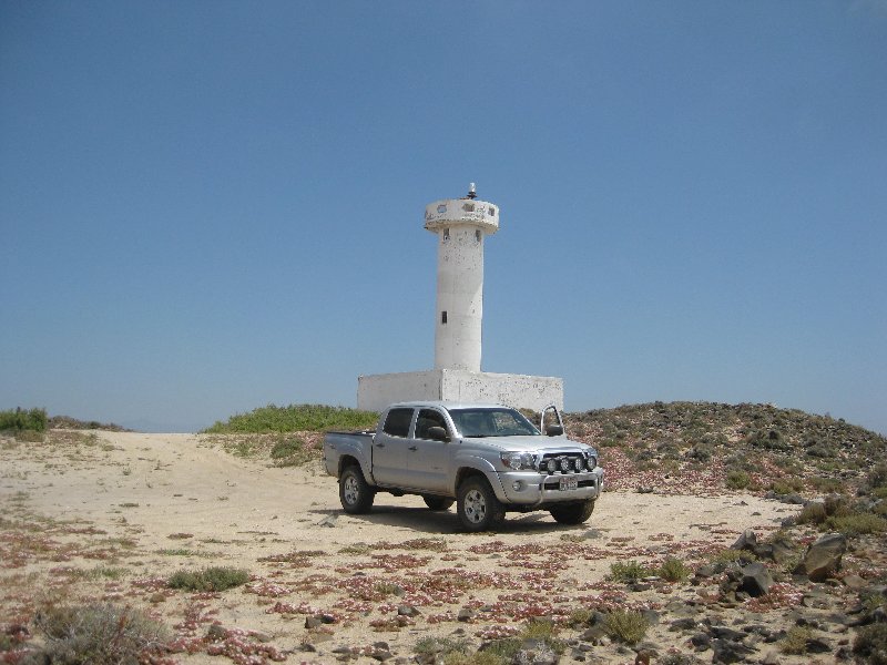
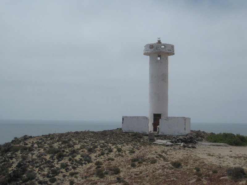
which one do you think is the best looking lighthouse in Baja?

last I counted we have around 150 old and new lighthouses
sometimes I I find a new to me in random Baja videos on youtube
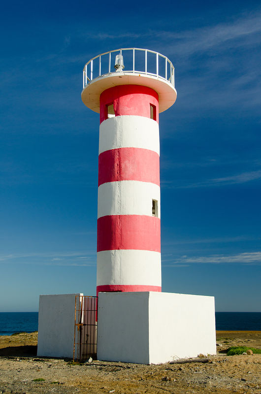
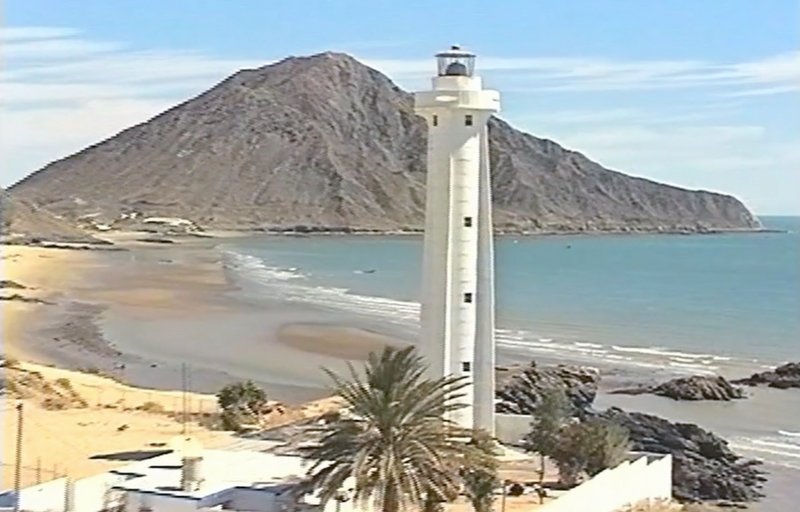
like the one below at Punta Lobo

btw, Tijuana, Guerrero Negro and San Felipe style are almost identical

Punta Lobo lighthouse copy.jpg - 136kB

del mar - 8-11-2021 at 07:47 AM

seen this one?

4x4abc - 8-11-2021 at 07:52 AM

tell me where

I found most on Google Earth and not in person

Punta Marquez

David K - 8-11-2021 at 09:25 AM


JC43 - 8-11-2021 at 11:34 AM

The one in Mulege, quit working/flashing some time ago. Anyone knows the reason? CFE bill maybe like SAPA?

4x4abc - 8-11-2021 at 11:14 PM

here are the lighthouses I have so far
if you are on the water a lot and know more - please let us know

Attachment: all lighthouses, all Faros.kmz (17kB)
This file has been downloaded 185 times

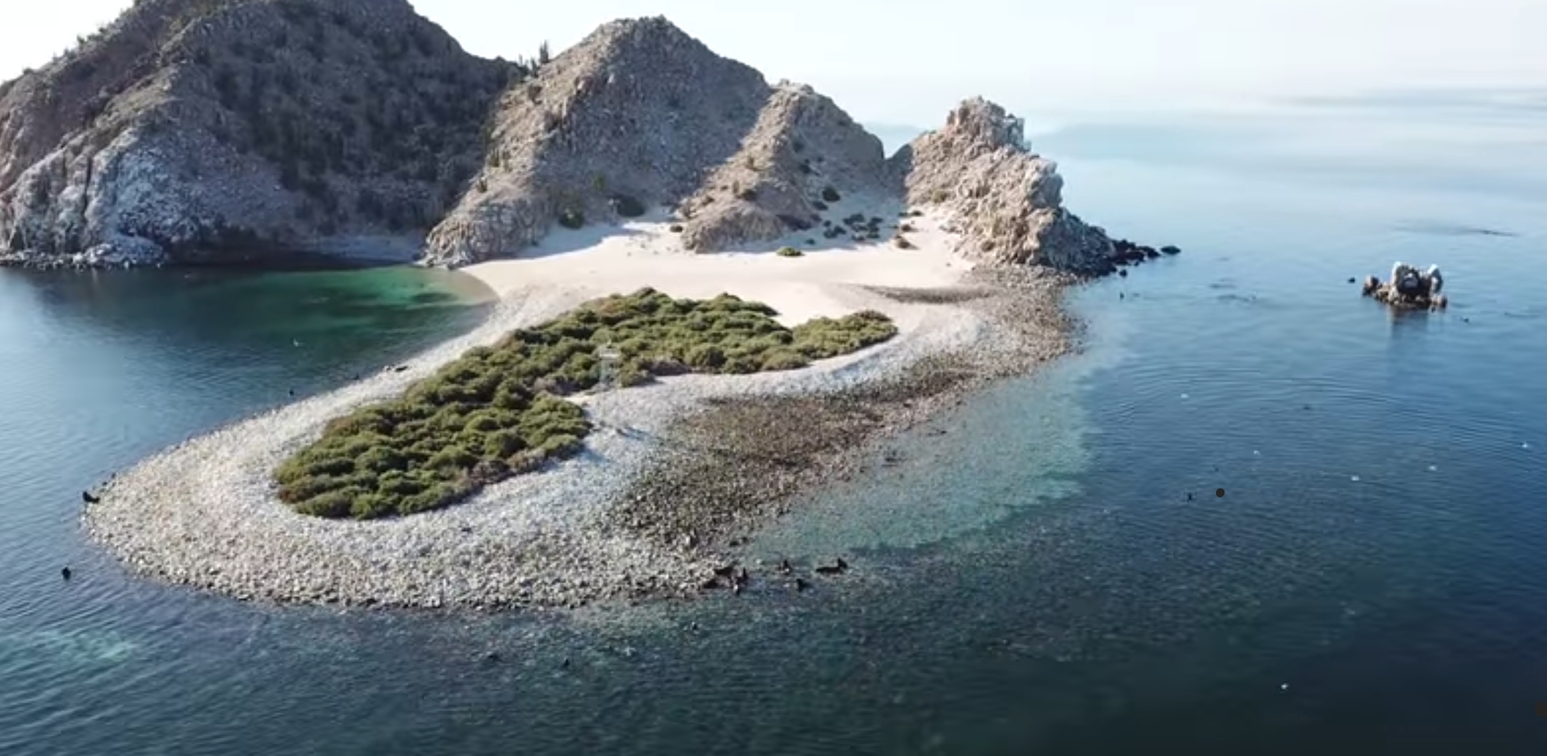
JZ - 8-12-2021 at 12:58 PM

Where is it?


[Edited on 8-12-2021 by JZ]

David K - 8-12-2021 at 02:36 PM

Quote: Originally posted by 4x4abc  
here are the lighthouses I have so far
if you are on the water a lot and know more - please let us know


There is a lighthouse at El Vergel, Km. 35 south of San Felipe. It has been there since the 1980s.

Punta Baja (near El Rosario)

David K - 8-12-2021 at 02:39 PM


4x4abc - 8-12-2021 at 04:33 PM

Quote: Originally posted by JZ  
Where is it?


[Edited on 8-12-2021 by JZ]


looks like Isla el Granito to me
29.562436°, -113.534708°

4x4abc - 8-12-2021 at 04:38 PM

Quote: Originally posted by David K  

There is a lighthouse at El Vergel, Km. 35 south of San Felipe. It has been there since the 1980s.


not detectable on Google Earth
do you have a lat/long?

4x4abc - 8-12-2021 at 04:50 PM

Quote: Originally posted by Don Pisto  
Quote: Originally posted by 4x4abc  
tell me where

I found most on Google Earth and not in person


I cheated, thats a movie set at the old Fox studios south of Rosarito next to the Popotla fishing village!:biggrin:


love it!

David K - 8-12-2021 at 06:03 PM

Quote: Originally posted by 4x4abc  
Quote: Originally posted by David K  

There is a lighthouse at El Vergel, Km. 35 south of San Felipe. It has been there since the 1980s.


not detectable on Google Earth
do you have a lat/long?


30° 41.793'N, 114° 42.011'W
On Google Earth, you can see the long shadow from it.

JZ - 8-12-2021 at 06:15 PM

Quote: Originally posted by 4x4abc  


looks like Isla el Granito to me
29.562436°, -113.534708°


That's it. Huge sea lion colony to the left.

It can be seen at the 3:06 mark here:


4x4abc - 8-12-2021 at 10:21 PM

Quote: Originally posted by JZ  
Quote: Originally posted by 4x4abc  


looks like Isla el Granito to me
29.562436°, -113.534708°


That's it. Huge sea lion colony to the left.

It can be seen at the 3:06 mark here:


I might have used your video to put that lighthouse on the map

geoffff - 8-14-2021 at 11:11 AM


David K - 8-14-2021 at 11:13 AM

Donde?
(Nice avatar!)

geoffff - 8-14-2021 at 11:15 AM

27.8251, -114.8537
El Chebo near Punta Loco on the Vizcaino peninsula

geoffff - 8-14-2021 at 11:29 AM

I'm now wondering why it isn't Punta Loca?

4x4abc - 8-14-2021 at 11:47 AM

Quote: Originally posted by geoffff  
I'm now wondering why it isn't Punta Loca?


Punta El Loco seems straight forward correct

Screen Shot 2021-08-14 at 4.25.55 PM.png - 234kB

[Edited on 8-14-2021 by 4x4abc]

David K - 8-14-2021 at 03:37 PM

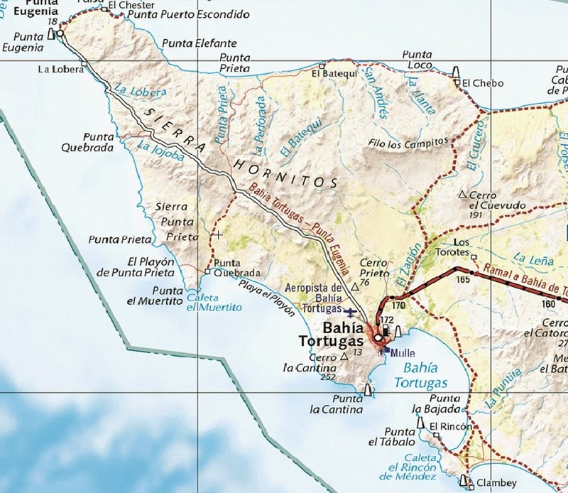
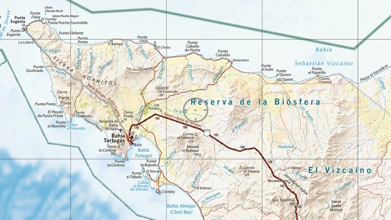
Anyone notice the new Baja Atlas from Benchmark has symbols for lighthouses... I now count six in this corner of Baja (thanks to Harald):


[Edited on 8-14-2021 by David K]

4x4abc - 8-14-2021 at 04:31 PM

Quote: Originally posted by David K  
Anyone notice the new Baja Atlas from Benchmark has symbols for lighthouses... I count 5 in this corner of Baja:


I count 6

David K - 8-14-2021 at 04:42 PM

Quote: Originally posted by 4x4abc  
Quote: Originally posted by David K  
Anyone notice the new Baja Atlas from Benchmark has symbols for lighthouses... I count 5 in this corner of Baja:


I count 6


You are correct, I see six now, too! They also use the same * symbol as the INEGI map you posted, in other parts of Baja. In the legend they have both the lighthouse building and that * symbol.

https://www.benchmarkmaps.com/landscape-map-legend-baja


4x4abc - 8-14-2021 at 05:21 PM

there seems to be a new lighthouse at Punta El Loco

geoffff - 8-14-2021 at 10:47 PM

My bad - I was looking at Benchmark. INEGI shows "Punta el Loco", as you say. Baja Almanac has Punta Loco, though ...

4x4abc - 8-15-2021 at 02:22 AM

old 250k map

Screen Shot 2021-08-15 at 3.20.42 AM copy.jpg - 120kB

David K - 8-15-2021 at 09:02 AM

Understand that the Benchmark map comes from government sources like INEGI (Mexico), as did the Baja Almanac. From those Mexican base maps, we (Almanac and Atlas) then add (or fix) content.

If the 'El' is that important, let us add it to the edits for the 2nd Edition Benchmark Atlas!
'Crazy Point' to 'The Crazy Point'
:light::biggrin:;)


David K - 8-15-2021 at 12:00 PM

Quote: Originally posted by lencho  
Quote: Originally posted by David K  

'Crazy Point' to 'The Crazy Point'
:light::biggrin:;)

Uh, uh. More like "Crasy Point" to "Crazy Man Point".

As the Expert on All Things Baja, your ignorance of the local language seems... weird.


Who said that? There will always be a lot more about Baja I don't know than do.

Language expert was you, I thought.
So Punta El Loco is the Crazy Man Point (Punta La Loca would be the Crazy Woman Point, I guess)?
Why is Punta Loco different than Punta El Loco. If the point is crazy would it not be Punta Loca?
Maybe related, the people of El Rosario always refer to their town as 'Rosario', never with an 'El'. Dropping 'The' (El) before the noun seems pretty common?
Thank you for your information to help my 'ignorance'.

PaulW - 8-15-2021 at 01:51 PM

Atlas version of Punta Loco
I count 5 Lighthouses on the image.
And the Punta Loco is really at El Chebo?


mtgoat666 - 8-15-2021 at 02:41 PM

Quote: Originally posted by David K  


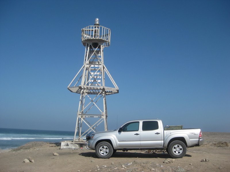
This photo looks like a beacon on a lattice tower, not a lighthouse.
Lighthouses are beacons on or in an enclosed structure.
I know of few true lighthouses in baja, I.e traditional lighthouses where house/bldg existed for lightkeeper.

Don’t recall ever hearing a foghorn in baja, are there any?

If you want to see the navigational aids on a map, look at the Mexico navigation charts, not the Baja road atlas.

SFandH - 8-15-2021 at 03:00 PM

The Tijuana and Point Loma (San Diego) lighthouses have different flash patterns so mariners can distinguish between the two, which are relatively close to each other. Google Images has plenty of photos of both.

Also: https://en.wikipedia.org/wiki/Fresnel_lens


[Edited on 8-15-2021 by SFandH]

David K - 8-15-2021 at 09:28 PM

Goat, the term 'lighthouse' in Baja is rarely a structure like we see along the coast of Maine. It is more often an automated beacon. I think we know it here means a navigation aid for ships. Take it up with Harald, who made a list of them.

As SFandH mentions, each lighthouse (or beacon) has unique flash and pause sequences, listed on the charts, so captains know which coastal light they are seeing. Naturally, most sailors rely on the satellites our nation's military put in space for safe navigation, ie. GPS. :light:

4x4abc - 8-15-2021 at 09:37 PM

Google usually has an answer:

"A lighthouse is a tower, building, or other type of structure designed to emit light from a system of lamps and lenses and to serve as a beacon for navigational aid"

please note - "other type of structure"

David K - 8-16-2021 at 07:09 AM

Good one, Harald.
Goat, did you get that?

David K - 8-16-2021 at 09:26 AM

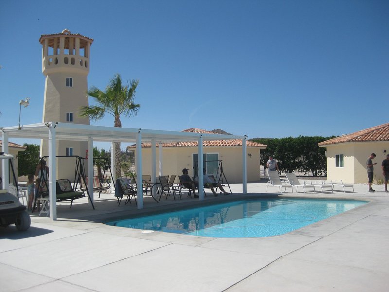
Speaking of lighthouses... here is one in Baja, owned by a Nomad and you can sleep in it. Where am I, in 2019?


4x4abc - 8-16-2021 at 12:13 PM

one of the good looking lighthouses

David K - 8-16-2021 at 12:54 PM

Indeed... and nobody guessed the answer!
Bob & Susan's Playa Frambes Lighthouse Resort on Bahía Concepción www.mulege.org

David K - 8-16-2021 at 05:44 PM

Quote: Originally posted by PaulW  
Atlas version of Punta Loco
I count 5 Lighthouses on the image.
And the Punta Loco is really at El Chebo?


PaulW, look again at the map. I first counted 5 like you. Harald saw 6. When I was more careful, I also counted 6.

Staring at the bottom is 1) Clambey; then going clockwise:
2) Punta el Tábalo; 3) Bahía Tortugas; 4) Punta la Cantina;
5) Punta Eugenia; 6) El Chebo.

David K - 8-16-2021 at 05:48 PM

The San Felipe Lighthouse (off the Matomi 2001 video by El Camote):

David K - 8-16-2021 at 05:51 PM

The Laguna Guerrero Negro lighthouse:


4x4abc - 8-16-2021 at 06:19 PM

Quote: Originally posted by David K  
Indeed... and nobody guessed the answer!
Bob & Susan's Playa Frambes Lighthouse Resort on Bahía Concepción www.mulege.org


quite an effort to build a fake lighthouse

4x4abc - 8-16-2021 at 06:21 PM

Quote: Originally posted by David K  
The Laguna Guerrero Negro lighthouse:


Puerto Guerrero Negro

4x4abc - 8-16-2021 at 06:27 PM

Quote: Originally posted by David K  
The San Felipe Lighthouse (off the Matomi 2001 video by El Camote):


The Tijuana lighthouse is in the same style

lighthouse Tijuana.jpeg - 79kB

4x4abc - 8-16-2021 at 06:30 PM

Puerto Guerrero Negro is similar in concept

old Guerrero Negro lighthouse.jpeg - 59kB

4x4abc - 8-16-2021 at 08:43 PM

where did the image of EL Chebo lighthouse go?

Bob and Susan - 8-17-2021 at 05:56 AM

wind speeds...8 hurricanes...all ok

50 feet high
at a place called Punta Arena
light is on every night

if you touch it you'll find out it's not "fake" hahaha

place to sit up on top and drink coffee or eat lunch
sleeps 2 adults and 2 kids
lots of stairs

David K - 8-17-2021 at 07:20 AM

Quote: Originally posted by 4x4abc  
where did the image of EL Chebo lighthouse go?


It is still there:

Quote: Originally posted by geoffff  


bajagerman - 9-10-2021 at 04:28 AM

Hi Harald,

I looked at your pictures of the lighthouses with interest.
I myself have sometimes dealt directly with lighthouses.
For example, I received the order for the country of Lithuania
to plan a coast radio station, to monitor the installation and
to put the system into operation.
It was the Global Maritime Distress Safety System. (GMDSS)
I needed high positions for the transmit and receive antennas.
For this I have chosen lighthouses on the coast of Lithuania.
In the far north I chose the lighthouse in Sventoji.
I planned the central station in Klaipeda.
The station in the very south was installed in Nida, right
on the Russian border.
The connection between the individual stations was established
by a radio relay system.
More text and another picture can be found under the following link:
https://www.seefunk-gmdss.de/kuestenfunkstelle-litauen/

Here are following some pictures from the installation in Sventoji.

bajagerman - 9-10-2021 at 04:32 AM

This is the lighthouse in Sventoji.

Turm Sventoji.jpg - 78kB

bajagerman - 9-10-2021 at 04:36 AM

Installation inside the lighthouse.

Leuchtfeuer Sventoji.jpg - 100kB

bajagerman - 9-10-2021 at 04:40 AM

Antenna for the radio relay system.

richtfunkantenne.jpg - 119kB

bajagerman - 9-13-2021 at 10:40 AM

After looking at many interesting lighthouses here, I would also like to make a small contribution
to the topic. The oldest lighthouse in Germany is in Travemünde and was mentioned in a document
as being built in 1316. Over the decades this lighthouse was completely destroyed by warfare,
struck by lightning, burned out, but repeatedly rebuilt. For many decades, such beacons were
operated as open fires. In 1903 the beacon was switched from petroleum lamps to electric light
with carbon arc lamps. From 1937 onwards, a cylindrical concave mirror (1.2 m wide and 55 cm high)
increased the light from the incandescent lamp, which replaced the arc lamp from 1903. A lamp
changing device with 1000 W / 24 V lamps was available for quick replacement of defective lamps.
The nominal range was 16 nautical miles.Germany's longest-serving lighthouse ceased operations
in 1972 because the view was obscured by the new construction of the Maritim Hotel in Travemünde.
The old lighthouse is now a technical monument and has been a museum since 2004, in which,
among other things, historical shipping signs as well as equipment from lightships and lighthouses
are shown. Models of lightships, sea lanterns and lighting systems from other lighthouses can be
seen on eight floors. On the top floor, which can be reached via 142 steps, the functional system
of the old Travemünde lighthouse with its 1000 watt incandescent lamps has been preserved.
The tower and museum are open to visitors.

Klinkerman 3.jpg - 133kB

geoffff - 9-13-2021 at 11:29 AM

I like the contrast of this pair of lighthouses at Punta Arena de la Ventana: (24.0599, -109.8325)


I love how no one stops you from messing around in dangerous places!


geoffff - 9-13-2021 at 11:38 AM

Some resources...

http://www.lighthousesrus.org/showSql.php?page=SA/MexicoW
http://www.ibiblio.org/lighthouse/baje.htm
http://www.ibiblio.org/lighthouse/bajs.htm

Apparently the Punta Arena de la Ventana one has since been painted with red stripes.

[Edited on 9-13-2021 by geoffff]

4x4abc - 9-13-2021 at 12:19 PM

remember those pictures when you have local contractors build your house
It will only look good the first year

David K - 9-13-2021 at 01:30 PM

Quote: Originally posted by geoffff  
Some resources...

http://www.lighthousesrus.org/showSql.php?page=SA/MexicoW
http://www.ibiblio.org/lighthouse/baje.htm
http://www.ibiblio.org/lighthouse/bajs.htm

Apparently the Punta Arena de la Ventana one has since been painted with red stripes.

[Edited on 9-13-2021 by geoffff]


Nice list... http://www.ibiblio.org/lighthouse/baje.htm
Many photos.
The one listed as 'Bahia Santa Maria' is actually the one ~3 kms south, at El Vergel, I mentioned earlier (and stated in the website text).

geoffff - 9-13-2021 at 10:00 PM

Punta San Hipolito (26.9729, -113.9886)


bajaric - 9-14-2021 at 08:22 AM

One of the links above noted that the decrepit lighthouse on Isla Miramar (El Muerto) appears to have been replaced, because there are now two lighthouses shown on Google satellite. This is indeed the case. A new lighthouse went in several years ago.

Many a night I have sat out under the stars in the lonely campo while the light blinks, twice every ten seconds, and the shrimp trawlers slowly run back and forth, all night long.

Forgot I had this one... April 2017:

David K - 9-14-2021 at 09:08 AM


Any guesses where it is?

David K - 9-14-2021 at 11:29 AM

No guesses?
It is on Morro Santo Domingo, west of Villa Jesus María and overlooking Laguna Manuela.

bajagerman - 9-15-2021 at 01:23 AM

Until about 1990, all lighthouses and light ships were still equipped with staff who carried
out the necessary work. During this time I was often on lightships, especially on the lightship Elbe 1.
This ship had its position in the Elbe estuary and showed ships the correct approach to the river Elbe.
I have often calibrated the radio direction finder on vessels at the river Elbe or in the North Sea.
After this work, I was brought to the fire ship together with the Elbe pilot by a service ship.
I went back with the next ship that are going to Hamburg. All lightships on the German coasts were
converted to automatic operation, I helped by planning and commissioning a radio link for remote
control between the central station and the ship.

Ultimately, all lighthouses and light ships along the German coast were switched to fully automatic and
remote-controlled operation. That worked very well with the lighthouses on land but sometimes not well
with the light ships.The reason for this was that in bad weather you couldn't get on board to fix errors.
The Elbe 1 position in the mouth of the Elbe was very important for navigating the fairway.
This lightship was not allowed to be longer out of order to guarantee a safe approach.
Another solution to the problem had to be found.

Year 1983 I introduced the first civil GPS receiver in Germany.In Germany and other countries I have
given many introductory courses on this new technology. Together with my team, we have developed a
navigation system for the sea based on this new technology. The main problem was the lack of nautical
charts in the WGS 84 format used by the GPS. World Geodetic System 84 is a global map format which
shows the correct position all over the world. Each nation had its own map date at that time. Here in
Germany, the ED map date was in use. In order to use GPS with ED maps, we have created an electronic
system which converts WGS 84 permanently into ED. Our first navigation system worked with nautical charts in ED date format.
The nautical chart was stretched in a frame. Underneath, we had constructed a mechanism which shone a
light point from below onto the card. This point of light was controlled by the converter in ED format.
This first navigation system has been continuously developed over the years.
Nowadays, all nautical charts are created in WGS 84 and are typically used directly on a monitor.

After these navigation systems worked well, lightships were no longer needed. All lightships along the
German coast were withdrawn, scrapped or used for other purposes. My special lightship Elbe 1 will
continue to be maintained by volunteer men as a museum ship.

LKW.jpg - 102kB

With the exhibition truck, equipped with a lot of navigation and communication equipment,
I drove through Germany and demonstrated the new navigation system.

bajagerman - 9-15-2021 at 01:36 AM


Elbe neu.jpg - 85kB

The tower with the beacon, behind it the antenna for the navigation signal can be seen.

bajagerman - 9-15-2021 at 01:42 AM


Feuerschiff Elbe 1.jpg - 144kB

The Elbe 1 light ship is now used as a museum ship but is also used for events and trips with guests.


A selection was made from various projects that I have carried out in different countries in order
to create a book from them. Under the link www.seefunk-gmdss.de you can see a short description
for each article in connection with one or two pictures. The descriptions are in German but you
can easily read it with Google Translator. A description of the project on the Baja California
at Las Barrancas can be seen with two pictures under the heading "Solar Energy Project Sonntlan".

4x4abc - 9-15-2021 at 07:17 AM

in my search for more lighthouses I came across this arrow in the mountains of Isla Santa Margarita near Puerto Cortes.
What could it mean?

The light tower is at the bottom of the image
24°27'30.20"N, 111°48'11.32"W

arrow.jpg - 301kB

David K - 9-15-2021 at 03:25 PM

It means, "Go This Way" ! :light::biggrin:

Bob and Susan - 9-15-2021 at 03:39 PM

in the usa those are all over...air mail
the planes followed them

4x4abc - 9-15-2021 at 05:00 PM

followed the arrow into the mountains - found a mine that I not mapped yet
cool!
has a dozed road going there - not just burro trails

geoffff - 9-15-2021 at 09:08 PM

David, I've been there many times! It's one of my favorite camping spots heading south. Punta Morro Santo Domingo.


David K - 10-6-2021 at 08:24 AM

Quote: Originally posted by David K  
Quote: Originally posted by 4x4abc  
here are the lighthouses I have so far
if you are on the water a lot and know more - please let us know


There is a lighthouse at El Vergel, Km. 35 south of San Felipe. It has been there since the 1980s.


From the El Vergel Facebook page: https://www.facebook.com/groups/salvadorcastro2000/

Lighthouse El Vergel-1.jpg - 63kB Lighthouse El Vergel-2.jpg - 58kB

bajaric - 3-5-2022 at 02:26 PM

Twin candystripes --

Candy Stripes full jpg.jpg - 72kB

Edit: No guesses? Isla El Muerto aka Isla Miramar. The older lighthouse was replaced a couple of years ago but left standing.

[Edited on 3-6-2022 by bajaric]

gueribo - 3-6-2022 at 03:16 PM

Very nice thread . . . thanks all, for the photos.