BajaNomad

2015 Baja California Almanac is now available

geoffff - 9-1-2021 at 05:08 PM

I just got the following email:

Quote:

The 2015 Baja California Almanac is now available

Landon died, and although he had completed the new book in early 2015 he did not get the chance to publish it.

I have posted a digital copy of the updated book on the Baja-Almanac website for personal, non-commercial use. It is flattened/rasterized,.

The book was assembled from the files Landon was drawing and editing. These maps were not proofread and may contain mistakes.

http://www.baja-almanac.com/

You are receiving this email because you signed up for our newsletter or made a purchase from our shop.


[Edited on 9-2-2021 by geoffff]

geoffff - 9-1-2021 at 05:11 PM

Sure enough, I just downloaded the PDF! I haven't done any comparisons yet with the old 3rd edition. As is, of course, potentially with errors.

-- Geoff


geoffff - 9-1-2021 at 05:26 PM

I just poked around a bit in some places I'm familiar with, and I don't immediately see any major changes. Lots of little things have been moved around a bit. Perhaps one of you experts can spot some bigger differences :)

In any case, I do like having a crisp PDF file instead of my mediocre old scans. I sent a donation.

2015:


2009:


[Edited on 9-2-2021 by geoffff]

David K - 9-1-2021 at 07:37 PM

Interesting!
I don't see a difference or much of one??
Thanks Geoffff!

edit: I was on my phone, but on my PC, the 2015 looks crisper.

edit II: Looks like the latitude numbers were fixed (yea); He returned to the size-friendly 9" x 11" size of the 2003 edition (yea), so there are now many more map pages over the 2009 edition. He still has a 2009 copyright.
Not many road updates other than more paving on Hwy. 5. The Cabo San Lucas toll road is not shown. The paved road to San Francisco de la Sierra or the complete San Juanico highway, and the ComondĂș paved road, also not shown.

Look forward to studying it more.
Thanks Geoffff!

Edit III: The paved roads to (almost) San Ignacio Lagoon, Santa Agueda, and San José de Magdalena are not on the 2015 Almanac.

[Edited on 9-2-2021 by David K]

JZ - 9-1-2021 at 07:46 PM

Awesome! Downloaded it. Thanks Geoffff.

David K - 9-2-2021 at 08:59 AM

Quote: Originally posted by geoffff  
I just poked around a bit in some places I'm familiar with, and I don't immediately see any major changes. Lots of little things have been moved around a bit. Perhaps one of you experts can spot some bigger differences :)

In any case, I do like having a crisp PDF file instead of my mediocre old scans. I sent a donation.

2015:


2009:


[Edited on 9-2-2021 by geoffff]

Just to compare...
2021 Baja California Road & Recreation Atlas:


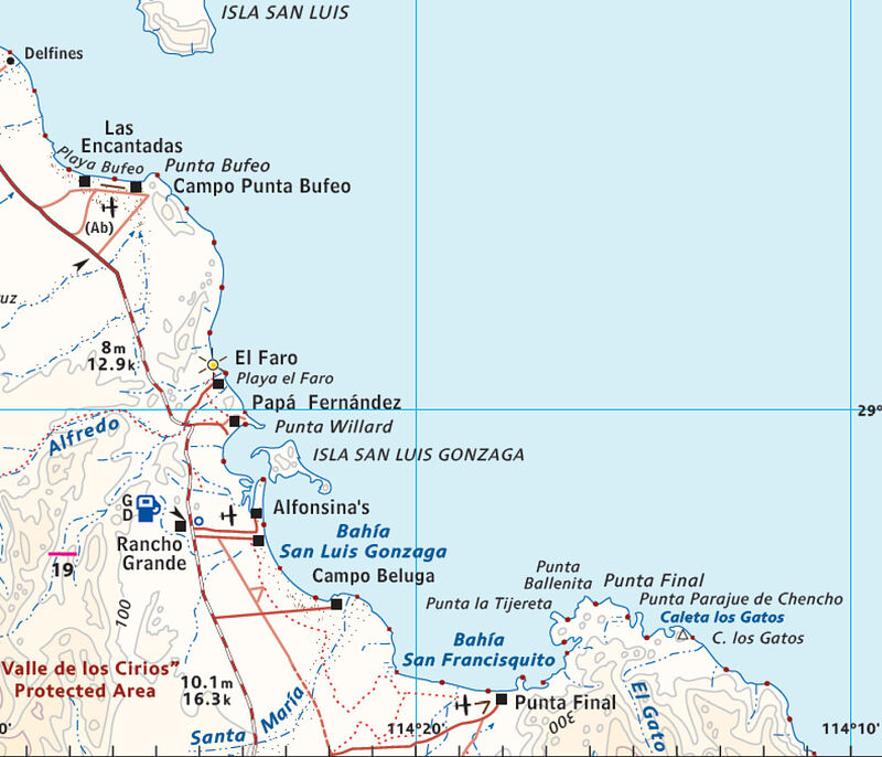
Has kilometer points on the highway and shows the correct location of roads and Camp Beluga, plus Sacrificio and mission trails.

4x4abc - 9-2-2021 at 09:38 AM

where did the name "Campo los Frailes" come from?

David K - 9-2-2021 at 10:07 AM

I will presume from INEGI, the base map source?
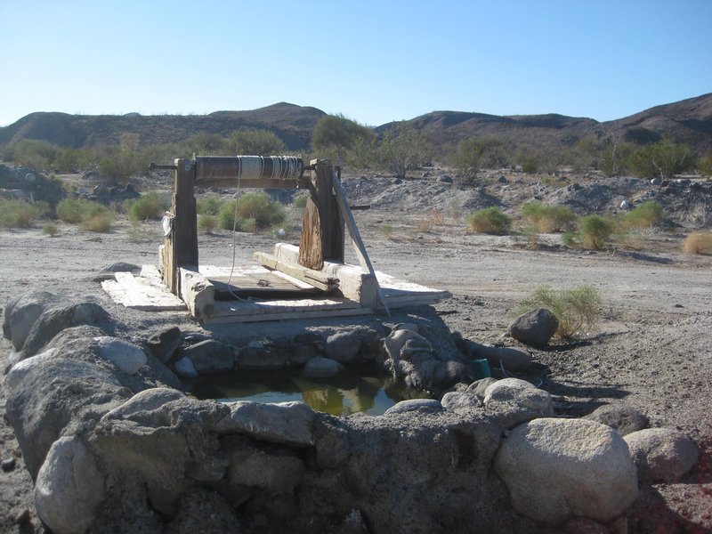
In that arroyo, not far back from the beach, is Pozo de los Frailes. A well that locals said dates back to mission times (per 1958 + Lower California Guidebook).
It has been modified. Probably by Papa Fernandez' family?


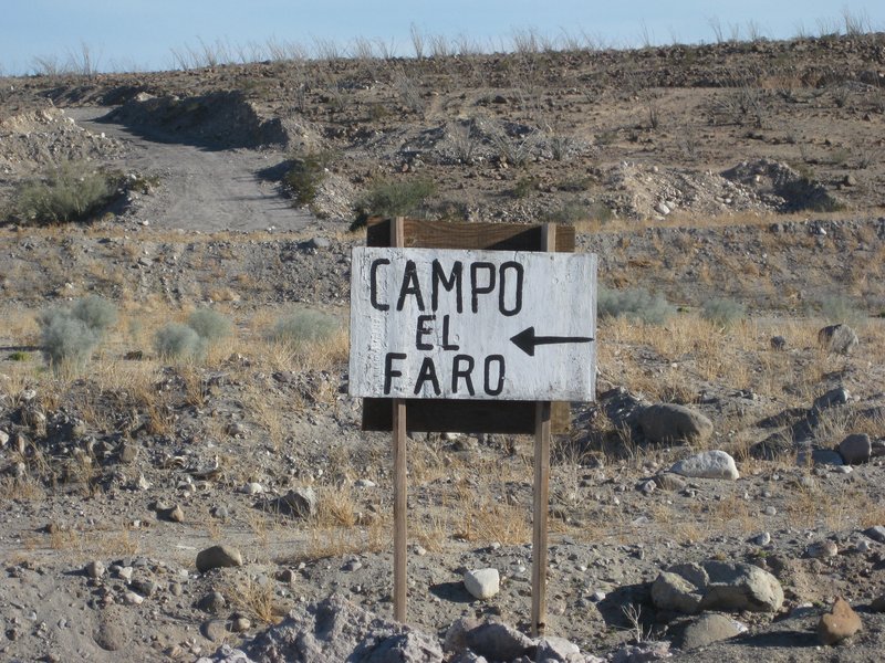
Reach it from Papa Fernandez' road (Km. 143, south side of bridge) by taking the left/ north fork at Mile 0.3. The well is at Mile 1.1. The road continues north across the arroyo to meet the El Faro road (from the north side of the bridge near Km. 143) at Mile 1.6. The abandoned fish camp of El Faro is at Mile 1.9.

willardguy - 9-2-2021 at 10:42 AM

Quote: Originally posted by 4x4abc  
where did the name "Campo los Frailes" come from?


during hwy5 construction a well known crook took it upon himself to sell water to the concrete crews and made a bundle, he called his operation los frailes. then someone put it on a map:rolleyes:

white whale - 9-2-2021 at 10:45 AM

I got the same email. Just seems like an odd story. Glad it is a legit file - hoping I'd find a post here. Thought it might be a pay wall or teaser look. This was one of the first things I learned about on my visit - try to find this book! The resale prices sure indicated that money could be made on a new print run or at least a digital file. Must be more to the man behind the map. Pen to paper map makers are the unsung hero's of world history. Virtual travel here I come.

David K - 9-2-2021 at 11:15 AM

I think this is a great honor to Landon Crumpton, that his final map project has finally been shared so we map fans can enjoy it.

4x4abc - 9-2-2021 at 12:23 PM

the version before Campo los Frailes


Screen Shot 2021-09-02 at 1.09.01 PM copy.jpg - 213kB

David K - 9-2-2021 at 01:31 PM

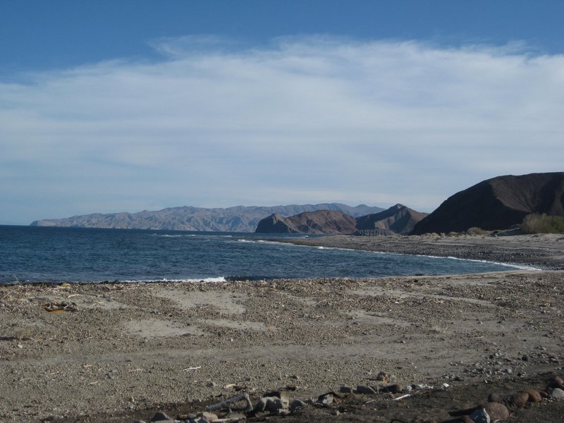
Interesting the number of houses/ shacks around El Faro and the well (El Pozo) put on that map!!! Not one standing structure at either location in 2017.


Site of El Faro


BajaNomad - 9-2-2021 at 04:07 PM

Is the email address on the site (sales at baja - almanac dot com) being monitored, or is there another way to contact the person who's made it available?

Thx.

David K - 9-2-2021 at 04:25 PM

Quote: Originally posted by BajaNomad  
Is the email address on the site (sales at baja - almanac dot com) being monitored, or is there another way to contact the person who's made it available?

Thx.


The PayPal donate name is Tom Hayes Jr.

BajaNomad - 9-3-2021 at 01:13 AM

Quote: Originally posted by David K  
Quote: Originally posted by BajaNomad  
Is the email address on the site (sales at baja - almanac dot com) being monitored, or is there another way to contact the person who's made it available?

Thx.


The PayPal donate name is Tom Hayes Jr.


AlanDavid90 - 9-22-2021 at 12:07 PM

Stunning!! but with mistakes, although we would have liked them to digitize all editions of the Baja Almanac (from its first edition)

David K - 9-22-2021 at 12:44 PM

Quote: Originally posted by AlanDavid90  
Stunning!! but with mistakes, although we would have liked them to digitize all editions of the Baja Almanac (from its first edition)


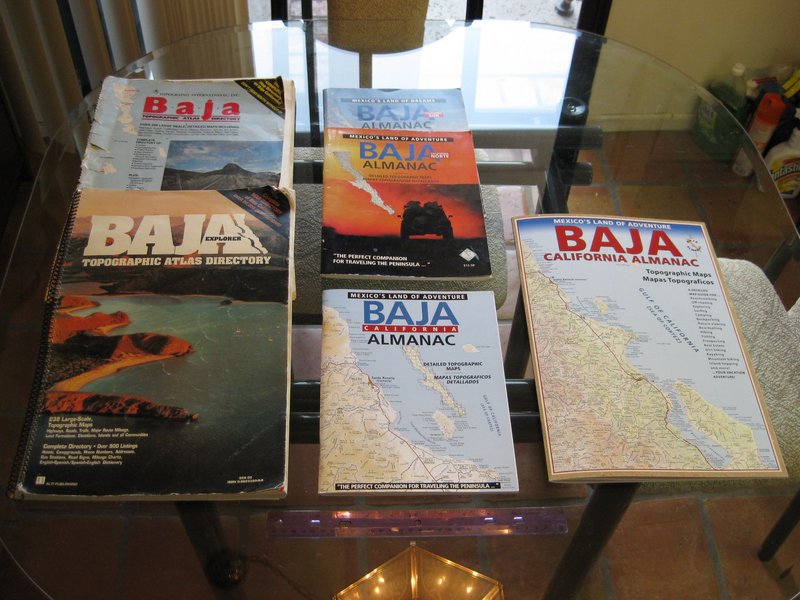
There were six books/ five editions (one edition was a 2-book set) from Landon:


1986 and 1991 were the Baja Topo Atlas and Baja Explorer Topo Atlas. Large size, large scale.
About 1998 was the two-part (Norte and Sur) Baja Calif. Almanac (8.5"x11")
2003 was the all-color Baja Calif. Almanac (8.5" x 11")
2009 was back to the large size, but reduced scale, Baja Calif. Almanac.

For 2015, it appears Landon was returning to the 8.5" x 11" size... Same scale as the 2009 but cut up into more pages.

AlanDavid90 - 9-22-2021 at 03:40 PM

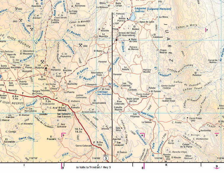
One of the big errors on the Baja Almanac 2015 on the page 14


David K - 9-22-2021 at 03:51 PM

The black line? Yes, an oops... any more?

David K - 9-22-2021 at 04:04 PM

The map is from 2015, but the data is older. Several roads were paved but not shown as such on the 2015 edition.

I am reluctant to poo poo the work, it was wonderful at its time and now has historical value. It is a little better than the 2009 Almanac with the few updates and the smaller size.

Thanks to Benchmark, we have a truly updated and pretty accurate 2021 Baja road map. The wall map is coming soon... so I am anxious to see it. It has been a long time since Mike McMahan provided us with some beautiful Baja wall maps!


AlanDavid90 - 9-22-2021 at 06:55 PM

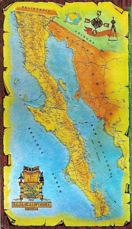
We hope it includes a insert map of the Tijuana-Ensenada's corridor as in the folded map of the Baja California Peninsula by Esparza Editores