BajaNomad

Calamajué Wash

TinCanAdventureVan - 9-29-2021 at 12:39 PM

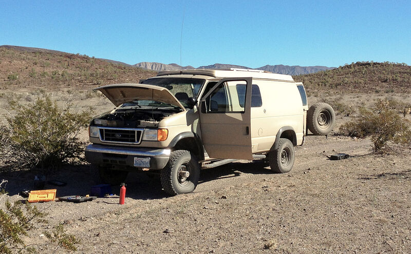
Hey all, planning to do a little loop in a couple weeks south from San Diego via route 1 as far as Bahia De Los Angeles then returning north via route 5 and heading west on 2D before the border and maybe crossing back into California in Tecate or points west. I'd like to explore as many scenic dirt trails as possible and one that looks interesting to me is Calamajué Wash. I was wondering if anyones been there recently. I'm curious how deep the crossings are now and if I'll be able to get an old 2wd Econoline through there. I've read some trip reports of people making it through with a 2wd vehicle but Ive also seen some insane water crossing photos! I'm not trying to turn the van into a submarine! Its been a very dry year so I'd think theres a good chance the crossings are just puddles at the moment. Thought it couldn't hurt to check with the pros on here. Thanks so much for reading this far!

TMW - 9-29-2021 at 01:19 PM

The problem you'll have is not the water but sand. There are a few places where there is soft sand. If you are alone a 2wd vehicle is not a good ideal, even with a locker in the rear. A VW bug probably OK because your running the engine weight over the drive wheels.

David K - 9-29-2021 at 01:58 PM

While I feel that a 4WD vehicle is a 'must have' for exploring Baja's back country... it is amazing what a skilled driver in a 2WD can do, but damage and stucks are a possibility. Lowering the air pressure in all 4 tires will let a 2WD pass... and we are talking 10-15 psi range. So, a good air pump is mandatory equipment. There is the one steep grade you will need to climb where you leave the arroyo after exiting the canyon. FYI: the 1766 mission site is across the arroyo from this grade, on the opposite side, up on a bench. A road goes up to it. After you are out of the arroyo on the road north to Coco's New Corner, the gold mill ruins are along the side of the cliff, on the right. They date from the early 1900s and were worked by Dick Daggett, a name you will see around Baja.

I was last in Calamajué Canyon in Sept. 2016 and the puddles were all shallow with only one medium puddle at the north end (by the big white mineral bench).

Previously, I was there in 2012 (July) and also shallow water (even though Coco was scaring a Jeep couple from going as he said the water was deep).

It all depends on rain as it is an arroyo and while it is fed by springs, rain and flash flood water charging the canyon can happen.

Know that prior to 1983, going back to about 1960, this was the main route from north to south on the gulf side ('Hwy. 5') so it got more constant traffic and the water rarely stopped passage.

Photos, north to south:


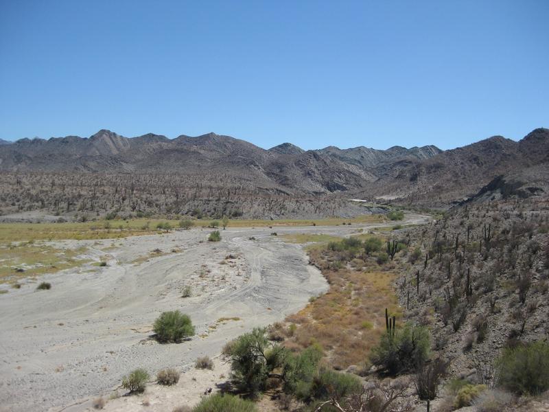
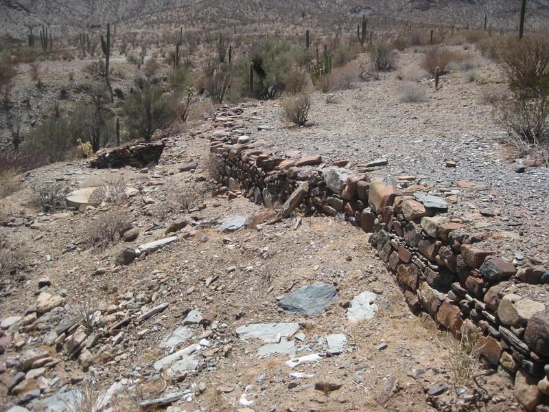
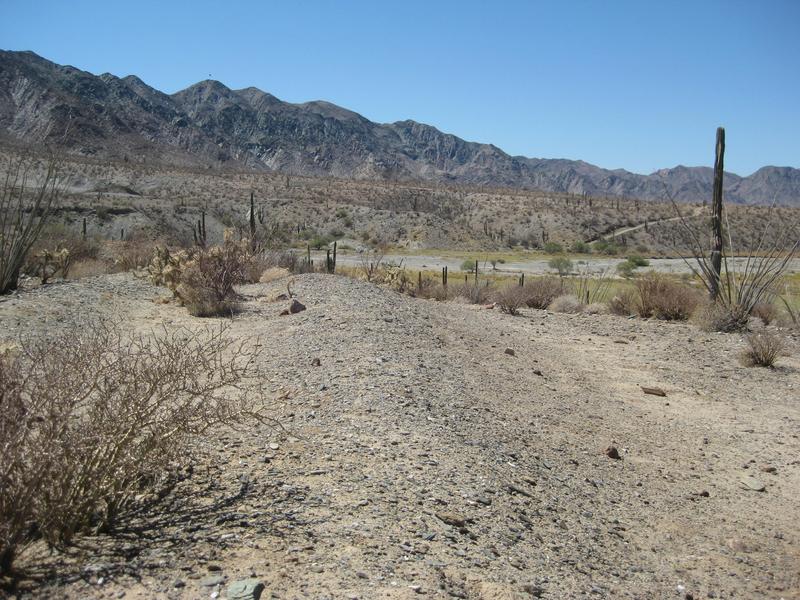
Arroyo Calamajué, from the gold mill site.


Gold mill remains.


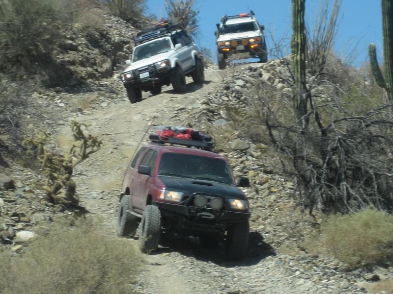
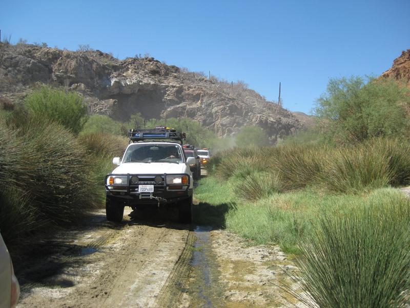
Toyota 4x4s coming down the grade into the arroyo.


Mission remains (not much) from 1766-1767. The water was too salty to grow food here so they moved the mission to Santa María. Note the grade across the arroyo, we just drove down.


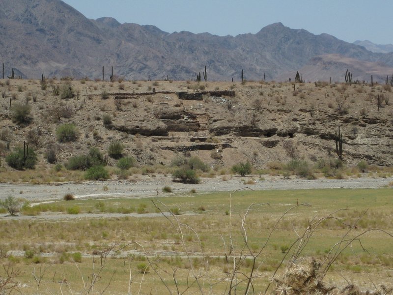
Gold Mill ruins as seen from the mission site. Baja is filled with history... history that you can touch!


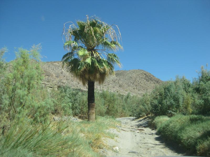
Palm in the canyon.


Little water to drive in. It has been deeper on my trips in 2002, 1979, 1975, 1974, and 1967... but not bad. The 2006 Baja 1000 came through here and they had a muddy mess to deal with!

Here is a photo from 2012 of the deepest puddle:

JZ - 9-29-2021 at 02:13 PM

Don't try to take a 2wd through there.


geoffff - 9-29-2021 at 02:39 PM

I somehow missed the gold mill the last time I went through there. Judging by your photos, is it here? 29.4255, -114.1989


Don Pisto - 9-29-2021 at 02:45 PM

we did it twice in a 2wd Camburg lifted E-150, watch the weather and go!:coolup:

David K - 9-29-2021 at 03:12 PM

Quote: Originally posted by geoffff  
I somehow missed the gold mill the last time I went through there. Judging by your photos, is it here? 29.4255, -114.1989


Close: 29.4248, -114.1987 LOL
It is on the Benchmark Atlas (El Molino).


From the Lower California Guidebook, 1962-1970 editions:


[Edited on 9-29-2021 by David K]

Welcome to the forum!

AKgringo - 9-29-2021 at 03:56 PM

I have driven that route four times, traveling both directions, but the last time I was on it was 2018. I did not encounter another vehicle on any of those runs.

I am sure that with low water, I could drive that in two wheel drive, but if you do have a problem, it could be a long time before any potential help drives your way! Many Baja races have used that route, and a lot of them are 2wd.

If you are looking for a good dirt road, head south from Bahia de Los Angeles through El Arco to hwy 1.

[Edited on 9-29-2021 by AKgringo]

From the old Baja photo album

David K - 9-29-2021 at 04:11 PM


My first time driving in Calamajué Canyon, I was a passenger (1967)!
1967 Calamajue.jpg - 74kB
This was at the gold mill ruins... I am against a big wood beam.

In Calamajué Canyon, pre-running the 1979 Baja 1000 in my Subaru:


In 1979, just south of the canyon, :
1979 Prerun Subaru.jpg - 143kB

[Edited on 9-29-2021 by David K]

TinCanAdventureVan - 9-29-2021 at 05:36 PM

David I've seen a lot of these photos in my research for the trip! You've been on some amazing adventures! In the photo you took of the Toyotas coming down into the wash are they headed north or south? I'd be going in from the south and heading north. I'm not too scared of descending a sketchy hill but climbing out of a steep, sandy rutted hill could be a problem in my old van.

I do have an air compressor for airing up, I've dealt with a fair amount of sandy situations but usually in places where I feel there's a decent chance of help showing up within a day or so or at the very least I can probably make the trek to some cell service to get some help in a dangerous situation. Sounds like those safety nets might not be the case in the canyon. I'm still on the fence about it given some say to not even try it with a 2wd and others saying they've done it no problem hah! Maybe when it comes down to it I'll just see how adventurous we're feeling when we're leaving L.A. Bay.

I'll look into that road you mentioned AKgringo, thanks!

4x4abc - 9-29-2021 at 06:02 PM

Quote: Originally posted by geoffff  
I somehow missed the gold mill the last time I went through there. Judging by your photos, is it here? 29.4255, -114.1989


that is the processing site
the Mine El Toro is a little up
29°24'36.28"N, 114°12'30.60"W

and some minor activity (Marmol on one map) close to the airfield
29°25'30.97"N, 114°12'29.72"W

TinCanAdventureVan - 9-29-2021 at 06:11 PM

On second thought I'm definitely discounting the first hand experience people here have had driving through with 2wd. I just watched a video of someone riding through the canyon and the conditions in their video didn't look like anything I haven't done before. Thanks everyone, I probably will end up driving through!

4x4abc - 9-29-2021 at 06:17 PM

the grade in one of David's pictures is north to south

pjpvi - 9-29-2021 at 07:22 PM

Me and some friends will be going that way late October so if you get stuck just wait for us and we'll pull you out!

Enjoy the trip!

David K - 9-29-2021 at 07:58 PM

Yes, all my photos are from north to south. Climbing that grade will be the hardest part for you. I don't recall any sand issues. The arroyo bottom is more fine gravel than soft sand.

KasloKid - 9-29-2021 at 10:49 PM

A couple of strips of carpet (18" x 8') will come in handy if you do encounter an issue with soft sand or gravel... bring a shovel too.
Chances are you won't need them, but a bit of cheap insurance won't hurt.
A compressor will also be a handy tool to have with you too.

[Edited on 9-30-2021 by KasloKid]

surfhat - 9-30-2021 at 07:59 AM

You beat me to it Kaslo. i was about to suggest a set of sand tracks, or even two sets, since they are plastic and lightweight and stack together easily.

I used to carry four pieces of marsden matting, the heavy military grade steel sand tracks. They saved me a couple of times from having to be towed out of where I should not have gone to begin with.


Driving the whoop de do's

AKgringo - 9-30-2021 at 12:21 PM

One time through the wash, I was driving a 2 door Kia Sportage, and pulling a small utility trailer. There is a stretch of the trail south of the wash that has been modified by many race rigs into a series of extreme dips, and steep rises.

To minimize launching myself and dog, or the utility trailer on each peak (without slowing to crawl speed) I treated the woops as a series of "S" turns. I would cross on the far side of one bump, then steer to the opposite side for the next one, crossing the bottom of the dip at a slight angle.

I don't know if that would work for a long wheel base vehicle, but for my little rig and trailer it made the run a lot smoother, and more fun!

JZ - 9-30-2021 at 12:36 PM

You all don't want to break down or get stuck on that trail.

Now that Coco's has moved, traffic is less and the distance to hike to for help is a lot further.

Better have a plan. My truck is a lot more capable than a 2wd van and I'd think real hard about taking my truck on that trail alone.


David K - 9-30-2021 at 12:42 PM

Wowsers, it was so easy all the times I drove it!

Don Pisto - 9-30-2021 at 12:56 PM

The veteran racer says the real adventure starts when you break down.

“I got into this for the adventure,” he says. “It wasn’t because of the racing; it was the thrill of the unknown.”

Ivan the "Ironman" Stewart

mtgoat666 - 9-30-2021 at 12:56 PM

Quote: Originally posted by JZ  
You all don't want to break down or get stuck on that trail.

Now that Coco's has moved, traffic is less and the distance to hike to for help is a lot further.

Better have a plan. My truck is a lot more capable than a 2wd van and I'd think real hard about taking my truck on that trail alone.


Shorty,
Don’t be a girly man. Your truck can venture further than the mall. Take some extra water, and sturdier shoes than flip flops, and even you can drive a rough unpaved road.
Turn around before you get stuck (not after you get stuck)..
Drive slow, your truck won’t break.
:light:

John Harper - 9-30-2021 at 01:42 PM

Quote: Originally posted by mtgoat666  
Quote: Originally posted by JZ  
You all don't want to break down or get stuck on that trail.

Now that Coco's has moved, traffic is less and the distance to hike to for help is a lot further.

Better have a plan. My truck is a lot more capable than a 2wd van and I'd think real hard about taking my truck on that trail alone.


Shorty,
Don’t be a girly man. Your truck can venture further than the mall. Take some extra water, and sturdier shoes than flip flops, and even you can drive a rough unpaved road.
Turn around before you get stuck (not after you get stuck)..
Drive slow, your truck won’t break.
:light:


Maybe he should just stay in his basement, like he tells the rest of us.

John

geoffff - 9-30-2021 at 03:17 PM

And the thing about this Ironman aspect of "adventure" is that it isn't necessarily fun in the heat of the moment. It's fun afterwards when you think back on what you accomplished, and tell the stories.

geoffff - 9-30-2021 at 03:20 PM


[Edited on 9-30-2021 by geoffff]

JZ - 9-30-2021 at 03:48 PM

Quote: Originally posted by mtgoat666  


Shorty,
Don’t be a girly man. Your truck can venture further than the mall. Take some extra water, and sturdier shoes than flip flops, and even you can drive a rough unpaved road.
Turn around before you get stuck (not after you get stuck)..
Drive slow, your truck won’t break.
:light:


I would just drop my bike down off the truck and ride out.

But, what are you even talking about, you are afraid to go near the SOC side if the temps are above 80 degrees. So, I don't want to hear anything from your mouth.


advrider - 9-30-2021 at 05:37 PM

I've ridden that wash many times on my 500 and even 990, it is deep sand. Everyone has a risk level they are comfortable with, I've been fourwheeling/rock crawling for years but have not done a lot of sand driving. I wouldn't run a 2wd up that wash unless I was with other, 4wd no problem. With Coco gone it will be much more remote and see a lot less traffic, so plan a head. Please report back so we know how it goes...

David K - 9-30-2021 at 05:52 PM

Coco's Corner is not gone, he moved 4 miles north to where the original road to Calamajué left the road from Gonzaga to Chapala (at Las Arrastras).


TinCanAdventureVan - 9-30-2021 at 06:11 PM

I didn't realize Coco had moved. Does anyone happen to have the coordinates of where he's located now?

I'll report back on the trip when I return. I guess if you don't hear from me I either forgot or I got stuck and am living in the canyon!

On another note is there anything you guys recommend checking out on the way from San Felipe to the border? I've got plenty of things to look at on my way down from San Diego to L.A. Bay but for the drive north I'll be taking highway 5 most likely and I don't really have anything on the list north of San Felipe. I noticed the Guadalupe Canyon hot springs but I havent really read about the road out that way yet or if the hot springs are worth visiting. The hot springs in California I've gone to tend to be a bit disappointing.

Thanks everyone!

advrider - 9-30-2021 at 06:40 PM

I meant that Coco moved across the way so I don't think there will be as much traffic out that way, you won't miss his new spot. I've always wanted to check out the water fall / Oasis outside of SF across the dry lake bed, sorry don't have the name on hand.
Always worth going over Laguna Hansen on the way back, maybe even stay the night in the park?

4x4abc - 9-30-2021 at 06:41 PM

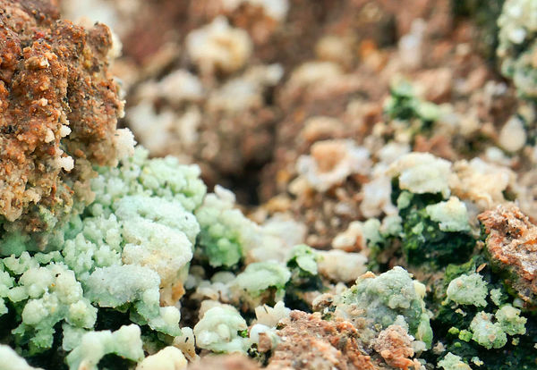
go see the Fumarole!

Fumarole copy 2.jpg - 327kB

4x4abc - 9-30-2021 at 06:49 PM

the Fumarole is a steam geyser "born" during the 2010 earthquake
it is even visible on sat images
32°19'36.40"N, 115°25'1.41"W

https://www.youtube.com/watch?v=fl8rgEin-bY

space.jpg - 201kB

4x4abc - 9-30-2021 at 06:52 PM

you have to hike the last 3/4 mile
only the bravest of 4x4 have driven all the way
26 km - 16 miles from pavement

Attachment: 4x4 rural to Fumarole 26 km, 16 miles.kmz (9kB)
This file has been downloaded 194 times

TinCanAdventureVan - 9-30-2021 at 06:57 PM

Wow that geyser looks amazing!

I havent heard about the waterfall/Oasis west of SF. I've only heard of the one further south near Cataviña. Ive seen it called several things but often referred to as the Santa Maria Oasis. Looks like a far hike from Cataviña but it appears you can drive to within about 5 miles of it from the east without having to do any rock crawling and then hike the rest of the way. Have any of you been there?

geoffff - 9-30-2021 at 07:54 PM

The fumarole is curious. Alien landscape. Worth a visit if you are in the area!


geoffff - 9-30-2021 at 07:57 PM

Yeah, many discussions here on Baja Nomad of the Santa Maria Oasis. Use the Search function!

Here's a recent one to get you started:
Hike to Oasis Santa Maria from Gonzaga side

TinCanAdventureVan - 9-30-2021 at 07:58 PM

Perfect thanks I'll dive in, no need to bring the discussion to this thread!

Maderita - 9-30-2021 at 08:23 PM

Quote: Originally posted by TinCanAdventureVan  

On another note is there anything you guys recommend checking out on the way from San Felipe to the border? I've got plenty of things to look at on my way down from San Diego to L.A. Bay but for the drive north I'll be taking highway 5 most likely and I don't really have anything on the list north of San Felipe. I noticed the Guadalupe Canyon hot springs but I havent really read about the road out that way yet or if the hot springs are worth visiting...

I'm guessing that you do know about the hot springs at Puertecitos? It is best to time it according to the tides to get the best mix of seawater for ideal temperatures.

The "waterfall/oasis" west of SF that you are referring to is likely the palm canyon, Cañón del Diablo, which descends from 10,000' Picacho del Diablo to the desert. A stream flows over granite and creates some pools big enough to swim. You may have seen photos of a rope and rope ladder to pass the pools hiking up the canyon. A more obscure palm canyon is
Cañón Providencia, another steep canyon descending from the mountain, a few miles to the south. If you are interested, search "Tina del Rey Providencia". A couple guide services have started guiding wilderness hiking trips there.

Going north from San Felipe on Mex 5, well don't fall asleep at the wheel. Long and boring flat desert for the most part. Cañón de Guadalupe is unique. Visiting on weekdays may be more to your liking. It gets busy on weekends and holidays. http://guadalupecanyonoasis.com/index.html
It is possible to cut across Laguna Salada from Mex 5 in dry weather. Don't try it if there has been significant, though rare, rain. If you are driving south to Canyon Guadalupe from Mex 2D, the eastern of the two roads is smooth and fast across the dry lake bed of Laguna Salada. The road exits 2D at the large Pavarotti sign. If there has been significant rain, take the western, high, road around the lake to avoid the 30 miles of soft mud.

October is almost always a nice month in the Sierra de Juárez. Elevations to 5,000', pine trees, granite crags, and a national park at Laguna Hanson. The lake will be dry in October, but becomes a pleasant meadow to visit, picnic, or camp. You could drive north from SF and take Mex 3 (toward Ensenada), then go north from Ojos Negros to the Parque Nacional Constitución de 1857. From Laguna Hanson, you can continue north to the town of La Rumorosa at Mex 2, another 2 hours/40 miles. 2WD except during winter storms.

Driving north from Laguna Hanson, approx 14 miles, a 2 mile detour to the west of the Laguna Hanson road will take you to Rancho El Topo. A lovely place among Jeffrey pines for camping, hiking, and nearby rock climbing. Secure camping on the gated ranch is 100 pesos per night, per adult. The Sandovals welcome visitors. Weekends visits are best, there is more going on, yet it is easy to camp away from others. Horseback riding available on weekends. Betito will guide to a nearby small lake, 1.5 hours total, for I believe 400 pesos ($21). Should you happen by the ranch on October 22-24, I will be hosting a large fiesta for rock climbers.
https://www.facebook.com/RanchoElTopoSierraDeJuarez

In the town of La Rumorosa, La Cabaña del Abuelo restuarant is wonderful. Tortillas made fresh in the middle of the restaurant while you eat. Next door to the one PEMEX station, near the west side of town.
https://www.facebook.com/lacabanadelabuelorestaurant

Just north of the 2D on the west side of La Rumorosa is a gated park for viewing Native American cave paintings. Admission is quite inexpensive, with secure parking. Self-guided loop trail; figure 45 minutes - 1 hour.
The west Rumorosa exit from the 2D, signed Rumorosa/Vallecito. KM 68 if I recall correctly. If already in town on Mex 2 (libre/free road), there is a cut-across road about a mile west of the PEMEX.
https://en.wikipedia.org/wiki/El_Vallecito


TinCanAdventureVan - 9-30-2021 at 08:42 PM

Wow those are some great tips Maderita!

I've actually been to the hot springs at Puertecitos and had a great time soaking there. I think I noticed on google maps theyre marked as temporarily closed but I will probably check it out and see what the story is. I saw someone online complaining that they charge to much for the hot springs and that there's free ones further south but I remember when I went maybe years ago thinking the price was fine.

I really like your idea of taking Mex 3 and climbing into the mountains. I think you may have changed the last leg of my trip! a 2wd van should handle those roads from Ojos Negros to Laguna Hanson and on to La Rumorosa? I was planning on stopping to see the pictographs there.

Seriously thank you for all of your help and ideas! I wish I was going to be around still for your rock climbing gathering!

David K - 9-30-2021 at 09:13 PM

Baja has an endless supply of interesting sites. One trip will only tease your need to return.
Coco's new Corner is on my map (km.179.5) just off the highway.
The Santa María Mission requires a high clearance 4x4. The oasis (there are several) you may have seen requires difficult hiking.
Just enjoy what you do see and come back for more! I have been coming back all my life!!

4x4abc - 9-30-2021 at 11:16 PM

Quote: Originally posted by TinCanAdventureVan  
Wow that geyser looks amazing!

I havent heard about the waterfall/Oasis west of SF. I've only heard of the one further south near Cataviña. Ive seen it called several things but often referred to as the Santa Maria Oasis. Looks like a far hike from Cataviña but it appears you can drive to within about 5 miles of it from the east without having to do any rock crawling and then hike the rest of the way. Have any of you been there?


many names for Poza de Escuadra (Square Pool)

hike from the east 5 hours (one of the best hikes in Baja)
the road from the west has been so abused that only competent 4x4 rigs (2 lockers) with good drivers should attempt to get close to the pool (you get to within 3/4 of a mile)
2WD and average 4WD can get within 5 miles
2+ hours hike in on the downhill
3+ hours on the way back - uphill

I drove in this year and was surprised about the bad shape of the road. The last 3 years have seen more destruction than the 30 years before

4x4abc - 9-30-2021 at 11:22 PM

Quote: Originally posted by TinCanAdventureVan  
Wow those are some great tips Maderita!

I've actually been to the hot springs at Puertecitos and had a great time soaking there. I think I noticed on google maps theyre marked as temporarily closed but I will probably check it out and see what the story is. I saw someone online complaining that they charge to much for the hot springs and that there's free ones further south but I remember when I went maybe years ago thinking the price was fine.

I really like your idea of taking Mex 3 and climbing into the mountains. I think you may have changed the last leg of my trip! a 2wd van should handle those roads from Ojos Negros to Laguna Hanson and on to La Rumorosa? I was planning on stopping to see the pictographs there.

Seriously thank you for all of your help and ideas! I wish I was going to be around still for your rock climbing gathering!


the pictograph site in La Rumorosa is closed (no idea why)

Maderita - 10-1-2021 at 01:18 AM

Quote: Originally posted by 4x4abc  

the pictograph site in La Rumorosa is closed (no idea why)


4x4abc,
Is El Vallecito currently closed every day? I believe the normal days of operation are Wednesday through Sunday only; closed Monday & Tuesday.
The government agency INAH oversees El Vallecito and should be able to provide the current status for visitors.

TCAV,
De nada. The Ojos Negros - Laguna Hanson - La Rumorosa route will almost certainly be 2WD through mid-November. The dirt roads are mostly graded, just a bit rough. Airing the van tires down to 20-22 psi is not required, but will preserve your dental fillings. A sedan can do it, just by taking it a little slower. Thanksgiving through March the situation can change at those higher elevations (over 5,000'), such as, a foot of snow or deep mud sections.


David K - 10-1-2021 at 06:26 AM

Quote: Originally posted by Maderita  

TCAV,
De nada. The Ojos Negros - Laguna Hanson - La Rumorosa route will almost certainly be 2WD through mid-November. The dirt roads are mostly graded, just a bit rough. Airing the van tires down to 20-22 psi is not required, but will preserve your dental fillings. A sedan can do it, just by taking it a little slower. Thanksgiving through March the situation can change at those higher elevations (over 5,000'), such as, a foot of snow or deep mud sections.


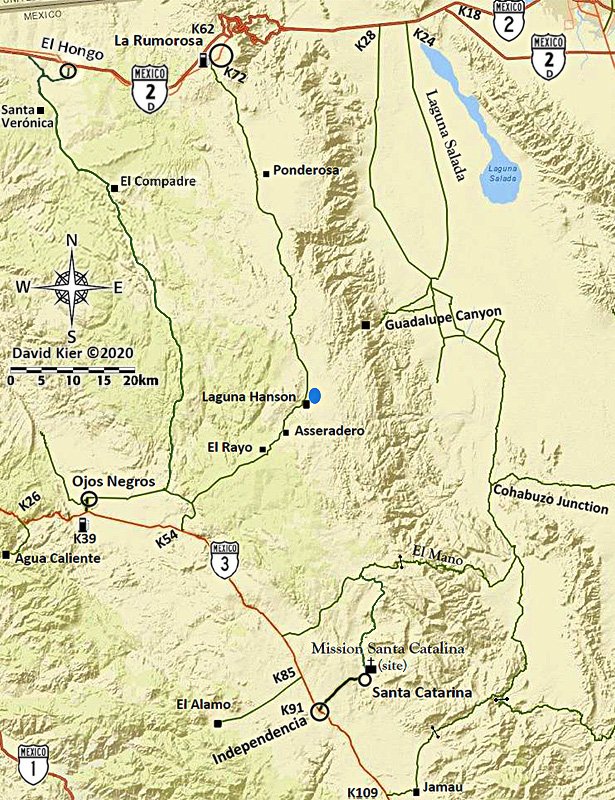
I made a road log of this route in 2018 plus my map.


Road Log: Hwy. 3 to Hwy. 2 via Laguna Hanson

0.0 Miles Hwy. 3 at Km. 54.5 (from Ensenada).
2.7 Fork, go left
3.8 Fork, go right
4.8 Oak Grove
5.2 Fork, go left (elev. 4,000')
11.2 First pine trees (elev. 5,000')
13.7 Rancho El Rayo
15.1 Road right to Rancho La Botella, cattle guard crossing.
16.2 Aserradero (abandoned homes) a former sawmill, elev. 5,277'.
16.4 Food advertised.
17.5 Cabins for rent, food store "Oxxxo".
19.1 Fork, go left.
19.8 LAGUNA HANSON (cabins) 68 pesos camping fee, elev. 5,300'
20.5 Km. 60 sign (37.2 miles from La Rumorosa, Hwy. 2).
22.1 Road east to Rancho San Luis... located above the top of Guadalupe Canyon.
23.8 Km. 55 sign.
24.6 Rancho Rodeo del Rey, an abandoned/ deteriorated hotel/restaurant.
25.0 Rancho Bajío Largo road west.
26.9 Km. 50 sign.
35.6 Rancho El Topo road west.
35.7 Km. 35 sign.
40.4 Former mining area of La Milla.
41.4 Condor road west, elev. 4,916'.
41.9 Km. 25 sign.
42.7 Junction with a road southwest from Las Margaritas.
44.4 Road to the east.
45.6 Rancho La Ponderosa road east.
47.2 Km. 17 sign.
48.7 Rancho Nuevo road east
53.1 Km. 7, 'Inspection' station, open gate.
55.1 Blacktop paved road begins.
55.4 Parques Los Potrillos and El Tesoro campgrounds.
57.5 Highway 2 (Km. 72), La Rumorosa.


David K - 10-1-2021 at 08:23 AM

No doubt some Mexican hikers named it that when they first posted about it on some platform. There is no mention of that name in any of the books or publications I have seen from before seeing it on Facebook.

Look how well my name for the steep grade near the mission has been accepted by Mexican off-roaders... all Spanish videos with the word "widowmaker" included!

Names start somewhere and are either accepted or changed. I think I have only named two places in Baja in all my years, 'Shell Island' and 'Widowmaker'.


[Edited on 10-1-2021 by David K]

mjs - 10-1-2021 at 09:20 AM

The turn off to Laguna Hansen/Compadre Trail at K54 on Hwy 3 is closed. Barbed wire strung tight (not a gate) with a deep backhoe ditch behind it across the road. Might be possible to access the lake coming from Ojos but I have not tried it lately.

David K - 10-1-2021 at 09:57 AM

Quote: Originally posted by mjs  
The turn off to Laguna Hansen/Compadre Trail at K54 on Hwy 3 is closed. Barbed wire strung tight (not a gate) with a deep backhoe ditch behind it across the road. Might be possible to access the lake coming from Ojos but I have not tried it lately.


I had heard that before (earlier this year)... When did you find it that way? I will update the guide. This was the signed main road to Hanson in 2018 (and before).

willardguy - 10-1-2021 at 10:11 AM

last report Ride Baja guys had no problem accessing from Ojo's....


geoffff - 10-1-2021 at 10:21 AM

Here? (GPS: 31.864, -116.1156)

I passed through here just fine in 2016, but that was 5 years ago.


mjs - 10-1-2021 at 10:59 AM

Last time I went by was September 8th, 2021. Still closed same as last spring. There was/is a section of fence to the side that a bike could get around. Would have required some fence removal And bush wacking to get my truck through at that time.

ETA. Geoff, yes that is the spot.

[Edited on 10-1-2021 by mjs]

Km. 54.5

David K - 10-1-2021 at 11:28 AM

Geoff, it was the signed road for the Park and Laguna Hanson in August 2018 when I was doing my final research trip for the Baja Bound Road Guide.


A fork in the road north of the highway:


David K - 11-23-2021 at 03:16 PM

Paul, an Aug. 2021 street view image show a big gate there, signed Sangre de Cristo. Is this unlocked and you passed through?


PaulW - 11-23-2021 at 04:30 PM

I just drew a track on Google Earth I have never been there.

I would refer others to ingnor Sangre and use the other road I drew from Ojos
I will delete the sangre post

[Edited on 11-23-2021 by PaulW]

PaulW - 11-23-2021 at 04:58 PM

Avoid Sangre de Cristo and K58 to get to L Hansen Just drive the road shown from Ojos Negro

Avoid K54.8.jpg - 185kB

David K - 11-23-2021 at 05:31 PM

Thank you, Paul!

pjpvi - 11-24-2021 at 10:48 AM

Back to the original topic ...

On my recent Baja trip I was going to repeat the route I did last year from Hwy 5 (Coco's) exiting onto Hwy 1 via Calamajué Wash. I stopped and visited with Coco at his new place and he said we would encounter a locked gate and to just use the bypass around it. I can't believe I didn't take a pic of the gate but it is located at (29.529245, -114.283586) and is very clearly marked as closed and no entry. I was traveling with a couple other vehicles and I went half way around the short steep bypass but we all mutually agreed that given the very clear messaging on the signs that we would abandon this route.

Anyone know what the deal is with the locked gate? We did bump into a couple riding motorcycles a few days later that said they went around the gate and had no issues.

David K - 11-24-2021 at 11:40 AM

Why go to the old Coco's Corner from the new, if Calamajué is your goal?

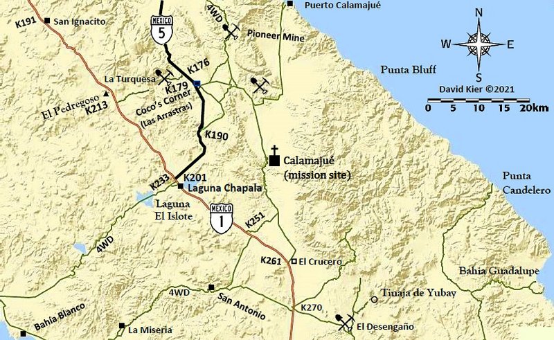
Use the original road from Las Arrastras (New Coco's) to Calamajué. It leaves the older main road just after it curves south. A second road joins it a bit beyond. Use Google Earth to see them.

I show these roads on my map, too (they are also how you get to the Pioneer Mine road):

pjpvi - 11-24-2021 at 12:54 PM

Why didn't I go your way, because I wasn't aware of it and went the way I did last year that worked well. Now I know another way.

Thanks


[Edited on 11-24-2021 by pjpvi]


[Edited on 11-24-2021 by pjpvi]

[Edited on 11-24-2021 by pjpvi]

Possible to avoid the gate?

PaulW - 11-24-2021 at 01:08 PM

I have not been to the new gate. I bet the gate is close to Old Coco’s place. If so, here are some roads in the area.
At K179.5
Follow the blue road past New Coco’s place and take the first left. Decent road that has not been used for racing for a while. Be aware the race just when thru there and the turn off the old Hwy 5 may be hidden behind the bank on the side of the old road.
Do not take the gold colored road which is old Hwy5 and the race track, and lead’s to old Coco;s place and back to new Hwy5.
The image also shows the new Hwy to Chapala.
When you follow the blue road you will come to the intersection to the Pioneer mine and follow to Calamajue.
Make the hard right turn onto the green road to Calamajue.

To help you find the blue road at new Coco look on your device for these coords
29 32.984, -114 20.383 and 29 33, -114 20.33


Avoid New gate.jpg - 244kB

David K - 11-24-2021 at 01:18 PM

Quote: Originally posted by pjpvi  
Why didn't I go your way, because I wasn't aware of it and went the way I did last year that worked well. Now I am know another way.

Thanks


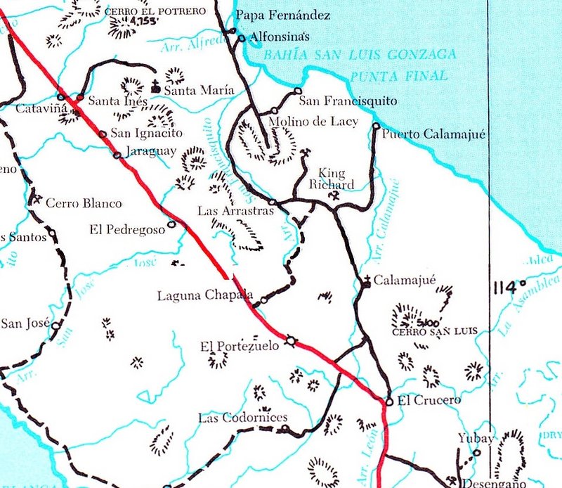
I am only surprised that Coco didn't provide it as an option... It was the main route of 'Hwy. 5' prior to 1983 (when the road from Chapala was graded to Puerto Calamajué). Coco's original corner was where that new road met the road to Gonzaga (graded in 1986).

1975 Map:


David K - 11-24-2021 at 01:47 PM

This was just posted on my Baja Missions Facebook page... a 360° drone photo above Mission Calamajué: https://www.facebook.com/photo/?fbid=4831400766904982

pjpvi - 11-24-2021 at 04:29 PM

Quote: Originally posted by PaulW  
I have not been to the new gate. I bet the gate is close to Old Coco’s place. If so, here are some roads in the area.
At K179.5
Follow the blue road past New Coco’s place and take the first left. Decent road that has not been used for racing for a while. Be aware the race just when thru there and the turn off the old Hwy 5 may be hidden behind the bank on the side of the old road.
Do not take the gold colored road which is old Hwy5 and the race track, and lead’s to old Coco;s place and back to new Hwy5.
The image also shows the new Hwy to Chapala.
When you follow the blue road you will come to the intersection to the Pioneer mine and follow to Calamajue.
Make the hard right turn onto the green road to Calamajue.

To help you find the blue road at new Coco look on your device for these coords
29 32.984, -114 20.383 and 29 33, -114 20.33


That does look like it would go around the gate I encountered. Hope there isn't one on the blue route now too!

Thanks.

TMW - 11-24-2021 at 10:41 PM

I don't understand the problem. Why not just take the bypass around the gate? That's what we did. In my opinion it's pretty stupid to put in a locked gate then build a bypass around it, what good does that do?

4x4abc - 11-24-2021 at 11:59 PM

the gate on the Calamajue Road has always been there
I have seen it closed many years ago
but mostly it is open
it was locked again this year in March
Coco was not aware of it when I told him after I had encountered it in March


gate.jpg - 128kB


ran into 2 other attempts to block the roads in the area with giant tires

tires.jpg - 115kB

tire.jpg - 195kB

David K - 11-25-2021 at 08:39 AM

I drove from Coco's Old Corner to Calamajué Mission and on south to El Crucero in September of 2016 and about 4 months later drove from Coco's to Puerto Calamajué and back... no gate or blockade attempt then or before on my earlier trips in Calamajué Canyon (2012, 2002, 1979, 1975, 1974, 1967)... so saying it "always has been there" maybe is not precise?

I am curious when this gate was installed (2017+ ?) and if the reason was the illegal mining of material rock, I read in the past?

100X - 11-25-2021 at 09:21 AM

1967!

4x4abc - 11-25-2021 at 12:18 PM

Quote: Originally posted by David K  
I drove from Coco's Old Corner to Calamajué Mission and on south to El Crucero in September of 2016 and about 4 months later drove from Coco's to Puerto Calamajué and back... no gate or blockade attempt then or before on my earlier trips in Calamajué Canyon (2012, 2002, 1979, 1975, 1974, 1967)... so saying it "always has been there" maybe is not precise?

I am curious when this gate was installed (2017+ ?) and if the reason was the illegal mining of material rock, I read in the past?


the gate has been there 30+ years - always open
except once about 20 years ago

good to hear it was open in2016, David.
and now

Coco claims he is not involved

David K - 11-25-2021 at 12:25 PM

Was this gate very near Coco's old corner, as one GPS point indicated? Not only was it open, on every one of my past trips, but hard to imagine I didn't see it, unless the well-used road simply went around it and I paid no mind to it being there?? Funny that no other Nomad trip reports mentioned a locked gate blocking the road the past 20 years!

4x4abc - 11-25-2021 at 12:53 PM

there is some sort of a fence line going across the road
don't know whether it is related to the nearby mining claim
or the Ejido

since the other blockages are big tractor tires - maybe some of the road workforce wanted to play a practical joke?

Coco knows everything that happened in the area
he claimed in March that he did not know about it
he is a pretty good prankster
I suspect him of putting up that gate

advrider - 11-25-2021 at 01:01 PM

Very cool drone shot!

David K - 11-25-2021 at 05:41 PM

Quote: Originally posted by advrider  
Very cool drone shot!


I agree!
The fellow posted it on my Baja Missions Facebook group.
Join us! https://www.facebook.com/groups/bajamissions