BajaNomad

Alejandros access road

hombre66 - 10-9-2021 at 05:19 PM

Anyone in the Nomad surf community know of the difficulty level of the access road into Alejandros, just nort of Sta Rosallillita? I dont have a 4x4 anymore and will be going in early this winter in my 2wd Tundra(it does has limited slip and new wide/taller tires) Someone once mentioned a steep rutted section. Thanks in advance

shari - 10-10-2021 at 10:03 AM

I'll never tell:cool: hahaha
the last hill before the camp is rutted and gnarly but you can make it in especially with higher clearance...it's getting out that is the challenge.

David K - 10-10-2021 at 11:48 AM

Quote: Originally posted by hombre66  
Anyone in the Nomad surf community know of the difficulty level of the access road into Alejandros, just nort of Sta Rosallillita? I dont have a 4x4 anymore and will be going in early this winter in my 2wd Tundra(it does has limited slip and new wide/taller tires) Someone once mentioned a steep rutted section. Thanks in advance


I drove in, in mid 2017. Maybe it was my trip report you read? Unless they ran a dozer over the road over that hill to the beach, it was a bit rough. If the tires spin, let some air out. Always have an air pump (and a tire plug repair kit) when driving in Baja. Deflating the tires for loose surfaces and sand always is a plus!

hombre66 - 10-10-2021 at 01:01 PM

Cant imagine they'd doze this stretch unless whoever runs the fishcamp down there would pay to have it done. Sounds dicey, but my partner vehicle (a 4x pathfinder) wants to go there. May change rigs for this trip as we could possibly continue all the way thru to Pta Blanca and points north.

hombre66 - 10-10-2021 at 05:41 PM

Shari,,David, thanks. My wife just rolled her eyes about changing rigs. :o( I do love my base model Tundra and just experienced some sticker shock looking at ANY Toyota thats for sale at this time. I always carry a good compressor, but will probably enhance my gear with carpet and plywood strips along with a lengthy and strong tow strap.
nbentley1 - 10-11-2021 at 08:40 AM

We drove it back in September (in 4x4 trucks) Its probably doable in a 2 wheel dive as long as you are not carrying too much weight.

jwheel1970 - 10-11-2021 at 07:55 PM

We were there in July and the road was a non-issue from what I remember, not difficult and 2WD should be ok.

hombre66 - 10-12-2021 at 09:42 AM

jwheel1970, my guess is the surf was dead flat in July? Maybe a little bit of a west gets in there?

David K - 10-12-2021 at 11:16 AM

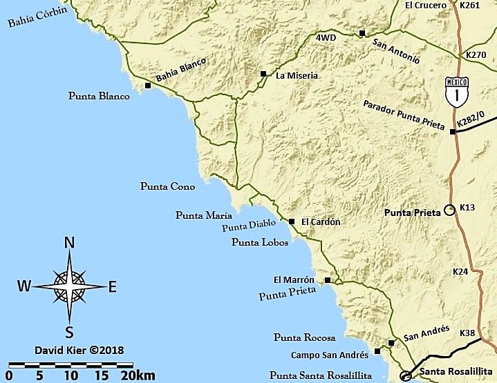
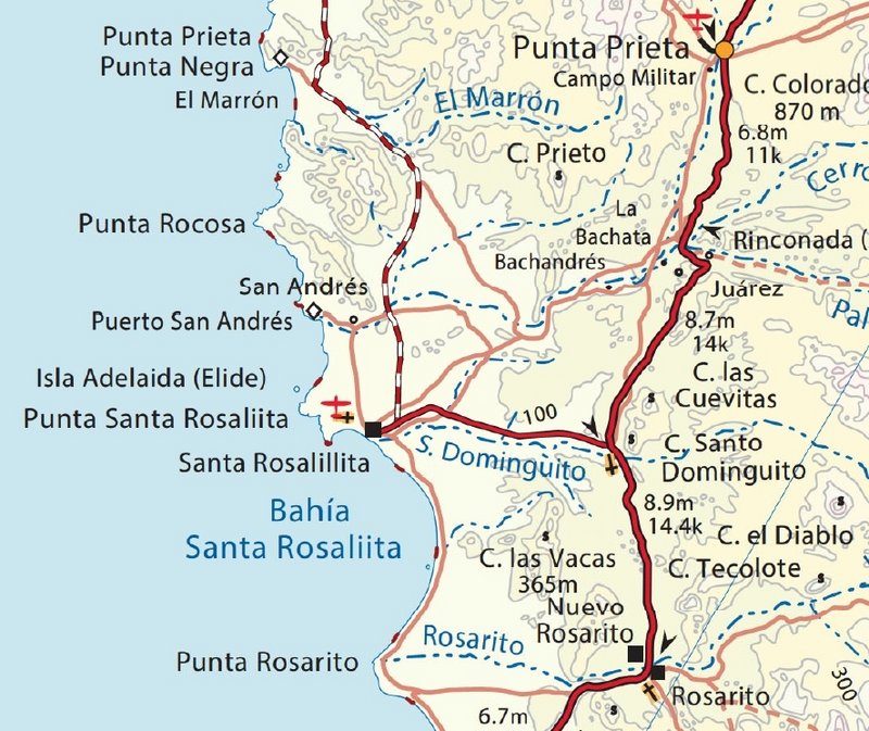
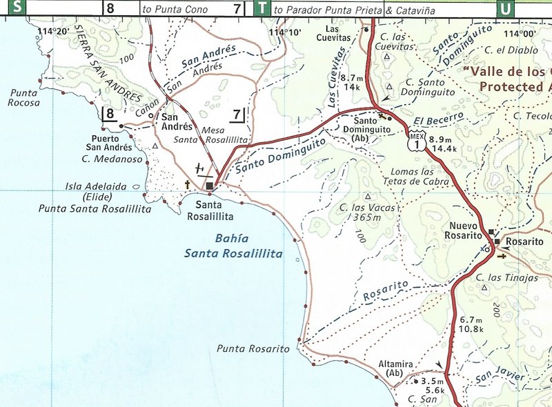
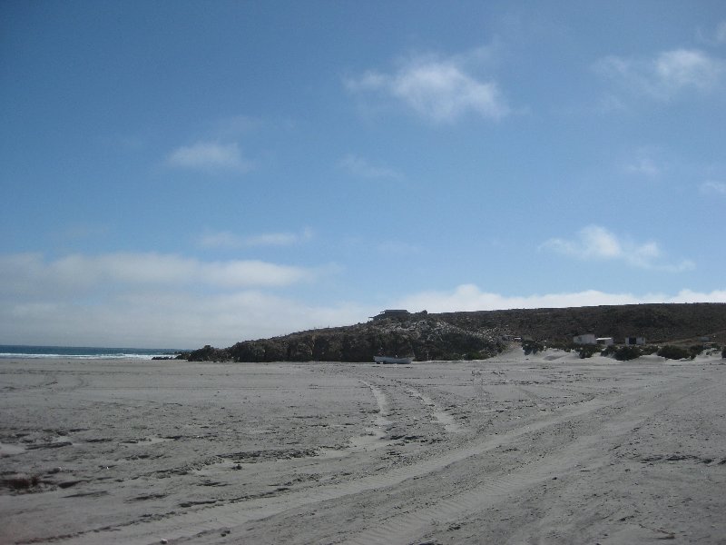
In April 2017, it was signed as Campo San Andres and on the topo maps as Puerto San Andres, and not Alejandro's:


On the 2015 Baja Almanac folding map:


On the 2009 Baja Almanac map book:


[Edited on 10-12-2021 by David K]

hombre66 - 10-12-2021 at 01:52 PM

DK thanks for the maps and pic. Know of any additional grading done past Pta Maria?

David K - 10-12-2021 at 02:46 PM

Quote: Originally posted by hombre66  
DK thanks for the maps and pic. Know of any additional grading done past Pta Maria?


The graded dirt highway going north ended at the road to Punta Cono, in 2017.
I have no newer road data.
The surfers like to keep all data on the Seven Sisters secret... well some of them. The bad roads and beaches there appeal to me, not the surf. I try to not describe surf breaks and such as I am not a board surfer.

hombre66 - 10-12-2021 at 05:51 PM

I understand and knew that DK, but was aware that you are a road afficionado. The secrecy issue with surfers nowadays is really a non issue even tho some of them think theyre protecting the area. I used to know the whole stretch from Millers Landing all the way up to Pt Canoas but as stated earlier, its been a few years since I even crossed the border. I am sure its fairly dicey past Cono, as is the rule in general.

bajajoaquin - 10-12-2021 at 07:26 PM

Quote: Originally posted by David K  
In April 2017, it was signed as Campo San Andres and on the topo maps as Puerto San Andres, and not Alejandro's:

[Edited on 10-12-2021 by David K]


I think it's the difference between the name of the geographical location and the surf spot. The point is San Andreas, the surf spot is Alejandro's.

David K - 10-13-2021 at 09:02 AM

I remember seeing a sign in 2007 for Alejandro's but in 2017, the sign said 'Campo San Andres'... I think it was the same place since that road goes over the hill to the beach and just one group of structures are there.

We tend to keep calling a place by the same name we knew it by when we first camped there... and it gets confusing when the land owner changes the name... takes maps a while to catch up! I still see Agua de Chale on Mexican maps instead of Nuevo Mazatlan (the name since 1967)! LOL