
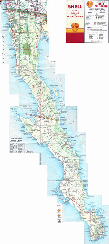
David K - 11-14-2021 at 07:52 AM
Thanks to map guru, 'geoffff' who stiched together my scans of this great little folding map I was given by Nomad 'Mexray'... click to open first link
and again to enlarge and zoom in:
https://octopup.org/img/media/maps/baja/1958--Baja-Californi...
A non-zoom look:
AKgringo - 11-14-2021 at 08:24 AM
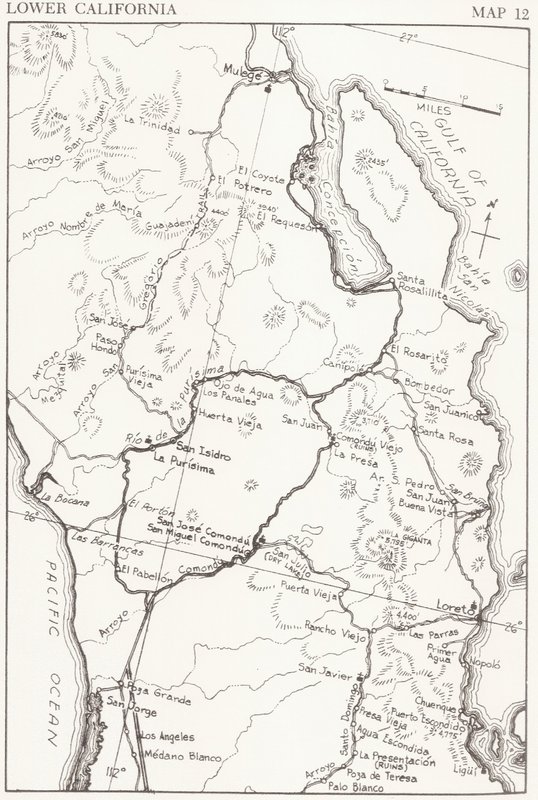
South of Bahia de Concepcion, what we now know as highway 1 took a whole different course through the Comondus.
Even what was then called highway 7 cut over the mountains through San Javier, rather than the route we follow now.
David K - 11-14-2021 at 09:10 AM
Yes, the main road to La Paz went via Comondu (I was a passenger on that road in 1966).
The road to Loreto was a dead end until the mid-1950s when they made the auto road to San Javier (and then on to Santo Domingo).
1959 Auto Club Map (notice the Hwy. #1 symbol between Comondú and Canipole):

1962 Howard Gulick Map:
StuckSucks - 11-15-2021 at 01:50 PM
Always fun/sad to look at old maps. Thanks!
David K - 11-15-2021 at 02:30 PM
Why sad?
Because it was before we could drive those roads?
geoffff - 11-16-2021 at 09:45 AM
If I were to dwell on this, I might be sad about the loss of adventure exploring places that with pavement become too easy. And developed. And
signposted/fenced. Like I've seen on the La Paz to Cabo strip over the last 20 years, and Highway 5 in the next 10.