BajaNomad

La Paz campsite

Mulege Canuck - 1-18-2022 at 06:58 AM

Looking for a place to stay in my camper in La Paz that is walking distance to town. My wife wants to check out the place. After that we are planning to head out to San Evaristo and loop back to Mex 1 on the gravel road.

Thanks

4x4abc - 1-18-2022 at 09:25 AM

what are you driving?

Cancamo - 1-18-2022 at 10:07 AM

Strap everything down, the 4x4 climb out of there has steps. Once on top, no worries........

G-Man - 1-18-2022 at 11:26 AM

There are no actual campsites walking distance to town. We do see, for a night or two, RVs and Campers parked along the malecón & side streets throughout town. Most camp on the outer beaches of Pichilingue & Tecolote_ 30 minutes below/out of town.

Mulege Canuck - 1-18-2022 at 12:16 PM

Quote: Originally posted by 4x4abc  
what are you driving?


I have an F350 with a large camper.

Mulege Canuck - 1-18-2022 at 12:19 PM

Quote: Originally posted by G-Man  
There are no actual campsites walking distance to town. We do see, for a night or two, RVs and Campers parked along the malecón & side streets throughout town. Most camp on the outer beaches of Pichilingue & Tecolote_ 30 minutes below/out of town.


Thanks G MAN.

Music to my ears. Now I don’t have to stay in the city. My wife will not be as pleased.

Cancamo - 1-18-2022 at 12:42 PM

The meaning of "camping" has changed anymore.

If you are looking to park and sleep in your camper, Campestre Maranatha, is a trailer park, "camp". In Chemetla, not near the malecon. Lots of overnighters passing through there off and on, dog friendly, showers, etc..... you could grab a bus or taxi downtown.

mtgoat666 - 1-18-2022 at 12:46 PM

Quote: Originally posted by Mulege Canuck  
Looking for a place to stay in my camper in La Paz that is walking distance to town. My wife wants to check out the place. After that we are planning to head out to San Evaristo and loop back to Mex 1 on the gravel road.

Thanks


"peace center" (former peace hostel) is right in town, has a few rooms, and spaces for 4 or 5 vans no bigger than sprinters (no large RVs).

not sure what happened to the hostel, the pics of peace center look a bit spartan compared to former hostel, but OK reviews in ioverlander

4x4abc - 1-18-2022 at 03:56 PM

Quote: Originally posted by Cancamo  
Strap everything down, the 4x4 climb out of there has steps. Once on top, no worries........


I just drove the grade from San Evaristo to El Bosque a few days ago
it is in decent shape
but very steep and bumpy in parts - 2 hours to La Soledad
no rain damage
from La Soledad to Mision San Luis Gonzaga also very steep in parts and bumpy - 6 hours
some rain damage - but the gov is working on it
drove it Sunday - great trail!

3 hours from La Paz to San Evaristo

all in all one of the best drives in Baja

camping downtown?
yeah right

Mulege Canuck - 1-18-2022 at 04:48 PM

Quote: Originally posted by 4x4abc  
Quote: Originally posted by Cancamo  
Strap everything down, the 4x4 climb out of there has steps. Once on top, no worries........


I just drove the grade from San Evaristo to El Bosque a few days ago
it is in decent shape
but very steep and bumpy in parts - 2 hours to La Soledad
no rain damage
from La Soledad to Mision San Luis Gonzaga also very steep in parts and bumpy - 6 hours
some rain damage - but the gov is working on it
drove it Sunday - great trail!

3 hours from La Paz to San Evaristo

all in all one of the best drives in Baja

camping downtown?
yeah right


So you figure a Dumbass Canadian, with a sheet ton of beer will be able to do that San Evaristo loop back to Mex 1 ?

Only thing that screws me is overhanging rock bluffs where I just don’t fit or excessive brushing.

What do you think big dog ?

camper

John M - 1-18-2022 at 04:51 PM

Being that all truck & camper set ups are not equal, maybe a photo of your truck with camper?

John M

Mulege Canuck - 1-18-2022 at 05:12 PM

Quote: Originally posted by John M  
Being that all truck & camper set ups are not equal, maybe a photo of your truck with camper?

John M


5CFE51B0-CD4B-4636-9E39-E4C60CE76FDC.jpeg - 29kB

I have done the road from Mulege to San Juanico, but I won’t
do that again. Too much brushing. I did the Tembabichi road but I can go back there since I felled too many trees to get in there and peeed off the locals.

So how bad is this road? I will take the path of least resistance from San Evaristo to Mex1. I just don’t want to have to back track to La Paz if I can avoid it.

AKgringo - 1-18-2022 at 05:38 PM

It has been a year since I drove that road, but I doubt that any vegetation has grown enough since then to cause you problems. Your truck looks like clearance under you will be fine, but wheel placement in a couple of the steeper pitches will be important.

David K - 1-18-2022 at 05:59 PM

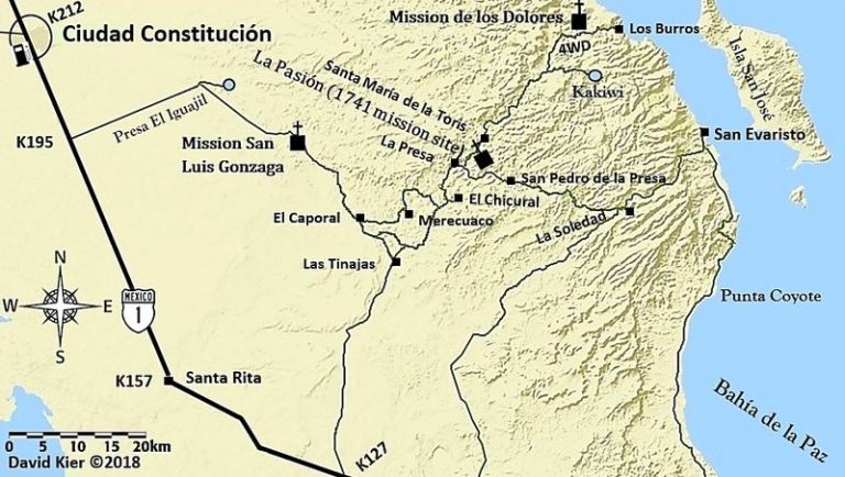
Not as bad as the others you named. It is just a steep grade up from San Evaristo. The road improves when you reach the junction of roads near La Soledad, by the schools.
If your goal is Mission San Luis Gonzaga, do not use the shortcut via Merecuaco to El Caporal, stay on the good graded road towards Las Tinajas, then work north.


You might wish to review my Trip #6 Report to see if anything I photographed is of interest to you, when you are in the area.

https://www.tacomaworld.com/threads/2017-baja-expedition-6-s...

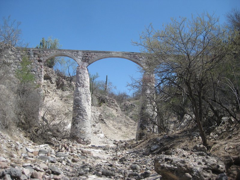
The aqueduct between Rancho La Presa and the La Pasión mission site:


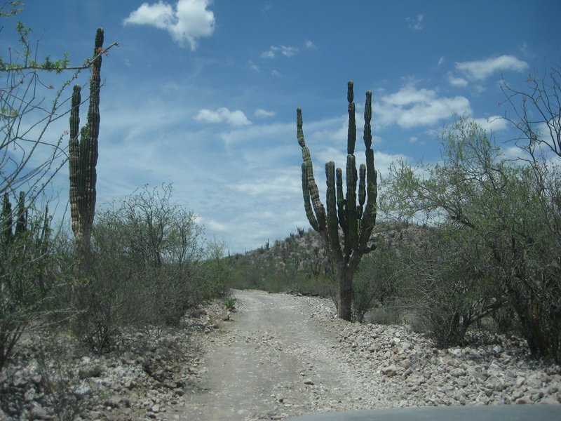
The road south of Mission San Luis Gonzaga is not a major road...


[Edited on 1-19-2022 by David K]

Mulege Canuck - 1-18-2022 at 06:15 PM

Thanks boys!

Appreciate the info. That trip will be in a month. I will post a trip report.

4x4abc - 1-18-2022 at 06:38 PM

Quote: Originally posted by Mulege Canuck  
Quote: Originally posted by 4x4abc  
Quote: Originally posted by Cancamo  
Strap everything down, the 4x4 climb out of there has steps. Once on top, no worries........


I just drove the grade from San Evaristo to El Bosque a few days ago
it is in decent shape
but very steep and bumpy in parts - 2 hours to La Soledad
no rain damage
from La Soledad to Mision San Luis Gonzaga also very steep in parts and bumpy - 6 hours
some rain damage - but the gov is working on it
drove it Sunday - great trail!

3 hours from La Paz to San Evaristo

all in all one of the best drives in Baja

camping downtown?
yeah right


So you figure a Dumbass Canadian, with a sheet ton of beer will be able to do that San Evaristo loop back to Mex 1 ?

Only thing that screws me is overhanging rock bluffs where I just don’t fit or excessive brushing.

What do you think big dog ?


I think you'll fit

that said, I just remembered that Cuesta El Fraile had some rain damage (deep washouts) they might make your house sway towards the canyon. If your wife does not like to be so close to the edge - either give her a Valium or skip the mountain loop.

How much time are you planning for that leg?

La Soledad to Las Pocitas are boring 1.5 hours.

Recently had to drive it at night. No fun a t all. Took me 3 hours.
Installing Baja lights now.

Mulege Canuck - 1-18-2022 at 07:00 PM

I have a couple of buddies going with me who are a little more conservative. I was thinking of heading straight for Mex 1 from Las Tinajas. What do you think?


4x4abc - 1-18-2022 at 07:38 PM

Quote: Originally posted by Mulege Canuck  
I have a couple of buddies going with me who are a little more conservative. I was thinking of heading straight for Mex 1 from Las Tinajas. What do you think?


Las Tinajas is a fast way out

but you are missing out on a great mission site

window shot 800.jpg - 316kB

4x4abc - 1-18-2022 at 07:41 PM

again, how much time have you set aside for this trip?

Marty Mateo - 1-18-2022 at 08:05 PM

Is the Aquamarina RV Park not open anymore? It’s next door to the old cement plant, turned events centre and close to the navy base . It was run by an elderly woman who had lots of interesting stories of old La Paz and her and her husbands adventures on the Sea of Cortez. Last time I was there a few years ago she had some young guys helping her run it.

JZ - 1-19-2022 at 07:09 AM

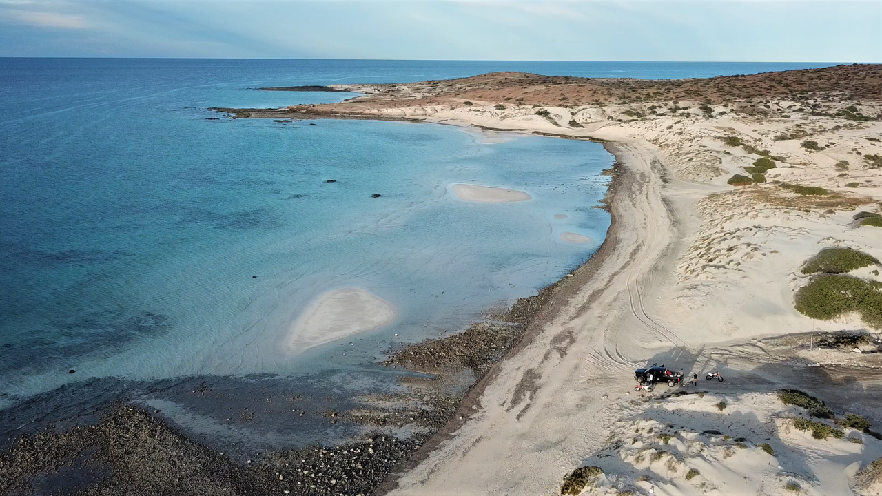
There are really nice and wide open beaches to the East of Tecolote.

I would drive the dirt road from San Evaristo to Constitucion. It's not that hard of a drive.

Mulege Canuck - 1-19-2022 at 07:27 AM

Quote: Originally posted by 4x4abc  
again, how much time have you set aside for this trip?


No time table yet. I would like to find some nice spots to camp along the way. Probably 3 day trip at least.

Is there any chance a 2WD F 250 could make that climb out of San Evaristo?

If I go from Las Tinjas to the mission, avoiding the shortcuts David recommended, is that road worse or the same as the climb out of San Evaristo?

David K - 1-19-2022 at 08:17 AM

There is no climb or grades near Mission San Luis Gonzaga.

4x4abc - 1-19-2022 at 09:16 AM

Quote: Originally posted by Mulege Canuck  
Quote: Originally posted by 4x4abc  
again, how much time have you set aside for this trip?


No time table yet. I would like to find some nice spots to camp along the way. Probably 3 day trip at least.

Is there any chance a 2WD F 250 could make that climb out of San Evaristo?

If I go from Las Tinjas to the mission, avoiding the shortcuts David recommended, is that road worse or the same as the climb out of San Evaristo?


2WD on the San Evaristo grade?
Not ideal - but properly aired down it should work
ranchers do it all the time

the road from Las Tinajas to San Luis Gonzaga and beyond was graded last week
very smooth and in good shape

Mulege Canuck - 1-19-2022 at 03:50 PM

So I make it up the hill to La Soledad, what is the road like from there to Las Tinajas?

Thanks for you help everyone.

Sounds like once I get to Las Tinajas I am home free to the mission and beyond to Mex 1.

Can you buy gas from Vendors in San Evaristo?

David K - 1-19-2022 at 04:37 PM

Quote: Originally posted by Mulege Canuck  
So I make it up the hill to La Soledad, what is the road like from there to Las Tinajas?

Thanks for you help everyone.

Sounds like once I get to Las Tinajas I am home free to the mission and beyond to Mex 1.

Can you buy gas from Vendors in San Evaristo?


I posted several photos and details in my Trip #6 Report... TRIP #6 REPORT

This is on Tacoma World forums since the photos there were not 'messed with' by Photobucket issues, like here on Nomad. I will be making a web page for this trip... eventually.

JZ - 1-19-2022 at 05:11 PM

Here is a shot of one of the beaches East of Tecolote. You hardly see anyone out there. Lots of open beaches.


Mulege Canuck - 1-19-2022 at 05:17 PM

Quote: Originally posted by JZ  
Here is a shot of one of the beaches East of Tecolote. You hardly see anyone out there. Lots of open beaches.


Wow!

Looks amazing. Thanks for the photo JZ

AKgringo - 1-19-2022 at 05:54 PM

Quote: Originally posted by Mulege Canuck  


Can you buy gas from Vendors in San Evaristo?


In an emergency, you could probably find someone who would sell you some of their personal supply, but I never saw any place that looked like they were a vendor.

There is a gas station out on Hwy 1 at Las Pocitas, at about km113.

Mulege Canuck - 1-19-2022 at 07:47 PM

Thanks AK.

I am thinking about doing that loop from Mex 1 to SAN Evaristo, then on to La Paz, so my buddy with a 2WD does not have to go up that grade.

AKgringo - 1-19-2022 at 08:25 PM

I almost suggested that in my reply about the gas station! My first trip over that road was up the pass after a visit to San Evaristo. It was quite a challenge then because it was after tropical storm "Odile" washed much of it away.

Crews were working on the lower parts of the road, but the steep part was borderline rock crawling. When I reached La Soledad, a woman there was very surprised to see me, and asked about the road conditions!

The second run through there was from MX 1, headed east, and it is a much surer way for a 2WD truck. In addition to being less challenging, the view out over the Sea of Cortez is better through your windshield than a rear-view mirror!

Last year I again traveled from the highway east to San Evaristo, this time through Las Pocitas. It was a good road, but Harald is right that the northern road offers better scenery.

4x4abc - 1-20-2022 at 02:02 AM

here is the a trip to San Evaristo
up the grade after heavy rain
then from Soledad to San Luis Gonzaga
and some other stuff
enjoy!
https://carlosnpainter.smugmug.com/Travel/Baja-California-No...

[Edited on 1-20-2022 by 4x4abc]

4x4abc - 1-20-2022 at 02:14 AM

just drove towards San Evaristo today
super smooth road up to the shrimp farm
rougher after that

by the way, the local Baja races all go up the San Evaristo grade and on to San Luis Gonzaga
most of them are 2WD
if they can do it - you can do it

going south is definitely easier than going north

Mulege Canuck - 1-20-2022 at 07:35 AM

Quote: Originally posted by 4x4abc  
just drove towards San Evaristo today
super smooth road up to the shrimp farm
rougher after that

by the way, the local Baja races all go up the San Evaristo grade and on to San Luis Gonzaga
most of them are 2WD
if they can do it - you can do it

going south is definitely easier than going north


Love those photos Harold!

This is definitely a trip to make happen. I really appreciate the information. Now I just have to make sure my 2WD buddy does not back out.

BajaNomad - 1-20-2022 at 09:05 AM

Quote: Originally posted by 4x4abc  

https://carlosnpainter.smugmug.com/Travel/Baja-California-No...


:o

David K - 1-20-2022 at 09:25 AM

Indeed, great photos of some great spots!

AKgringo - 1-20-2022 at 09:41 AM

One of the things I like about that drive, is the rock formations that have been exposed by geologic activities and erosion as the Earth evolved!

4x4abc - 1-20-2022 at 09:50 AM

Quote: Originally posted by Mulege Canuck  

Love those photos Harold!

This is definitely a trip to make happen. I really appreciate the information. Now I just have to make sure my 2WD buddy does not back out.


then you go alone

don't let him keep you from doing the good stuff

some of the epic stuff I have done - I have done alone
after all the early enthusiasts had bailed out

there is only one person you can always trust - yourself

yellow toy on beach, feet in water.jpg - 193kB

4x4abc - 1-20-2022 at 10:01 AM

actually I had an epic trip yesterday
trail in bad shape that hadn't been used in about 10 years
40 million year old ocean floor
very remote - no living soul in the area

moon rocks.jpg - 222kB

David K - 1-20-2022 at 10:05 AM

So nice that you can get around again, Harald! I hope the pain is manageable.

JZ - 1-20-2022 at 10:17 AM

When in San Evaristo have a panga take you out to Isla San Jose and Isla San Francisco. You can find a guy by the little restaurant. About $100 to go out for a half day or so.

San Francisco


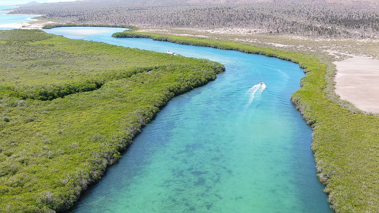
Mangrove on San Jose:


[Edited on 1-20-2022 by JZ]

4x4abc - 1-20-2022 at 10:28 AM

Isla Pardito is a must visit
https://www.youtube.com/watch?v=alU5RQf0-8c

JZ - 1-20-2022 at 10:34 AM

Quote: Originally posted by 4x4abc  
Isla Pardito is a must visit
https://www.youtube.com/watch?v=alU5RQf0-8c


I shot video of it once a couple years ago. And then 30 mins later crashed the drone into the side of the mountain on San Francisco.

I asked you once in a thread for the best hiking path to a specific gps location and you posted a kmz. That was to the drone.

100X - 1-20-2022 at 10:49 AM

Going to be at San Evaristo and Los Burros next week. Is there a place to stay in San Evaristo or do I need to plan on camping? Best place to camp?

AKgringo - 1-20-2022 at 11:28 AM

Quote: Originally posted by 4x4abc  
actually I had an epic trip yesterday
trail in bad shape that hadn't been used in about 10 years
40 million year old ocean floor
very remote - no living soul in the area


Harald, I did a day trip from Campestre Maranatha. checking out beaches near Punta Coyote about eight years ago. I noticed tracks heading up the arroyo just south of where the road is sandwiched between cliffs, and the sea, and decided to follow them.

The pair of tracks turned out to be one vehicle that did a U-turn about eight miles up the canyon, but it led me to some pretty impressive cliffs and bedrock carved out of the pink, and green sedimentary deposits that are being mined in other places on that side of the peninsula.

I was driving my Kia Sportage 2dr with the top off, and wound up with leaves and twigs in the back seat, and dragged in a few spots, so it is not for a standard SUV or large rig.

Mulege Canuck - 1-20-2022 at 12:38 PM

Quote: Originally posted by 4x4abc  
Quote: Originally posted by Mulege Canuck  

Love those photos Harold!

This is definitely a trip to make happen. I really appreciate the information. Now I just have to make sure my 2WD buddy does not back out.


then you go alone

don't let him keep you from doing the good stuff


some of the epic stuff I have done - I have done alone
after all the early enthusiasts had bailed out

there is only one person you can always trust - yourself


I have been down that road before….

Told my buddy to “Suck it up Princess “ . Once we got to our destination he did not talk to me for three Margaritas.

4x4abc - 1-20-2022 at 12:40 PM

Quote: Originally posted by 100X  
Going to be at San Evaristo and Los Burros next week. Is there a place to stay in San Evaristo or do I need to plan on camping? Best place to camp?


there are cabins for rent in San Evaristo
run by the people that have the restaurant and offer boat trips
https://www.facebook.com/barbarita.tours.mx/services

4x4abc - 1-20-2022 at 12:50 PM

Quote: Originally posted by AKgringo  


Harald, I did a day trip from Campestre Maranatha. checking out beaches near Punta Coyote about eight years ago. I noticed tracks heading up the arroyo just south of where the road is sandwiched between cliffs, and the sea, and decided to follow them.

The pair of tracks turned out to be one vehicle that did a U-turn about eight miles up the canyon, but it led me to some pretty impressive cliffs and bedrock carved out of the pink, and green sedimentary deposits that are being mined in other places on that side of the peninsula.

I was driving my Kia Sportage 2dr with the top off, and wound up with leaves and twigs in the back seat, and dragged in a few spots, so it is not for a standard SUV or large rig.


I was in the same area - just a bit south
my laptop was covered with leaves and Mezquite twigs
I rely on Google Earth for accurate locations

Gaia, Avenza and all the other crap only gives you a dot on a bad map
Google Earth rules
but I use a very old GPS to feed information to my laptop

I have done all the various GPS gimmicks since they first came out
they are only good with an RV on pavement
and there you don't need them anyway

remember David's zigg zagg lines from his inReach?
useless crap (for tracking and navigation - kinda good otherwise)

JZ - 1-20-2022 at 01:24 PM

Quote: Originally posted by 4x4abc  
Quote: Originally posted by AKgringo  


Harald, I did a day trip from Campestre Maranatha. checking out beaches near Punta Coyote about eight years ago. I noticed tracks heading up the arroyo just south of where the road is sandwiched between cliffs, and the sea, and decided to follow them.

The pair of tracks turned out to be one vehicle that did a U-turn about eight miles up the canyon, but it led me to some pretty impressive cliffs and bedrock carved out of the pink, and green sedimentary deposits that are being mined in other places on that side of the peninsula.

I was driving my Kia Sportage 2dr with the top off, and wound up with leaves and twigs in the back seat, and dragged in a few spots, so it is not for a standard SUV or large rig.


I was in the same area - just a bit south
my laptop was covered with leaves and Mezquite twigs
I rely on Google Earth for accurate locations

Gaia, Avenza and all the other crap only gives you a dot on a bad map
Google Earth rules
but I use a very old GPS to feed information to my laptop

I have done all the various GPS gimmicks since they first came out
they are only good with an RV on pavement
and there you don't need them anyway

remember David's zigg zagg lines from his inReach?
useless crap (for tracking and navigation - kinda good otherwise)


GE + Gaia or BCN is the way to go.

I do planning on GE with my big, clear monitor.

Can export to BCN on my phone in 30 seconds. Have satellite imagery for offline use on BCN.

AKgringo - 1-20-2022 at 01:37 PM

On that trip, I was using "line of sight", backed up by a AAA Baja map!

I was hoping that the arroyo/trail would connect to a road crossing over to the main highway, but mainly I was seeing what was around the next bend!

JZ - 1-20-2022 at 06:34 PM

Quote: Originally posted by 100X  
Going to be at San Evaristo and Los Burros next week. Is there a place to stay in San Evaristo or do I need to plan on camping? Best place to camp?


If you do camp, the best place is the far North part of the bay. We built a big fire there this day.


[Edited on 1-21-2022 by JZ]

100X - 1-20-2022 at 08:45 PM

Thank you Harald and JZ.

JZ, the bay north of town and by what looks to be the second/largest arroyo (doesn't look like I can access the small bay to the east on the point)?

JZ - 1-20-2022 at 09:17 PM

Quote: Originally posted by 100X  


JZ, the bay north of town and by what looks to be the second/largest arroyo (doesn't look like I can access the small bay to the east on the point)?


Here: 24°54'46.61"N 110°42'20.77"W

Yeah, I think you'd have to swim to the bay to the East.

To set your expectations properly. San Evaristo isn't a very pretty place. It's so, so. What is very beautiful is the drive into it and the islands that are close offshore.


[Edited on 1-21-2022 by JZ]

4x4abc - 1-20-2022 at 09:33 PM

San Evaristo has the only beach cemetery in Baja
there are several individual graves on the beach up and down Baja (one even in the water) - but not an entire cemetery on the beach
next to the Salina
check it out!

beach cemetery San Evaristo 800.jpg - 153kB

geoffff - 1-20-2022 at 11:20 PM

Quote: Originally posted by JZ  
GE + Gaia or BCN is the way to go.


Gaia stopped using the Caltopo INEGI maps, and their replacement is mediocre.

but of course I am biased

4x4abc - 1-21-2022 at 08:26 AM

Quote: Originally posted by David K  
So nice that you can get around again, Harald! I hope the pain is manageable.


tried a radical approach - no more beer
hard
very hard

but

no more pain
no more arthritis
no more depression

David K - 1-21-2022 at 09:28 AM

Amazing... a German not drinking beer???!!!

How wonderful that such a thing as not drinking beer would be so curative!!

I am very happy for you! :bounce::bounce::cool:

Mulege Canuck - 1-21-2022 at 09:33 AM

Quote: Originally posted by JZ  
Quote: Originally posted by 100X  


JZ, the bay north of town and by what looks to be the second/largest arroyo (doesn't look like I can access the small bay to the east on the point)?


Here: 24°54'46.61"N 110°42'20.77"W

Yeah, I think you'd have to swim to the bay to the East.

To set your expectations properly. San Evaristo isn't a very pretty place. It's so, so. What is very beautiful is the drive into it and the islands that are close offshore.


[Edited on 1-21-2022 by JZ]


Thanks for that camping spot JZ

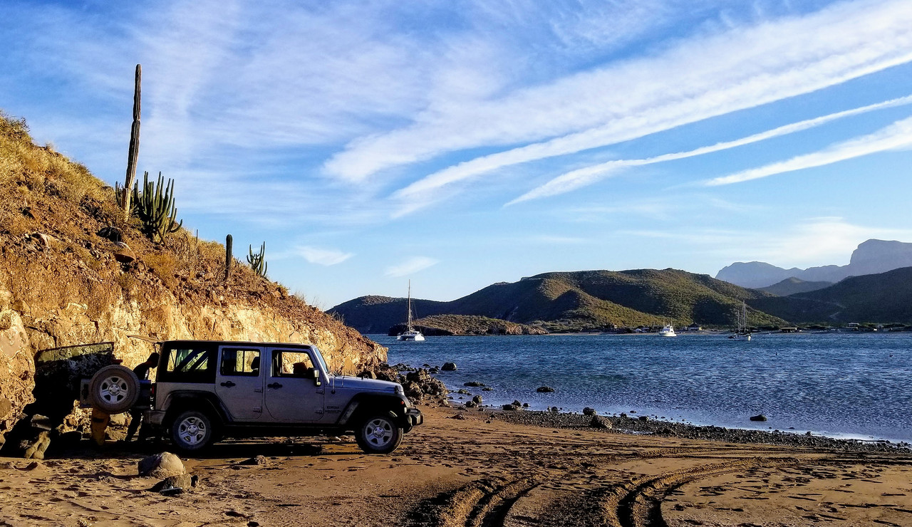
San Evaristo, August 2017

David K - 1-21-2022 at 09:51 AM


San Evaristo is a fishing village on an attractive bay.


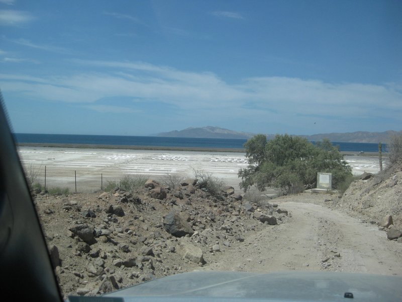
The salt works are just north of the village and where the road ends.


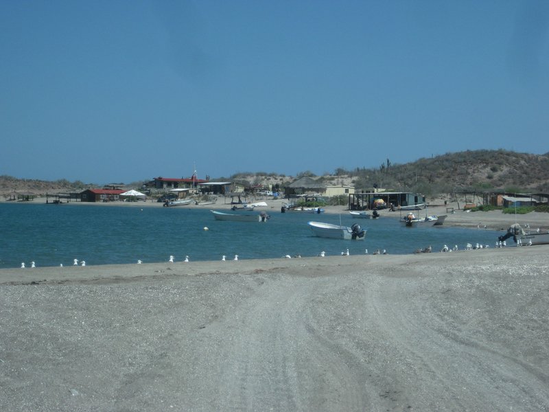
Locals along the road.

100X - 1-21-2022 at 10:12 AM

Thank you again JZ for clarifying the location.

I had wondered what those were in looking at GE--salt works--Thanks David. And I also have the cemetery now to check out!

I got on to the new GPS technology in 1997 I think, with a Garmin that you had to hand-type coordinates into. Luckily I was able to get them from the Baja Almanac! I had ridden MC's to Cabo previously using mostly the more standard race routes, but wanted to see new stuff, so talked a group into going and used the GPS to go through San Evaristo (as well as what the Baja Adventure Book called the "River Rock Trail" south of San Ignacio--only night I ever had to sleep in the desert in a space blanket).

Thanks for all the info!

Mulege Canuck - 2-28-2022 at 08:06 AM

We just got back from a 10/10 trip. We drove a bush road from Las Pocitas to San Evaristo and then headed south towards La Paz. We left Mex 1 at 1:00 and we drove through an amazing canyon. There was lots of water there with large palm trees and very rich farmland. The ranchos looked very well kept. Large portions of the road were made of poured concrete.

When we reached the summit and started our descent to the Sea of Cortez, the road got pretty steep. We had to build rock ramps to get over some of the drop offs without wrecking our truck. One corner was really tight on a Cliff edge but we made it around. My wife got out of the truck as she did not appreciate the view from the passenger seat. We camped at a beautiful campsite made by the government in the middle of nowhere. Great views of the ocean and surrounding mountains.


After a three day stay we started on our way south towards La Paz. Met a Merican dude who thought we would never make it up the road. No problems. A Mexican family was cheering us on as we crawled up the steep road.

There is something in the rock there that gives it a green colour, maybe copper? It was a fantastic drive. We are back at our home in Mulege now. My wife needs a break from booney bashing😎


674C7C9A-5AB0-4F51-81B1-9B686B511439.png - 179kB
This was a tight spot Harold mentioned.


413B4792-835D-409A-991A-D903637FB681.jpeg - 7kB
Concrete road near In the mountains.

CC4A2D22-B626-479C-A2DE-074E482B445C.jpeg - 24kB

Green rock in amazing.

3075DE9F-B961-4781-A99F-6C9B072A58E6.jpeg - 15kB
This is what greeted us after we got down from the mountain road.

Great trip. I planned to do the trip with two other buddies but the 2WD truck bailed out and my other friend blew an air bag before we left.


JZ - 2-28-2022 at 09:17 AM

Pretty impressive the places you are able to take your rig!

Sounds like you had a great trip.


monoloco - 2-28-2022 at 04:58 PM

Quote: Originally posted by Mulege Canuck  
We just got back from a 10/10 trip. We drove a bush road from Las Pocitas to San Evaristo and then headed south towards La Paz. We left Mex 1 at 1:00 and we drove through an amazing canyon. There was lots of water there with large palm trees and very rich farmland. The ranchos looked very well kept. Large portions of the road were made of poured concrete.

Great trip. I planned to do the trip with two other buddies but the 2WD truck bailed out and my other friend blew an air bag before we left.

Dang, that's a heavy camper for a single rear wheel truck. I have the same truck with the 9.4 2500 Bigfoot, and I'm still over my gross weight limit by a bit. Have you done any suspension mods on that thing? I have airbags, but I'm thinking about going to a heavier duty rear spring pack.

AKgringo - 2-28-2022 at 05:10 PM

Did you find a place to set up your camper in La Paz as you intended?

Mulege Canuck - 2-28-2022 at 09:10 PM

Quote: Originally posted by monoloco  
Quote: Originally posted by Mulege Canuck  
We just got back from a 10/10 trip. We drove a bush road from Las Pocitas to San Evaristo and then headed south towards La Paz. We left Mex 1 at 1:00 and we drove through an amazing canyon. There was lots of water there with large palm trees and very rich farmland. The ranchos looked very well kept. Large portions of the road were made of poured concrete.

Great trip. I planned to do the trip with two other buddies but the 2WD truck bailed out and my other friend blew an air bag before we left.

Dang, that's a heavy camper for a single rear wheel truck. I have the same truck with the 9.4 2500 Bigfoot, and I'm still over my gross weight limit by a bit. Have you done any suspension mods on that thing? I have airbags, but I'm thinking about going to a heavier duty rear spring pack.


I put on Timbrens. They are basically a large bump stop that replaces the stock ones from Ford. You have to shim them so the overload springs are just touching when the camper is on. It gives you three points of contact on both sides. It was an amazing difference. It reduced the rocking when off road and improved highway driving in cross winds.

I have a 3800 lb load capacity in my 201 F350 6.2 l gaser. My camper weighs 2850 dry, so loaded I am just about at the max. I am not a fan of air bags because if you pop a boob your screwed. Especially in Mexico. Timbrens are simple and guaranteed for the life of the truck.

Mulege Canuck - 2-28-2022 at 09:13 PM

Quote: Originally posted by AKgringo  
Did you find a place to set up your camper in La Paz as you intended?


We found a beautiful spot to camp out there near San Evaristo so I was able to get out of going into La Paz. Cities are not my thing but my wife was disappointed 😎

4x4abc - 2-28-2022 at 09:47 PM

Quote: Originally posted by Mulege Canuck  
We just got back from a 10/10 trip. We drove a bush road from Las Pocitas to San Evaristo and then headed south towards La Paz. We left Mex 1 at 1:00 and we drove through an amazing canyon. There was lots of water there with large palm trees and very rich farmland. The ranchos looked very well kept. Large portions of the road were made of poured concrete.

When we reached the summit and started our descent to the Sea of Cortez, the road got pretty steep. We had to build rock ramps to get over some of the drop offs without wrecking our truck. One corner was really tight on a Cliff edge but we made it around. My wife got out of the truck as she did not appreciate the view from the passenger seat. We camped at a beautiful campsite made by the government in the middle of nowhere. Great views of the ocean and surrounding mountains.


how brave of you to go down to San Evaristo

finally someone is doing what others only talk about