BajaNomad

goat trails or new roads?

Almost - 5-29-2022 at 08:01 PM

Wildlife and/or livestock create the best routes to wherever they need to go. Water, feed and shelter. Those are things that we all need. The original road builders used those trails and the local knowledge to expand the 'goat trails' into passable routes for commerce etc. Not necessarily the fastest, most direct routes, but more practical for travel at the time.

David K - 5-30-2022 at 07:25 AM

I found the El Camino Real where it left Arroyo Santa María (on the Gonzaga Bay side of the mountain) thanks to converging cattle tracks that pointed the place where the mission trail climbed up the hill.

From my Nov. 2002 trip page:

Here it is!!! 29°41.74′, -114°28.22′ (WGS 84)


Three cattle trails cross Arroyo Santa Maria and converge at the only place where a climb out of the arroyo is possible. This was on my second day searching, and the reward was worth it!

bajatrailrider - 5-30-2022 at 09:57 AM

We find new animal trails every week on motos. We try to ride them do not tear up the land. Even when we return weeks later we cannot see our tire tracks. Since we dont use GPS we put a little ribbon only on turns. Once the animals use trails more and us we find them more easy .Except brush grows back so fast only use memory to guild us.

David K - 5-30-2022 at 12:45 PM

Nothing remains the same and the longer we live the more 'change' happens! We don't like it and often we can't prevent it. Each generation will have a 'new normal' for them!

Imagine the drive to La Paz when I was a kid: 700 dirt miles, many were ungraded (El Rosario to San Ignacio), just two tracks through the cirios and cardóns! Over-night'ing at San Quintín Bay, Agua Dulce, near Punta Prieta, near El Arco, Santa Rosalia, ... you get the picture, 100-miles-a-day averages!

mtgoat666 - 5-30-2022 at 12:59 PM

Quote: Originally posted by 4x4abc  
Quote: Originally posted by bajatrailrider  
We find new animal trails every week on motos. We try to ride them do not tear up the land. Even when we return weeks later we cannot see our tire tracks. Since we dont use GPS we put a little ribbon only on turns. Once the animals use trails more and us we find them more easy .Except brush grows back so fast only use memory to guild us.


I have seen a massive increase in cattle trails all over Baja. So, it's not only tourists bringing Baja down - cattle do a big number on vegetation and habitat of other animals.
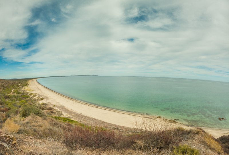
There is a stretch of Baja without cows and goats. It is so significantly different than all other areas. Different plant pattern. Different wild life. Lotsa eagles with gigantic nests.
No, I will not tell you where.


Goats are cuter than cows.

HeyMulegeScott - 5-30-2022 at 04:43 PM

Ah so this is how you gave me that horrible trail that didn't exist between Santa Ines and Mulege. :biggrin:

Almost - 5-30-2022 at 08:45 PM

Pretty sure that I was on part of that trail from Mulge to S. Ynez. It's a narrow donkey trail with just a hint of roadway here and there. There's a significant washout closer to Mulege. I think 'grounproofing would be best accomplished on foot. My pup found more cactus than trail that day. Tough little guy though. He'd tripod up to me, out come the pliers, he grunts as I pull it out, then hits the ground running for more:bounce:

HeyMulegeScott - 5-31-2022 at 08:37 AM

Probably some kind of a trail at some point but pretty overgrown now.


David K - 5-31-2022 at 09:48 AM

Maybe that map is simply not accurate? It does not show a parallel road just inland, where the road is now. I think that road, now paved, was built by Bolero, so it would be on that map. The map also shows the road along Conception Bay not quite accurate. It hugs or hugged the water there, in places.

TMW - 5-31-2022 at 12:20 PM

Quote: Originally posted by mtgoat666  


Goats are cuter than cows.


Are you saying you would rather kiss a goat than a cow?

David K - 5-31-2022 at 01:27 PM

The map indeed shows the Boleo built roads or trails, and the mine center. I hope you find the one you say is there. Probably no automobiles until the 1920s there?


David K - 6-1-2022 at 07:45 AM

Not sure why the image didn't show, Harald.
Here is the map you are using in this thread: https://octopup.org/img/media/maps/baja/1900--Baja-Californi...

David K - 6-1-2022 at 08:37 AM

Quote: Originally posted by 4x4abc  
looks like the admin will have to fix this
I have no longer the option to post pictures


You do, but since Doug moved this to the Classified ads/ My Baja website forum, attaching isn't available. Use Postimages.org here. If you don't want to use the FREE Postimages site, email me what you want posted here.

On another topic, I do hope you and Kevin communicate on the Camino Real tracks... Looking forward to that!