BajaNomad

Del Barco on the Sierra La Asamblea / De Jubai

Lance S. - 8-6-2022 at 04:01 PM


From Miguel Del Barco's chapter on Calamajue:

"padeciendo la misma falta las bestias de la misión, necesarias
así para que los padres salieran a las confesiones de enfermos muy dis-
tantes, como para el acarreo de víveres y de cuanto era menester, por lo
menos desde San Borja. Había el padre Linck dado a estos padres un
poco de ganado menor, para algún alivio en sus trabajos; mas a poco tiem-
po, consumido lo que tenía que comer en el arroyo, se hallaba en la mis-
ma necesidad que la caballada. Registraron la inmediata sierra de Jubai,
que es alta, y la subida es difícil, arenosa y sin descanso. Hallaron en su
cima dos pequeños manantiales de muy buena agua, pero en sitios en que
no podían tener otro uso que apagar la sed. Hay en esas alturas muchas
y muy altas palmas y algunos pinos; mas las pequeñas llanuras que hay
en este paraje están como las laderas de la sierra, desnudas de pasto, a
excepción de las cercanías de los aguajes, en que habían algunas yerbas.
Enviaron los padres a esta sierra el ganado menor para que lograran aquel
poco alimento cercano a los aguajes; mas habiendo estado allí un solo día,
volvió muy disminuido, habiendo muerte no poco de frío"

Maybe here, appears to have water at least seasonally

29°22'08"N 114°04'52"W


[Edited on 8-7-2022 by Lance S.]

David K - 8-6-2022 at 05:43 PM

For the English only readers, can you provide a better translation?

Tinaja de Yubay is a major water source north of San Borja.
It is a tank that holds rain or flash flood water for long periods.

Unfortunately, Google isn't a Native speaker!:

"Suffering from the same lack the beasts of the mission, necessary
so that the parents would go out to the confessions of very different patients.

Enough, as for the transport of food and whatever was necessary, so
less from San Borja.

Had Father Linck given these parents a little small cattle, for some relief in their work; but little time little, consumed what he had to eat in the stream, was in the same necessity than the cavalry.

They searched the immediate Jubai [Yubay] mountain range,
which is high, and the climb is difficult, sandy and without rest.

They found in his top two small springs with very good water, but in places where they could have no other use than to quench thirst.

There are in those heights many and very tall palms and some pines; but the small plains that there are in this place they are like the slopes of the mountains, bare of grass, except for the vicinity of the aguajes [water sources], where there were some herbs.

The padres sent their small cattle to this mountain range so that they could achieve that little food near the aguajes; but having been there a single day,
he returned greatly diminished, having died not a little from the cold"


[Edited on 4-2-2024 by David K]

Lance S. - 8-6-2022 at 06:58 PM

The jesuits refered to the Sierra La Asamblea as the Sierra De Jubai. See Clavigero's chapter on Calamajue, I believe it's on the first page.

Basically they tried to keep one small head of cattle at Calamajue to use as a work animal but it quickly ate the available grass. They explored the heights of the Sierra De Jubai and found the small "plains" to be desolate except in the vicinity of two small aquajes. They took the small malnourished beast all the way up there but it died after one day "due in no small part to the cold".


[Edited on 8-7-2022 by Lance S.]

David K - 8-6-2022 at 07:05 PM

Yes, thanks... named after the all-important waterhole (or maybe it was the other way around?).

Keep up the historical subject posts! :light:

I hiked to the Tinaja de Yubay in 2001 (it was very low). Neal Johns went there in 2003, and it was overflowing! See his photos: https://vivabaja.com/neal2/

David K - 8-6-2022 at 09:03 PM

Thanks, Lencho!

Lance S. - 8-7-2022 at 10:57 AM

Is this Cerro la Asamblea? 29°22'04"N 114°05'23"W
It is adjacent to that cool little pocket meadow ( 29°22'08"N 114°04'52"W) that could be the place Del Barco was talking about.

https://www.researchgate.net/figure/Maps-of-the-Sierra-La-As...

[Edited on 8-7-2022 by Lance S.]

Lance S. - 8-7-2022 at 11:45 AM

On the Goldbaum map there is a trail from Calamajue to a location marked Asamblea. Perhaps this is the water mentioned by Del Barco? Next to Cerro la Asamblea?

https://collections.lib.uwm.edu/digital/collection/agdm/id/3...

The route shown from Calamajue to Asamblea could be pretty much the same one taken by the people in Del Barco's account.

The location also appears on this one
https://octopup.org/img/misc/forums/bajanomad/maps/1923-1928...




[Edited on 8-7-2022 by Lance S.]

David K - 8-8-2022 at 09:36 AM

Quote: Originally posted by Lance S.  
On the Goldbaum map there is a trail from Calamajue to a location marked Asamblea. Perhaps this is the water mentioned by Del Barco? Next to Cerro la Asamblea?

https://collections.lib.uwm.edu/digital/collection/agdm/id/3...

The route shown from Calamajue to Asamblea could be pretty much the same one taken by the people in Del Barco's account.

The location also appears on this one
https://octopup.org/img/misc/forums/bajanomad/maps/1923-1928...


Lance, I have these maps on VivaBaja.com and you can zoom in closer than the Nomad linked one. Octopup ('geoffff') made them for VivaBaja as well.

All maps on VivaBaja: https://vivabaja.com/maps/

1918 David Goldbaum Baja California Norte Map (printed in 1925): https://octopup.org/img/media/maps/baja/1925--Baja-Californi...

1923 & 1928 Baja California Geographical Maps: https://octopup.org/img/misc/forums/bajanomad/maps/1923-1928...

Lance S. - 8-9-2022 at 07:46 PM

Thank you David.

The name Asamblea is an interesting one. There is a theme common in yuman mythology where the culture hero assembles the people somewhere to teach them something . The romantic in me likes to believe that Cerro Asamblea, the highest point in the sierra, is one of those places.

The pinyon forest would also have made the water source up there ( wherever it is) a place of assembly. Pinyon are harvested from the late summer into fall so that water would have to be perennial for that to be the case.

Asamblea could also have Christian significance, synonymous with congregation.


[Edited on 8-10-2022 by Lance S.]

Lance S. - 8-9-2022 at 07:52 PM

Oddly, not to long after founding San Borja Linck is told about a place of assembly two days to the north. Tinaja Jubai was two days north of San Borja.


[Edited on 8-10-2022 by Lance S.]

David K - 8-10-2022 at 04:20 AM

Keep up the good research, Lance.

Wouldn't it be fun to go to the top of Asamblea and maybe see where the pinyon trees were cut by the Spaniards? They had only enough wood to make one door for the new mission at Calamajué.

On a similar subject, here are the güéríbo trees cut in 1719 to build Ugarte's ship, El Triunfo de la Cruz: https://www.dstretch.com/CNPSGueribo/

4x4abc - 8-11-2022 at 11:22 AM

Quote: Originally posted by Lance S.  
Thank you David.

The name Asamblea is an interesting one. There is a theme common in yuman mythology where the culture hero assembles the people somewhere to teach them something . The romantic in me likes to believe that Cerro Asamblea, the highest point in the sierra, is one of those places.

The pinyon forest would also have made the water source up there ( wherever it is) a place of assembly. Pinyon are harvested from the late summer into fall so that water would have to be perennial for that to be the case.

Asamblea could also have Christian significance, synonymous with congregation.


[Edited on 8-10-2022 by Lance S.]


no Cerro Asamblea in all of Baja California
Sierra La Asamblea - yes

4x4abc - 8-11-2022 at 11:26 AM

the 2 springs mentioned are at Rancho San Luis (why Sierra La Asamblea is also called Sierra San Luis)
29.276251°, -114.048566°

no pine forest around there

4x4abc - 8-11-2022 at 11:33 AM

I have traced 3 distinct trails recorded leading to the San Luis springs
29.289429°, -114.115773°
29.279381°, -114.100723°
29.277524°, -114.097636°
all start around Mina Placer de Cota

and then there is the easy route from the south (Yubay)

4x4abc - 8-11-2022 at 11:37 AM

a longer, steeper and tougher route is visible through Arroyo Las Palmas
29.344188°, -114.118156°

the road to the hunting camp is still drivable
29.346221°, -114.150139°

David K - 8-11-2022 at 12:00 PM

Quote: Originally posted by 4x4abc  
the 2 springs mentioned are at Rancho San Luis (why Sierra La Asamblea is also called Sierra San Luis)
29.276251°, -114.048566°

no pine forest around there


Look a few miles north of Rancho San Luis... Higher in elevation, lot's of green trees and this little grassy meadow:
29.368999°, -114.081412°

AKgringo - 8-11-2022 at 01:00 PM

Quote: Originally posted by 4x4abc  
the 2 springs mentioned are at Rancho San Luis (why Sierra La Asamblea is also called Sierra San Luis)
29.276251°, -114.048566°

no pine forest around there


I was not aware that Pinyon Pines grew in Baja, but if they do, they would be more a shrub patch than a forest of trees.

4x4abc - 8-11-2022 at 01:13 PM

Quote: Originally posted by David K  
Quote: Originally posted by 4x4abc  
the 2 springs mentioned are at Rancho San Luis (why Sierra La Asamblea is also called Sierra San Luis)
29.276251°, -114.048566°

no pine forest around there


Look a few miles north of Rancho San Luis... Higher in elevation, lot's of green trees and this little grassy meadow:
29.368999°, -114.081412°


yes, that is one of the trail intersections coming up from Arroyo Las Palmas, connecting to San Luis (8 miles away) - well established trail
there is an area along the trail that likely has water
Palm trees are present
29.362611°, -114.083972°

[Edited on 8-11-2022 by 4x4abc]

David K - 8-11-2022 at 01:17 PM

Quote: Originally posted by AKgringo  
Quote: Originally posted by 4x4abc  
the 2 springs mentioned are at Rancho San Luis (why Sierra La Asamblea is also called Sierra San Luis)
29.276251°, -114.048566°

no pine forest around there


I was not aware that Pinyon Pines grew in Baja, but if they do, they would be more a shrub patch than a forest of trees.


There is even a distinct Pinyon Pine (Pinus lagunae) native to the Sierra la Laguna, south of La Paz... page 59-60 of...


Lance S. - 8-11-2022 at 02:59 PM

Single leaf pinyon, they grow pretty densely on some of the east and north facing slopes near the top of the Sierra La Asamblea. It's a sky island with disjunct species from farther north.

[Edited on 8-11-2022 by Lance S.]

Lance S. - 8-11-2022 at 03:24 PM

https://www.researchgate.net/figure/Average-spectral-signatu...

Lance S. - 8-11-2022 at 03:44 PM

Canyon Las Equis
29°22'13"N 114°06'18"W


[Edited on 9-16-2022 by Lance S.]

Lance S. - 8-11-2022 at 04:55 PM

Cross over the rise immediately south of the meadow and you are in the head of Arroyo Asamblea. You can then follow it and its palm groves to the gulf. That must be the section on the Goldbaum map between Asamblea and Pozo Solorio.


[Edited on 8-13-2022 by Lance S.]

David K - 8-11-2022 at 05:28 PM

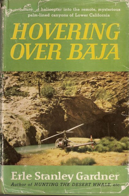
He didn't write about pinyon pines, but Erle Stanly Gardner was enthralled with the area! He wrote a book in 1961 about the canyons north of L.A. Bay...


4x4abc - 8-11-2022 at 05:39 PM

Quote: Originally posted by Lance S.  
https://www.researchgate.net/figure/Average-spectral-signatu...


cool paper

Lance S. - 8-11-2022 at 06:08 PM

Quote: Originally posted by 4x4abc  
Quote: Originally posted by Lance S.  
https://www.researchgate.net/figure/Average-spectral-signatu...


cool paper


Glad you liked it. Here is a similar paper that comes to mind in case you haven't seen it.

https://www.researchgate.net/figure/Distributions-of-native-...

4x4abc - 8-11-2022 at 09:00 PM

Quote: Originally posted by Lance S.  
Is this Cerro la Asamblea? 29°22'04"N 114°05'23"W
It is adjacent to that cool little pocket meadow ( 29°22'08"N 114°04'52"W) that could be the place Del Barco was talking about.


I call it Cerro La Asamblea
it is the highest peak in the area
INEGI did not name it on any of its maps

asamblea.jpg - 272kB asamblea.jpg - 272kB

4x4abc - 8-11-2022 at 09:48 PM

Quote: Originally posted by Lance S.  
Quote: Originally posted by 4x4abc  
Quote: Originally posted by Lance S.  
https://www.researchgate.net/figure/Average-spectral-signatu...


cool paper


Glad you liked it. Here is a similar paper that comes to mind in case you haven't seen it.

https://www.researchgate.net/figure/Distributions-of-native-...
'
yeah, I saw that paper some time ago.
I have identified quite a number of Phoenix locations by now.
Better resolution GE images have really helped to identify them
They are usually tied to missionary activity - but early 1800's settlers also planted Phoenix.
They need a lot of care and don't easily seed themselves.
Only the old-timers were willing to do that

Screen Shot 2022-08-11 at 10.43.41 PM copy.jpg - 287kB

David K - 8-12-2022 at 06:47 AM

From a paper, midway down many papers on geology and biology of Baja and the gulf:

https://www.academia.edu/15521074/Baja_California_oases_a_hi...

DISTRIBUTION OF CHAPARRAL AND PINE-OAK “SKY ISLANDS” IN CENTRAL AND SOUTHERN BAJA CALIFORNIA AND IMPLICATIONS OF PACK RAT MIDDEN RECORDS ON CLIMATE CHANGE SINCE THE LAST GLACIAL MAXIMUM


FIGURE 3A (ABOVE).
Chaparral on Cerro San Luis in the Sierra La Asamblea.
Adenostoma fasciculatum
(chamise) in the foreground growing with taller
Pinus monophylla
. The Gulf of California is in the distance (photo courtesy of K. Geraghty).

FIGURE 3B (BELOW).
Resistant bedrock granite slope with
Quercus chrysolepis
,
Pinus monophylla
, and
Brahea armata
on the Sierra La Asamblea plateau (photo courtesy of K. Geraghty).


[Edited on 8-12-2022 by David K]

mtgoat666 - 8-12-2022 at 08:54 AM

Quote: Originally posted by David K  
From a paper, midway down many papers on geology and biology of Baja and the gulf:

https://www.academia.edu/15521074/Baja_California_oases_a_hi...

DISTRIBUTION OF CHAPARRAL AND PINE-OAK “SKY ISLANDS” IN CENTRAL AND SOUTHERN BAJA CALIFORNIA AND IMPLICATIONS OF PACK RAT MIDDEN RECORDS ON CLIMATE CHANGE SINCE THE LAST GLACIAL MAXIMUM


FIGURE 3A (ABOVE).
Chaparral on Cerro San Luis in the Sierra La Asamblea.
Adenostoma fasciculatum
(chamise) in the foreground growing with taller
Pinus monophylla
. The Gulf of California is in the distance (photo courtesy of K. Geraghty).

FIGURE 3B (BELOW).
Resistant bedrock granite slope with
Quercus chrysolepis
,
Pinus monophylla
, and
Brahea armata
on the Sierra La Asamblea plateau (photo courtesy of K. Geraghty).


[Edited on 8-12-2022 by David K]


Pretty typical vegetation zones for baja mountains.

What story did the pack rat middens tell?

David K - 8-12-2022 at 08:58 AM

You can read it for yourself, here: https://www.academia.edu/15521074/Baja_California_oases_a_hi...

4x4abc - 8-12-2022 at 11:58 AM

with every paper comes a new challenge
the challenge to relate the names given by the authors to waterways and peaks
they rarely relate to official (INEGI) names

Cerro San Luis?
a peak close to Rancho San Luis?

Lance S. - 8-12-2022 at 02:30 PM

That looks like Mesa Colorado on the right. Maybe Cerro San Luis is another name for Cerro la Asamblea.

[Edited on 8-13-2022 by Lance S.]

Lance S. - 8-12-2022 at 08:34 PM

Quote: Originally posted by David K  
He didn't write about pinyon pines, but Erle Stanly Gardner was enthralled with the area! He wrote a book in 1961 about the canyons north of L.A.


What did he say about aqua buena? Are there photos that might help identify it?

4x4abc - 8-13-2022 at 12:24 AM

Quote: Originally posted by Lance S.  
Quote: Originally posted by David K  
He didn't write about pinyon pines, but Erle Stanly Gardner was enthralled with the area! He wrote a book in 1961 about the canyons north of L.A.


What did he say about aqua buena? Are there photos that might help identify it?


29°22'58.43"N, 113°58'17.45"W
in Arroyo Asamblea

David K - 8-13-2022 at 07:58 AM

Thank Harald. That looks about right.
Lance, I just flipped through Hovering Over Baja and did not see a mention of the name Agua Buena, except on the map.

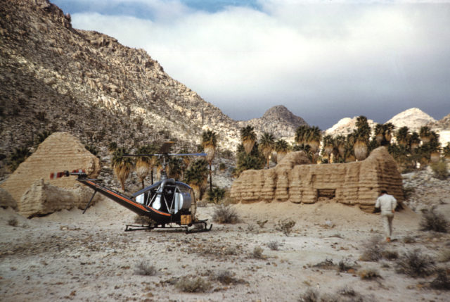
Of course, I may have just missed it... This is one of Gardner's great exploring-adventure books (©1961) and has many references to other places, like the Hamilton Ranch, the road to Mission Santa María being built, and exploring by helicopter looking for palm canyons and the Lost Mission of Santa Isabel! I think I will re-read it again soon!

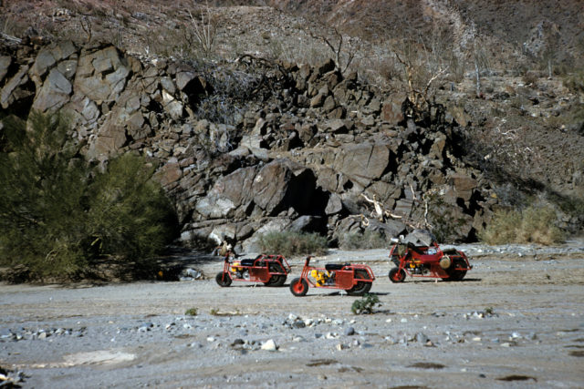
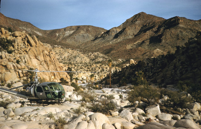
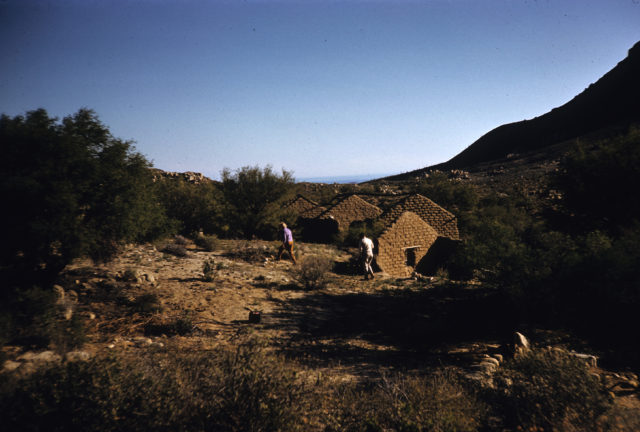
Here are some color photos from Gardner's camera that were possibly from this trip in 1960 (obtained from the Temecula Valley Library):


More at: https://vivabaja.com/esg/

4x4abc - 8-13-2022 at 10:15 AM

The Goldbaum map is hard to work with. Too many serious mistakes.
Much of it not from personal experience.

Pozo Salorio can not be along the coastline.
There are NO water sources between Aguaje San Juan y San Pablo (Puerto Calamajue) and Bahia de Los Angeles along the coast.

The most likely location of Pozo Salorio is Aguaje Las Palmitas (old Punta Final water source) - also called Calam or Solorrro

Today Pozo Salorio is an archaelogical site way out in the bushes
29°40'0.31"N, 114°39'59.45"W
however, I suspect that the location in given wrong on purpose

Salorio.jpg - 199kB

Lance S. - 8-13-2022 at 10:32 AM

I was thinking maybe it was a batequi.

[Edited on 8-13-2022 by Lance S.]

Lance S. - 8-13-2022 at 10:41 AM

Quote: Originally posted by David K  
A what?


It is a place where an arroyo meets the sea where you can dig just behind the shore for water at high tide. Fresh water is pushed up by the salt water. These water holes were typically brackish but drinkable.


[Edited on 8-13-2022 by Lance S.]

[Edited on 8-13-2022 by Lance S.]

4x4abc - 8-13-2022 at 12:08 PM

the 1917 David Golden map shows Pozo Salorio about in the Aguaje Las Palmitas location (far left)
but it also shows it south of Punta Bluff (far right)

David Golden.jpg - 257kB

Lance S. - 8-13-2022 at 12:12 PM

Where the heck did that map come from? Awesome!

I think the other Pozo Solorio is La Turquesa (or Las Arrastras),I could of course be wrong but it lines up well with that old mine road over the divide from near Rinconada.

Rinconada 29°29'36"N 114°29'09"W
A trail junction. You could go west to El Gato or Jaraguacito, east to La Turquesa, north to San Ignacito, or south to Pozo Chapala.


[Edited on 8-16-2022 by Lance S.]

Batequi

AKgringo - 8-13-2022 at 12:17 PM

Quote: Originally posted by Lance S.  
Quote: Originally posted by David K  
A what?


It is a place where an arroyo meets the sea where you can dig for water at high tide. Fresh water is pushed up by the salt water. These water holes were typically brackish but drinkable.

[Edited on 8-13-2022 by Lance S.]


That is a word, and a concept that I have never heard before! :wow:

Lance S. - 8-13-2022 at 12:49 PM

Quote: Originally posted by AKgringo  
Quote: Originally posted by Lance S.  
Quote: Originally posted by David K  
A what?


It is a place where an arroyo meets the sea where you can dig for water at high tide. Fresh water is pushed up by the salt water. These water holes were typically brackish but drinkable.

[Edited on 8-13-2022 by Lance S.]


That is a word, and a concept that I have never heard before! :wow:


I learned that from Homer Aschmann's The Central Desert of Baja California.

Lance S. - 8-13-2022 at 12:56 PM

https://www.jstor.org/stable/20138415

Lance S. - 8-13-2022 at 01:00 PM

Quote: Originally posted by lencho  
Quote: Originally posted by Lance S.  
I was thinking maybe it was a batequi.
Where did you hear that word as referring to a water source? :?:

The only reference I can find is of a specific cave somewhere around Comondú with paintings inside.

Edit: Cross-posted with your answer. Does that book indicate where he got the word?

[Edited on 8-13-2022 by lencho]


He doesn't say where he learned it. You can see it in other place names on the peninsula. There is also a Los Batequitos.

David K - 8-13-2022 at 03:09 PM

'Batiquitos' Lagoon is here in San Diego County between Leucadia and Carlsbad (La Costa Ave). I think Padre Crespi named it in 1769, heading for Monterey from San Diego?

4x4abc - 8-13-2022 at 04:27 PM

Quote: Originally posted by Lance S.  
Where the heck did that map come from? Awesome!

I think the other Pozo Solorio is La Turquesa, I could of course be wrong but it lines up well with that old mine road over the divide from near Rinconada.

Rinconada 29°29'36"N 114°29'09"W
A trail junction. You could go west to El Gato or Jaraguacito, east to La Turquesa, north to San Ignacito, or south to Pozo Chapala.


[Edited on 8-13-2022 by Lance S.]


1917 David Goldbaum map - has all mining claims in the north

David Goldbaum mining.jpg - 234kB

4x4abc - 8-13-2022 at 04:47 PM

Quote: Originally posted by Lance S.  
Where the heck did that map come from? Awesome!

I think the other Pozo Solorio is La Turquesa, I could of course be wrong but it lines up well with that old mine road over the divide from near Rinconada.

Rinconada 29°29'36"N 114°29'09"W
A trail junction. You could go west to El Gato or Jaraguacito, east to La Turquesa, north to San Ignacito, or south to Pozo Chapala.


[Edited on 8-13-2022 by Lance S.]


you might be right
this 1915 Harris&Cromwell map shows it clearly

Salorio 0 Turquesa.jpg - 229kB

BajaRat - 8-13-2022 at 06:41 PM

Strong work people
Best Nomad Thread in years
Love that piece of earth
Lionel :cool:

4x4abc - 8-13-2022 at 11:56 PM

Quote: Originally posted by Lance S.  

Rinconada 29°29'36"N 114°29'09"W
A trail junction. You could go west to El Gato or Jaraguacito, east to La Turquesa, north to San Ignacito, or south to Pozo Chapala.


La Rinconada, km 213
29°31'11.16"N, 114°30'1.28"W

Lance S. - 8-14-2022 at 10:59 AM

Quote: Originally posted by 4x4abc  
Quote: Originally posted by Lance S.  

Rinconada 29°29'36"N 114°29'09"W
A trail junction. You could go west to El Gato or Jaraguacito, east to La Turquesa, north to San Ignacito, or south to Pozo Chapala.


La Rinconada, km 213
29°31'11.16"N, 114°30'1.28"W


Perfect! Thank you for the correction. So the old mine road actually begins at La Rinconada. Cool. Now I can see how well the 1915 map reflects the trail layout.


[Edited on 8-17-2022 by Lance S.]

David K - 8-14-2022 at 02:12 PM

Quote: Originally posted by 4x4abc  
Quote: Originally posted by Lance S.  
Where the heck did that map come from? Awesome!

I think the other Pozo Solorio is La Turquesa, I could of course be wrong but it lines up well with that old mine road over the divide from near Rinconada.

Rinconada 29°29'36"N 114°29'09"W
A trail junction. You could go west to El Gato or Jaraguacito, east to La Turquesa, north to San Ignacito, or south to Pozo Chapala.


[Edited on 8-13-2022 by Lance S.]


you might be right
this 1915 Harris&Cromwell map shows it clearly


Harald, can you please share the link or source of this map... It looks really beautiful! I hope the rest of the peninsula is included!

EDIT: Thank you Harald and Thank you 'geoffff' :
A super-zoom version is linked on https://vivabaja.com/maps/ (at 1915...)


[Edited on 8-15-2022 by David K]

mtgoat666 - 8-14-2022 at 07:59 PM

Quote: Originally posted by David K  
From a paper, midway down many papers on geology and biology of Baja and the gulf:

https://www.academia.edu/15521074/Baja_California_oases_a_hi...

DISTRIBUTION OF CHAPARRAL AND PINE-OAK “SKY ISLANDS” IN CENTRAL AND SOUTHERN BAJA CALIFORNIA AND IMPLICATIONS OF PACK RAT MIDDEN RECORDS ON CLIMATE CHANGE SINCE THE LAST GLACIAL MAXIMUM


FIGURE 3A (ABOVE).
Chaparral on Cerro San Luis in the Sierra La Asamblea.
Adenostoma fasciculatum
(chamise) in the foreground growing with taller
Pinus monophylla
. The Gulf of California is in the distance (photo courtesy of K. Geraghty).

FIGURE 3B (BELOW).
Resistant bedrock granite slope with
Quercus chrysolepis
,
Pinus monophylla
, and
Brahea armata
on the Sierra La Asamblea plateau (photo courtesy of K. Geraghty).


[Edited on 8-12-2022 by David K]


Y’all should do a E-W traverse hike over the mountains, start at the highway, cross the range at the high point with pinyon, finish at the sea, get picked up by a boat.

Lance S. - 8-15-2022 at 04:50 PM

The other name, Sierra San Luis.

In 1765 linck could really begin working on getting the population to the north of San Borja, the territory that would become mission Calamajue, ready for a mission. He called the territory San Luis. There was a place he called "this mission of San Luis", He did have supplies including clothing sent for the neophytes. He also mentions a ranch nearby where horses were raised. In 1766 he doesn't mention a Mission of San Luis but he does visit a rancheria by that name. It is the first water traveling north from Laguna Chapala to Aqua Dulce. Possibly San Ignacito or El Gato. The chieftain of the rancheria would later become neophyte governor of Calamajue.
The territory sounds like a possible origin for the name. He does give the full name at one point as San Luis Gonzaga, so the territory was named after the bay.

Lincks Reports and Letters (Burrus 1967)
Lincks 1766 expedition (Burrus 1966)


[Edited on 9-17-2022 by Lance S.]

[Edited on 12-24-2022 by Lance S.]

David K - 8-15-2022 at 05:27 PM

San Luis was often how they described Gonzaga Bay... It is Bahía SAN LUIS Gonzaga, after all!
Old Maps of the 1800s had the bay named simply 'San Luis' and with some confusion, the Jesuits would name a population center and future mission of San Luis.
Perhaps not related, but an old rancho named San Luis was between Cataviña and Santa Ynez... It is still there, over-looking the palm arroyo on the south side of the vado.

[Edited on 8-16-2022 by David K]

Lance S. - 8-15-2022 at 07:38 PM

Ok so apparently a batequi is a water source that is not always available. The kind I described is one kind of batequi. It is an indigenous word but from Sinaloa.


[Edited on 8-16-2022 by Lance S.]

4x4abc - 12-19-2022 at 01:16 AM

about Batequi:
(right above the cross of Ligüi)
https://www.culcobcs.com/cultura-entretenimiento/23-dias-de-...

Screen Shot 2022-12-19 at 1.13.17 AM.png - 299kB

David K - 12-19-2022 at 06:41 AM

Quote: Originally posted by 4x4abc  
about Batequi:
(right above the cross of Ligüi)
https://www.culcobcs.com/cultura-entretenimiento/23-dias-de-...


The photo in that article (of the cross at Ligüí) was mine from 2012.

The book of Padre Guillén's expeditions is quite interesting. He discover the future site of Mission Los Dolores Apaté, during his trek to La Paz to help establish that mission in 1720.

In 1721, Guillén moved his mission (San Luis Bautista) from Ligüí (the location name was changed to Malibat by the new tribe who moved into that area) to Apaté.

New financiang was available from a new benefactor, so the mission took on a new name with the move... Nuestra Señora de los Dolores Apaté (also known as 'Dolores del Sur' to prevent confusion with an earlier named Dolores closer to Loreto that had breifly planned on becoming a mission).

So many odd facts ablout the missions that had confused earlier writers, is clarified in my book.

Here is the Ligüí marker cross photo of 2012. The mission foundation was washed away by an expanding arroyo. The last chunk af masonry from it, I photographed in December 2001. The cross was erected about 500 feet from the original site and it too was washed away after the 2012 photo!


[Edited on 12-19-2022 by David K]

Lance S. - 12-20-2022 at 10:24 PM

That's great stuff Harald, thanks for sharing.

Lance S. - 12-20-2022 at 10:32 PM

Based on the paper David posted a link to, the coast live oak grow over here 29°19'13"N 114°06'25"W

I wonder if you can find the same kind of bedrock mortar milling stations associated with acorn processing farther north.


[Edited on 12-21-2022 by Lance S.]

David K - 12-21-2022 at 06:39 AM

Quote: Originally posted by Lance S.  
Ok so apparently a batequi is a water source that is not always available. The kind I described is one kind of batequi. It is an indigenous word but from Sinaloa.
[Edited on 8-16-2022 by Lance S.]


This sounds like what desert rats call a "coyote well"... Coyotes (and maybe other animals) can smell water that is near the surface and dig down to get a drink. In Baja, tinajas are places/ depressions that store water for long periods, after rains, and are in shadows from rocks or cliffs that helps reduce evaporation. Tinaja de Santa María (south of L.A. Bay) was where Neal Johns shared this with me. No surface water visible, but coyotes dug a pit in the sand arroyo, seeking water there.


mtgoat666 - 12-21-2022 at 09:22 AM

Quote: Originally posted by Lance S.  
Based on the paper David posted a link to, the coast live oak grow over here 29°19'13"N 114°06'25"W

I wonder if you can find the same kind of bedrock mortar milling stations associated with acorn processing farther north.

[Edited on 12-21-2022 by Lance S.]


I have seen morteros in many desert places with no oaks. I think the original peoples ground many food materials besides acorns.

Not just for water!

AKgringo - 12-21-2022 at 09:59 AM

Quote: Originally posted by David K  


This sounds like what desert rats call a "coyote well"... Coyotes (and maybe other animals) can smell water that is near the surface and dig down to get a drink.


Coyote street, in Nevada City CA, was not named for the critter. During the gold rush days, miners would dig vertical shafts down through the overburden hoping to find gold down next to the bedrock.

They rarely bothered to fill in the shafts when they were done!


David K - 12-21-2022 at 01:24 PM

If only we could smell gold and know where to dig for it! Calling Tony Beets!

Lance S. - 4-2-2024 at 11:02 AM

Here is a story about the name Asamblea that I never heard before. True or not it is interesting as a piece of folklore. One thing I do agree with though, San Luis is the original European name for the entire sierra and Asamblea was a location on top.

Last paragraph.
https://www.elvigia.net/general/2022/9/20/la-sierra-la-asamb...

"The Cochimí groups that inhabited the region at that time rebelled against evangelization, so they held a meeting at the top of the mountain range that at that time was called San Luis. There, the Cochimí were attacked by a group led by Juan Nepomuceno who was in favor of the missionaries and from then on the region was also known as Sierra de La Assembly for this historical event."

[Edited on 4-2-2024 by Lance S.]

David K - 4-2-2024 at 02:23 PM

Thanks Lance!

Perhaps since this thread started, I have become Facebook friends with the family member who owns Rancho San Luis. This connection came about while working on my Eliodoro Arce webpage. Eliodoro is also part of the family of San Luis.
As I recall, the original name Sierra San Luis was altered to Sierra La Asemblea by the missionaries who would 'assemble the Natives in the high meadow there'??
The Benchmark Atlas labels this mountain range as >>> Sierra La Asamblea (San Luis) <<<

Enjoy my interviews with the family members reported in my Baja Bound article: https://www.bajabound.com/bajaadventures/bajatravel/eliodoro...

My Eliodoro webpage: https://vivabaja.com/eliodoro/

Lance S. - 4-2-2024 at 03:22 PM

Fantastic, so two variations of the same story.

Jimy Torres then speaks about the mountain range name, “The sierra is connected by corridors between the mission of San Borja, and to the north, with Calamajué. Now it is very common for many people to call the Sierra de San Luis as the Sierra de la Asamblea, but the first name is Sierra de San Luis. Later they named it the Sierra de la Asamblea. A little higher up to the north, it is assumed that the old Cochimí Natives used to meet in that part. They revealed themselves to the evangelization by the Spaniards, which is why they called it 'The Assembly'.”

So where exactly is Asamblea and does it have water available year round?
Does Jimmy Torres know anything about Rancho Santa Ana? (The one at or near Aqua de Higuera on the Camino real)

[Edited on 4-2-2024 by Lance S.]

David K - 4-2-2024 at 05:22 PM

Where did you pull that conversation from, my Facebook exchange with Jimy? Very good! I will ask him about Santa Ana, which appears on plenty of maps over the years. I have never seen it (Santa Ana) myself and since Howard Gulick never included it on his maps or road logs, I will assume it ceased to exist before 1956??