BajaNomad

Hurricane Hilary

mtgoat666 - 8-15-2023 at 04:24 PM

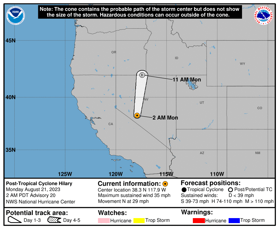
New storm brewing... not yet named, but should soon be Hilary. The NWS is saying likely to feed moisture to San Diego region this weekend, maybe even an inch of rain in san diego, say the forecasters. Here is NHC narrative...

ZCZC MIATWOEP ALL
TTAA00 KNHC DDHHMM

Tropical Weather Outlook
NWS National Hurricane Center Miami FL
500 PM PDT Tue Aug 15 2023

For the eastern North Pacific...east of 140 degrees west longitude:

Active Systems:
The National Hurricane Center is issuing advisories on Hurricane
Fernanda, located several hundred miles west-southwest of the
southern tip of the Baja California peninsula.

1. Off the Coast of Southwestern Mexico (EP90):
Showers and thunderstorms are beginning to show signs of
organization in association with a broad area of low pressure
located a few hundred miles south of Acapulco, Mexico.
Environmental conditions appear conducive for continued development,
and a tropical depression or tropical storm is anticipated to form
within the next day or so. The system is expected to move
west-northwestward to northwestward, roughly parallel to the coast
of southwestern Mexico and the Baja California peninsula during the
next several days. Additional information on this system, including
gale warnings, can be found in High Seas Forecasts issued by the
National Weather Service.
* Formation chance through 48 hours...high...90 percent.
* Formation chance through 7 days...high...90 percent.

https://www.nhc.noaa.gov/gtwo.php?basin=epac&fdays=2


[Edited on 8-17-2023 by mtgoat666]

AKgringo - 8-15-2023 at 04:42 PM

Tracking it on Windy, it looks like it will wash the length of the Baja Penninsula!

https://www.windy.com/?2023082015,27.294,-103.667,4,m:ej7ac3...

JZ - 8-16-2023 at 07:17 AM

Quote: Originally posted by AKgringo  
Tracking it on Windy, it looks like it will wash the length of the Baja Penninsula!

https://www.windy.com/?2023082015,27.294,-103.667,4,m:ej7ac3...


Time to grab the board and head to the Seven Sisters!!


Phil C - 8-16-2023 at 03:15 PM

I love it when the peninsula gets drenched without major wind.

AKgringo - 8-16-2023 at 03:28 PM

Quote: Originally posted by Phil C  
I love it when the peninsula gets drenched without major wind.


It is a bit early in the season for me, but I may have to make a run just to catch the bloom!:wow:
Of course there could also be a bloom of insects :(

SFandH - 8-16-2023 at 03:36 PM

The next 6 to 8 weeks is the time of the season.


Don Pisto - 8-16-2023 at 03:57 PM

at least Hilary is gonna miss rosarito's popular beachfest, its over:D

RFClark - 8-16-2023 at 05:36 PM

Goat and SD might get hammered by this one!

mtgoat666 - 8-16-2023 at 05:57 PM


000
WTPZ44 KNHC 162044
TCDEP4

Tropical Storm Hilary Discussion Number 2
NWS National Hurricane Center Miami FL EP092023
400 PM CDT Wed Aug 16 2023

Hilary has not changed much this afternoon. A large burst of
convection, with cloud top temperatures colder than -85 degrees C,
continues to obscure the low-level circulation and some outflow has
developed on the southern semicircle of the storm. Subjective and
objective satellite intensity estimates range from 30 to 43 kt and
the initial intensity is remains at 35 kt.

The storm is moving to the west-northwest at 13 kt. Hilary is
forecast to gradually turn, first to the northwest by day 2 and
then to the north-northwest by day 3 with the same general forward
motion. This is likely driven by a building ridge over the United
States and a trough off the coast of California. The short-term
track prediction has shifted to the right of the previous forecast,
largely due to an adjustment in the rather uncertain initial
position. It is closest to the simple consensus aid, TVCE.

Strengthening is still expected due to the conducive atmospheric
conditions and warm sea surface temperatures. Hilary is forecast to
be in an area of weak vertical wind shear through 72-96 hours and
remain over warm waters through 72 hours. Therefore, steady to
rapid intensification is anticipated and the official forecast
shows Hilary becoming a hurricane in 24 hours. However, the system
is broad and it could take slightly longer to initially consolidate
and strengthen. Beyond day 3, Hilary is forecast to cross over a
gradient of cooling ocean waters which should induce a weakening
trend. The system is still expected to be post-tropical by the end
of the forecast period.

[Edited on 8-17-2023 by mtgoat666]

AKgringo - 8-16-2023 at 07:01 PM

Our local weather report is saying that the storm remnants might bring an extremely rare mid-summer rainfall to my area in Nevada County.

I wish it was here now, a lightning strike started a fire on highway 20 near the town of Washington. Mandatory evacuations are underway, but I think the air and ground attacks are making good progress!

AKgringo - 8-16-2023 at 07:30 PM

Quote: Originally posted by lencho  
Quote: Originally posted by AKgringo  
Mandatory evacuations are underway, but I think the air and ground attacks are making good progress!

How are you set up should something start nearby? Could you defend your place?


There is a fire department within a half mile of my house, and a fire hydrant across the street from my driveway.

The property I frequently talk about is ten miles from where I live. It would be more than I could handle if a fire came through parts of it!

[Edited on 8-17-2023 by AKgringo]

RFClark - 8-16-2023 at 08:53 PM

Lencho,

I ‘ve been through 2 wildfires that burned over where I lived. Generally there are a few things you can do in advance, but leave quickly with your valuables is my advice.

The top picture is about 15 min before the fire reached our house. This was the 3rd fire that this house survived. The 2nd picture is the after picture.

This fire was not strongly wind driven but it actually rained burning bits and pieces that spread the fire. I used the emergency water to put out burning stuff after the fire passed (about 20 min).

The things made of metal came through the best. All the trees behind the house in the 1st picture burned.

61800414840__50377ED9-575B-49D3-BDCA-BC2E595F904A.jpeg - 114kB

IMG_4433.jpeg - 106kB

Santiago - 8-17-2023 at 05:02 AM

Funny hijack - yesterday I told my partner, who has family in SD, that it looked like Hillary was going to affect California. A staunch republican, he blurted out, "Oh god, is she running again?"

mtgoat666 - 8-17-2023 at 05:30 AM


Tropical Storm Hilary Discussion Number 4
NWS National Hurricane Center Miami FL EP092023
300 AM MDT Thu Aug 17 2023

Hilary is a large tropical storm. An elongated band of deep
convection curves around the southern and eastern side of the
circulation, and a Central Dense Overcast has begun to develop due
to new convection near Hilary's center, with possibly the formative
stages of an eye. Subjective Dvorak estimates from TAFB and SAB
have jumped to a consensus T3.5/55 kt, and given the improved
satellite presentation since 06 UTC, the initial intensity is set at
60 kt.

Hilary is moving toward the west-northwest (300/11 kt), to the south
of a mid-tropospheric high stretching from the U.S. Rockies
southward into northern Mexico. The ridge is expected to shift
eastward to the Central Plains during the next 48 hours, while a
mid- to upper-level low moves eastward to the California coast. This
steering pattern evolution should cause Hilary to recurve toward the
northwest and then north during the next 3 days. Model guidance is
in generally good agreement on Hilary's future path, with a fairly
tightly packed guidance envelope for much of the forecast period.
Therefore, the new NHC track forecast is very close to a blend of
the previous forecast with the HFIP Corrected Consensus aid (HCCA)
and the TVCE consensus. Despite the high confidence in the track,
Hilary's oblique angle of approach to the west coast of the Baja
California peninsula does make it nearly impossible to know at this
point if the center will remain just offshore or move over the
peninsula before reaching the southwestern United States.

Negligible shear, very warm waters of 30 degrees Celsius, and
plentiful atmospheric moisture mean the environment is ripe for
Hilary to rapidly intensify during the next couple of days. In
fact, many of the SHIPS Rapid Intensification (RI) indices are
showing a 100 percent chance of RI during the next 48 hours. The
NHC intensity forecast follows this thinking and shows Hilary
becoming a hurricane very soon and then a major hurricane by tonight
or early Friday, more or less a blend of the HCCA aid and the SHIPS
solutions. Hilary should reach waters colder than 26 degrees
Celsius soon after 72 hours, and fast weakening is indicated after
that time, especially if the storm crosses over the Baja California
peninsula. The surface circulation is likely to be dissipated by
day 5, but a day 5 forecast point (as a remnant low) is still
provided to maintain a forecast track north of the Baja California
peninsula.


Area Forecast Discussion
National Weather Service San Diego CA
445 AM PDT Thu Aug 17 2023

.SYNOPSIS...
A low pressure system moving to near the California coast will
bring drier southwest flow aloft for today and Friday and begin to
spread cooling inland. For the weekend into early next week,
developing Hurricane Hilary is expected to bring a significant
surge of monsoonal and tropical moisture with widespread heavy
rainfall, especially for Sunday into Monday, and a high potential
for flash flooding in the mountains and deserts. Residual moisture
will maintain an active monsoon pattern through at least the
middle of next week with afternoon and evening thunderstorms in
the mountains, deserts, and inland valleys.

&&

.DISCUSSION...FOR EXTREME SOUTHWESTERN CALIFORNIA INCLUDING ORANGE...
SAN DIEGO...WESTERN RIVERSIDE AND SOUTHWESTERN SAN BERNARDINO
COUNTIES...

.
Tropical Storm Hilary is expected to become a hurricane today and
rapidly intensify into a major hurricane as it moves northward off
the Pacific coast of southern Baja, eventually tracking near the
Pacific coast or inland through northern Baja as it moves
northward.

Regardless of the exact track, it will bring a substantial surge
of moisture into portions of southern California with a high
potential for heavy rainfall and flash flooding, especially for
the lower deserts into the adjacent mountains. The latest WPC
forecast has rainfall through Monday exceeding 5 inches for the
lower deserts into the adjacent mountains with 5 to 10 inches on
portions of the east slopes of the mountains. Potential wind
threats are less certain and more track dependent, generally
greater for a track a little farther west and less for a track a
little farther east.

Once this surge in moisture occurs, the moisture will be slow to
dissipate with an active monsoon pattern expected to persist
through at the least the middle of next week. NBM daily chances
of measurable rainfall at Big Bear remain above 30 percent through
Thursday of next week.

[Edited on 8-17-2023 by mtgoat666]

mtgoat666 - 8-17-2023 at 05:43 AM

Big, big rains coming to northern half of baja peninsula and so cal…

Don Jorge - 8-17-2023 at 07:01 AM

Been a long time since the the river flowed bank to bank through Valle de Guadalupe.

There has been, to put it mildly, a bit of change in the area since the arroyo last raged. Development has encroached on the almost always dry watercourse.

Almost always. Be interesting to see how this plays out.

Rain is always welcome, until it isn't.

thebajarunner - 8-17-2023 at 09:51 AM

Send it our way, por favor!!
Our usual monsoons have been all dry so far
Lots of wind (Monsoon means wind, not rain) and lots of tree damage but no rain
Last Summer the Greater Phoenix area had about 3 massive rain events.
This year, not a drip nor a drizzle.
And Monsoon Season typically ends here September 15
The saguaros are dropping arms to conserve internal moisture.

mtgoat666 - 8-17-2023 at 10:24 AM

Quote: Originally posted by thebajarunner  
Send it our way, por favor!!
Our usual monsoons have been all dry so far
Lots of wind (Monsoon means wind, not rain) and lots of tree damage but no rain
Last Summer the Greater Phoenix area had about 3 massive rain events.
This year, not a drip nor a drizzle.
And Monsoon Season typically ends here September 15
The saguaros are dropping arms to conserve internal moisture.


be careful what you wish for. Current forecast thinks maybe 5+ inches of rain on east side of baja, imperial valley-san felipe region. with a bit of shift in storm track, phoenix could get slammed


[Edited on 8-17-2023 by mtgoat666]

AlanDavid90 - 8-17-2023 at 09:39 PM

A disaster is coming...

BajaBlanca - 8-18-2023 at 02:48 AM

I saw a video of La Paz - major flooding in the streets.

mtgoat666 - 8-18-2023 at 06:01 AM

Hurricane Hilary Discussion Number 8
NWS National Hurricane Center Miami FL EP092023
300 AM MDT Fri Aug 18 2023

Hilary's satellite presentation has continued to improve overnight,
with a solid ring of cold cloud tops surrounding a warming eye.
TAFB and SAB provided consensus Dvorak estimates of T6.0/115 kt
while objective estimates are a bit higher, between 125-135 kt.
The advisory intensity is therefore set at 125 kt as a blend
of the various estimates. Hilary has rapidly intensified by a
remarkable 65 kt over the past 24 hours. The hurricane remains
large, and the initial wind radii have been adjusted based on a
recent ASCAT-C pass. An Air Force Reserve Hurricane Hunter
aircraft is scheduled to investigate Hilary around midday and
should provide a more precise estimate of the hurricane's intensity.

The hurricane continues to move toward the west-northwest, or 300/11
kt. However, with mid-tropospheric high pressure nudging eastward
from the Rocky Mountains into the Central Plains, and a cut-off low
off the California coast, Hilary is expected to turn northwestward
very soon and then turn northward and begin accelerating by 48
hours. The track guidance is more tightly clustered than usual
during the first 72 hours of the forecast, and therefore there is
relatively high confidence in the NHC track forecast, which is
essentially unchanged from the previous advisory. Since Hilary's
forecast track parallels the coast from the central Baja California
peninsula northward to southern California, it is still nearly
impossible to predict an exact landfall location, not to mention
that Hilary's exact landfall probably won't make much difference
when it comes to the expected hazards and impacts in the region.

Hilary could strengthen a little more during the next 12 hours or
so. However, once hurricanes reach major hurricane strength, they
are prone to fluctuations in intensity, particularly if an eyewall
replacement begins. In addition, oceanic heat content will be
dropping significantly in 24-36 hours, and it's likely that Hilary's
large wind field will mix up cooler water ahead of the arrival of
the center. This colder water, as well as potential interaction
with the terrain of the Baja California peninsula, is expected to
induce faster weakening over the weekend, with Hilary likely to drop
below hurricane intensity some time on Sunday. Due to its
accelerating motion in 2 to 3 days, Hilary is still expected to be
producing tropical-storm-force winds when it reaches southern
California. The surface circulation is likely to dissipate soon
after moving into California, but a day 4 remnant low point is still
shown over the western U.S. for continuity purposes.


[Edited on 8-18-2023 by mtgoat666]

The Bit*h is back

RFClark - 8-18-2023 at 06:54 AM

The outer bands apptoch BCS. I’ll post pictures as long as possible.

IMG_4437.jpeg - 266kB

SFandH - 8-18-2023 at 06:57 AM

Oh, just great. I have a house renovation project that's not ready to be rained upon. Strong winds could be a problem, too. I have major work ahead of me today and tomorrow to get ready for the storm.


We’re ready! Were we paranoid enough?

RFClark - 8-18-2023 at 07:22 AM


IMG_4439.jpeg - 267kB

mtgoat666 - 8-18-2023 at 07:37 AM

Quote: Originally posted by RFClark  


We’re ready! Were we paranoid enough?


I dont think most of BCS has much to worry about. But anything north of san ignacio is gonna get hammered. The mountains and east slope of mountains are gonna get huge amount of rains. Gonna lose some bridges and roads... Bola gonna have a river running high. Even pac coast areas going to get 2+ inches…

lewmt - 8-18-2023 at 08:35 AM

Windy is now showing the track veering inland much further south than NOAA & even their own forecasts earlier. It'll be interesting to see which service is more accurate.

RFClark - 8-18-2023 at 11:25 AM

lencho,

Murphy will always outbid your worst nightmares!

So we’ll see. Wind should stay under 90km/hr for this one.

EngineerMike - 8-18-2023 at 01:34 PM

Folks in Mulegé carting out furniture & fridges to storage on higher ground. Hil is fairly wide and there will be rain over the Pacific/Cortez drainage divide so some amount of flash flooding is likely unless the storm tracks further west fairly soon.
Drainage thru Sta. Rosalia also going to see runoff.

JZ - 8-18-2023 at 01:40 PM

What's the worst case scenario for LA in terms of wind/rain.

Do I need to think about taking my boat out of the water? I doubt it, but thought I'd ask.

Right now, the NOAA forecast is showing gusts to 45mph on Monday.


[Edited on 8-18-2023 by JZ]

AKgringo - 8-18-2023 at 01:52 PM

Quote: Originally posted by JZ  


Do I need to think about taking my boat out of the water?

[Edited on 8-18-2023 by JZ]


I recommend that you verify that your bilge pump is functioning, and has a reliable power supply. I have seen boats in Southeast Alaska take on enough rainwater to sink while moored.

JZ - 8-18-2023 at 01:55 PM

Quote: Originally posted by AKgringo  
Quote: Originally posted by JZ  


Do I need to think about taking my boat out of the water?

[Edited on 8-18-2023 by JZ]


I recommend that you verify that your bilge pump is functioning, and has a reliable power supply. I have seen boats in Southeast Alaska take on enough rainwater to sink while moored.


Good idea. Pumps and batteries are good. It's a center console, so most of the water runs out on it own.


AKgringo - 8-18-2023 at 02:13 PM

Quote: Originally posted by AlanDavid90  
A disaster is coming...


There are some changes coming that could be bad, but there may be some good come out of it as well. I am thinking of the Salton Sea, Lake Mead, and maybe some flushing of the lower Colorado River!

mtgoat666 - 8-18-2023 at 02:25 PM

Quote: Originally posted by JZ  
What's the worst case scenario for LA in terms of wind/rain.

Do I need to think about taking my boat out of the water? I doubt it, but thought I'd ask.

Right now, the NOAA forecast is showing gusts to 45mph on Monday.


[Edited on 8-18-2023 by JZ]


reality sometimes different than forecast... The thing about high winds is that most of our trees, docs, roofs, etc., have not been stressed like this before, and this will be the test. so will your dock survive?? you'll find out

the force of wind acting across many boats tied to a dock may determine if the dock is anchored well.
one thing i have seen is that securely tied boats may be damaged by another boat that breaks free because it was not moored well...

my san diego neighborhood has only seen high winds once since I have been in this house. a micro-burst during a t-storm hit a few blocks away and shredded every tall tree on the block. was a huge mess.

JZ - 8-18-2023 at 03:29 PM

Quote: Originally posted by AlanDavid90  
A disaster is coming...


https://www.tiktok.com/t/ZT8NooqdS/ :lol:

StuckSucks - 8-18-2023 at 03:44 PM

A friend has a 48' sailboat in Marina del Rey. This morning we went down and dropped the jib, also secured other stuff for weather. BTW this was a big-axe/heavy jib.

JZ - 8-18-2023 at 04:25 PM

Quote: Originally posted by StuckSucks  
A friend has a 48' sailboat in Marina del Rey. This morning we went down and dropped the jib, also secured other stuff for weather. BTW this was a big-axe/heavy jib.


Was in MDR the last 3 days. Just left this afternoon.

Place I stayed at was at the docks.


Bajazly - 8-18-2023 at 05:02 PM

Why would you leave the jib, or any other sail for that matter up when docked?

mtgoat666 - 8-18-2023 at 05:27 PM

Quote: Originally posted by Bajazly  
Why would you leave the jib, or any other sail for that matter up when docked?


Best to take down roller furler sails in a storm for moored boats. If the sails come loose, the boat catches more wind, and chaos ensues

StuckSucks - 8-18-2023 at 06:15 PM

Quote: Originally posted by JZ  


Was in MDR the last 3 days. Just left this afternoon.

Place I stayed at was at the docks.


His slip is near the old Chart House.

Bajazly - 8-18-2023 at 06:20 PM

Quote: Originally posted by mtgoat666  
Quote: Originally posted by Bajazly  
Why would you leave the jib, or any other sail for that matter up when docked?


Best to take down roller furler sails in a storm for moored boats. If the sails come loose, the boat catches more wind, and chaos ensues


Ya think? Pretty much applies whenever a vessel is moored or docked.

JZ - 8-18-2023 at 06:25 PM

I think you guys have different ideas what "take down" means, and that's where the confusion lies.

SFandH - 8-19-2023 at 04:48 AM

windy.com prediction for noon, Sunday:

40 kt winds San Felipe, 20 kt San Diego.


windy hilary.png - 308kB


[Edited on 8-19-2023 by SFandH]

Cabo = Baja?

AKgringo - 8-19-2023 at 08:02 AM

An idiot weather reporter on a local channel was showing the same storm track that is shown on this thread. She was reporting that Cabo San Lucas will probably not be impacted too severely, because the storm will come ashore further north along the Cabo coastline.

So far Hillary hasn’t been that bad!

RFClark - 8-19-2023 at 08:17 AM

This morning’s picture.

4/10ths of an inch of rain and 40MPH winds

IMG_4443.jpeg - 240kB

Bajatripper - 8-19-2023 at 08:51 AM

Quote: Originally posted by lencho  
Quote: Originally posted by BajaBlanca  
I saw a video of La Paz - major flooding in the streets.

"Major" is probably an exaggeration-- La Paz streets are its storm drain system and this happens every time there's a cloudburst.

Always pains my heart to see all that fresh water running down into the bay, but it does kind of flush things clean.


Right you are, Lencho. The street in front of my house was a river for a while as I left, but by the time I got home a couple of hours later was full of mud as the water had receded. I had to cross an arroyo to get to where I was going and had sort of anticipated that I might not be able to get there only to find a small bit of water running.
It seems that we might be spared the worse from Hilary as we have overcast clouds at the moment and only a bit of wind...but that could change as the day progresses. I definitely welcome the overcast conditions as I've been suffering from the heat after being in the Pacific Northwest for the past ten years and am very slowly acclimating again.

Latest satellite photo of Hillary

RFClark - 8-19-2023 at 09:33 AM

Hillary seems to be loosing strength and organization over the cooler water. Hopefully it won’t be as bad as was first thought.

It seems to be raining as far north across Baja as about 100Km south of San Ignacio. The rain at the coasts is generally lite.

IMG_4446.jpeg - 135kB

Timo1 - 8-19-2023 at 10:51 AM

I'm in Asuncion and so far just steady rain during the night and all of today so far. It is 11 am here sat. morning

SFandH - 8-19-2023 at 11:03 AM

Quote: Originally posted by Timo1  
I'm in Asuncion and so far just steady rain during the night and all of today so far. It is 11 am here sat. morning


Thanks. Make a post when it's over for you....if you can.


[Edited on 8-19-2023 by SFandH]

Hillary’s gone again! Some wind not much rain,

RFClark - 8-19-2023 at 11:21 AM

.37” of rain gusts to 42Mph.

IMG_4449.jpeg - 249kB

RFClark - 8-19-2023 at 11:32 AM

We’re the Gringo Rancho Nuevo at KM72 on the highway to Los Cabos. South of Todos Santos.

RFClark - 8-19-2023 at 11:38 AM

Or not! Hard to say, Murphy never sleeps!

RFClark - 8-19-2023 at 12:25 PM

L,

It usually gets “interesting” after the monsoon starts. This was the start. The next 6 weeks will be interesting and the next 10 weeks could be interesting!

Bruce R Leech - 8-19-2023 at 02:50 PM

Bob is it raining in yet

EngineerMike - 8-19-2023 at 03:03 PM

Mulegé report as of this a.m.:
Heavy rain started 0830, power out 0845, by 1030 local rains producing heavy local runoff (no storm drains so running in the streets)
Power back on ~1200

[Edited on 8-19-2023 by EngineerMike]

Ateo - 8-19-2023 at 04:09 PM

Large swells here around K-38 en playas de Rosarito. Ollie’s pizza tonight and then heading north. Good luck everyone!

Timo1 - 8-19-2023 at 04:36 PM

Huge swells and now gale force winds. Projection has it here at midnight. Bahia Asuncion

RFClark - 8-19-2023 at 10:43 PM

The CFE power seems to be generally off around Cerritos. Cell service might be down as well.

Both are based on the fact that the tower lights usually visible are out and the Diamante Resort is reporting a complete power outage. Several cell linked devices in Rancho Nuevo are also not reporting.


Ateo - 8-20-2023 at 08:12 AM

Light rain here in Playas de Rosarito, probably similar to what San Diego is starting to see. The people in the hotel room next to us last night partied till 4am!!

[Edited on 8-20-2023 by Ateo]

mtgoat666 - 8-20-2023 at 09:27 AM

Big rain last night and this morning in El Rosario, bola, Catavina,… roads a total mess. Storm still marching on

JZ - 8-20-2023 at 10:04 AM

Slight drizzle here in LA.


bajaric - 8-20-2023 at 10:42 AM

Steady light rain all night in east San Diego, continuing this morning. Less than 1 inch. The "eye" is supposed to arrive here tonight (Sunday) or what is left of it after it crosses all that cold water north of Punta Eugenia.

AKgringo - 8-20-2023 at 11:14 AM

Quote: Originally posted by bajaric  
Steady light rain all night in east San Diego, continuing this morning. Less than 1 inch. The "eye" is supposed to arrive here tonight (Sunday) or what is left of it after it crosses all that cold water north of Punta Eugenia.


The "Windy" forecast model shows Hilary picking up moisture from the upper Sea of Cortez, which might bring heavier precipitation from an eastward or northeast flow.

JZ - 8-20-2023 at 11:53 AM

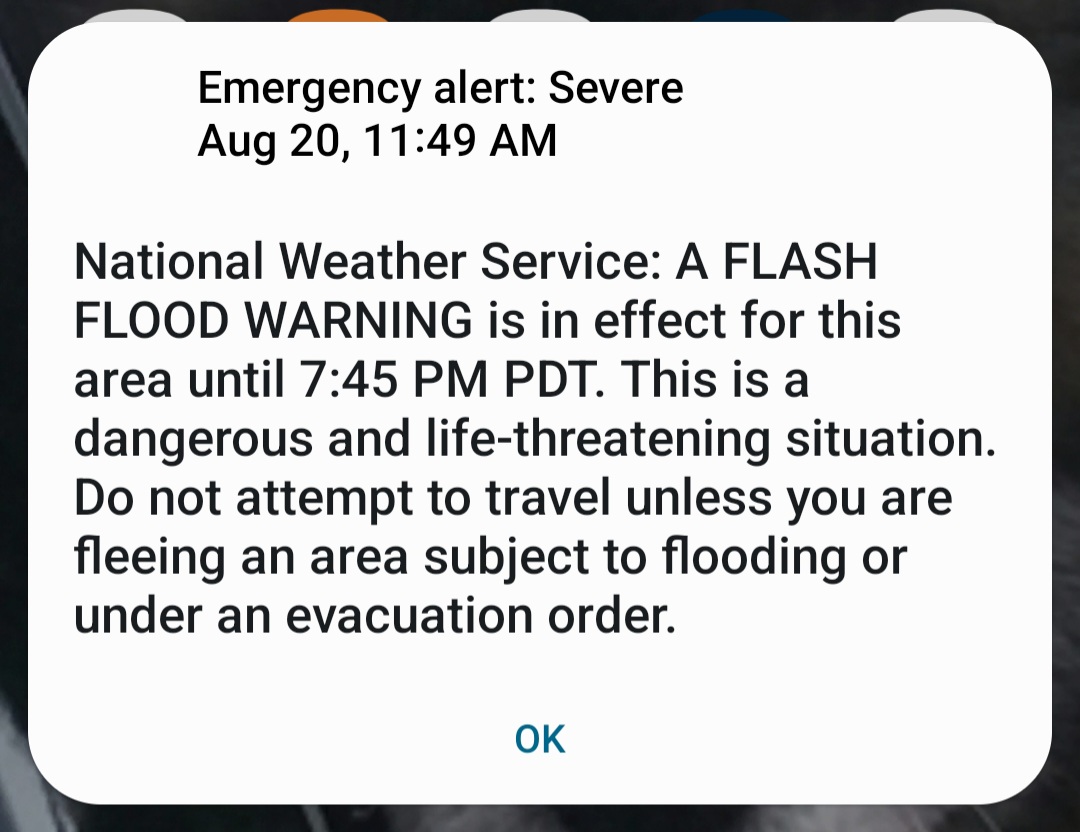
Rain has picked up a bit. Just got the Emergency Alert on my phone.


[Edited on 8-20-2023 by JZ]

WideAngleWandering - 8-20-2023 at 12:16 PM

The pics and vids I've seen out of Bahia Asuncion show a lot of damage. I have some friends out in Abreojos. Does anyone know how the the other towns south of Asuncion are fairing?

twogringos - 8-20-2023 at 12:56 PM

Where did you see posts from Bahia Asuncion?

Lee - 8-20-2023 at 01:08 PM

Just heard it made landfall at San Quintin.

Death in Santa Rosallia was a man in a car that got washed away.

Website of storm | https://

www.facebook.com/groups/TalkBaja/posts/7351562688191607/

Ateo - 8-20-2023 at 01:40 PM

Many car accidents on the Blvd 2000. Flipped cars and even a truck and trailer turned over. Puddles in the road and speed appeared to maybe play a factor. Sentri had zero cars. Zero wait at the pedestrian line as well in Otay. I acknowledge my lame updates are for the frontera zone, not further south where things were legit.

Good luck everyone down south! We hope to hear from Shari soon!

mtgoat666 - 8-20-2023 at 02:01 PM

Quote: Originally posted by twogringos  
Where did you see posts from Bahia Asuncion?


Facebook talk baja has a bunch of reports, one from BA, and links to a number of other FB sites with reports.

BA was hammered pretty bad. Turtle bay too.

Don Pisto - 8-20-2023 at 02:54 PM

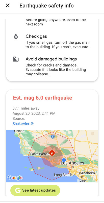
if a tropical storm wasn't enough our friends in Ojai just had a 5.0 earthquake, mother nature is PO'ed:o

Hillary’s gone again.

RFClark - 8-20-2023 at 02:57 PM

On to the next one!

[Edited on 8-20-2023 by RFClark]

IMG_4451.jpeg - 325kB

JZ - 8-20-2023 at 02:57 PM

I felt the earthquake. Actually got a notice before the shaking started.


[Edited on 8-20-2023 by JZ]

San Diego reports?

geraldalexander7 - 8-20-2023 at 03:53 PM

What’s the storm doing in San Diego?

JZ - 8-20-2023 at 03:59 PM

Still no real wind where we are in LA. The forecast says 20mph, but we've had 8-10mph.

It was gusting to 19mph at my marina, but down to 15mph now.


[Edited on 8-20-2023 by JZ]

Loretana - 8-20-2023 at 04:00 PM

Quote: Originally posted by twogringos  
Where did you see posts from Bahia Asuncion?


Take a look at Shari Bondy's posts on Talk Baja

Not good.

WideAngleWandering - 8-20-2023 at 04:18 PM

Quote: Originally posted by twogringos  
Where did you see posts from Bahia Asuncion?


This talk baja thread has photos and videos from folks on the ground:

https://www.facebook.com/groups/TalkBaja/permalink/734623574...

My friends in Abreojos reported in. They are ok but the walls around their campo and their car were damaged. I don't know about the village.

Photos from Asuncion look like a huge mess.

Flooding in Santa Rosalia looks pretty bad.

Bridges out on Highway 5 too.

BooJumMan - 8-20-2023 at 04:52 PM

Quote: Originally posted by geraldalexander7  
What’s the storm doing in San Diego?


Steady rain since about 3am. Light to moderate at times. A few heavy downpours. Light winds. Forecast still shows winds to start nuking later this evening.

Hwy 5 ?

PaulW - 8-20-2023 at 05:04 PM

Just noticed a video supposedly Hwy5. The guys cited the wrong Km
See the pics and what do you think?
Facebook San Felipe Talk


Road-1.jpg - 126kB Road-2.jpg - 72kB Road-3.jpg - 68kB

4x4abc - 8-20-2023 at 05:16 PM

km 155, Arroyo Santa Maria. That is how all bridges in Baja have failed. Reinforcement for the landing usually bad. And they did not want to spend the money on 50 more meters of bridge.

Ateo - 8-20-2023 at 06:52 PM

Quote: Originally posted by geraldalexander7  
What’s the storm doing in San Diego?


It got windy here in San Diego about 1 hour ago. Some downed branches and an umbrella in the backyard are casualties. That's about it.

David K - 8-20-2023 at 07:25 PM

Quote: Originally posted by 4x4abc  
km 155, Arroyo Santa Maria. That is how all bridges in Baja have failed. Reinforcement for the landing usually bad. And they did not want to spend the money on 50 more meters of bridge.


Can you be more specific as to which part of the Baja highway, please (I assume Hwy. 1). For example:
Cabo San Lucas to La Paz, La Paz to Insurgentes, Cd. Insurgentes to Loreto, etc.
Thanks Harald, it makes it easier for us old guys to not have to guess. :light:

Bajazly - 8-20-2023 at 09:35 PM

Pretty much a snooze fest in San Felipe. We got more rain Friday night and Saturday morning than we did this morning when the storm came thru here. Some standing water around and in town, bit of wind today but pretty disappointing here.

Good to see it lived up to the weather guessers predictions in some places.

RFClark - 8-20-2023 at 10:47 PM

David,

I think that it’s this bridge. It’s just south of the rest area before the entrance to Punta Final (29.7226346, -114.4063720)

IMG_4454.jpeg - 17kB

[Edited on 8-21-2023 by RFClark]

David K - 8-21-2023 at 09:50 AM

Quote: Originally posted by RFClark  
David,

I think that it’s this bridge. It’s just south of the reat area before the entrance to Punta Final (29.7226346, -114.4063720)


Yes, thank you... I just posted the video that was used above for those clips. Km. 155 is the BIG BRIDGE over Arroyo Santa María, eight kms. south of Gonzaga Bay Pemex/ Rancho Grande Store. The bridge with the fancy monument. Sad that this and so many other new bridges were not built to actually have lots of water flow under them!

Here is the short video... maybe turn off sound as it is just the wind noise in the microphone... https://www.facebook.com/elbrazopoderoso/videos/520965856862...

RFClark - 8-21-2023 at 10:21 AM

David,

I think the poor footing design is deliberate. I think they would rather loose the approaches than loose the whole bridge. That said I may be giving them credit they don’t deserve.

The other problem many Mexican bridges have is poor or no upstream channeling.

That said the US lost or had badly damaged the US 10 bridge at Whitewater yesterday. It had good channeling but probably took damage to its footings from scouring as a result of the high velocity of the flow.

Anyone heard if the two bridges south of Santa Rosalia survived?

[Edited on 8-21-2023 by RFClark]

HeyMulegeScott - 8-21-2023 at 12:04 PM

Quote: Originally posted by RFClark  
David,


Anyone heard if the two bridges south of Santa Rosalia survived?

[Edited on 8-21-2023 by RFClark]


Mulege to Santa Rosalia was reported as passable yesterday. Didn't see any images of damage to the bridges. https://www.facebook.com/radiokashana

Santiago - 8-21-2023 at 01:53 PM

Quote: Originally posted by RFClark  
David,

I think the poor footing design is deliberate. I think they would rather loose the approaches than loose the whole bridge. That said I may be giving them credit they don’t deserve.


Slight hijack: is the footing where the road leaves the ground and starts to span? I'm thinking that the 'footing' would be the foundation that is under the piers? I must be wrong?

Bwana_John - 8-21-2023 at 04:17 PM

Quote: Originally posted by Santiago  
Quote: Originally posted by RFClark  
David,

I think the poor footing design is deliberate. I think they would rather loose the approaches than loose the whole bridge. That said I may be giving them credit they don’t deserve.


Slight hijack: is the footing where the road leaves the ground and starts to span? I'm thinking that the 'footing' would be the foundation that is under the piers? I must be wrong?


“Abutment”

JZ - 8-21-2023 at 08:40 PM

Took the ponies to the park late afternoon during the TS.


RFClark - 8-21-2023 at 08:59 PM

Lencho,

See the gate’s not locked!

IMG_4461.jpeg - 187kB

RFClark - 8-21-2023 at 09:54 PM

Since Baja lives or dies by its road, roads and bridges are important. Here’s a link to a study done in Australia describing the remedial action taken after a similar problem. For those interested it shows how bridge approaches are designed.

Bridges are designed to withstand flowing water of a certain depth, past that the approaches usually wash out first reducing the pressure on the bridge. The approach pictured above is well designed, its design limit was exceeded by a substantial margin and it washed out. If that fails to reduce the pressure on the bridge enough spans can collapse because their footings can be undermined.

https://www.researchgate.net/publication/310673499_Restorati...

mtgoat666 - 8-22-2023 at 06:06 AM

After natural disasters, all nomads become armchair civil engineers and structural engineers!


And a little further north....Burning Man is all wet!

AKgringo - 8-22-2023 at 06:01 PM

The ancient dry lake bed that the festival is set up on is flooded by Hilary!

https://www.msn.com/en-us/weather/topstories/burning-man-s-b...

Arroyo Santa María/ Las Arrastras bridge detour open

David K - 8-23-2023 at 09:10 AM


Gonzaga Bridge Detour 8-23-23.jpg - 50kB

PaulW - 8-23-2023 at 09:20 AM

Another picture showed a bulldozer deep in the space where the abutment washed away. The method shown above is much faster.

RFClark - 8-23-2023 at 04:39 PM

David,

Your detour picture won’t load and now it does!

Goat,

The guy that designed the Tacoma narrows bridge was a Civil Engineer! The replacement bridge was still there yesterday when I drove across it!

Any flood water get under your bed?

[Edited on 8-23-2023 by RFClark]

AKgringo - 8-24-2023 at 05:46 PM

My MSN news feed posted an article about San Felipe, and San Quintin being declared "disaster areas" and will be receiving federal assistance.

I haven't heard much about the damage there and was wondering if it was worse than other Baja communities, or do they just have better connections?

shari - 8-26-2023 at 12:29 PM

It’s been a week since we started preparing for the arrival of Hurricane Hilary here on the central Pacific coast in the Municipality of Mulege. It was the biggest hurricane ever to hit our area and left a terrible disaster after high winds toppled trees, garages, roofs etc and the over 25' waves came up into the main street of town at high tide. The best thing is that we got very little rain so streets arent flooded and traffic is flowing fine now.

It's official, Bahia Asuncion was declared a disaster zone after Hilary. I was astounded how fast CFE got power back on the very next day and internet too! The military brought in a huge crew by helicopter to clean up the streets and provide aid to the folks left without houses. The government responded very quickly and the Governor and Municipal president flew in as well to assess the situation and reassure the village that help was imminent.


[img]https://i.imgur.com/lyUTARP.jpg?1[/img]


It seems like it was just yesterday as this week has been a whirlwind of emotion and massive clean up and recovery from the worst hurricane ever to hit our area. I am still physically very sore & traumatized grappling with the enormous task of repairing all the damage. Little by little with lots of help we are picking up the mess….I found things that blew out of my garage 2 miles away!
Here at La Bufadora Inn, the hotel part which is newer is fine with hardly any damage except to my beautiful gardens. Thanks to my friends and great crew we are all cleaned up & open for business and sure hope people come our way!

My house is in rough shape with some roof that flew off so it flooded badly. The walls were covered with sand and seaweed from the huge swells that lashed the cliffside. Two garages blew down completely & some gates torn off. In the morning when I took a look at the devastation, I was sure I parked my truck in the garage but there it was out in the open! I didn’t realize the whole garage was down.


Campo Sirena was damaged too but will be finished fixing up today! The Beach House was fine! Just a lot of debris.

I have been trying to coordinate help for my daughter who suffered terrible damage at our new Hacienda Baja Magic. She is just starting out with her new business and really needs our help. Here is what she wrote about the storm.

SIRENA BONDY’S ACCOUNT OF HURRICAINE HILLARY at her Hacienda Baja Magic…3 DAYS AFTER.

Reading through all the posts, comments and scrolling through photos that our friends took up and down Baja, I feel a knot form in my throat and tears in my eyes. As I look around our home, that doubles as our business and a home away from home for Baja Travelers, I realize the magnitude of damage that we sustained here at our Hacienda Baja Magic in Guerrero Negro as well.

The night of Saturday, August 19th, and early morning of Sunday, August 20th, 2023, our beloved towns of the municipality of Mulege in Baja California Sur, were hit by the largest hurricane I have seen in my 33 years on this planet.
As usual, a couple of days before, we heard on social media and weather platforms that a storm was coming. We began with our usual preparations, taking down tents, boarding up windows, reinforcing fences, tying down roofs, purchasing essentials like gas, canned food, drinking water, etc. I don’t think anyone was prepared for the amount of destruction that Hilary would leave in her wake.

As we were getting ready to go to bed Saturday night, I truly believed that it was “just another rain storm” and due to the fact we, in central parts like Guerrero Negro, rarely get hit too hard, I was confident that I would wake up to very little damage…I was wrong.
At about midnight power began to flicker and we could hear the wind raging outside of our bedroom window. Doors were rattling and trees were heard straining against the relentless winds. As my youngest son climbed into bed with me from a mattress I had put beside us on the floor for him. My first pinch of fear was “what if the window bursts and he is up here with us?” which sent my mind in to overdrive in a domino effect of plans and concerns for us, as well as all of our loved ones up and down the peninsula.

Then came the thought of my Mom, hours away, facing this raging storm by herself. I mentally reviewed all of her security measures and the strategies we had always had in place when I was growing up in case of a storm…while I felt confident that she could handle pretty much anything I was still worried to the point of being sick to my stomach.

All the while the door rattling became louder and more prominent…until finally I heard something crack. My first instinct was to jump up and go check what it was, but my partner Charly of course being the voice of reason, held me back and said we were in the safest place in our home and we could check on everything in the morning because it was not worth getting hurt over…I am so glad he did.

After a sleepless night of hearing glass breaking, wood cracking, and many loud bangs over the span of a few hours, daylight came through the blinds, and even though the storm raged on, the wind was considerably less than it had been hours before.
Not being able to wait any longer I clutched a flashlight and crept out to our living room, where through glass doors I saw the utter destruction in our clubhouse. The roof above our small indoor pool was torn clean off and was folded backward, laying on top of our kitchen roof, large beams still suspended almost in mid-air and clashing up and down with the wind still. Our front and back doors were broken open by the force of the winds. The cement wall top part was torn off and embedded in the part of the roof that had been raised about 15 cm. As I looked outside, I saw that a whole portion of our wooden fence had been completely blown down and was laying in the middle of the road covered by a large puddle with mud and debris from other homes in the area. Our beautiful garden which we spent months tending to and bringing back to glory was flattened, our trees bare, and not even birds could be heard.

I don’t think it fully registered until a couple of hours later when we tried to patch up everything as best we could, all I was focused on was survival mode in case the winds picked up again, not rationally realizing the storm was over.


I am well aware there were people that lost so much more, sadly this Hurricane took at least 4 lives, and we are fortunate to be healthy and have our loved ones safe and sound. However, the daunting task of rebuilding both the Baja Magic Hacienda and my Mom’s Bufadora Inn will be costly and ongoing… but as with everything we do it will be done with love and care.

We are so blessed to have friends and family that continue to support and help us, which truly does mean the world to us. We are overwhelmed by everyone’s response to this tragedy and appreciate the help you are all willing to give. So many of you have offered to bring construction materials down and while appreciated, we would really love to support our local businesses in buying materials for rebuilding, that way we can also help them get back on their feet. My Mom set up a link we can send you if you want to help with our recovery.

Everything raised here will go directly to the repairs needed so we can be up and running to receive guests as soon as possible. We will also be setting up a local drop spot here at the Hacienda for any clothes, blankets, materials people drop off when coming through which we in turn will deliver to other families in need locally.

We thank you from the bottom of our hearts for always stepping up and helping in our times of need, those who know us know we do not hesitate to do the same when our friends need us. If you care to help please go to my personal facebook page or to Baja Magicmx on Facebook to find the link to directly send donations to us.

https://donate.stripe.com/9AQ6oDdQM6Ow1YQaEE


[Edited on 8-26-2023 by shari]