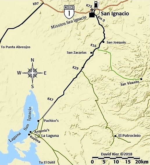
| Hi, I’m bringing my motorcycle down to La Paz (I spend winters there) in April. Coming down M5. I’ve driven down Baja several times in a van or
rv and thought it might be a change of scenery from the highways to take this route. I’ve got a TW200 and am in no hurry. What’s this route like?
Road conditions, fuel availability, good places to eat or stay (tent or hotel). Things to see. I can carry about 4.2 gallons of gas which should be
enough but it would be nice to know if I could get some fuel if needed. |