BajaNomad

"THE IMPOSSIBLE" 4WD Run FEBRUARY 16-24, 2019 [update 2 Feb 2019] - FINAL ROUTE

 Pages:  1  2    4

Ken Cooke - 7-31-2018 at 11:26 PM

Quote: Originally posted by Akula  
Quote: Originally posted by PaulW  
Heavy diff covers are not for desert like Matomi. What we use is a skid so the thing will slide over the rock. A skid that protects the pinion and u-joint is just as important.

[Edited on 7-18-2018 by PaulW]


I've already have the AEV diff skid installed as well as an ARB engine/trans skid. I'm getting the diff covers to keep anything from punching a hole in the diffs.
https://www.aev-conversions.com/product/jk-slider-differenti...


I need to do the same

Ken Cooke - 8-1-2018 at 08:29 PM

Quote: Originally posted by David K  
Quote: Originally posted by bajatrailrider  
Dang Ken I need hot meals twice a day.

Does Mi Ranchita do take-out? LOL
Everyone should try this great restaurant in San Vicente!!
It is north of the bridge, north of town, alongside the road west to the mission, km. 88.5.


Depending on our time out of El Rosario, that might work into the itinerary. Drivers breakfast at 7 am-8 am. San Vicente B4 noon.

bajatrailrider - 8-1-2018 at 08:44 PM

I eat there most nights great food nice people.

Ken Cooke - 8-2-2018 at 03:04 PM

Quote: Originally posted by bajatrailrider  
I eat there most nights great food nice people.


I don't like to be the bad guy. That Sunday, we will be pressed to make it across the border before nightfall. If we have a large group, it will take 1 hour minimum for each restaurant stop. If possible, call out on your 2 meter radio, and we'll stop for a meal and a quick goodbye.

bajatrailrider - 8-3-2018 at 08:34 PM

Yes the bigger the group the more time do I know that. Me myself try to not drive Baja at night. Black cows rocks stalled cars no lights all the rest only one head light.

John Harper - 8-4-2018 at 07:13 AM

Quote: Originally posted by bajatrailrider  
Yes the bigger the group the more time do I know that.


It's usually good idea to add at least 15 minutes delay for every member beyond one or two in a group. Just my experience.

Hopefully your group has it's chit together more than most folks I've tried to travel with in the past. I have a big problem with people who aren't ready to go at planned times, so I just avoid group travel today.

John

[Edited on 8-4-2018 by John Harper]

bajatrailrider - 8-4-2018 at 07:45 AM

The first and only run I did on Kens pole line run 2015. Most everybody was well set up and prepared. Funny part the 3 trucks that broke down all drivers where residents of Baja. If I remember The Blazer dropped the mufflers and pipes. The Ranger I cant remember but both managed to get out to highway and get home. My friend Wil in his Hot rod Bronco with BM blower. Next to last day the one China part that is name brand. No longer made in USA broke no spark dead in the water. We had to tow it out over 50 miles. In the worst places you could think of. All the guys on the trip real fine people had a ball. Ken works very hard at setting up these runs and does a great job. When I have big group of guys on dirt bikes like 10 guys. I know we are in trouble first mile of 4 day ride. One has already got lost JAAAAA.

David K - 8-4-2018 at 08:26 AM

If I recall, the Ford Ranger (belonging to Nomad MICK) had transmission oil issues and elected to back out before getting too far down the World War II trail if things got worse. The Blazer was with MICK. To have one secure, reliable vehicle, to get back to civilization, John M in a Toyota Tacoma Off Road TRD volunteered. It was a bummer that John wasn't with us for the rest of the run. He is a hoot and a good story man having authored several Mojave Desert books.

El Imposible official RSVP instructions

Ken Cooke - 8-4-2018 at 06:57 PM

Hi everyone interested in the official 'El Imposible' 4WD run. I am going to request mailing addresses from all interested parties and will provide my mailing address and email address. This will allow me to set up your hotel reservations IN YOUR NAME ONLY. If you have to cancel to get your money back, I will provide you with the phone number to call.

Why am I doing this?

1. To provide clarity as to know who is going.
2. To reserve our hotel rooms to keep our group together.
3. To create a closed line of communication with those who are going and to keep our run totally private.

When do I need hotel reservation money?

I will request it beginning SEPTEMBER 1, 2018 until a future, unspecified date.

Is there a fee that I will need to pay?

No - I am not taking personal funds, just reserving your room without having to impact my personal finances.

What if I cannot attend your run due to prior commitments?

You will need to speak with the motels that I reserve your room, and refer to their cancellation policy. More on this later as I review vacancies and locations. This is to keep our motels exclusive and the parking lot to ourselves.

How much money will these hotels cost? Is there a receipt for the transaction?

Under $200 - I will provide you with information related to your room and some form of receipt to provide full transparency.

What if all of our 4WDs break down and we have to cancel our hotel?

Then, 'El Imposible' lives up to its' name and a legend is born!

See you at 'El Imposible' in 6 months! I will attempt to contact everyone who has expressed interest by sending me a U2U, a message on Facebook/Messenger or texted me on my cell phone.

David K - 8-5-2018 at 08:46 AM

Good job Ken! The 'hotels' will probably be half that cost, but better to over budget and have more fun money leftover.

Pole Line Road plans

Ken Cooke - 8-5-2018 at 05:52 PM

Plan A - enter Pole Line Road via the traditional Pole Line Road entrance (bypass). Not legitimate:!:

Plan B - enter via private rancho (Valle Trinidad). Totally legitimate:!:

Plan C - enter via Arroyo Grande at La Ventana. Also legitimate, but the hillclimb on the Bad Hill a little extreme.:!:

Plan D- Little Summit HARDCORE ROCK Jeep trail.

These are just a few options that I am looking at. The Pole Line Group is diligently researching and speaking with land owners in an effort to ensure legal passage through lands surrounding the Pole Line Road.

It was explained to me that Mexican Constitutional law grants legal passage through overland areas so that it's citizens can travel where they like. However, land owners wanting to guard their cattle willingly block routes with locked gates in an effort to thwart cattle rustlers and irresponsible travelers who leave gates open after they pass through these entrances and exits.

One item that was brought up - 'El Imposible' participants MAY need to wear a uniform in order that property owners will see that our group is an organized one and not an assortment of vandals out to wreck and litter ranches on our days off from work.

Purchase of 'El Imposible' sweaters or t-shirts may be mandatory thanks to this evolving reality. :!:

TMW - 8-5-2018 at 07:58 PM

Ken tell me more about Plan B above. The road on the private rancho at Valle Trinidad.

Also Plan D the Little Summit Jeep trail. Is this the same as the lower Summit known as Summit #2.

A couple of years ago we started on the PLR and where it splits to go east to the white water tank we went south looking for the bottom of Summit #3 where an old ranch house was suppose to be. Didn't get to it so we went over the Race Summit to the junction coming in from Hwy 3 at KM108. We went east by the Jamau Outpost hotel and campground. Maybe a mile or so past it we came to a locked steel gate. It blocked access to both Summit #3 and #2. #2 can be accessed just after you get on the PLR within maybe 1/4 mile from the arroyo where the locked gate is blocking the PLR, but the road up is very rough with rocks.

Ken Cooke - 8-5-2018 at 09:15 PM

Quote: Originally posted by TMW  
Ken tell me more about Plan B above. The road on the private rancho at Valle Trinidad.

Also Plan D the Little Summit Jeep trail. Is this the same as the lower Summit known as Summit #2.


Plan B involves travel across Hwy 5 to Hwy 3 to the Valle Trinidad area. My 4WD club contact in Mexicali knows the ranchero who lives there. One year ago, no locked gates existed. The problem in Baja is so many local 4 wheelers are completely damaging the image of responsible 4 wheel drive owners like myself. They do more damsge to our activities than we can work to improve the tarnish that they create. Hence, gates are being built faster than I can organize runs to visit places being closed to the public.

Plan D involves a trail outside of San Felipe. Paul Wilson and Rich T know more about it. I haven't traveled this mini summit,but if I can't run the Pole Line Road, it will definitely increase the extreme nature of this series of runs. We could probably motel an additional night which would allow us to carry less gear on this rock house, although, some drivers won't participate.

I will have to wait on more Intel so I can't provide more info until the weather improves. I won't know anything until late October or November.

David K - 8-5-2018 at 10:40 PM

I would think coming to the Pole Line Road at the white tank, from the north, would be the obvious winner? Neal Johns had done that road and if no gates in the way, a clear shot. All the good cobblestone grades and the tough Basketball Hill is east of the white tank, so nothing fun is missed.

Another option is to go from La Ventana west onto the Pole Line Road and do as much of the bad stuff as you want then turn around and go back to Arroyo Grande then onto the SCORE road to El Chinero, which was also the Pole Line Road route to San Felipe.

Just brain storming with you...

PaulW - 8-6-2018 at 06:38 AM

My plan is what David just posted. Except we will start from Chinero instead of Ventana to cut the mileage from San Felipe.
Better to be conservative and avoid the northern approach.

Ken Cooke - 8-6-2018 at 07:03 AM

I was told that the route to the White Tank is presently overgrown with vegitation. That may become the new route bypassing the armed Rancheros and their network of gates.

ehall - 8-6-2018 at 07:35 AM

Quote: Originally posted by Ken Cooke  
I was told that the route to the White Tank is presently overgrown with vegitation. That may become the new route bypassing the armed Rancheros and their network of gates.


Sounds like you might have to prerun some of it. Lol. Always looking for an excuse to get down there.

rich t - 8-6-2018 at 10:01 AM

Ken, If you decide to run the Mini Summit will be glad to help you out, also if you want to do the Mine trail it could be a good option on the extra day in Gonzaga, there is another route that brings you out about 7 miles north of Cocos, the whole trip is only about 4 hours.

Looks fun

Nextlevelbaja - 8-6-2018 at 02:50 PM

This trip sounds really fun! Id like to make it out this year. In regards to prerunning or testing out difficult trails, I'm always willing to help and have a more than capable Jeep to help clear the trail.

PaulW nice work on getting through that rock garden!

PaulW - 8-6-2018 at 02:58 PM

Thanks. My Jeep is back to it good design with up grades. It should be better now. It had lots of issues from the hard trails in Baja. I even had to do one trip with no front driveshaft, but got it repaired in San Felipe in a reasonable time.

Ken Cooke - 8-6-2018 at 07:48 PM

4 hrs = ½ day Jeep trail. I would like that, but the wife will want to rest. Maybe,we could run in the afternoon and people can sightsee and sleep in.

I will plug that in my agenda Rich T!:bounce:
What is the name of that trail, again?

rich t - 8-6-2018 at 10:56 PM

Pioneer Mine Trail

PaulW - 8-8-2018 at 06:08 AM

IMO
The list of difficult rides diving distance from San Felipe. Hardest first.
With the local names
* Huatamote from Parral to L Diablo. (No record of a passage yet).
* Mini Summit Going up Hill (aka power line road summit)
* Mini summit going down hill
* Pioneer Mine road
* Turquesia grade
* Matomi
* Pole line road (stack the rocks and move it down the list)
* The other SF arroyos: Huatamote, Azufre, & Chanate, & Curevitas
(previous recent weather dependent)
* Both the Pinta passes
* San Pedro (aka Green Door)

Add your own choices to the list


[Edited on 8-9-2018 by PaulW]

rich t - 8-8-2018 at 07:48 AM

Paul, We should run the la turguesa(XR Trail,Freds Tractor Trail) this winter,a local Mexican jeep club ran it earlier this year, I met up with them at Coco's in April.

PaulW - 8-8-2018 at 04:47 PM

Power line refers to Mini Summit not Pole line.

PaulW - 8-8-2018 at 05:16 PM

Telegraph is improper for all the tracks.
Poleline and Powerline are not the same tracks
I used telegraph because I saw it in print somewhere I should not have repeated it.

David K - 8-8-2018 at 06:33 PM

10-4 Paul... I will just delete my stuff added today. You guys have fun and keep an eye open for history!

PaulW - 8-9-2018 at 05:27 AM

Quote: Originally posted by rich t  
Paul, We should run the la turguesa(XR Trail,Freds Tractor Trail) this winter,a local Mexican jeep club ran it earlier this year, I met up with them at Coco's in April.

=====
Agree it has been on my to do list for years. Went there a long time ago but was voted down by my companions.

Ken Cooke - 8-9-2018 at 02:25 PM

Quote: Originally posted by PaulW  
IMO
The list of difficult rides diving distance from San Felipe. Hardest first.
With the local names
* Huatamote from Parral to L Diablo. (No record of a passage yet).
* Mini Summit Going up Hill (aka power line road summit)
* Mini summit going down hill
* Pioneer Mine road
* Turquesia grade
* Matomi
* Pole line road (stack the rocks and move it down the list)
* The other SF arroyos: Huatamote, Azufre, & Chanate, & Curevitas
(previous recent weather dependent)
* Both the Pinta passes
* San Pedro (aka Green Door)

Add your own choices to the list


[Edited on 8-9-2018 by PaulW]


Thanks for the comprehensive list, Paul.

bajatrailrider - 8-9-2018 at 03:47 PM

The Xr trail a tuff one on our bikes years ago was not passable by 4 wheeler. With all the SXS going up hopeful it is more easy now. After the boulders to get to hill climb. That took many runs on the bikes to get over rock pile at bottom climb. 17 or more years ago sounds like best in a jeep.

Ken Cooke - 8-9-2018 at 03:54 PM

Quote: Originally posted by bajatrailrider  
The Xr trail a tuff one on our bikes years ago was not passable by 4 wheeler. With all the SXS going up hopeful it is more easy now. After the boulders to get to hill climb. That took many runs on the bikes to get over rock pile at bottom climb. 17 or more years ago sounds like best in a jeep.


I drove up La Turquesa near the mine about 10 years ago, but I couldn't find the route to the uphill grade. It was a nice side trip for our group.

rich t - 8-9-2018 at 08:21 PM

I have done both ends but never the whole trail.

bajatrailrider - 8-9-2018 at 09:18 PM

Quote: Originally posted by rich t  
I have done both ends but never the whole trail.
Did you go the bottom up turn around go back down. Or stop at start up hill.

David K - 8-9-2018 at 09:28 PM

For what it's worth, here is my observation after finding the top of the grade in February 2007 to 'discover' it was an auto road and not a single track as I thought Kacey Smith had described it: http://vivabaja.com/207/ (first two pages)

Following that trip, 'steekers' rode in with his m/c and took photos of the grade from the turquoise mine, then Ken and his group tried to get to the bottom of the grade from the turquoise mine. Finally, with help from TW and others, Roy 'The Squarecircle' in an LR-3 Land Rover made it to the base, then drove to the top and on the Hwy. 1.

TMW - 8-10-2018 at 11:00 AM

I think Roy had more trouble at the bottom of the hill after getting out of the arroyo than the section from the mine to the arroyo exit.

bajatrailrider - 8-10-2018 at 11:41 AM

Yes the bottom of the hill had large rocks holes very steep angle at bottom. This was years ago Mike was on his TT680 custom framed Yamaha. I was on my TT680 with Cr500 Susp and Girl on back. She was able to walk faster then we could ride the bikes HAAAA

rich t - 8-10-2018 at 06:49 PM

Quote: Originally posted by bajatrailrider  
Quote: Originally posted by rich t  
I have done both ends but never the whole trail.
Did you go the bottom up turn around go back down. Or stop at start up hill.


We did the part from hwy 5 to the mine in the Jeeps about 7 years ago, last year I took a look at it from hwy 1 looking down, was on a 6 day dirt bike trip and that was not part of our route but took a look for future rides.

courtesy of Animals4x4 Club, Mexicali

Ken Cooke - 8-25-2018 at 08:08 PM


...and on to THE SUMMIT and Laguna Hanson for these hardy 4 wheelers! Muchas gracias por las fotos, Animales 4x4!

Chloe Blair

Ken Cooke - 8-25-2018 at 08:24 PM

Chloe Blaire offered to provide THE IMPOSSIBLE participants with a full MATOMI tour!:bounce:

Chloe Blaire wrote:
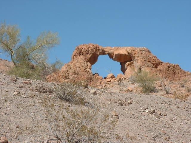
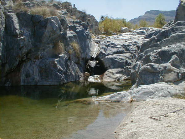
"Cinnamon valley is in Matomi Canyon and it has an arch like they have in Utah.. Have you gone all the way in Matomi to the ranch hole, has water fall and a large pool of water. You can even do dry camping there."

David K - 8-25-2018 at 09:59 PM

Quote: Originally posted by Ken Cooke  
Chloe Blaire offered to provide THE IMPOSSIBLE participants with a full MATOMI tour!:bounce:

Chloe Blaire wrote:
"Cinnamon valley is in Matomi Canyon and it has an arch like they have in Utah.. Have you gone all the way in Matomi to the ranch hole, has water fall and a large pool of water. You can even do dry camping there."


Arroyo Las Blancas, south of Arroyo Matomí:


Photo from PaulW... from one of your threads Ken: http://forums.bajanomad.com/viewthread.php?tid=68128

I was going there last March 2017 but the boulders blocking the Narrows of Matomí Canyon prevented that!

PaulW - 8-26-2018 at 07:20 AM

The arch still looks pretty fragile, but on closer inspection it has not deteriorated - if any over the years.
Time to go back after my absence of a couple of years.
If the Arch is the destination then a drive down the highway is our most common approach. That way the folks with SUVs can come along.
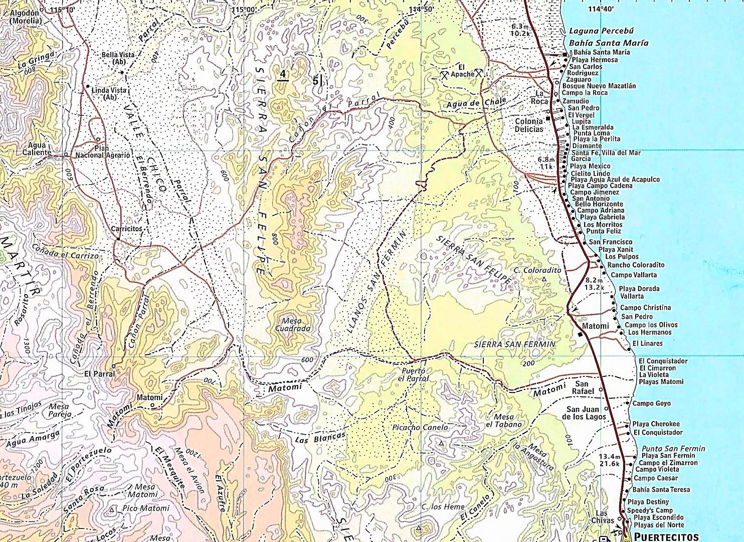
The turn from Matomi into Los Blancas where the arch is located is a little faint which ever way you go. Usually not many tracks to follow. Las Blancas is clearly shown on the Almanac.
Let me clarify. Los Blancas is the drainage (arroyo) leading to the Cinnamon (Canelo) Preserve. The valley of Los Blancas is called Cinnamon valley. Arroyo Cinnamon (El Canelo) is the next major drainage just south of Arroyo Matomi and there is a pretty good mountain range between Arroyo Cinnamon and Arroyo Los Blancas. The main peak on the mountain range is named Picacho Canelo
Arroyo Cinnamon is a huge drainage an it is on my to do list to explore it upper reaches.
Arroyo Cinnamon (English translation) is shown on the Almanc as El Canelo (Spanish correct name)

David K - 8-26-2018 at 08:15 AM

Quote: Originally posted by PaulW  
The arch still looks pretty fragile, but on closer inspection it has not deteriorated - if any over the years.
Time to go back after my absence of a couple of years.
If the Arch is the destination then a drive down the highway is our most common approach. That way the folks with SUVs can come along.
The turn from Matomi into Los Blancas where the arch is located is a little faint which ever way you go. Usually not many tracks to follow. Las Blancas is clearly shown on the Almanac.
Let me clarify. Los Blancas is the drainage (arroyo) leading to the Cinnamon (Canelo) Preserve. The valley of Los Blancas is called Cinnamon valley. Arroyo Cinnamon (El Canelo) is the next major drainage just south of Arroyo Matomi and there is a pretty good mountain range between Arroyo Cinnamon and Arroyo Los Blancas. The main peak on the mountain range is named Picacho Canelo
Arroyo Cinnamon is a huge drainage an it is on my to do list to explore it upper reaches.
Arroyo Cinnamon (English translation) is shown on the Almanc as El Canelo (Spanish correct name)


David K - 8-26-2018 at 08:21 AM

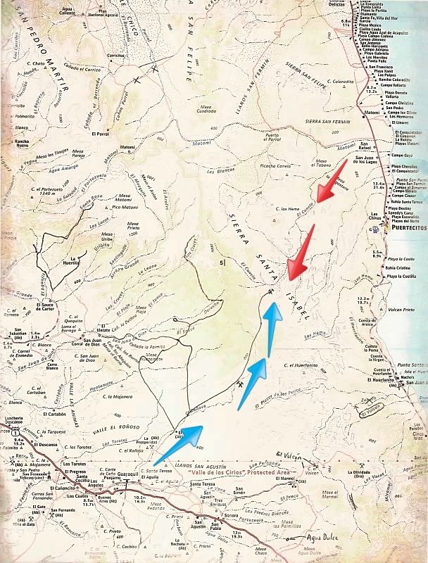
Here is the dream route... explored by bajalou, TW, and others... The lines drawn in are roads not on the Almanac. The arrows added are hopeful new routes to cross from the gulf to Pacific side. The blue arrows are along the road from La Aguila on Hwy. 1 to an un-named mine, just SW of Puertecitos.


TMW - 8-26-2018 at 10:03 AM

Several years ago I tried riding my motorcycle down El Canelo where the red arrows are. Didn't get too far due to deep sand and rocks. I figured if I could get to the mine it might be a short cut to cross on. If I remember right Baja Lou tried the same thing in a buggy with similar results.

David K - 8-26-2018 at 10:12 AM

A D9 is such a great thing! BAJA CAT could drive it!

Ken Cooke - 8-26-2018 at 01:40 PM

Quote: Originally posted by David K  


Photo from PaulW... from one of your threads Ken: http://forums.bajanomad.com/viewthread.php?tid=68128

I was going there last March 2017 but the boulders blocking the Narrows of Matomí Canyon prevented that!


I didn't remember this from the thread as I don't have personal experience visiting there as you and Paul do.

The plan:
On our San Felipe day, we will shop for fresh food, stop at the beach for a few hours, then stage in the Matomi area, setting up camp at about 4:00 pm.

Our Matomi run will hopefully allow for catching the sights of La Canela before we tackle the wash on our way to San Luis Gonzaga. I promised everyone a day at the beach the following day, and it is likely that we will reach Hwy 5 at dusk that day. No worries as we will set up our base camp in Gonzaga Bay for 2 nights.

Paul - We plan to tackle Matomi Wash first thing on day #5, so if we cannot see Cinnamon Valley on the afternoon of Day #4 or morning of Day #5, our limited time in Gonzaga Bay will be affected. Hope for the best plan for the worst. This is El Imposible!:light:

received_366300600423117_zpsxuuymwbf.jpeg - 48kB

PaulW - 8-26-2018 at 04:15 PM

My only attempt on El Canelo I was with 3 sand rails and they only got 100 yards up from the road and we had to dig to get them unstuck so the trip was aborted. Yes the sand was soft and deep. 4x4 is needed. The sand rails did not deflate their tires or we would have gotten further?

PaulW - 8-26-2018 at 04:20 PM

Ken,
Normal Matomi run is east bound. If done that way time is always short for a Las Blancas/Arch run.
A westbound run up Matomi should be planned for an early start because it is much slower when going west. Do it that way and you will understand. Deep sand to start and rock crawling up hill is interesting.

Ken Cooke - 8-26-2018 at 04:49 PM

Quote: Originally posted by PaulW  
Ken,
Normal Matomi run is east bound. If done that way time is always short for a Las Blancas/Arch run.
A westbound run up Matomi should be planned for an early start because it is much slower when going west. Do it that way and you will understand. Deep sand to start and rock crawling up hill is interesting.


Paul,

I will let Chloe know this. Momentum is always helpful. Our group will be loaded down with water, gasoline, gear. We will plan accordingly. I have to keep the days manageable so that we don't exhaust ourselves. This will be mid February, and the days will be short. Each driver will be aired down, will have their own shovel on-board, and will have 4WD. We will expect the impossible, but not at the expense of not arriving in Gonzaga Bay.

RubiSunrise.JPG - 29kB

rich t - 8-26-2018 at 06:21 PM

Ken, what ever you do you should be thru the tight spot at Matomi by 1:00 P.M., from there it is about 3 hours to Gonzaga with a group, we ran it twice during the 250 this year chasing for a truck and took about 1 hour to do the 15 mile stretch from the tight spot to hwy 5.

Ken Cooke - 8-26-2018 at 07:36 PM

Quote: Originally posted by rich t  
Ken, what ever you do you should be thru the tight spot at Matomi by 1:00 P.M., from there it is about 3 hours to Gonzaga with a group, we ran it twice during the 250 this year chasing for a truck and took about 1 hour to do the 15 mile stretch from the tight spot to hwy 5.


Thanks for the intel Rich

David K - 8-27-2018 at 09:27 AM

Going downhill in the deep sand/ gravel of Arroyo Matomí is easier, indeed. That's how the Nomad group did it in 2004: www.vivabaja.com/204

In June 2006 Baja Angel and I took my Tacoma up from Hwy. 5 to the Matomí waterfall... it was over 100° in the desert and until I deflated the tires, my truck heated up! http://vivabaja.com/618/


Approaching the Narrows.

By-the-way, the narrows to Highway 5 is over 20 miles drive. It is over 30 miles to the waterfall...


In June, the waterfall was down to a trickle! I have been there in June (1979) when the flow was 'normal', however.


In February 2004. (Edie H. photo)


In February 2001. (Amo Pescar photo)

rich t - 8-27-2018 at 03:37 PM

Ken, another option would be leave San Felipe, camp at Percebu, take Crazy Horse or Apache tears(El Parrel) to matomi(about 10 miles north of the bad spot and follow it back out the hwy 5, the camping would be nicer at the beach and time wise would be about the same.

Ken Cooke - 8-27-2018 at 08:53 PM

Quote: Originally posted by rich t  
Ken, another option would be leave San Felipe, camp at Percebu, take Crazy Horse or Apache tears(El Parrel) to matomi(about 10 miles north of the bad spot and follow it back out the hwy 5, the camping would be nicer at the beach and time wise would be about the same.


The camping should be incredible at the beach. That's a very good idea. A Campo with a restroom 10 miles from the trail instead of 100% primitive camping will be easier since we will still be recovering from the Pole Line Road. Having an optional drive/nondrive day will be a treat. In the past, when a nondrive day was planned at Baja Grande, participants chose instead to drive. I preferred to sit near the water and vegetate.

rich t - 8-27-2018 at 09:05 PM

Ken, the whole loop is about 72 miles from Percebu thru crazy Horse to matomi and back to the hwy 5, I can send you the track if you want to check it out.

David K - 8-27-2018 at 11:25 PM

Quote: Originally posted by rich t  
Ken, the whole loop is about 72 miles from Percebu thru crazy Horse to matomi and back to the hwy 5, I can send you the track if you want to check it out.


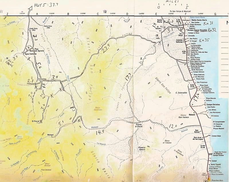
Camping at Percebu or Nuevo Mazatlan, going to Valle Chico via Cañada el Parral/ Azufre Wash/ Crazy Horse Canyon (three names for the same pass) and drop into Matomi to tackle the Narrows. The good news is if it is not passable, just go back to Hwy. 5 the same route you just took.

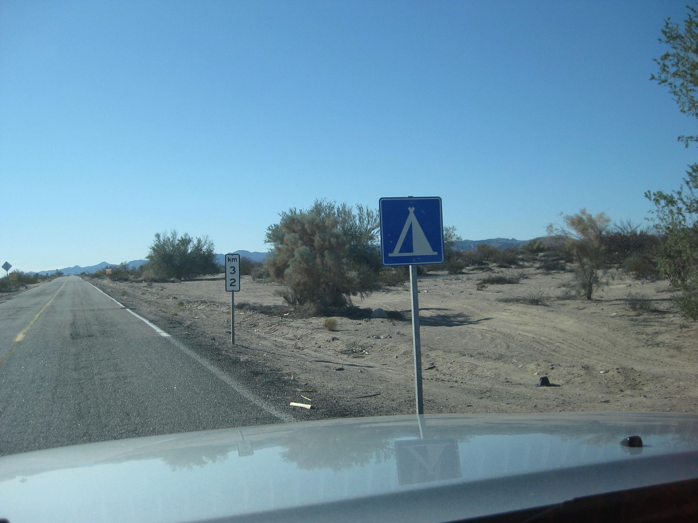
From Hwy. 5 (Km. 32) west to Sulfur Mine/ Old Puertecitos Rd.: 4.4 miles. (fast old road)
South to Azufre Wash Rd.: 1.4 miles. (slow beat up road)
West to Valle Chico rd.: 24.6 miles. (Interesting pass through mountain)
South to Cañon Matomí: 8.3 miles (Slow whooped-out road)
The waterfall is 5 miles west, rough!
Hwy. 5 (Km. 60) is 27 miles east.
Total Hwy to Hwy without the waterfall visit is about 66 miles.
Puertecitos is at Km. 74.5 and Gonzaga Bay is at Km. 147.

MAP:


rich t - 8-28-2018 at 01:24 PM

Nuevo Mazatlan is a nice place to camp, Percebu has the restaurant and bar, they may even open the restaurant early for breakfast if you have enough people eating there. If you get to Percebu early enough you may be able to tour the Chenowith museum if the Chenowiths are around.

David K - 8-29-2018 at 08:10 AM

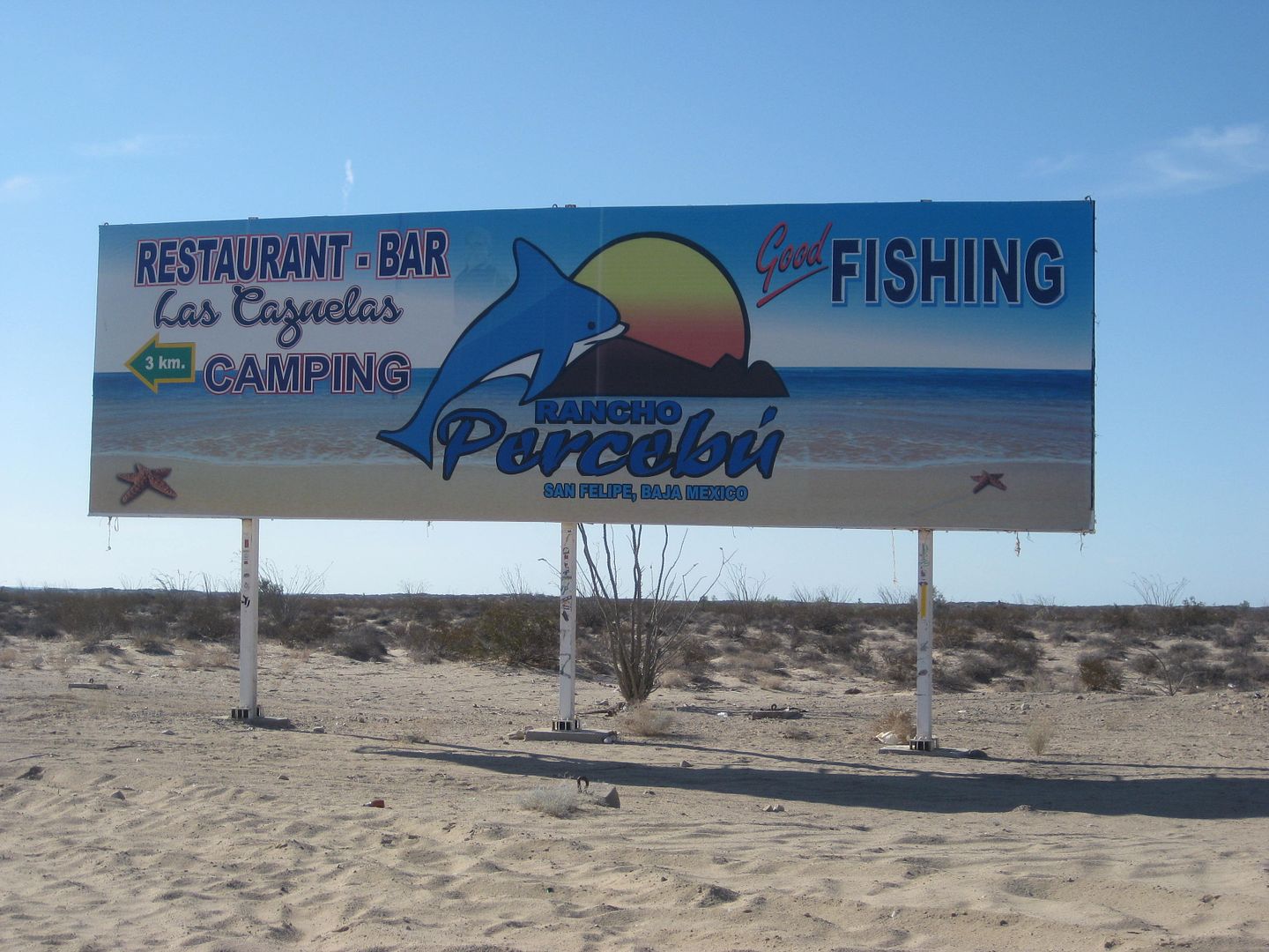
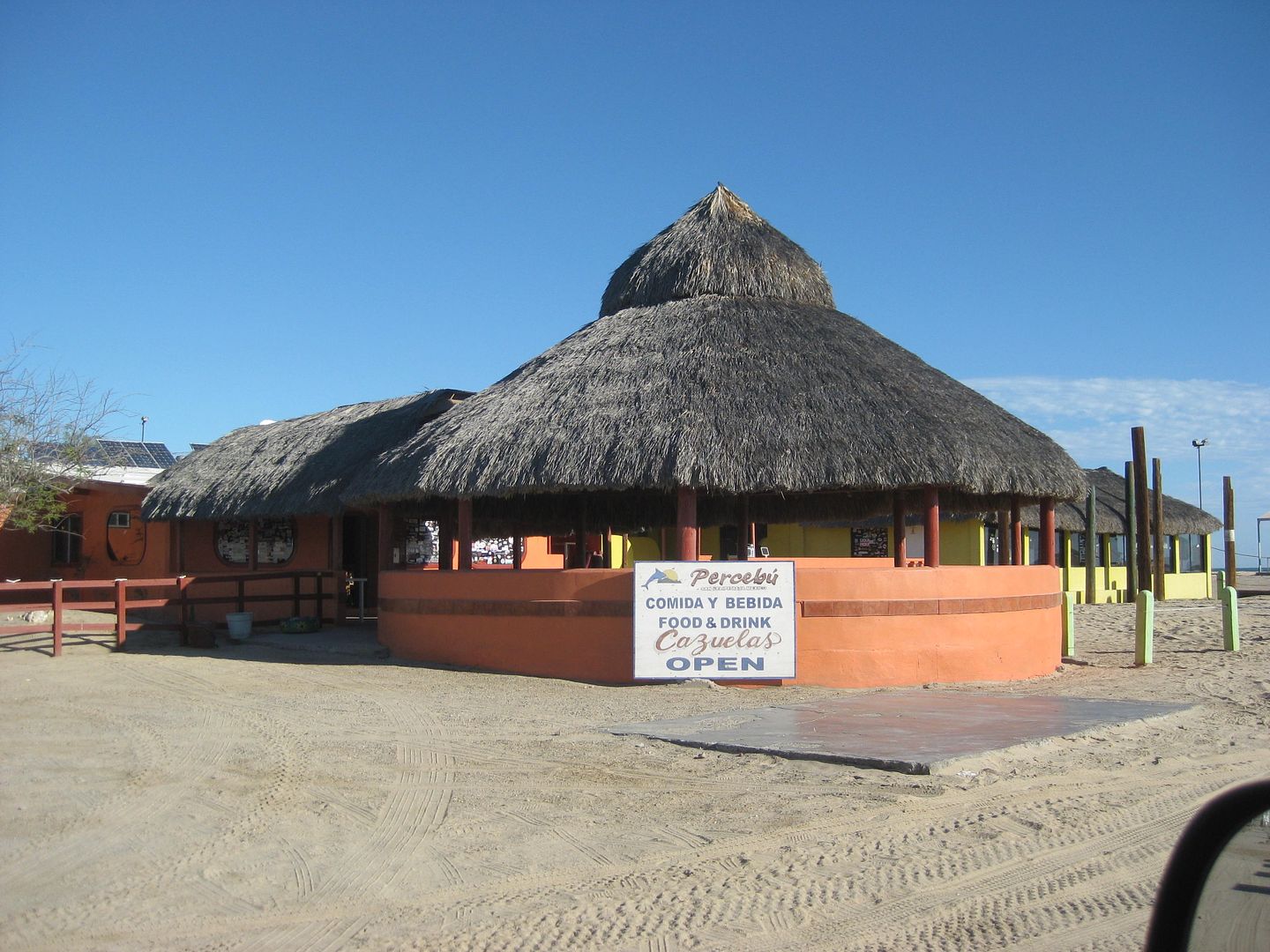
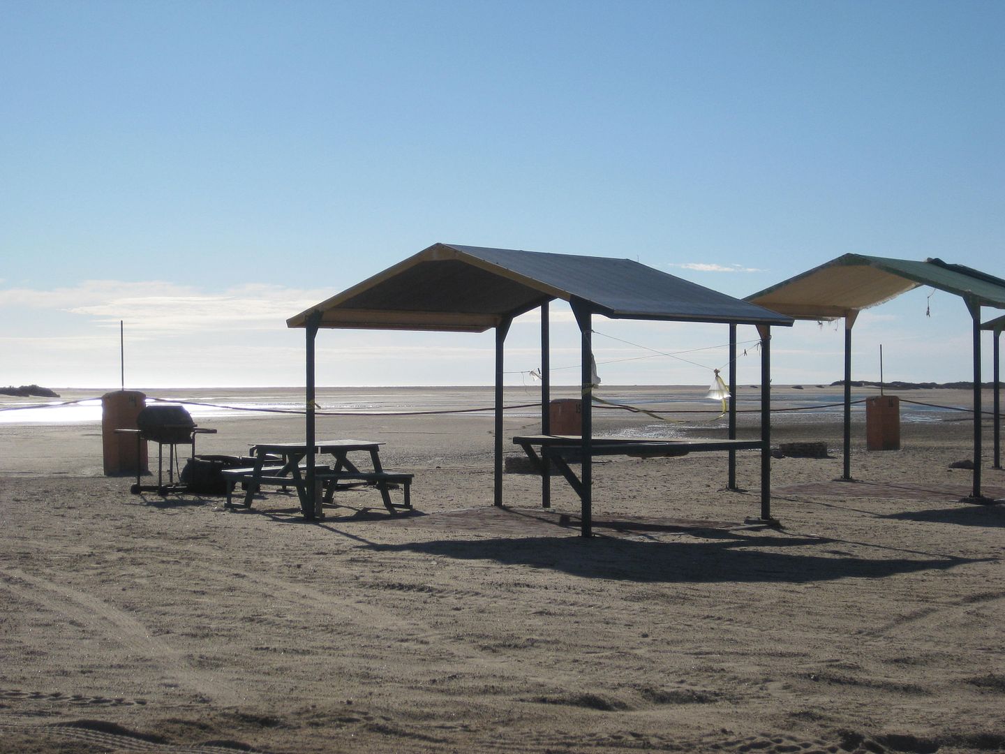
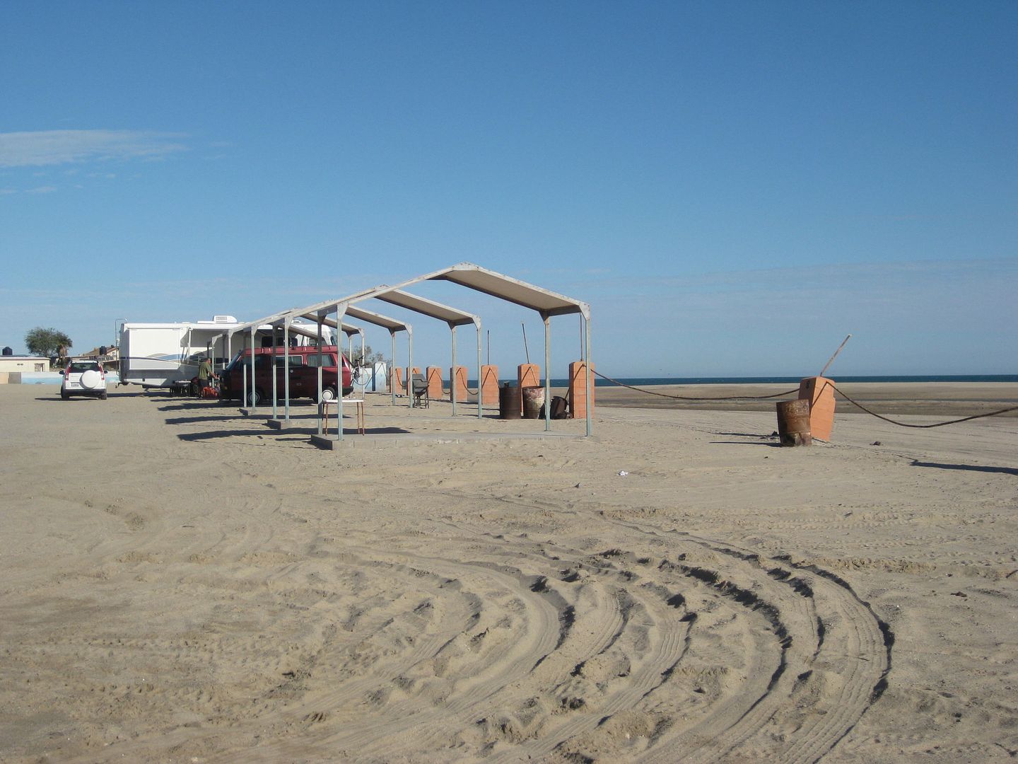
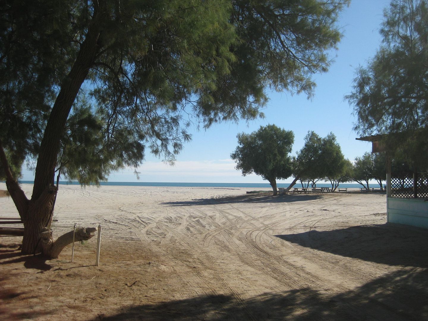
Rancho Percebú (Km. 20.5+):


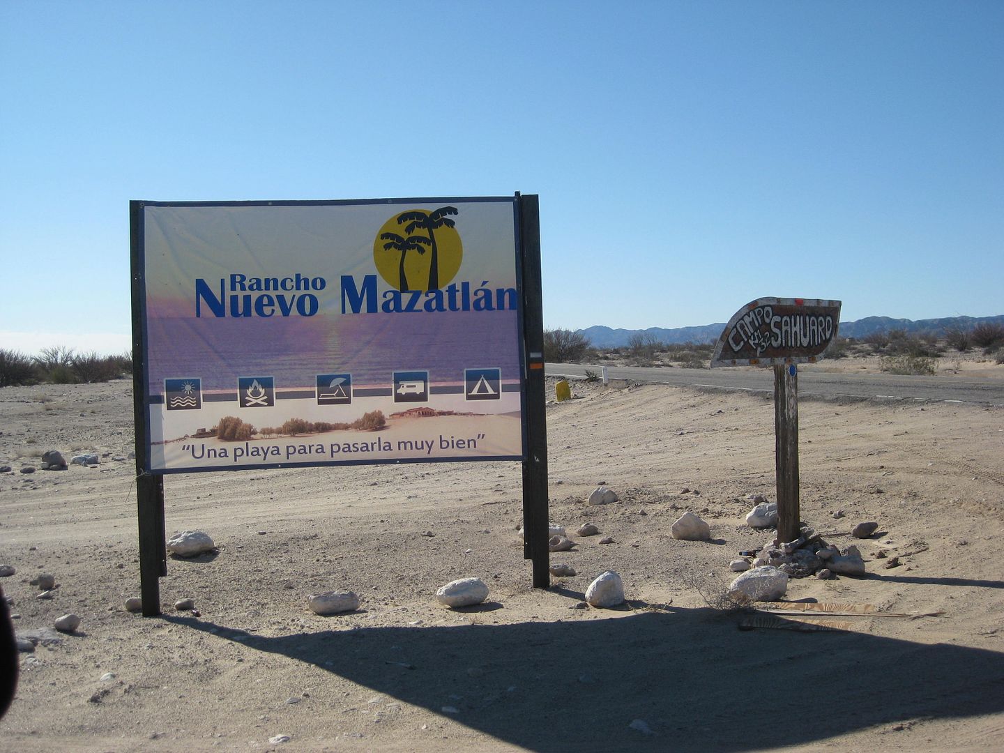
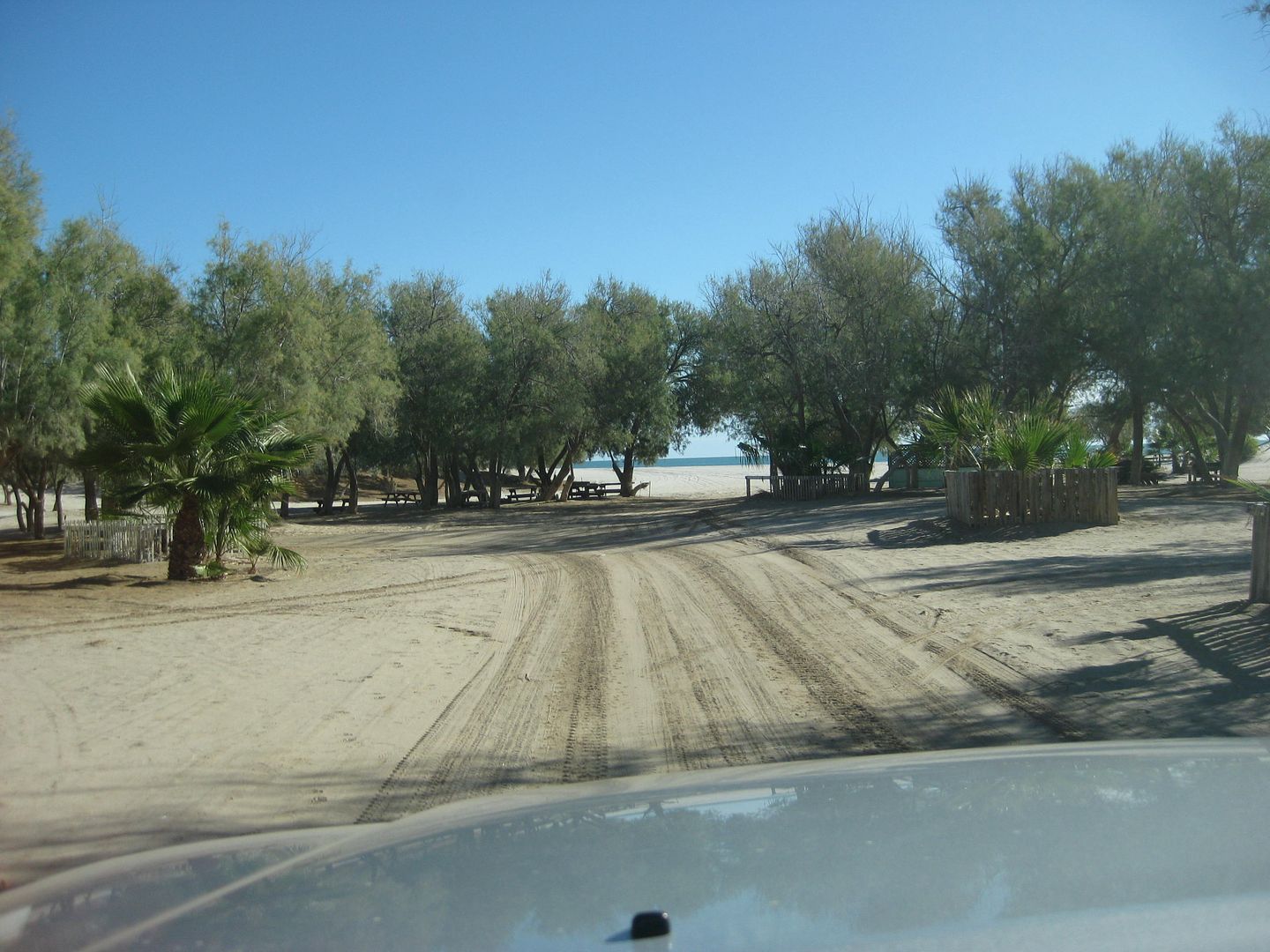
Nuevo Mazatlán (Km. 32)


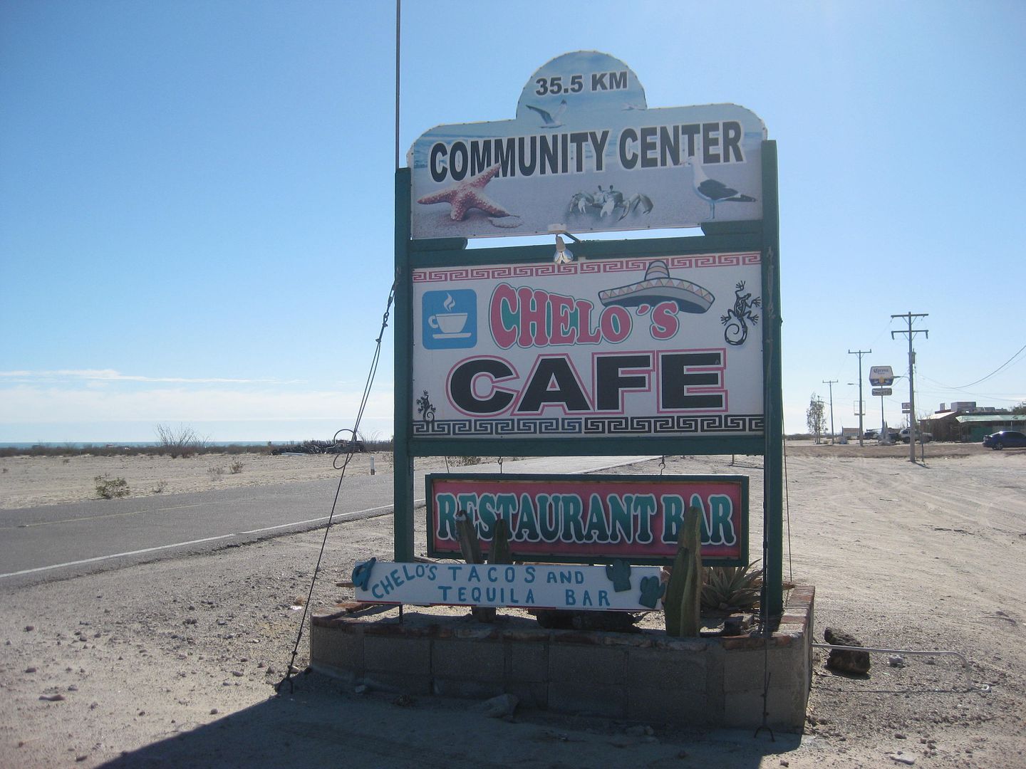
Restaurnts at Km. 35.5:


ehall - 8-29-2018 at 10:49 AM

Quote: Originally posted by PaulW  
Here is my chance to provide some interesting things about off roading in Baja.
Agree about the Dometec. We have a CFX 50 (50l) for our camping trips. Good investment because between camping trips is serves us for extra freezer space. 12v and 110V unit.
We also have a CDR-11, (10.5l) 12volt only for day trips. Fits behind the seat and is for keeping lunch and drinks cool for our regular biweekly desert trips. The 11 has the exact same control features as the 50, which is good to prevent vehicle battery discharge.
Both require an add-on 10A 12V circuit connected directly to the battery.

About radios forget the marine radio because of very low output and limited frequency choices. Get a Ham radio with the mod to add full spectrum use. I have a Yaesu FT-2900R radio, replaced by the latest version FT2980R. I think 10 of the guys I wheel with in Baja are using the 2900R. Great value.
GigaParts also sells the radio with the MARS Mod Level 3 to open up all the frequency spectrum.
Read here about location of antenna for Jeeps
https://www.jk-forum.com/forums/jk-cb-ham-radios-128/here-wh...
Forget about Firestick and go with a conventional VHF whip antenna 5/8 DB with NMO mount. Firestick units are specific for CB radios. Any HAM vendor will fix you up correctly.
Do the above regarding radios and you will be able to talk to all the rest of us who have the proper equipment.


Hey Paul. I sent you a U2U. I want you to give me your opinion on the radio stuff I am about to order.

Ken Cooke - 8-29-2018 at 06:48 PM

Very helpful information on the Matomi and Percebu region David and Rich. Thank you. I haven't spent time there since 2010. Time really flies!

ehall - 8-29-2018 at 07:32 PM

Hey Ken. What radio frequency we running?

Ken Cooke - 9-1-2018 at 06:52 PM

Quote: Originally posted by ehall  
Hey Ken. What radio frequency we running?


I don't know yet. I have a handheld Baofeng from Saturnino, but I haven't studied about HAM frequencies, nor do I have a license yet. This will be a short-term goal between now and the new year. Maybe you can help out, and I can delegate this role to you? I have a learning curve to deal with on this subject.

Ken Cooke - 9-3-2018 at 05:44 PM

There should be more Ham radio license tests coming into the end of 2018

https://www.eham.net/exams/

ehall - 9-3-2018 at 06:16 PM

Whatever frequency Paul uses works for me.

mtgoat666 - 9-3-2018 at 06:22 PM

What’s the frequency, Kenneth?


ehall - 9-3-2018 at 06:24 PM

Not all frequencies require a license . We can stay in the frs range if you are concerned

TMW - 9-3-2018 at 06:25 PM

There are a lot of frequencies you can use. One of the more common one's is the Weatherman's channel 151.625mhz. If a SCORE race is going on they don't want you on it. What you use in Mexico is not much of a problem unless it is used by the government or cops etc. Actually in the US it isn't much of a problem either in the desert areas.

Akula - 9-19-2018 at 10:46 PM

Counting down the days until we can do this again!


rich t - 9-20-2018 at 08:35 AM

A good radio is the Yaesu FT-2980R or the Yaesu FT-2900R, they have alot of legal frequencies and can be used in the U.S. and Mexico, we have ours programed for some frequencies that are not legal in the U.S. but are not a problem in Baja. Paul and I can dial in any of the frequencies that come standard in the radio, they are far superior to the handheld radios which have about the same range as a CB radio.

ehall - 9-20-2018 at 12:05 PM

Quote: Originally posted by rich t  
A good radio is the Yaesu FT-2980R or the Yaesu FT-2900R, they have alot of legal frequencies and can be used in the U.S. and Mexico, we have ours programed for some frequencies that are not legal in the U.S. but are not a problem in Baja. Paul and I can dial in any of the frequencies that come standard in the radio, they are far superior to the handheld radios which have about the same range as a CB radio.


Just finished installing and tuning my ft2980r. Field testing it this weekend.

rich t - 9-20-2018 at 01:43 PM

Good choice, I have the 2900r and an ICOM 8000, the Yaesu runs much cooler.

TMW - 9-20-2018 at 03:49 PM

The main problem with CB radios is that they are AM which has more noise and other interference issues. Because they are at a lower frequency (26mhz) they will go further and for hwy comms especially in the midwest they work very good.

The FM radios listed above are much cleaner.

I have a friend who talks from Rocky point to San Felipe using a 5 watt handheld radio. Over salt water the transmission is greatly increased.

Ken Cooke - 9-22-2018 at 05:29 AM


IMG_20180918_205258.jpg - 127kB

David K - 9-22-2018 at 07:23 AM

Nice logo Ken!

rich t - 9-22-2018 at 08:13 AM

Looks good Ken.

Ken Cooke - 9-22-2018 at 11:54 AM

Thanks guys. These are preliminary images from the graphic designer. There will be some changes, but this will be the theme for the front of the shirts and hoodies.

ehall - 9-24-2018 at 05:22 AM

Cool design. My radio worked great. Worked so well I was able to keep it at 5 watts and still talk 2 or 3 miles in the mountains. At 80 watts the harbor master at the lake 30 miles away could hear me. We changed frequency after that.

PaulW - 9-24-2018 at 06:52 AM

Good radio
:D

Quote: Originally posted by ehall  
Cool design. My radio worked great. Worked so well I was able to keep it at 5 watts and still talk 2 or 3 miles in the mountains. At 80 watts the harbor master at the lake 30 miles away could hear me. We changed frequency after that.

ehall - 9-26-2018 at 05:20 PM

Quote: Originally posted by PaulW  
Good radio
:D

Quote: Originally posted by ehall  
Cool design. My radio worked great. Worked so well I was able to keep it at 5 watts and still talk 2 or 3 miles in the mountains. At 80 watts the harbor master at the lake 30 miles away could hear me. We changed frequency after that.


Do I need to power it up to program it? Not too convenient if so. Guess I could grab my laptop from work.

PaulW - 9-26-2018 at 06:54 PM

When I programmed mine it was installed in the vehicle and power was available. I do not remember the method I just follow the directions. Seems like the radio was on?

advrider - 9-26-2018 at 07:28 PM

Are shirts going to be for sale for people not on the run? Cool design...

bajatrailrider - 9-27-2018 at 10:54 PM

Hey Ken any thinking on going past Coyotes and Mikes . I have been scouting new routes on my Dirt bike last two weeks. There is a route to go on Simson trail Past Cato rancho. Maybe able to get one time permission to run that route. as the Melings bought all that property.

PaulW - 9-28-2018 at 06:41 AM

Hopefully you are stating with Coyote? If so stop at Coyote and speak with Mike to find out the condition of the track.

ehall - 9-28-2018 at 07:16 AM

Quote: Originally posted by bajatrailrider  
Hey Ken any thinking on going past Coyotes and Mikes . I have been scouting new routes on my Dirt bike last two weeks. There is a route to go on Simson trail Past Cato rancho. Maybe able to get one time permission to run that route. as the Melings bought all that property.


Maybe we can get that permission for our trip at the end of March.

bajatrailrider - 9-28-2018 at 07:47 AM

Quote: Originally posted by PaulW  
Hopefully you are stating with Coyote? If so stop at Coyote and speak with Mike to fiut the condition of the track.
. I have two great routes done on my bike behind locked gates have the key for one.the closed route from melings to simson trail if we stay at coyotes. I can try to get one time permission I have already asked.

Ken Cooke - 9-29-2018 at 11:45 AM

Hey everyone,

I am partnering with Ru KinKon (his Jeep alias) to establish a limited run of EL IMPOSIBLE WINE from Guadalupe Valley, Baja California! Stay tuned.

As for Mike's/El Coyote, due to time constraints, I won't be able to run the trails in that region and keep the trip at 9 days..

Ken Cooke - 9-29-2018 at 11:46 AM

Quote: Originally posted by advrider  
Are shirts going to be for sale for people not on the run? Cool design...


Yes, I will make shirts, wine, stickers and hoodies available in November.

Ken Cooke - 9-29-2018 at 11:53 AM

This morning at San Miguel Restaurante in Playas de Tijuana with Ru KinKon - Guadalupe Valley vinter.

IMG_20180929_115118.jpg - 69kB

David K - 9-30-2018 at 09:51 AM

Quote: Originally posted by Ken Cooke  
Hey everyone,

I am partnering with Ru KinKon (his Jeep alias) to establish a limited run of EL IMPOSIBLE WINE from Guadalupe Valley, Baja California! Stay tuned.

As for Mike's/El Coyote, due to time constraints, I won't be able to run the trails in that region and keep the trip at 9 days..


This is very very cool, Ken! :cool:

Ken Cooke - 9-30-2018 at 04:02 PM

Quote: Originally posted by bajatrailrider  
Hey Ken any thinking on going past Coyotes and Mikes . I have been scouting new routes on my Dirt bike last two weeks. There is a route to go on Simson trail Past Cato rancho. Maybe able to get one time permission to run that route. as the Melings bought all that property.


The last day, mplans are to begin in El Rosario and try to reach, then cross the border by dusk. Hopefully, the weather will cooperate and not produce rainfall and/or snowfall which would impact our travel that day. If anyone plans to run additional trails, I wish that my schedule would support additional days.

mtgoat666 - 9-30-2018 at 04:24 PM

Quote: Originally posted by Ken Cooke  
Hey everyone,

I am partnering with Ru KinKon (his Jeep alias) to establish a limited run of EL IMPOSIBLE WINE from Guadalupe Valley, Baja California! Stay tuned.

As for Mike's/El Coyote, due to time constraints, I won't be able to run the trails in that region and keep the trip at 9 days..


So, an off-road wine that tastes like 2-buck-chuck mixed with tecate and monster energy drink?
(Based on the ads, I have always assumed that off-roaders only drink monster or tecate)

Ken Cooke - 9-30-2018 at 05:16 PM

Quote: Originally posted by mtgoat666  
Quote: Originally posted by Ken Cooke  
Hey everyone,

I am partnering with Ru KinKon (his Jeep alias) to establish a limited run of EL IMPOSIBLE WINE from Guadalupe Valley, Baja California! Stay tuned.

As for Mike's/El Coyote, due to time constraints, I won't be able to run the trails in that region and keep the trip at 9 days..


So, an off-road wine that tastes like 2-buck-chuck mixed with tecate and monster energy drink?
(Based on the ads, I have always assumed that off-roaders only drink monster or tecate)


Mtn Goat - Please review Overland Journal before making your gross generalizations about what we do. Your extremely ignorant of anything non-urban/pro-conservationist.

No Ken, neither

John M - 9-30-2018 at 05:57 PM

mtgoat666 is just in his world and has no room to accommodate others with a differing view of the world. Why he/she would wish to insert comment in this thread speaks to his/her state of mind. It is a forum open to members but most members with alternate ideas don't choose to display their ignorance or lack of tolerance.

John M

Ken Cooke - 10-7-2018 at 06:43 AM


I have been monitoring the storm impacts of Rosa and the possible impacts on my Baja run - El Imposible. During the best of times, this run has an ambitious schedule - featuring The 1942 Pole Line Road, Matomi Wash, Gonzaga Bay, and the Mission Impossible trail. But, with recent photographs illustrating this week's damage to infrastructure and roadways of Hwy 5 and San Felipe, it appears that a rapid response to road damage and flash flooding is of the utmost importance.

Currently, Military troops have been deployed to the most dire sections of highway south of San Felipe to construct bypass routes by hand. In the coming weeks, local participants of the El Imposible run will attempt a prerunner of Matomi Canyon and Matomi Wash. I will report back on their findings as they relate to our scheduled day run of the Matomi area. If we need to alter the planned trails, alternates such as the extreme 'Mini Summit' can be substituted in place of the likely (now) extreme Matomi Wash. Improvements to local infrastructure will need to be in place before this trails access and new rating can be given.

With Sergio on the horizon, the possibility of more storm damage and impassible roads exists. I will report back on road improvements, access to gasoline and supplies, and our likely modified route of 'El Imposible'. We will still hit the trail to Baja - it is yet to be determined if our route will include each of the trails and attractions on the 'El Imposible' event list:

-1942 Baja Pole Line Road
-Matomi Canyon and Wash
-Gonzaga Bay
-Coco's Corner
-Mission Impossible/Misión Sta María
-Mama Espinosas Seafood dinner

If Hwy 5 is restored to it's former glory, the above list will continue on. If not, our hotel stay in San Felipe will continue, however it would be prudent to skip room reservations as any disruption to our run schedule would impact our (my) room down payments.


[Edited on 10-7-2018 by Ken Cooke]

rich t - 10-7-2018 at 08:19 AM

If you want to do an extreme trail the Mini Summit is a good one, even when you here Matomi is not passible I have never found it to be that hard if you are set up for rock crawling.

David K - 10-7-2018 at 01:59 PM

I hope to hear that the latest flood has deposited new sand on the boulders in the Matomi Narrows rather than take what little was in there, away!

In the 1970s and 80s, it was difficult (with exposed boulders to drive over) but in the 2000s, it was easy as sand covered the boulders... Now in the mid- to late 2010s, it is difficult again.

Flash floods bring or take away sand!

4 more months

Ken Cooke - 10-8-2018 at 09:56 PM

We're 4 months away and here is a list of our crew so far (first names only). If you're not on the list, please reply to this message or send me a U2U and I will place you on the list.

Ken (me)
Ed (Phoenix)
Buck (San Diego)
Daryl (B.C. Canada)
+2 Jeeps with Daryl (B.C. Canada) (!!)
Victor (Tijuana 4x4)
Saturnino (PLR only)
Huitzi (San Bernardino)
Rich (San Felipe)
Paul (San Felipe)
Chloe (San Felipe)
Victor (Phoenix, AZ)
David (San Diego)
Powell (San Diego)
Norman (San Diego)
Ricky (Los Angeles)
Mark (San Felipe)
Alex (Ensenada)
David (San Diego)

Pole Line Road will require everyone driving thru.

Matomi will be optional as David mentioned above the narrows will be challenging and some drivers don't want to risk their Jeeps while having to return to Canada one week later.

Mission Impossible may be flooded 4 feet at the swamp. Crossing the swamp will be optional.

The graphic designer in Seattle is working on the merchandise.

Rich T. and Paul W. plan to scout out Matomi narrows.

No hotels have been reserved as plans may change due to storm impacts. Please understand my planning is like a gamble with everything going on at the moment with regards to Hwy 5 damage.

Stay tuned:light:

[Edited on 10-9-2018 by Ken Cooke]

Ken Cooke - 10-9-2018 at 10:07 AM

Quote: Originally posted by Ken Cooke  

Ken (me)
Ed (Phoenix)
Buck (San Diego)
Daryl (B.C. Canada)
+2 Jeeps with Daryl (B.C. Canada) (!!)
Victor (Tijuana 4x4)
Saturnino (PLR only)
Huitzi (San Bernardino)
Rich (San Felipe)
Paul (San Felipe)
Chloe (San Felipe)
Victor (Phoenix, AZ)
David (San Diego)
Powell (San Diego)
Norman (San Diego)
Ricky (Los Angeles)
Mark (San Felipe)
Alex (Ensenada)
David (San Diego)


Add two more drivers -
Jerry - who attended the 2016 Pole Line Run
Harvey - an experienced Rock crawler

ehall - 10-9-2018 at 07:40 PM

Put some new tread on tonight.

20181009_180846-1008x756.jpg - 151kB

mtgoat666 - 10-9-2018 at 07:54 PM

Quote: Originally posted by David K  
Two "Davids" in San Diego?


Very common name. Maybe the most common. Common man. Sort of a bible thumper name, the famous bible guy was some Hebrew dude, had some kind of dispute with a big guy named Goliath.

 Pages:  1  2    4